Wired for the Wild: Technology is Powering Conservation
Wildlife Tracking Redraws the Map
Keep in Touch!
Sign up to receive monthly conservation news and updates from Arizona and beyond.
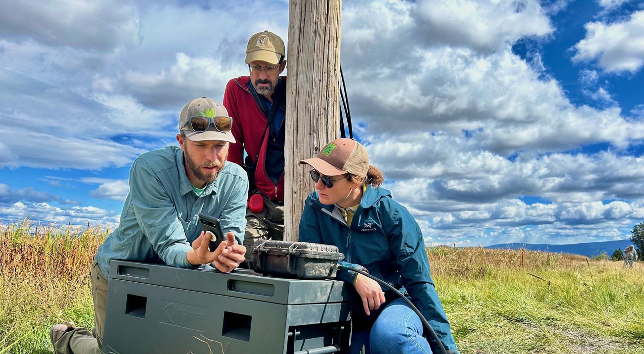
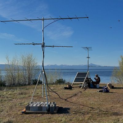
Across Arizona and beyond, a quiet revolution is underway. With a flicker of wings and a whisper of technology, birds and bats are revealing secrets we’ve never known. Thanks to tiny transmitters and a growing network of wildlife tracking stations, scientists can now monitor tagged species within an approximate 8-mile radius, offering a clearer picture of how animals move through the landscape.
Arizona is currently home to around 15 Motus Wildlife Tracking System (Motus) stations, each part of a global network spanning thousands of locations.
Bird biologist Edwin Juarez with the Arizona Game and Fish Department (AZGFD) is helping lead the charge. “We’re learning something new almost every week,” he says. “For instance, a snowy plover tagged in Utah was mapped in the Colorado River corridor during its southward migration. Before, that was just an educated guess that the species used that route.”
As we face the twin crises of climate change and biodiversity loss, this near real-time data is more vital than ever.
Local Stations
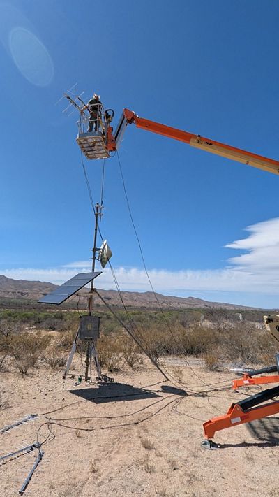
The Nature Conservancy in Arizona (TNC Arizona) recently joined the Motus network with a new station at the Middle San Pedro Preserve near Benson.
The installation was supported by the AZGFD, Bureau of Reclamation and the Bird Conservancy of the Rockies. Another station is now active at Patagonia-Sonoita Creek Preserve in southern Arizona, relocated from the Tucson Bird Alliance Patton Center in 2025 to improve data collection.
Looking ahead, TNC Arizona plans to collaborate with researchers to tag more birds and bats—adding to the nearly 60,000 tagged individuals already recorded by Motus.
“Before this technology, we relied on volunteers and conservationists to track species of concern in the field with binoculars and a clipboard,” said Jonathan Lutz, TNC Arizona’s steward program manager. “This tool is far more efficient and cost-effective—not to mention the sheer volume of data now at our fingertips.”
This growing body of knowledge helps pinpoint where conservation efforts are most needed. For nearly 60 years, TNC Arizona has worked to protect lands that provide essential natural benefits—often through conservation easements that safeguard critical habitats. By preserving these landscapes, we’re also protecting the forage, nesting sites and resting places that vulnerable species depend on.
Stories from the Field
Early field reports are already turning up fascinating insights.
AZGFD shared that a yellow-billed cuckoo tagged in southern California was detected by the Audubon Research Ranch in Arizona—a surprising and valuable data point.
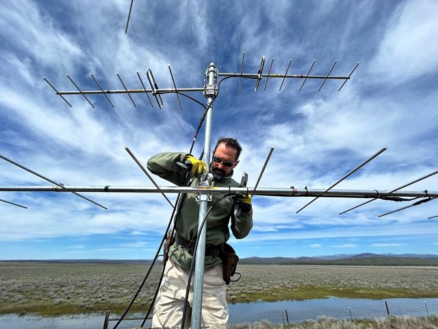
Two new Motus stations are now active on Oregon TNC preserves thanks to a partnership effort. The chapter’s Sycan Marsh station picked up a passing American kestrel originally tagged near the Salton Sea by CDFW in early 2023.
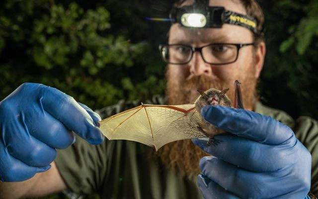
Across Tennessee, TNC has installed more than 30 Motus towers to better understand the needs of aerial wildlife, especially endangered bats. Data gathered through Motus technology is frequently cited in national scientific publications, underscoring Tennessee’s vital role in the broader network.

Research That Builds Resilience
Motus data is also helping inform TNC’s broader efforts to protect connected and climate-resilient landscapes across the U.S. After a decade-long analysis, TNC scientists developed a map identifying the lands most likely to sustain native plants, animals and natural processes into the future.
Quote: Erin Creekmur
Healthy, resilient landscapes do more than support wildlife. They clean our air and water, buffer communities from extreme weather and provide green spaces where people can connect with nature.
Technology in the Toolbox
Motus is just one of several high-tech tools transforming conservation. On some preserves, wildlife cameras capture animal movements, while advanced acoustic sensors record natural soundscapes and identify species by their calls. These tools can be resource-intensive—but the insights they provide are invaluable.
“Technology is transforming conservation by expanding our ability to monitor ecosystems in real time, analyze complex data at scale and collaborate across borders like never before,” said Mark Goering, TNC’s emerging conservation technology lead. “As these technologies become more affordable and connectivity expands, we’re seeing unprecedented opportunities to bridge local action with global conservation insight—supporting more timely, inclusive and data-driven decision-making around the world.”
TNC’s Motus network is expanding, with active stations now in California, Missouri, Oregon, Tennessee and Washington, among others.
