Students Take on a Piping Plover Mystery
Researchers look for answers to help shore up nesting habitat for a rare bird.
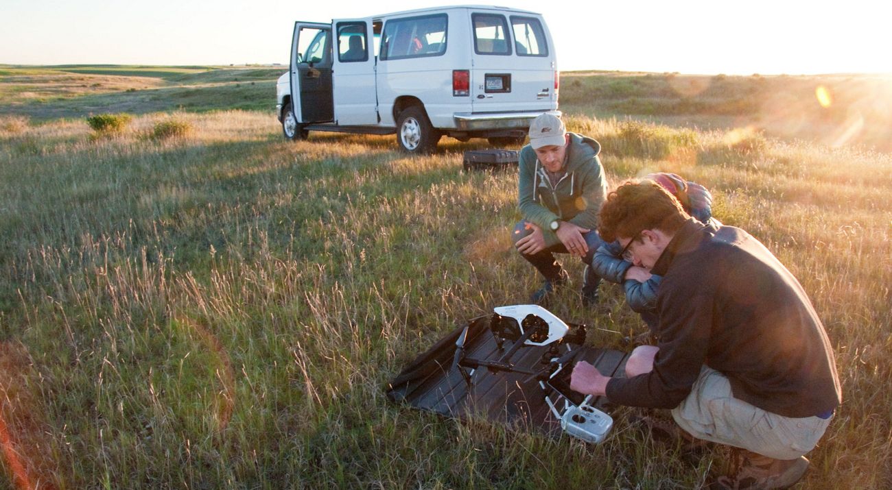
It started in 2016 when students at the University of St. Thomas wanted to do their capstone research project outside of Minnesota
“They wanted to go to someplace new,” recalls Lisa Lamb, geology and environmental science professor at the St. Paul campus. Lamb sought advice from staff at The Nature Conservancy. What would be a good project for these students?
Go to North Dakota, she was told, to help solve a conservation mystery: Why is one of the best nesting sites for a rare shorebird not producing as many baby birds?
Piping Plovers: Rare Bird in Rare Habitat
TNC’s John E. Williams preserve encompasses a chain of lakes and surrounding grasslands that are so stark and treeless that the locals called it the Valley of the Moon. When seen from the air, the lakes at the preserve are unlike others nearby: they are less blue, greener, at times even opaque and white in appearance.


The preserve’s lakes are different because they are saturated with minerals. They occupy the low point of the surrounding area and have no outlet. Consequently, a lot of rainwater and groundwater finds its way into them along with various salts and minerals that accumulate over time. The result is alkaline lakes that are a haven for waterbirds, including piping plovers.
Plovers are a type of shorebird that are commonly seen running alongside lakes and seashores. Piping plovers have lost essential habitat; the U.S. Fish and Wildlife Service now lists them as a threatened species. Piping plovers are found along Atlantic beaches, shorelines of the western Great Lakes and in the northern Great Plains. The Great Plains population is the largest and is a key to the species’ survival.
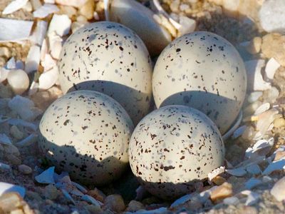
One of their favorite nesting sites has long been the John E. Williams preserve. Piping plovers like to lay their eggs on gravelly beaches with relatively little vegetation—the eggs blend in with the rocks and the lack of vegetation makes it hard for predators like skunks and foxes to stalk and attack the birds. The salty water at John E. Williams discourages plant growth along its beaches and piping plovers nest there in large numbers—more than a hundred birds in some years. Researchers began monitoring these nesting grounds in the 80’s and TNC began protecting John E. Williams’ beaches in 1986.
But the longterm trend for piping plover nesting success at the preserve is concerning. Some traditional nesting areas are now abandoned. In recent years, few piping plovers can be found nesting at the preserve. TNC wanted to know what can be done to help them recover.
Studying Hydrology to Detect Changes in Nesting Habitat
The St. Thomas seniors began their investigation by looking at the nesting habitat and examining what might be making it less suitable. That required understanding the lakes better, studying the flow of groundwater into the lakes and documenting their water chemistry. Piezometers, or mini-wells of narrow porous pipes bored into the ground, allowed the students to sample groundwater and measure its height at different distances from the lakes. The students took sediment cores from the lake bottoms and began compiling weather data and other historical information. A multi-year project was launched, involving successive classes from St. Thomas.
On a bright summer day, geology student Alicia Gaytan and Lamb hike out to piezometers arrayed in a row near a beach. At each one, they lower a beep tape—so-called because it beeps when wet, revealing how far down the surface of the groundwater is underground. Next, the pair retrieve groundwater samples and used a digital tester to record temperature, salinity, total dissolved solids and other measures of water quality.
Quote: Lisa Lamb
This information helps us understand the local hydrology and how it affects the lakes and their beaches.
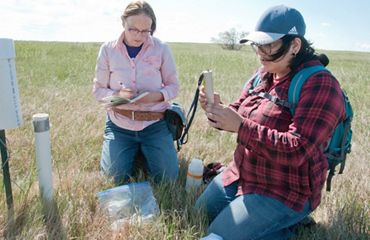
Another important measure is the height of a lake’s surface. Lamb wades out into the water holding a gradated marker and Gaytan records water height against known elevation using a surveyor’s scope from shore. Lamb asks: “Is the lake growing or shrinking? Is the groundwater level or the groundwater’s chemistry changing?” These measures over time reveal trends that can shape the plovers’ nesting habitat.


Surveying Plover Nests Using Drones
In 2017, the University started using yet another tool at the John E. Williams preserve—drones. Drones can fly over beaches that are hard to reach on foot, take photographs, and minimally disturb the birds. Drones can fly these survey transects precisely and repeatedly, making it possible to exactly document changes to plovers’ nesting beaches over time. The camera on a drone 200 feet in the air photographs one square inch of beach per recorded pixel. During a 13-minute flight, a drone traveling 17 miles per hour can traverse 16 acres and take up to 1,000 photographs detailing every inch of a beach. Stitch those photos together and you have an extraordinarily detailed map.
Early one morning, Nate Bennett, a biology and environmental science student, and programmer of drone flights, pulls a drone from its large carrying case, places it atop a portable landing pad, inserts its four props and installs a bulky battery. Bennett connects his iPad to the drone’s controls, runs a pre-flight checklist to verify the Gimbals that aim the drone’s camera are working, loads the flight path for the morning’s first transect—and stands back. The machine suddenly comes alive, humming like an enormous insect, darts vertically upward, pauses as if deciding which direction to turn, then quickly flies away, becoming a tiny speck in the sky.
Back in the Lab, Connecting the Dots
“Drones allow us to get a lot of information quickly and consistently, but fewer hours in the field are traded for longer hours in the lab,” says Bennett. It can take an entire day for Bennett to stitch together photos captured from a single, brief drone flight. Bennett must zoom in on the assembled images to identify the plants photographed and outline their locations. “It must be done carefully by hand; there’s too much detail to automate that step,” he says. His final product, a day or two later, is a graphic overlay of colored polygons that map the extent and types of vegetation along a single plover nesting beach. There are 62 beaches at John E. Williams.
Quote: Nate Bennett
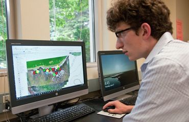
Drones allow us to get a lot of information quickly and consistently, but fewer hours in the field are traded for longer hours in the lab.
Bennett has nesting records for piping plovers at John E. Williams from as far back as 1984. Researchers with The Nature Conservancy and the U.S. Fish and Wildlife Service early on noted the GPS coordinates for plover nests and their hatching success, including whether chicks survived to fledge and eventually migrate south. Nest locations plotted on the beach maps developed by St. Thomas students with drones show that plovers do best on points of land and peninsulas and prefer the eastern side of lakes. The combined research also shows that some nest sites used years ago are now underwater.
Bennett’s work also reveals that plants are starting to take over the open beaches that nesting plovers need. The first to arrive is sea blite, a low, sprawling plant that is not bothered by salty soils. Sea blite, in fact, takes up salt from the ground, making it easier for other plants to follow. Alkali grass arrives next and then come various broad-leafed perennials. This succession results in fewer plovers. There is simply less available real estate for nests.

Why Are Plover Nesting Sites Decreasing?
This is a region subject to cycles of rain and drought, confirmed by evidence in the lake sediment cores and the historical record. Past droughts promoted residents near the preserve to describe clouds of billowing silt from dried up-lakes as looking like “smoke from a grassfire.” A severe drought ravaged the area from 1988 to 1992. Since then, rainfall has caused lake levels to rise. Water now covers the broad, flat beaches that plovers prefer, forcing them onto the steeper, higher beaches closer to shoreline vegetation.
What’s unclear is whether this is merely a wet period or a new normal, caused by a warmer climate generating more rainfall. But whatever the cause, TNC is looking for ways to maintain beaches for plovers. Staff have experimented with creating new beaches by trucking in gravel to bury plants and build new nesting habitat.
Another possibility is spraying salty lake water onto shorelines to inhibit plant growth. Prescribed burns, careful use of herbicides and installation of weed cloth all might help keep beaches open and inviting to plovers. What works best can be informed through more research on how the lakes function and future drone flights that map where vegetation has retreated and where plovers have nested.
“Having students conduct this research is a great asset for us,” said Chris Gordon, TNC’s land steward who oversees our John E. Williams preserve. “They’re tracking trends and it provides us with more tools to help guide our management and create the most habitat we can for piping plovers.”
NOTE: Due to COVID-19, the University of St. Thomas has put a hold on field research at John E. Williams so far this year. TNC is monitoring the plover population and is working to improve nesting habitat.

