2 Days Only:
Your $1 = $2 for Nature.
Close
interstitialRedirectModalTitle
interstitialRedirectModalMessage
interstitialRedirectModalRedirectCTA
interstitialRedirectModalDismissCTA
×
Skip to content
Language:
English
English
Español
Donate
What We Do
What We Do
Our Priorities
Tackle Climate Change
Protect Ocean, Land & Fresh Water
Provide Food and Water
Our Insights
Perspectives
Reports
Data & Tools
About Us
About Us
Who We Are
Our People
Our Science
Our Accountability
How We Work
Our History
Where We Work
Africa
Asia Pacific
Canada
Caribbean
Europe
India
Latin America
United States
Get Involved
Get Involved
How To Help
Volunteer
Attend Events
Take Action
Calculate Your Carbon Footprint
Explore the Places We Protect
Educational Resources
Membership & Giving
Membership & Giving
Donate
Become a Member
Renew
Give Monthly
Gift & Estate Planning
Other Ways to Give
English
Go Back
English
Español
Show search
Renew
Donate
Search
How to Help
Explore Our Protected Lands in North America
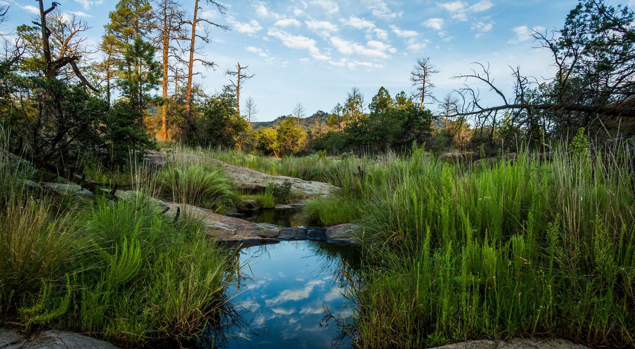
Scenic view
in Davis Mountain Preserve in Fort Davis, Texas.
©
Jerod Foster
Use the map to find a preserve near you to visit and connect with nature!
Share
View page in:
English
|
Español
{"openHighlightPin":"/etc.clientlibs/tnc/clientlibs/assets/resources/icons/Icon_C17-Pin-Hover-Open.svg","openInactivePin":"/etc.clientlibs/tnc/clientlibs/assets/resources/icons/Icon_C17-Pin-Default-Open.svg","paginationCount":"20","notFoundError":"No results found.","limitedInactivePin":"/etc.clientlibs/tnc/clientlibs/assets/resources/icons/Icon_C17-Pin-Default-Limited-Access.svg","limitedHighlightPin":"/etc.clientlibs/tnc/clientlibs/assets/resources/icons/Icon_C17-Pin-Hover-Limited-Access.svg","closedSelectedPin":"/etc.clientlibs/tnc/clientlibs/assets/resources/icons/Icon_C17-Pin-Clicked-Closed.svg","openSelectedPin":"/etc.clientlibs/tnc/clientlibs/assets/resources/icons/Icon_C17-Pin-Clicked-Open.svg","radiusValues":["{\"value\":\"500\"}","{\"value\":\"250\"}","{\"value\":\"120\"}","{\"value\":\"100\"}"],"notFoundFilterError":"No results found with those filters applied.","closedInactivePin":"/etc.clientlibs/tnc/clientlibs/assets/resources/icons/Icon_C17-Pin-Default-Closed.svg","limitedSelectedPin":"/etc.clientlibs/tnc/clientlibs/assets/resources/icons/Icon_C17-Pin-Clicked-Limited-Access.svg","closestRangeError":"Here is the closest place we found.","disableGeoService":"no","pinTypes":"status","value":["500","250","120","100"],"filterByAccess":"true","closedHighlightPin":"/etc.clientlibs/tnc/clientlibs/assets/resources/icons/Icon_C17-Pin-Hover-Closed.svg","activityTags":[{"activity":"biking"},{"activity":"birding"},{"activity":"boating"},{"activity":"camping"},{"activity":"diving"},{"activity":"fishing"},{"activity":"hiking"},{"activity":"hunting"},{"activity":"nature photography"},{"activity":"running"},{"activity":"skiing"},{"activity":"snorkeling"},{"activity":"snowmobiling"},{"activity":"snowshoeing"},{"activity":"swimming"},{"activity":"walking"},{"activity":"native gardening"},{"activity":"wildlife watching"}],"canFilter":true,"mapItems":[{"ctaLink":"https://www.nature.org/en-us/get-involved/how-to-help/places-we-protect/gila-river-preserve/","link":"https://www.nature.org/en-us/get-involved/how-to-help/places-we-protect/gila-river-preserve/","markerImage":{"small":"https://natureconservancy-h.assetsadobe.com/is/image/content/dam/tnc/nature/en/photos/t/n/tnc_44393792_4000x2200.jpg?crop=875%2C0%2C2138%2C2138&wid=150&hei=150&scl=14.253333333333334","default":"https://natureconservancy-h.assetsadobe.com/is/image/content/dam/tnc/nature/en/photos/t/n/tnc_44393792_4000x2200.jpg?crop=875%2C0%2C2138%2C2138&wid=600&hei=600&scl=3.5633333333333335","medium2x":"https://natureconservancy-h.assetsadobe.com/is/image/content/dam/tnc/nature/en/photos/t/n/tnc_44393792_4000x2200.jpg?crop=875%2C0%2C2138%2C2138&wid=600&hei=600&scl=3.5633333333333335","large":"https://natureconservancy-h.assetsadobe.com/is/image/content/dam/tnc/nature/en/photos/t/n/tnc_44393792_4000x2200.jpg?crop=875%2C0%2C2138%2C2138&wid=800&hei=800&scl=2.6725","small2x":"https://natureconservancy-h.assetsadobe.com/is/image/content/dam/tnc/nature/en/photos/t/n/tnc_44393792_4000x2200.jpg?crop=233%2C0%2C3420%2C2138&wid=512&hei=320&scl=6.68125","medium":"https://natureconservancy-h.assetsadobe.com/is/image/content/dam/tnc/nature/en/photos/t/n/tnc_44393792_4000x2200.jpg?crop=875%2C0%2C2138%2C2138&wid=600&hei=600&scl=3.5633333333333335","large2x":"https://natureconservancy-h.assetsadobe.com/is/image/content/dam/tnc/nature/en/photos/t/n/tnc_44393792_4000x2200.jpg?crop=875%2C0%2C2138%2C2138&wid=800&hei=800&scl=2.6725"},"markerImageAlt":"Gila River.","markerTitle":"Gila River Preserve","markerShortDescription":"The Gila River Preserve protects the Southwest's fragile riparian habitat and the verdant gallery woodland along the Gila River, one of the last free-flowing rivers in the Southwest.","markerLatitude":"33.043116","markerLongitude":"-108.532133","title":"Gila River Preserve","description":"The Gila River Preserve protects the Southwest's fragile riparian habitat and the verdant gallery woodland along the Gila River, one of the last free-flowing rivers in the Southwest.","preserveStatus":"Open to the Public","wheelchairAccess":"wheelchair-no","preserveTags":[{"tag":"water conservation"},{"tag":"land conservation"},{"tag":"wetlands restoration"},{"tag":"conservation work"},{"tag":"rivers"},{"tag":"stewardship"},{"tag":"habitat restoration"},{"tag":"New Mexico"},{"tag":"United States"}],"markerSubtitle":"New Mexico","hoursDesc":"Visit Our Preserve","locationTitle":"Near Silver City, New Mexico"},{"ctaLink":"https://www.nature.org/en-us/get-involved/how-to-help/places-we-protect/kitty-todd-nature-preserve-salamander-flats/","link":"https://www.nature.org/en-us/get-involved/how-to-help/places-we-protect/kitty-todd-nature-preserve-salamander-flats/","markerImage":{"small":"https://natureconservancy-h.assetsadobe.com/is/image/content/dam/tnc/nature/en/photos/o/h/OH_Kitty-Todd_Salamander-Flats_Pete-Blank_0643.jpg?crop=375%2C0%2C2250%2C2250&wid=150&hei=150&scl=15.0","default":"https://natureconservancy-h.assetsadobe.com/is/image/content/dam/tnc/nature/en/photos/o/h/OH_Kitty-Todd_Salamander-Flats_Pete-Blank_0643.jpg?crop=375%2C0%2C2250%2C2250&wid=600&hei=600&scl=3.75","medium2x":"https://natureconservancy-h.assetsadobe.com/is/image/content/dam/tnc/nature/en/photos/o/h/OH_Kitty-Todd_Salamander-Flats_Pete-Blank_0643.jpg?crop=375%2C0%2C2250%2C2250&wid=600&hei=600&scl=3.75","large":"https://natureconservancy-h.assetsadobe.com/is/image/content/dam/tnc/nature/en/photos/o/h/OH_Kitty-Todd_Salamander-Flats_Pete-Blank_0643.jpg?crop=375%2C0%2C2250%2C2250&wid=800&hei=800&scl=2.8125","small2x":"https://natureconservancy-h.assetsadobe.com/is/image/content/dam/tnc/nature/en/photos/o/h/OH_Kitty-Todd_Salamander-Flats_Pete-Blank_0643.jpg?crop=0%2C187%2C3000%2C1875&wid=512&hei=320&scl=5.859375","medium":"https://natureconservancy-h.assetsadobe.com/is/image/content/dam/tnc/nature/en/photos/o/h/OH_Kitty-Todd_Salamander-Flats_Pete-Blank_0643.jpg?crop=375%2C0%2C2250%2C2250&wid=600&hei=600&scl=3.75","large2x":"https://natureconservancy-h.assetsadobe.com/is/image/content/dam/tnc/nature/en/photos/o/h/OH_Kitty-Todd_Salamander-Flats_Pete-Blank_0643.jpg?crop=375%2C0%2C2250%2C2250&wid=800&hei=800&scl=2.8125"},"markerImageAlt":"Prairie habitat at Kitty Todd Nature Preserve's Salamander Flats.","markerTitle":"Kitty Todd Nature Preserve Salamander Flats","markerShortDescription":"Part of the Kitty Todd Nature Preserve, Salamander Flats offers a hike through rare mesic to wet sand prairie habitat in the Oak Openings Region of northwest Ohio.","markerLatitude":"41.61168149450721","markerLongitude":"-83.8063061108896","title":"Kitty Todd Nature Preserve Salamander Flats","description":"Part of the Kitty Todd Nature Preserve, Salamander Flats offers a hike through rare mesic to wet sand prairie habitat in the Oak Openings Region of northwest Ohio.","preserveStatus":"Open to the Public","wheelchairAccess":"wheelchair-no","preserveTags":[{"tag":"Ohio"},{"tag":"United States"}],"markerSubtitle":"Ohio","hoursDesc":"The preserve is open year-round from dawn to dusk.","locationTitle":"Northwest Ohio near Swanton"},{"ctaLink":"https://www.nature.org/en-us/get-involved/how-to-help/places-we-protect/arlington-native-plant-garden/","link":"https://www.nature.org/en-us/get-involved/how-to-help/places-we-protect/arlington-native-plant-garden/","markerImage":{"small":"https://natureconservancy-h.assetsadobe.com/is/image/content/dam/tnc/nature/en/photos/w/i/WildHydrangea.jpeg?crop=459%2C0%2C1289%2C1289&wid=150&hei=150&scl=8.593333333333334","default":"https://natureconservancy-h.assetsadobe.com/is/image/content/dam/tnc/nature/en/photos/w/i/WildHydrangea.jpeg?crop=459%2C0%2C1289%2C1289&wid=600&hei=600&scl=2.1483333333333334","medium2x":"https://natureconservancy-h.assetsadobe.com/is/image/content/dam/tnc/nature/en/photos/w/i/WildHydrangea.jpeg?crop=459%2C0%2C1289%2C1289&wid=600&hei=600&scl=2.1483333333333334","large":"https://natureconservancy-h.assetsadobe.com/is/image/content/dam/tnc/nature/en/photos/w/i/WildHydrangea.jpeg?crop=459%2C0%2C1289%2C1289&wid=800&hei=800&scl=1.61125","small2x":"https://natureconservancy-h.assetsadobe.com/is/image/content/dam/tnc/nature/en/photos/w/i/WildHydrangea.jpeg?crop=72%2C0%2C2062%2C1289&wid=512&hei=320&scl=4.028125","medium":"https://natureconservancy-h.assetsadobe.com/is/image/content/dam/tnc/nature/en/photos/w/i/WildHydrangea.jpeg?crop=459%2C0%2C1289%2C1289&wid=600&hei=600&scl=2.1483333333333334","large2x":"https://natureconservancy-h.assetsadobe.com/is/image/content/dam/tnc/nature/en/photos/w/i/WildHydrangea.jpeg?crop=459%2C0%2C1289%2C1289&wid=800&hei=800&scl=1.61125"},"markerImageAlt":"A bed of white wild hydrangeas.","markerTitle":"Arlington Native Plant Garden","markerShortDescription":"Visit The Nature Conservancy’s tiniest preserve, the Arlington Native Plant Garden.","markerLatitude":"38.882886","markerLongitude":"-77.112315","title":"Arlington Native Plant Garden","description":"Visit The Nature Conservancy’s tiniest preserve, the Arlington Native Plant Garden.","preserveStatus":"Open to the Public","wheelchairAccess":"wheelchair-no","preserveTags":[{"tag":"Global"},{"tag":"Virginia"},{"tag":"United States"}],"markerSubtitle":"Steps from the city’s hustle and bustle, a peaceful and purposeful ode to the mid-Atlantic’s natural heritage awaits year round in “TNC’s Tiniest Preserve.”","hoursDesc":"The garden is open during daylight hours year-round, seven days a week.","locationTitle":"Arlington, VA"},{"ctaLink":"https://www.nature.org/en-us/get-involved/how-to-help/places-we-protect/san-andreas-linkage/","link":"https://www.nature.org/en-us/get-involved/how-to-help/places-we-protect/san-andreas-linkage/","markerImage":{"small":"https://natureconservancy-h.assetsadobe.com/is/image/content/dam/tnc/nature/en/photos/v/u/Vulpes_macrotis_mutica_with_pups.jpg?crop=242%2C0%2C1015%2C1015&wid=150&hei=150&scl=6.766666666666667","default":"https://natureconservancy-h.assetsadobe.com/is/image/content/dam/tnc/nature/en/photos/v/u/Vulpes_macrotis_mutica_with_pups.jpg?crop=242%2C0%2C1015%2C1015&wid=600&hei=600&scl=1.6916666666666667","medium2x":"https://natureconservancy-h.assetsadobe.com/is/image/content/dam/tnc/nature/en/photos/v/u/Vulpes_macrotis_mutica_with_pups.jpg?crop=242%2C0%2C1015%2C1015&wid=600&hei=600&scl=1.6916666666666667","large":"https://natureconservancy-h.assetsadobe.com/is/image/content/dam/tnc/nature/en/photos/v/u/Vulpes_macrotis_mutica_with_pups.jpg?crop=242%2C0%2C1015%2C1015&wid=800&hei=800&scl=1.26875","small2x":"https://natureconservancy-h.assetsadobe.com/is/image/content/dam/tnc/nature/en/photos/v/u/Vulpes_macrotis_mutica_with_pups.jpg?crop=0%2C38%2C1500%2C937&wid=512&hei=320&scl=2.9296875","medium":"https://natureconservancy-h.assetsadobe.com/is/image/content/dam/tnc/nature/en/photos/v/u/Vulpes_macrotis_mutica_with_pups.jpg?crop=242%2C0%2C1015%2C1015&wid=600&hei=600&scl=1.6916666666666667","large2x":"https://natureconservancy-h.assetsadobe.com/is/image/content/dam/tnc/nature/en/photos/v/u/Vulpes_macrotis_mutica_with_pups.jpg?crop=242%2C0%2C1015%2C1015&wid=800&hei=800&scl=1.26875"},"markerImageAlt":"A mama fox sits in golden grasses and protects her two pups that are sitting near her.","markerTitle":"San Andreas Linkage","markerShortDescription":"TNC is working to create the San Andreas Linkage along the inner Coast Ranges to protect a vulnerable wildlife corridor for species native to this region such as the endangered San Joaquin kit fox.","markerLatitude":"35.189815655610005","markerLongitude":"-119.86337230435417","title":"San Andreas Linkage","description":"TNC is working to create the San Andreas Linkage along the inner Coast Ranges to protect a vulnerable wildlife corridor for species native to this region such as the endangered San Joaquin kit fox.","preserveStatus":"Limited Access","wheelchairAccess":"wheelchair-no","preserveTags":[{"tag":"California"},{"tag":"conservation work"},{"tag":"landscape scale"},{"tag":"wildlife corridors"},{"tag":"United States"},{"tag":"wildlife conservation"}],"markerSubtitle":"California","locationTitle":"California's Inner Coast Range"},{"ctaLink":"https://www.nature.org/en-us/get-involved/how-to-help/places-we-protect/maidstone-bends-preserve/","link":"https://www.nature.org/en-us/get-involved/how-to-help/places-we-protect/maidstone-bends-preserve/","markerImage":{"small":"https://natureconservancy-h.assetsadobe.com/is/image/content/dam/tnc/nature/en/photos/m/a/MaidstoneBendsAerialWeb_DBodnar.jpg?crop=208%2C0%2C879%2C879&wid=150&hei=150&scl=5.86","default":"https://natureconservancy-h.assetsadobe.com/is/image/content/dam/tnc/nature/en/photos/m/a/MaidstoneBendsAerialWeb_DBodnar.jpg?crop=208%2C0%2C879%2C879&wid=600&hei=600&scl=1.465","medium2x":"https://natureconservancy-h.assetsadobe.com/is/image/content/dam/tnc/nature/en/photos/m/a/MaidstoneBendsAerialWeb_DBodnar.jpg?crop=208%2C0%2C879%2C879&wid=600&hei=600&scl=1.465","large":"https://natureconservancy-h.assetsadobe.com/is/image/content/dam/tnc/nature/en/photos/m/a/MaidstoneBendsAerialWeb_DBodnar.jpg?crop=208%2C0%2C878%2C879&wid=800&hei=800&scl=1.09875","small2x":"https://natureconservancy-h.assetsadobe.com/is/image/content/dam/tnc/nature/en/photos/m/a/MaidstoneBendsAerialWeb_DBodnar.jpg?crop=0%2C34%2C1296%2C810&wid=512&hei=320&scl=2.53125","medium":"https://natureconservancy-h.assetsadobe.com/is/image/content/dam/tnc/nature/en/photos/m/a/MaidstoneBendsAerialWeb_DBodnar.jpg?crop=208%2C0%2C879%2C879&wid=600&hei=600&scl=1.465","large2x":"https://natureconservancy-h.assetsadobe.com/is/image/content/dam/tnc/nature/en/photos/m/a/MaidstoneBendsAerialWeb_DBodnar.jpg?crop=208%2C0%2C878%2C879&wid=800&hei=800&scl=1.09875"},"markerImageAlt":"An aerial view of a river winding through a forested landscape.","markerTitle":"Maidstone Bends Preserve","markerShortDescription":"Located along the banks of the Connecticut River, these lands help protect drinking water for people while providing vital habitat for wildlife on the move.","markerLatitude":"44.586804","markerLongitude":"-71.530278","title":"Maidstone Bends Preserve","description":"Located along the banks of the Connecticut River, these lands help protect drinking water for people while providing vital habitat for wildlife on the move.","preserveStatus":"Open to the Public","wheelchairAccess":"wheelchair-no","preserveTags":[{"tag":"water conservation"},{"tag":"land conservation"},{"tag":"biodiversity"},{"tag":"conservation work"},{"tag":"New Hampshire"},{"tag":"habitat restoration"},{"tag":"United States"},{"tag":"wildlife conservation"}],"markerSubtitle":"New Hampshire","hoursDesc":"Open dawn to dusk.","locationTitle":"Groveton and Northumberland, NH"},{"ctaLink":"https://www.nature.org/en-us/get-involved/how-to-help/places-we-protect/rising-river-preserve/","link":"https://www.nature.org/en-us/get-involved/how-to-help/places-we-protect/rising-river-preserve/","markerImage":{"small":"https://natureconservancy-h.assetsadobe.com/is/image/content/dam/tnc/nature/en/photos/8/5/851A6460.JPG?crop=384%2C0%2C1537%2C1537&wid=150&hei=150&scl=10.246666666666666","default":"https://natureconservancy-h.assetsadobe.com/is/image/content/dam/tnc/nature/en/photos/8/5/851A6460.JPG?crop=384%2C0%2C1537%2C1537&wid=600&hei=600&scl=2.5616666666666665","medium2x":"https://natureconservancy-h.assetsadobe.com/is/image/content/dam/tnc/nature/en/photos/8/5/851A6460.JPG?crop=384%2C0%2C1537%2C1537&wid=600&hei=600&scl=2.5616666666666665","large":"https://natureconservancy-h.assetsadobe.com/is/image/content/dam/tnc/nature/en/photos/8/5/851A6460.JPG?crop=384%2C0%2C1537%2C1537&wid=800&hei=800&scl=1.92125","small2x":"https://natureconservancy-h.assetsadobe.com/is/image/content/dam/tnc/nature/en/photos/8/5/851A6460.JPG?crop=0%2C48%2C2305%2C1440&wid=512&hei=320&scl=4.501953125","medium":"https://natureconservancy-h.assetsadobe.com/is/image/content/dam/tnc/nature/en/photos/8/5/851A6460.JPG?crop=384%2C0%2C1537%2C1537&wid=600&hei=600&scl=2.5616666666666665","large2x":"https://natureconservancy-h.assetsadobe.com/is/image/content/dam/tnc/nature/en/photos/8/5/851A6460.JPG?crop=384%2C0%2C1537%2C1537&wid=800&hei=800&scl=1.92125"},"markerImageAlt":"Glassy water in the foreground with a snow-dusted mountain in the background. ","markerTitle":"Rising River Preserve","markerShortDescription":"At the edge of Lassen National Forest in Shasta County, cold water percolates up from one of the largest spring systems in the nation, forming Rising River Lake. ","markerLatitude":"40.93759905580865","markerLongitude":"-121.60454917754089","title":"Rising River Preserve","description":"At the edge of Lassen National Forest in Shasta County, cold water percolates up from one of the largest spring systems in the nation, forming Rising River Lake. ","preserveStatus":"Limited Access","wheelchairAccess":"wheelchair-no","preserveTags":[{"tag":"California"},{"tag":"United States"}],"locationTitle":"Shasta County"},{"ctaLink":"https://www.nature.org/en-us/get-involved/how-to-help/places-we-protect/kansas-sandhills-ranch/","link":"https://www.nature.org/en-us/get-involved/how-to-help/places-we-protect/kansas-sandhills-ranch/","markerImage":{"small":"https://natureconservancy-h.assetsadobe.com/is/image/content/dam/tnc/nature/en/photos/s/a/sandhills-ranch-prairie-kansas.jpg?crop=1000%2C0%2C4000%2C4000&wid=150&hei=150&scl=26.666666666666668","default":"https://natureconservancy-h.assetsadobe.com/is/image/content/dam/tnc/nature/en/photos/s/a/sandhills-ranch-prairie-kansas.jpg?crop=1000%2C0%2C4000%2C4000&wid=600&hei=600&scl=6.666666666666667","medium2x":"https://natureconservancy-h.assetsadobe.com/is/image/content/dam/tnc/nature/en/photos/s/a/sandhills-ranch-prairie-kansas.jpg?crop=1000%2C0%2C4000%2C4000&wid=600&hei=600&scl=6.666666666666667","large":"https://natureconservancy-h.assetsadobe.com/is/image/content/dam/tnc/nature/en/photos/s/a/sandhills-ranch-prairie-kansas.jpg?crop=1000%2C0%2C4000%2C4000&wid=800&hei=800&scl=5.0","small2x":"https://natureconservancy-h.assetsadobe.com/is/image/content/dam/tnc/nature/en/photos/s/a/sandhills-ranch-prairie-kansas.jpg?crop=0%2C125%2C6000%2C3750&wid=512&hei=320&scl=11.71875","medium":"https://natureconservancy-h.assetsadobe.com/is/image/content/dam/tnc/nature/en/photos/s/a/sandhills-ranch-prairie-kansas.jpg?crop=1000%2C0%2C4000%2C4000&wid=600&hei=600&scl=6.666666666666667","large2x":"https://natureconservancy-h.assetsadobe.com/is/image/content/dam/tnc/nature/en/photos/s/a/sandhills-ranch-prairie-kansas.jpg?crop=1000%2C0%2C4000%2C4000&wid=800&hei=800&scl=5.0"},"markerImageAlt":"Undulating hills covered in green and brown grass.","markerTitle":"Sandhills Ranch","markerShortDescription":"10,000+ acres of sand prairie in central Kansas protected by The Nature Conservancy.","markerLatitude":"37.727789","markerLongitude":"-99.559525","title":"Sandhills Ranch","description":"10,000+ acres of sand prairie in central Kansas protected by The Nature Conservancy.","preserveStatus":"Closed to the Public","wheelchairAccess":"wheelchair-no","preserveTags":[{"tag":"land conservation"},{"tag":"water conservation"},{"tag":"Kansas"},{"tag":"grasslands"},{"tag":"places"},{"tag":"conservation work"},{"tag":"wetlands"},{"tag":"United States"}],"markerSubtitle":"Kansas","locationTitle":"Between Dodge City & Greensburg, Kansas"},{"ctaLink":"https://www.nature.org/en-us/get-involved/how-to-help/places-we-protect/agassiz-addition/","link":"https://www.nature.org/en-us/get-involved/how-to-help/places-we-protect/agassiz-addition/","markerImage":{"small":"https://natureconservancy-h.assetsadobe.com/is/image/content/dam/tnc/nature/en/photos/m/r/MRCC120811_D210.jpg?crop=952%2C0%2C4096%2C4096&wid=150&hei=150&scl=27.30666666666667","default":"https://natureconservancy-h.assetsadobe.com/is/image/content/dam/tnc/nature/en/photos/m/r/MRCC120811_D210.jpg?crop=952%2C0%2C4096%2C4096&wid=600&hei=600&scl=6.826666666666667","medium2x":"https://natureconservancy-h.assetsadobe.com/is/image/content/dam/tnc/nature/en/photos/m/r/MRCC120811_D210.jpg?crop=952%2C0%2C4096%2C4096&wid=600&hei=600&scl=6.826666666666667","large":"https://natureconservancy-h.assetsadobe.com/is/image/content/dam/tnc/nature/en/photos/m/r/MRCC120811_D210.jpg?crop=952%2C0%2C4096%2C4096&wid=800&hei=800&scl=5.12","small2x":"https://natureconservancy-h.assetsadobe.com/is/image/content/dam/tnc/nature/en/photos/m/r/MRCC120811_D210.jpg?crop=0%2C173%2C6000%2C3750&wid=512&hei=320&scl=11.71875","medium":"https://natureconservancy-h.assetsadobe.com/is/image/content/dam/tnc/nature/en/photos/m/r/MRCC120811_D210.jpg?crop=952%2C0%2C4096%2C4096&wid=600&hei=600&scl=6.826666666666667","large2x":"https://natureconservancy-h.assetsadobe.com/is/image/content/dam/tnc/nature/en/photos/m/r/MRCC120811_D210.jpg?crop=952%2C0%2C4096%2C4096&wid=800&hei=800&scl=5.12"},"markerImageAlt":"Closeup of wispy purple flowers growing in a field against a clear blue sky.","markerTitle":"Agassiz Dunes Addition","markerShortDescription":"The Nature Conservancy protected approximately 120 acres of native prairie and grasslands in Polk County that provide essential habitat for grassland birds and prairie pollinators.","markerLatitude":"47.514445","markerLongitude":"-96.287554","title":"Agassiz Dunes Addition","description":"The Nature Conservancy protected approximately 120 acres of native prairie and grasslands in Polk County that provide essential habitat for grassland birds and prairie pollinators.","preserveStatus":"Open to the Public","wheelchairAccess":"wheelchair-no","preserveTags":[{"tag":"land conservation"},{"tag":"Minnesota"},{"tag":"grasslands"},{"tag":"conservation work"},{"tag":"habitat restoration"},{"tag":"United States"},{"tag":"prairie restoration"}],"markerSubtitle":"Minnesota","locationTitle":"Polk County, Minnesota"},{"ctaLink":"https://www.nature.org/en-us/get-involved/how-to-help/places-we-protect/florian-preserve/","link":"https://www.nature.org/en-us/get-involved/how-to-help/places-we-protect/florian-preserve/","markerImage":{"small":"https://natureconservancy-h.assetsadobe.com/is/image/content/dam/tnc/nature/en/photos/m/r/MRCC120811_D126.jpg?crop=960%2C0%2C3840%2C3840&wid=150&hei=150&scl=25.6","default":"https://natureconservancy-h.assetsadobe.com/is/image/content/dam/tnc/nature/en/photos/m/r/MRCC120811_D126.jpg?crop=960%2C0%2C3840%2C3840&wid=600&hei=600&scl=6.4","medium2x":"https://natureconservancy-h.assetsadobe.com/is/image/content/dam/tnc/nature/en/photos/m/r/MRCC120811_D126.jpg?crop=960%2C0%2C3840%2C3840&wid=600&hei=600&scl=6.4","large":"https://natureconservancy-h.assetsadobe.com/is/image/content/dam/tnc/nature/en/photos/m/r/MRCC120811_D126.jpg?crop=960%2C0%2C3840%2C3840&wid=800&hei=800&scl=4.8","small2x":"https://natureconservancy-h.assetsadobe.com/is/image/content/dam/tnc/nature/en/photos/m/r/MRCC120811_D126.jpg?crop=0%2C120%2C5760%2C3600&wid=512&hei=320&scl=11.25","medium":"https://natureconservancy-h.assetsadobe.com/is/image/content/dam/tnc/nature/en/photos/m/r/MRCC120811_D126.jpg?crop=960%2C0%2C3840%2C3840&wid=600&hei=600&scl=6.4","large2x":"https://natureconservancy-h.assetsadobe.com/is/image/content/dam/tnc/nature/en/photos/m/r/MRCC120811_D126.jpg?crop=960%2C0%2C3840%2C3840&wid=800&hei=800&scl=4.8"},"markerImageAlt":"Closeup of purple-tipped grasses blowing in the breeze.","markerTitle":"Wallace C. Dayton Conservation and Wildlife Area Addition","markerShortDescription":"TNC protected 135 acres in the Tallgrass Aspen Parkland landscape comprised of grasslands and beach ridge wetlands that provide habitat for a variety of wildlife.","markerLatitude":"48.398806","markerLongitude":"-96.55055","title":"Wallace C. Dayton Conservation and Wildlife Area Addition","description":"TNC protected 135 acres in the Tallgrass Aspen Parkland landscape comprised of grasslands and beach ridge wetlands that provide habitat for a variety of wildlife.","preserveStatus":"Open to the Public","wheelchairAccess":"wheelchair-no","preserveTags":[{"tag":"land conservation"},{"tag":"water conservation"},{"tag":"Minnesota"},{"tag":"grasslands"},{"tag":"conservation work"},{"tag":"wetlands"},{"tag":"United States"}],"markerSubtitle":"Minnesota","locationTitle":"Marshall County, Minnesota"},{"ctaLink":"https://www.nature.org/en-us/get-involved/how-to-help/places-we-protect/hole-in-the-mountain-addition/","link":"https://www.nature.org/en-us/get-involved/how-to-help/places-we-protect/hole-in-the-mountain-addition/","markerImage":{"small":"https://natureconservancy-h.assetsadobe.com/is/image/content/dam/tnc/nature/en/photos/r/h/RHS_H3_6E7E4170.jpg?crop=144%2C0%2C576%2C576&wid=150&hei=150&scl=3.84","default":"https://natureconservancy-h.assetsadobe.com/is/image/content/dam/tnc/nature/en/photos/r/h/RHS_H3_6E7E4170.jpg?crop=144%2C0%2C576%2C576&wid=600&hei=600&scl=0.96","medium2x":"https://natureconservancy-h.assetsadobe.com/is/image/content/dam/tnc/nature/en/photos/r/h/RHS_H3_6E7E4170.jpg?crop=144%2C0%2C576%2C576&wid=600&hei=600&scl=0.96","large":"https://natureconservancy-h.assetsadobe.com/is/image/content/dam/tnc/nature/en/photos/r/h/RHS_H3_6E7E4170.jpg?crop=144%2C0%2C576%2C576&wid=800&hei=800&scl=0.72","small2x":"https://natureconservancy-h.assetsadobe.com/is/image/content/dam/tnc/nature/en/photos/r/h/RHS_H3_6E7E4170.jpg?crop=0%2C18%2C864%2C540&wid=512&hei=320&scl=1.6875","medium":"https://natureconservancy-h.assetsadobe.com/is/image/content/dam/tnc/nature/en/photos/r/h/RHS_H3_6E7E4170.jpg?crop=144%2C0%2C576%2C576&wid=600&hei=600&scl=0.96","large2x":"https://natureconservancy-h.assetsadobe.com/is/image/content/dam/tnc/nature/en/photos/r/h/RHS_H3_6E7E4170.jpg?crop=144%2C0%2C576%2C576&wid=800&hei=800&scl=0.72"},"markerImageAlt":"A cluster of bright yellow wildflowers grows in a large prairie.","markerTitle":"Hole-in-the-Mountain Prairie Addition","markerShortDescription":"The Nature Conservancy protected 199 acres in Lincoln County that includes native prairie, an oak-basswood forest and coulee, providing habitat for prairie butterflies and grassland birds. ","markerLatitude":"44.243089","markerLongitude":"-96.323146","title":"Hole-in-the-Mountain Prairie Addition","description":"The Nature Conservancy protected 199 acres in Lincoln County that includes native prairie, an oak-basswood forest and coulee, providing habitat for prairie butterflies and grassland birds. ","preserveStatus":"Open to the Public","wheelchairAccess":"wheelchair-no","preserveTags":[{"tag":"land conservation"},{"tag":"Minnesota"},{"tag":"grasslands"},{"tag":"conservation work"},{"tag":"habitat restoration"},{"tag":"United States"},{"tag":"prairie restoration"}],"markerSubtitle":"Minnesota","locationTitle":"Lincoln County, Minnesota"},{"ctaLink":"https://www.nature.org/en-us/get-involved/how-to-help/places-we-protect/leif-mountain-addition/","link":"https://www.nature.org/en-us/get-involved/how-to-help/places-we-protect/leif-mountain-addition/","markerImage":{"small":"https://natureconservancy-h.assetsadobe.com/is/image/content/dam/tnc/nature/en/photos/m/r/MRCC140830_D653.jpg?crop=192%2C0%2C768%2C768&wid=150&hei=150&scl=5.12","default":"https://natureconservancy-h.assetsadobe.com/is/image/content/dam/tnc/nature/en/photos/m/r/MRCC140830_D653.jpg?crop=192%2C0%2C768%2C768&wid=600&hei=600&scl=1.28","medium2x":"https://natureconservancy-h.assetsadobe.com/is/image/content/dam/tnc/nature/en/photos/m/r/MRCC140830_D653.jpg?crop=192%2C0%2C768%2C768&wid=600&hei=600&scl=1.28","large":"https://natureconservancy-h.assetsadobe.com/is/image/content/dam/tnc/nature/en/photos/m/r/MRCC140830_D653.jpg?crop=192%2C0%2C768%2C768&wid=800&hei=800&scl=0.96","small2x":"https://natureconservancy-h.assetsadobe.com/is/image/content/dam/tnc/nature/en/photos/m/r/MRCC140830_D653.jpg?crop=0%2C24%2C1152%2C720&wid=512&hei=320&scl=2.25","medium":"https://natureconservancy-h.assetsadobe.com/is/image/content/dam/tnc/nature/en/photos/m/r/MRCC140830_D653.jpg?crop=192%2C0%2C768%2C768&wid=600&hei=600&scl=1.28","large2x":"https://natureconservancy-h.assetsadobe.com/is/image/content/dam/tnc/nature/en/photos/m/r/MRCC140830_D653.jpg?crop=192%2C0%2C768%2C768&wid=800&hei=800&scl=0.96"},"markerImageAlt":"Delicate purple flowers grow in the foreground of a green grassland; yellow flowers are blurred out in the background.","markerTitle":"Leif Mountain Addition","markerShortDescription":"The Nature Conservancy protected 54 acres in Kandiyohi County, including a dry gravel hill prairie rated as outstanding by the Minnesota Biological Survey as well as woodlands and wetlands.","markerLatitude":"45.3946623","markerLongitude":"-95.1679130","title":"Leif Mountain Addition","description":"The Nature Conservancy protected 54 acres in Kandiyohi County, including a dry gravel hill prairie rated as outstanding by the Minnesota Biological Survey as well as woodlands and wetlands.","preserveStatus":"Open to the Public","wheelchairAccess":"wheelchair-no","preserveTags":[{"tag":"land conservation"},{"tag":"Minnesota"},{"tag":"grasslands"},{"tag":"conservation work"},{"tag":"habitat restoration"},{"tag":"United States"},{"tag":"prairie restoration"}],"markerSubtitle":"Minnesota","locationTitle":"Kandiyohi County, Minnesota"},{"ctaLink":"https://www.nature.org/en-us/get-involved/how-to-help/places-we-protect/mccarthy-lake-wma-addition/","link":"https://www.nature.org/en-us/get-involved/how-to-help/places-we-protect/mccarthy-lake-wma-addition/","markerImage":{"small":"https://natureconservancy-h.assetsadobe.com/is/image/content/dam/tnc/nature/en/photos/m/r/MRCC140830_D599.jpg?crop=241%2C0%2C669%2C669&wid=150&hei=150&scl=4.46","default":"https://natureconservancy-h.assetsadobe.com/is/image/content/dam/tnc/nature/en/photos/m/r/MRCC140830_D599.jpg?crop=241%2C0%2C669%2C669&wid=600&hei=600&scl=1.115","medium2x":"https://natureconservancy-h.assetsadobe.com/is/image/content/dam/tnc/nature/en/photos/m/r/MRCC140830_D599.jpg?crop=241%2C0%2C669%2C669&wid=600&hei=600&scl=1.115","large":"https://natureconservancy-h.assetsadobe.com/is/image/content/dam/tnc/nature/en/photos/m/r/MRCC140830_D599.jpg?crop=241%2C0%2C669%2C669&wid=800&hei=800&scl=0.83625","small2x":"https://natureconservancy-h.assetsadobe.com/is/image/content/dam/tnc/nature/en/photos/m/r/MRCC140830_D599.jpg?crop=40%2C0%2C1070%2C669&wid=512&hei=320&scl=2.090625","medium":"https://natureconservancy-h.assetsadobe.com/is/image/content/dam/tnc/nature/en/photos/m/r/MRCC140830_D599.jpg?crop=241%2C0%2C669%2C669&wid=600&hei=600&scl=1.115","large2x":"https://natureconservancy-h.assetsadobe.com/is/image/content/dam/tnc/nature/en/photos/m/r/MRCC140830_D599.jpg?crop=241%2C0%2C669%2C669&wid=800&hei=800&scl=0.83625"},"markerImageAlt":"Closeup of three echinacea plants flowering in a prairie under a blue sky with puffy white clouds.","markerTitle":"McCarthy Lake WMA Addition","markerShortDescription":"The Nature Conservancy protected 146 acres in Wabasha County, including sand prairie and dune habitat for grassland nesting birds and Blanding’s turtles. ","markerLatitude":"44.265437","markerLongitude":"-91.943856","title":"McCarthy Lake WMA Addition","description":"The Nature Conservancy protected 146 acres in Wabasha County, including sand prairie and dune habitat for grassland nesting birds and Blanding’s turtles. ","preserveStatus":"Open to the Public","wheelchairAccess":"wheelchair-no","preserveTags":[{"tag":"Minnesota"},{"tag":"United States"}],"markerSubtitle":"Minnesota","locationTitle":"Wabasha County, Minnesota"},{"ctaLink":"https://www.nature.org/en-us/get-involved/how-to-help/places-we-protect/weaver-dunes-addition/","link":"https://www.nature.org/en-us/get-involved/how-to-help/places-we-protect/weaver-dunes-addition/","markerImage":{"small":"https://natureconservancy-h.assetsadobe.com/is/image/content/dam/tnc/nature/en/photos/m/r/MRCC140830_D730.jpg?crop=252%2C0%2C648%2C648&wid=150&hei=150&scl=4.32","default":"https://natureconservancy-h.assetsadobe.com/is/image/content/dam/tnc/nature/en/photos/m/r/MRCC140830_D730.jpg?crop=252%2C0%2C648%2C648&wid=600&hei=600&scl=1.08","medium2x":"https://natureconservancy-h.assetsadobe.com/is/image/content/dam/tnc/nature/en/photos/m/r/MRCC140830_D730.jpg?crop=252%2C0%2C648%2C648&wid=600&hei=600&scl=1.08","large":"https://natureconservancy-h.assetsadobe.com/is/image/content/dam/tnc/nature/en/photos/m/r/MRCC140830_D730.jpg?crop=252%2C0%2C648%2C648&wid=800&hei=800&scl=0.81","small2x":"https://natureconservancy-h.assetsadobe.com/is/image/content/dam/tnc/nature/en/photos/m/r/MRCC140830_D730.jpg?crop=57%2C0%2C1036%2C648&wid=512&hei=320&scl=2.025","medium":"https://natureconservancy-h.assetsadobe.com/is/image/content/dam/tnc/nature/en/photos/m/r/MRCC140830_D730.jpg?crop=252%2C0%2C648%2C648&wid=600&hei=600&scl=1.08","large2x":"https://natureconservancy-h.assetsadobe.com/is/image/content/dam/tnc/nature/en/photos/m/r/MRCC140830_D730.jpg?crop=252%2C0%2C648%2C648&wid=800&hei=800&scl=0.81"},"markerImageAlt":"Golden grasses sway in the breeze.","markerTitle":"Weaver Dunes Addition","markerShortDescription":"The Nature Conservancy protected approximately 146 acres in Wabasha County, including sand prairie and dune habitat for grassland nesting birds and Blanding’s turtles. ","markerLatitude":"44.251409","markerLongitude":"-91.943935","title":"Weaver Dunes Addition","description":"The Nature Conservancy protected approximately 146 acres in Wabasha County, including sand prairie and dune habitat for grassland nesting birds and Blanding’s turtles. ","preserveStatus":"Open to the Public","wheelchairAccess":"wheelchair-no","preserveTags":[{"tag":"Minnesota"},{"tag":"United States"}],"markerSubtitle":"Minnesota","locationTitle":"Wabasha County, Minnesota"},{"ctaLink":"https://www.nature.org/en-us/get-involved/how-to-help/places-we-protect/mount-olivet-preserve/","link":"https://www.nature.org/en-us/get-involved/how-to-help/places-we-protect/mount-olivet-preserve/","markerImage":{"small":"https://natureconservancy-h.assetsadobe.com/is/image/content/dam/tnc/nature/en/photos/p/1/P1080394.jpg?crop=875%2C0%2C2250%2C2250&wid=150&hei=150&scl=15.0","default":"https://natureconservancy-h.assetsadobe.com/is/image/content/dam/tnc/nature/en/photos/p/1/P1080394.jpg?crop=875%2C0%2C2250%2C2250&wid=600&hei=600&scl=3.75","medium2x":"https://natureconservancy-h.assetsadobe.com/is/image/content/dam/tnc/nature/en/photos/p/1/P1080394.jpg?crop=875%2C0%2C2250%2C2250&wid=600&hei=600&scl=3.75","large":"https://natureconservancy-h.assetsadobe.com/is/image/content/dam/tnc/nature/en/photos/p/1/P1080394.jpg?crop=875%2C0%2C2250%2C2250&wid=800&hei=800&scl=2.8125","small2x":"https://natureconservancy-h.assetsadobe.com/is/image/content/dam/tnc/nature/en/photos/p/1/P1080394.jpg?crop=200%2C0%2C3600%2C2250&wid=512&hei=320&scl=7.03125","medium":"https://natureconservancy-h.assetsadobe.com/is/image/content/dam/tnc/nature/en/photos/p/1/P1080394.jpg?crop=875%2C0%2C2250%2C2250&wid=600&hei=600&scl=3.75","large2x":"https://natureconservancy-h.assetsadobe.com/is/image/content/dam/tnc/nature/en/photos/p/1/P1080394.jpg?crop=875%2C0%2C2250%2C2250&wid=800&hei=800&scl=2.8125"},"markerImageAlt":"A man sits on a high-backed wooden bench reading a book in a green space encircled by trees.","markerTitle":"Mount Olivet Cemetery","markerShortDescription":"Explore a historic cemetery reimagined as an urban arboretum, green space and demonstration site for many important conservation practices. ","markerLatitude":"38.91209032580726","markerLongitude":"-76.97918658788186","title":"Mount Olivet Cemetery","description":"Explore a historic cemetery reimagined as an urban arboretum, green space and demonstration site for many important conservation practices. ","preserveStatus":"Open to the Public","wheelchairAccess":"wheelchair-no","preserveTags":[{"tag":"Maryland and D.C."},{"tag":"conservation work"},{"tag":"city parks"},{"tag":"activities"},{"tag":"walking"},{"tag":"outdoor activities"},{"tag":"stormwater"},{"tag":"birding"},{"tag":"urban conservation"},{"tag":"healthy cities"},{"tag":"District of Columbia"},{"tag":"United States"},{"tag":"cities"}],"hoursDesc":"March 16 to November 2, 7:30 am to 7:00 pm. November 3 to March 15, 7:30 am to 5:00 pm","locationTitle":"Washington, DC"},{"ctaLink":"https://www.nature.org/en-us/get-involved/how-to-help/places-we-protect/ca-north-coast/","link":"https://www.nature.org/en-us/get-involved/how-to-help/places-we-protect/ca-north-coast/","markerImage":{"small":"https://natureconservancy-h.assetsadobe.com/is/image/content/dam/tnc/nature/en/photos/groundwater-resource-hub/tnc_63367942_Large_GarciaRiverEstuary_byDouglasSteakley.jpg?crop=503%2C0%2C1993%2C1993&wid=150&hei=150&scl=13.286666666666667","default":"https://natureconservancy-h.assetsadobe.com/is/image/content/dam/tnc/nature/en/photos/groundwater-resource-hub/tnc_63367942_Large_GarciaRiverEstuary_byDouglasSteakley.jpg?crop=503%2C0%2C1993%2C1993&wid=600&hei=600&scl=3.3216666666666668","medium2x":"https://natureconservancy-h.assetsadobe.com/is/image/content/dam/tnc/nature/en/photos/groundwater-resource-hub/tnc_63367942_Large_GarciaRiverEstuary_byDouglasSteakley.jpg?crop=503%2C0%2C1993%2C1993&wid=600&hei=600&scl=3.3216666666666668","large":"https://natureconservancy-h.assetsadobe.com/is/image/content/dam/tnc/nature/en/photos/groundwater-resource-hub/tnc_63367942_Large_GarciaRiverEstuary_byDouglasSteakley.jpg?crop=503%2C0%2C1993%2C1993&wid=800&hei=800&scl=2.49125","small2x":"https://natureconservancy-h.assetsadobe.com/is/image/content/dam/tnc/nature/en/photos/groundwater-resource-hub/tnc_63367942_Large_GarciaRiverEstuary_byDouglasSteakley.jpg?crop=0%2C59%2C3000%2C1875&wid=512&hei=320&scl=5.859375","medium":"https://natureconservancy-h.assetsadobe.com/is/image/content/dam/tnc/nature/en/photos/groundwater-resource-hub/tnc_63367942_Large_GarciaRiverEstuary_byDouglasSteakley.jpg?crop=503%2C0%2C1993%2C1993&wid=600&hei=600&scl=3.3216666666666668","large2x":"https://natureconservancy-h.assetsadobe.com/is/image/content/dam/tnc/nature/en/photos/groundwater-resource-hub/tnc_63367942_Large_GarciaRiverEstuary_byDouglasSteakley.jpg?crop=503%2C0%2C1993%2C1993&wid=800&hei=800&scl=2.49125"},"markerImageAlt":"The Garcia River joins the Pacific Ocean in this view of estuary at Stornetta Ranch.","markerTitle":"North Coast","markerShortDescription":"The estuaries, rivers, and forests of California’s North Coast are known worldwide for their beauty, importance to conservation, and recreational value. ","markerLatitude":"39.152133","markerLongitude":"-123.358057","title":"North Coast","description":"The estuaries, rivers, and forests of California’s North Coast are known worldwide for their beauty, importance to conservation, and recreational value. ","preserveStatus":"Limited Access","wheelchairAccess":"wheelchair-no","preserveTags":[{"tag":"California"},{"tag":"United States"}],"markerSubtitle":"California","locationTitle":"Mendocino County"},{"ctaLink":"https://www.nature.org/en-us/get-involved/how-to-help/places-we-protect/ten-mile-river/","link":"https://www.nature.org/en-us/get-involved/how-to-help/places-we-protect/ten-mile-river/","markerImage":{"small":"https://natureconservancy-h.assetsadobe.com/is/image/content/dam/tnc/nature/en/photos/TenMile_ScenicEstuary.png?crop=78%2C0%2C468%2C468&wid=150&hei=150&scl=3.12","default":"https://natureconservancy-h.assetsadobe.com/is/image/content/dam/tnc/nature/en/photos/TenMile_ScenicEstuary.png?crop=78%2C0%2C468%2C468&wid=600&hei=600&scl=0.78","medium2x":"https://natureconservancy-h.assetsadobe.com/is/image/content/dam/tnc/nature/en/photos/TenMile_ScenicEstuary.png?crop=78%2C0%2C468%2C468&wid=600&hei=600&scl=0.78","large":"https://natureconservancy-h.assetsadobe.com/is/image/content/dam/tnc/nature/en/photos/TenMile_ScenicEstuary.png?crop=78%2C0%2C468%2C468&wid=800&hei=800&scl=0.585","small2x":"https://natureconservancy-h.assetsadobe.com/is/image/content/dam/tnc/nature/en/photos/TenMile_ScenicEstuary.png?crop=0%2C39%2C624%2C390&wid=512&hei=320&scl=1.21875","medium":"https://natureconservancy-h.assetsadobe.com/is/image/content/dam/tnc/nature/en/photos/TenMile_ScenicEstuary.png?crop=78%2C0%2C468%2C468&wid=600&hei=600&scl=0.78","large2x":"https://natureconservancy-h.assetsadobe.com/is/image/content/dam/tnc/nature/en/photos/TenMile_ScenicEstuary.png?crop=78%2C0%2C468%2C468&wid=800&hei=800&scl=0.585"},"markerImageAlt":"A view down to the Ten Mile River.","markerTitle":"Ten Mile River","markerShortDescription":"The Ten Mile River flows from open grasslands, through towering redwood forests, rich coastal wetlands, and ultimately empties into the Pacific Ocean on the picturesque Mendocino coast. ","markerLatitude":"39.5497","markerLongitude":"-123.7325","title":"Ten Mile River","description":"The Ten Mile River flows from open grasslands, through towering redwood forests, rich coastal wetlands, and ultimately empties into the Pacific Ocean on the picturesque Mendocino coast. ","preserveStatus":"Limited Access","wheelchairAccess":"wheelchair-no","preserveTags":[{"tag":"California"},{"tag":"United States"}],"markerSubtitle":"California","locationTitle":"Mendocino County, CA"},{"ctaLink":"https://www.nature.org/en-us/get-involved/how-to-help/places-we-protect/lower-garcia-river/","link":"https://www.nature.org/en-us/get-involved/how-to-help/places-we-protect/lower-garcia-river/","markerImage":{"small":"https://natureconservancy-h.assetsadobe.com/is/image/content/dam/tnc/nature/en/photos/groundwater-resource-hub/tnc_63367942_Large_GarciaRiverEstuary_byDouglasSteakley.jpg?crop=503%2C0%2C1993%2C1993&wid=150&hei=150&scl=13.286666666666667","default":"https://natureconservancy-h.assetsadobe.com/is/image/content/dam/tnc/nature/en/photos/groundwater-resource-hub/tnc_63367942_Large_GarciaRiverEstuary_byDouglasSteakley.jpg?crop=503%2C0%2C1993%2C1993&wid=600&hei=600&scl=3.3216666666666668","medium2x":"https://natureconservancy-h.assetsadobe.com/is/image/content/dam/tnc/nature/en/photos/groundwater-resource-hub/tnc_63367942_Large_GarciaRiverEstuary_byDouglasSteakley.jpg?crop=503%2C0%2C1993%2C1993&wid=600&hei=600&scl=3.3216666666666668","large":"https://natureconservancy-h.assetsadobe.com/is/image/content/dam/tnc/nature/en/photos/groundwater-resource-hub/tnc_63367942_Large_GarciaRiverEstuary_byDouglasSteakley.jpg?crop=503%2C0%2C1993%2C1993&wid=800&hei=800&scl=2.49125","small2x":"https://natureconservancy-h.assetsadobe.com/is/image/content/dam/tnc/nature/en/photos/groundwater-resource-hub/tnc_63367942_Large_GarciaRiverEstuary_byDouglasSteakley.jpg?crop=0%2C59%2C3000%2C1875&wid=512&hei=320&scl=5.859375","medium":"https://natureconservancy-h.assetsadobe.com/is/image/content/dam/tnc/nature/en/photos/groundwater-resource-hub/tnc_63367942_Large_GarciaRiverEstuary_byDouglasSteakley.jpg?crop=503%2C0%2C1993%2C1993&wid=600&hei=600&scl=3.3216666666666668","large2x":"https://natureconservancy-h.assetsadobe.com/is/image/content/dam/tnc/nature/en/photos/groundwater-resource-hub/tnc_63367942_Large_GarciaRiverEstuary_byDouglasSteakley.jpg?crop=503%2C0%2C1993%2C1993&wid=800&hei=800&scl=2.49125"},"markerImageAlt":"Mouth of the Garcia River.","markerTitle":"Lower Garcia River","markerShortDescription":"In Mendocino County, the Garcia River harbors one of the last naturally reproducing, wild populations of coho salmon remaining on the southern Pacific Coast. ","markerLatitude":"38.9499","markerLongitude":"-123.7196","title":"Lower Garcia River","description":"In Mendocino County, the Garcia River harbors one of the last naturally reproducing, wild populations of coho salmon remaining on the southern Pacific Coast. ","preserveStatus":"Closed to the Public","wheelchairAccess":"wheelchair-no","preserveTags":[{"tag":"California"},{"tag":"United States"}],"markerSubtitle":"California","locationTitle":"Mendocino County, CA"},{"ctaLink":"https://www.nature.org/en-us/get-involved/how-to-help/places-we-protect/central-sands-priority-area/","link":"https://www.nature.org/en-us/get-involved/how-to-help/places-we-protect/central-sands-priority-area/","markerImage":{"small":"https://natureconservancy-h.assetsadobe.com/is/image/content/dam/tnc/nature/en/photos/Quincy-Bluff-and-Wetlands-Harold-Malde.tif?crop=242%2C0%2C916%2C916&wid=150&hei=150&scl=6.1066666666666665","default":"https://natureconservancy-h.assetsadobe.com/is/image/content/dam/tnc/nature/en/photos/Quincy-Bluff-and-Wetlands-Harold-Malde.tif?crop=242%2C0%2C916%2C916&wid=600&hei=600&scl=1.5266666666666666","medium2x":"https://natureconservancy-h.assetsadobe.com/is/image/content/dam/tnc/nature/en/photos/Quincy-Bluff-and-Wetlands-Harold-Malde.tif?crop=242%2C0%2C916%2C916&wid=600&hei=600&scl=1.5266666666666666","large":"https://natureconservancy-h.assetsadobe.com/is/image/content/dam/tnc/nature/en/photos/Quincy-Bluff-and-Wetlands-Harold-Malde.tif?crop=242%2C0%2C916%2C916&wid=800&hei=800&scl=1.145","small2x":"https://natureconservancy-h.assetsadobe.com/is/image/content/dam/tnc/nature/en/photos/Quincy-Bluff-and-Wetlands-Harold-Malde.tif?crop=0%2C20%2C1400%2C875&wid=512&hei=320&scl=2.734375","medium":"https://natureconservancy-h.assetsadobe.com/is/image/content/dam/tnc/nature/en/photos/Quincy-Bluff-and-Wetlands-Harold-Malde.tif?crop=242%2C0%2C916%2C916&wid=600&hei=600&scl=1.5266666666666666","large2x":"https://natureconservancy-h.assetsadobe.com/is/image/content/dam/tnc/nature/en/photos/Quincy-Bluff-and-Wetlands-Harold-Malde.tif?crop=242%2C0%2C916%2C916&wid=800&hei=800&scl=1.145"},"markerImageAlt":"A green grassland dotted with trees stretches to the horizon where a hill is silhouetted against the sky. ","markerTitle":"Central Sands Priority Area","markerShortDescription":"The Central Sands region of Wisconsin is a unique mix of sandy plain, wetlands, oak and pine barrens, and scattered mesas and buttes that once stood as islands in an ancient glacial lake. ","markerLatitude":"43.9738316","markerLongitude":"-89.8378158","title":"Central Sands Priority Area","description":"The Central Sands region of Wisconsin is a unique mix of sandy plain, wetlands, oak and pine barrens, and scattered mesas and buttes that once stood as islands in an ancient glacial lake. ","preserveStatus":"Open to the Public","wheelchairAccess":"wheelchair-no","preserveTags":[{"tag":"animals"},{"tag":"land conservation"},{"tag":"fire"},{"tag":"nature photography"},{"tag":"Wisconsin"},{"tag":"Species"},{"tag":"hunting"},{"tag":"sandhill crane"},{"tag":"whooping crane"},{"tag":"walking"},{"tag":"wildlife watching"},{"tag":"woodpecker"},{"tag":"birds"},{"tag":"birding"},{"tag":"prescribed fire"},{"tag":"songbird"},{"tag":"habitat restoration"},{"tag":"United States"},{"tag":"endangered species"},{"tag":"conservation work"},{"tag":"landscape scale"},{"tag":"activities"},{"tag":"forest conservation"},{"tag":"water conservation"},{"tag":"hiking"},{"tag":"controlled burn"},{"tag":"outdoor activities"},{"tag":"biodiversity"},{"tag":"crane"},{"tag":"prairie chicken"},{"tag":"wildlife conservation"}],"markerSubtitle":"Wisconsin","hoursDesc":"Open year-round, daily from dawn to dusk.","locationTitle":"Friendship, WI"},{"ctaLink":"https://www.nature.org/en-us/get-involved/how-to-help/places-we-protect/alabama-wheeler-mountain/","link":"https://www.nature.org/en-us/get-involved/how-to-help/places-we-protect/alabama-wheeler-mountain/","markerImage":{"small":"https://natureconservancy-h.assetsadobe.com/is/image/content/dam/tnc/nature/en/photos/wheeler_mountain_alabama.jpg?crop=1157%2C0%2C2485%2C2485&wid=150&hei=150&scl=16.566666666666666","default":"https://natureconservancy-h.assetsadobe.com/is/image/content/dam/tnc/nature/en/photos/wheeler_mountain_alabama.jpg?crop=1157%2C0%2C2485%2C2485&wid=600&hei=600&scl=4.141666666666667","medium2x":"https://natureconservancy-h.assetsadobe.com/is/image/content/dam/tnc/nature/en/photos/wheeler_mountain_alabama.jpg?crop=1157%2C0%2C2485%2C2485&wid=600&hei=600&scl=4.141666666666667","large":"https://natureconservancy-h.assetsadobe.com/is/image/content/dam/tnc/nature/en/photos/wheeler_mountain_alabama.jpg?crop=1157%2C0%2C2485%2C2485&wid=800&hei=800&scl=3.10625","small2x":"https://natureconservancy-h.assetsadobe.com/is/image/content/dam/tnc/nature/en/photos/wheeler_mountain_alabama.jpg?crop=412%2C0%2C3976%2C2485&wid=512&hei=320&scl=7.765625","medium":"https://natureconservancy-h.assetsadobe.com/is/image/content/dam/tnc/nature/en/photos/wheeler_mountain_alabama.jpg?crop=1157%2C0%2C2485%2C2485&wid=600&hei=600&scl=4.141666666666667","large2x":"https://natureconservancy-h.assetsadobe.com/is/image/content/dam/tnc/nature/en/photos/wheeler_mountain_alabama.jpg?crop=1157%2C0%2C2485%2C2485&wid=800&hei=800&scl=3.10625"},"markerImageAlt":"A mountain peak emerges from surrounding forested lands.","markerTitle":"Wheeler Mountain","markerShortDescription":"This 596-acre property boasts one of the most diverse natural longleaf pine stands in Alabama.","markerLatitude":"32.8890","markerLongitude":"-87.1061","title":"Wheeler Mountain","description":"This 596-acre property boasts one of the most diverse natural longleaf pine stands in Alabama.","preserveStatus":"Closed to the Public","wheelchairAccess":"wheelchair-no","preserveTags":[{"tag":"fire"},{"tag":"controlled burn"},{"tag":"Alabama"},{"tag":"conservation work"},{"tag":"prescribed fire"},{"tag":"United States"}],"markerSubtitle":"Alabama","locationTitle":"Bibb County, Alabama"},{"ctaLink":"https://www.nature.org/en-us/get-involved/how-to-help/places-we-protect/silver-mountain-colorado/","link":"https://www.nature.org/en-us/get-involved/how-to-help/places-we-protect/silver-mountain-colorado/","markerImage":{"small":"https://natureconservancy-h.assetsadobe.com/is/image/content/dam/tnc/nature/en/photos/MAG21016x_210504_0115.jpg?crop=419%2C0%2C1671%2C1671&wid=150&hei=150&scl=11.14","default":"https://natureconservancy-h.assetsadobe.com/is/image/content/dam/tnc/nature/en/photos/MAG21016x_210504_0115.jpg?crop=419%2C0%2C1671%2C1671&wid=600&hei=600&scl=2.785","medium2x":"https://natureconservancy-h.assetsadobe.com/is/image/content/dam/tnc/nature/en/photos/MAG21016x_210504_0115.jpg?crop=419%2C0%2C1671%2C1671&wid=600&hei=600&scl=2.785","large":"https://natureconservancy-h.assetsadobe.com/is/image/content/dam/tnc/nature/en/photos/MAG21016x_210504_0115.jpg?crop=419%2C0%2C1671%2C1671&wid=800&hei=800&scl=2.08875","small2x":"https://natureconservancy-h.assetsadobe.com/is/image/content/dam/tnc/nature/en/photos/MAG21016x_210504_0115.jpg?crop=0%2C51%2C2509%2C1568&wid=512&hei=320&scl=4.900390625","medium":"https://natureconservancy-h.assetsadobe.com/is/image/content/dam/tnc/nature/en/photos/MAG21016x_210504_0115.jpg?crop=419%2C0%2C1671%2C1671&wid=600&hei=600&scl=2.785","large2x":"https://natureconservancy-h.assetsadobe.com/is/image/content/dam/tnc/nature/en/photos/MAG21016x_210504_0115.jpg?crop=419%2C0%2C1671%2C1671&wid=800&hei=800&scl=2.08875"},"markerImageAlt":"A landscape scene from Silver Mountain Preserve in Colorado. ","markerTitle":"Silver Mountain Preserve","markerShortDescription":"Strikingly beautiful and nestled among conservation and public lands, Silver Mountain Preserve in Huerfano County is a top priority for The Nature Conservancy in Colorado.","markerLatitude":"37.5","markerLongitude":"-105.02","title":"Silver Mountain Preserve","description":"Strikingly beautiful and nestled among conservation and public lands, Silver Mountain Preserve in Huerfano County is a top priority for The Nature Conservancy in Colorado.","preserveStatus":"Closed to the Public","wheelchairAccess":"wheelchair-no","preserveTags":[{"tag":"animals"},{"tag":"land conservation"},{"tag":"Species"},{"tag":"bison"},{"tag":"conservation work"},{"tag":"agriculture"},{"tag":"water source protection"},{"tag":"Colorado"},{"tag":"mammals"},{"tag":"water conservation"},{"tag":"elk"},{"tag":"ranching"},{"tag":"United States"}],"markerSubtitle":"Colorado"},{"ctaLink":"https://www.nature.org/en-us/get-involved/how-to-help/places-we-protect/pratt-and-post-coves-preserve/","link":"https://www.nature.org/en-us/get-involved/how-to-help/places-we-protect/pratt-and-post-coves-preserve/","actualHeroMarkerImage":"/content/dam/tnc/nature/en/photos/t/n/tnc_71216750.jpg","markerImage":{"small":"https://natureconservancy-h.assetsadobe.com/is/image/content/dam/tnc/nature/en/photos/t/n/tnc_71216750.jpg?crop=500%2C0%2C2000%2C2000&wid=150&hei=150&scl=13.333333333333334","default":"https://natureconservancy-h.assetsadobe.com/is/image/content/dam/tnc/nature/en/photos/t/n/tnc_71216750.jpg?crop=500%2C0%2C2000%2C2000&wid=600&hei=600&scl=3.3333333333333335","medium2x":"https://natureconservancy-h.assetsadobe.com/is/image/content/dam/tnc/nature/en/photos/t/n/tnc_71216750.jpg?crop=500%2C0%2C2000%2C2000&wid=600&hei=600&scl=3.3333333333333335","large":"https://natureconservancy-h.assetsadobe.com/is/image/content/dam/tnc/nature/en/photos/t/n/tnc_71216750.jpg?crop=500%2C0%2C2000%2C2000&wid=800&hei=800&scl=2.5","small2x":"https://natureconservancy-h.assetsadobe.com/is/image/content/dam/tnc/nature/en/photos/t/n/tnc_71216750.jpg?crop=0%2C62%2C3000%2C1875&wid=512&hei=320&scl=5.859375","medium":"https://natureconservancy-h.assetsadobe.com/is/image/content/dam/tnc/nature/en/photos/t/n/tnc_71216750.jpg?crop=500%2C0%2C2000%2C2000&wid=600&hei=600&scl=3.3333333333333335","large2x":"https://natureconservancy-h.assetsadobe.com/is/image/content/dam/tnc/nature/en/photos/t/n/tnc_71216750.jpg?crop=500%2C0%2C2000%2C2000&wid=800&hei=800&scl=2.5"},"markerImageAlt":"Osprey in flight","markerTitle":"Pratt And Post Coves Preserve","markerShortDescription":"Pratt and Post Coves Preserve coves are excellent examples of freshwater tidal marsh.","markerLatitude":"41.382962","markerLongitude":"-72.426054","title":"Pratt And Post Coves Preserve","description":"Pratt and Post Coves Preserve coves are excellent examples of freshwater tidal marsh.","preserveStatus":"Open to the Public","preserveTags":[{"tag":"boating"},{"tag":"hiking"},{"tag":"outdoor activities"},{"tag":"canoeing"},{"tag":"Connecticut"},{"tag":"activities"},{"tag":"United States"}],"markerSubtitle":"Connecticut","hoursDesc":"Dawn to dusk","locationTitle":"Deep River, CT"},{"ctaLink":"https://www.nature.org/en-us/get-involved/how-to-help/places-we-protect/gandys-beach-preserve/","link":"https://www.nature.org/en-us/get-involved/how-to-help/places-we-protect/gandys-beach-preserve/","markerImage":{"small":"https://natureconservancy-h.assetsadobe.com/is/image/content/dam/tnc/nature/en/photos/tnc_85687607_4000x2200.jpg?crop=900%2C0%2C2200%2C2200&wid=150&hei=150&scl=14.666666666666666","default":"https://natureconservancy-h.assetsadobe.com/is/image/content/dam/tnc/nature/en/photos/tnc_85687607_4000x2200.jpg?crop=900%2C0%2C2200%2C2200&wid=600&hei=600&scl=3.6666666666666665","medium2x":"https://natureconservancy-h.assetsadobe.com/is/image/content/dam/tnc/nature/en/photos/tnc_85687607_4000x2200.jpg?crop=900%2C0%2C2200%2C2200&wid=600&hei=600&scl=3.6666666666666665","large":"https://natureconservancy-h.assetsadobe.com/is/image/content/dam/tnc/nature/en/photos/tnc_85687607_4000x2200.jpg?crop=900%2C0%2C2200%2C2200&wid=800&hei=800&scl=2.75","small2x":"https://natureconservancy-h.assetsadobe.com/is/image/content/dam/tnc/nature/en/photos/tnc_85687607_4000x2200.jpg?crop=240%2C0%2C3520%2C2200&wid=512&hei=320&scl=6.875","medium":"https://natureconservancy-h.assetsadobe.com/is/image/content/dam/tnc/nature/en/photos/tnc_85687607_4000x2200.jpg?crop=900%2C0%2C2200%2C2200&wid=600&hei=600&scl=3.6666666666666665","large2x":"https://natureconservancy-h.assetsadobe.com/is/image/content/dam/tnc/nature/en/photos/tnc_85687607_4000x2200.jpg?crop=900%2C0%2C2200%2C2200&wid=800&hei=800&scl=2.75"},"markerImageAlt":"Shorebirds migrating through Gandy’s Beach Preserve.","markerTitle":"Gandy’s Beach Preserve","markerShortDescription":"A top shorebird site within the extraordinary migratory crossroads of the Delaware Bay, the preserve’s extensive marshes also protect the area from the impacts of storms.","markerLatitude":"39.2795191904589","markerLongitude":"-75.24229926941406","title":"Gandy’s Beach Preserve","description":"A top shorebird site within the extraordinary migratory crossroads of the Delaware Bay, the preserve’s extensive marshes also protect the area from the impacts of storms.","preserveStatus":"Open to the Public","wheelchairAccess":"wheelchair-no","preserveTags":[{"tag":"outdoor activities"},{"tag":"New Jersey"},{"tag":"birding"},{"tag":"activities"},{"tag":"United States"}],"markerSubtitle":"New Jersey","hoursDesc":"Open year-round during daylight hours.","locationTitle":"Cumberland County, NJ"},{"ctaLink":"https://www.nature.org/en-us/get-involved/how-to-help/places-we-protect/margherita-preserve-audubon-prairie/","link":"https://www.nature.org/en-us/get-involved/how-to-help/places-we-protect/margherita-preserve-audubon-prairie/","markerImage":{"small":"https://natureconservancy-h.assetsadobe.com/is/image/content/dam/tnc/nature/en/photos/m/r/MRCC050810_F023_4000x2200.jpg?crop=900%2C0%2C2200%2C2200&wid=150&hei=150&scl=14.666666666666666","default":"https://natureconservancy-h.assetsadobe.com/is/image/content/dam/tnc/nature/en/photos/m/r/MRCC050810_F023_4000x2200.jpg?crop=900%2C0%2C2200%2C2200&wid=600&hei=600&scl=3.6666666666666665","medium2x":"https://natureconservancy-h.assetsadobe.com/is/image/content/dam/tnc/nature/en/photos/m/r/MRCC050810_F023_4000x2200.jpg?crop=900%2C0%2C2200%2C2200&wid=600&hei=600&scl=3.6666666666666665","large":"https://natureconservancy-h.assetsadobe.com/is/image/content/dam/tnc/nature/en/photos/m/r/MRCC050810_F023_4000x2200.jpg?crop=900%2C0%2C2200%2C2200&wid=800&hei=800&scl=2.75","small2x":"https://natureconservancy-h.assetsadobe.com/is/image/content/dam/tnc/nature/en/photos/m/r/MRCC050810_F023_4000x2200.jpg?crop=240%2C0%2C3520%2C2200&wid=512&hei=320&scl=6.875","medium":"https://natureconservancy-h.assetsadobe.com/is/image/content/dam/tnc/nature/en/photos/m/r/MRCC050810_F023_4000x2200.jpg?crop=900%2C0%2C2200%2C2200&wid=600&hei=600&scl=3.6666666666666665","large2x":"https://natureconservancy-h.assetsadobe.com/is/image/content/dam/tnc/nature/en/photos/m/r/MRCC050810_F023_4000x2200.jpg?crop=900%2C0%2C2200%2C2200&wid=800&hei=800&scl=2.75"},"markerImageAlt":" Margherita Preserve Audubon Prairie","markerTitle":"Margherita Preserve-Audubon Prairie","markerShortDescription":"The Margherita Preserve-Audubon Prairie is part of a network of preserves where the greater prairie chicken continues to live.","markerLatitude":"46.806405","markerLongitude":"-96.399203","title":"Margherita Preserve-Audubon Prairie","description":"The Margherita Preserve-Audubon Prairie is part of a network of preserves where the greater prairie chicken continues to live.","preserveStatus":"Open to the Public","preserveTags":[{"tag":"Minnesota"},{"tag":"outdoor activities"},{"tag":"Species"},{"tag":"birding"},{"tag":"activities"},{"tag":"plants"},{"tag":"native plants"},{"tag":"United States"}],"markerSubtitle":"Minnesota","locationTitle":"Southeast of Moorhead, Minnesota"},{"ctaLink":"https://www.nature.org/en-us/get-involved/how-to-help/places-we-protect/prairie-grove-glades/","link":"https://www.nature.org/en-us/get-involved/how-to-help/places-we-protect/prairie-grove-glades/","markerImage":{"small":"https://natureconservancy-h.assetsadobe.com/is/image/content/dam/tnc/nature/en/photos/t/n/tnc_36885676_4000x2200.jpg?crop=697%2C0%2C1704%2C1704&wid=150&hei=150&scl=11.36","default":"https://natureconservancy-h.assetsadobe.com/is/image/content/dam/tnc/nature/en/photos/t/n/tnc_36885676_4000x2200.jpg?crop=697%2C0%2C1704%2C1704&wid=600&hei=600&scl=2.84","medium2x":"https://natureconservancy-h.assetsadobe.com/is/image/content/dam/tnc/nature/en/photos/t/n/tnc_36885676_4000x2200.jpg?crop=697%2C0%2C1704%2C1704&wid=600&hei=600&scl=2.84","large":"https://natureconservancy-h.assetsadobe.com/is/image/content/dam/tnc/nature/en/photos/t/n/tnc_36885676_4000x2200.jpg?crop=697%2C0%2C1704%2C1704&wid=800&hei=800&scl=2.13","small2x":"https://natureconservancy-h.assetsadobe.com/is/image/content/dam/tnc/nature/en/photos/t/n/tnc_36885676_4000x2200.jpg?crop=185%2C0%2C2726%2C1704&wid=512&hei=320&scl=5.325","medium":"https://natureconservancy-h.assetsadobe.com/is/image/content/dam/tnc/nature/en/photos/t/n/tnc_36885676_4000x2200.jpg?crop=697%2C0%2C1704%2C1704&wid=600&hei=600&scl=2.84","large2x":"https://natureconservancy-h.assetsadobe.com/is/image/content/dam/tnc/nature/en/photos/t/n/tnc_36885676_4000x2200.jpg?crop=697%2C0%2C1704%2C1704&wid=800&hei=800&scl=2.13"},"markerImageAlt":"forest floor","markerTitle":"Prairie Grove Glades","markerShortDescription":"The glades are flat limestone outcroppings interspersed with islands of cedar trees and other hardwoods. The preserve is home to at least 12 rare plants and an abundance of wildflowers.","markerLatitude":"34.517926","markerLongitude":"-87.503947","title":"Prairie Grove Glades","description":"The glades are flat limestone outcroppings interspersed with islands of cedar trees and other hardwoods. The preserve is home to at least 12 rare plants and an abundance of wildflowers.","preserveStatus":"Open to the Public","preserveTags":[{"tag":"Alabama"},{"tag":"United States"}],"markerSubtitle":"Alabama","locationTitle":"Lawrence County in northern Alabama"},{"ctaLink":"https://www.nature.org/en-us/get-involved/how-to-help/places-we-protect/waubesa-wetland-preserve/","link":"https://www.nature.org/en-us/get-involved/how-to-help/places-we-protect/waubesa-wetland-preserve/","markerImage":{"small":"https://natureconservancy-h.assetsadobe.com/is/image/content/dam/tnc/nature/en/photos/w/a/WaubesaWetlands1_JoshuaMayer.jpg?crop=675%2C0%2C2649%2C2649&wid=150&hei=150&scl=17.66","default":"https://natureconservancy-h.assetsadobe.com/is/image/content/dam/tnc/nature/en/photos/w/a/WaubesaWetlands1_JoshuaMayer.jpg?crop=675%2C0%2C2649%2C2649&wid=600&hei=600&scl=4.415","medium2x":"https://natureconservancy-h.assetsadobe.com/is/image/content/dam/tnc/nature/en/photos/w/a/WaubesaWetlands1_JoshuaMayer.jpg?crop=675%2C0%2C2649%2C2649&wid=600&hei=600&scl=4.415","large":"https://natureconservancy-h.assetsadobe.com/is/image/content/dam/tnc/nature/en/photos/w/a/WaubesaWetlands1_JoshuaMayer.jpg?crop=675%2C0%2C2649%2C2649&wid=800&hei=800&scl=3.31125","small2x":"https://natureconservancy-h.assetsadobe.com/is/image/content/dam/tnc/nature/en/photos/w/a/WaubesaWetlands1_JoshuaMayer.jpg?crop=0%2C74%2C4000%2C2500&wid=512&hei=320&scl=7.8125","medium":"https://natureconservancy-h.assetsadobe.com/is/image/content/dam/tnc/nature/en/photos/w/a/WaubesaWetlands1_JoshuaMayer.jpg?crop=675%2C0%2C2649%2C2649&wid=600&hei=600&scl=4.415","large2x":"https://natureconservancy-h.assetsadobe.com/is/image/content/dam/tnc/nature/en/photos/w/a/WaubesaWetlands1_JoshuaMayer.jpg?crop=675%2C0%2C2649%2C2649&wid=800&hei=800&scl=3.31125"},"markerImageAlt":"small stream through green wetlands under blue sky","markerTitle":"Waubesa Wetland Preserve","markerShortDescription":"The preserve is a \"living museum\" in Madison's backyard. The marshy terrain provides habitat for many species of waterfowl and other migrating birds.","markerLatitude":"42.996926","markerLongitude":"-89.361763","title":"Waubesa Wetland Preserve","description":"The preserve is a \"living museum\" in Madison's backyard. The marshy terrain provides habitat for many species of waterfowl and other migrating birds.","preserveStatus":"Open to the Public","preserveTags":[{"tag":"animals"},{"tag":"Wisconsin"},{"tag":"Species"},{"tag":"wildflowers"},{"tag":"sandhill crane"},{"tag":"fish"},{"tag":"shorebird"},{"tag":"activities"},{"tag":"plants"},{"tag":"native plants"},{"tag":"hiking"},{"tag":"outdoor activities"},{"tag":"birds"},{"tag":"crane"},{"tag":"goose"},{"tag":"United States"}],"markerSubtitle":"Wisconsin","hoursDesc":"Open year round, dawn to dusk","locationTitle":"About 4 miles south of Madison, WI"},{"ctaLink":"https://www.nature.org/en-us/get-involved/how-to-help/places-we-protect/cathedral-pines-preserve/","link":"https://www.nature.org/en-us/get-involved/how-to-help/places-we-protect/cathedral-pines-preserve/","markerImage":{"small":"https://natureconservancy-h.assetsadobe.com/is/image/content/dam/tnc/nature/en/photos/t/n/tnc_63330632_4000x2200.jpg?crop=900%2C0%2C2200%2C2200&wid=150&hei=150&scl=14.666666666666666","default":"https://natureconservancy-h.assetsadobe.com/is/image/content/dam/tnc/nature/en/photos/t/n/tnc_63330632_4000x2200.jpg?crop=900%2C0%2C2200%2C2200&wid=600&hei=600&scl=3.6666666666666665","medium2x":"https://natureconservancy-h.assetsadobe.com/is/image/content/dam/tnc/nature/en/photos/t/n/tnc_63330632_4000x2200.jpg?crop=900%2C0%2C2200%2C2200&wid=600&hei=600&scl=3.6666666666666665","large":"https://natureconservancy-h.assetsadobe.com/is/image/content/dam/tnc/nature/en/photos/t/n/tnc_63330632_4000x2200.jpg?crop=900%2C0%2C2200%2C2200&wid=800&hei=800&scl=2.75","small2x":"https://natureconservancy-h.assetsadobe.com/is/image/content/dam/tnc/nature/en/photos/t/n/tnc_63330632_4000x2200.jpg?crop=240%2C0%2C3520%2C2200&wid=512&hei=320&scl=6.875","medium":"https://natureconservancy-h.assetsadobe.com/is/image/content/dam/tnc/nature/en/photos/t/n/tnc_63330632_4000x2200.jpg?crop=900%2C0%2C2200%2C2200&wid=600&hei=600&scl=3.6666666666666665","large2x":"https://natureconservancy-h.assetsadobe.com/is/image/content/dam/tnc/nature/en/photos/t/n/tnc_63330632_4000x2200.jpg?crop=900%2C0%2C2200%2C2200&wid=800&hei=800&scl=2.75"},"markerImageAlt":"Eastern hemlock.","markerTitle":"Cathedral Pines Preserve","markerShortDescription":"New England's largest stand of old-growth white pine and hemlock trees was devastated by three tornadoes in July 1989. The existing trail at Cathedral Pines traverses the remaining intact portion of the stand.","markerLatitude":"41.836073","markerLongitude":"-73.325086","title":"Cathedral Pines Preserve","description":"New England's largest stand of old-growth white pine and hemlock trees was devastated by three tornadoes in July 1989. The existing trail at Cathedral Pines traverses the remaining intact portion of the stand.","preserveStatus":"Open to the Public","wheelchairAccess":"wheelchair-no","preserveTags":[{"tag":"hiking"},{"tag":"outdoor activities"},{"tag":"Connecticut"},{"tag":"activities"},{"tag":"United States"}],"markerSubtitle":"Connecticut","hoursDesc":"Dawn to dusk","locationTitle":"Near Cornwall, CT."},{"ctaLink":"https://www.nature.org/en-us/get-involved/how-to-help/places-we-protect/kamehame/","link":"https://www.nature.org/en-us/get-involved/how-to-help/places-we-protect/kamehame/","markerImage":{"small":"https://natureconservancy-h.assetsadobe.com/is/image/content/dam/tnc/nature/en/photos/k/a/kamehame-beach-640-x-400_4000x2200.jpg?crop=900%2C0%2C2200%2C2200&wid=150&hei=150&scl=14.666666666666666","default":"https://natureconservancy-h.assetsadobe.com/is/image/content/dam/tnc/nature/en/photos/k/a/kamehame-beach-640-x-400_4000x2200.jpg?crop=900%2C0%2C2200%2C2200&wid=600&hei=600&scl=3.6666666666666665","medium2x":"https://natureconservancy-h.assetsadobe.com/is/image/content/dam/tnc/nature/en/photos/k/a/kamehame-beach-640-x-400_4000x2200.jpg?crop=900%2C0%2C2200%2C2200&wid=600&hei=600&scl=3.6666666666666665","large":"https://natureconservancy-h.assetsadobe.com/is/image/content/dam/tnc/nature/en/photos/k/a/kamehame-beach-640-x-400_4000x2200.jpg?crop=900%2C0%2C2200%2C2200&wid=800&hei=800&scl=2.75","small2x":"https://natureconservancy-h.assetsadobe.com/is/image/content/dam/tnc/nature/en/photos/k/a/kamehame-beach-640-x-400_4000x2200.jpg?crop=240%2C0%2C3520%2C2200&wid=512&hei=320&scl=6.875","medium":"https://natureconservancy-h.assetsadobe.com/is/image/content/dam/tnc/nature/en/photos/k/a/kamehame-beach-640-x-400_4000x2200.jpg?crop=900%2C0%2C2200%2C2200&wid=600&hei=600&scl=3.6666666666666665","large2x":"https://natureconservancy-h.assetsadobe.com/is/image/content/dam/tnc/nature/en/photos/k/a/kamehame-beach-640-x-400_4000x2200.jpg?crop=900%2C0%2C2200%2C2200&wid=800&hei=800&scl=2.75"},"markerImageAlt":"Ocean waves crash up against volcanic rock on the shore at Kamehame Beach.","markerTitle":"Kamehame Beach","markerShortDescription":"This small beach on the Ka‘u Coast is the single most important nesting site in the U.S. for the endangered hawksbill turtle, as well as a refuge for the threatened green sea turtle.","markerLatitude":"19.146955","markerLongitude":"-155.458023","title":"Kamehame Beach","description":"This small beach on the Ka‘u Coast is the single most important nesting site in the U.S. for the endangered hawksbill turtle, as well as a refuge for the threatened green sea turtle.","preserveStatus":"Open to the Public","wheelchairAccess":"wheelchair-no","preserveTags":[{"tag":"Hawaii"},{"tag":"United States"}],"markerSubtitle":"Island of Hawai‘i","locationTitle":"Ka‘u, South Hawai‘i Island"},{"ctaLink":"https://www.nature.org/en-us/get-involved/how-to-help/places-we-protect/the-nature-conservancy-in-california-1972-marin-headlands/","link":"https://www.nature.org/en-us/get-involved/how-to-help/places-we-protect/the-nature-conservancy-in-california-1972-marin-headlands/","markerImage":{"small":"https://natureconservancy-h.assetsadobe.com/is/image/content/dam/tnc/nature/en/photos/t/n/tnc_33343257_Full.jpg?crop=671%2C0%2C2657%2C2657&wid=150&hei=150&scl=17.713333333333335","default":"https://natureconservancy-h.assetsadobe.com/is/image/content/dam/tnc/nature/en/photos/t/n/tnc_33343257_Full.jpg?crop=671%2C0%2C2657%2C2657&wid=600&hei=600&scl=4.428333333333334","medium2x":"https://natureconservancy-h.assetsadobe.com/is/image/content/dam/tnc/nature/en/photos/t/n/tnc_33343257_Full.jpg?crop=671%2C0%2C2657%2C2657&wid=600&hei=600&scl=4.428333333333334","large":"https://natureconservancy-h.assetsadobe.com/is/image/content/dam/tnc/nature/en/photos/t/n/tnc_33343257_Full.jpg?crop=671%2C0%2C2657%2C2657&wid=800&hei=800&scl=3.32125","small2x":"https://natureconservancy-h.assetsadobe.com/is/image/content/dam/tnc/nature/en/photos/t/n/tnc_33343257_Full.jpg?crop=0%2C78%2C4000%2C2500&wid=512&hei=320&scl=7.8125","medium":"https://natureconservancy-h.assetsadobe.com/is/image/content/dam/tnc/nature/en/photos/t/n/tnc_33343257_Full.jpg?crop=671%2C0%2C2657%2C2657&wid=600&hei=600&scl=4.428333333333334","large2x":"https://natureconservancy-h.assetsadobe.com/is/image/content/dam/tnc/nature/en/photos/t/n/tnc_33343257_Full.jpg?crop=671%2C0%2C2657%2C2657&wid=800&hei=800&scl=3.32125"},"markerImageAlt":"Hikers in the Marin Headlands","markerTitle":"Marin Headlands","markerShortDescription":"In the 1960s TNC took action to prevent the development of the Marin Headlands, and as a result helped to create the Golden Gate National Recreation Area - one of the largest urban parks in the world.","markerLatitude":"37.827778","markerLongitude":"-122.506111","title":"Marin Headlands","description":"In the 1960s TNC took action to prevent the development of the Marin Headlands, and as a result helped to create the Golden Gate National Recreation Area - one of the largest urban parks in the world.","preserveStatus":"Open to the Public","preserveTags":[{"tag":"California"},{"tag":"urban conservation"},{"tag":"conservation work"},{"tag":"United States"},{"tag":"cities"}],"markerSubtitle":"California","locationTitle":"Marin Headlands"},{"ctaLink":"https://www.nature.org/en-us/get-involved/how-to-help/places-we-protect/ozark-karst-program/","link":"https://www.nature.org/en-us/get-involved/how-to-help/places-we-protect/ozark-karst-program/","markerImage":{"small":"https://natureconservancy-h.assetsadobe.com/is/image/content/dam/tnc/nature/en/photos/i/n/Inlander_Sherfield_Cave_4000x2200.jpg?crop=900%2C0%2C2200%2C2200&wid=150&hei=150&scl=14.666666666666666","default":"https://natureconservancy-h.assetsadobe.com/is/image/content/dam/tnc/nature/en/photos/i/n/Inlander_Sherfield_Cave_4000x2200.jpg?crop=900%2C0%2C2200%2C2200&wid=600&hei=600&scl=3.6666666666666665","medium2x":"https://natureconservancy-h.assetsadobe.com/is/image/content/dam/tnc/nature/en/photos/i/n/Inlander_Sherfield_Cave_4000x2200.jpg?crop=900%2C0%2C2200%2C2200&wid=600&hei=600&scl=3.6666666666666665","large":"https://natureconservancy-h.assetsadobe.com/is/image/content/dam/tnc/nature/en/photos/i/n/Inlander_Sherfield_Cave_4000x2200.jpg?crop=900%2C0%2C2200%2C2200&wid=800&hei=800&scl=2.75","small2x":"https://natureconservancy-h.assetsadobe.com/is/image/content/dam/tnc/nature/en/photos/i/n/Inlander_Sherfield_Cave_4000x2200.jpg?crop=240%2C0%2C3520%2C2200&wid=512&hei=320&scl=6.875","medium":"https://natureconservancy-h.assetsadobe.com/is/image/content/dam/tnc/nature/en/photos/i/n/Inlander_Sherfield_Cave_4000x2200.jpg?crop=900%2C0%2C2200%2C2200&wid=600&hei=600&scl=3.6666666666666665","large2x":"https://natureconservancy-h.assetsadobe.com/is/image/content/dam/tnc/nature/en/photos/i/n/Inlander_Sherfield_Cave_4000x2200.jpg?crop=900%2C0%2C2200%2C2200&wid=800&hei=800&scl=2.75"},"markerImageAlt":"Entrance to Sherfield Cave","markerTitle":"Ozark Karst Program","markerShortDescription":"Stretching from northern Arkansas and southern Missouri and into eastern Oklahoma, Ozark karst terrain harbors bats, salamanders, fish, crustaceans and other invertebrates, including at least 60 species found nowhere else on Earth.","markerLatitude":"36.325545","markerLongitude":"-93.862133","title":"Ozark Karst Program","description":"Stretching from northern Arkansas and southern Missouri and into eastern Oklahoma, Ozark karst terrain harbors bats, salamanders, fish, crustaceans and other invertebrates, including at least 60 species found nowhere else on Earth.","preserveStatus":"Open to the Public","preserveTags":[{"tag":"land conservation"},{"tag":"Arkansas"},{"tag":"conservation work"},{"tag":"caves"},{"tag":"United States"}],"markerSubtitle":"Arkansas"},{"ctaLink":"https://www.nature.org/en-us/get-involved/how-to-help/places-we-protect/edge-of-appalachia-lynx-prairie-trail/","link":"https://www.nature.org/en-us/get-involved/how-to-help/places-we-protect/edge-of-appalachia-lynx-prairie-trail/","markerImage":{"small":"https://natureconservancy-h.assetsadobe.com/is/image/content/dam/tnc/nature/en/photos/lynx-prairie-randall-schieber.jpg?crop=900%2C0%2C2200%2C2200&wid=150&hei=150&scl=14.666666666666666","default":"https://natureconservancy-h.assetsadobe.com/is/image/content/dam/tnc/nature/en/photos/lynx-prairie-randall-schieber.jpg?crop=900%2C0%2C2200%2C2200&wid=600&hei=600&scl=3.6666666666666665","medium2x":"https://natureconservancy-h.assetsadobe.com/is/image/content/dam/tnc/nature/en/photos/lynx-prairie-randall-schieber.jpg?crop=900%2C0%2C2200%2C2200&wid=600&hei=600&scl=3.6666666666666665","large":"https://natureconservancy-h.assetsadobe.com/is/image/content/dam/tnc/nature/en/photos/lynx-prairie-randall-schieber.jpg?crop=900%2C0%2C2200%2C2200&wid=800&hei=800&scl=2.75","small2x":"https://natureconservancy-h.assetsadobe.com/is/image/content/dam/tnc/nature/en/photos/lynx-prairie-randall-schieber.jpg?crop=240%2C0%2C3520%2C2200&wid=512&hei=320&scl=6.875","medium":"https://natureconservancy-h.assetsadobe.com/is/image/content/dam/tnc/nature/en/photos/lynx-prairie-randall-schieber.jpg?crop=900%2C0%2C2200%2C2200&wid=600&hei=600&scl=3.6666666666666665","large2x":"https://natureconservancy-h.assetsadobe.com/is/image/content/dam/tnc/nature/en/photos/lynx-prairie-randall-schieber.jpg?crop=900%2C0%2C2200%2C2200&wid=800&hei=800&scl=2.75"},"markerImageAlt":"View of meadow and sunny sky.","markerTitle":"Edge Of Appalachia Lynx Prairie Trail","markerShortDescription":"The Nature Conservancy got its start in Ohio with this preserve on the advice of famed botanist E. Lucy Braun. Enjoy a hike on the looped trail through prairies and woodlands.","markerLatitude":"38.75928","markerLongitude":"-83.40695","title":"Edge Of Appalachia Lynx Prairie Trail","description":"The Nature Conservancy got its start in Ohio with this preserve on the advice of famed botanist E. Lucy Braun. Enjoy a hike on the looped trail through prairies and woodlands.","preserveStatus":"Open to the Public","wheelchairAccess":"wheelchair-no","preserveTags":[{"tag":"wildlife watching"},{"tag":"Ohio"},{"tag":"hiking"},{"tag":"outdoor activities"},{"tag":"nature photography"},{"tag":"birding"},{"tag":"activities"},{"tag":"walking"},{"tag":"United States"}],"markerSubtitle":"Ohio","hoursDesc":"Trails open year-round, daily from dawn to dusk.","locationTitle":"Southern Ohio near West Union"},{"ctaLink":"https://www.nature.org/en-us/get-involved/how-to-help/places-we-protect/long-island-center-for-conservation-east-hampton/","link":"https://www.nature.org/en-us/get-involved/how-to-help/places-we-protect/long-island-center-for-conservation-east-hampton/","markerImage":{"small":"https://natureconservancy-h.assetsadobe.com/is/image/content/dam/tnc/nature/en/photos/c/e/Center_for_convention_192_4000x2200.jpg?crop=900%2C0%2C2200%2C2200&wid=150&hei=150&scl=14.666666666666666","default":"https://natureconservancy-h.assetsadobe.com/is/image/content/dam/tnc/nature/en/photos/c/e/Center_for_convention_192_4000x2200.jpg?crop=900%2C0%2C2200%2C2200&wid=600&hei=600&scl=3.6666666666666665","medium2x":"https://natureconservancy-h.assetsadobe.com/is/image/content/dam/tnc/nature/en/photos/c/e/Center_for_convention_192_4000x2200.jpg?crop=900%2C0%2C2200%2C2200&wid=600&hei=600&scl=3.6666666666666665","large":"https://natureconservancy-h.assetsadobe.com/is/image/content/dam/tnc/nature/en/photos/c/e/Center_for_convention_192_4000x2200.jpg?crop=900%2C0%2C2200%2C2200&wid=800&hei=800&scl=2.75","small2x":"https://natureconservancy-h.assetsadobe.com/is/image/content/dam/tnc/nature/en/photos/c/e/Center_for_convention_192_4000x2200.jpg?crop=240%2C0%2C3520%2C2200&wid=512&hei=320&scl=6.875","medium":"https://natureconservancy-h.assetsadobe.com/is/image/content/dam/tnc/nature/en/photos/c/e/Center_for_convention_192_4000x2200.jpg?crop=900%2C0%2C2200%2C2200&wid=600&hei=600&scl=3.6666666666666665","large2x":"https://natureconservancy-h.assetsadobe.com/is/image/content/dam/tnc/nature/en/photos/c/e/Center_for_convention_192_4000x2200.jpg?crop=900%2C0%2C2200%2C2200&wid=800&hei=800&scl=2.75"},"markerImageAlt":"White building behind gardens of white flowers and trees.","markerTitle":"Center For Conservation East Hampton","markerShortDescription":"Come visit our gardens to see how attractive and colorful native plant options can be, and venture inside for information on how you can get involved in the important work of the Conservancy.","markerLatitude":"40.960328","markerLongitude":"-72.202042","title":"Center For Conservation East Hampton","description":"Come visit our gardens to see how attractive and colorful native plant options can be, and venture inside for information on how you can get involved in the important work of the Conservancy.","preserveStatus":"Open to the Public","wheelchairAccess":"wheelchair-no","preserveTags":[{"tag":"Species"},{"tag":"conservation work"},{"tag":"New York"},{"tag":"conservation education"},{"tag":"plants"},{"tag":"native plants"},{"tag":"United States"}],"markerSubtitle":"Long Island, New York","hoursDesc":"Open during working hours, Monday-Friday 9-5","locationTitle":"Long Island, New York"},{"ctaLink":"https://www.nature.org/en-us/get-involved/how-to-help/places-we-protect/high-creek-fen-preserve/","link":"https://www.nature.org/en-us/get-involved/how-to-help/places-we-protect/high-creek-fen-preserve/","markerImage":{"small":"https://natureconservancy-h.assetsadobe.com/is/image/content/dam/tnc/nature/en/photos/t/n/tnc_51825880_4000x2200.jpg?crop=675%2C0%2C1650%2C1650&wid=150&hei=150&scl=11.0","default":"https://natureconservancy-h.assetsadobe.com/is/image/content/dam/tnc/nature/en/photos/t/n/tnc_51825880_4000x2200.jpg?crop=675%2C0%2C1650%2C1650&wid=600&hei=600&scl=2.75","medium2x":"https://natureconservancy-h.assetsadobe.com/is/image/content/dam/tnc/nature/en/photos/t/n/tnc_51825880_4000x2200.jpg?crop=675%2C0%2C1650%2C1650&wid=600&hei=600&scl=2.75","large":"https://natureconservancy-h.assetsadobe.com/is/image/content/dam/tnc/nature/en/photos/t/n/tnc_51825880_4000x2200.jpg?crop=675%2C0%2C1650%2C1650&wid=800&hei=800&scl=2.0625","small2x":"https://natureconservancy-h.assetsadobe.com/is/image/content/dam/tnc/nature/en/photos/t/n/tnc_51825880_4000x2200.jpg?crop=180%2C0%2C2640%2C1650&wid=512&hei=320&scl=5.15625","medium":"https://natureconservancy-h.assetsadobe.com/is/image/content/dam/tnc/nature/en/photos/t/n/tnc_51825880_4000x2200.jpg?crop=675%2C0%2C1650%2C1650&wid=600&hei=600&scl=2.75","large2x":"https://natureconservancy-h.assetsadobe.com/is/image/content/dam/tnc/nature/en/photos/t/n/tnc_51825880_4000x2200.jpg?crop=675%2C0%2C1650%2C1650&wid=800&hei=800&scl=2.0625"},"markerImageAlt":"A shallow meandering creek running through grassy fields with mountains in the far distance.","markerTitle":"High Creek Fen Preserve","markerShortDescription":"A rare groundwater-fed wetland system, High Creek Fen is a vestige of the last ice age and home to many rare plant species.","markerLatitude":"39.10342","markerLongitude":"-105.98963","title":"High Creek Fen Preserve","description":"A rare groundwater-fed wetland system, High Creek Fen is a vestige of the last ice age and home to many rare plant species.","preserveStatus":"Open to the Public","wheelchairAccess":"wheelchair-no","preserveTags":[{"tag":"hiking"},{"tag":"outdoor activities"},{"tag":"Species"},{"tag":"birding"},{"tag":"wildflowers"},{"tag":"camping"},{"tag":"activities"},{"tag":"plants"},{"tag":"Colorado"},{"tag":"native plants"},{"tag":"United States"}],"markerSubtitle":"Colorado","locationTitle":"8.5 miles south of Fairplay, Central CO"},{"ctaLink":"https://www.nature.org/en-us/get-involved/how-to-help/places-we-protect/us-virgin-islands-estate-little-princess/","link":"https://www.nature.org/en-us/get-involved/how-to-help/places-we-protect/us-virgin-islands-estate-little-princess/","markerImage":{"small":"https://natureconservancy-h.assetsadobe.com/is/image/content/dam/tnc/nature/en/photos/e/s/Estate-Little-Princess-StCroix-USVI-KemitAmonLewis.jpg?crop=611%2C0%2C2037%2C2037&wid=150&hei=150&scl=13.58","default":"https://natureconservancy-h.assetsadobe.com/is/image/content/dam/tnc/nature/en/photos/e/s/Estate-Little-Princess-StCroix-USVI-KemitAmonLewis.jpg?crop=611%2C0%2C2037%2C2037&wid=600&hei=600&scl=3.395","medium2x":"https://natureconservancy-h.assetsadobe.com/is/image/content/dam/tnc/nature/en/photos/e/s/Estate-Little-Princess-StCroix-USVI-KemitAmonLewis.jpg?crop=611%2C0%2C2037%2C2037&wid=600&hei=600&scl=3.395","large":"https://natureconservancy-h.assetsadobe.com/is/image/content/dam/tnc/nature/en/photos/e/s/Estate-Little-Princess-StCroix-USVI-KemitAmonLewis.jpg?crop=611%2C0%2C2037%2C2037&wid=800&hei=800&scl=2.54625","small2x":"https://natureconservancy-h.assetsadobe.com/is/image/content/dam/tnc/nature/en/photos/e/s/Estate-Little-Princess-StCroix-USVI-KemitAmonLewis.jpg?crop=0%2C0%2C3259%2C2036&wid=512&hei=320&scl=6.365234375","medium":"https://natureconservancy-h.assetsadobe.com/is/image/content/dam/tnc/nature/en/photos/e/s/Estate-Little-Princess-StCroix-USVI-KemitAmonLewis.jpg?crop=611%2C0%2C2037%2C2037&wid=600&hei=600&scl=3.395","large2x":"https://natureconservancy-h.assetsadobe.com/is/image/content/dam/tnc/nature/en/photos/e/s/Estate-Little-Princess-StCroix-USVI-KemitAmonLewis.jpg?crop=611%2C0%2C2037%2C2037&wid=800&hei=800&scl=2.54625"},"markerImageAlt":"Flamboyant tree at Estate Little Princess, USVI","markerTitle":"U.S. Virgin Islands Estate Little Princess","markerShortDescription":"Visit these historic Danish sugar plantation buildings that today serve as the Conservancy's offices and a community education demonstration site showcasing innovative green technologies such as gray water reuse, solar-powered systems, constructed wetland for sewage treatment and native plant species reintroduction.","markerLatitude":"17.757581","markerLongitude":"-64.725739","title":"U.S. Virgin Islands Estate Little Princess","description":"Visit these historic Danish sugar plantation buildings that today serve as the Conservancy's offices and a community education demonstration site showcasing innovative green technologies such as gray water reuse, solar-powered systems, constructed wetland for sewage treatment and native plant species reintroduction.","preserveStatus":"Limited Access","preserveTags":[{"tag":"hiking"},{"tag":"outdoor activities"},{"tag":"birding"},{"tag":"Caribbean"},{"tag":"activities"},{"tag":"Virgin Islands"}],"markerSubtitle":"St. Croix, U.S. Virgin Islands","locationTitle":"Estate Little Princess, St. Croix"},{"ctaLink":"https://www.nature.org/en-us/get-involved/how-to-help/places-we-protect/cheyenne-bottoms-preserve/","link":"https://www.nature.org/en-us/get-involved/how-to-help/places-we-protect/cheyenne-bottoms-preserve/","markerImage":{"small":"https://natureconservancy-h.assetsadobe.com/is/image/content/dam/tnc/nature/en/photos/w/h/White-faced_Ibis_at_Cheyenne_Bottoms_Tom_Blandford_4000x2200.jpg?crop=900%2C0%2C2200%2C2200&wid=150&hei=150&scl=14.666666666666666","default":"https://natureconservancy-h.assetsadobe.com/is/image/content/dam/tnc/nature/en/photos/w/h/White-faced_Ibis_at_Cheyenne_Bottoms_Tom_Blandford_4000x2200.jpg?crop=900%2C0%2C2200%2C2200&wid=600&hei=600&scl=3.6666666666666665","medium2x":"https://natureconservancy-h.assetsadobe.com/is/image/content/dam/tnc/nature/en/photos/w/h/White-faced_Ibis_at_Cheyenne_Bottoms_Tom_Blandford_4000x2200.jpg?crop=900%2C0%2C2200%2C2200&wid=600&hei=600&scl=3.6666666666666665","large":"https://natureconservancy-h.assetsadobe.com/is/image/content/dam/tnc/nature/en/photos/w/h/White-faced_Ibis_at_Cheyenne_Bottoms_Tom_Blandford_4000x2200.jpg?crop=900%2C0%2C2200%2C2200&wid=800&hei=800&scl=2.75","small2x":"https://natureconservancy-h.assetsadobe.com/is/image/content/dam/tnc/nature/en/photos/w/h/White-faced_Ibis_at_Cheyenne_Bottoms_Tom_Blandford_4000x2200.jpg?crop=240%2C0%2C3520%2C2200&wid=512&hei=320&scl=6.875","medium":"https://natureconservancy-h.assetsadobe.com/is/image/content/dam/tnc/nature/en/photos/w/h/White-faced_Ibis_at_Cheyenne_Bottoms_Tom_Blandford_4000x2200.jpg?crop=900%2C0%2C2200%2C2200&wid=600&hei=600&scl=3.6666666666666665","large2x":"https://natureconservancy-h.assetsadobe.com/is/image/content/dam/tnc/nature/en/photos/w/h/White-faced_Ibis_at_Cheyenne_Bottoms_Tom_Blandford_4000x2200.jpg?crop=900%2C0%2C2200%2C2200&wid=800&hei=800&scl=2.75"},"markerImageAlt":"Scarlet birds with long curved bill stands in water.","markerTitle":"Cheyenne Bottoms Preserve","markerShortDescription":"As the richest wetland feeding grounds in the central flyway, Cheyenne Bottoms is critical to the survival of many species. ","markerLatitude":"38.478152","markerLongitude":"-98.774772","title":"Cheyenne Bottoms Preserve","description":"As the richest wetland feeding grounds in the central flyway, Cheyenne Bottoms is critical to the survival of many species. ","preserveStatus":"Open to the Public","wheelchairAccess":"wheelchair-no","preserveTags":[{"tag":"Kansas"},{"tag":"outdoor activities"},{"tag":"birding"},{"tag":"hunting"},{"tag":"activities"},{"tag":"United States"}],"markerSubtitle":"Kansas","locationTitle":"North of Great Bend, Kansas"},{"ctaLink":"https://www.nature.org/en-us/get-involved/how-to-help/places-we-protect/fortunes-cove-preserve/","link":"https://www.nature.org/en-us/get-involved/how-to-help/places-we-protect/fortunes-cove-preserve/","markerImage":{"small":"https://natureconservancy-h.assetsadobe.com/is/image/content/dam/tnc/nature/en/photos/i/m/IMG_9959_4000x2200.jpg?crop=900%2C0%2C2200%2C2200&wid=150&hei=150&scl=14.666666666666666","default":"https://natureconservancy-h.assetsadobe.com/is/image/content/dam/tnc/nature/en/photos/i/m/IMG_9959_4000x2200.jpg?crop=900%2C0%2C2200%2C2200&wid=600&hei=600&scl=3.6666666666666665","medium2x":"https://natureconservancy-h.assetsadobe.com/is/image/content/dam/tnc/nature/en/photos/i/m/IMG_9959_4000x2200.jpg?crop=900%2C0%2C2200%2C2200&wid=600&hei=600&scl=3.6666666666666665","large":"https://natureconservancy-h.assetsadobe.com/is/image/content/dam/tnc/nature/en/photos/i/m/IMG_9959_4000x2200.jpg?crop=900%2C0%2C2200%2C2200&wid=800&hei=800&scl=2.75","small2x":"https://natureconservancy-h.assetsadobe.com/is/image/content/dam/tnc/nature/en/photos/i/m/IMG_9959_4000x2200.jpg?crop=240%2C0%2C3520%2C2200&wid=512&hei=320&scl=6.875","medium":"https://natureconservancy-h.assetsadobe.com/is/image/content/dam/tnc/nature/en/photos/i/m/IMG_9959_4000x2200.jpg?crop=900%2C0%2C2200%2C2200&wid=600&hei=600&scl=3.6666666666666665","large2x":"https://natureconservancy-h.assetsadobe.com/is/image/content/dam/tnc/nature/en/photos/i/m/IMG_9959_4000x2200.jpg?crop=900%2C0%2C2200%2C2200&wid=800&hei=800&scl=2.75"},"markerImageAlt":"A mature tree grows at an angle along a forest trail. A large low branch sticks straight out from the trunk. ","markerTitle":"Fortune's Cove Preserve","markerShortDescription":"Fortune's Cove provides a challenging hike that rewards visitors with stunning mountain vistas. ","markerLatitude":"37.780264","markerLongitude":"-78.891696","title":"Fortune's Cove Preserve","description":"Fortune's Cove provides a challenging hike that rewards visitors with stunning mountain vistas. ","preserveStatus":"Open to the Public","wheelchairAccess":"wheelchair-no","preserveTags":[{"tag":"trail maintenance"},{"tag":"hiking"},{"tag":"outdoor activities"},{"tag":"volunteering"},{"tag":"nature photography"},{"tag":"Virginia"},{"tag":"monitoring"},{"tag":"activities"},{"tag":"United States"}],"markerSubtitle":"Virginia","hoursDesc":"Open daily, dawn to dusk, year-round","locationTitle":"Nelson County, VA (near Lovingston)"},{"ctaLink":"https://www.nature.org/en-us/get-involved/how-to-help/places-we-protect/pratts-ferry-cahaba-river/","link":"https://www.nature.org/en-us/get-involved/how-to-help/places-we-protect/pratts-ferry-cahaba-river/","markerImage":{"small":"https://natureconservancy-h.assetsadobe.com/is/image/content/dam/tnc/nature/en/photos/tnc_42932806.jpg?crop=665%2C0%2C2670%2C2670&wid=150&hei=150&scl=17.8","default":"https://natureconservancy-h.assetsadobe.com/is/image/content/dam/tnc/nature/en/photos/tnc_42932806.jpg?crop=665%2C0%2C2670%2C2670&wid=600&hei=600&scl=4.45","medium2x":"https://natureconservancy-h.assetsadobe.com/is/image/content/dam/tnc/nature/en/photos/tnc_42932806.jpg?crop=665%2C0%2C2670%2C2670&wid=600&hei=600&scl=4.45","large":"https://natureconservancy-h.assetsadobe.com/is/image/content/dam/tnc/nature/en/photos/tnc_42932806.jpg?crop=665%2C0%2C2670%2C2670&wid=800&hei=800&scl=3.3375","small2x":"https://natureconservancy-h.assetsadobe.com/is/image/content/dam/tnc/nature/en/photos/tnc_42932806.jpg?crop=0%2C85%2C4000%2C2500&wid=512&hei=320&scl=7.8125","medium":"https://natureconservancy-h.assetsadobe.com/is/image/content/dam/tnc/nature/en/photos/tnc_42932806.jpg?crop=665%2C0%2C2670%2C2670&wid=600&hei=600&scl=4.45","large2x":"https://natureconservancy-h.assetsadobe.com/is/image/content/dam/tnc/nature/en/photos/tnc_42932806.jpg?crop=665%2C0%2C2670%2C2670&wid=800&hei=800&scl=3.3375"},"markerImageAlt":"baby crayfish","markerTitle":"Pratts Ferry Cahaba River","markerShortDescription":"Numerous wildflowers bloom at Pratt's Ferry during the spring and summer months and is a popular locations for putting in and taking out of canoes.","markerLatitude":"33.0186","markerLongitude":"-87.0780","title":"Pratts Ferry Cahaba River","description":"Numerous wildflowers bloom at Pratt's Ferry during the spring and summer months and is a popular locations for putting in and taking out of canoes.","preserveStatus":"Open to the Public","preserveTags":[{"tag":"Alabama"},{"tag":"United States"}],"markerSubtitle":"Alabama","locationTitle":"North of Centreville in Bibb County"},{"ctaLink":"https://www.nature.org/en-us/get-involved/how-to-help/places-we-protect/long-pond-natural-area/","link":"https://www.nature.org/en-us/get-involved/how-to-help/places-we-protect/long-pond-natural-area/","markerImage":{"small":"https://natureconservancy-h.assetsadobe.com/is/image/content/dam/tnc/nature/en/photos/l/o/Long_Pond_c_Glenn_Suokko_natureorg_4000x2200.jpg?crop=900%2C0%2C2200%2C2200&wid=150&hei=150&scl=14.666666666666666","default":"https://natureconservancy-h.assetsadobe.com/is/image/content/dam/tnc/nature/en/photos/l/o/Long_Pond_c_Glenn_Suokko_natureorg_4000x2200.jpg?crop=900%2C0%2C2200%2C2200&wid=600&hei=600&scl=3.6666666666666665","medium2x":"https://natureconservancy-h.assetsadobe.com/is/image/content/dam/tnc/nature/en/photos/l/o/Long_Pond_c_Glenn_Suokko_natureorg_4000x2200.jpg?crop=900%2C0%2C2200%2C2200&wid=600&hei=600&scl=3.6666666666666665","large":"https://natureconservancy-h.assetsadobe.com/is/image/content/dam/tnc/nature/en/photos/l/o/Long_Pond_c_Glenn_Suokko_natureorg_4000x2200.jpg?crop=900%2C0%2C2200%2C2200&wid=800&hei=800&scl=2.75","small2x":"https://natureconservancy-h.assetsadobe.com/is/image/content/dam/tnc/nature/en/photos/l/o/Long_Pond_c_Glenn_Suokko_natureorg_4000x2200.jpg?crop=240%2C0%2C3520%2C2200&wid=512&hei=320&scl=6.875","medium":"https://natureconservancy-h.assetsadobe.com/is/image/content/dam/tnc/nature/en/photos/l/o/Long_Pond_c_Glenn_Suokko_natureorg_4000x2200.jpg?crop=900%2C0%2C2200%2C2200&wid=600&hei=600&scl=3.6666666666666665","large2x":"https://natureconservancy-h.assetsadobe.com/is/image/content/dam/tnc/nature/en/photos/l/o/Long_Pond_c_Glenn_Suokko_natureorg_4000x2200.jpg?crop=900%2C0%2C2200%2C2200&wid=800&hei=800&scl=2.75"},"markerImageAlt":"pond surrounded by pine forest","markerTitle":"Long Pond Natural Area","markerShortDescription":"Visitors can paddle this remote pond, or hike through the forest surrounding it with a chance to see the common loon, osprey, mink or river otter. ","markerLatitude":"44.633543","markerLongitude":"-72.257423","title":"Long Pond Natural Area","description":"Visitors can paddle this remote pond, or hike through the forest surrounding it with a chance to see the common loon, osprey, mink or river otter. ","preserveStatus":"Open to the Public","preserveTags":[{"tag":"Vermont"},{"tag":"United States"}],"markerSubtitle":"Vermont","locationTitle":"Greensboro, VT"},{"ctaLink":"https://www.nature.org/en-us/get-involved/how-to-help/places-we-protect/phantom-canyon-preserve/","link":"https://www.nature.org/en-us/get-involved/how-to-help/places-we-protect/phantom-canyon-preserve/","markerImage":{"small":"https://natureconservancy-h.assetsadobe.com/is/image/content/dam/tnc/nature/en/photos/colorado-phantom-canyon-preserve.jpg?crop=666%2C0%2C2667%2C2667&wid=150&hei=150&scl=17.78","default":"https://natureconservancy-h.assetsadobe.com/is/image/content/dam/tnc/nature/en/photos/colorado-phantom-canyon-preserve.jpg?crop=666%2C0%2C2667%2C2667&wid=600&hei=600&scl=4.445","medium2x":"https://natureconservancy-h.assetsadobe.com/is/image/content/dam/tnc/nature/en/photos/colorado-phantom-canyon-preserve.jpg?crop=666%2C0%2C2667%2C2667&wid=600&hei=600&scl=4.445","large":"https://natureconservancy-h.assetsadobe.com/is/image/content/dam/tnc/nature/en/photos/colorado-phantom-canyon-preserve.jpg?crop=666%2C0%2C2667%2C2667&wid=800&hei=800&scl=3.33375","small2x":"https://natureconservancy-h.assetsadobe.com/is/image/content/dam/tnc/nature/en/photos/colorado-phantom-canyon-preserve.jpg?crop=0%2C83%2C4000%2C2500&wid=512&hei=320&scl=7.8125","medium":"https://natureconservancy-h.assetsadobe.com/is/image/content/dam/tnc/nature/en/photos/colorado-phantom-canyon-preserve.jpg?crop=666%2C0%2C2667%2C2667&wid=600&hei=600&scl=4.445","large2x":"https://natureconservancy-h.assetsadobe.com/is/image/content/dam/tnc/nature/en/photos/colorado-phantom-canyon-preserve.jpg?crop=666%2C0%2C2667%2C2667&wid=800&hei=800&scl=3.33375"},"markerImageAlt":"Aerial view looking down into Phantom Canyon in Colorado, showing a green valley with a stream running through it surrounded by high, rocky mountains.","markerTitle":"Phantom Canyon Preserve","markerShortDescription":"One of the area's last roadless canyons, which you can visit through a field trip or fishing camp.","markerLatitude":"40.854851","markerLongitude":"-105.259323","title":"Phantom Canyon Preserve","description":"One of the area's last roadless canyons, which you can visit through a field trip or fishing camp.","preserveStatus":"Closed to the Public","wheelchairAccess":"wheelchair-no","preserveTags":[{"tag":"Colorado"},{"tag":"United States"}],"markerSubtitle":"Colorado","locationTitle":"30 miles northwest of Ft. Collins, CO"},{"ctaLink":"https://www.nature.org/en-us/get-involved/how-to-help/places-we-protect/soldier-meadows-conservation-project/","link":"https://www.nature.org/en-us/get-involved/how-to-help/places-we-protect/soldier-meadows-conservation-project/","markerImage":{"small":"https://natureconservancy-h.assetsadobe.com/is/image/content/dam/tnc/nature/en/photos/a/n/antelope_simonwilliams__4000x2200.jpg?crop=900%2C0%2C2200%2C2200&wid=150&hei=150&scl=14.666666666666666","default":"https://natureconservancy-h.assetsadobe.com/is/image/content/dam/tnc/nature/en/photos/a/n/antelope_simonwilliams__4000x2200.jpg?crop=900%2C0%2C2200%2C2200&wid=600&hei=600&scl=3.6666666666666665","medium2x":"https://natureconservancy-h.assetsadobe.com/is/image/content/dam/tnc/nature/en/photos/a/n/antelope_simonwilliams__4000x2200.jpg?crop=900%2C0%2C2200%2C2200&wid=600&hei=600&scl=3.6666666666666665","large":"https://natureconservancy-h.assetsadobe.com/is/image/content/dam/tnc/nature/en/photos/a/n/antelope_simonwilliams__4000x2200.jpg?crop=900%2C0%2C2200%2C2200&wid=800&hei=800&scl=2.75","small2x":"https://natureconservancy-h.assetsadobe.com/is/image/content/dam/tnc/nature/en/photos/a/n/antelope_simonwilliams__4000x2200.jpg?crop=240%2C0%2C3520%2C2200&wid=512&hei=320&scl=6.875","medium":"https://natureconservancy-h.assetsadobe.com/is/image/content/dam/tnc/nature/en/photos/a/n/antelope_simonwilliams__4000x2200.jpg?crop=900%2C0%2C2200%2C2200&wid=600&hei=600&scl=3.6666666666666665","large2x":"https://natureconservancy-h.assetsadobe.com/is/image/content/dam/tnc/nature/en/photos/a/n/antelope_simonwilliams__4000x2200.jpg?crop=900%2C0%2C2200%2C2200&wid=800&hei=800&scl=2.75"},"markerImageAlt":"Closeup of a pronghorn antelope.","markerTitle":"Soldier Meadows Conservation Project","markerShortDescription":"The Soldier Meadows Conservation Project is a unique public-private partnership in the high plateau country east of the Calico Mountains and north of the Black Rock Desert in Nevada.","markerLatitude":"41.350311","markerLongitude":"-119.188200","title":"Soldier Meadows Conservation Project","description":"The Soldier Meadows Conservation Project is a unique public-private partnership in the high plateau country east of the Calico Mountains and north of the Black Rock Desert in Nevada.","preserveStatus":"Open to the Public","wheelchairAccess":"wheelchair-no","preserveTags":[{"tag":"animals"},{"tag":"Nevada"},{"tag":"Species"},{"tag":"birds"},{"tag":"sage grouse"},{"tag":"bird of prey"},{"tag":"United States"}],"markerSubtitle":"Nevada","locationTitle":"About 60 miles north of Gerlach, Nevada"},{"ctaLink":"https://www.nature.org/en-us/get-involved/how-to-help/places-we-protect/new-point-comfort/","link":"https://www.nature.org/en-us/get-involved/how-to-help/places-we-protect/new-point-comfort/","markerImage":{"small":"https://natureconservancy-h.assetsadobe.com/is/image/content/dam/tnc/nature/en/photos/t/n/tnc_85933975_4000x2200.jpg?crop=900%2C0%2C2200%2C2200&wid=150&hei=150&scl=14.666666666666666","default":"https://natureconservancy-h.assetsadobe.com/is/image/content/dam/tnc/nature/en/photos/t/n/tnc_85933975_4000x2200.jpg?crop=900%2C0%2C2200%2C2200&wid=600&hei=600&scl=3.6666666666666665","medium2x":"https://natureconservancy-h.assetsadobe.com/is/image/content/dam/tnc/nature/en/photos/t/n/tnc_85933975_4000x2200.jpg?crop=900%2C0%2C2200%2C2200&wid=600&hei=600&scl=3.6666666666666665","large":"https://natureconservancy-h.assetsadobe.com/is/image/content/dam/tnc/nature/en/photos/t/n/tnc_85933975_4000x2200.jpg?crop=900%2C0%2C2200%2C2200&wid=800&hei=800&scl=2.75","small2x":"https://natureconservancy-h.assetsadobe.com/is/image/content/dam/tnc/nature/en/photos/t/n/tnc_85933975_4000x2200.jpg?crop=240%2C0%2C3520%2C2200&wid=512&hei=320&scl=6.875","medium":"https://natureconservancy-h.assetsadobe.com/is/image/content/dam/tnc/nature/en/photos/t/n/tnc_85933975_4000x2200.jpg?crop=900%2C0%2C2200%2C2200&wid=600&hei=600&scl=3.6666666666666665","large2x":"https://natureconservancy-h.assetsadobe.com/is/image/content/dam/tnc/nature/en/photos/t/n/tnc_85933975_4000x2200.jpg?crop=900%2C0%2C2200%2C2200&wid=800&hei=800&scl=2.75"},"markerImageAlt":"A tall stone lighthouse sits on a small island in the Chesapeake Bay just offshore of a public access area. Tall marsh grasses grow down to the water. A small beach is visible in the middle distance.","markerTitle":"New Point Comfort","markerShortDescription":"This preserve in Eastern Virginia is a key stopover point on the Atlantic Flyway for neo-tropical songbirds and other migratory birds. ","markerLatitude":"37.3173537","markerLongitude":"-76.2773395","title":"New Point Comfort","description":"This preserve in Eastern Virginia is a key stopover point on the Atlantic Flyway for neo-tropical songbirds and other migratory birds. ","preserveStatus":"Open to the Public","wheelchairAccess":"wheelchairaccess","preserveTags":[{"tag":"boating"},{"tag":"land conservation"},{"tag":"hiking"},{"tag":"outdoor activities"},{"tag":"kayaking"},{"tag":"nature photography"},{"tag":"canoeing"},{"tag":"Virginia"},{"tag":"birding"},{"tag":"conservation work"},{"tag":"activities"},{"tag":"United States"}],"markerSubtitle":"Virginia","hoursDesc":"Open year-round, dawn to dusk.","locationTitle":"Mathews County, VA"},{"ctaLink":"https://www.nature.org/en-us/get-involved/how-to-help/places-we-protect/bear-hollow-cave/","link":"https://www.nature.org/en-us/get-involved/how-to-help/places-we-protect/bear-hollow-cave/","markerImage":{"small":"https://natureconservancy-h.assetsadobe.com/is/image/content/dam/tnc/nature/en/photos/c/a/cave_crayfish.jpg?crop=266%2C0%2C1067%2C1067&wid=150&hei=150&scl=7.113333333333333","default":"https://natureconservancy-h.assetsadobe.com/is/image/content/dam/tnc/nature/en/photos/c/a/cave_crayfish.jpg?crop=266%2C0%2C1067%2C1067&wid=600&hei=600&scl=1.7783333333333333","medium2x":"https://natureconservancy-h.assetsadobe.com/is/image/content/dam/tnc/nature/en/photos/c/a/cave_crayfish.jpg?crop=266%2C0%2C1067%2C1067&wid=600&hei=600&scl=1.7783333333333333","large":"https://natureconservancy-h.assetsadobe.com/is/image/content/dam/tnc/nature/en/photos/c/a/cave_crayfish.jpg?crop=266%2C0%2C1067%2C1067&wid=800&hei=800&scl=1.33375","small2x":"https://natureconservancy-h.assetsadobe.com/is/image/content/dam/tnc/nature/en/photos/c/a/cave_crayfish.jpg?crop=0%2C33%2C1600%2C1000&wid=512&hei=320&scl=3.125","medium":"https://natureconservancy-h.assetsadobe.com/is/image/content/dam/tnc/nature/en/photos/c/a/cave_crayfish.jpg?crop=266%2C0%2C1067%2C1067&wid=600&hei=600&scl=1.7783333333333333","large2x":"https://natureconservancy-h.assetsadobe.com/is/image/content/dam/tnc/nature/en/photos/c/a/cave_crayfish.jpg?crop=266%2C0%2C1067%2C1067&wid=800&hei=800&scl=1.33375"},"markerImageAlt":"cave crayfish","markerTitle":"Bear Hollow Cave","markerShortDescription":"Bear Hollow Cave is one of only three caves known to harbor the endangered cave crayfish Cambarus aculabrum. Visitors are welcome to view the cave entrance and surrounding woodlands, but the cave interior is gated to protect fragile species.","markerLatitude":"36.498956","markerLongitude":"-94.214339","title":"Bear Hollow Cave","description":"Bear Hollow Cave is one of only three caves known to harbor the endangered cave crayfish Cambarus aculabrum. Visitors are welcome to view the cave entrance and surrounding woodlands, but the cave interior is gated to protect fragile species.","preserveStatus":"Open to the Public","preserveTags":[{"tag":"hiking"},{"tag":"outdoor activities"},{"tag":"Arkansas"},{"tag":"activities"},{"tag":"United States"}],"markerSubtitle":"Bear Hollow Cave","locationTitle":"Bella Vista, Benton County"},{"ctaLink":"https://www.nature.org/en-us/get-involved/how-to-help/places-we-protect/pine-butte-swamp-preserve/","link":"https://www.nature.org/en-us/get-involved/how-to-help/places-we-protect/pine-butte-swamp-preserve/","markerImage":{"small":"https://natureconservancy-h.assetsadobe.com/is/image/content/dam/tnc/nature/en/photos/p/b/pbs_preserve_birkeland_4000x2200.jpg?crop=900%2C0%2C2200%2C2200&wid=150&hei=150&scl=14.666666666666666","default":"https://natureconservancy-h.assetsadobe.com/is/image/content/dam/tnc/nature/en/photos/p/b/pbs_preserve_birkeland_4000x2200.jpg?crop=900%2C0%2C2200%2C2200&wid=600&hei=600&scl=3.6666666666666665","medium2x":"https://natureconservancy-h.assetsadobe.com/is/image/content/dam/tnc/nature/en/photos/p/b/pbs_preserve_birkeland_4000x2200.jpg?crop=900%2C0%2C2200%2C2200&wid=600&hei=600&scl=3.6666666666666665","large":"https://natureconservancy-h.assetsadobe.com/is/image/content/dam/tnc/nature/en/photos/p/b/pbs_preserve_birkeland_4000x2200.jpg?crop=900%2C0%2C2200%2C2200&wid=800&hei=800&scl=2.75","small2x":"https://natureconservancy-h.assetsadobe.com/is/image/content/dam/tnc/nature/en/photos/p/b/pbs_preserve_birkeland_4000x2200.jpg?crop=240%2C0%2C3520%2C2200&wid=512&hei=320&scl=6.875","medium":"https://natureconservancy-h.assetsadobe.com/is/image/content/dam/tnc/nature/en/photos/p/b/pbs_preserve_birkeland_4000x2200.jpg?crop=900%2C0%2C2200%2C2200&wid=600&hei=600&scl=3.6666666666666665","large2x":"https://natureconservancy-h.assetsadobe.com/is/image/content/dam/tnc/nature/en/photos/p/b/pbs_preserve_birkeland_4000x2200.jpg?crop=900%2C0%2C2200%2C2200&wid=800&hei=800&scl=2.75"},"markerImageAlt":"View from Guthrie Trail","markerTitle":"Pine Butte Swamp Preserve","markerShortDescription":"Montana's Pine Butte Preserve is one of the last strongholds of grizzly bear habitat on the plains and the Rocky Mountain Front’s largest wetland complex.","markerLatitude":"47.84629","markerLongitude":"-112.5803","title":"Pine Butte Swamp Preserve","description":"Montana's Pine Butte Preserve is one of the last strongholds of grizzly bear habitat on the plains and the Rocky Mountain Front’s largest wetland complex.","preserveStatus":"Limited Access","preserveTags":[{"tag":"Montana"},{"tag":"United States"}],"markerSubtitle":"Montana","locationTitle":"Choteau, MT"},{"ctaLink":"https://www.nature.org/en-us/get-involved/how-to-help/places-we-protect/newell-and-ann-meyer-nature-preserve/","link":"https://www.nature.org/en-us/get-involved/how-to-help/places-we-protect/newell-and-ann-meyer-nature-preserve/","markerImage":{"small":"https://natureconservancy-h.assetsadobe.com/is/image/content/dam/tnc/nature/en/photos/t/n/tnc_70890740_4000x2200.jpg?crop=900%2C0%2C2200%2C2200&wid=150&hei=150&scl=14.666666666666666","default":"https://natureconservancy-h.assetsadobe.com/is/image/content/dam/tnc/nature/en/photos/t/n/tnc_70890740_4000x2200.jpg?crop=900%2C0%2C2200%2C2200&wid=600&hei=600&scl=3.6666666666666665","medium2x":"https://natureconservancy-h.assetsadobe.com/is/image/content/dam/tnc/nature/en/photos/t/n/tnc_70890740_4000x2200.jpg?crop=900%2C0%2C2200%2C2200&wid=600&hei=600&scl=3.6666666666666665","large":"https://natureconservancy-h.assetsadobe.com/is/image/content/dam/tnc/nature/en/photos/t/n/tnc_70890740_4000x2200.jpg?crop=900%2C0%2C2200%2C2200&wid=800&hei=800&scl=2.75","small2x":"https://natureconservancy-h.assetsadobe.com/is/image/content/dam/tnc/nature/en/photos/t/n/tnc_70890740_4000x2200.jpg?crop=240%2C0%2C3520%2C2200&wid=512&hei=320&scl=6.875","medium":"https://natureconservancy-h.assetsadobe.com/is/image/content/dam/tnc/nature/en/photos/t/n/tnc_70890740_4000x2200.jpg?crop=900%2C0%2C2200%2C2200&wid=600&hei=600&scl=3.6666666666666665","large2x":"https://natureconservancy-h.assetsadobe.com/is/image/content/dam/tnc/nature/en/photos/t/n/tnc_70890740_4000x2200.jpg?crop=900%2C0%2C2200%2C2200&wid=800&hei=800&scl=2.75"},"markerImageAlt":"Oak trees near wetland area.","markerTitle":"Newell And Ann Meyer Nature Preserve","markerShortDescription":"The Newell and Ann Meyer Nature Preserve is 374 acres of oak savanna and woodlands, wetlands and former agricultural land near Eagle, Wisconsin.","markerLatitude":"42.846747177","markerLongitude":"-88.514260008","title":"Newell And Ann Meyer Nature Preserve","description":"The Newell and Ann Meyer Nature Preserve is 374 acres of oak savanna and woodlands, wetlands and former agricultural land near Eagle, Wisconsin.","preserveStatus":"Open to the Public","preserveTags":[{"tag":"animals"},{"tag":"wetlands restoration"},{"tag":"Oak"},{"tag":"nature photography"},{"tag":"Wisconsin"},{"tag":"Species"},{"tag":"hunting"},{"tag":"sandhill crane"},{"tag":"conservation work"},{"tag":"activities"},{"tag":"plants"},{"tag":"hiking"},{"tag":"outdoor activities"},{"tag":"trees"},{"tag":"birding"},{"tag":"birds"},{"tag":"crane"},{"tag":"habitat restoration"},{"tag":"United States"},{"tag":"prairie restoration"}],"markerSubtitle":"Wisconsin","hoursDesc":"Open year-round, dawn to dusk","locationTitle":"35 minutes southwest of Milwaukee, WI"},{"ctaLink":"https://www.nature.org/en-us/get-involved/how-to-help/places-we-protect/dry-creek/","link":"https://www.nature.org/en-us/get-involved/how-to-help/places-we-protect/dry-creek/","markerImage":{"small":"https://natureconservancy-h.assetsadobe.com/is/image/content/dam/tnc/nature/en/photos/a/l/Alan-Cressler-Clematis-socialis.jpg?crop=666%2C0%2C2667%2C2667&wid=150&hei=150&scl=17.78","default":"https://natureconservancy-h.assetsadobe.com/is/image/content/dam/tnc/nature/en/photos/a/l/Alan-Cressler-Clematis-socialis.jpg?crop=666%2C0%2C2667%2C2667&wid=600&hei=600&scl=4.445","medium2x":"https://natureconservancy-h.assetsadobe.com/is/image/content/dam/tnc/nature/en/photos/a/l/Alan-Cressler-Clematis-socialis.jpg?crop=666%2C0%2C2667%2C2667&wid=600&hei=600&scl=4.445","large":"https://natureconservancy-h.assetsadobe.com/is/image/content/dam/tnc/nature/en/photos/a/l/Alan-Cressler-Clematis-socialis.jpg?crop=666%2C0%2C2667%2C2667&wid=800&hei=800&scl=3.33375","small2x":"https://natureconservancy-h.assetsadobe.com/is/image/content/dam/tnc/nature/en/photos/a/l/Alan-Cressler-Clematis-socialis.jpg?crop=0%2C83%2C4000%2C2500&wid=512&hei=320&scl=7.8125","medium":"https://natureconservancy-h.assetsadobe.com/is/image/content/dam/tnc/nature/en/photos/a/l/Alan-Cressler-Clematis-socialis.jpg?crop=666%2C0%2C2667%2C2667&wid=600&hei=600&scl=4.445","large2x":"https://natureconservancy-h.assetsadobe.com/is/image/content/dam/tnc/nature/en/photos/a/l/Alan-Cressler-Clematis-socialis.jpg?crop=666%2C0%2C2667%2C2667&wid=800&hei=800&scl=3.33375"},"markerImageAlt":"pink flowers","markerTitle":"Dry Creek","markerShortDescription":"This preserve in St. Clair County protects one of the few known populations of the globally rare Alabama leather flower (Clematis socialis).","markerLatitude":"33.7395091","markerLongitude":"-86.4483009","title":"Dry Creek","description":"This preserve in St. Clair County protects one of the few known populations of the globally rare Alabama leather flower (Clematis socialis).","preserveStatus":"Open to the Public","preserveTags":[{"tag":"Species"},{"tag":"Alabama"},{"tag":"plants"},{"tag":"native plants"},{"tag":"United States"}],"markerSubtitle":"Alabama","locationTitle":"St. Clair County in central Alabama"},{"ctaLink":"https://www.nature.org/en-us/get-involved/how-to-help/places-we-protect/garrett-family-preserve-at-cape-island-creek/","link":"https://www.nature.org/en-us/get-involved/how-to-help/places-we-protect/garrett-family-preserve-at-cape-island-creek/","markerImage":{"small":"https://natureconservancy-h.assetsadobe.com/is/image/content/dam/tnc/nature/en/photos/garrett_wildflowers_Damon_Noe_4000x2200.jpg?crop=900%2C0%2C2200%2C2200&wid=150&hei=150&scl=14.666666666666666","default":"https://natureconservancy-h.assetsadobe.com/is/image/content/dam/tnc/nature/en/photos/garrett_wildflowers_Damon_Noe_4000x2200.jpg?crop=900%2C0%2C2200%2C2200&wid=600&hei=600&scl=3.6666666666666665","medium2x":"https://natureconservancy-h.assetsadobe.com/is/image/content/dam/tnc/nature/en/photos/garrett_wildflowers_Damon_Noe_4000x2200.jpg?crop=900%2C0%2C2200%2C2200&wid=600&hei=600&scl=3.6666666666666665","large":"https://natureconservancy-h.assetsadobe.com/is/image/content/dam/tnc/nature/en/photos/garrett_wildflowers_Damon_Noe_4000x2200.jpg?crop=900%2C0%2C2200%2C2200&wid=800&hei=800&scl=2.75","small2x":"https://natureconservancy-h.assetsadobe.com/is/image/content/dam/tnc/nature/en/photos/garrett_wildflowers_Damon_Noe_4000x2200.jpg?crop=240%2C0%2C3520%2C2200&wid=512&hei=320&scl=6.875","medium":"https://natureconservancy-h.assetsadobe.com/is/image/content/dam/tnc/nature/en/photos/garrett_wildflowers_Damon_Noe_4000x2200.jpg?crop=900%2C0%2C2200%2C2200&wid=600&hei=600&scl=3.6666666666666665","large2x":"https://natureconservancy-h.assetsadobe.com/is/image/content/dam/tnc/nature/en/photos/garrett_wildflowers_Damon_Noe_4000x2200.jpg?crop=900%2C0%2C2200%2C2200&wid=800&hei=800&scl=2.75"},"markerImageAlt":"Wildflowers in a field at Cape Island Creek.","markerTitle":"Garrett Family Preserve at Cape Island Creek","markerShortDescription":"A haven for migrating birds, raptors and pollinators like bumblebees and monarch butterflies.","markerLatitude":"38.949571","markerLongitude":"-74.923714","title":"Garrett Family Preserve at Cape Island Creek","description":"A haven for migrating birds, raptors and pollinators like bumblebees and monarch butterflies.","preserveStatus":"Open to the Public","wheelchairAccess":"wheelchair-no","preserveTags":[{"tag":"animals"},{"tag":"migration"},{"tag":"nature photography"},{"tag":"Species"},{"tag":"conservation work"},{"tag":"activities"},{"tag":"walking"},{"tag":"wildlife watching"},{"tag":"hiking"},{"tag":"outdoor activities"},{"tag":"New Jersey"},{"tag":"birds"},{"tag":"birding"},{"tag":"biodiversity"},{"tag":"United States"},{"tag":"wildlife conservation"}],"markerSubtitle":"New Jersey","hoursDesc":"Open year-round during daylight hours.","locationTitle":"Lower Township, NJ"},{"ctaLink":"https://www.nature.org/en-us/get-involved/how-to-help/places-we-protect/vandell-preserve-at-cumberland-marsh/","link":"https://www.nature.org/en-us/get-involved/how-to-help/places-we-protect/vandell-preserve-at-cumberland-marsh/","markerImage":{"small":"https://natureconservancy-h.assetsadobe.com/is/image/content/dam/tnc/nature/en/photos/i/m/IMG_7635_4000x2200.jpg?crop=900%2C0%2C2200%2C2200&wid=150&hei=150&scl=14.666666666666666","default":"https://natureconservancy-h.assetsadobe.com/is/image/content/dam/tnc/nature/en/photos/i/m/IMG_7635_4000x2200.jpg?crop=900%2C0%2C2200%2C2200&wid=600&hei=600&scl=3.6666666666666665","medium2x":"https://natureconservancy-h.assetsadobe.com/is/image/content/dam/tnc/nature/en/photos/i/m/IMG_7635_4000x2200.jpg?crop=900%2C0%2C2200%2C2200&wid=600&hei=600&scl=3.6666666666666665","large":"https://natureconservancy-h.assetsadobe.com/is/image/content/dam/tnc/nature/en/photos/i/m/IMG_7635_4000x2200.jpg?crop=900%2C0%2C2200%2C2200&wid=800&hei=800&scl=2.75","small2x":"https://natureconservancy-h.assetsadobe.com/is/image/content/dam/tnc/nature/en/photos/i/m/IMG_7635_4000x2200.jpg?crop=240%2C0%2C3520%2C2200&wid=512&hei=320&scl=6.875","medium":"https://natureconservancy-h.assetsadobe.com/is/image/content/dam/tnc/nature/en/photos/i/m/IMG_7635_4000x2200.jpg?crop=900%2C0%2C2200%2C2200&wid=600&hei=600&scl=3.6666666666666665","large2x":"https://natureconservancy-h.assetsadobe.com/is/image/content/dam/tnc/nature/en/photos/i/m/IMG_7635_4000x2200.jpg?crop=900%2C0%2C2200%2C2200&wid=800&hei=800&scl=2.75"},"markerImageAlt":"Two women in a canoe paddle through open water at the edge of a marsh. Two kayakers float ahead of them. The bright blue sky is filled with high puffy white clouds.","markerTitle":"Vandell Preserve At Cumberland Marsh","markerShortDescription":"This preserve along Virginia's Pamunkey River provides habitat for wetlands species, migrating waterfowl and the world's largest population of the rare plant sensitive joint-vetch. ","markerLatitude":"37.519802","markerLongitude":"-76.972017","title":"Vandell Preserve At Cumberland Marsh","description":"This preserve along Virginia's Pamunkey River provides habitat for wetlands species, migrating waterfowl and the world's largest population of the rare plant sensitive joint-vetch. ","preserveStatus":"Open to the Public","wheelchairAccess":"wheelchairaccess","preserveTags":[{"tag":"water conservation"},{"tag":"boating"},{"tag":"outdoor activities"},{"tag":"kayaking"},{"tag":"canoeing"},{"tag":"Virginia"},{"tag":"birding"},{"tag":"wetlands"},{"tag":"conservation work"},{"tag":"activities"},{"tag":"habitat restoration"},{"tag":"United States"}],"markerSubtitle":"Virginia","hoursDesc":"Open from dawn to dusk.","locationTitle":"New Kent County, VA"},{"ctaLink":"https://www.nature.org/en-us/get-involved/how-to-help/places-we-protect/edge-of-appalachia-the-wilderness-trail/","link":"https://www.nature.org/en-us/get-involved/how-to-help/places-we-protect/edge-of-appalachia-the-wilderness-trail/","markerImage":{"small":"https://natureconservancy-h.assetsadobe.com/is/image/content/dam/tnc/nature/en/photos/b/e/Beech-Trees-Wilderness-Trail.jpg?crop=578%2C0%2C2843%2C2843&wid=150&hei=150&scl=18.953333333333333","default":"https://natureconservancy-h.assetsadobe.com/is/image/content/dam/tnc/nature/en/photos/b/e/Beech-Trees-Wilderness-Trail.jpg?crop=578%2C0%2C2843%2C2843&wid=600&hei=600&scl=4.738333333333333","medium2x":"https://natureconservancy-h.assetsadobe.com/is/image/content/dam/tnc/nature/en/photos/b/e/Beech-Trees-Wilderness-Trail.jpg?crop=578%2C0%2C2843%2C2843&wid=600&hei=600&scl=4.738333333333333","large":"https://natureconservancy-h.assetsadobe.com/is/image/content/dam/tnc/nature/en/photos/b/e/Beech-Trees-Wilderness-Trail.jpg?crop=578%2C0%2C2843%2C2843&wid=800&hei=800&scl=3.55375","small2x":"https://natureconservancy-h.assetsadobe.com/is/image/content/dam/tnc/nature/en/photos/b/e/Beech-Trees-Wilderness-Trail.jpg?crop=0%2C171%2C4000%2C2500&wid=512&hei=320&scl=7.8125","medium":"https://natureconservancy-h.assetsadobe.com/is/image/content/dam/tnc/nature/en/photos/b/e/Beech-Trees-Wilderness-Trail.jpg?crop=578%2C0%2C2843%2C2843&wid=600&hei=600&scl=4.738333333333333","large2x":"https://natureconservancy-h.assetsadobe.com/is/image/content/dam/tnc/nature/en/photos/b/e/Beech-Trees-Wilderness-Trail.jpg?crop=578%2C0%2C2843%2C2843&wid=800&hei=800&scl=3.55375"},"markerImageAlt":"Beech trees in forest.","markerTitle":"Edge Of Appalachia The Wilderness Trail","markerShortDescription":"This trail at the Edge of Appalachia Preserve offers hikers a chance to escape into the woods for some peace and quiet, except for the sounds of local wildlife.","markerLatitude":"38.78021","markerLongitude":"-83.41724","title":"Edge Of Appalachia The Wilderness Trail","description":"This trail at the Edge of Appalachia Preserve offers hikers a chance to escape into the woods for some peace and quiet, except for the sounds of local wildlife.","preserveStatus":"Open to the Public","wheelchairAccess":"wheelchair-no","preserveTags":[{"tag":"wildlife watching"},{"tag":"Ohio"},{"tag":"hiking"},{"tag":"outdoor activities"},{"tag":"nature photography"},{"tag":"birding"},{"tag":"activities"},{"tag":"walking"},{"tag":"United States"}],"markerSubtitle":"Ohio","hoursDesc":"Trails are open year-round, daily from dawn to dusk.","locationTitle":"Southern Ohio near West Union"},{"ctaLink":"https://www.nature.org/en-us/get-involved/how-to-help/places-we-protect/keystone-ancient-forest-preserve/","link":"https://www.nature.org/en-us/get-involved/how-to-help/places-we-protect/keystone-ancient-forest-preserve/","markerImage":{"small":"https://natureconservancy-h.assetsadobe.com/is/image/content/dam/tnc/nature/en/photos/k/e/Keystone_Ancient_Forest_4_MFUHR_4000x2200.jpg?crop=900%2C0%2C2200%2C2200&wid=150&hei=150&scl=14.666666666666666","default":"https://natureconservancy-h.assetsadobe.com/is/image/content/dam/tnc/nature/en/photos/k/e/Keystone_Ancient_Forest_4_MFUHR_4000x2200.jpg?crop=900%2C0%2C2200%2C2200&wid=600&hei=600&scl=3.6666666666666665","medium2x":"https://natureconservancy-h.assetsadobe.com/is/image/content/dam/tnc/nature/en/photos/k/e/Keystone_Ancient_Forest_4_MFUHR_4000x2200.jpg?crop=900%2C0%2C2200%2C2200&wid=600&hei=600&scl=3.6666666666666665","large":"https://natureconservancy-h.assetsadobe.com/is/image/content/dam/tnc/nature/en/photos/k/e/Keystone_Ancient_Forest_4_MFUHR_4000x2200.jpg?crop=900%2C0%2C2200%2C2200&wid=800&hei=800&scl=2.75","small2x":"https://natureconservancy-h.assetsadobe.com/is/image/content/dam/tnc/nature/en/photos/k/e/Keystone_Ancient_Forest_4_MFUHR_4000x2200.jpg?crop=240%2C0%2C3520%2C2200&wid=512&hei=320&scl=6.875","medium":"https://natureconservancy-h.assetsadobe.com/is/image/content/dam/tnc/nature/en/photos/k/e/Keystone_Ancient_Forest_4_MFUHR_4000x2200.jpg?crop=900%2C0%2C2200%2C2200&wid=600&hei=600&scl=3.6666666666666665","large2x":"https://natureconservancy-h.assetsadobe.com/is/image/content/dam/tnc/nature/en/photos/k/e/Keystone_Ancient_Forest_4_MFUHR_4000x2200.jpg?crop=900%2C0%2C2200%2C2200&wid=800&hei=800&scl=2.75"},"markerImageAlt":"Keystone Ancient Forest Preserve","markerTitle":"Keystone Ancient Forest Preserve","markerShortDescription":"The CrossTimbers Preserve of in Oklahoma protects the ancient (up to 500 years old) oak and cedar crosstimbers barrier to the great plains.","markerLatitude":"36.1811146","markerLongitude":"-96.2297579","title":"Keystone Ancient Forest Preserve","description":"The CrossTimbers Preserve of in Oklahoma protects the ancient (up to 500 years old) oak and cedar crosstimbers barrier to the great plains.","preserveStatus":"Limited Access","preserveTags":[{"tag":"life science"},{"tag":"forestry"},{"tag":"conservation work"},{"tag":"science"},{"tag":"Oklahoma"},{"tag":"United States"}],"markerSubtitle":"Oklahoma","hoursDesc":"Hiking hours are 7 a.m. to 2 p.m. on Thursdays and 7 a.m. to 6 p.m. on Friday, Saturday and Sundays.","locationTitle":"Sand Springs, OK"},{"ctaLink":"https://www.nature.org/en-us/get-involved/how-to-help/places-we-protect/bear-island-potomac-gorge/","link":"https://www.nature.org/en-us/get-involved/how-to-help/places-we-protect/bear-island-potomac-gorge/","markerImage":{"small":"https://natureconservancy-h.assetsadobe.com/is/image/content/dam/tnc/nature/en/photos/t/n/tnc_87551810_4000x2200.jpg?crop=900%2C0%2C2200%2C2200&wid=150&hei=150&scl=14.666666666666666","default":"https://natureconservancy-h.assetsadobe.com/is/image/content/dam/tnc/nature/en/photos/t/n/tnc_87551810_4000x2200.jpg?crop=900%2C0%2C2200%2C2200&wid=600&hei=600&scl=3.6666666666666665","medium2x":"https://natureconservancy-h.assetsadobe.com/is/image/content/dam/tnc/nature/en/photos/t/n/tnc_87551810_4000x2200.jpg?crop=900%2C0%2C2200%2C2200&wid=600&hei=600&scl=3.6666666666666665","large":"https://natureconservancy-h.assetsadobe.com/is/image/content/dam/tnc/nature/en/photos/t/n/tnc_87551810_4000x2200.jpg?crop=900%2C0%2C2200%2C2200&wid=800&hei=800&scl=2.75","small2x":"https://natureconservancy-h.assetsadobe.com/is/image/content/dam/tnc/nature/en/photos/t/n/tnc_87551810_4000x2200.jpg?crop=240%2C0%2C3520%2C2200&wid=512&hei=320&scl=6.875","medium":"https://natureconservancy-h.assetsadobe.com/is/image/content/dam/tnc/nature/en/photos/t/n/tnc_87551810_4000x2200.jpg?crop=900%2C0%2C2200%2C2200&wid=600&hei=600&scl=3.6666666666666665","large2x":"https://natureconservancy-h.assetsadobe.com/is/image/content/dam/tnc/nature/en/photos/t/n/tnc_87551810_4000x2200.jpg?crop=900%2C0%2C2200%2C2200&wid=800&hei=800&scl=2.75"},"markerImageAlt":"The Potomac River cascades over a series of low rocky falls in the Potomac Gorge. White water swirls on the large boulders that protrude from the water. Tall trees line the river bank.","markerTitle":"Bear Island Potomac Gorge","markerShortDescription":"Explore a landscape of great ecological significance and stunning beauty on the outskirts of Washington, D.C.","markerLatitude":"39.000972","markerLongitude":"-77.239989","title":"Bear Island Potomac Gorge","description":"Explore a landscape of great ecological significance and stunning beauty on the outskirts of Washington, D.C.","preserveStatus":"Open to the Public","wheelchairAccess":"wheelchair-no","preserveTags":[{"tag":"land conservation"},{"tag":"outdoor activities"},{"tag":"Maryland and D.C."},{"tag":"conservation work"},{"tag":"District of Columbia"},{"tag":"activities"},{"tag":"United States"}],"markerSubtitle":"Maryland/DC","hoursDesc":"Open year-round during daylight hours. Call ahead to check if the trail is open: 301-767-3714.","locationTitle":"Potomac, MD"},{"ctaLink":"https://www.nature.org/en-us/get-involved/how-to-help/places-we-protect/kiholo-preserve/","link":"https://www.nature.org/en-us/get-involved/how-to-help/places-we-protect/kiholo-preserve/","markerImage":{"small":"https://natureconservancy-h.assetsadobe.com/is/image/content/dam/tnc/nature/en/photos/a/e/aerial-kiholo-fish-pond.jpg?crop=900%2C0%2C2200%2C2200&wid=150&hei=150&scl=14.666666666666666","default":"https://natureconservancy-h.assetsadobe.com/is/image/content/dam/tnc/nature/en/photos/a/e/aerial-kiholo-fish-pond.jpg?crop=900%2C0%2C2200%2C2200&wid=600&hei=600&scl=3.6666666666666665","medium2x":"https://natureconservancy-h.assetsadobe.com/is/image/content/dam/tnc/nature/en/photos/a/e/aerial-kiholo-fish-pond.jpg?crop=900%2C0%2C2200%2C2200&wid=600&hei=600&scl=3.6666666666666665","large":"https://natureconservancy-h.assetsadobe.com/is/image/content/dam/tnc/nature/en/photos/a/e/aerial-kiholo-fish-pond.jpg?crop=900%2C0%2C2200%2C2200&wid=800&hei=800&scl=2.75","small2x":"https://natureconservancy-h.assetsadobe.com/is/image/content/dam/tnc/nature/en/photos/a/e/aerial-kiholo-fish-pond.jpg?crop=240%2C0%2C3520%2C2200&wid=512&hei=320&scl=6.875","medium":"https://natureconservancy-h.assetsadobe.com/is/image/content/dam/tnc/nature/en/photos/a/e/aerial-kiholo-fish-pond.jpg?crop=900%2C0%2C2200%2C2200&wid=600&hei=600&scl=3.6666666666666665","large2x":"https://natureconservancy-h.assetsadobe.com/is/image/content/dam/tnc/nature/en/photos/a/e/aerial-kiholo-fish-pond.jpg?crop=900%2C0%2C2200%2C2200&wid=800&hei=800&scl=2.75"},"markerImageAlt":"Aerial view of Kiholo Fishpond on Hawai'i Island.","markerTitle":"Kīholo Preserve","markerShortDescription":"Kīholo is part of a coastal area once coveted by Hawaiian chiefs for its fisheries, fishponds and anchialine pools.","markerLatitude":"19.85444444","markerLongitude":"-155.92111111","title":"Kīholo Preserve","description":"Kīholo is part of a coastal area once coveted by Hawaiian chiefs for its fisheries, fishponds and anchialine pools.","preserveStatus":"Limited Access","wheelchairAccess":"wheelchair-no","preserveTags":[{"tag":"Hawaii"},{"tag":"coral reef conservation"},{"tag":"ocean conservation"},{"tag":"conservation work"},{"tag":"aquaculture"},{"tag":"habitat restoration"},{"tag":"United States"}],"markerSubtitle":"Island of Hawaiʻi ","locationTitle":"North Kona Coast"},{"ctaLink":"https://www.nature.org/en-us/get-involved/how-to-help/places-we-protect/spring-green-preserve/","link":"https://www.nature.org/en-us/get-involved/how-to-help/places-we-protect/spring-green-preserve/","markerImage":{"small":"https://natureconservancy-h.assetsadobe.com/is/image/content/dam/tnc/nature/en/photos/s/p/SpringGreen2020_EmilyMillsTNC.jpg?crop=720%2C0%2C2880%2C2880&wid=150&hei=150&scl=19.2","default":"https://natureconservancy-h.assetsadobe.com/is/image/content/dam/tnc/nature/en/photos/s/p/SpringGreen2020_EmilyMillsTNC.jpg?crop=720%2C0%2C2880%2C2880&wid=600&hei=600&scl=4.8","medium2x":"https://natureconservancy-h.assetsadobe.com/is/image/content/dam/tnc/nature/en/photos/s/p/SpringGreen2020_EmilyMillsTNC.jpg?crop=720%2C0%2C2880%2C2880&wid=600&hei=600&scl=4.8","large":"https://natureconservancy-h.assetsadobe.com/is/image/content/dam/tnc/nature/en/photos/s/p/SpringGreen2020_EmilyMillsTNC.jpg?crop=720%2C0%2C2880%2C2880&wid=800&hei=800&scl=3.6","small2x":"https://natureconservancy-h.assetsadobe.com/is/image/content/dam/tnc/nature/en/photos/s/p/SpringGreen2020_EmilyMillsTNC.jpg?crop=0%2C90%2C4320%2C2700&wid=512&hei=320&scl=8.4375","medium":"https://natureconservancy-h.assetsadobe.com/is/image/content/dam/tnc/nature/en/photos/s/p/SpringGreen2020_EmilyMillsTNC.jpg?crop=720%2C0%2C2880%2C2880&wid=600&hei=600&scl=4.8","large2x":"https://natureconservancy-h.assetsadobe.com/is/image/content/dam/tnc/nature/en/photos/s/p/SpringGreen2020_EmilyMillsTNC.jpg?crop=720%2C0%2C2880%2C2880&wid=800&hei=800&scl=3.6"},"markerImageAlt":"A landscape of green prairie.","markerTitle":"Spring Green Preserve","markerShortDescription":"Known as the \"Wisconsin Desert,\" Spring Green is a place where forest meets bluff and bluff levels off into plains and dunes. A landscape of cacti, lizards, sand dunes, and dry grasses gives visitors a taste of the American West.","markerLatitude":"43.1976513496202","markerLongitude":"-90.0591124925953","title":"Spring Green Preserve","description":"Known as the \"Wisconsin Desert,\" Spring Green is a place where forest meets bluff and bluff levels off into plains and dunes. A landscape of cacti, lizards, sand dunes, and dry grasses gives visitors a taste of the American West.","preserveStatus":"Open to the Public","wheelchairAccess":"wheelchair-no","preserveTags":[{"tag":"animals"},{"tag":"hiking"},{"tag":"outdoor activities"},{"tag":"Wisconsin"},{"tag":"Species"},{"tag":"birding"},{"tag":"hunting"},{"tag":"insects"},{"tag":"activities"},{"tag":"Arthropoda"},{"tag":"United States"},{"tag":"mammals"}],"markerSubtitle":"Wisconsin","hoursDesc":"Open year-round, dawn to dusk","locationTitle":"Sauk County just north of Spring Green"},{"ctaLink":"https://www.nature.org/en-us/get-involved/how-to-help/places-we-protect/denton-sanctuary/","link":"https://www.nature.org/en-us/get-involved/how-to-help/places-we-protect/denton-sanctuary/","markerImage":{"small":"https://natureconservancy-h.assetsadobe.com/is/image/content/dam/tnc/nature/en/photos/t/n/tnc_50343521_4000x2200.jpg?crop=900%2C0%2C2200%2C2200&wid=150&hei=150&scl=14.666666666666666","default":"https://natureconservancy-h.assetsadobe.com/is/image/content/dam/tnc/nature/en/photos/t/n/tnc_50343521_4000x2200.jpg?crop=900%2C0%2C2200%2C2200&wid=600&hei=600&scl=3.6666666666666665","medium2x":"https://natureconservancy-h.assetsadobe.com/is/image/content/dam/tnc/nature/en/photos/t/n/tnc_50343521_4000x2200.jpg?crop=900%2C0%2C2200%2C2200&wid=600&hei=600&scl=3.6666666666666665","large":"https://natureconservancy-h.assetsadobe.com/is/image/content/dam/tnc/nature/en/photos/t/n/tnc_50343521_4000x2200.jpg?crop=900%2C0%2C2200%2C2200&wid=800&hei=800&scl=2.75","small2x":"https://natureconservancy-h.assetsadobe.com/is/image/content/dam/tnc/nature/en/photos/t/n/tnc_50343521_4000x2200.jpg?crop=240%2C0%2C3520%2C2200&wid=512&hei=320&scl=6.875","medium":"https://natureconservancy-h.assetsadobe.com/is/image/content/dam/tnc/nature/en/photos/t/n/tnc_50343521_4000x2200.jpg?crop=900%2C0%2C2200%2C2200&wid=600&hei=600&scl=3.6666666666666665","large2x":"https://natureconservancy-h.assetsadobe.com/is/image/content/dam/tnc/nature/en/photos/t/n/tnc_50343521_4000x2200.jpg?crop=900%2C0%2C2200%2C2200&wid=800&hei=800&scl=2.75"},"markerImageAlt":"Pitch Pine forest","markerTitle":"Denton Sanctuary","markerShortDescription":"Located on a historically important transportation corridor, Denton Sanctuary borders the Hudson River on the west and contains stretches of an abandoned canal and an old electric trolley line.","markerLatitude":"43.136865","markerLongitude":"-73.584425","title":"Denton Sanctuary","description":"Located on a historically important transportation corridor, Denton Sanctuary borders the Hudson River on the west and contains stretches of an abandoned canal and an old electric trolley line.","preserveStatus":"Open to the Public","preserveTags":[{"tag":"hiking"},{"tag":"outdoor activities"},{"tag":"trees"},{"tag":"Species"},{"tag":"New York"},{"tag":"activities"},{"tag":"plants"},{"tag":"Pine"},{"tag":"United States"}],"markerSubtitle":"New York","locationTitle":"Greenwich, Washington County, NY"},{"ctaLink":"https://www.nature.org/en-us/get-involved/how-to-help/places-we-protect/pickerel-lake-fen-preserve/","link":"https://www.nature.org/en-us/get-involved/how-to-help/places-we-protect/pickerel-lake-fen-preserve/","markerImage":{"small":"https://natureconservancy-h.assetsadobe.com/is/image/content/dam/tnc/nature/en/photos/p/i/pickerel-lake-fen-misty-morning.jpg?crop=900%2C0%2C2200%2C2200&wid=150&hei=150&scl=14.666666666666666","default":"https://natureconservancy-h.assetsadobe.com/is/image/content/dam/tnc/nature/en/photos/p/i/pickerel-lake-fen-misty-morning.jpg?crop=900%2C0%2C2200%2C2200&wid=600&hei=600&scl=3.6666666666666665","medium2x":"https://natureconservancy-h.assetsadobe.com/is/image/content/dam/tnc/nature/en/photos/p/i/pickerel-lake-fen-misty-morning.jpg?crop=900%2C0%2C2200%2C2200&wid=600&hei=600&scl=3.6666666666666665","large":"https://natureconservancy-h.assetsadobe.com/is/image/content/dam/tnc/nature/en/photos/p/i/pickerel-lake-fen-misty-morning.jpg?crop=900%2C0%2C2200%2C2200&wid=800&hei=800&scl=2.75","small2x":"https://natureconservancy-h.assetsadobe.com/is/image/content/dam/tnc/nature/en/photos/p/i/pickerel-lake-fen-misty-morning.jpg?crop=240%2C0%2C3520%2C2200&wid=512&hei=320&scl=6.875","medium":"https://natureconservancy-h.assetsadobe.com/is/image/content/dam/tnc/nature/en/photos/p/i/pickerel-lake-fen-misty-morning.jpg?crop=900%2C0%2C2200%2C2200&wid=600&hei=600&scl=3.6666666666666665","large2x":"https://natureconservancy-h.assetsadobe.com/is/image/content/dam/tnc/nature/en/photos/p/i/pickerel-lake-fen-misty-morning.jpg?crop=900%2C0%2C2200%2C2200&wid=800&hei=800&scl=2.75"},"markerImageAlt":"Thick morning fog covers a landscape filled with wildflowers and trees.","markerTitle":"Pickerel Lake Fen Preserve","markerShortDescription":"Located south of Pickerel Lake, the preserve is largely dominated by oak openings, an extremely rare plant community. The relative high elevation for the area offers pleasant views of the lake and fragile fen.","markerLatitude":"42.816181","markerLongitude":"-88.437967","title":"Pickerel Lake Fen Preserve","description":"Located south of Pickerel Lake, the preserve is largely dominated by oak openings, an extremely rare plant community. The relative high elevation for the area offers pleasant views of the lake and fragile fen.","preserveStatus":"Open to the Public","wheelchairAccess":"wheelchair-no","preserveTags":[{"tag":"animals"},{"tag":"White Oak"},{"tag":"Oak"},{"tag":"endangered species"},{"tag":"amphibians"},{"tag":"nature photography"},{"tag":"Wisconsin"},{"tag":"Species"},{"tag":"hunting"},{"tag":"wildflowers"},{"tag":"fish"},{"tag":"activities"},{"tag":"plants"},{"tag":"native plants"},{"tag":"frog"},{"tag":"hiking"},{"tag":"outdoor activities"},{"tag":"leopard frog"},{"tag":"trees"},{"tag":"birding"},{"tag":"United States"}],"markerSubtitle":"Wisconsin","hoursDesc":"Open year round, dawn to dusk","locationTitle":"35 minutes southwest of Milwaukee, WI"},{"ctaLink":"https://www.nature.org/en-us/get-involved/how-to-help/places-we-protect/fernbrook-natural-area/","link":"https://www.nature.org/en-us/get-involved/how-to-help/places-we-protect/fernbrook-natural-area/","markerImage":{"small":"https://natureconservancy-h.assetsadobe.com/is/image/content/dam/tnc/nature/en/photos/1/4/14692626334_8a7d1573aa_k_4000x2200.jpg?crop=900%2C0%2C2200%2C2200&wid=150&hei=150&scl=14.666666666666666","default":"https://natureconservancy-h.assetsadobe.com/is/image/content/dam/tnc/nature/en/photos/1/4/14692626334_8a7d1573aa_k_4000x2200.jpg?crop=900%2C0%2C2200%2C2200&wid=600&hei=600&scl=3.6666666666666665","medium2x":"https://natureconservancy-h.assetsadobe.com/is/image/content/dam/tnc/nature/en/photos/1/4/14692626334_8a7d1573aa_k_4000x2200.jpg?crop=900%2C0%2C2200%2C2200&wid=600&hei=600&scl=3.6666666666666665","large":"https://natureconservancy-h.assetsadobe.com/is/image/content/dam/tnc/nature/en/photos/1/4/14692626334_8a7d1573aa_k_4000x2200.jpg?crop=900%2C0%2C2200%2C2200&wid=800&hei=800&scl=2.75","small2x":"https://natureconservancy-h.assetsadobe.com/is/image/content/dam/tnc/nature/en/photos/1/4/14692626334_8a7d1573aa_k_4000x2200.jpg?crop=240%2C0%2C3520%2C2200&wid=512&hei=320&scl=6.875","medium":"https://natureconservancy-h.assetsadobe.com/is/image/content/dam/tnc/nature/en/photos/1/4/14692626334_8a7d1573aa_k_4000x2200.jpg?crop=900%2C0%2C2200%2C2200&wid=600&hei=600&scl=3.6666666666666665","large2x":"https://natureconservancy-h.assetsadobe.com/is/image/content/dam/tnc/nature/en/photos/1/4/14692626334_8a7d1573aa_k_4000x2200.jpg?crop=900%2C0%2C2200%2C2200&wid=800&hei=800&scl=2.75"},"markerImageAlt":"Grounds-eye view of a leafy forest floor with thick tree trunks visible in the background. A mushroom with an upturned cap is in the foreground, displaying a ribbed, pink underside. ","markerTitle":"Fernbrook Natural Area","markerShortDescription":"Fernbrook Natural Area is an excellent example of a southern Piedmont forest in varying stages of succession.","markerLatitude":"38.112286","markerLongitude":"-78.397140","title":"Fernbrook Natural Area","description":"Fernbrook Natural Area is an excellent example of a southern Piedmont forest in varying stages of succession.","preserveStatus":"Limited Access","wheelchairAccess":"wheelchair-no","preserveTags":[{"tag":"land conservation"},{"tag":"forests"},{"tag":"Virginia"},{"tag":"conservation work"},{"tag":"United States"}],"markerSubtitle":"Virginia","locationTitle":"Albemarle County, VA"},{"ctaLink":"https://www.nature.org/en-us/get-involved/how-to-help/places-we-protect/crown-of-the-continent/","link":"https://www.nature.org/en-us/get-involved/how-to-help/places-we-protect/crown-of-the-continent/","markerImage":{"small":"https://natureconservancy-h.assetsadobe.com/is/image/content/dam/tnc/nature/en/photos/c/o/condon_pond_4000x2200.jpg?crop=900%2C0%2C2200%2C2200&wid=150&hei=150&scl=14.666666666666666","default":"https://natureconservancy-h.assetsadobe.com/is/image/content/dam/tnc/nature/en/photos/c/o/condon_pond_4000x2200.jpg?crop=900%2C0%2C2200%2C2200&wid=600&hei=600&scl=3.6666666666666665","medium2x":"https://natureconservancy-h.assetsadobe.com/is/image/content/dam/tnc/nature/en/photos/c/o/condon_pond_4000x2200.jpg?crop=900%2C0%2C2200%2C2200&wid=600&hei=600&scl=3.6666666666666665","large":"https://natureconservancy-h.assetsadobe.com/is/image/content/dam/tnc/nature/en/photos/c/o/condon_pond_4000x2200.jpg?crop=900%2C0%2C2200%2C2200&wid=800&hei=800&scl=2.75","small2x":"https://natureconservancy-h.assetsadobe.com/is/image/content/dam/tnc/nature/en/photos/c/o/condon_pond_4000x2200.jpg?crop=240%2C0%2C3520%2C2200&wid=512&hei=320&scl=6.875","medium":"https://natureconservancy-h.assetsadobe.com/is/image/content/dam/tnc/nature/en/photos/c/o/condon_pond_4000x2200.jpg?crop=900%2C0%2C2200%2C2200&wid=600&hei=600&scl=3.6666666666666665","large2x":"https://natureconservancy-h.assetsadobe.com/is/image/content/dam/tnc/nature/en/photos/c/o/condon_pond_4000x2200.jpg?crop=900%2C0%2C2200%2C2200&wid=800&hei=800&scl=2.75"},"markerImageAlt":"Pond near Condon in the Crown of the Continent","markerTitle":"Crown Of The Continent","markerShortDescription":"Wildness defines the Crown—a 10-million acre wonderland of glaciers, peaks, prairies and wetlands. It remains a refuge for grizzlies, lynx, and vast herds of wild game that has disappeared from most of the continent.","markerLatitude":"48.2307499","markerLongitude":"-113.5931291","title":"Crown Of The Continent","description":"Wildness defines the Crown—a 10-million acre wonderland of glaciers, peaks, prairies and wetlands. It remains a refuge for grizzlies, lynx, and vast herds of wild game that has disappeared from most of the continent.","preserveStatus":"Open to the Public","preserveTags":[{"tag":"Montana"},{"tag":"United States"}],"markerSubtitle":"Montana"},{"ctaLink":"https://www.nature.org/en-us/get-involved/how-to-help/places-we-protect/garden-creek-ranch/","link":"https://www.nature.org/en-us/get-involved/how-to-help/places-we-protect/garden-creek-ranch/","markerImage":{"small":"https://natureconservancy-h.assetsadobe.com/is/image/content/dam/tnc/nature/en/photos/t/n/tncidaho_80987408_4000x2200.jpg?crop=900%2C0%2C2200%2C2200&wid=150&hei=150&scl=14.666666666666666","default":"https://natureconservancy-h.assetsadobe.com/is/image/content/dam/tnc/nature/en/photos/t/n/tncidaho_80987408_4000x2200.jpg?crop=900%2C0%2C2200%2C2200&wid=600&hei=600&scl=3.6666666666666665","medium2x":"https://natureconservancy-h.assetsadobe.com/is/image/content/dam/tnc/nature/en/photos/t/n/tncidaho_80987408_4000x2200.jpg?crop=900%2C0%2C2200%2C2200&wid=600&hei=600&scl=3.6666666666666665","large":"https://natureconservancy-h.assetsadobe.com/is/image/content/dam/tnc/nature/en/photos/t/n/tncidaho_80987408_4000x2200.jpg?crop=900%2C0%2C2200%2C2200&wid=800&hei=800&scl=2.75","small2x":"https://natureconservancy-h.assetsadobe.com/is/image/content/dam/tnc/nature/en/photos/t/n/tncidaho_80987408_4000x2200.jpg?crop=240%2C0%2C3520%2C2200&wid=512&hei=320&scl=6.875","medium":"https://natureconservancy-h.assetsadobe.com/is/image/content/dam/tnc/nature/en/photos/t/n/tncidaho_80987408_4000x2200.jpg?crop=900%2C0%2C2200%2C2200&wid=600&hei=600&scl=3.6666666666666665","large2x":"https://natureconservancy-h.assetsadobe.com/is/image/content/dam/tnc/nature/en/photos/t/n/tncidaho_80987408_4000x2200.jpg?crop=900%2C0%2C2200%2C2200&wid=800&hei=800&scl=2.75"},"markerImageAlt":"Hells Canyon is the deepest river gorge in the United States","markerTitle":"Garden Creek Ranch","markerShortDescription":"Located in Hells Canyon--the deepest canyon in the country--Garden Creek rewards visitors with stunning vistas, beautiful spring wildflower displays and abundant wildlife. Access is by foot or by jet boat tours from Lewiston.","markerLatitude":"45.997714","markerLongitude":"-116.917219","title":"Garden Creek Ranch","description":"Located in Hells Canyon--the deepest canyon in the country--Garden Creek rewards visitors with stunning vistas, beautiful spring wildflower displays and abundant wildlife. Access is by foot or by jet boat tours from Lewiston.","preserveStatus":"Open to the Public","preserveTags":[{"tag":"boating"},{"tag":"hiking"},{"tag":"outdoor activities"},{"tag":"Idaho"},{"tag":"birding"},{"tag":"fishing"},{"tag":"activities"},{"tag":"United States"}],"markerSubtitle":"Idaho","hoursDesc":"Sunrise to sunset year-round","locationTitle":"Snake River from Lewiston, Idaho"},{"ctaLink":"https://www.nature.org/en-us/get-involved/how-to-help/places-we-protect/middleford-north-preserve/","link":"https://www.nature.org/en-us/get-involved/how-to-help/places-we-protect/middleford-north-preserve/","markerImage":{"small":"https://natureconservancy-h.assetsadobe.com/is/image/content/dam/tnc/nature/en/photos/p/u/Purple_love_grass_at_site_of_spring_prescribed_burn_HurleyTractMiddlefordNortxahPhoto_NatashaWhetzelTNC.jpg?crop=500%2C0%2C3000%2C3000&wid=150&hei=150&scl=20.0","default":"https://natureconservancy-h.assetsadobe.com/is/image/content/dam/tnc/nature/en/photos/p/u/Purple_love_grass_at_site_of_spring_prescribed_burn_HurleyTractMiddlefordNortxahPhoto_NatashaWhetzelTNC.jpg?crop=500%2C0%2C3000%2C3000&wid=600&hei=600&scl=5.0","medium2x":"https://natureconservancy-h.assetsadobe.com/is/image/content/dam/tnc/nature/en/photos/p/u/Purple_love_grass_at_site_of_spring_prescribed_burn_HurleyTractMiddlefordNortxahPhoto_NatashaWhetzelTNC.jpg?crop=500%2C0%2C3000%2C3000&wid=600&hei=600&scl=5.0","large":"https://natureconservancy-h.assetsadobe.com/is/image/content/dam/tnc/nature/en/photos/p/u/Purple_love_grass_at_site_of_spring_prescribed_burn_HurleyTractMiddlefordNortxahPhoto_NatashaWhetzelTNC.jpg?crop=500%2C0%2C3000%2C3000&wid=800&hei=800&scl=3.75","small2x":"https://natureconservancy-h.assetsadobe.com/is/image/content/dam/tnc/nature/en/photos/p/u/Purple_love_grass_at_site_of_spring_prescribed_burn_HurleyTractMiddlefordNortxahPhoto_NatashaWhetzelTNC.jpg?crop=0%2C250%2C4000%2C2500&wid=512&hei=320&scl=7.8125","medium":"https://natureconservancy-h.assetsadobe.com/is/image/content/dam/tnc/nature/en/photos/p/u/Purple_love_grass_at_site_of_spring_prescribed_burn_HurleyTractMiddlefordNortxahPhoto_NatashaWhetzelTNC.jpg?crop=500%2C0%2C3000%2C3000&wid=600&hei=600&scl=5.0","large2x":"https://natureconservancy-h.assetsadobe.com/is/image/content/dam/tnc/nature/en/photos/p/u/Purple_love_grass_at_site_of_spring_prescribed_burn_HurleyTractMiddlefordNortxahPhoto_NatashaWhetzelTNC.jpg?crop=500%2C0%2C3000%2C3000&wid=800&hei=800&scl=3.75"},"markerImageAlt":"An open grassland of tall rust colored grass extends into the distance before ending at a line of trees along the horizon. White clouds float in the blue sky above.","markerTitle":"Middleford North Preserve","markerShortDescription":"Land conservation at Middleford North Preserve helps protect water quality in the Nanticoke River watershed.","markerLatitude":"38.684983","markerLongitude":"-75.554290","title":"Middleford North Preserve","description":"Land conservation at Middleford North Preserve helps protect water quality in the Nanticoke River watershed.","preserveStatus":"Closed to the Public","wheelchairAccess":"wheelchair-no","preserveTags":[{"tag":"water conservation"},{"tag":"Delaware"},{"tag":"conservation work"},{"tag":"rivers"},{"tag":"United States"}],"markerSubtitle":"Delaware","locationTitle":"Sussex County, Delaware"},{"ctaLink":"https://www.nature.org/en-us/get-involved/how-to-help/places-we-protect/ice-mountain-preserve/","link":"https://www.nature.org/en-us/get-involved/how-to-help/places-we-protect/ice-mountain-preserve/","markerImage":{"small":"https://natureconservancy-h.assetsadobe.com/is/image/content/dam/tnc/nature/en/photos/i/c/ice-mountain-preserve.jpg?crop=600%2C0%2C2400%2C2400&wid=150&hei=150&scl=16.0","default":"https://natureconservancy-h.assetsadobe.com/is/image/content/dam/tnc/nature/en/photos/i/c/ice-mountain-preserve.jpg?crop=600%2C0%2C2400%2C2400&wid=600&hei=600&scl=4.0","medium2x":"https://natureconservancy-h.assetsadobe.com/is/image/content/dam/tnc/nature/en/photos/i/c/ice-mountain-preserve.jpg?crop=600%2C0%2C2400%2C2400&wid=600&hei=600&scl=4.0","large":"https://natureconservancy-h.assetsadobe.com/is/image/content/dam/tnc/nature/en/photos/i/c/ice-mountain-preserve.jpg?crop=600%2C0%2C2400%2C2400&wid=800&hei=800&scl=3.0","small2x":"https://natureconservancy-h.assetsadobe.com/is/image/content/dam/tnc/nature/en/photos/i/c/ice-mountain-preserve.jpg?crop=0%2C75%2C3600%2C2250&wid=512&hei=320&scl=7.03125","medium":"https://natureconservancy-h.assetsadobe.com/is/image/content/dam/tnc/nature/en/photos/i/c/ice-mountain-preserve.jpg?crop=600%2C0%2C2400%2C2400&wid=600&hei=600&scl=4.0","large2x":"https://natureconservancy-h.assetsadobe.com/is/image/content/dam/tnc/nature/en/photos/i/c/ice-mountain-preserve.jpg?crop=600%2C0%2C2400%2C2400&wid=800&hei=800&scl=3.0"},"markerImageAlt":"View of a large rockslide area in the midst of a densely wooded forest.","markerTitle":"Ice Mountain Preserve","markerShortDescription":"Open for guided visitation, Ice Mountain takes its name from the accumulation of ice inside the mountain’s talus, a sloping mass of debris at the foot of the mountain.","markerLatitude":"39.33655638","markerLongitude":"-78.50336594","title":"Ice Mountain Preserve","description":"Open for guided visitation, Ice Mountain takes its name from the accumulation of ice inside the mountain’s talus, a sloping mass of debris at the foot of the mountain.","preserveStatus":"Open to the Public","wheelchairAccess":"wheelchair-no","preserveTags":[{"tag":"forest restoration"},{"tag":"nature photography"},{"tag":"Species"},{"tag":"conservation work"},{"tag":"West Virginia"},{"tag":"activities"},{"tag":"garlic mustard"},{"tag":"tree of heaven"},{"tag":"hiking"},{"tag":"outdoor activities"},{"tag":"invasive species"},{"tag":"birding"},{"tag":"habitat restoration"},{"tag":"Invasive plants"},{"tag":"United States"}],"markerSubtitle":"West Virginia","hoursDesc":"The preserve is open for guided visitation most of the year, and visitors are asked to reserve a trip three weeks to a month in advance. Trips are usually held on Saturdays. To minimize impact, groups are limited to 15 participants.","locationTitle":"Hampshire County, WV"},{"ctaLink":"https://www.nature.org/en-us/get-involved/how-to-help/places-we-protect/charlotte-ryde-preserve-at-cheat-canyon/","link":"https://www.nature.org/en-us/get-involved/how-to-help/places-we-protect/charlotte-ryde-preserve-at-cheat-canyon/","markerImage":{"small":"https://natureconservancy-h.assetsadobe.com/is/image/content/dam/tnc/nature/en/photos/tnc_49777325_Full_4000x2200.jpg?crop=900%2C0%2C2200%2C2200&wid=150&hei=150&scl=14.666666666666666","default":"https://natureconservancy-h.assetsadobe.com/is/image/content/dam/tnc/nature/en/photos/tnc_49777325_Full_4000x2200.jpg?crop=900%2C0%2C2200%2C2200&wid=600&hei=600&scl=3.6666666666666665","medium2x":"https://natureconservancy-h.assetsadobe.com/is/image/content/dam/tnc/nature/en/photos/tnc_49777325_Full_4000x2200.jpg?crop=900%2C0%2C2200%2C2200&wid=600&hei=600&scl=3.6666666666666665","large":"https://natureconservancy-h.assetsadobe.com/is/image/content/dam/tnc/nature/en/photos/tnc_49777325_Full_4000x2200.jpg?crop=900%2C0%2C2200%2C2200&wid=800&hei=800&scl=2.75","small2x":"https://natureconservancy-h.assetsadobe.com/is/image/content/dam/tnc/nature/en/photos/tnc_49777325_Full_4000x2200.jpg?crop=240%2C0%2C3520%2C2200&wid=512&hei=320&scl=6.875","medium":"https://natureconservancy-h.assetsadobe.com/is/image/content/dam/tnc/nature/en/photos/tnc_49777325_Full_4000x2200.jpg?crop=900%2C0%2C2200%2C2200&wid=600&hei=600&scl=3.6666666666666665","large2x":"https://natureconservancy-h.assetsadobe.com/is/image/content/dam/tnc/nature/en/photos/tnc_49777325_Full_4000x2200.jpg?crop=900%2C0%2C2200%2C2200&wid=800&hei=800&scl=2.75"},"markerImageAlt":"Closeup view of many red boulders with a river trickling through and over them.","markerTitle":"Charlotte Ryde Preserve at Cheat Canyon","markerShortDescription":"Charlotte Ryde Nature Preserve is a 1,361-acre preserve along Cheat Canyon in Preston County, WV, featuring 5 miles of the Cheat River and is one of the premier whitewater rafting spots in the state.","markerLatitude":"39.5688889","markerLongitude":"-79.7208333","title":"Charlotte Ryde Preserve at Cheat Canyon","description":"Charlotte Ryde Nature Preserve is a 1,361-acre preserve along Cheat Canyon in Preston County, WV, featuring 5 miles of the Cheat River and is one of the premier whitewater rafting spots in the state.","preserveStatus":"Open to the Public","wheelchairAccess":"wheelchair-no","preserveTags":[{"tag":"endangered species"},{"tag":"nature photography"},{"tag":"Species"},{"tag":"habitat protection"},{"tag":"conservation work"},{"tag":"West Virginia"},{"tag":"activities"},{"tag":"water conservation"},{"tag":"hiking"},{"tag":"outdoor activities"},{"tag":"rivers"},{"tag":"habitat restoration"},{"tag":"United States"}],"markerSubtitle":"West Virginia","locationTitle":"Preston County, WV"},{"ctaLink":"https://www.nature.org/en-us/get-involved/how-to-help/places-we-protect/glade-wetland-preserve/","link":"https://www.nature.org/en-us/get-involved/how-to-help/places-we-protect/glade-wetland-preserve/","markerImage":{"small":"https://natureconservancy-h.assetsadobe.com/is/image/content/dam/tnc/nature/en/photos/u/p/Upland_Sandpiper_4646_4000x2200.jpg?crop=900%2C0%2C2200%2C2200&wid=150&hei=150&scl=14.666666666666666","default":"https://natureconservancy-h.assetsadobe.com/is/image/content/dam/tnc/nature/en/photos/u/p/Upland_Sandpiper_4646_4000x2200.jpg?crop=900%2C0%2C2200%2C2200&wid=600&hei=600&scl=3.6666666666666665","medium2x":"https://natureconservancy-h.assetsadobe.com/is/image/content/dam/tnc/nature/en/photos/u/p/Upland_Sandpiper_4646_4000x2200.jpg?crop=900%2C0%2C2200%2C2200&wid=600&hei=600&scl=3.6666666666666665","large":"https://natureconservancy-h.assetsadobe.com/is/image/content/dam/tnc/nature/en/photos/u/p/Upland_Sandpiper_4646_4000x2200.jpg?crop=900%2C0%2C2200%2C2200&wid=800&hei=800&scl=2.75","small2x":"https://natureconservancy-h.assetsadobe.com/is/image/content/dam/tnc/nature/en/photos/u/p/Upland_Sandpiper_4646_4000x2200.jpg?crop=240%2C0%2C3520%2C2200&wid=512&hei=320&scl=6.875","medium":"https://natureconservancy-h.assetsadobe.com/is/image/content/dam/tnc/nature/en/photos/u/p/Upland_Sandpiper_4646_4000x2200.jpg?crop=900%2C0%2C2200%2C2200&wid=600&hei=600&scl=3.6666666666666665","large2x":"https://natureconservancy-h.assetsadobe.com/is/image/content/dam/tnc/nature/en/photos/u/p/Upland_Sandpiper_4646_4000x2200.jpg?crop=900%2C0%2C2200%2C2200&wid=800&hei=800&scl=2.75"},"markerImageAlt":"Close-up of Upland sandpiper bird on fence post","markerTitle":"Glade Wetland Preserve","markerShortDescription":"Glade Wetland contains some of the most unique wetland plant communities and bird habitat in the state of Ohio.","markerLatitude":"39.0837857","markerLongitude":"-82.9511183","title":"Glade Wetland Preserve","description":"Glade Wetland contains some of the most unique wetland plant communities and bird habitat in the state of Ohio.","preserveStatus":"Closed to the Public","preserveTags":[{"tag":"Ohio"},{"tag":"United States"}],"markerSubtitle":"Ohio","locationTitle":"Pike and Jackson Counties, Ohio"},{"ctaLink":"https://www.nature.org/en-us/get-involved/how-to-help/places-we-protect/the-great-salt-lake-shorelands-preserve/","link":"https://www.nature.org/en-us/get-involved/how-to-help/places-we-protect/the-great-salt-lake-shorelands-preserve/","markerImage":{"small":"https://natureconservancy-h.assetsadobe.com/is/image/content/dam/tnc/nature/en/photos/g/r/great-salt-lake-shorelands-preserve.jpg?crop=666%2C0%2C2667%2C2667&wid=150&hei=150&scl=17.78","default":"https://natureconservancy-h.assetsadobe.com/is/image/content/dam/tnc/nature/en/photos/g/r/great-salt-lake-shorelands-preserve.jpg?crop=666%2C0%2C2667%2C2667&wid=600&hei=600&scl=4.445","medium2x":"https://natureconservancy-h.assetsadobe.com/is/image/content/dam/tnc/nature/en/photos/g/r/great-salt-lake-shorelands-preserve.jpg?crop=666%2C0%2C2667%2C2667&wid=600&hei=600&scl=4.445","large":"https://natureconservancy-h.assetsadobe.com/is/image/content/dam/tnc/nature/en/photos/g/r/great-salt-lake-shorelands-preserve.jpg?crop=666%2C0%2C2667%2C2667&wid=800&hei=800&scl=3.33375","small2x":"https://natureconservancy-h.assetsadobe.com/is/image/content/dam/tnc/nature/en/photos/g/r/great-salt-lake-shorelands-preserve.jpg?crop=0%2C83%2C4000%2C2500&wid=512&hei=320&scl=7.8125","medium":"https://natureconservancy-h.assetsadobe.com/is/image/content/dam/tnc/nature/en/photos/g/r/great-salt-lake-shorelands-preserve.jpg?crop=666%2C0%2C2667%2C2667&wid=600&hei=600&scl=4.445","large2x":"https://natureconservancy-h.assetsadobe.com/is/image/content/dam/tnc/nature/en/photos/g/r/great-salt-lake-shorelands-preserve.jpg?crop=666%2C0%2C2667%2C2667&wid=800&hei=800&scl=3.33375"},"markerImageAlt":"Landscape view of a long boardwalk through a marsh that ends in a covered pavilion.","markerTitle":"The Great Salt Lake Shorelands Preserve","markerShortDescription":"The Great Salt Lake Shorelands Preserve provides visitors with more than a mile of boardwalk and access to the wetlands of the Great Salt Lake—important habitat for more than 250 species of birds.","markerLatitude":"41.042195","markerLongitude":"-112.02644","title":"The Great Salt Lake Shorelands Preserve","description":"The Great Salt Lake Shorelands Preserve provides visitors with more than a mile of boardwalk and access to the wetlands of the Great Salt Lake—important habitat for more than 250 species of birds.","preserveStatus":"Open to the Public","wheelchairAccess":"wheelchair-no","preserveTags":[{"tag":"outdoor activities"},{"tag":"Utah"},{"tag":"birding"},{"tag":"activities"},{"tag":"walking"},{"tag":"United States"}],"markerSubtitle":"Utah","hoursDesc":"Visitors may experience the Great Salt Lake Shorelands Preserve any time of year. The visitor center is open every day: March to October: 6 a.m. to 9 p.m.; November to February: 7 a.m. to 6 p.m.","locationTitle":"Layton, Utah"},{"ctaLink":"https://www.nature.org/en-us/get-involved/how-to-help/places-we-protect/bear-rocks-preserve/","link":"https://www.nature.org/en-us/get-involved/how-to-help/places-we-protect/bear-rocks-preserve/","markerImage":{"small":"https://natureconservancy-h.assetsadobe.com/is/image/content/dam/tnc/nature/en/photos/t/n/tnc_17127478_Large_2504x1565.jpg?crop=469%2C0%2C1565%2C1565&wid=150&hei=150&scl=10.433333333333334","default":"https://natureconservancy-h.assetsadobe.com/is/image/content/dam/tnc/nature/en/photos/t/n/tnc_17127478_Large_2504x1565.jpg?crop=469%2C0%2C1565%2C1565&wid=600&hei=600&scl=2.6083333333333334","medium2x":"https://natureconservancy-h.assetsadobe.com/is/image/content/dam/tnc/nature/en/photos/t/n/tnc_17127478_Large_2504x1565.jpg?crop=469%2C0%2C1565%2C1565&wid=600&hei=600&scl=2.6083333333333334","large":"https://natureconservancy-h.assetsadobe.com/is/image/content/dam/tnc/nature/en/photos/t/n/tnc_17127478_Large_2504x1565.jpg?crop=469%2C0%2C1565%2C1565&wid=800&hei=800&scl=1.95625","small2x":"https://natureconservancy-h.assetsadobe.com/is/image/content/dam/tnc/nature/en/photos/t/n/tnc_17127478_Large_2504x1565.jpg?crop=0%2C0%2C2504%2C1565&wid=512&hei=320&scl=4.890625","medium":"https://natureconservancy-h.assetsadobe.com/is/image/content/dam/tnc/nature/en/photos/t/n/tnc_17127478_Large_2504x1565.jpg?crop=469%2C0%2C1565%2C1565&wid=600&hei=600&scl=2.6083333333333334","large2x":"https://natureconservancy-h.assetsadobe.com/is/image/content/dam/tnc/nature/en/photos/t/n/tnc_17127478_Large_2504x1565.jpg?crop=469%2C0%2C1565%2C1565&wid=800&hei=800&scl=1.95625"},"markerImageAlt":"Sunrise shows in the misty air behind spruce trees and a rocky landscape.","markerTitle":"Bear Rocks Preserve","markerShortDescription":"Bear Rocks offers striking views of the Appalachians and opportunities to discover plants and animals rare to West Virginia.","markerLatitude":"39.06646297","markerLongitude":"-79.30058577","title":"Bear Rocks Preserve","description":"Bear Rocks offers striking views of the Appalachians and opportunities to discover plants and animals rare to West Virginia.","preserveStatus":"Open to the Public","wheelchairAccess":"wheelchair-no","preserveTags":[{"tag":"animals"},{"tag":"forest restoration"},{"tag":"amphibians"},{"tag":"nature photography"},{"tag":"Species"},{"tag":"conservation work"},{"tag":"West Virginia"},{"tag":"activities"},{"tag":"plants"},{"tag":"salamander"},{"tag":"hiking"},{"tag":"outdoor activities"},{"tag":"trees"},{"tag":"birding"},{"tag":"Spruce"},{"tag":"snowshoeing"},{"tag":"habitat restoration"},{"tag":"United States"}],"markerSubtitle":"West Virginia","locationTitle":"Monongahela National Forest, WV"},{"ctaLink":"https://www.nature.org/en-us/get-involved/how-to-help/places-we-protect/talisheek-pine-wetlands-preserve/","link":"https://www.nature.org/en-us/get-involved/how-to-help/places-we-protect/talisheek-pine-wetlands-preserve/","markerImage":{"small":"https://natureconservancy-h.assetsadobe.com/is/image/content/dam/tnc/nature/en/photos/tnc_96731675_Full.jpg?crop=666%2C0%2C2667%2C2667&wid=150&hei=150&scl=17.78","default":"https://natureconservancy-h.assetsadobe.com/is/image/content/dam/tnc/nature/en/photos/tnc_96731675_Full.jpg?crop=666%2C0%2C2667%2C2667&wid=600&hei=600&scl=4.445","medium2x":"https://natureconservancy-h.assetsadobe.com/is/image/content/dam/tnc/nature/en/photos/tnc_96731675_Full.jpg?crop=666%2C0%2C2667%2C2667&wid=600&hei=600&scl=4.445","large":"https://natureconservancy-h.assetsadobe.com/is/image/content/dam/tnc/nature/en/photos/tnc_96731675_Full.jpg?crop=666%2C0%2C2667%2C2667&wid=800&hei=800&scl=3.33375","small2x":"https://natureconservancy-h.assetsadobe.com/is/image/content/dam/tnc/nature/en/photos/tnc_96731675_Full.jpg?crop=0%2C83%2C4000%2C2500&wid=512&hei=320&scl=7.8125","medium":"https://natureconservancy-h.assetsadobe.com/is/image/content/dam/tnc/nature/en/photos/tnc_96731675_Full.jpg?crop=666%2C0%2C2667%2C2667&wid=600&hei=600&scl=4.445","large2x":"https://natureconservancy-h.assetsadobe.com/is/image/content/dam/tnc/nature/en/photos/tnc_96731675_Full.jpg?crop=666%2C0%2C2667%2C2667&wid=800&hei=800&scl=3.33375"},"markerImageAlt":"gopher tortoise","markerTitle":"Talisheek Pine Wetlands Preserve","markerShortDescription":"Talisheek Pine Wetlands Preserve supports one of the largest tracts of intact pine flatwood wetlands in southeast Louisiana. It is home to longleaf pine flatwood savanna, slash pine—pond cypress woodlands and bayhead swamps. ","markerLatitude":"30.5785","markerLongitude":"-89.9208","title":"Talisheek Pine Wetlands Preserve","description":"Talisheek Pine Wetlands Preserve supports one of the largest tracts of intact pine flatwood wetlands in southeast Louisiana. It is home to longleaf pine flatwood savanna, slash pine—pond cypress woodlands and bayhead swamps. ","preserveStatus":"Closed to the Public","preserveTags":[{"tag":"forest restoration"},{"tag":"Louisiana"},{"tag":"conservation work"},{"tag":"habitat restoration"},{"tag":"United States"}],"markerSubtitle":"Louisiana","locationTitle":"About 10 miles NE of Abita Springs, LA"},{"ctaLink":"https://www.nature.org/en-us/get-involved/how-to-help/places-we-protect/rush-creek-woods-wma/","link":"https://www.nature.org/en-us/get-involved/how-to-help/places-we-protect/rush-creek-woods-wma/","markerImage":{"small":"https://natureconservancy-h.assetsadobe.com/is/image/content/dam/tnc/nature/en/photos/other/6/_68A1426_4000x2200.jpg?crop=900%2C0%2C2200%2C2200&wid=150&hei=150&scl=14.666666666666666","default":"https://natureconservancy-h.assetsadobe.com/is/image/content/dam/tnc/nature/en/photos/other/6/_68A1426_4000x2200.jpg?crop=900%2C0%2C2200%2C2200&wid=600&hei=600&scl=3.6666666666666665","medium2x":"https://natureconservancy-h.assetsadobe.com/is/image/content/dam/tnc/nature/en/photos/other/6/_68A1426_4000x2200.jpg?crop=900%2C0%2C2200%2C2200&wid=600&hei=600&scl=3.6666666666666665","large":"https://natureconservancy-h.assetsadobe.com/is/image/content/dam/tnc/nature/en/photos/other/6/_68A1426_4000x2200.jpg?crop=900%2C0%2C2200%2C2200&wid=800&hei=800&scl=2.75","small2x":"https://natureconservancy-h.assetsadobe.com/is/image/content/dam/tnc/nature/en/photos/other/6/_68A1426_4000x2200.jpg?crop=240%2C0%2C3520%2C2200&wid=512&hei=320&scl=6.875","medium":"https://natureconservancy-h.assetsadobe.com/is/image/content/dam/tnc/nature/en/photos/other/6/_68A1426_4000x2200.jpg?crop=900%2C0%2C2200%2C2200&wid=600&hei=600&scl=3.6666666666666665","large2x":"https://natureconservancy-h.assetsadobe.com/is/image/content/dam/tnc/nature/en/photos/other/6/_68A1426_4000x2200.jpg?crop=900%2C0%2C2200%2C2200&wid=800&hei=800&scl=2.75"},"markerImageAlt":"Rush Creek Woods WMA aerial image.","markerTitle":"Rush Creek Woods WMA","markerShortDescription":"The Nature Conservancy protected 274 acres in Fillmore and Houston counties. The property is now owned and managed by Minnesota DNR as Rush Creek Woods Wildlife Management Area.","markerLatitude":"43.831902","markerLongitude":"-91.740158","title":"Rush Creek Woods WMA","description":"The Nature Conservancy protected 274 acres in Fillmore and Houston counties. The property is now owned and managed by Minnesota DNR as Rush Creek Woods Wildlife Management Area.","preserveStatus":"Open to the Public","preserveTags":[{"tag":"Minnesota"},{"tag":"hiking"},{"tag":"outdoor activities"},{"tag":"nature photography"},{"tag":"hunting"},{"tag":"birding"},{"tag":"skiing"},{"tag":"fishing"},{"tag":"snowshoeing"},{"tag":"cross country skiing"},{"tag":"activities"},{"tag":"United States"}],"markerSubtitle":"Minnesota","locationTitle":"Fillmore and Houston Counties, Minnesota"},{"ctaLink":"https://www.nature.org/en-us/get-involved/how-to-help/places-we-protect/goose-pond-cypress-slough/","link":"https://www.nature.org/en-us/get-involved/how-to-help/places-we-protect/goose-pond-cypress-slough/","markerImage":{"small":"https://natureconservancy-h.assetsadobe.com/is/image/content/dam/tnc/nature/en/photos/g/o/Goose_Pont_Cypress_Slough_4000x2200.jpg?crop=900%2C0%2C2200%2C2200&wid=150&hei=150&scl=14.666666666666666","default":"https://natureconservancy-h.assetsadobe.com/is/image/content/dam/tnc/nature/en/photos/g/o/Goose_Pont_Cypress_Slough_4000x2200.jpg?crop=900%2C0%2C2200%2C2200&wid=600&hei=600&scl=3.6666666666666665","medium2x":"https://natureconservancy-h.assetsadobe.com/is/image/content/dam/tnc/nature/en/photos/g/o/Goose_Pont_Cypress_Slough_4000x2200.jpg?crop=900%2C0%2C2200%2C2200&wid=600&hei=600&scl=3.6666666666666665","large":"https://natureconservancy-h.assetsadobe.com/is/image/content/dam/tnc/nature/en/photos/g/o/Goose_Pont_Cypress_Slough_4000x2200.jpg?crop=900%2C0%2C2200%2C2200&wid=800&hei=800&scl=2.75","small2x":"https://natureconservancy-h.assetsadobe.com/is/image/content/dam/tnc/nature/en/photos/g/o/Goose_Pont_Cypress_Slough_4000x2200.jpg?crop=240%2C0%2C3520%2C2200&wid=512&hei=320&scl=6.875","medium":"https://natureconservancy-h.assetsadobe.com/is/image/content/dam/tnc/nature/en/photos/g/o/Goose_Pont_Cypress_Slough_4000x2200.jpg?crop=900%2C0%2C2200%2C2200&wid=600&hei=600&scl=3.6666666666666665","large2x":"https://natureconservancy-h.assetsadobe.com/is/image/content/dam/tnc/nature/en/photos/g/o/Goose_Pont_Cypress_Slough_4000x2200.jpg?crop=900%2C0%2C2200%2C2200&wid=800&hei=800&scl=2.75"},"markerImageAlt":"Goose Pond Cypress Slough in Posey County","markerTitle":"Goose Pond Cypress Slough","markerShortDescription":"Goose Pond Cypress Slough is a series of ponds and marshy areas where one of Indiana's few remaining cypress stands can be found today. Best time to hike? In midsummer after the mud deposited from floodwaters has dried.","markerLatitude":"37.903341","markerLongitude":"-87.834275","title":"Goose Pond Cypress Slough","description":"Goose Pond Cypress Slough is a series of ponds and marshy areas where one of Indiana's few remaining cypress stands can be found today. Best time to hike? In midsummer after the mud deposited from floodwaters has dried.","preserveStatus":"Open to the Public","preserveTags":[{"tag":"wildlife watching"},{"tag":"hiking"},{"tag":"outdoor activities"},{"tag":"nature photography"},{"tag":"birding"},{"tag":"activities"},{"tag":"walking"},{"tag":"United States"},{"tag":"Indiana"}],"markerSubtitle":"Indiana","hoursDesc":"Open year-round from dawn to dusk.","locationTitle":"Mount Vernon, Indiana"},{"ctaLink":"https://www.nature.org/en-us/get-involved/how-to-help/places-we-protect/ohoopee-dunes/","link":"https://www.nature.org/en-us/get-involved/how-to-help/places-we-protect/ohoopee-dunes/","markerImage":{"small":"https://natureconservancy-h.assetsadobe.com/is/image/content/dam/tnc/nature/en/photos/t/n/tncgeorgia_72752380_Large.jpg?crop=500%2C0%2C1999%2C1999&wid=150&hei=150&scl=13.326666666666666","default":"https://natureconservancy-h.assetsadobe.com/is/image/content/dam/tnc/nature/en/photos/t/n/tncgeorgia_72752380_Large.jpg?crop=500%2C0%2C1999%2C1999&wid=600&hei=600&scl=3.3316666666666666","medium2x":"https://natureconservancy-h.assetsadobe.com/is/image/content/dam/tnc/nature/en/photos/t/n/tncgeorgia_72752380_Large.jpg?crop=500%2C0%2C1999%2C1999&wid=600&hei=600&scl=3.3316666666666666","large":"https://natureconservancy-h.assetsadobe.com/is/image/content/dam/tnc/nature/en/photos/t/n/tncgeorgia_72752380_Large.jpg?crop=500%2C0%2C1998%2C1999&wid=800&hei=800&scl=2.49875","small2x":"https://natureconservancy-h.assetsadobe.com/is/image/content/dam/tnc/nature/en/photos/t/n/tncgeorgia_72752380_Large.jpg?crop=0%2C62%2C3000%2C1875&wid=512&hei=320&scl=5.859375","medium":"https://natureconservancy-h.assetsadobe.com/is/image/content/dam/tnc/nature/en/photos/t/n/tncgeorgia_72752380_Large.jpg?crop=500%2C0%2C1999%2C1999&wid=600&hei=600&scl=3.3316666666666666","large2x":"https://natureconservancy-h.assetsadobe.com/is/image/content/dam/tnc/nature/en/photos/t/n/tncgeorgia_72752380_Large.jpg?crop=500%2C0%2C1998%2C1999&wid=800&hei=800&scl=2.49875"},"markerImageAlt":"The area has open, desert-like appearance, a variety of aromatic herbs and shrubs, stunted turkey oaks, isolated longleaf pine, and gopher tortoise habitat. ","markerTitle":"Ohoopee Dunes","markerShortDescription":"This preserve a small part of the Ohoopee River dune system, which stretches over 35 miles along the river and covers around 40,000 acres. Unique to Georgia, the system is comprised of large oval dunes formed around 20,000 years ago.","markerLatitude":"32.52263","markerLongitude":"-82.44398","title":"Ohoopee Dunes","description":"This preserve a small part of the Ohoopee River dune system, which stretches over 35 miles along the river and covers around 40,000 acres. Unique to Georgia, the system is comprised of large oval dunes formed around 20,000 years ago.","preserveStatus":"Closed to the Public","preserveTags":[{"tag":"land conservation"},{"tag":"Georgia"},{"tag":"dunes"},{"tag":"conservation work"},{"tag":"United States"},{"tag":"coasts"}],"markerSubtitle":"Georgia","locationTitle":"About 10 mi. southwest of Swainsboro, GA"},{"ctaLink":"https://www.nature.org/en-us/get-involved/how-to-help/places-we-protect/coles-brook-preserve/","link":"https://www.nature.org/en-us/get-involved/how-to-help/places-we-protect/coles-brook-preserve/","markerImage":{"small":"https://natureconservancy-h.assetsadobe.com/is/image/content/dam/tnc/nature/en/photos/Mid_Fork_Wfld_River_103105_047_Alden_Warner_4000x2200.jpg?crop=900%2C0%2C2200%2C2200&wid=150&hei=150&scl=14.666666666666666","default":"https://natureconservancy-h.assetsadobe.com/is/image/content/dam/tnc/nature/en/photos/Mid_Fork_Wfld_River_103105_047_Alden_Warner_4000x2200.jpg?crop=900%2C0%2C2200%2C2200&wid=600&hei=600&scl=3.6666666666666665","medium2x":"https://natureconservancy-h.assetsadobe.com/is/image/content/dam/tnc/nature/en/photos/Mid_Fork_Wfld_River_103105_047_Alden_Warner_4000x2200.jpg?crop=900%2C0%2C2200%2C2200&wid=600&hei=600&scl=3.6666666666666665","large":"https://natureconservancy-h.assetsadobe.com/is/image/content/dam/tnc/nature/en/photos/Mid_Fork_Wfld_River_103105_047_Alden_Warner_4000x2200.jpg?crop=900%2C0%2C2200%2C2200&wid=800&hei=800&scl=2.75","small2x":"https://natureconservancy-h.assetsadobe.com/is/image/content/dam/tnc/nature/en/photos/Mid_Fork_Wfld_River_103105_047_Alden_Warner_4000x2200.jpg?crop=240%2C0%2C3520%2C2200&wid=512&hei=320&scl=6.875","medium":"https://natureconservancy-h.assetsadobe.com/is/image/content/dam/tnc/nature/en/photos/Mid_Fork_Wfld_River_103105_047_Alden_Warner_4000x2200.jpg?crop=900%2C0%2C2200%2C2200&wid=600&hei=600&scl=3.6666666666666665","large2x":"https://natureconservancy-h.assetsadobe.com/is/image/content/dam/tnc/nature/en/photos/Mid_Fork_Wfld_River_103105_047_Alden_Warner_4000x2200.jpg?crop=900%2C0%2C2200%2C2200&wid=800&hei=800&scl=2.75"},"markerImageAlt":"Water-level view of a brook running through a forest in autumn.","markerTitle":"Coles Brook Preserve","markerShortDescription":"This 1,418-acre preserve in western Massachusetts protects a variety of forest types and stream and wetland habitats.","markerLatitude":"42.35700408","markerLongitude":"-73.05266007","title":"Coles Brook Preserve","description":"This 1,418-acre preserve in western Massachusetts protects a variety of forest types and stream and wetland habitats.","preserveStatus":"Open to the Public","wheelchairAccess":"wheelchair-no","preserveTags":[{"tag":"outdoor activities"},{"tag":"skiing"},{"tag":"snowshoeing"},{"tag":"cross country skiing"},{"tag":"activities"},{"tag":"walking"},{"tag":"Massachusetts"},{"tag":"United States"}],"markerSubtitle":"Massachusetts","locationTitle":"Reservoir and Becket Rd, Washington, MA"},{"ctaLink":"https://www.nature.org/en-us/get-involved/how-to-help/places-we-protect/wales-preserve/","link":"https://www.nature.org/en-us/get-involved/how-to-help/places-we-protect/wales-preserve/","markerImage":{"small":"https://natureconservancy-h.assetsadobe.com/is/image/content/dam/tnc/nature/en/photos/w/a/WalesGridCloseEA6_4000x2200.jpg?crop=900%2C0%2C2200%2C2200&wid=150&hei=150&scl=14.666666666666666","default":"https://natureconservancy-h.assetsadobe.com/is/image/content/dam/tnc/nature/en/photos/w/a/WalesGridCloseEA6_4000x2200.jpg?crop=900%2C0%2C2200%2C2200&wid=600&hei=600&scl=3.6666666666666665","medium2x":"https://natureconservancy-h.assetsadobe.com/is/image/content/dam/tnc/nature/en/photos/w/a/WalesGridCloseEA6_4000x2200.jpg?crop=900%2C0%2C2200%2C2200&wid=600&hei=600&scl=3.6666666666666665","large":"https://natureconservancy-h.assetsadobe.com/is/image/content/dam/tnc/nature/en/photos/w/a/WalesGridCloseEA6_4000x2200.jpg?crop=900%2C0%2C2200%2C2200&wid=800&hei=800&scl=2.75","small2x":"https://natureconservancy-h.assetsadobe.com/is/image/content/dam/tnc/nature/en/photos/w/a/WalesGridCloseEA6_4000x2200.jpg?crop=240%2C0%2C3520%2C2200&wid=512&hei=320&scl=6.875","medium":"https://natureconservancy-h.assetsadobe.com/is/image/content/dam/tnc/nature/en/photos/w/a/WalesGridCloseEA6_4000x2200.jpg?crop=900%2C0%2C2200%2C2200&wid=600&hei=600&scl=3.6666666666666665","large2x":"https://natureconservancy-h.assetsadobe.com/is/image/content/dam/tnc/nature/en/photos/w/a/WalesGridCloseEA6_4000x2200.jpg?crop=900%2C0%2C2200%2C2200&wid=800&hei=800&scl=2.75"},"markerImageAlt":"The Gridley River flows through the Wales Preserve.","markerTitle":"Wales Preserve","markerShortDescription":"A 48-acre ravine in Sharon, with ferns, majestic white pines and hemlocks, traversed by the Gridley River.","markerLatitude":"42.8162681597","markerLongitude":"-71.9705969962","title":"Wales Preserve","description":"A 48-acre ravine in Sharon, with ferns, majestic white pines and hemlocks, traversed by the Gridley River.","preserveStatus":"Open to the Public","preserveTags":[{"tag":"hiking"},{"tag":"outdoor activities"},{"tag":"birding"},{"tag":"New Hampshire"},{"tag":"activities"},{"tag":"United States"}],"markerSubtitle":"New Hampshire","locationTitle":"Sharon, NH"},{"ctaLink":"https://www.nature.org/en-us/get-involved/how-to-help/places-we-protect/vickie-bunnell-preserve/","link":"https://www.nature.org/en-us/get-involved/how-to-help/places-we-protect/vickie-bunnell-preserve/","markerImage":{"small":"https://natureconservancy-h.assetsadobe.com/is/image/content/dam/tnc/nature/en/photos/t/n/tnc_35718101_preview_cropped.jpg?crop=264%2C0%2C1072%2C1072&wid=150&hei=150&scl=7.1466666666666665","default":"https://natureconservancy-h.assetsadobe.com/is/image/content/dam/tnc/nature/en/photos/t/n/tnc_35718101_preview_cropped.jpg?crop=264%2C0%2C1072%2C1072&wid=600&hei=600&scl=1.7866666666666666","medium2x":"https://natureconservancy-h.assetsadobe.com/is/image/content/dam/tnc/nature/en/photos/t/n/tnc_35718101_preview_cropped.jpg?crop=264%2C0%2C1072%2C1072&wid=600&hei=600&scl=1.7866666666666666","large":"https://natureconservancy-h.assetsadobe.com/is/image/content/dam/tnc/nature/en/photos/t/n/tnc_35718101_preview_cropped.jpg?crop=264%2C0%2C1072%2C1072&wid=800&hei=800&scl=1.34","small2x":"https://natureconservancy-h.assetsadobe.com/is/image/content/dam/tnc/nature/en/photos/t/n/tnc_35718101_preview_cropped.jpg?crop=0%2C36%2C1600%2C1000&wid=512&hei=320&scl=3.125","medium":"https://natureconservancy-h.assetsadobe.com/is/image/content/dam/tnc/nature/en/photos/t/n/tnc_35718101_preview_cropped.jpg?crop=264%2C0%2C1072%2C1072&wid=600&hei=600&scl=1.7866666666666666","large2x":"https://natureconservancy-h.assetsadobe.com/is/image/content/dam/tnc/nature/en/photos/t/n/tnc_35718101_preview_cropped.jpg?crop=264%2C0%2C1072%2C1072&wid=800&hei=800&scl=1.34"},"markerImageAlt":"Conservancy staffer Peter Benson measures an old-growth fir on TNC's Vickie Bunnell Preserve in Columbia, New Hampshire. ","markerTitle":"Vickie Bunnell Preserve","markerShortDescription":"At 10,330 acres, the Vickie Bunnell Preserve is the Conservancy's largest nature preserve in the state. Located in Columbia and Stratford, it includes 3,723-foot Bunnell Mountain, 12 other peaks above 3,000 feet and 28 miles of stream frontage.","markerLatitude":"44.7782076481","markerLongitude":"-71.5252428843","title":"Vickie Bunnell Preserve","description":"At 10,330 acres, the Vickie Bunnell Preserve is the Conservancy's largest nature preserve in the state. Located in Columbia and Stratford, it includes 3,723-foot Bunnell Mountain, 12 other peaks above 3,000 feet and 28 miles of stream frontage.","preserveStatus":"Open to the Public","preserveTags":[{"tag":"hiking"},{"tag":"outdoor activities"},{"tag":"birding"},{"tag":"snowmobiling"},{"tag":"snowshoeing"},{"tag":"New Hampshire"},{"tag":"activities"},{"tag":"United States"}],"markerSubtitle":"New Hampshire","locationTitle":"Columbia and Stratford, NH"},{"ctaLink":"https://www.nature.org/en-us/get-involved/how-to-help/places-we-protect/long-island-central-pine-barrens/","link":"https://www.nature.org/en-us/get-involved/how-to-help/places-we-protect/long-island-central-pine-barrens/","markerImage":{"small":"https://natureconservancy-h.assetsadobe.com/is/image/content/dam/tnc/nature/en/photos/c/e/CentralPineBarrensNY.jpg?crop=541%2C0%2C1917%2C1917&wid=150&hei=150&scl=12.78","default":"https://natureconservancy-h.assetsadobe.com/is/image/content/dam/tnc/nature/en/photos/c/e/CentralPineBarrensNY.jpg?crop=541%2C0%2C1917%2C1917&wid=600&hei=600&scl=3.195","medium2x":"https://natureconservancy-h.assetsadobe.com/is/image/content/dam/tnc/nature/en/photos/c/e/CentralPineBarrensNY.jpg?crop=541%2C0%2C1917%2C1917&wid=600&hei=600&scl=3.195","large":"https://natureconservancy-h.assetsadobe.com/is/image/content/dam/tnc/nature/en/photos/c/e/CentralPineBarrensNY.jpg?crop=541%2C0%2C1917%2C1917&wid=800&hei=800&scl=2.39625","small2x":"https://natureconservancy-h.assetsadobe.com/is/image/content/dam/tnc/nature/en/photos/c/e/CentralPineBarrensNY.jpg?crop=0%2C21%2C3000%2C1875&wid=512&hei=320&scl=5.859375","medium":"https://natureconservancy-h.assetsadobe.com/is/image/content/dam/tnc/nature/en/photos/c/e/CentralPineBarrensNY.jpg?crop=541%2C0%2C1917%2C1917&wid=600&hei=600&scl=3.195","large2x":"https://natureconservancy-h.assetsadobe.com/is/image/content/dam/tnc/nature/en/photos/c/e/CentralPineBarrensNY.jpg?crop=541%2C0%2C1917%2C1917&wid=800&hei=800&scl=2.39625"},"markerImageAlt":"Mountain laurel in bloom.","markerTitle":"Central Pine Barrens","markerShortDescription":"This region is a diverse mosaic of pitch pine woodlands, pitch pine-oak forests, coastal plain ponds, swamps, marshes, bogs and streams.","markerLatitude":"40.89710459750","markerLongitude":"-72.80548534020","title":"Central Pine Barrens","description":"This region is a diverse mosaic of pitch pine woodlands, pitch pine-oak forests, coastal plain ponds, swamps, marshes, bogs and streams.","preserveStatus":"Open to the Public","wheelchairAccess":"wheelchair-no","preserveTags":[{"tag":"New York"},{"tag":"United States"}],"markerSubtitle":"New York","locationTitle":"Long Island, NY"},{"ctaLink":"https://www.nature.org/en-us/get-involved/how-to-help/places-we-protect/washmorgan-hollow/","link":"https://www.nature.org/en-us/get-involved/how-to-help/places-we-protect/washmorgan-hollow/","markerImage":{"small":"https://natureconservancy-h.assetsadobe.com/is/image/content/dam/tnc/nature/en/photos/washmorgan-hollow-img_6088.jpg?crop=500%2C0%2C3000%2C3000&wid=150&hei=150&scl=20.0","default":"https://natureconservancy-h.assetsadobe.com/is/image/content/dam/tnc/nature/en/photos/washmorgan-hollow-img_6088.jpg?crop=500%2C0%2C3000%2C3000&wid=600&hei=600&scl=5.0","medium2x":"https://natureconservancy-h.assetsadobe.com/is/image/content/dam/tnc/nature/en/photos/washmorgan-hollow-img_6088.jpg?crop=500%2C0%2C3000%2C3000&wid=600&hei=600&scl=5.0","large":"https://natureconservancy-h.assetsadobe.com/is/image/content/dam/tnc/nature/en/photos/washmorgan-hollow-img_6088.jpg?crop=500%2C0%2C3000%2C3000&wid=800&hei=800&scl=3.75","small2x":"https://natureconservancy-h.assetsadobe.com/is/image/content/dam/tnc/nature/en/photos/washmorgan-hollow-img_6088.jpg?crop=0%2C250%2C4000%2C2500&wid=512&hei=320&scl=7.8125","medium":"https://natureconservancy-h.assetsadobe.com/is/image/content/dam/tnc/nature/en/photos/washmorgan-hollow-img_6088.jpg?crop=500%2C0%2C3000%2C3000&wid=600&hei=600&scl=5.0","large2x":"https://natureconservancy-h.assetsadobe.com/is/image/content/dam/tnc/nature/en/photos/washmorgan-hollow-img_6088.jpg?crop=500%2C0%2C3000%2C3000&wid=800&hei=800&scl=3.75"},"markerImageAlt":"Washmorgan Hollow.","markerTitle":"Washmorgan Hollow","markerShortDescription":"Washmorgan Hollow is a 73-acre State Natural Area owned by The Nature Conservancy. It features a perennial stream flowing through the middle of this wooded preserve.","markerLatitude":"36.339569","markerLongitude":"-85.532212","title":"Washmorgan Hollow","description":"Washmorgan Hollow is a 73-acre State Natural Area owned by The Nature Conservancy. It features a perennial stream flowing through the middle of this wooded preserve.","preserveStatus":"Open to the Public","preserveTags":[{"tag":"hiking"},{"tag":"outdoor activities"},{"tag":"Species"},{"tag":"birding"},{"tag":"wildflowers"},{"tag":"activities"},{"tag":"plants"},{"tag":"Tennessee"},{"tag":"native plants"},{"tag":"United States"}],"markerSubtitle":"Tennessee","locationTitle":"Washmorgan Hollow"},{"ctaLink":"https://www.nature.org/en-us/get-involved/how-to-help/places-we-protect/milford-neck-preserve/","link":"https://www.nature.org/en-us/get-involved/how-to-help/places-we-protect/milford-neck-preserve/","markerImage":{"small":"https://natureconservancy-h.assetsadobe.com/is/image/content/dam/tnc/nature/en/photos/Milford_Neck_drone.jpg?crop=875%2C0%2C2250%2C2250&wid=150&hei=150&scl=15.0","default":"https://natureconservancy-h.assetsadobe.com/is/image/content/dam/tnc/nature/en/photos/Milford_Neck_drone.jpg?crop=875%2C0%2C2250%2C2250&wid=600&hei=600&scl=3.75","medium2x":"https://natureconservancy-h.assetsadobe.com/is/image/content/dam/tnc/nature/en/photos/Milford_Neck_drone.jpg?crop=875%2C0%2C2250%2C2250&wid=600&hei=600&scl=3.75","large":"https://natureconservancy-h.assetsadobe.com/is/image/content/dam/tnc/nature/en/photos/Milford_Neck_drone.jpg?crop=875%2C0%2C2250%2C2250&wid=800&hei=800&scl=2.8125","small2x":"https://natureconservancy-h.assetsadobe.com/is/image/content/dam/tnc/nature/en/photos/Milford_Neck_drone.jpg?crop=200%2C0%2C3600%2C2250&wid=512&hei=320&scl=7.03125","medium":"https://natureconservancy-h.assetsadobe.com/is/image/content/dam/tnc/nature/en/photos/Milford_Neck_drone.jpg?crop=875%2C0%2C2250%2C2250&wid=600&hei=600&scl=3.75","large2x":"https://natureconservancy-h.assetsadobe.com/is/image/content/dam/tnc/nature/en/photos/Milford_Neck_drone.jpg?crop=875%2C0%2C2250%2C2250&wid=800&hei=800&scl=2.8125"},"markerImageAlt":"Aerial view looking down on tidal marshlands. Creeks and channels wind through the wetlands. A thin strip of beach provides a buffer from the ocean. ","markerTitle":"Milford Neck Preserve","markerShortDescription":"Milford Neck offers an abundance of natural beauty and biological diversity with undeveloped beaches and dunes, vast tidal marshlands, swamp and upland forests.","markerLatitude":"38.978403","markerLongitude":"-75.338127","title":"Milford Neck Preserve","description":"Milford Neck offers an abundance of natural beauty and biological diversity with undeveloped beaches and dunes, vast tidal marshlands, swamp and upland forests.","preserveStatus":"Closed to the Public","wheelchairAccess":"wheelchair-no","preserveTags":[{"tag":"animals"},{"tag":"Species"},{"tag":"birds"},{"tag":"Delaware"},{"tag":"conservation work"},{"tag":"coastal resilience"},{"tag":"United States"}],"markerSubtitle":"Delaware","locationTitle":"Eastern Kent County on the Delaware Bay"},{"ctaLink":"https://www.nature.org/en-us/get-involved/how-to-help/places-we-protect/delta/","link":"https://www.nature.org/en-us/get-involved/how-to-help/places-we-protect/delta/","markerImage":{"small":"https://natureconservancy-h.assetsadobe.com/is/image/content/dam/tnc/nature/en/photos/s/a/sandhill-cranes-sacramento-delta-CA.jpg?crop=268%2C0%2C1074%2C1074&wid=150&hei=150&scl=7.16","default":"https://natureconservancy-h.assetsadobe.com/is/image/content/dam/tnc/nature/en/photos/s/a/sandhill-cranes-sacramento-delta-CA.jpg?crop=268%2C0%2C1074%2C1074&wid=600&hei=600&scl=1.79","medium2x":"https://natureconservancy-h.assetsadobe.com/is/image/content/dam/tnc/nature/en/photos/s/a/sandhill-cranes-sacramento-delta-CA.jpg?crop=268%2C0%2C1074%2C1074&wid=600&hei=600&scl=1.79","large":"https://natureconservancy-h.assetsadobe.com/is/image/content/dam/tnc/nature/en/photos/s/a/sandhill-cranes-sacramento-delta-CA.jpg?crop=268%2C0%2C1074%2C1074&wid=800&hei=800&scl=1.3425","small2x":"https://natureconservancy-h.assetsadobe.com/is/image/content/dam/tnc/nature/en/photos/s/a/sandhill-cranes-sacramento-delta-CA.jpg?crop=0%2C33%2C1610%2C1006&wid=512&hei=320&scl=3.14453125","medium":"https://natureconservancy-h.assetsadobe.com/is/image/content/dam/tnc/nature/en/photos/s/a/sandhill-cranes-sacramento-delta-CA.jpg?crop=268%2C0%2C1074%2C1074&wid=600&hei=600&scl=1.79","large2x":"https://natureconservancy-h.assetsadobe.com/is/image/content/dam/tnc/nature/en/photos/s/a/sandhill-cranes-sacramento-delta-CA.jpg?crop=268%2C0%2C1074%2C1074&wid=800&hei=800&scl=1.3425"},"markerImageAlt":"sandhill cranes gathered in a wetland.","markerTitle":"Sacramento-San Joaquin Delta","markerShortDescription":"Not far southwest of the state capitol, California's two largest rivers, the Sacramento and the San Joaquin, meet to form the Delta, the largest estuary on the west coast of North and South America.","markerLatitude":"38.08","markerLongitude":"-121.84","title":"Sacramento-San Joaquin Delta","description":"Not far southwest of the state capitol, California's two largest rivers, the Sacramento and the San Joaquin, meet to form the Delta, the largest estuary on the west coast of North and South America.","preserveStatus":"Closed to the Public","wheelchairAccess":"wheelchair-no","preserveTags":[{"tag":"water conservation"},{"tag":"California"},{"tag":"wetlands restoration"},{"tag":"wetlands"},{"tag":"conservation work"},{"tag":"habitat restoration"},{"tag":"United States"},{"tag":"economy and environment"}],"markerSubtitle":"California"},{"ctaLink":"https://www.nature.org/en-us/get-involved/how-to-help/places-we-protect/brooklyn-heights-preserve/","link":"https://www.nature.org/en-us/get-involved/how-to-help/places-we-protect/brooklyn-heights-preserve/","markerImage":{"small":"https://natureconservancy-h.assetsadobe.com/is/image/content/dam/tnc/nature/en/photos/t/n/tnc_82725127_4000x2200.jpg?crop=900%2C0%2C2200%2C2200&wid=150&hei=150&scl=14.666666666666666","default":"https://natureconservancy-h.assetsadobe.com/is/image/content/dam/tnc/nature/en/photos/t/n/tnc_82725127_4000x2200.jpg?crop=900%2C0%2C2200%2C2200&wid=600&hei=600&scl=3.6666666666666665","medium2x":"https://natureconservancy-h.assetsadobe.com/is/image/content/dam/tnc/nature/en/photos/t/n/tnc_82725127_4000x2200.jpg?crop=900%2C0%2C2200%2C2200&wid=600&hei=600&scl=3.6666666666666665","large":"https://natureconservancy-h.assetsadobe.com/is/image/content/dam/tnc/nature/en/photos/t/n/tnc_82725127_4000x2200.jpg?crop=900%2C0%2C2200%2C2200&wid=800&hei=800&scl=2.75","small2x":"https://natureconservancy-h.assetsadobe.com/is/image/content/dam/tnc/nature/en/photos/t/n/tnc_82725127_4000x2200.jpg?crop=240%2C0%2C3520%2C2200&wid=512&hei=320&scl=6.875","medium":"https://natureconservancy-h.assetsadobe.com/is/image/content/dam/tnc/nature/en/photos/t/n/tnc_82725127_4000x2200.jpg?crop=900%2C0%2C2200%2C2200&wid=600&hei=600&scl=3.6666666666666665","large2x":"https://natureconservancy-h.assetsadobe.com/is/image/content/dam/tnc/nature/en/photos/t/n/tnc_82725127_4000x2200.jpg?crop=900%2C0%2C2200%2C2200&wid=800&hei=800&scl=2.75"},"markerImageAlt":"Morning mist over the Dry Fork River, a tributary of the Black Fork of the Cheat River in eastern West Virginia.","markerTitle":"Brooklyn Heights Preserve","markerShortDescription":"The 108-acre Brooklyn Heights Preserve in Tucker County, WV sits on the site of an abandoned town and borders Monongahela National Forest.","markerLatitude":"39.0710246","markerLongitude":"-79.6631655","title":"Brooklyn Heights Preserve","description":"The 108-acre Brooklyn Heights Preserve in Tucker County, WV sits on the site of an abandoned town and borders Monongahela National Forest.","preserveStatus":"Open to the Public","wheelchairAccess":"wheelchair-no","preserveTags":[{"tag":"bears"},{"tag":"animals"},{"tag":"black bears"},{"tag":"Species"},{"tag":"West Virginia"},{"tag":"bats"},{"tag":"United States"},{"tag":"mammals"}],"markerSubtitle":"West Virginia","locationTitle":"Tucker County, WV"},{"ctaLink":"https://www.nature.org/en-us/get-involved/how-to-help/places-we-protect/gulf-islands-landscape-conservation-area/","link":"https://www.nature.org/en-us/get-involved/how-to-help/places-we-protect/gulf-islands-landscape-conservation-area/","markerImage":{"small":"https://natureconservancy-h.assetsadobe.com/is/image/content/dam/tnc/nature/en/photos/t/n/tnc_91021389.jpg?crop=665%2C0%2C2670%2C2670&wid=150&hei=150&scl=17.8","default":"https://natureconservancy-h.assetsadobe.com/is/image/content/dam/tnc/nature/en/photos/t/n/tnc_91021389.jpg?crop=665%2C0%2C2670%2C2670&wid=600&hei=600&scl=4.45","medium2x":"https://natureconservancy-h.assetsadobe.com/is/image/content/dam/tnc/nature/en/photos/t/n/tnc_91021389.jpg?crop=665%2C0%2C2670%2C2670&wid=600&hei=600&scl=4.45","large":"https://natureconservancy-h.assetsadobe.com/is/image/content/dam/tnc/nature/en/photos/t/n/tnc_91021389.jpg?crop=665%2C0%2C2670%2C2670&wid=800&hei=800&scl=3.3375","small2x":"https://natureconservancy-h.assetsadobe.com/is/image/content/dam/tnc/nature/en/photos/t/n/tnc_91021389.jpg?crop=0%2C85%2C4000%2C2500&wid=512&hei=320&scl=7.8125","medium":"https://natureconservancy-h.assetsadobe.com/is/image/content/dam/tnc/nature/en/photos/t/n/tnc_91021389.jpg?crop=665%2C0%2C2670%2C2670&wid=600&hei=600&scl=4.45","large2x":"https://natureconservancy-h.assetsadobe.com/is/image/content/dam/tnc/nature/en/photos/t/n/tnc_91021389.jpg?crop=665%2C0%2C2670%2C2670&wid=800&hei=800&scl=3.3375"},"markerImageAlt":"bird on rocks","markerTitle":"Gulf Islands Landscape Conservation Area","markerShortDescription":"Gulf Islands is the name applied natural areas in Bon Secour National Wildlife Refuge, on Dauphin Island, within Gulf State Park and at Gulf Oak Ridge.","markerLatitude":"30.237787","markerLongitude":"-87.839555","title":"Gulf Islands Landscape Conservation Area","description":"Gulf Islands is the name applied natural areas in Bon Secour National Wildlife Refuge, on Dauphin Island, within Gulf State Park and at Gulf Oak Ridge.","preserveStatus":"Open to the Public","wheelchairAccess":"wheelchair-no","preserveTags":[{"tag":"Species"},{"tag":"Alabama"},{"tag":"plants"},{"tag":"native plants"},{"tag":"United States"}],"markerSubtitle":"Alabama"},{"ctaLink":"https://www.nature.org/en-us/get-involved/how-to-help/places-we-protect/okayanahli-preserve/","link":"https://www.nature.org/en-us/get-involved/how-to-help/places-we-protect/okayanahli-preserve/","markerImage":{"small":"https://natureconservancy-h.assetsadobe.com/is/image/content/dam/tnc/nature/en/photos/Blue%20Rapids%20FUHR.jpg","default":"https://natureconservancy-h.assetsadobe.com/is/image/content/dam/tnc/nature/en/photos/Blue%20Rapids%20FUHR.jpg","medium2x":"https://natureconservancy-h.assetsadobe.com/is/image/content/dam/tnc/nature/en/photos/Blue%20Rapids%20FUHR.jpg","large":"https://natureconservancy-h.assetsadobe.com/is/image/content/dam/tnc/nature/en/photos/Blue%20Rapids%20FUHR.jpg","small2x":"https://natureconservancy-h.assetsadobe.com/is/image/content/dam/tnc/nature/en/photos/Blue%20Rapids%20FUHR.jpg","medium":"https://natureconservancy-h.assetsadobe.com/is/image/content/dam/tnc/nature/en/photos/Blue%20Rapids%20FUHR.jpg","large2x":"https://natureconservancy-h.assetsadobe.com/is/image/content/dam/tnc/nature/en/photos/Blue%20Rapids%20FUHR.jpg"},"markerImageAlt":"Blue RIver at Oka' Yanahli Preserve.","markerTitle":"Oka' Yanahli Preserve","markerShortDescription":"Oka’ Yanahli Preserve, along two-miles of the Blue River, is an iconic symbol of natural beauty and a precious resource for life and economic development in southern Oklahoma.","markerLatitude":"34.445237914318575","markerLongitude":"-96.62619888782501","title":"Oka' Yanahli Preserve","description":"Oka’ Yanahli Preserve, along two-miles of the Blue River, is an iconic symbol of natural beauty and a precious resource for life and economic development in southern Oklahoma.","preserveStatus":"Closed to the Public","wheelchairAccess":"wheelchair-no","preserveTags":[{"tag":"water conservation"},{"tag":"conservation work"},{"tag":"rivers"},{"tag":"Oklahoma"},{"tag":"United States"}],"markerSubtitle":"Oklahoma","locationTitle":"Johnston County"},{"ctaLink":"https://www.nature.org/en-us/get-involved/how-to-help/places-we-protect/horse-creek-fen/","link":"https://www.nature.org/en-us/get-involved/how-to-help/places-we-protect/horse-creek-fen/","markerImage":{"small":"https://natureconservancy-h.assetsadobe.com/is/image/content/dam/tnc/nature/en/photos/d/a/Danielsfamily.jpg?crop=666%2C0%2C2667%2C2667&wid=150&hei=150&scl=17.78","default":"https://natureconservancy-h.assetsadobe.com/is/image/content/dam/tnc/nature/en/photos/d/a/Danielsfamily.jpg?crop=666%2C0%2C2667%2C2667&wid=600&hei=600&scl=4.445","medium2x":"https://natureconservancy-h.assetsadobe.com/is/image/content/dam/tnc/nature/en/photos/d/a/Danielsfamily.jpg?crop=666%2C0%2C2667%2C2667&wid=600&hei=600&scl=4.445","large":"https://natureconservancy-h.assetsadobe.com/is/image/content/dam/tnc/nature/en/photos/d/a/Danielsfamily.jpg?crop=666%2C0%2C2667%2C2667&wid=800&hei=800&scl=3.33375","small2x":"https://natureconservancy-h.assetsadobe.com/is/image/content/dam/tnc/nature/en/photos/d/a/Danielsfamily.jpg?crop=0%2C83%2C4000%2C2500&wid=512&hei=320&scl=7.8125","medium":"https://natureconservancy-h.assetsadobe.com/is/image/content/dam/tnc/nature/en/photos/d/a/Danielsfamily.jpg?crop=666%2C0%2C2667%2C2667&wid=600&hei=600&scl=4.445","large2x":"https://natureconservancy-h.assetsadobe.com/is/image/content/dam/tnc/nature/en/photos/d/a/Danielsfamily.jpg?crop=666%2C0%2C2667%2C2667&wid=800&hei=800&scl=3.33375"},"markerImageAlt":"Beginning Ranchers at Horse Creek Fen","markerTitle":"Horse Creek Fen","markerShortDescription":"Preserving healthy fens for native flora and fauna is our goal for the Horse Creek Fen project.","markerLatitude":"42.2882911","markerLongitude":"-100.9789459","title":"Horse Creek Fen","description":"Preserving healthy fens for native flora and fauna is our goal for the Horse Creek Fen project.","preserveStatus":"Closed to the Public","preserveTags":[{"tag":"Nebraska"},{"tag":"United States"}],"markerSubtitle":"Nebraska","locationTitle":"Cherry County, NE"},{"ctaLink":"https://www.nature.org/en-us/get-involved/how-to-help/places-we-protect/long-island-montauk-mountain-preserve/","link":"https://www.nature.org/en-us/get-involved/how-to-help/places-we-protect/long-island-montauk-mountain-preserve/","markerImage":{"small":"https://natureconservancy-h.assetsadobe.com/is/image/content/dam/tnc/nature/en/photos/m/o/Montauk_246_4000x2200.jpg?crop=900%2C0%2C2200%2C2200&wid=150&hei=150&scl=14.666666666666666","default":"https://natureconservancy-h.assetsadobe.com/is/image/content/dam/tnc/nature/en/photos/m/o/Montauk_246_4000x2200.jpg?crop=900%2C0%2C2200%2C2200&wid=600&hei=600&scl=3.6666666666666665","medium2x":"https://natureconservancy-h.assetsadobe.com/is/image/content/dam/tnc/nature/en/photos/m/o/Montauk_246_4000x2200.jpg?crop=900%2C0%2C2200%2C2200&wid=600&hei=600&scl=3.6666666666666665","large":"https://natureconservancy-h.assetsadobe.com/is/image/content/dam/tnc/nature/en/photos/m/o/Montauk_246_4000x2200.jpg?crop=900%2C0%2C2200%2C2200&wid=800&hei=800&scl=2.75","small2x":"https://natureconservancy-h.assetsadobe.com/is/image/content/dam/tnc/nature/en/photos/m/o/Montauk_246_4000x2200.jpg?crop=240%2C0%2C3520%2C2200&wid=512&hei=320&scl=6.875","medium":"https://natureconservancy-h.assetsadobe.com/is/image/content/dam/tnc/nature/en/photos/m/o/Montauk_246_4000x2200.jpg?crop=900%2C0%2C2200%2C2200&wid=600&hei=600&scl=3.6666666666666665","large2x":"https://natureconservancy-h.assetsadobe.com/is/image/content/dam/tnc/nature/en/photos/m/o/Montauk_246_4000x2200.jpg?crop=900%2C0%2C2200%2C2200&wid=800&hei=800&scl=2.75"},"markerImageAlt":"Maritime grassland with colorful shrubs and bushy plant.","markerTitle":"Montauk Mountain Preserve","markerShortDescription":"Montauk Mountain is a great place to explore a remnant of Montauk's now rare moorland habitat. It harbors three extremely rare plants of this distinctive habitat.","markerLatitude":"41.03775848880","markerLongitude":"-71.96067469730","title":"Montauk Mountain Preserve","description":"Montauk Mountain is a great place to explore a remnant of Montauk's now rare moorland habitat. It harbors three extremely rare plants of this distinctive habitat.","preserveStatus":"Open to the Public","wheelchairAccess":"wheelchair-no","preserveTags":[{"tag":"land conservation"},{"tag":"hiking"},{"tag":"outdoor activities"},{"tag":"conservation work"},{"tag":"New York"},{"tag":"activities"},{"tag":"United States"},{"tag":"coasts"}],"markerSubtitle":"New York","hoursDesc":"Open from dawn to dusk.","locationTitle":"Montauk, Long Island, NY"},{"ctaLink":"https://www.nature.org/en-us/get-involved/how-to-help/places-we-protect/presson-oglesby-preserve/","link":"https://www.nature.org/en-us/get-involved/how-to-help/places-we-protect/presson-oglesby-preserve/","markerImage":{"small":"https://natureconservancy-h.assetsadobe.com/is/image/content/dam/tnc/nature/en/photos/l/i/Liatris_at_Presson_July2011_Feltus_4000x2200.jpg?crop=900%2C0%2C2200%2C2200&wid=150&hei=150&scl=14.666666666666666","default":"https://natureconservancy-h.assetsadobe.com/is/image/content/dam/tnc/nature/en/photos/l/i/Liatris_at_Presson_July2011_Feltus_4000x2200.jpg?crop=900%2C0%2C2200%2C2200&wid=600&hei=600&scl=3.6666666666666665","medium2x":"https://natureconservancy-h.assetsadobe.com/is/image/content/dam/tnc/nature/en/photos/l/i/Liatris_at_Presson_July2011_Feltus_4000x2200.jpg?crop=900%2C0%2C2200%2C2200&wid=600&hei=600&scl=3.6666666666666665","large":"https://natureconservancy-h.assetsadobe.com/is/image/content/dam/tnc/nature/en/photos/l/i/Liatris_at_Presson_July2011_Feltus_4000x2200.jpg?crop=900%2C0%2C2200%2C2200&wid=800&hei=800&scl=2.75","small2x":"https://natureconservancy-h.assetsadobe.com/is/image/content/dam/tnc/nature/en/photos/l/i/Liatris_at_Presson_July2011_Feltus_4000x2200.jpg?crop=240%2C0%2C3520%2C2200&wid=512&hei=320&scl=6.875","medium":"https://natureconservancy-h.assetsadobe.com/is/image/content/dam/tnc/nature/en/photos/l/i/Liatris_at_Presson_July2011_Feltus_4000x2200.jpg?crop=900%2C0%2C2200%2C2200&wid=600&hei=600&scl=3.6666666666666665","large2x":"https://natureconservancy-h.assetsadobe.com/is/image/content/dam/tnc/nature/en/photos/l/i/Liatris_at_Presson_July2011_Feltus_4000x2200.jpg?crop=900%2C0%2C2200%2C2200&wid=800&hei=800&scl=2.75"},"markerImageAlt":"Liatris blooming at Presson-Oglesby Preserve","markerTitle":"Presson Oglesby Preserve","markerShortDescription":"Visitors to the Presson-Oglesby Preserve can glimpse the native Cherokee prairies that originally covered tens of thousands of acres within the Arkansas River valley of west central Arkansas.","markerLatitude":"35.342690","markerLongitude":"-94.023441","title":"Presson Oglesby Preserve","description":"Visitors to the Presson-Oglesby Preserve can glimpse the native Cherokee prairies that originally covered tens of thousands of acres within the Arkansas River valley of west central Arkansas.","preserveStatus":"Open to the Public","preserveTags":[{"tag":"Arkansas"},{"tag":"United States"}],"markerSubtitle":"Arkansas","locationTitle":"Franklin County, near Charleston, AR"},{"ctaLink":"https://www.nature.org/en-us/get-involved/how-to-help/places-we-protect/kenrose-preserve/","link":"https://www.nature.org/en-us/get-involved/how-to-help/places-we-protect/kenrose-preserve/","markerImage":{"small":"https://natureconservancy-h.assetsadobe.com/is/image/content/dam/tnc/nature/en/photos/c/j/CJG_7677.jpg?crop=665%2C0%2C2670%2C2670&wid=150&hei=150&scl=17.8","default":"https://natureconservancy-h.assetsadobe.com/is/image/content/dam/tnc/nature/en/photos/c/j/CJG_7677.jpg?crop=665%2C0%2C2670%2C2670&wid=600&hei=600&scl=4.45","medium2x":"https://natureconservancy-h.assetsadobe.com/is/image/content/dam/tnc/nature/en/photos/c/j/CJG_7677.jpg?crop=665%2C0%2C2670%2C2670&wid=600&hei=600&scl=4.45","large":"https://natureconservancy-h.assetsadobe.com/is/image/content/dam/tnc/nature/en/photos/c/j/CJG_7677.jpg?crop=665%2C0%2C2670%2C2670&wid=800&hei=800&scl=3.3375","small2x":"https://natureconservancy-h.assetsadobe.com/is/image/content/dam/tnc/nature/en/photos/c/j/CJG_7677.jpg?crop=0%2C85%2C4000%2C2500&wid=512&hei=320&scl=7.8125","medium":"https://natureconservancy-h.assetsadobe.com/is/image/content/dam/tnc/nature/en/photos/c/j/CJG_7677.jpg?crop=665%2C0%2C2670%2C2670&wid=600&hei=600&scl=4.45","large2x":"https://natureconservancy-h.assetsadobe.com/is/image/content/dam/tnc/nature/en/photos/c/j/CJG_7677.jpg?crop=665%2C0%2C2670%2C2670&wid=800&hei=800&scl=3.3375"},"markerImageAlt":"Looking up at the green canopy of many trees.","markerTitle":"Kenrose Preserve","markerShortDescription":"With its 1½ mile trail, Kenrose Preserve offers a case study in the reversion of cultivated farmland back to natural forest.","markerLatitude":"42.602352","markerLongitude":"-74.195643","title":"Kenrose Preserve","description":"With its 1½ mile trail, Kenrose Preserve offers a case study in the reversion of cultivated farmland back to natural forest.","preserveStatus":"Open to the Public","preserveTags":[{"tag":"New York"},{"tag":"United States"}],"markerSubtitle":"New York","locationTitle":"Berne, NY"},{"ctaLink":"https://www.nature.org/en-us/get-involved/how-to-help/places-we-protect/oldtown-shale-barren-1/","link":"https://www.nature.org/en-us/get-involved/how-to-help/places-we-protect/oldtown-shale-barren-1/","markerImage":{"small":"https://natureconservancy-h.assetsadobe.com/is/image/content/dam/tnc/nature/en/photos/t/n/tnc_81334385_4000x2200.jpg?crop=900%2C0%2C2200%2C2200&wid=150&hei=150&scl=14.666666666666666","default":"https://natureconservancy-h.assetsadobe.com/is/image/content/dam/tnc/nature/en/photos/t/n/tnc_81334385_4000x2200.jpg?crop=900%2C0%2C2200%2C2200&wid=600&hei=600&scl=3.6666666666666665","medium2x":"https://natureconservancy-h.assetsadobe.com/is/image/content/dam/tnc/nature/en/photos/t/n/tnc_81334385_4000x2200.jpg?crop=900%2C0%2C2200%2C2200&wid=600&hei=600&scl=3.6666666666666665","large":"https://natureconservancy-h.assetsadobe.com/is/image/content/dam/tnc/nature/en/photos/t/n/tnc_81334385_4000x2200.jpg?crop=900%2C0%2C2200%2C2200&wid=800&hei=800&scl=2.75","small2x":"https://natureconservancy-h.assetsadobe.com/is/image/content/dam/tnc/nature/en/photos/t/n/tnc_81334385_4000x2200.jpg?crop=240%2C0%2C3520%2C2200&wid=512&hei=320&scl=6.875","medium":"https://natureconservancy-h.assetsadobe.com/is/image/content/dam/tnc/nature/en/photos/t/n/tnc_81334385_4000x2200.jpg?crop=900%2C0%2C2200%2C2200&wid=600&hei=600&scl=3.6666666666666665","large2x":"https://natureconservancy-h.assetsadobe.com/is/image/content/dam/tnc/nature/en/photos/t/n/tnc_81334385_4000x2200.jpg?crop=900%2C0%2C2200%2C2200&wid=800&hei=800&scl=2.75"},"markerImageAlt":"Small multi-petal yellow flowers grow out of clefts in a rock face.","markerTitle":"Oldtown Shale Barren","markerShortDescription":"Shale barrens represent a unique combination of geology, soil, topography and climate.","markerLatitude":"39.54283141","markerLongitude":"-78.59667655","title":"Oldtown Shale Barren","description":"Shale barrens represent a unique combination of geology, soil, topography and climate.","preserveStatus":"Closed to the Public","wheelchairAccess":"wheelchair-no","preserveTags":[{"tag":"land conservation"},{"tag":"Maryland and D.C."},{"tag":"conservation work"},{"tag":"United States"}],"markerSubtitle":"Maryland/DC","locationTitle":"Allegany County, MD"},{"ctaLink":"https://www.nature.org/en-us/get-involved/how-to-help/places-we-protect/baker-swamp-preserve/","link":"https://www.nature.org/en-us/get-involved/how-to-help/places-we-protect/baker-swamp-preserve/","markerImage":{"small":"https://natureconservancy-h.assetsadobe.com/is/image/content/dam/tnc/nature/en/photos/b/a/Baker-Swamp-OH_TNC.jpg?crop=128%2C0%2C768%2C768&wid=150&hei=150&scl=5.12","default":"https://natureconservancy-h.assetsadobe.com/is/image/content/dam/tnc/nature/en/photos/b/a/Baker-Swamp-OH_TNC.jpg?crop=128%2C0%2C768%2C768&wid=600&hei=600&scl=1.28","medium2x":"https://natureconservancy-h.assetsadobe.com/is/image/content/dam/tnc/nature/en/photos/b/a/Baker-Swamp-OH_TNC.jpg?crop=128%2C0%2C768%2C768&wid=600&hei=600&scl=1.28","large":"https://natureconservancy-h.assetsadobe.com/is/image/content/dam/tnc/nature/en/photos/b/a/Baker-Swamp-OH_TNC.jpg?crop=128%2C0%2C768%2C768&wid=800&hei=800&scl=0.96","small2x":"https://natureconservancy-h.assetsadobe.com/is/image/content/dam/tnc/nature/en/photos/b/a/Baker-Swamp-OH_TNC.jpg?crop=0%2C64%2C1024%2C640&wid=512&hei=320&scl=2.0","medium":"https://natureconservancy-h.assetsadobe.com/is/image/content/dam/tnc/nature/en/photos/b/a/Baker-Swamp-OH_TNC.jpg?crop=128%2C0%2C768%2C768&wid=600&hei=600&scl=1.28","large2x":"https://natureconservancy-h.assetsadobe.com/is/image/content/dam/tnc/nature/en/photos/b/a/Baker-Swamp-OH_TNC.jpg?crop=128%2C0%2C768%2C768&wid=800&hei=800&scl=0.96"},"markerImageAlt":"Expansive view of wetlands and wooded area","markerTitle":"Baker Swamp Preserve","markerShortDescription":"Baker Swamp is a large wetland that developed in the course of the preglacial Marietta River, the main tributary of the preglacial Teays River in southeastern Ohio.","markerLatitude":"39.0520","markerLongitude":"-82.63655","title":"Baker Swamp Preserve","description":"Baker Swamp is a large wetland that developed in the course of the preglacial Marietta River, the main tributary of the preglacial Teays River in southeastern Ohio.","preserveStatus":"Closed to the Public","preserveTags":[{"tag":"Ohio"},{"tag":"United States"}],"markerSubtitle":"Ohio","locationTitle":"Near Jackson, Ohio"},{"ctaLink":"https://www.nature.org/en-us/get-involved/how-to-help/places-we-protect/burnham-brook-preserve/","link":"https://www.nature.org/en-us/get-involved/how-to-help/places-we-protect/burnham-brook-preserve/","markerImage":{"small":"https://natureconservancy-h.assetsadobe.com/is/image/content/dam/tnc/nature/en/photos/t/n/tncconnecticut_27118423_4000x2200.jpg?crop=900%2C0%2C2200%2C2200&wid=150&hei=150&scl=14.666666666666666","default":"https://natureconservancy-h.assetsadobe.com/is/image/content/dam/tnc/nature/en/photos/t/n/tncconnecticut_27118423_4000x2200.jpg?crop=900%2C0%2C2200%2C2200&wid=600&hei=600&scl=3.6666666666666665","medium2x":"https://natureconservancy-h.assetsadobe.com/is/image/content/dam/tnc/nature/en/photos/t/n/tncconnecticut_27118423_4000x2200.jpg?crop=900%2C0%2C2200%2C2200&wid=600&hei=600&scl=3.6666666666666665","large":"https://natureconservancy-h.assetsadobe.com/is/image/content/dam/tnc/nature/en/photos/t/n/tncconnecticut_27118423_4000x2200.jpg?crop=900%2C0%2C2200%2C2200&wid=800&hei=800&scl=2.75","small2x":"https://natureconservancy-h.assetsadobe.com/is/image/content/dam/tnc/nature/en/photos/t/n/tncconnecticut_27118423_4000x2200.jpg?crop=240%2C0%2C3520%2C2200&wid=512&hei=320&scl=6.875","medium":"https://natureconservancy-h.assetsadobe.com/is/image/content/dam/tnc/nature/en/photos/t/n/tncconnecticut_27118423_4000x2200.jpg?crop=900%2C0%2C2200%2C2200&wid=600&hei=600&scl=3.6666666666666665","large2x":"https://natureconservancy-h.assetsadobe.com/is/image/content/dam/tnc/nature/en/photos/t/n/tncconnecticut_27118423_4000x2200.jpg?crop=900%2C0%2C2200%2C2200&wid=800&hei=800&scl=2.75"},"markerImageAlt":"forest in Burnham Brook Preserve","markerTitle":"Burnham Brook Preserve","markerShortDescription":"Burnham Brook Preserve is home to a large, intact forest that harbors a wide range of bird species. It is within the watershed of the Eightmile River, a major focus of TNC in Connecticut.","markerLatitude":"41.461841","markerLongitude":"-72.320123","title":"Burnham Brook Preserve","description":"Burnham Brook Preserve is home to a large, intact forest that harbors a wide range of bird species. It is within the watershed of the Eightmile River, a major focus of TNC in Connecticut.","preserveStatus":"Open to the Public","preserveTags":[{"tag":"wildlife watching"},{"tag":"boating"},{"tag":"hiking"},{"tag":"outdoor activities"},{"tag":"canoeing"},{"tag":"birding"},{"tag":"skiing"},{"tag":"cross country skiing"},{"tag":"Connecticut"},{"tag":"activities"},{"tag":"United States"}],"markerSubtitle":"Connecticut","hoursDesc":"Open year-round, dawn to dusk","locationTitle":"East Haddam, Connecticut"},{"ctaLink":"https://www.nature.org/en-us/get-involved/how-to-help/places-we-protect/eastern-marian-yarrow-sanctuary/","link":"https://www.nature.org/en-us/get-involved/how-to-help/places-we-protect/eastern-marian-yarrow-sanctuary/","markerImage":{"small":"https://natureconservancy-h.assetsadobe.com/is/image/content/dam/tnc/nature/en/photos/f/r/Frosty_FungusNY.jpg?crop=666%2C0%2C2667%2C2667&wid=150&hei=150&scl=17.78","default":"https://natureconservancy-h.assetsadobe.com/is/image/content/dam/tnc/nature/en/photos/f/r/Frosty_FungusNY.jpg?crop=666%2C0%2C2667%2C2667&wid=600&hei=600&scl=4.445","medium2x":"https://natureconservancy-h.assetsadobe.com/is/image/content/dam/tnc/nature/en/photos/f/r/Frosty_FungusNY.jpg?crop=666%2C0%2C2667%2C2667&wid=600&hei=600&scl=4.445","large":"https://natureconservancy-h.assetsadobe.com/is/image/content/dam/tnc/nature/en/photos/f/r/Frosty_FungusNY.jpg?crop=666%2C0%2C2667%2C2667&wid=800&hei=800&scl=3.33375","small2x":"https://natureconservancy-h.assetsadobe.com/is/image/content/dam/tnc/nature/en/photos/f/r/Frosty_FungusNY.jpg?crop=0%2C83%2C4000%2C2500&wid=512&hei=320&scl=7.8125","medium":"https://natureconservancy-h.assetsadobe.com/is/image/content/dam/tnc/nature/en/photos/f/r/Frosty_FungusNY.jpg?crop=666%2C0%2C2667%2C2667&wid=600&hei=600&scl=4.445","large2x":"https://natureconservancy-h.assetsadobe.com/is/image/content/dam/tnc/nature/en/photos/f/r/Frosty_FungusNY.jpg?crop=666%2C0%2C2667%2C2667&wid=800&hei=800&scl=3.33375"},"markerImageAlt":"Unexpected beauty on a hike in New York","markerTitle":"Marian Yarrow Sanctuary","markerShortDescription":"Travel through the hardwood forests of Marian Yarrow to discover its wetlands, and continue on to Hidden Lake to watch for migratory birds.","markerLatitude":"41.283999","markerLongitude":"-73.632109","title":"Marian Yarrow Sanctuary","description":"Travel through the hardwood forests of Marian Yarrow to discover its wetlands, and continue on to Hidden Lake to watch for migratory birds.","preserveStatus":"Open to the Public","preserveTags":[{"tag":"hiking"},{"tag":"outdoor activities"},{"tag":"New York"},{"tag":"activities"},{"tag":"United States"}],"markerSubtitle":"New York","locationTitle":"Lewisboro, NY"},{"ctaLink":"https://www.nature.org/en-us/get-involved/how-to-help/places-we-protect/pennywort-cliffs/","link":"https://www.nature.org/en-us/get-involved/how-to-help/places-we-protect/pennywort-cliffs/","markerImage":{"small":"https://natureconservancy-h.assetsadobe.com/is/image/content/dam/tnc/nature/en/photos/p/e/Pennywort-Cliffs-Jordan.jpg?crop=324%2C0%2C1751%2C1751&wid=150&hei=150&scl=11.673333333333334","default":"https://natureconservancy-h.assetsadobe.com/is/image/content/dam/tnc/nature/en/photos/p/e/Pennywort-Cliffs-Jordan.jpg?crop=324%2C0%2C1751%2C1751&wid=600&hei=600&scl=2.9183333333333334","medium2x":"https://natureconservancy-h.assetsadobe.com/is/image/content/dam/tnc/nature/en/photos/p/e/Pennywort-Cliffs-Jordan.jpg?crop=324%2C0%2C1751%2C1751&wid=600&hei=600&scl=2.9183333333333334","large":"https://natureconservancy-h.assetsadobe.com/is/image/content/dam/tnc/nature/en/photos/p/e/Pennywort-Cliffs-Jordan.jpg?crop=324%2C0%2C1751%2C1751&wid=800&hei=800&scl=2.18875","small2x":"https://natureconservancy-h.assetsadobe.com/is/image/content/dam/tnc/nature/en/photos/p/e/Pennywort-Cliffs-Jordan.jpg?crop=0%2C125%2C2400%2C1500&wid=512&hei=320&scl=4.6875","medium":"https://natureconservancy-h.assetsadobe.com/is/image/content/dam/tnc/nature/en/photos/p/e/Pennywort-Cliffs-Jordan.jpg?crop=324%2C0%2C1751%2C1751&wid=600&hei=600&scl=2.9183333333333334","large2x":"https://natureconservancy-h.assetsadobe.com/is/image/content/dam/tnc/nature/en/photos/p/e/Pennywort-Cliffs-Jordan.jpg?crop=324%2C0%2C1751%2C1751&wid=800&hei=800&scl=2.18875"},"markerImageAlt":"A small waterfall flows down a tributary to Big Creek in Pennywort Cliffs Nature Preserve, southern Indiana.","markerTitle":"Pennywort Cliffs","markerShortDescription":"Young walnut plantations, 100-year-old tulip stands, flowing springs and a 30-foot waterfall is bound to make Pennywort Cliffs an awe-inspiring experience.","markerLatitude":"38.81906681","markerLongitude":"-85.53306903","title":"Pennywort Cliffs","description":"Young walnut plantations, 100-year-old tulip stands, flowing springs and a 30-foot waterfall is bound to make Pennywort Cliffs an awe-inspiring experience.","preserveStatus":"Open to the Public","preserveTags":[{"tag":"land conservation"},{"tag":"Species"},{"tag":"wildflowers"},{"tag":"conservation work"},{"tag":"activities"},{"tag":"plants"},{"tag":"native plants"},{"tag":"water conservation"},{"tag":"hiking"},{"tag":"outdoor activities"},{"tag":"forests"},{"tag":"springs"},{"tag":"United States"},{"tag":"Indiana"}],"markerSubtitle":"Indiana","locationTitle":"Jefferson County, Indiana"},{"ctaLink":"https://www.nature.org/en-us/get-involved/how-to-help/places-we-protect/hemlock-draw/","link":"https://www.nature.org/en-us/get-involved/how-to-help/places-we-protect/hemlock-draw/","markerImage":{"small":"https://natureconservancy-h.assetsadobe.com/is/image/content/dam/tnc/nature/en/photos/t/n/tnc_96575398_4000x2200.jpg?crop=900%2C0%2C2200%2C2200&wid=150&hei=150&scl=14.666666666666666","default":"https://natureconservancy-h.assetsadobe.com/is/image/content/dam/tnc/nature/en/photos/t/n/tnc_96575398_4000x2200.jpg?crop=900%2C0%2C2200%2C2200&wid=600&hei=600&scl=3.6666666666666665","medium2x":"https://natureconservancy-h.assetsadobe.com/is/image/content/dam/tnc/nature/en/photos/t/n/tnc_96575398_4000x2200.jpg?crop=900%2C0%2C2200%2C2200&wid=600&hei=600&scl=3.6666666666666665","large":"https://natureconservancy-h.assetsadobe.com/is/image/content/dam/tnc/nature/en/photos/t/n/tnc_96575398_4000x2200.jpg?crop=900%2C0%2C2200%2C2200&wid=800&hei=800&scl=2.75","small2x":"https://natureconservancy-h.assetsadobe.com/is/image/content/dam/tnc/nature/en/photos/t/n/tnc_96575398_4000x2200.jpg?crop=240%2C0%2C3520%2C2200&wid=512&hei=320&scl=6.875","medium":"https://natureconservancy-h.assetsadobe.com/is/image/content/dam/tnc/nature/en/photos/t/n/tnc_96575398_4000x2200.jpg?crop=900%2C0%2C2200%2C2200&wid=600&hei=600&scl=3.6666666666666665","large2x":"https://natureconservancy-h.assetsadobe.com/is/image/content/dam/tnc/nature/en/photos/t/n/tnc_96575398_4000x2200.jpg?crop=900%2C0%2C2200%2C2200&wid=800&hei=800&scl=2.75"},"markerImageAlt":"Trail through forest at Hemlock Draw.","markerTitle":"Hemlock Draw","markerShortDescription":"At Hemlock Draw in the Baraboo Hills, you can see plants and birds typically found in the northern areas of the state growing close to those typically found in southern Wisconsin.","markerLatitude":"43.358886","markerLongitude":"-89.952021","title":"Hemlock Draw","description":"At Hemlock Draw in the Baraboo Hills, you can see plants and birds typically found in the northern areas of the state growing close to those typically found in southern Wisconsin.","preserveStatus":"Open to the Public","wheelchairAccess":"wheelchair-no","preserveTags":[{"tag":"animals"},{"tag":"Wisconsin"},{"tag":"Species"},{"tag":"wildflowers"},{"tag":"activities"},{"tag":"plants"},{"tag":"native plants"},{"tag":"woodpecker"},{"tag":"hiking"},{"tag":"outdoor activities"},{"tag":"trees"},{"tag":"birding"},{"tag":"birds"},{"tag":"Birch"},{"tag":"bird of prey"},{"tag":"United States"}],"markerSubtitle":"Wisconsin","hoursDesc":"Open year-round, dawn to dusk","locationTitle":"Near Leland, 30 minutes from Baraboo, WI"},{"ctaLink":"https://www.nature.org/en-us/get-involved/how-to-help/places-we-protect/debsconeag-lakes-wilderness-area/","link":"https://www.nature.org/en-us/get-involved/how-to-help/places-we-protect/debsconeag-lakes-wilderness-area/","markerImage":{"small":"https://natureconservancy-h.assetsadobe.com/is/image/content/dam/tnc/nature/en/photos/s/u/sunset-paddle-DLWA.jpg?crop=667%2C0%2C2666%2C2666&wid=150&hei=150&scl=17.773333333333333","default":"https://natureconservancy-h.assetsadobe.com/is/image/content/dam/tnc/nature/en/photos/s/u/sunset-paddle-DLWA.jpg?crop=667%2C0%2C2666%2C2666&wid=600&hei=600&scl=4.443333333333333","medium2x":"https://natureconservancy-h.assetsadobe.com/is/image/content/dam/tnc/nature/en/photos/s/u/sunset-paddle-DLWA.jpg?crop=667%2C0%2C2666%2C2666&wid=600&hei=600&scl=4.443333333333333","large":"https://natureconservancy-h.assetsadobe.com/is/image/content/dam/tnc/nature/en/photos/s/u/sunset-paddle-DLWA.jpg?crop=667%2C0%2C2666%2C2666&wid=800&hei=800&scl=3.3325","small2x":"https://natureconservancy-h.assetsadobe.com/is/image/content/dam/tnc/nature/en/photos/s/u/sunset-paddle-DLWA.jpg?crop=0%2C83%2C4000%2C2500&wid=512&hei=320&scl=7.8125","medium":"https://natureconservancy-h.assetsadobe.com/is/image/content/dam/tnc/nature/en/photos/s/u/sunset-paddle-DLWA.jpg?crop=667%2C0%2C2666%2C2666&wid=600&hei=600&scl=4.443333333333333","large2x":"https://natureconservancy-h.assetsadobe.com/is/image/content/dam/tnc/nature/en/photos/s/u/sunset-paddle-DLWA.jpg?crop=667%2C0%2C2666%2C2666&wid=800&hei=800&scl=3.3325"},"markerImageAlt":"Canoe on the water at Debsconeag Lakes Wilderness Area.","markerTitle":"Debsconeag Lakes Wilderness Area","markerShortDescription":"The Nature Conservancy’s Debsconeag Lakes Wilderness Area contains the highest concentration of pristine, remote ponds in New England, and thousands of acres of mature forests.","markerLatitude":"45.8360","markerLongitude":"-68.9740","title":"Debsconeag Lakes Wilderness Area","description":"The Nature Conservancy’s Debsconeag Lakes Wilderness Area contains the highest concentration of pristine, remote ponds in New England, and thousands of acres of mature forests.","preserveStatus":"Open to the Public","wheelchairAccess":"wheelchair-no","preserveTags":[{"tag":"wildlife watching"},{"tag":"boating"},{"tag":"hiking"},{"tag":"outdoor activities"},{"tag":"nature photography"},{"tag":"canoeing"},{"tag":"fishing"},{"tag":"activities"},{"tag":"Maine"},{"tag":"United States"}],"markerSubtitle":"Maine","locationTitle":"Northwest of Millinocket, ME"},{"ctaLink":"https://www.nature.org/en-us/get-involved/how-to-help/places-we-protect/long-island-scallop-pond-preserve/","link":"https://www.nature.org/en-us/get-involved/how-to-help/places-we-protect/long-island-scallop-pond-preserve/","markerImage":{"small":"https://natureconservancy-h.assetsadobe.com/is/image/content/dam/tnc/nature/en/photos/s/c/ScallopPondNY.jpg?crop=623%2C0%2C2752%2C2753&wid=150&hei=150&scl=18.35333333333333","default":"https://natureconservancy-h.assetsadobe.com/is/image/content/dam/tnc/nature/en/photos/s/c/ScallopPondNY.jpg?crop=623%2C0%2C2752%2C2753&wid=600&hei=600&scl=4.588333333333333","medium2x":"https://natureconservancy-h.assetsadobe.com/is/image/content/dam/tnc/nature/en/photos/s/c/ScallopPondNY.jpg?crop=623%2C0%2C2752%2C2753&wid=600&hei=600&scl=4.588333333333333","large":"https://natureconservancy-h.assetsadobe.com/is/image/content/dam/tnc/nature/en/photos/s/c/ScallopPondNY.jpg?crop=623%2C0%2C2753%2C2753&wid=800&hei=800&scl=3.44125","small2x":"https://natureconservancy-h.assetsadobe.com/is/image/content/dam/tnc/nature/en/photos/s/c/ScallopPondNY.jpg?crop=0%2C126%2C4000%2C2500&wid=512&hei=320&scl=7.8125","medium":"https://natureconservancy-h.assetsadobe.com/is/image/content/dam/tnc/nature/en/photos/s/c/ScallopPondNY.jpg?crop=623%2C0%2C2752%2C2753&wid=600&hei=600&scl=4.588333333333333","large2x":"https://natureconservancy-h.assetsadobe.com/is/image/content/dam/tnc/nature/en/photos/s/c/ScallopPondNY.jpg?crop=623%2C0%2C2753%2C2753&wid=800&hei=800&scl=3.44125"},"markerImageAlt":"Looking out over shoreline with marsh habitat to the left and ocean view to the right and background. ","markerTitle":"Scallop Pond Preserve","markerShortDescription":"Scallop Pond Preserve is one of the most pristine salt marshes left on eastern Long Island. If you'd like to view one of Long Island's least disturbed salt marsh ecosystems, then Scallop Pond Preserve is for you.","markerLatitude":"40.93299876630","markerLongitude":"-72.42618771300","title":"Scallop Pond Preserve","description":"Scallop Pond Preserve is one of the most pristine salt marshes left on eastern Long Island. If you'd like to view one of Long Island's least disturbed salt marsh ecosystems, then Scallop Pond Preserve is for you.","preserveStatus":"Open to the Public","wheelchairAccess":"wheelchair-no","preserveTags":[{"tag":"hiking"},{"tag":"outdoor activities"},{"tag":"birding"},{"tag":"New York"},{"tag":"activities"},{"tag":"United States"}],"markerSubtitle":"New York","locationTitle":"North Sea, NY"},{"ctaLink":"https://www.nature.org/en-us/get-involved/how-to-help/places-we-protect/grand-river-grasslands-region/","link":"https://www.nature.org/en-us/get-involved/how-to-help/places-we-protect/grand-river-grasslands-region/","markerImage":{"small":"https://natureconservancy-h.assetsadobe.com/is/image/content/dam/tnc/nature/en/photos/t/n/tnciowa_grg_4000x2200.jpg?crop=900%2C0%2C2200%2C2200&wid=150&hei=150&scl=14.666666666666666","default":"https://natureconservancy-h.assetsadobe.com/is/image/content/dam/tnc/nature/en/photos/t/n/tnciowa_grg_4000x2200.jpg?crop=900%2C0%2C2200%2C2200&wid=600&hei=600&scl=3.6666666666666665","medium2x":"https://natureconservancy-h.assetsadobe.com/is/image/content/dam/tnc/nature/en/photos/t/n/tnciowa_grg_4000x2200.jpg?crop=900%2C0%2C2200%2C2200&wid=600&hei=600&scl=3.6666666666666665","large":"https://natureconservancy-h.assetsadobe.com/is/image/content/dam/tnc/nature/en/photos/t/n/tnciowa_grg_4000x2200.jpg?crop=900%2C0%2C2200%2C2200&wid=800&hei=800&scl=2.75","small2x":"https://natureconservancy-h.assetsadobe.com/is/image/content/dam/tnc/nature/en/photos/t/n/tnciowa_grg_4000x2200.jpg?crop=240%2C0%2C3520%2C2200&wid=512&hei=320&scl=6.875","medium":"https://natureconservancy-h.assetsadobe.com/is/image/content/dam/tnc/nature/en/photos/t/n/tnciowa_grg_4000x2200.jpg?crop=900%2C0%2C2200%2C2200&wid=600&hei=600&scl=3.6666666666666665","large2x":"https://natureconservancy-h.assetsadobe.com/is/image/content/dam/tnc/nature/en/photos/t/n/tnciowa_grg_4000x2200.jpg?crop=900%2C0%2C2200%2C2200&wid=800&hei=800&scl=2.75"},"markerImageAlt":"at Grand River Grasslands.","markerTitle":"Grand River Grasslands Region","markerShortDescription":"Grand River Grasslands is home to species that enjoy open grasslands, including prairie chickens.","markerLatitude":"40.6572595","markerLongitude":"-94.1108797","title":"Grand River Grasslands Region","description":"Grand River Grasslands is home to species that enjoy open grasslands, including prairie chickens.","preserveStatus":"Open to the Public","preserveTags":[{"tag":"animals"},{"tag":"outdoor activities"},{"tag":"Species"},{"tag":"birding"},{"tag":"birds"},{"tag":"Iowa"},{"tag":"prairie chicken"},{"tag":"activities"},{"tag":"United States"}],"markerSubtitle":"Iowa","locationTitle":"Kellerton, Iowa"},{"ctaLink":"https://www.nature.org/en-us/get-involved/how-to-help/places-we-protect/arthur-w-butler-memorial-sanctuary/","link":"https://www.nature.org/en-us/get-involved/how-to-help/places-we-protect/arthur-w-butler-memorial-sanctuary/","markerImage":{"small":"https://natureconservancy-h.assetsadobe.com/is/image/content/dam/tnc/nature/en/photos/c/j/CJG_7462.jpg?crop=665%2C0%2C2670%2C2670&wid=150&hei=150&scl=17.8","default":"https://natureconservancy-h.assetsadobe.com/is/image/content/dam/tnc/nature/en/photos/c/j/CJG_7462.jpg?crop=665%2C0%2C2670%2C2670&wid=600&hei=600&scl=4.45","medium2x":"https://natureconservancy-h.assetsadobe.com/is/image/content/dam/tnc/nature/en/photos/c/j/CJG_7462.jpg?crop=665%2C0%2C2670%2C2670&wid=600&hei=600&scl=4.45","large":"https://natureconservancy-h.assetsadobe.com/is/image/content/dam/tnc/nature/en/photos/c/j/CJG_7462.jpg?crop=665%2C0%2C2670%2C2670&wid=800&hei=800&scl=3.3375","small2x":"https://natureconservancy-h.assetsadobe.com/is/image/content/dam/tnc/nature/en/photos/c/j/CJG_7462.jpg?crop=0%2C85%2C4000%2C2500&wid=512&hei=320&scl=7.8125","medium":"https://natureconservancy-h.assetsadobe.com/is/image/content/dam/tnc/nature/en/photos/c/j/CJG_7462.jpg?crop=665%2C0%2C2670%2C2670&wid=600&hei=600&scl=4.45","large2x":"https://natureconservancy-h.assetsadobe.com/is/image/content/dam/tnc/nature/en/photos/c/j/CJG_7462.jpg?crop=665%2C0%2C2670%2C2670&wid=800&hei=800&scl=3.3375"},"markerImageAlt":"Man sitting on a kayak looking out over a body of water.","markerTitle":"Arthur W. Butler Memorial Sanctuary","markerShortDescription":"The Butler Sanctuary’s rugged outcrops and boulder-strewn hills provide a foundation for deciduous forests, flowing streams and swamps teeming with flora and fauna.","markerLatitude":"41.182538","markerLongitude":"-73.686676","title":"Arthur W. Butler Memorial Sanctuary","description":"The Butler Sanctuary’s rugged outcrops and boulder-strewn hills provide a foundation for deciduous forests, flowing streams and swamps teeming with flora and fauna.","preserveStatus":"Open to the Public","wheelchairAccess":"wheelchair-no","preserveTags":[{"tag":"hiking"},{"tag":"outdoor activities"},{"tag":"birding"},{"tag":"New York"},{"tag":"activities"},{"tag":"United States"}],"markerSubtitle":"New York","hoursDesc":"Open year-round from dawn until dusk.","locationTitle":"Bedford, NY"},{"ctaLink":"https://www.nature.org/en-us/get-involved/how-to-help/places-we-protect/mentor-prairie/","link":"https://www.nature.org/en-us/get-involved/how-to-help/places-we-protect/mentor-prairie/","markerImage":{"small":"https://natureconservancy-h.assetsadobe.com/is/image/content/dam/tnc/nature/en/photos/t/n/tnc_27476827_4000x2200.jpg?crop=900%2C0%2C2200%2C2200&wid=150&hei=150&scl=14.666666666666666","default":"https://natureconservancy-h.assetsadobe.com/is/image/content/dam/tnc/nature/en/photos/t/n/tnc_27476827_4000x2200.jpg?crop=900%2C0%2C2200%2C2200&wid=600&hei=600&scl=3.6666666666666665","medium2x":"https://natureconservancy-h.assetsadobe.com/is/image/content/dam/tnc/nature/en/photos/t/n/tnc_27476827_4000x2200.jpg?crop=900%2C0%2C2200%2C2200&wid=600&hei=600&scl=3.6666666666666665","large":"https://natureconservancy-h.assetsadobe.com/is/image/content/dam/tnc/nature/en/photos/t/n/tnc_27476827_4000x2200.jpg?crop=900%2C0%2C2200%2C2200&wid=800&hei=800&scl=2.75","small2x":"https://natureconservancy-h.assetsadobe.com/is/image/content/dam/tnc/nature/en/photos/t/n/tnc_27476827_4000x2200.jpg?crop=240%2C0%2C3520%2C2200&wid=512&hei=320&scl=6.875","medium":"https://natureconservancy-h.assetsadobe.com/is/image/content/dam/tnc/nature/en/photos/t/n/tnc_27476827_4000x2200.jpg?crop=900%2C0%2C2200%2C2200&wid=600&hei=600&scl=3.6666666666666665","large2x":"https://natureconservancy-h.assetsadobe.com/is/image/content/dam/tnc/nature/en/photos/t/n/tnc_27476827_4000x2200.jpg?crop=900%2C0%2C2200%2C2200&wid=800&hei=800&scl=2.75"},"markerImageAlt":"Western Prairie Fringed orchid","markerTitle":"Mentor Prairie Preserve","markerShortDescription":"Rare western prairie fringed orchids grow on this site, a spectacular plant that can grow nearly three feet tall and display more than 30 flowers per plant when it blossoms in July.","markerLatitude":"47.7522222","markerLongitude":"-096.1805556","title":"Mentor Prairie Preserve","description":"Rare western prairie fringed orchids grow on this site, a spectacular plant that can grow nearly three feet tall and display more than 30 flowers per plant when it blossoms in July.","preserveStatus":"Open to the Public","preserveTags":[{"tag":"Minnesota"},{"tag":"United States"}],"markerSubtitle":"Minnesota","locationTitle":"Polk County, Minnesota"},{"ctaLink":"https://www.nature.org/en-us/get-involved/how-to-help/places-we-protect/foulweather-bluff/","link":"https://www.nature.org/en-us/get-involved/how-to-help/places-we-protect/foulweather-bluff/","markerImage":{"small":"https://natureconservancy-h.assetsadobe.com/is/image/content/dam/tnc/nature/en/photos/t/n/tncwashington_37871996_Full_4000x2200.jpg?crop=900%2C0%2C2200%2C2200&wid=150&hei=150&scl=14.666666666666666","default":"https://natureconservancy-h.assetsadobe.com/is/image/content/dam/tnc/nature/en/photos/t/n/tncwashington_37871996_Full_4000x2200.jpg?crop=900%2C0%2C2200%2C2200&wid=600&hei=600&scl=3.6666666666666665","medium2x":"https://natureconservancy-h.assetsadobe.com/is/image/content/dam/tnc/nature/en/photos/t/n/tncwashington_37871996_Full_4000x2200.jpg?crop=900%2C0%2C2200%2C2200&wid=600&hei=600&scl=3.6666666666666665","large":"https://natureconservancy-h.assetsadobe.com/is/image/content/dam/tnc/nature/en/photos/t/n/tncwashington_37871996_Full_4000x2200.jpg?crop=900%2C0%2C2200%2C2200&wid=800&hei=800&scl=2.75","small2x":"https://natureconservancy-h.assetsadobe.com/is/image/content/dam/tnc/nature/en/photos/t/n/tncwashington_37871996_Full_4000x2200.jpg?crop=240%2C0%2C3520%2C2200&wid=512&hei=320&scl=6.875","medium":"https://natureconservancy-h.assetsadobe.com/is/image/content/dam/tnc/nature/en/photos/t/n/tncwashington_37871996_Full_4000x2200.jpg?crop=900%2C0%2C2200%2C2200&wid=600&hei=600&scl=3.6666666666666665","large2x":"https://natureconservancy-h.assetsadobe.com/is/image/content/dam/tnc/nature/en/photos/t/n/tncwashington_37871996_Full_4000x2200.jpg?crop=900%2C0%2C2200%2C2200&wid=800&hei=800&scl=2.75"},"markerImageAlt":"Two children kneel down in the sand at low tide.","markerTitle":"Foulweather Bluff","markerShortDescription":"The combination of forest, marsh, and 3,800 feet of beach makes the Foulweather Bluff Preserve one of the most valuable wildlife havens on the Kitsap Peninsula.","markerLatitude":"47.922768","markerLongitude":"-122.600085","title":"Foulweather Bluff","description":"The combination of forest, marsh, and 3,800 feet of beach makes the Foulweather Bluff Preserve one of the most valuable wildlife havens on the Kitsap Peninsula.","preserveStatus":"Open to the Public","wheelchairAccess":"wheelchair-no","preserveTags":[{"tag":"wildlife watching"},{"tag":"hiking"},{"tag":"outdoor activities"},{"tag":"nature photography"},{"tag":"Washington"},{"tag":"birding"},{"tag":"activities"},{"tag":"United States"}],"markerSubtitle":"Washington","hoursDesc":"This preserve is open year-round during daylight hours only.","locationTitle":"2 miles northwest of Hansville, WA"},{"ctaLink":"https://www.nature.org/en-us/get-involved/how-to-help/places-we-protect/equinox-highlands/","link":"https://www.nature.org/en-us/get-involved/how-to-help/places-we-protect/equinox-highlands/","markerImage":{"small":"https://natureconservancy-h.assetsadobe.com/is/image/content/dam/tnc/nature/en/photos/e/q/Equinox_Gardner_natureorg_4000x2200.jpg?crop=900%2C0%2C2200%2C2200&wid=150&hei=150&scl=14.666666666666666","default":"https://natureconservancy-h.assetsadobe.com/is/image/content/dam/tnc/nature/en/photos/e/q/Equinox_Gardner_natureorg_4000x2200.jpg?crop=900%2C0%2C2200%2C2200&wid=600&hei=600&scl=3.6666666666666665","medium2x":"https://natureconservancy-h.assetsadobe.com/is/image/content/dam/tnc/nature/en/photos/e/q/Equinox_Gardner_natureorg_4000x2200.jpg?crop=900%2C0%2C2200%2C2200&wid=600&hei=600&scl=3.6666666666666665","large":"https://natureconservancy-h.assetsadobe.com/is/image/content/dam/tnc/nature/en/photos/e/q/Equinox_Gardner_natureorg_4000x2200.jpg?crop=900%2C0%2C2200%2C2200&wid=800&hei=800&scl=2.75","small2x":"https://natureconservancy-h.assetsadobe.com/is/image/content/dam/tnc/nature/en/photos/e/q/Equinox_Gardner_natureorg_4000x2200.jpg?crop=240%2C0%2C3520%2C2200&wid=512&hei=320&scl=6.875","medium":"https://natureconservancy-h.assetsadobe.com/is/image/content/dam/tnc/nature/en/photos/e/q/Equinox_Gardner_natureorg_4000x2200.jpg?crop=900%2C0%2C2200%2C2200&wid=600&hei=600&scl=3.6666666666666665","large2x":"https://natureconservancy-h.assetsadobe.com/is/image/content/dam/tnc/nature/en/photos/e/q/Equinox_Gardner_natureorg_4000x2200.jpg?crop=900%2C0%2C2200%2C2200&wid=800&hei=800&scl=2.75"},"markerImageAlt":"Equinox Highlands in Vermont.","markerTitle":"Equinox Highlands Natural Area","markerShortDescription":"The Equinox Highlands is the finest example of rich northern hardwood forest in the Northeast, home to two species of globally rare bats, peregrine falcons and many large mammals.","markerLatitude":"43.209931","markerLongitude":"-73.082571","title":"Equinox Highlands Natural Area","description":"The Equinox Highlands is the finest example of rich northern hardwood forest in the Northeast, home to two species of globally rare bats, peregrine falcons and many large mammals.","preserveStatus":"Open to the Public","preserveTags":[{"tag":"animals"},{"tag":"hiking"},{"tag":"outdoor activities"},{"tag":"Species"},{"tag":"skiing"},{"tag":"bats"},{"tag":"Vermont"},{"tag":"snowshoeing"},{"tag":"activities"},{"tag":"United States"},{"tag":"mammals"}],"markerSubtitle":"Vermont","locationTitle":"Manchester, Vermont"},{"ctaLink":"https://www.nature.org/en-us/get-involved/how-to-help/places-we-protect/yankauer-preserve/","link":"https://www.nature.org/en-us/get-involved/how-to-help/places-we-protect/yankauer-preserve/","markerImage":{"small":"https://natureconservancy-h.assetsadobe.com/is/image/content/dam/tnc/nature/en/photos/y/a/Yankauer-Preserve.jpg?crop=666%2C0%2C2667%2C2667&wid=150&hei=150&scl=17.78","default":"https://natureconservancy-h.assetsadobe.com/is/image/content/dam/tnc/nature/en/photos/y/a/Yankauer-Preserve.jpg?crop=666%2C0%2C2667%2C2667&wid=600&hei=600&scl=4.445","medium2x":"https://natureconservancy-h.assetsadobe.com/is/image/content/dam/tnc/nature/en/photos/y/a/Yankauer-Preserve.jpg?crop=666%2C0%2C2667%2C2667&wid=600&hei=600&scl=4.445","large":"https://natureconservancy-h.assetsadobe.com/is/image/content/dam/tnc/nature/en/photos/y/a/Yankauer-Preserve.jpg?crop=666%2C0%2C2667%2C2667&wid=800&hei=800&scl=3.33375","small2x":"https://natureconservancy-h.assetsadobe.com/is/image/content/dam/tnc/nature/en/photos/y/a/Yankauer-Preserve.jpg?crop=0%2C83%2C4000%2C2500&wid=512&hei=320&scl=7.8125","medium":"https://natureconservancy-h.assetsadobe.com/is/image/content/dam/tnc/nature/en/photos/y/a/Yankauer-Preserve.jpg?crop=666%2C0%2C2667%2C2667&wid=600&hei=600&scl=4.445","large2x":"https://natureconservancy-h.assetsadobe.com/is/image/content/dam/tnc/nature/en/photos/y/a/Yankauer-Preserve.jpg?crop=666%2C0%2C2667%2C2667&wid=800&hei=800&scl=3.33375"},"markerImageAlt":"A narrow dirt trail winds through a densely wooded forest.","markerTitle":"Yankauer Preserve","markerShortDescription":"Three well-marked trails at Yankauer Preserve allow hikers to explore the preserve's mature forest of large oaks and maples. ","markerLatitude":"39.50143062","markerLongitude":"-77.85315685","title":"Yankauer Preserve","description":"Three well-marked trails at Yankauer Preserve allow hikers to explore the preserve's mature forest of large oaks and maples. ","preserveStatus":"Open to the Public","wheelchairAccess":"wheelchair-no","preserveTags":[{"tag":"hiking"},{"tag":"outdoor activities"},{"tag":"West Virginia"},{"tag":"activities"},{"tag":"United States"}],"markerSubtitle":"West Virginia","hoursDesc":"Year-round during daylight hours","locationTitle":"Berkeley County, WV"},{"ctaLink":"https://www.nature.org/en-us/get-involved/how-to-help/places-we-protect/thomson-memorial-prairie/","link":"https://www.nature.org/en-us/get-involved/how-to-help/places-we-protect/thomson-memorial-prairie/","markerImage":{"small":"https://natureconservancy-h.assetsadobe.com/is/image/content/dam/tnc/nature/en/photos/ThomsonPrairie_Farlinger.jpg?crop=666%2C0%2C2667%2C2667&wid=150&hei=150&scl=17.78","default":"https://natureconservancy-h.assetsadobe.com/is/image/content/dam/tnc/nature/en/photos/ThomsonPrairie_Farlinger.jpg?crop=666%2C0%2C2667%2C2667&wid=600&hei=600&scl=4.445","medium2x":"https://natureconservancy-h.assetsadobe.com/is/image/content/dam/tnc/nature/en/photos/ThomsonPrairie_Farlinger.jpg?crop=666%2C0%2C2667%2C2667&wid=600&hei=600&scl=4.445","large":"https://natureconservancy-h.assetsadobe.com/is/image/content/dam/tnc/nature/en/photos/ThomsonPrairie_Farlinger.jpg?crop=666%2C0%2C2667%2C2667&wid=800&hei=800&scl=3.33375","small2x":"https://natureconservancy-h.assetsadobe.com/is/image/content/dam/tnc/nature/en/photos/ThomsonPrairie_Farlinger.jpg?crop=0%2C83%2C4000%2C2500&wid=512&hei=320&scl=7.8125","medium":"https://natureconservancy-h.assetsadobe.com/is/image/content/dam/tnc/nature/en/photos/ThomsonPrairie_Farlinger.jpg?crop=666%2C0%2C2667%2C2667&wid=600&hei=600&scl=4.445","large2x":"https://natureconservancy-h.assetsadobe.com/is/image/content/dam/tnc/nature/en/photos/ThomsonPrairie_Farlinger.jpg?crop=666%2C0%2C2667%2C2667&wid=800&hei=800&scl=3.33375"},"markerImageAlt":"Yellow and purple prairie flowers in rolling landscape","markerTitle":"Thomson Memorial Prairie","markerShortDescription":"A remnant of dry prairie that is home to wildflowers, butterflies, and grassland birds.","markerLatitude":"42.985605","markerLongitude":"-89.83762","title":"Thomson Memorial Prairie","description":"A remnant of dry prairie that is home to wildflowers, butterflies, and grassland birds.","preserveStatus":"Open to the Public","preserveTags":[{"tag":"hiking"},{"tag":"outdoor activities"},{"tag":"nature photography"},{"tag":"Wisconsin"},{"tag":"birding"},{"tag":"hunting"},{"tag":"activities"},{"tag":"United States"}],"markerSubtitle":"Wisconsin","hoursDesc":"Open year-round, dawn to dusk (except during the winter when plowed snow prevents off-road parking)","locationTitle":"30 miles west of Madison, WI"},{"ctaLink":"https://www.nature.org/en-us/get-involved/how-to-help/places-we-protect/tom-mccall-preserve-at-rowena/","link":"https://www.nature.org/en-us/get-involved/how-to-help/places-we-protect/tom-mccall-preserve-at-rowena/","markerImage":{"small":"https://natureconservancy-h.assetsadobe.com/is/image/content/dam/tnc/nature/en/photos/t/o/tom-mccall2_4000x2200.jpg?crop=900%2C0%2C2200%2C2200&wid=150&hei=150&scl=14.666666666666666","default":"https://natureconservancy-h.assetsadobe.com/is/image/content/dam/tnc/nature/en/photos/t/o/tom-mccall2_4000x2200.jpg?crop=900%2C0%2C2200%2C2200&wid=600&hei=600&scl=3.6666666666666665","medium2x":"https://natureconservancy-h.assetsadobe.com/is/image/content/dam/tnc/nature/en/photos/t/o/tom-mccall2_4000x2200.jpg?crop=900%2C0%2C2200%2C2200&wid=600&hei=600&scl=3.6666666666666665","large":"https://natureconservancy-h.assetsadobe.com/is/image/content/dam/tnc/nature/en/photos/t/o/tom-mccall2_4000x2200.jpg?crop=900%2C0%2C2200%2C2200&wid=800&hei=800&scl=2.75","small2x":"https://natureconservancy-h.assetsadobe.com/is/image/content/dam/tnc/nature/en/photos/t/o/tom-mccall2_4000x2200.jpg?crop=240%2C0%2C3520%2C2200&wid=512&hei=320&scl=6.875","medium":"https://natureconservancy-h.assetsadobe.com/is/image/content/dam/tnc/nature/en/photos/t/o/tom-mccall2_4000x2200.jpg?crop=900%2C0%2C2200%2C2200&wid=600&hei=600&scl=3.6666666666666665","large2x":"https://natureconservancy-h.assetsadobe.com/is/image/content/dam/tnc/nature/en/photos/t/o/tom-mccall2_4000x2200.jpg?crop=900%2C0%2C2200%2C2200&wid=800&hei=800&scl=2.75"},"markerImageAlt":"Tom McCall Preserve at Rowena Crest in Oregon.","markerTitle":"Tom McCall Preserve at Rowena","markerShortDescription":"Spectacular spring wildflower displays grace this magnificent plateau overlooking the Columbia River.","markerLatitude":"45.67372754","markerLongitude":"-121.3041722","title":"Tom McCall Preserve at Rowena","description":"Spectacular spring wildflower displays grace this magnificent plateau overlooking the Columbia River.","preserveStatus":"Open to the Public","wheelchairAccess":"wheelchair-no","preserveTags":[{"tag":"hiking"},{"tag":"outdoor activities"},{"tag":"nature photography"},{"tag":"Species"},{"tag":"birding"},{"tag":"wildflowers"},{"tag":"Oregon"},{"tag":"activities"},{"tag":"walking"},{"tag":"plants"},{"tag":"native plants"},{"tag":"United States"}],"markerSubtitle":"Oregon","locationTitle":"Rowena, OR"},{"ctaLink":"https://www.nature.org/en-us/get-involved/how-to-help/places-we-protect/bluffs-of-beaver-bend-1/","link":"https://www.nature.org/en-us/get-involved/how-to-help/places-we-protect/bluffs-of-beaver-bend-1/","markerImage":{"small":"https://natureconservancy-h.assetsadobe.com/is/image/content/dam/tnc/nature/en/photos/b/l/Bluffs_of_Beaver_Bend_D005_4000x2200.jpg?crop=900%2C0%2C2200%2C2200&wid=150&hei=150&scl=14.666666666666666","default":"https://natureconservancy-h.assetsadobe.com/is/image/content/dam/tnc/nature/en/photos/b/l/Bluffs_of_Beaver_Bend_D005_4000x2200.jpg?crop=900%2C0%2C2200%2C2200&wid=600&hei=600&scl=3.6666666666666665","medium2x":"https://natureconservancy-h.assetsadobe.com/is/image/content/dam/tnc/nature/en/photos/b/l/Bluffs_of_Beaver_Bend_D005_4000x2200.jpg?crop=900%2C0%2C2200%2C2200&wid=600&hei=600&scl=3.6666666666666665","large":"https://natureconservancy-h.assetsadobe.com/is/image/content/dam/tnc/nature/en/photos/b/l/Bluffs_of_Beaver_Bend_D005_4000x2200.jpg?crop=900%2C0%2C2200%2C2200&wid=800&hei=800&scl=2.75","small2x":"https://natureconservancy-h.assetsadobe.com/is/image/content/dam/tnc/nature/en/photos/b/l/Bluffs_of_Beaver_Bend_D005_4000x2200.jpg?crop=240%2C0%2C3520%2C2200&wid=512&hei=320&scl=6.875","medium":"https://natureconservancy-h.assetsadobe.com/is/image/content/dam/tnc/nature/en/photos/b/l/Bluffs_of_Beaver_Bend_D005_4000x2200.jpg?crop=900%2C0%2C2200%2C2200&wid=600&hei=600&scl=3.6666666666666665","large2x":"https://natureconservancy-h.assetsadobe.com/is/image/content/dam/tnc/nature/en/photos/b/l/Bluffs_of_Beaver_Bend_D005_4000x2200.jpg?crop=900%2C0%2C2200%2C2200&wid=800&hei=800&scl=2.75"},"markerImageAlt":"Bluffs of Beaver Bend","markerTitle":"Bluffs Of Beaver Bend","markerShortDescription":"A botanical and geological wonderland rich in history and local lore.","markerLatitude":"38.658273","markerLongitude":"-86.806028","title":"Bluffs Of Beaver Bend","description":"A botanical and geological wonderland rich in history and local lore.","preserveStatus":"Open to the Public","preserveTags":[{"tag":"hiking"},{"tag":"outdoor activities"},{"tag":"nature photography"},{"tag":"birding"},{"tag":"activities"},{"tag":"United States"},{"tag":"Indiana"}],"markerSubtitle":"Indiana","hoursDesc":"Open year-round from dawn to dusk.","locationTitle":"Shoals, Indiana"},{"ctaLink":"https://www.nature.org/en-us/get-involved/how-to-help/places-we-protect/adirondacks-champlain-valley/","link":"https://www.nature.org/en-us/get-involved/how-to-help/places-we-protect/adirondacks-champlain-valley/","markerImage":{"small":"https://natureconservancy-h.assetsadobe.com/is/image/content/dam/tnc/nature/en/photos/d/s/DSC_0081_CGleberman.jpg?crop=666%2C0%2C2667%2C2667&wid=150&hei=150&scl=17.78","default":"https://natureconservancy-h.assetsadobe.com/is/image/content/dam/tnc/nature/en/photos/d/s/DSC_0081_CGleberman.jpg?crop=666%2C0%2C2667%2C2667&wid=600&hei=600&scl=4.445","medium2x":"https://natureconservancy-h.assetsadobe.com/is/image/content/dam/tnc/nature/en/photos/d/s/DSC_0081_CGleberman.jpg?crop=666%2C0%2C2667%2C2667&wid=600&hei=600&scl=4.445","large":"https://natureconservancy-h.assetsadobe.com/is/image/content/dam/tnc/nature/en/photos/d/s/DSC_0081_CGleberman.jpg?crop=666%2C0%2C2667%2C2667&wid=800&hei=800&scl=3.33375","small2x":"https://natureconservancy-h.assetsadobe.com/is/image/content/dam/tnc/nature/en/photos/d/s/DSC_0081_CGleberman.jpg?crop=0%2C83%2C4000%2C2500&wid=512&hei=320&scl=7.8125","medium":"https://natureconservancy-h.assetsadobe.com/is/image/content/dam/tnc/nature/en/photos/d/s/DSC_0081_CGleberman.jpg?crop=666%2C0%2C2667%2C2667&wid=600&hei=600&scl=4.445","large2x":"https://natureconservancy-h.assetsadobe.com/is/image/content/dam/tnc/nature/en/photos/d/s/DSC_0081_CGleberman.jpg?crop=666%2C0%2C2667%2C2667&wid=800&hei=800&scl=3.33375"},"markerImageAlt":"Fields for miles","markerTitle":"Champlain Valley","markerShortDescription":"The Champlain Valley presents a rare opportunity to conserve a spectrum of large landscapes in the Northeast, from unbroken wetlands to thriving rare plant communities, to working family farms and wildlife corridors.","markerLatitude":"44.3580","markerLongitude":"-73.3912","title":"Champlain Valley","description":"The Champlain Valley presents a rare opportunity to conserve a spectrum of large landscapes in the Northeast, from unbroken wetlands to thriving rare plant communities, to working family farms and wildlife corridors.","preserveStatus":"Open to the Public","preserveTags":[{"tag":"New York"},{"tag":"United States"}],"markerSubtitle":"New York","locationTitle":"St. Lawrence County, NY"},{"ctaLink":"https://www.nature.org/en-us/get-involved/how-to-help/places-we-protect/grand-bay-savanna-landscape/","link":"https://www.nature.org/en-us/get-involved/how-to-help/places-we-protect/grand-bay-savanna-landscape/","markerImage":{"small":"https://natureconservancy-h.assetsadobe.com/is/image/content/dam/tnc/nature/en/photos/t/n/tnc_98254230_4000x2200.jpg?crop=900%2C0%2C2200%2C2200&wid=150&hei=150&scl=14.666666666666666","default":"https://natureconservancy-h.assetsadobe.com/is/image/content/dam/tnc/nature/en/photos/t/n/tnc_98254230_4000x2200.jpg?crop=900%2C0%2C2200%2C2200&wid=600&hei=600&scl=3.6666666666666665","medium2x":"https://natureconservancy-h.assetsadobe.com/is/image/content/dam/tnc/nature/en/photos/t/n/tnc_98254230_4000x2200.jpg?crop=900%2C0%2C2200%2C2200&wid=600&hei=600&scl=3.6666666666666665","large":"https://natureconservancy-h.assetsadobe.com/is/image/content/dam/tnc/nature/en/photos/t/n/tnc_98254230_4000x2200.jpg?crop=900%2C0%2C2200%2C2200&wid=800&hei=800&scl=2.75","small2x":"https://natureconservancy-h.assetsadobe.com/is/image/content/dam/tnc/nature/en/photos/t/n/tnc_98254230_4000x2200.jpg?crop=240%2C0%2C3520%2C2200&wid=512&hei=320&scl=6.875","medium":"https://natureconservancy-h.assetsadobe.com/is/image/content/dam/tnc/nature/en/photos/t/n/tnc_98254230_4000x2200.jpg?crop=900%2C0%2C2200%2C2200&wid=600&hei=600&scl=3.6666666666666665","large2x":"https://natureconservancy-h.assetsadobe.com/is/image/content/dam/tnc/nature/en/photos/t/n/tnc_98254230_4000x2200.jpg?crop=900%2C0%2C2200%2C2200&wid=800&hei=800&scl=2.75"},"markerImageAlt":"grasses","markerTitle":"Grand Bay Savanna Landscape","markerShortDescription":"The Grand Bay Savanna is an intact landscape of the mosaic of natural communities that once characterized the southern coastal plain.","markerLatitude":"30.4705387","markerLongitude":"-88.383515","title":"Grand Bay Savanna Landscape","description":"The Grand Bay Savanna is an intact landscape of the mosaic of natural communities that once characterized the southern coastal plain.","preserveStatus":"Closed to the Public","preserveTags":[{"tag":"Alabama"},{"tag":"United States"}],"markerSubtitle":"Alabama"},{"ctaLink":"https://www.nature.org/en-us/get-involved/how-to-help/places-we-protect/me-basin-preserve/","link":"https://www.nature.org/en-us/get-involved/how-to-help/places-we-protect/me-basin-preserve/","markerImage":{"small":"https://natureconservancy-h.assetsadobe.com/is/image/content/dam/tnc/nature/en/photos/2/0/20180619-DSC00077.jpg?crop=674%2C0%2C2651%2C2651&wid=150&hei=150&scl=17.673333333333332","default":"https://natureconservancy-h.assetsadobe.com/is/image/content/dam/tnc/nature/en/photos/2/0/20180619-DSC00077.jpg?crop=674%2C0%2C2651%2C2651&wid=600&hei=600&scl=4.418333333333333","medium2x":"https://natureconservancy-h.assetsadobe.com/is/image/content/dam/tnc/nature/en/photos/2/0/20180619-DSC00077.jpg?crop=674%2C0%2C2651%2C2651&wid=600&hei=600&scl=4.418333333333333","large":"https://natureconservancy-h.assetsadobe.com/is/image/content/dam/tnc/nature/en/photos/2/0/20180619-DSC00077.jpg?crop=674%2C0%2C2651%2C2651&wid=800&hei=800&scl=3.31375","small2x":"https://natureconservancy-h.assetsadobe.com/is/image/content/dam/tnc/nature/en/photos/2/0/20180619-DSC00077.jpg?crop=0%2C75%2C4000%2C2500&wid=512&hei=320&scl=7.8125","medium":"https://natureconservancy-h.assetsadobe.com/is/image/content/dam/tnc/nature/en/photos/2/0/20180619-DSC00077.jpg?crop=674%2C0%2C2651%2C2651&wid=600&hei=600&scl=4.418333333333333","large2x":"https://natureconservancy-h.assetsadobe.com/is/image/content/dam/tnc/nature/en/photos/2/0/20180619-DSC00077.jpg?crop=674%2C0%2C2651%2C2651&wid=800&hei=800&scl=3.31375"},"markerImageAlt":"Casting from shore at The Basin Preserve","markerTitle":"Basin Preserve","markerShortDescription":"The Basin Preserve, Phippsburg, Maine","markerLatitude":"43.8073361","markerLongitude":"-69.8312861","title":"Basin Preserve","description":"The Basin Preserve, Phippsburg, Maine","preserveStatus":"Open to the Public","preserveTags":[{"tag":"Maine"},{"tag":"United States"}],"markerSubtitle":"Maine","hoursDesc":"Sunrise to sunset","locationTitle":"The Basin Preserve"},{"ctaLink":"https://www.nature.org/en-us/get-involved/how-to-help/places-we-protect/abita-creek-flatwoods-preserve/","link":"https://www.nature.org/en-us/get-involved/how-to-help/places-we-protect/abita-creek-flatwoods-preserve/","markerImage":{"small":"https://natureconservancy-h.assetsadobe.com/is/image/content/dam/tnc/nature/en/photos/s/u/sunset-at-abita_4000x2200.jpg?crop=900%2C0%2C2200%2C2200&wid=150&hei=150&scl=14.666666666666666","default":"https://natureconservancy-h.assetsadobe.com/is/image/content/dam/tnc/nature/en/photos/s/u/sunset-at-abita_4000x2200.jpg?crop=900%2C0%2C2200%2C2200&wid=600&hei=600&scl=3.6666666666666665","medium2x":"https://natureconservancy-h.assetsadobe.com/is/image/content/dam/tnc/nature/en/photos/s/u/sunset-at-abita_4000x2200.jpg?crop=900%2C0%2C2200%2C2200&wid=600&hei=600&scl=3.6666666666666665","large":"https://natureconservancy-h.assetsadobe.com/is/image/content/dam/tnc/nature/en/photos/s/u/sunset-at-abita_4000x2200.jpg?crop=900%2C0%2C2200%2C2200&wid=800&hei=800&scl=2.75","small2x":"https://natureconservancy-h.assetsadobe.com/is/image/content/dam/tnc/nature/en/photos/s/u/sunset-at-abita_4000x2200.jpg?crop=240%2C0%2C3520%2C2200&wid=512&hei=320&scl=6.875","medium":"https://natureconservancy-h.assetsadobe.com/is/image/content/dam/tnc/nature/en/photos/s/u/sunset-at-abita_4000x2200.jpg?crop=900%2C0%2C2200%2C2200&wid=600&hei=600&scl=3.6666666666666665","large2x":"https://natureconservancy-h.assetsadobe.com/is/image/content/dam/tnc/nature/en/photos/s/u/sunset-at-abita_4000x2200.jpg?crop=900%2C0%2C2200%2C2200&wid=800&hei=800&scl=2.75"},"markerImageAlt":"Sunset through the longleaf pines at Abita Creek ","markerTitle":"Abita Creek Flatwoods Preserve","markerShortDescription":"Abita Creek Flatwoods is home to pine-dominated wetland communities, including longleaf pine savanna, longleaf flatwoods, bayhead, slash pine/pond cypress woodland and riparian forest. Twenty-four species of plants considered rare, threatened or endangered by the Louisiana Natural Heritage Program have been located on the preserve thus far, and many more are likely to be found","markerLatitude":"30.5173","markerLongitude":"-89.9681","title":"Abita Creek Flatwoods Preserve","description":"Abita Creek Flatwoods is home to pine-dominated wetland communities, including longleaf pine savanna, longleaf flatwoods, bayhead, slash pine/pond cypress woodland and riparian forest. Twenty-four species of plants considered rare, threatened or endangered by the Louisiana Natural Heritage Program have been located on the preserve thus far, and many more are likely to be found","preserveStatus":"Open to the Public","preserveTags":[{"tag":"Louisiana"},{"tag":"United States"}],"markerSubtitle":"Louisiana","locationTitle":"Abita Springs, Louisiana"},{"ctaLink":"https://www.nature.org/en-us/get-involved/how-to-help/places-we-protect/dennis-cove/","link":"https://www.nature.org/en-us/get-involved/how-to-help/places-we-protect/dennis-cove/","markerImage":{"small":"https://natureconservancy-h.assetsadobe.com/is/image/content/dam/tnc/nature/en/photos/t/n/tnc_37761813_4000x2200.jpg?crop=675%2C0%2C1650%2C1650&wid=150&hei=150&scl=11.0","default":"https://natureconservancy-h.assetsadobe.com/is/image/content/dam/tnc/nature/en/photos/t/n/tnc_37761813_4000x2200.jpg?crop=675%2C0%2C1650%2C1650&wid=600&hei=600&scl=2.75","medium2x":"https://natureconservancy-h.assetsadobe.com/is/image/content/dam/tnc/nature/en/photos/t/n/tnc_37761813_4000x2200.jpg?crop=675%2C0%2C1650%2C1650&wid=600&hei=600&scl=2.75","large":"https://natureconservancy-h.assetsadobe.com/is/image/content/dam/tnc/nature/en/photos/t/n/tnc_37761813_4000x2200.jpg?crop=675%2C0%2C1650%2C1650&wid=800&hei=800&scl=2.0625","small2x":"https://natureconservancy-h.assetsadobe.com/is/image/content/dam/tnc/nature/en/photos/t/n/tnc_37761813_4000x2200.jpg?crop=180%2C0%2C2640%2C1650&wid=512&hei=320&scl=5.15625","medium":"https://natureconservancy-h.assetsadobe.com/is/image/content/dam/tnc/nature/en/photos/t/n/tnc_37761813_4000x2200.jpg?crop=675%2C0%2C1650%2C1650&wid=600&hei=600&scl=2.75","large2x":"https://natureconservancy-h.assetsadobe.com/is/image/content/dam/tnc/nature/en/photos/t/n/tnc_37761813_4000x2200.jpg?crop=675%2C0%2C1650%2C1650&wid=800&hei=800&scl=2.0625"},"markerImageAlt":"yellow grasses","markerTitle":"Dennis Cove","markerShortDescription":"This preserve includes a sweeping expanse of tidal marsh, salt flats and bayous along the mouth of the Fowl River at the southern tip of Mon Louis Island.","markerLatitude":"30.800543","markerLongitude":"-88.164966","title":"Dennis Cove","description":"This preserve includes a sweeping expanse of tidal marsh, salt flats and bayous along the mouth of the Fowl River at the southern tip of Mon Louis Island.","preserveStatus":"Open to the Public","preserveTags":[{"tag":"land conservation"},{"tag":"salt marsh"},{"tag":"Alabama"},{"tag":"conservation work"},{"tag":"United States"},{"tag":"coasts"}],"markerSubtitle":"Alabama","locationTitle":"Mobile County, AL"},{"ctaLink":"https://www.nature.org/en-us/get-involved/how-to-help/places-we-protect/knapp-prairie/","link":"https://www.nature.org/en-us/get-involved/how-to-help/places-we-protect/knapp-prairie/","markerImage":{"small":"https://natureconservancy-h.assetsadobe.com/is/image/content/dam/tnc/nature/en/photos/t/n/tnciowa_coneflower_4000x2200.jpg?crop=900%2C0%2C2200%2C2200&wid=150&hei=150&scl=14.666666666666666","default":"https://natureconservancy-h.assetsadobe.com/is/image/content/dam/tnc/nature/en/photos/t/n/tnciowa_coneflower_4000x2200.jpg?crop=900%2C0%2C2200%2C2200&wid=600&hei=600&scl=3.6666666666666665","medium2x":"https://natureconservancy-h.assetsadobe.com/is/image/content/dam/tnc/nature/en/photos/t/n/tnciowa_coneflower_4000x2200.jpg?crop=900%2C0%2C2200%2C2200&wid=600&hei=600&scl=3.6666666666666665","large":"https://natureconservancy-h.assetsadobe.com/is/image/content/dam/tnc/nature/en/photos/t/n/tnciowa_coneflower_4000x2200.jpg?crop=900%2C0%2C2200%2C2200&wid=800&hei=800&scl=2.75","small2x":"https://natureconservancy-h.assetsadobe.com/is/image/content/dam/tnc/nature/en/photos/t/n/tnciowa_coneflower_4000x2200.jpg?crop=240%2C0%2C3520%2C2200&wid=512&hei=320&scl=6.875","medium":"https://natureconservancy-h.assetsadobe.com/is/image/content/dam/tnc/nature/en/photos/t/n/tnciowa_coneflower_4000x2200.jpg?crop=900%2C0%2C2200%2C2200&wid=600&hei=600&scl=3.6666666666666665","large2x":"https://natureconservancy-h.assetsadobe.com/is/image/content/dam/tnc/nature/en/photos/t/n/tnciowa_coneflower_4000x2200.jpg?crop=900%2C0%2C2200%2C2200&wid=800&hei=800&scl=2.75"},"markerImageAlt":"coneflower.","markerTitle":"Knapp Prairie","markerShortDescription":"More than 900 regal fritillaries, orange and yellow butterflies, have been observed in a single survey at Knapp prairie, making it one of the largest U.S. populations of this butterfly.","markerLatitude":"42.664466","markerLongitude":"-96.452107","title":"Knapp Prairie","description":"More than 900 regal fritillaries, orange and yellow butterflies, have been observed in a single survey at Knapp prairie, making it one of the largest U.S. populations of this butterfly.","preserveStatus":"Open to the Public","preserveTags":[{"tag":"Iowa"},{"tag":"United States"}],"markerSubtitle":"Iowa","locationTitle":"Plymouth County, Iowa"},{"ctaLink":"https://www.nature.org/en-us/get-involved/how-to-help/places-we-protect/east-creek-natural-area/","link":"https://www.nature.org/en-us/get-involved/how-to-help/places-we-protect/east-creek-natural-area/","markerImage":{"small":"https://natureconservancy-h.assetsadobe.com/is/image/content/dam/tnc/nature/en/photos/d/s/DSC02561.JPG?crop=500%2C0%2C3000%2C3000&wid=150&hei=150&scl=20.0","default":"https://natureconservancy-h.assetsadobe.com/is/image/content/dam/tnc/nature/en/photos/d/s/DSC02561.JPG?crop=500%2C0%2C3000%2C3000&wid=600&hei=600&scl=5.0","medium2x":"https://natureconservancy-h.assetsadobe.com/is/image/content/dam/tnc/nature/en/photos/d/s/DSC02561.JPG?crop=500%2C0%2C3000%2C3000&wid=600&hei=600&scl=5.0","large":"https://natureconservancy-h.assetsadobe.com/is/image/content/dam/tnc/nature/en/photos/d/s/DSC02561.JPG?crop=500%2C0%2C3000%2C3000&wid=800&hei=800&scl=3.75","small2x":"https://natureconservancy-h.assetsadobe.com/is/image/content/dam/tnc/nature/en/photos/d/s/DSC02561.JPG?crop=0%2C250%2C4000%2C2500&wid=512&hei=320&scl=7.8125","medium":"https://natureconservancy-h.assetsadobe.com/is/image/content/dam/tnc/nature/en/photos/d/s/DSC02561.JPG?crop=500%2C0%2C3000%2C3000&wid=600&hei=600&scl=5.0","large2x":"https://natureconservancy-h.assetsadobe.com/is/image/content/dam/tnc/nature/en/photos/d/s/DSC02561.JPG?crop=500%2C0%2C3000%2C3000&wid=800&hei=800&scl=3.75"},"markerImageAlt":"canoeing on a creek","markerTitle":"East Creek Natural Area","markerShortDescription":"Lower East Creek is a slow-moving stream that flows into Lake Champlain and serves as the lifeline for 800 acres of wetlands. ","markerLatitude":"43.804928","markerLongitude":"-73.345150","title":"East Creek Natural Area","description":"Lower East Creek is a slow-moving stream that flows into Lake Champlain and serves as the lifeline for 800 acres of wetlands. ","preserveStatus":"Open to the Public","preserveTags":[{"tag":"boating"},{"tag":"outdoor activities"},{"tag":"canoeing"},{"tag":"birding"},{"tag":"Vermont"},{"tag":"activities"},{"tag":"United States"}],"markerSubtitle":"Vermont","locationTitle":"Orwell, VT"},{"ctaLink":"https://www.nature.org/en-us/get-involved/how-to-help/places-we-protect/freda-haffner-preserve/","link":"https://www.nature.org/en-us/get-involved/how-to-help/places-we-protect/freda-haffner-preserve/","markerImage":{"small":"https://natureconservancy-h.assetsadobe.com/is/image/content/dam/tnc/nature/en/photos/r/o/rough-blazing-star-freda-Haffner-maggie-keller.jpg?crop=0%2C500%2C3000%2C3000&wid=150&hei=150&scl=20.0","default":"https://natureconservancy-h.assetsadobe.com/is/image/content/dam/tnc/nature/en/photos/r/o/rough-blazing-star-freda-Haffner-maggie-keller.jpg?crop=0%2C500%2C3000%2C3000&wid=600&hei=600&scl=5.0","medium2x":"https://natureconservancy-h.assetsadobe.com/is/image/content/dam/tnc/nature/en/photos/r/o/rough-blazing-star-freda-Haffner-maggie-keller.jpg?crop=0%2C500%2C3000%2C3000&wid=600&hei=600&scl=5.0","large":"https://natureconservancy-h.assetsadobe.com/is/image/content/dam/tnc/nature/en/photos/r/o/rough-blazing-star-freda-Haffner-maggie-keller.jpg?crop=0%2C500%2C3000%2C3000&wid=800&hei=800&scl=3.75","small2x":"https://natureconservancy-h.assetsadobe.com/is/image/content/dam/tnc/nature/en/photos/r/o/rough-blazing-star-freda-Haffner-maggie-keller.jpg?crop=0%2C1062%2C3000%2C1875&wid=512&hei=320&scl=5.859375","medium":"https://natureconservancy-h.assetsadobe.com/is/image/content/dam/tnc/nature/en/photos/r/o/rough-blazing-star-freda-Haffner-maggie-keller.jpg?crop=0%2C500%2C3000%2C3000&wid=600&hei=600&scl=5.0","large2x":"https://natureconservancy-h.assetsadobe.com/is/image/content/dam/tnc/nature/en/photos/r/o/rough-blazing-star-freda-Haffner-maggie-keller.jpg?crop=0%2C500%2C3000%2C3000&wid=800&hei=800&scl=3.75"},"markerImageAlt":"Close up of rough blazing star plant.","markerTitle":"Freda Haffner Kettlehole State Preserve","markerShortDescription":"The natural communities here include the unique \"kettle\" wetland, dry gravel prairie to mesic prairie on the ridgetops and slopes, and wet mesic prairie and sedge meadow in the floodplain.","markerLatitude":"43.348011","markerLongitude":"-95.221918","title":"Freda Haffner Kettlehole State Preserve","description":"The natural communities here include the unique \"kettle\" wetland, dry gravel prairie to mesic prairie on the ridgetops and slopes, and wet mesic prairie and sedge meadow in the floodplain.","preserveStatus":"Open to the Public","preserveTags":[{"tag":"Iowa"},{"tag":"United States"}],"markerSubtitle":"Iowa","locationTitle":"Dickinson County, Iowa"},{"ctaLink":"https://www.nature.org/en-us/get-involved/how-to-help/places-we-protect/sandy-island-preserve/","link":"https://www.nature.org/en-us/get-involved/how-to-help/places-we-protect/sandy-island-preserve/","markerImage":{"small":"https://natureconservancy-h.assetsadobe.com/is/image/content/dam/tnc/nature/en/photos/tnc_18668259_4000x2200.jpg?crop=900%2C0%2C2200%2C2200&wid=150&hei=150&scl=14.666666666666666","default":"https://natureconservancy-h.assetsadobe.com/is/image/content/dam/tnc/nature/en/photos/tnc_18668259_4000x2200.jpg?crop=900%2C0%2C2200%2C2200&wid=600&hei=600&scl=3.6666666666666665","medium2x":"https://natureconservancy-h.assetsadobe.com/is/image/content/dam/tnc/nature/en/photos/tnc_18668259_4000x2200.jpg?crop=900%2C0%2C2200%2C2200&wid=600&hei=600&scl=3.6666666666666665","large":"https://natureconservancy-h.assetsadobe.com/is/image/content/dam/tnc/nature/en/photos/tnc_18668259_4000x2200.jpg?crop=900%2C0%2C2200%2C2200&wid=800&hei=800&scl=2.75","small2x":"https://natureconservancy-h.assetsadobe.com/is/image/content/dam/tnc/nature/en/photos/tnc_18668259_4000x2200.jpg?crop=240%2C0%2C3520%2C2200&wid=512&hei=320&scl=6.875","medium":"https://natureconservancy-h.assetsadobe.com/is/image/content/dam/tnc/nature/en/photos/tnc_18668259_4000x2200.jpg?crop=900%2C0%2C2200%2C2200&wid=600&hei=600&scl=3.6666666666666665","large2x":"https://natureconservancy-h.assetsadobe.com/is/image/content/dam/tnc/nature/en/photos/tnc_18668259_4000x2200.jpg?crop=900%2C0%2C2200%2C2200&wid=800&hei=800&scl=2.75"},"markerImageAlt":"A person fishes on the edge of a coastal pond.","markerTitle":"Sandy Island Preserve","markerShortDescription":"Sandy Island is a unique land form in South Carolina, supporting a diverse assemblage of natural communities.","markerLatitude":"33.556","markerLongitude":"-79.137","title":"Sandy Island Preserve","description":"Sandy Island is a unique land form in South Carolina, supporting a diverse assemblage of natural communities.","preserveStatus":"Open to the Public","wheelchairAccess":"wheelchair-no","preserveTags":[{"tag":"South Carolina"},{"tag":"United States"}],"markerSubtitle":"South Carolina","locationTitle":"Visit Sandy Island Preserve"},{"ctaLink":"https://www.nature.org/en-us/get-involved/how-to-help/places-we-protect/aravaipa-canyon-preserve/","link":"https://www.nature.org/en-us/get-involved/how-to-help/places-we-protect/aravaipa-canyon-preserve/","markerImage":{"small":"https://natureconservancy-h.assetsadobe.com/is/image/content/dam/tnc/nature/en/photos/tnc_14981874_4000x2200.jpg?crop=900%2C0%2C2200%2C2200&wid=150&hei=150&scl=14.666666666666666","default":"https://natureconservancy-h.assetsadobe.com/is/image/content/dam/tnc/nature/en/photos/tnc_14981874_4000x2200.jpg?crop=900%2C0%2C2200%2C2200&wid=600&hei=600&scl=3.6666666666666665","medium2x":"https://natureconservancy-h.assetsadobe.com/is/image/content/dam/tnc/nature/en/photos/tnc_14981874_4000x2200.jpg?crop=900%2C0%2C2200%2C2200&wid=600&hei=600&scl=3.6666666666666665","large":"https://natureconservancy-h.assetsadobe.com/is/image/content/dam/tnc/nature/en/photos/tnc_14981874_4000x2200.jpg?crop=900%2C0%2C2200%2C2200&wid=800&hei=800&scl=2.75","small2x":"https://natureconservancy-h.assetsadobe.com/is/image/content/dam/tnc/nature/en/photos/tnc_14981874_4000x2200.jpg?crop=240%2C0%2C3520%2C2200&wid=512&hei=320&scl=6.875","medium":"https://natureconservancy-h.assetsadobe.com/is/image/content/dam/tnc/nature/en/photos/tnc_14981874_4000x2200.jpg?crop=900%2C0%2C2200%2C2200&wid=600&hei=600&scl=3.6666666666666665","large2x":"https://natureconservancy-h.assetsadobe.com/is/image/content/dam/tnc/nature/en/photos/tnc_14981874_4000x2200.jpg?crop=900%2C0%2C2200%2C2200&wid=800&hei=800&scl=2.75"},"markerImageAlt":"Aravaipa Canyon Preserve.","markerTitle":"Aravaipa Canyon Preserve","markerShortDescription":"Isolated Aravaipa Canyon is one of the true natural Arizona wonders, featuring a desert steam, majestic cliffs and bighorn sheep.","markerLatitude":"32.897498","markerLongitude":"-110.569797","title":"Aravaipa Canyon Preserve","description":"Isolated Aravaipa Canyon is one of the true natural Arizona wonders, featuring a desert steam, majestic cliffs and bighorn sheep.","preserveStatus":"Limited Access","wheelchairAccess":"wheelchair-no","preserveTags":[{"tag":"wildlife watching"},{"tag":"hiking"},{"tag":"outdoor activities"},{"tag":"Arizona"},{"tag":"birding"},{"tag":"activities"},{"tag":"United States"}],"markerSubtitle":"Arizona","locationTitle":"About 50 Miles Northeast of Tucson"},{"ctaLink":"https://www.nature.org/en-us/get-involved/how-to-help/places-we-protect/spiderweed-preserve/","link":"https://www.nature.org/en-us/get-involved/how-to-help/places-we-protect/spiderweed-preserve/","markerImage":{"small":"https://natureconservancy-h.assetsadobe.com/is/image/content/dam/tnc/nature/en/photos/t/n/tnc_74346839_4000x2200.jpg?crop=900%2C0%2C2200%2C2200&wid=150&hei=150&scl=14.666666666666666","default":"https://natureconservancy-h.assetsadobe.com/is/image/content/dam/tnc/nature/en/photos/t/n/tnc_74346839_4000x2200.jpg?crop=900%2C0%2C2200%2C2200&wid=600&hei=600&scl=3.6666666666666665","medium2x":"https://natureconservancy-h.assetsadobe.com/is/image/content/dam/tnc/nature/en/photos/t/n/tnc_74346839_4000x2200.jpg?crop=900%2C0%2C2200%2C2200&wid=600&hei=600&scl=3.6666666666666665","large":"https://natureconservancy-h.assetsadobe.com/is/image/content/dam/tnc/nature/en/photos/t/n/tnc_74346839_4000x2200.jpg?crop=900%2C0%2C2200%2C2200&wid=800&hei=800&scl=2.75","small2x":"https://natureconservancy-h.assetsadobe.com/is/image/content/dam/tnc/nature/en/photos/t/n/tnc_74346839_4000x2200.jpg?crop=240%2C0%2C3520%2C2200&wid=512&hei=320&scl=6.875","medium":"https://natureconservancy-h.assetsadobe.com/is/image/content/dam/tnc/nature/en/photos/t/n/tnc_74346839_4000x2200.jpg?crop=900%2C0%2C2200%2C2200&wid=600&hei=600&scl=3.6666666666666665","large2x":"https://natureconservancy-h.assetsadobe.com/is/image/content/dam/tnc/nature/en/photos/t/n/tnc_74346839_4000x2200.jpg?crop=900%2C0%2C2200%2C2200&wid=800&hei=800&scl=2.75"},"markerImageAlt":"Wild Geranium (Geranium maculatum)","markerTitle":"Spiderweed Preserve","markerShortDescription":"This preserve offers a three-mile hike through dry oak woods, along massive rock outcrops.","markerLatitude":"41.519149","markerLongitude":"-72.599802","title":"Spiderweed Preserve","description":"This preserve offers a three-mile hike through dry oak woods, along massive rock outcrops.","preserveStatus":"Open to the Public","preserveTags":[{"tag":"boating"},{"tag":"hiking"},{"tag":"outdoor activities"},{"tag":"canoeing"},{"tag":"birding"},{"tag":"skiing"},{"tag":"cross country skiing"},{"tag":"Connecticut"},{"tag":"activities"},{"tag":"United States"}],"markerSubtitle":"Connecticut","hoursDesc":"Dawn to dusk","locationTitle":"Middletown, CT"},{"ctaLink":"https://www.nature.org/en-us/get-involved/how-to-help/places-we-protect/wallace-c-dayton-conservation/","link":"https://www.nature.org/en-us/get-involved/how-to-help/places-we-protect/wallace-c-dayton-conservation/","markerImage":{"small":"https://natureconservancy-h.assetsadobe.com/is/image/content/dam/tnc/nature/en/photos/tnc_15536481-2_4000x2200.jpg?crop=900%2C0%2C2200%2C2200&wid=150&hei=150&scl=14.666666666666666","default":"https://natureconservancy-h.assetsadobe.com/is/image/content/dam/tnc/nature/en/photos/tnc_15536481-2_4000x2200.jpg?crop=900%2C0%2C2200%2C2200&wid=600&hei=600&scl=3.6666666666666665","medium2x":"https://natureconservancy-h.assetsadobe.com/is/image/content/dam/tnc/nature/en/photos/tnc_15536481-2_4000x2200.jpg?crop=900%2C0%2C2200%2C2200&wid=600&hei=600&scl=3.6666666666666665","large":"https://natureconservancy-h.assetsadobe.com/is/image/content/dam/tnc/nature/en/photos/tnc_15536481-2_4000x2200.jpg?crop=900%2C0%2C2200%2C2200&wid=800&hei=800&scl=2.75","small2x":"https://natureconservancy-h.assetsadobe.com/is/image/content/dam/tnc/nature/en/photos/tnc_15536481-2_4000x2200.jpg?crop=240%2C0%2C3520%2C2200&wid=512&hei=320&scl=6.875","medium":"https://natureconservancy-h.assetsadobe.com/is/image/content/dam/tnc/nature/en/photos/tnc_15536481-2_4000x2200.jpg?crop=900%2C0%2C2200%2C2200&wid=600&hei=600&scl=3.6666666666666665","large2x":"https://natureconservancy-h.assetsadobe.com/is/image/content/dam/tnc/nature/en/photos/tnc_15536481-2_4000x2200.jpg?crop=900%2C0%2C2200%2C2200&wid=800&hei=800&scl=2.75"},"markerImageAlt":"The Tallgrass Aspen Parkland landscape in Minnesota is home to elk.","markerTitle":"Wallace C. Dayton Conservation Area","markerShortDescription":"Identified as a \"Last Great Place\" by the Conservancy, a 140,000-acre landscape (in Kittson County, Minnesota, and two adjacent Manitoba municipalities) has become a priority for land acquisition and community-based conservation.","markerLatitude":"48.903749","markerLongitude":"-96.491633","title":"Wallace C. Dayton Conservation Area","description":"Identified as a \"Last Great Place\" by the Conservancy, a 140,000-acre landscape (in Kittson County, Minnesota, and two adjacent Manitoba municipalities) has become a priority for land acquisition and community-based conservation.","preserveStatus":"Open to the Public","preserveTags":[{"tag":"Minnesota"},{"tag":"United States"}],"markerSubtitle":"Minnesota","locationTitle":"Kittson County, Minnesota"},{"ctaLink":"https://www.nature.org/en-us/get-involved/how-to-help/places-we-protect/gustavus-forelands-preserve/","link":"https://www.nature.org/en-us/get-involved/how-to-help/places-we-protect/gustavus-forelands-preserve/","markerImage":{"small":"https://natureconservancy-h.assetsadobe.com/is/image/content/dam/tnc/nature/en/photos/n/e/neilson_(7_of_18)_4000x2200.jpg?crop=900%2C0%2C2200%2C2200&wid=150&hei=150&scl=14.666666666666666","default":"https://natureconservancy-h.assetsadobe.com/is/image/content/dam/tnc/nature/en/photos/n/e/neilson_(7_of_18)_4000x2200.jpg?crop=900%2C0%2C2200%2C2200&wid=600&hei=600&scl=3.6666666666666665","medium2x":"https://natureconservancy-h.assetsadobe.com/is/image/content/dam/tnc/nature/en/photos/n/e/neilson_(7_of_18)_4000x2200.jpg?crop=900%2C0%2C2200%2C2200&wid=600&hei=600&scl=3.6666666666666665","large":"https://natureconservancy-h.assetsadobe.com/is/image/content/dam/tnc/nature/en/photos/n/e/neilson_(7_of_18)_4000x2200.jpg?crop=900%2C0%2C2200%2C2200&wid=800&hei=800&scl=2.75","small2x":"https://natureconservancy-h.assetsadobe.com/is/image/content/dam/tnc/nature/en/photos/n/e/neilson_(7_of_18)_4000x2200.jpg?crop=240%2C0%2C3520%2C2200&wid=512&hei=320&scl=6.875","medium":"https://natureconservancy-h.assetsadobe.com/is/image/content/dam/tnc/nature/en/photos/n/e/neilson_(7_of_18)_4000x2200.jpg?crop=900%2C0%2C2200%2C2200&wid=600&hei=600&scl=3.6666666666666665","large2x":"https://natureconservancy-h.assetsadobe.com/is/image/content/dam/tnc/nature/en/photos/n/e/neilson_(7_of_18)_4000x2200.jpg?crop=900%2C0%2C2200%2C2200&wid=800&hei=800&scl=2.75"},"markerImageAlt":"An adult and a child sit on a red bench on a trail in the midst of a large grassy field.","markerTitle":"Gustavus Forelands Preserve","markerShortDescription":"Moose, tens of thousands of sandhill cranes, and waterfowl rely on these lands to rest and refuel during migration.","markerLatitude":"58.412661","markerLongitude":"-135.738021","title":"Gustavus Forelands Preserve","description":"Moose, tens of thousands of sandhill cranes, and waterfowl rely on these lands to rest and refuel during migration.","preserveStatus":"Open to the Public","wheelchairAccess":"wheelchair-no","preserveTags":[{"tag":"Alaska"},{"tag":"United States"}],"markerSubtitle":"Alaska","locationTitle":"Gustavus, Alaska"},{"ctaLink":"https://www.nature.org/en-us/get-involved/how-to-help/places-we-protect/slaty-mountain-preserve/","link":"https://www.nature.org/en-us/get-involved/how-to-help/places-we-protect/slaty-mountain-preserve/","markerImage":{"small":"https://natureconservancy-h.assetsadobe.com/is/image/content/dam/tnc/nature/en/photos/t/n/tnc_79562817_Large_2504x1565.jpg?crop=469%2C0%2C1565%2C1565&wid=150&hei=150&scl=10.433333333333334","default":"https://natureconservancy-h.assetsadobe.com/is/image/content/dam/tnc/nature/en/photos/t/n/tnc_79562817_Large_2504x1565.jpg?crop=469%2C0%2C1565%2C1565&wid=600&hei=600&scl=2.6083333333333334","medium2x":"https://natureconservancy-h.assetsadobe.com/is/image/content/dam/tnc/nature/en/photos/t/n/tnc_79562817_Large_2504x1565.jpg?crop=469%2C0%2C1565%2C1565&wid=600&hei=600&scl=2.6083333333333334","large":"https://natureconservancy-h.assetsadobe.com/is/image/content/dam/tnc/nature/en/photos/t/n/tnc_79562817_Large_2504x1565.jpg?crop=469%2C0%2C1565%2C1565&wid=800&hei=800&scl=1.95625","small2x":"https://natureconservancy-h.assetsadobe.com/is/image/content/dam/tnc/nature/en/photos/t/n/tnc_79562817_Large_2504x1565.jpg?crop=0%2C0%2C2504%2C1565&wid=512&hei=320&scl=4.890625","medium":"https://natureconservancy-h.assetsadobe.com/is/image/content/dam/tnc/nature/en/photos/t/n/tnc_79562817_Large_2504x1565.jpg?crop=469%2C0%2C1565%2C1565&wid=600&hei=600&scl=2.6083333333333334","large2x":"https://natureconservancy-h.assetsadobe.com/is/image/content/dam/tnc/nature/en/photos/t/n/tnc_79562817_Large_2504x1565.jpg?crop=469%2C0%2C1565%2C1565&wid=800&hei=800&scl=1.95625"},"markerImageAlt":"A hiker walks along a trail in a densely wooded forest.","markerTitle":"Slaty Mountain Preserve","markerShortDescription":"Experience this preserve's globally rare shale-barren community. Birdwatchers will spot numerous species here, including the blue-headed vireo, scarlet tanager and chestnut-sided warbler.","markerLatitude":"37.65005356","markerLongitude":"-80.27015887","title":"Slaty Mountain Preserve","description":"Experience this preserve's globally rare shale-barren community. Birdwatchers will spot numerous species here, including the blue-headed vireo, scarlet tanager and chestnut-sided warbler.","preserveStatus":"Open to the Public","wheelchairAccess":"wheelchair-no","preserveTags":[{"tag":"outdoor activities"},{"tag":"Species"},{"tag":"birding"},{"tag":"West Virginia"},{"tag":"activities"},{"tag":"plants"},{"tag":"native plants"},{"tag":"United States"}],"markerSubtitle":"West Virginia","hoursDesc":"Open year-round during daylight hours","locationTitle":"Monroe County, WV"},{"ctaLink":"https://www.nature.org/en-us/get-involved/how-to-help/places-we-protect/high-pond-preserve/","link":"https://www.nature.org/en-us/get-involved/how-to-help/places-we-protect/high-pond-preserve/","markerImage":{"small":"https://natureconservancy-h.assetsadobe.com/is/image/content/dam/tnc/nature/en/photos/h/i/High_Pond_Trail_Bob_Klein_natureorg_4000x2200.jpg?crop=900%2C0%2C2200%2C2200&wid=150&hei=150&scl=14.666666666666666","default":"https://natureconservancy-h.assetsadobe.com/is/image/content/dam/tnc/nature/en/photos/h/i/High_Pond_Trail_Bob_Klein_natureorg_4000x2200.jpg?crop=900%2C0%2C2200%2C2200&wid=600&hei=600&scl=3.6666666666666665","medium2x":"https://natureconservancy-h.assetsadobe.com/is/image/content/dam/tnc/nature/en/photos/h/i/High_Pond_Trail_Bob_Klein_natureorg_4000x2200.jpg?crop=900%2C0%2C2200%2C2200&wid=600&hei=600&scl=3.6666666666666665","large":"https://natureconservancy-h.assetsadobe.com/is/image/content/dam/tnc/nature/en/photos/h/i/High_Pond_Trail_Bob_Klein_natureorg_4000x2200.jpg?crop=900%2C0%2C2200%2C2200&wid=800&hei=800&scl=2.75","small2x":"https://natureconservancy-h.assetsadobe.com/is/image/content/dam/tnc/nature/en/photos/h/i/High_Pond_Trail_Bob_Klein_natureorg_4000x2200.jpg?crop=240%2C0%2C3520%2C2200&wid=512&hei=320&scl=6.875","medium":"https://natureconservancy-h.assetsadobe.com/is/image/content/dam/tnc/nature/en/photos/h/i/High_Pond_Trail_Bob_Klein_natureorg_4000x2200.jpg?crop=900%2C0%2C2200%2C2200&wid=600&hei=600&scl=3.6666666666666665","large2x":"https://natureconservancy-h.assetsadobe.com/is/image/content/dam/tnc/nature/en/photos/h/i/High_Pond_Trail_Bob_Klein_natureorg_4000x2200.jpg?crop=900%2C0%2C2200%2C2200&wid=800&hei=800&scl=2.75"},"markerImageAlt":"people walking in the woods","markerTitle":"High Pond Preserve","markerShortDescription":"Located in the northernmost corner of Vermont's Taconic Mountains, High Pond Preserve is a haven for wildlife like large-ranging mammals and birds.","markerLatitude":"43.74239","markerLongitude":"-73.16019","title":"High Pond Preserve","description":"Located in the northernmost corner of Vermont's Taconic Mountains, High Pond Preserve is a haven for wildlife like large-ranging mammals and birds.","preserveStatus":"Open to the Public","wheelchairAccess":"wheelchair-no","preserveTags":[{"tag":"Vermont"},{"tag":"United States"}],"markerSubtitle":"Vermont","locationTitle":"Hubbardton, VT"},{"ctaLink":"https://www.nature.org/en-us/get-involved/how-to-help/places-we-protect/trail-creek-fen/","link":"https://www.nature.org/en-us/get-involved/how-to-help/places-we-protect/trail-creek-fen/","markerImage":{"small":"https://natureconservancy-h.assetsadobe.com/is/image/content/dam/tnc/nature/en/photos/t/r/TrailCreekFen_CJ-resized.jpg?crop=1151%2C0%2C2397%2C2397&wid=150&hei=150&scl=15.98","default":"https://natureconservancy-h.assetsadobe.com/is/image/content/dam/tnc/nature/en/photos/t/r/TrailCreekFen_CJ-resized.jpg?crop=1151%2C0%2C2397%2C2397&wid=600&hei=600&scl=3.995","medium2x":"https://natureconservancy-h.assetsadobe.com/is/image/content/dam/tnc/nature/en/photos/t/r/TrailCreekFen_CJ-resized.jpg?crop=1151%2C0%2C2397%2C2397&wid=600&hei=600&scl=3.995","large":"https://natureconservancy-h.assetsadobe.com/is/image/content/dam/tnc/nature/en/photos/t/r/TrailCreekFen_CJ-resized.jpg?crop=1151%2C0%2C2397%2C2397&wid=800&hei=800&scl=2.99625","small2x":"https://natureconservancy-h.assetsadobe.com/is/image/content/dam/tnc/nature/en/photos/t/r/TrailCreekFen_CJ-resized.jpg?crop=432%2C0%2C3835%2C2397&wid=512&hei=320&scl=7.490625","medium":"https://natureconservancy-h.assetsadobe.com/is/image/content/dam/tnc/nature/en/photos/t/r/TrailCreekFen_CJ-resized.jpg?crop=1151%2C0%2C2397%2C2397&wid=600&hei=600&scl=3.995","large2x":"https://natureconservancy-h.assetsadobe.com/is/image/content/dam/tnc/nature/en/photos/t/r/TrailCreekFen_CJ-resized.jpg?crop=1151%2C0%2C2397%2C2397&wid=800&hei=800&scl=2.99625"},"markerImageAlt":"Trail Creek Fen","markerTitle":"Trail Creek Fen","markerShortDescription":"A fen community with more than 200 species of plants in Northwest Indiana.","markerLatitude":"41.682708","markerLongitude":"-86.847985","title":"Trail Creek Fen","description":"A fen community with more than 200 species of plants in Northwest Indiana.","preserveStatus":"Open to the Public","preserveTags":[{"tag":"United States"},{"tag":"Indiana"}],"markerSubtitle":"Indiana","locationTitle":"Michigan City, Indiana"},{"ctaLink":"https://www.nature.org/en-us/get-involved/how-to-help/places-we-protect/berry-woods-preserve-1/","link":"https://www.nature.org/en-us/get-involved/how-to-help/places-we-protect/berry-woods-preserve-1/","markerImage":{"small":"https://natureconservancy-h.assetsadobe.com/is/image/content/dam/tnc/nature/en/photos/n/i/NIK_1397_4000x2200.jpg?crop=900%2C0%2C2200%2C2200&wid=150&hei=150&scl=14.666666666666666","default":"https://natureconservancy-h.assetsadobe.com/is/image/content/dam/tnc/nature/en/photos/n/i/NIK_1397_4000x2200.jpg?crop=900%2C0%2C2200%2C2200&wid=600&hei=600&scl=3.6666666666666665","medium2x":"https://natureconservancy-h.assetsadobe.com/is/image/content/dam/tnc/nature/en/photos/n/i/NIK_1397_4000x2200.jpg?crop=900%2C0%2C2200%2C2200&wid=600&hei=600&scl=3.6666666666666665","large":"https://natureconservancy-h.assetsadobe.com/is/image/content/dam/tnc/nature/en/photos/n/i/NIK_1397_4000x2200.jpg?crop=900%2C0%2C2200%2C2200&wid=800&hei=800&scl=2.75","small2x":"https://natureconservancy-h.assetsadobe.com/is/image/content/dam/tnc/nature/en/photos/n/i/NIK_1397_4000x2200.jpg?crop=240%2C0%2C3520%2C2200&wid=512&hei=320&scl=6.875","medium":"https://natureconservancy-h.assetsadobe.com/is/image/content/dam/tnc/nature/en/photos/n/i/NIK_1397_4000x2200.jpg?crop=900%2C0%2C2200%2C2200&wid=600&hei=600&scl=3.6666666666666665","large2x":"https://natureconservancy-h.assetsadobe.com/is/image/content/dam/tnc/nature/en/photos/n/i/NIK_1397_4000x2200.jpg?crop=900%2C0%2C2200%2C2200&wid=800&hei=800&scl=2.75"},"markerImageAlt":"View of a pond in Berry Woods Preserve.","markerTitle":"Berry Woods Preserve","markerShortDescription":"The Conservancy’s 377-acre Berry Woods Preserve connects with another 2,000 acres of conserved lands—including Reid State Park and Maine Audubon’s Josephine Newman Sanctuary, an area stretching all the way across the Georgetown Peninsula.","markerLatitude":"43.792","markerLongitude":"-69.758","title":"Berry Woods Preserve","description":"The Conservancy’s 377-acre Berry Woods Preserve connects with another 2,000 acres of conserved lands—including Reid State Park and Maine Audubon’s Josephine Newman Sanctuary, an area stretching all the way across the Georgetown Peninsula.","preserveStatus":"Open to the Public","wheelchairAccess":"wheelchair-no","preserveTags":[{"tag":"Maine"},{"tag":"United States"}],"markerSubtitle":"Maine","hoursDesc":"Sunrise to sunset","locationTitle":"Berry Woods Preserve"},{"ctaLink":"https://www.nature.org/en-us/get-involved/how-to-help/places-we-protect/smoky-valley-ranch/","link":"https://www.nature.org/en-us/get-involved/how-to-help/places-we-protect/smoky-valley-ranch/","markerImage":{"small":"https://natureconservancy-h.assetsadobe.com/is/image/content/dam/tnc/nature/en/photos/p/r/Pronghorn_LoganCountyKansas_BobGress_061017_1414.jpg?crop=469%2C0%2C1565%2C1565&wid=150&hei=150&scl=10.433333333333334","default":"https://natureconservancy-h.assetsadobe.com/is/image/content/dam/tnc/nature/en/photos/p/r/Pronghorn_LoganCountyKansas_BobGress_061017_1414.jpg?crop=469%2C0%2C1565%2C1565&wid=600&hei=600&scl=2.6083333333333334","medium2x":"https://natureconservancy-h.assetsadobe.com/is/image/content/dam/tnc/nature/en/photos/p/r/Pronghorn_LoganCountyKansas_BobGress_061017_1414.jpg?crop=469%2C0%2C1565%2C1565&wid=600&hei=600&scl=2.6083333333333334","large":"https://natureconservancy-h.assetsadobe.com/is/image/content/dam/tnc/nature/en/photos/p/r/Pronghorn_LoganCountyKansas_BobGress_061017_1414.jpg?crop=469%2C0%2C1565%2C1565&wid=800&hei=800&scl=1.95625","small2x":"https://natureconservancy-h.assetsadobe.com/is/image/content/dam/tnc/nature/en/photos/p/r/Pronghorn_LoganCountyKansas_BobGress_061017_1414.jpg?crop=0%2C0%2C2504%2C1565&wid=512&hei=320&scl=4.890625","medium":"https://natureconservancy-h.assetsadobe.com/is/image/content/dam/tnc/nature/en/photos/p/r/Pronghorn_LoganCountyKansas_BobGress_061017_1414.jpg?crop=469%2C0%2C1565%2C1565&wid=600&hei=600&scl=2.6083333333333334","large2x":"https://natureconservancy-h.assetsadobe.com/is/image/content/dam/tnc/nature/en/photos/p/r/Pronghorn_LoganCountyKansas_BobGress_061017_1414.jpg?crop=469%2C0%2C1565%2C1565&wid=800&hei=800&scl=1.95625"},"markerImageAlt":"A rust colored pronghorn antelope standing in a field of short green and brown prairie grasses.","markerTitle":"Smoky Valley Ranch: A Safe Haven for Grassland Wildlife","markerShortDescription":"Smoky Valley Ranch combines a working cattle ranch with thriving wildlife populations. It is home to lesser prairie-chicken, a bison herd and pronghorn.","markerLatitude":"38.8875459","markerLongitude":"-101.018183","title":"Smoky Valley Ranch: A Safe Haven for Grassland Wildlife","description":"Smoky Valley Ranch combines a working cattle ranch with thriving wildlife populations. It is home to lesser prairie-chicken, a bison herd and pronghorn.","preserveStatus":"Limited Access","wheelchairAccess":"wheelchair-no","preserveTags":[{"tag":"land conservation"},{"tag":"animals"},{"tag":"Kansas"},{"tag":"hiking"},{"tag":"outdoor activities"},{"tag":"bison"},{"tag":"Species"},{"tag":"grasslands"},{"tag":"conservation work"},{"tag":"activities"},{"tag":"United States"},{"tag":"mammals"}],"markerSubtitle":"Kansas","hoursDesc":"Open year-round during daylight hours.","locationTitle":"Oakley, KS"},{"ctaLink":"https://www.nature.org/en-us/get-involved/how-to-help/places-we-protect/herman-murrah-preserve/","link":"https://www.nature.org/en-us/get-involved/how-to-help/places-we-protect/herman-murrah-preserve/","markerImage":{"small":"https://natureconservancy-h.assetsadobe.com/is/image/content/dam/tnc/nature/en/photos/t/n/tnc_46987999_herman-murrah-preserve.jpg?crop=266%2C0%2C1067%2C1067&wid=150&hei=150&scl=7.113333333333333","default":"https://natureconservancy-h.assetsadobe.com/is/image/content/dam/tnc/nature/en/photos/t/n/tnc_46987999_herman-murrah-preserve.jpg?crop=266%2C0%2C1067%2C1067&wid=600&hei=600&scl=1.7783333333333333","medium2x":"https://natureconservancy-h.assetsadobe.com/is/image/content/dam/tnc/nature/en/photos/t/n/tnc_46987999_herman-murrah-preserve.jpg?crop=266%2C0%2C1067%2C1067&wid=600&hei=600&scl=1.7783333333333333","large":"https://natureconservancy-h.assetsadobe.com/is/image/content/dam/tnc/nature/en/photos/t/n/tnc_46987999_herman-murrah-preserve.jpg?crop=266%2C0%2C1067%2C1067&wid=800&hei=800&scl=1.33375","small2x":"https://natureconservancy-h.assetsadobe.com/is/image/content/dam/tnc/nature/en/photos/t/n/tnc_46987999_herman-murrah-preserve.jpg?crop=0%2C33%2C1600%2C1000&wid=512&hei=320&scl=3.125","medium":"https://natureconservancy-h.assetsadobe.com/is/image/content/dam/tnc/nature/en/photos/t/n/tnc_46987999_herman-murrah-preserve.jpg?crop=266%2C0%2C1067%2C1067&wid=600&hei=600&scl=1.7783333333333333","large2x":"https://natureconservancy-h.assetsadobe.com/is/image/content/dam/tnc/nature/en/photos/t/n/tnc_46987999_herman-murrah-preserve.jpg?crop=266%2C0%2C1067%2C1067&wid=800&hei=800&scl=1.33375"},"markerImageAlt":"Herman Murrah Preserve in Mississippi","markerTitle":"Herman Murrah Preserve","markerShortDescription":"This Preserve protects three miles of rich bottomland forest along the Pascagoula River. The Pascagoula is the largest, by volume of water, undammed river in the lower 48 states. Soaring swallowtail kites are a common sight in the summer.","markerLatitude":"30.95797752","markerLongitude":"-88.73746297","title":"Herman Murrah Preserve","description":"This Preserve protects three miles of rich bottomland forest along the Pascagoula River. The Pascagoula is the largest, by volume of water, undammed river in the lower 48 states. Soaring swallowtail kites are a common sight in the summer.","preserveStatus":"Closed to the Public","preserveTags":[{"tag":"animals"},{"tag":"Species"},{"tag":"Mississippi"},{"tag":"plants"},{"tag":"native plants"},{"tag":"United States"}],"markerSubtitle":"Mississippi","locationTitle":"Avent, MS"},{"ctaLink":"https://www.nature.org/en-us/get-involved/how-to-help/places-we-protect/canyonlands-research-center/","link":"https://www.nature.org/en-us/get-involved/how-to-help/places-we-protect/canyonlands-research-center/","markerImage":{"small":"https://natureconservancy-h.assetsadobe.com/is/image/content/dam/tnc/nature/en/photos/a/r/Ariel_CRC_4000x2200.jpg?crop=900%2C0%2C2200%2C2200&wid=150&hei=150&scl=14.666666666666666","default":"https://natureconservancy-h.assetsadobe.com/is/image/content/dam/tnc/nature/en/photos/a/r/Ariel_CRC_4000x2200.jpg?crop=900%2C0%2C2200%2C2200&wid=600&hei=600&scl=3.6666666666666665","medium2x":"https://natureconservancy-h.assetsadobe.com/is/image/content/dam/tnc/nature/en/photos/a/r/Ariel_CRC_4000x2200.jpg?crop=900%2C0%2C2200%2C2200&wid=600&hei=600&scl=3.6666666666666665","large":"https://natureconservancy-h.assetsadobe.com/is/image/content/dam/tnc/nature/en/photos/a/r/Ariel_CRC_4000x2200.jpg?crop=900%2C0%2C2200%2C2200&wid=800&hei=800&scl=2.75","small2x":"https://natureconservancy-h.assetsadobe.com/is/image/content/dam/tnc/nature/en/photos/a/r/Ariel_CRC_4000x2200.jpg?crop=240%2C0%2C3520%2C2200&wid=512&hei=320&scl=6.875","medium":"https://natureconservancy-h.assetsadobe.com/is/image/content/dam/tnc/nature/en/photos/a/r/Ariel_CRC_4000x2200.jpg?crop=900%2C0%2C2200%2C2200&wid=600&hei=600&scl=3.6666666666666665","large2x":"https://natureconservancy-h.assetsadobe.com/is/image/content/dam/tnc/nature/en/photos/a/r/Ariel_CRC_4000x2200.jpg?crop=900%2C0%2C2200%2C2200&wid=800&hei=800&scl=2.75"},"markerImageAlt":"Aerial view of Canyonlands Research Center in a large valley surrounded by red cliffs under blue sky.","markerTitle":"The Canyonlands Research Center","markerShortDescription":"The Canyonlands Research Center is a climate change and land management research facility located at The Nature Conservancy’s Dugout Ranch in Utah.","markerLatitude":"38.0704","markerLongitude":"-109.5649","title":"The Canyonlands Research Center","description":"The Canyonlands Research Center is a climate change and land management research facility located at The Nature Conservancy’s Dugout Ranch in Utah.","preserveStatus":"Closed to the Public","wheelchairAccess":"wheelchair-no","preserveTags":[{"tag":"climate change"},{"tag":"research"},{"tag":"Utah"},{"tag":"conservation work"},{"tag":"agriculture"},{"tag":"science"},{"tag":"ranching"},{"tag":"United States"}],"markerSubtitle":"Utah","locationTitle":"Monticello, Utah"},{"ctaLink":"https://www.nature.org/en-us/get-involved/how-to-help/places-we-protect/william-b-clark-conservation-area/","link":"https://www.nature.org/en-us/get-involved/how-to-help/places-we-protect/william-b-clark-conservation-area/","markerImage":{"small":"https://natureconservancy-h.assetsadobe.com/is/image/content/dam/tnc/nature/en/photos/Clark_Preserve_7087_Byron_Jorjorian_4000x2200.jpg?crop=900%2C0%2C2200%2C2200&wid=150&hei=150&scl=14.666666666666666","default":"https://natureconservancy-h.assetsadobe.com/is/image/content/dam/tnc/nature/en/photos/Clark_Preserve_7087_Byron_Jorjorian_4000x2200.jpg?crop=900%2C0%2C2200%2C2200&wid=600&hei=600&scl=3.6666666666666665","medium2x":"https://natureconservancy-h.assetsadobe.com/is/image/content/dam/tnc/nature/en/photos/Clark_Preserve_7087_Byron_Jorjorian_4000x2200.jpg?crop=900%2C0%2C2200%2C2200&wid=600&hei=600&scl=3.6666666666666665","large":"https://natureconservancy-h.assetsadobe.com/is/image/content/dam/tnc/nature/en/photos/Clark_Preserve_7087_Byron_Jorjorian_4000x2200.jpg?crop=900%2C0%2C2200%2C2200&wid=800&hei=800&scl=2.75","small2x":"https://natureconservancy-h.assetsadobe.com/is/image/content/dam/tnc/nature/en/photos/Clark_Preserve_7087_Byron_Jorjorian_4000x2200.jpg?crop=240%2C0%2C3520%2C2200&wid=512&hei=320&scl=6.875","medium":"https://natureconservancy-h.assetsadobe.com/is/image/content/dam/tnc/nature/en/photos/Clark_Preserve_7087_Byron_Jorjorian_4000x2200.jpg?crop=900%2C0%2C2200%2C2200&wid=600&hei=600&scl=3.6666666666666665","large2x":"https://natureconservancy-h.assetsadobe.com/is/image/content/dam/tnc/nature/en/photos/Clark_Preserve_7087_Byron_Jorjorian_4000x2200.jpg?crop=900%2C0%2C2200%2C2200&wid=800&hei=800&scl=2.75"},"markerImageAlt":"Tree trunks emerge from a swampy forest floor.","markerTitle":"William B Clark Conservation Area","markerShortDescription":"This complex ecosystem covers 427 acres of bottomland hardwood forest in the Wolf River floodplain.","markerLatitude":"35.055224","markerLongitude":"-89.540806","title":"William B Clark Conservation Area","description":"This complex ecosystem covers 427 acres of bottomland hardwood forest in the Wolf River floodplain.","preserveStatus":"Open to the Public","wheelchairAccess":"wheelchair-no","preserveTags":[{"tag":"wildlife watching"},{"tag":"outdoor activities"},{"tag":"nature photography"},{"tag":"birding"},{"tag":"activities"},{"tag":"Tennessee"},{"tag":"United States"}],"markerSubtitle":"Tennessee","hoursDesc":"Year-round, from Dawn to Dusk","locationTitle":"Fayette County, 35 miles east of Memphis"},{"ctaLink":"https://www.nature.org/en-us/get-involved/how-to-help/places-we-protect/sequoia-foothills/","link":"https://www.nature.org/en-us/get-involved/how-to-help/places-we-protect/sequoia-foothills/","markerImage":{"small":"https://natureconservancy-h.assetsadobe.com/is/image/content/dam/tnc/nature/en/photos/s/e/sequoia-foothills-yokohl-valley.jpg?crop=266%2C0%2C1067%2C1067&wid=150&hei=150&scl=7.113333333333333","default":"https://natureconservancy-h.assetsadobe.com/is/image/content/dam/tnc/nature/en/photos/s/e/sequoia-foothills-yokohl-valley.jpg?crop=266%2C0%2C1067%2C1067&wid=600&hei=600&scl=1.7783333333333333","medium2x":"https://natureconservancy-h.assetsadobe.com/is/image/content/dam/tnc/nature/en/photos/s/e/sequoia-foothills-yokohl-valley.jpg?crop=266%2C0%2C1067%2C1067&wid=600&hei=600&scl=1.7783333333333333","large":"https://natureconservancy-h.assetsadobe.com/is/image/content/dam/tnc/nature/en/photos/s/e/sequoia-foothills-yokohl-valley.jpg?crop=266%2C0%2C1067%2C1067&wid=800&hei=800&scl=1.33375","small2x":"https://natureconservancy-h.assetsadobe.com/is/image/content/dam/tnc/nature/en/photos/s/e/sequoia-foothills-yokohl-valley.jpg?crop=0%2C33%2C1600%2C1000&wid=512&hei=320&scl=3.125","medium":"https://natureconservancy-h.assetsadobe.com/is/image/content/dam/tnc/nature/en/photos/s/e/sequoia-foothills-yokohl-valley.jpg?crop=266%2C0%2C1067%2C1067&wid=600&hei=600&scl=1.7783333333333333","large2x":"https://natureconservancy-h.assetsadobe.com/is/image/content/dam/tnc/nature/en/photos/s/e/sequoia-foothills-yokohl-valley.jpg?crop=266%2C0%2C1067%2C1067&wid=800&hei=800&scl=1.33375"},"markerImageAlt":"Yokohl Valley in the Sequoia Foothills","markerTitle":"Sequoia Foothills","markerShortDescription":"Gateway to some of California's most spectacular national parks, forests, and monuments, the Sequoia Foothills Project Area stretches from the headwaters of the Kaweah and Tule rivers in the Sierra down through the foothills. ","markerLatitude":"36.333634","markerLongitude":"-119.166319","title":"Sequoia Foothills","description":"Gateway to some of California's most spectacular national parks, forests, and monuments, the Sequoia Foothills Project Area stretches from the headwaters of the Kaweah and Tule rivers in the Sierra down through the foothills. ","preserveStatus":"Closed to the Public","preserveTags":[{"tag":"California"},{"tag":"conservation work"},{"tag":"sustainable development"},{"tag":"habitat restoration"},{"tag":"United States"}],"markerSubtitle":"California"},{"ctaLink":"https://www.nature.org/en-us/get-involved/how-to-help/places-we-protect/upper-mississippi-river/","link":"https://www.nature.org/en-us/get-involved/how-to-help/places-we-protect/upper-mississippi-river/","markerImage":{"small":"https://natureconservancy-h.assetsadobe.com/is/image/content/dam/tnc/nature/en/photos/t/n/tnciowa_mississippiriver_4000x2200.jpg?crop=900%2C0%2C2200%2C2200&wid=150&hei=150&scl=14.666666666666666","default":"https://natureconservancy-h.assetsadobe.com/is/image/content/dam/tnc/nature/en/photos/t/n/tnciowa_mississippiriver_4000x2200.jpg?crop=900%2C0%2C2200%2C2200&wid=600&hei=600&scl=3.6666666666666665","medium2x":"https://natureconservancy-h.assetsadobe.com/is/image/content/dam/tnc/nature/en/photos/t/n/tnciowa_mississippiriver_4000x2200.jpg?crop=900%2C0%2C2200%2C2200&wid=600&hei=600&scl=3.6666666666666665","large":"https://natureconservancy-h.assetsadobe.com/is/image/content/dam/tnc/nature/en/photos/t/n/tnciowa_mississippiriver_4000x2200.jpg?crop=900%2C0%2C2200%2C2200&wid=800&hei=800&scl=2.75","small2x":"https://natureconservancy-h.assetsadobe.com/is/image/content/dam/tnc/nature/en/photos/t/n/tnciowa_mississippiriver_4000x2200.jpg?crop=240%2C0%2C3520%2C2200&wid=512&hei=320&scl=6.875","medium":"https://natureconservancy-h.assetsadobe.com/is/image/content/dam/tnc/nature/en/photos/t/n/tnciowa_mississippiriver_4000x2200.jpg?crop=900%2C0%2C2200%2C2200&wid=600&hei=600&scl=3.6666666666666665","large2x":"https://natureconservancy-h.assetsadobe.com/is/image/content/dam/tnc/nature/en/photos/t/n/tnciowa_mississippiriver_4000x2200.jpg?crop=900%2C0%2C2200%2C2200&wid=800&hei=800&scl=2.75"},"markerImageAlt":"Mississippi River Confluence","markerTitle":"Upper Mississippi River","markerShortDescription":"From the northern woods of Minnesota to Cairo, Illinois, the Upper Mississippi River is a crucial artery, sustaining many of the nation's natural communities and its economic strength.","markerLatitude":"42.4336502","markerLongitude":"-90.5593877","title":"Upper Mississippi River","description":"From the northern woods of Minnesota to Cairo, Illinois, the Upper Mississippi River is a crucial artery, sustaining many of the nation's natural communities and its economic strength.","preserveStatus":"Closed to the Public","preserveTags":[{"tag":"Iowa"},{"tag":"United States"}],"locationTitle":"Southern Illinois to Northern Minnesota"},{"ctaLink":"https://www.nature.org/en-us/get-involved/how-to-help/places-we-protect/whitaker-preserve/","link":"https://www.nature.org/en-us/get-involved/how-to-help/places-we-protect/whitaker-preserve/","actualHeroMarkerImage":"/content/dam/tnc/nature/en/photos/p/a/paint-rock-river-alabama.jpg","markerImage":{"small":"https://natureconservancy-h.assetsadobe.com/is/image/content/dam/tnc/nature/en/photos/p/a/paint-rock-river-alabama.jpg?crop=648%2C0%2C2592%2C2592&wid=150&hei=150&scl=17.28","default":"https://natureconservancy-h.assetsadobe.com/is/image/content/dam/tnc/nature/en/photos/p/a/paint-rock-river-alabama.jpg?crop=648%2C0%2C2592%2C2592&wid=600&hei=600&scl=4.32","medium2x":"https://natureconservancy-h.assetsadobe.com/is/image/content/dam/tnc/nature/en/photos/p/a/paint-rock-river-alabama.jpg?crop=648%2C0%2C2592%2C2592&wid=600&hei=600&scl=4.32","large":"https://natureconservancy-h.assetsadobe.com/is/image/content/dam/tnc/nature/en/photos/p/a/paint-rock-river-alabama.jpg?crop=648%2C0%2C2592%2C2592&wid=800&hei=800&scl=3.24","small2x":"https://natureconservancy-h.assetsadobe.com/is/image/content/dam/tnc/nature/en/photos/p/a/paint-rock-river-alabama.jpg?crop=0%2C81%2C3888%2C2430&wid=512&hei=320&scl=7.59375","medium":"https://natureconservancy-h.assetsadobe.com/is/image/content/dam/tnc/nature/en/photos/p/a/paint-rock-river-alabama.jpg?crop=648%2C0%2C2592%2C2592&wid=600&hei=600&scl=4.32","large2x":"https://natureconservancy-h.assetsadobe.com/is/image/content/dam/tnc/nature/en/photos/p/a/paint-rock-river-alabama.jpg?crop=648%2C0%2C2592%2C2592&wid=800&hei=800&scl=3.24"},"markerImageAlt":"Jackson County, Alabama","markerTitle":"Whitaker Preserve","markerShortDescription":"Acquired in 2005, and once a cattle pasture, this property has been actively restored with native grasses and hardwoods. Located along a mile and half stretch of the Paint Rock River, it is a favorite destination for bird watching. The Conservancy has worked to return Cole Springs Branch to its original path and continues to work with local residents to restore and preserve the Paint Rock watershed.","markerLatitude":"34.76375","markerLongitude":"-86.323274","title":"Whitaker Preserve","description":"Acquired in 2005, and once a cattle pasture, this property has been actively restored with native grasses and hardwoods. Located along a mile and half stretch of the Paint Rock River, it is a favorite destination for bird watching. The Conservancy has worked to return Cole Springs Branch to its original path and continues to work with local residents to restore and preserve the Paint Rock watershed.","preserveStatus":"Open to the Public","preserveTags":[{"tag":"Alabama"},{"tag":"United States"}],"markerSubtitle":"Alabama","locationTitle":"Jackson County, AL"},{"ctaLink":"https://www.nature.org/en-us/get-involved/how-to-help/places-we-protect/saunders-woods/","link":"https://www.nature.org/en-us/get-involved/how-to-help/places-we-protect/saunders-woods/","markerImage":{"small":"https://natureconservancy-h.assetsadobe.com/is/image/content/dam/tnc/nature/en/photos/s/a/SaundersWoodsp22.resized.jpg?crop=0%2C407%2C3185%2C3185&wid=150&hei=150&scl=21.233333333333334","default":"https://natureconservancy-h.assetsadobe.com/is/image/content/dam/tnc/nature/en/photos/s/a/SaundersWoodsp22.resized.jpg?crop=0%2C407%2C3185%2C3185&wid=600&hei=600&scl=5.308333333333334","medium2x":"https://natureconservancy-h.assetsadobe.com/is/image/content/dam/tnc/nature/en/photos/s/a/SaundersWoodsp22.resized.jpg?crop=0%2C407%2C3185%2C3185&wid=600&hei=600&scl=5.308333333333334","large":"https://natureconservancy-h.assetsadobe.com/is/image/content/dam/tnc/nature/en/photos/s/a/SaundersWoodsp22.resized.jpg?crop=0%2C407%2C3185%2C3185&wid=800&hei=800&scl=3.98125","small2x":"https://natureconservancy-h.assetsadobe.com/is/image/content/dam/tnc/nature/en/photos/s/a/SaundersWoodsp22.resized.jpg?crop=0%2C1004%2C3185%2C1990&wid=512&hei=320&scl=6.220703125","medium":"https://natureconservancy-h.assetsadobe.com/is/image/content/dam/tnc/nature/en/photos/s/a/SaundersWoodsp22.resized.jpg?crop=0%2C407%2C3185%2C3185&wid=600&hei=600&scl=5.308333333333334","large2x":"https://natureconservancy-h.assetsadobe.com/is/image/content/dam/tnc/nature/en/photos/s/a/SaundersWoodsp22.resized.jpg?crop=0%2C407%2C3185%2C3185&wid=800&hei=800&scl=3.98125"},"markerImageAlt":"Saunders Woods in Gibson County.","markerTitle":"Saunders Woods","markerShortDescription":"One of the largest examples of southern bottomland hardwood forest in the state, Saunders Woods is a fascinating piece of Indiana heritage.","markerLatitude":"38.370236","markerLongitude":"-87.715000","title":"Saunders Woods","description":"One of the largest examples of southern bottomland hardwood forest in the state, Saunders Woods is a fascinating piece of Indiana heritage.","preserveStatus":"Open to the Public","preserveTags":[{"tag":"hiking"},{"tag":"outdoor activities"},{"tag":"nature photography"},{"tag":"birding"},{"tag":"activities"},{"tag":"United States"},{"tag":"Indiana"}],"markerSubtitle":"Indiana","hoursDesc":"Open year-round from dawn to dusk.","locationTitle":"Gibson County, Indiana"},{"ctaLink":"https://www.nature.org/en-us/get-involved/how-to-help/places-we-protect/berry-woods/","link":"https://www.nature.org/en-us/get-involved/how-to-help/places-we-protect/berry-woods/","markerImage":{"small":"https://natureconservancy-h.assetsadobe.com/is/image/content/dam/tnc/nature/en/photos/t/n/tnciowa_berrywoodsroot_4000x2200.jpg?crop=900%2C0%2C2200%2C2200&wid=150&hei=150&scl=14.666666666666666","default":"https://natureconservancy-h.assetsadobe.com/is/image/content/dam/tnc/nature/en/photos/t/n/tnciowa_berrywoodsroot_4000x2200.jpg?crop=900%2C0%2C2200%2C2200&wid=600&hei=600&scl=3.6666666666666665","medium2x":"https://natureconservancy-h.assetsadobe.com/is/image/content/dam/tnc/nature/en/photos/t/n/tnciowa_berrywoodsroot_4000x2200.jpg?crop=900%2C0%2C2200%2C2200&wid=600&hei=600&scl=3.6666666666666665","large":"https://natureconservancy-h.assetsadobe.com/is/image/content/dam/tnc/nature/en/photos/t/n/tnciowa_berrywoodsroot_4000x2200.jpg?crop=900%2C0%2C2200%2C2200&wid=800&hei=800&scl=2.75","small2x":"https://natureconservancy-h.assetsadobe.com/is/image/content/dam/tnc/nature/en/photos/t/n/tnciowa_berrywoodsroot_4000x2200.jpg?crop=240%2C0%2C3520%2C2200&wid=512&hei=320&scl=6.875","medium":"https://natureconservancy-h.assetsadobe.com/is/image/content/dam/tnc/nature/en/photos/t/n/tnciowa_berrywoodsroot_4000x2200.jpg?crop=900%2C0%2C2200%2C2200&wid=600&hei=600&scl=3.6666666666666665","large2x":"https://natureconservancy-h.assetsadobe.com/is/image/content/dam/tnc/nature/en/photos/t/n/tnciowa_berrywoodsroot_4000x2200.jpg?crop=900%2C0%2C2200%2C2200&wid=800&hei=800&scl=2.75"},"markerImageAlt":"Berry Woods Preserve.","markerTitle":"Berry Woods","markerShortDescription":"Berry Woods was the first preserve owned by the Conservancy in Iowa.","markerLatitude":"41.415682","markerLongitude":"-93.585169","title":"Berry Woods","description":"Berry Woods was the first preserve owned by the Conservancy in Iowa.","preserveStatus":"Open to the Public","preserveTags":[{"tag":"Iowa"},{"tag":"United States"}],"markerSubtitle":"Iowa","locationTitle":"Warren County, Iowa"},{"ctaLink":"https://www.nature.org/en-us/get-involved/how-to-help/places-we-protect/mary-macdonald-preserve-at-horseshoe-harbor/","link":"https://www.nature.org/en-us/get-involved/how-to-help/places-we-protect/mary-macdonald-preserve-at-horseshoe-harbor/","markerImage":{"small":"https://natureconservancy-h.assetsadobe.com/is/image/content/dam/tnc/nature/en/photos/m/i/MI_ReuterParrishTrip_20210930_019.jpg?crop=504%2C0%2C3024%2C3024&wid=150&hei=150&scl=20.16","default":"https://natureconservancy-h.assetsadobe.com/is/image/content/dam/tnc/nature/en/photos/m/i/MI_ReuterParrishTrip_20210930_019.jpg?crop=504%2C0%2C3024%2C3024&wid=600&hei=600&scl=5.04","medium2x":"https://natureconservancy-h.assetsadobe.com/is/image/content/dam/tnc/nature/en/photos/m/i/MI_ReuterParrishTrip_20210930_019.jpg?crop=504%2C0%2C3024%2C3024&wid=600&hei=600&scl=5.04","large":"https://natureconservancy-h.assetsadobe.com/is/image/content/dam/tnc/nature/en/photos/m/i/MI_ReuterParrishTrip_20210930_019.jpg?crop=504%2C0%2C3024%2C3024&wid=800&hei=800&scl=3.78","small2x":"https://natureconservancy-h.assetsadobe.com/is/image/content/dam/tnc/nature/en/photos/m/i/MI_ReuterParrishTrip_20210930_019.jpg?crop=0%2C252%2C4032%2C2520&wid=512&hei=320&scl=7.875","medium":"https://natureconservancy-h.assetsadobe.com/is/image/content/dam/tnc/nature/en/photos/m/i/MI_ReuterParrishTrip_20210930_019.jpg?crop=504%2C0%2C3024%2C3024&wid=600&hei=600&scl=5.04","large2x":"https://natureconservancy-h.assetsadobe.com/is/image/content/dam/tnc/nature/en/photos/m/i/MI_ReuterParrishTrip_20210930_019.jpg?crop=504%2C0%2C3024%2C3024&wid=800&hei=800&scl=3.78"},"markerImageAlt":"Water between two large rock formations, covered in lichen and other plants, along the shore of Lake Superior in the Keweenaw Peninsula of Michigan.","markerTitle":"Mary Macdonald Preserve at Horseshoe Harbor","markerShortDescription":"TNC's Mary Macdonald Preserve encompasses 1,200 acres, including five miles of Lake Superior shoreline, in Michigan's Keweenaw Peninsula.","markerLatitude":"47.46941","markerLongitude":"-87.80426","title":"Mary Macdonald Preserve at Horseshoe Harbor","description":"TNC's Mary Macdonald Preserve encompasses 1,200 acres, including five miles of Lake Superior shoreline, in Michigan's Keweenaw Peninsula.","preserveStatus":"Open to the Public","wheelchairAccess":"wheelchair-no","preserveTags":[{"tag":"hiking"},{"tag":"outdoor activities"},{"tag":"Michigan"},{"tag":"birding"},{"tag":"hunting"},{"tag":"swimming"},{"tag":"snowshoeing"},{"tag":"activities"},{"tag":"United States"}],"markerSubtitle":"Michigan","locationTitle":"Copper Harbor, Michigan"},{"ctaLink":"https://www.nature.org/en-us/get-involved/how-to-help/places-we-protect/central-thousand-acre-swamp/","link":"https://www.nature.org/en-us/get-involved/how-to-help/places-we-protect/central-thousand-acre-swamp/","markerImage":{"small":"https://natureconservancy-h.assetsadobe.com/is/image/content/dam/tnc/nature/en/photos/2/0/20074603212_11852f2e77_o.jpg?crop=640%2C0%2C2592%2C2592&wid=150&hei=150&scl=17.28","default":"https://natureconservancy-h.assetsadobe.com/is/image/content/dam/tnc/nature/en/photos/2/0/20074603212_11852f2e77_o.jpg?crop=640%2C0%2C2592%2C2592&wid=600&hei=600&scl=4.32","medium2x":"https://natureconservancy-h.assetsadobe.com/is/image/content/dam/tnc/nature/en/photos/2/0/20074603212_11852f2e77_o.jpg?crop=640%2C0%2C2592%2C2592&wid=600&hei=600&scl=4.32","large":"https://natureconservancy-h.assetsadobe.com/is/image/content/dam/tnc/nature/en/photos/2/0/20074603212_11852f2e77_o.jpg?crop=640%2C0%2C2592%2C2592&wid=800&hei=800&scl=3.24","small2x":"https://natureconservancy-h.assetsadobe.com/is/image/content/dam/tnc/nature/en/photos/2/0/20074603212_11852f2e77_o.jpg?crop=0%2C86%2C3872%2C2420&wid=512&hei=320&scl=7.5625","medium":"https://natureconservancy-h.assetsadobe.com/is/image/content/dam/tnc/nature/en/photos/2/0/20074603212_11852f2e77_o.jpg?crop=640%2C0%2C2592%2C2592&wid=600&hei=600&scl=4.32","large2x":"https://natureconservancy-h.assetsadobe.com/is/image/content/dam/tnc/nature/en/photos/2/0/20074603212_11852f2e77_o.jpg?crop=640%2C0%2C2592%2C2592&wid=800&hei=800&scl=3.24"},"markerImageAlt":"A woman pruning a row of plants in a garden.","markerTitle":"Thousand Acre Swamp","markerShortDescription":"The Thousand Acre Swamp's history reaches back to the Ice Ages. Full of unique habitats, the preserve has an extensive boardwalk and trail system that allows visitors to observe a wide variety of plants and wildlife.","markerLatitude":"43.167289","markerLongitude":"-77.450881","title":"Thousand Acre Swamp","description":"The Thousand Acre Swamp's history reaches back to the Ice Ages. Full of unique habitats, the preserve has an extensive boardwalk and trail system that allows visitors to observe a wide variety of plants and wildlife.","preserveStatus":"Open to the Public","preserveTags":[{"tag":"wildlife watching"},{"tag":"outdoor activities"},{"tag":"hunting"},{"tag":"New York"},{"tag":"activities"},{"tag":"United States"}],"markerSubtitle":"New York","locationTitle":"Penfield, NY"},{"ctaLink":"https://www.nature.org/en-us/get-involved/how-to-help/places-we-protect/taylor-hollow/","link":"https://www.nature.org/en-us/get-involved/how-to-help/places-we-protect/taylor-hollow/","markerImage":{"small":"https://natureconservancy-h.assetsadobe.com/is/image/content/dam/tnc/nature/en/photos/Taylor_Hollow_TNC_Paul_Kingsbury_-_original_4000x2200.jpg?crop=900%2C0%2C2200%2C2200&wid=150&hei=150&scl=14.666666666666666","default":"https://natureconservancy-h.assetsadobe.com/is/image/content/dam/tnc/nature/en/photos/Taylor_Hollow_TNC_Paul_Kingsbury_-_original_4000x2200.jpg?crop=900%2C0%2C2200%2C2200&wid=600&hei=600&scl=3.6666666666666665","medium2x":"https://natureconservancy-h.assetsadobe.com/is/image/content/dam/tnc/nature/en/photos/Taylor_Hollow_TNC_Paul_Kingsbury_-_original_4000x2200.jpg?crop=900%2C0%2C2200%2C2200&wid=600&hei=600&scl=3.6666666666666665","large":"https://natureconservancy-h.assetsadobe.com/is/image/content/dam/tnc/nature/en/photos/Taylor_Hollow_TNC_Paul_Kingsbury_-_original_4000x2200.jpg?crop=900%2C0%2C2200%2C2200&wid=800&hei=800&scl=2.75","small2x":"https://natureconservancy-h.assetsadobe.com/is/image/content/dam/tnc/nature/en/photos/Taylor_Hollow_TNC_Paul_Kingsbury_-_original_4000x2200.jpg?crop=240%2C0%2C3520%2C2200&wid=512&hei=320&scl=6.875","medium":"https://natureconservancy-h.assetsadobe.com/is/image/content/dam/tnc/nature/en/photos/Taylor_Hollow_TNC_Paul_Kingsbury_-_original_4000x2200.jpg?crop=900%2C0%2C2200%2C2200&wid=600&hei=600&scl=3.6666666666666665","large2x":"https://natureconservancy-h.assetsadobe.com/is/image/content/dam/tnc/nature/en/photos/Taylor_Hollow_TNC_Paul_Kingsbury_-_original_4000x2200.jpg?crop=900%2C0%2C2200%2C2200&wid=800&hei=800&scl=2.75"},"markerImageAlt":"A wooded valley with purple wildflowers growing in the understory.","markerTitle":"Taylor Hollow","markerShortDescription":"Taylor Hollow is a botanically rich Highland Rim forest that has been little disturbed by human activities. Its spring wildflower displays are particularly beautiful. Contact us for access.","markerLatitude":"36.51689669855857","markerLongitude":"-86.23821258544922","title":"Taylor Hollow","description":"Taylor Hollow is a botanically rich Highland Rim forest that has been little disturbed by human activities. Its spring wildflower displays are particularly beautiful. Contact us for access.","preserveStatus":"Closed to the Public","wheelchairAccess":"wheelchair-no","preserveTags":[{"tag":"Species"},{"tag":"wildflowers"},{"tag":"plants"},{"tag":"Tennessee"},{"tag":"native plants"},{"tag":"United States"}],"markerSubtitle":"Tennessee","hoursDesc":"Open year-round during daylight hours.","locationTitle":"Westmoreland, TN"},{"ctaLink":"https://www.nature.org/en-us/get-involved/how-to-help/places-we-protect/eny-hannacroix-ravine/","link":"https://www.nature.org/en-us/get-involved/how-to-help/places-we-protect/eny-hannacroix-ravine/","markerImage":{"small":"https://natureconservancy-h.assetsadobe.com/is/image/content/dam/tnc/nature/en/photos/t/n/tnc_10930067_Full.jpg?crop=643%2C0%2C2574%2C2574&wid=150&hei=150&scl=17.16","default":"https://natureconservancy-h.assetsadobe.com/is/image/content/dam/tnc/nature/en/photos/t/n/tnc_10930067_Full.jpg?crop=643%2C0%2C2574%2C2574&wid=600&hei=600&scl=4.29","medium2x":"https://natureconservancy-h.assetsadobe.com/is/image/content/dam/tnc/nature/en/photos/t/n/tnc_10930067_Full.jpg?crop=643%2C0%2C2574%2C2574&wid=600&hei=600&scl=4.29","large":"https://natureconservancy-h.assetsadobe.com/is/image/content/dam/tnc/nature/en/photos/t/n/tnc_10930067_Full.jpg?crop=643%2C0%2C2574%2C2574&wid=800&hei=800&scl=3.2175","small2x":"https://natureconservancy-h.assetsadobe.com/is/image/content/dam/tnc/nature/en/photos/t/n/tnc_10930067_Full.jpg?crop=0%2C80%2C3861%2C2413&wid=512&hei=320&scl=7.541015625","medium":"https://natureconservancy-h.assetsadobe.com/is/image/content/dam/tnc/nature/en/photos/t/n/tnc_10930067_Full.jpg?crop=643%2C0%2C2574%2C2574&wid=600&hei=600&scl=4.29","large2x":"https://natureconservancy-h.assetsadobe.com/is/image/content/dam/tnc/nature/en/photos/t/n/tnc_10930067_Full.jpg?crop=643%2C0%2C2574%2C2574&wid=800&hei=800&scl=3.2175"},"markerImageAlt":"A small bunch of light purple hepatica wildflowers. ","markerTitle":"Hannacroix Ravine","markerShortDescription":"Hannacroix Ravine preserve in Eastern New York is a 415-acre TNC preserve with 100-year old hemlock trees. Along the creek, you will find beech, yellow birch, basswood, red oak, sugar maple and red pine trees. In the spring, a variety of vibrant wildflowers grow along the banks of the creek.","markerLatitude":"42.575883","markerLongitude":"-73.999886","title":"Hannacroix Ravine","description":"Hannacroix Ravine preserve in Eastern New York is a 415-acre TNC preserve with 100-year old hemlock trees. Along the creek, you will find beech, yellow birch, basswood, red oak, sugar maple and red pine trees. In the spring, a variety of vibrant wildflowers grow along the banks of the creek.","preserveStatus":"Open to the Public","wheelchairAccess":"wheelchair-no","preserveTags":[{"tag":"hiking"},{"tag":"outdoor activities"},{"tag":"Species"},{"tag":"wildflowers"},{"tag":"New York"},{"tag":"activities"},{"tag":"plants"},{"tag":"native plants"},{"tag":"United States"}],"markerSubtitle":"New York","locationTitle":"New Scotland & Berne, New York"},{"ctaLink":"https://www.nature.org/en-us/get-involved/how-to-help/places-we-protect/lulu-lake-preserve/","link":"https://www.nature.org/en-us/get-involved/how-to-help/places-we-protect/lulu-lake-preserve/","markerImage":{"small":"https://natureconservancy-h.assetsadobe.com/is/image/content/dam/tnc/nature/en/photos/LuluLake_Emmerich_05-007_4000x2200.jpg?crop=900%2C0%2C2200%2C2200&wid=150&hei=150&scl=14.666666666666666","default":"https://natureconservancy-h.assetsadobe.com/is/image/content/dam/tnc/nature/en/photos/LuluLake_Emmerich_05-007_4000x2200.jpg?crop=900%2C0%2C2200%2C2200&wid=600&hei=600&scl=3.6666666666666665","medium2x":"https://natureconservancy-h.assetsadobe.com/is/image/content/dam/tnc/nature/en/photos/LuluLake_Emmerich_05-007_4000x2200.jpg?crop=900%2C0%2C2200%2C2200&wid=600&hei=600&scl=3.6666666666666665","large":"https://natureconservancy-h.assetsadobe.com/is/image/content/dam/tnc/nature/en/photos/LuluLake_Emmerich_05-007_4000x2200.jpg?crop=900%2C0%2C2200%2C2200&wid=800&hei=800&scl=2.75","small2x":"https://natureconservancy-h.assetsadobe.com/is/image/content/dam/tnc/nature/en/photos/LuluLake_Emmerich_05-007_4000x2200.jpg?crop=240%2C0%2C3520%2C2200&wid=512&hei=320&scl=6.875","medium":"https://natureconservancy-h.assetsadobe.com/is/image/content/dam/tnc/nature/en/photos/LuluLake_Emmerich_05-007_4000x2200.jpg?crop=900%2C0%2C2200%2C2200&wid=600&hei=600&scl=3.6666666666666665","large2x":"https://natureconservancy-h.assetsadobe.com/is/image/content/dam/tnc/nature/en/photos/LuluLake_Emmerich_05-007_4000x2200.jpg?crop=900%2C0%2C2200%2C2200&wid=800&hei=800&scl=2.75"},"markerImageAlt":"Stream through wetland near forest edge","markerTitle":"Lulu Lake Preserve","markerShortDescription":"Just 35 minutes from Milwaukee, Lulu Lake and the surrounding wetlands and oak savannas are home to rare plants, fish, and mussels, and many other wildlife species.","markerLatitude":"42.83771","markerLongitude":"-88.46391","title":"Lulu Lake Preserve","description":"Just 35 minutes from Milwaukee, Lulu Lake and the surrounding wetlands and oak savannas are home to rare plants, fish, and mussels, and many other wildlife species.","preserveStatus":"Open to the Public","wheelchairAccess":"wheelchair-no","preserveTags":[{"tag":"animals"},{"tag":"Oak"},{"tag":"nature photography"},{"tag":"Wisconsin"},{"tag":"Species"},{"tag":"hunting"},{"tag":"wildflowers"},{"tag":"sandhill crane"},{"tag":"fish"},{"tag":"activities"},{"tag":"plants"},{"tag":"native plants"},{"tag":"hiking"},{"tag":"outdoor activities"},{"tag":"trees"},{"tag":"birding"},{"tag":"birds"},{"tag":"crane"},{"tag":"United States"}],"markerSubtitle":"Wisconsin","hoursDesc":"Open year-round, dawn to dusk","locationTitle":"35 minutes southwest of Milwaukee, WI"},{"ctaLink":"https://www.nature.org/en-us/get-involved/how-to-help/places-we-protect/chippewa-prairie-addition/","link":"https://www.nature.org/en-us/get-involved/how-to-help/places-we-protect/chippewa-prairie-addition/","markerImage":{"small":"https://natureconservancy-h.assetsadobe.com/is/image/content/dam/tnc/nature/en/photos/m/r/MRCC130622_D018_4000x2200.jpg?crop=900%2C0%2C2200%2C2200&wid=150&hei=150&scl=14.666666666666666","default":"https://natureconservancy-h.assetsadobe.com/is/image/content/dam/tnc/nature/en/photos/m/r/MRCC130622_D018_4000x2200.jpg?crop=900%2C0%2C2200%2C2200&wid=600&hei=600&scl=3.6666666666666665","medium2x":"https://natureconservancy-h.assetsadobe.com/is/image/content/dam/tnc/nature/en/photos/m/r/MRCC130622_D018_4000x2200.jpg?crop=900%2C0%2C2200%2C2200&wid=600&hei=600&scl=3.6666666666666665","large":"https://natureconservancy-h.assetsadobe.com/is/image/content/dam/tnc/nature/en/photos/m/r/MRCC130622_D018_4000x2200.jpg?crop=900%2C0%2C2200%2C2200&wid=800&hei=800&scl=2.75","small2x":"https://natureconservancy-h.assetsadobe.com/is/image/content/dam/tnc/nature/en/photos/m/r/MRCC130622_D018_4000x2200.jpg?crop=240%2C0%2C3520%2C2200&wid=512&hei=320&scl=6.875","medium":"https://natureconservancy-h.assetsadobe.com/is/image/content/dam/tnc/nature/en/photos/m/r/MRCC130622_D018_4000x2200.jpg?crop=900%2C0%2C2200%2C2200&wid=600&hei=600&scl=3.6666666666666665","large2x":"https://natureconservancy-h.assetsadobe.com/is/image/content/dam/tnc/nature/en/photos/m/r/MRCC130622_D018_4000x2200.jpg?crop=900%2C0%2C2200%2C2200&wid=800&hei=800&scl=2.75"},"markerImageAlt":"Chippewa Prairie Preserve","markerTitle":"Chippewa Prairie Addition","markerShortDescription":"The Nature Conservancy protected an approximately 240-acre property in Swift County, Minnesota. The property contains wet, mesic and gravel prairies, providing habitat for wildlife including prairie butterflies.","markerLatitude":"45.1661111","markerLongitude":"-096.0005556","title":"Chippewa Prairie Addition","description":"The Nature Conservancy protected an approximately 240-acre property in Swift County, Minnesota. The property contains wet, mesic and gravel prairies, providing habitat for wildlife including prairie butterflies.","preserveStatus":"Open to the Public","preserveTags":[{"tag":"Minnesota"},{"tag":"United States"}],"markerSubtitle":"Minnesota","locationTitle":"Swift County, Minnesota"},{"ctaLink":"https://www.nature.org/en-us/get-involved/how-to-help/places-we-protect/roy-e-larsen-sandyland-sanctuary/","link":"https://www.nature.org/en-us/get-involved/how-to-help/places-we-protect/roy-e-larsen-sandyland-sanctuary/","markerImage":{"small":"https://natureconservancy-h.assetsadobe.com/is/image/content/dam/tnc/nature/en/photos/t/x/TX_WOPA150610_D087_JPG.Jpg?crop=824%2C0%2C3280%2C3280&wid=150&hei=150&scl=21.866666666666667","default":"https://natureconservancy-h.assetsadobe.com/is/image/content/dam/tnc/nature/en/photos/t/x/TX_WOPA150610_D087_JPG.Jpg?crop=824%2C0%2C3280%2C3280&wid=600&hei=600&scl=5.466666666666667","medium2x":"https://natureconservancy-h.assetsadobe.com/is/image/content/dam/tnc/nature/en/photos/t/x/TX_WOPA150610_D087_JPG.Jpg?crop=824%2C0%2C3280%2C3280&wid=600&hei=600&scl=5.466666666666667","large":"https://natureconservancy-h.assetsadobe.com/is/image/content/dam/tnc/nature/en/photos/t/x/TX_WOPA150610_D087_JPG.Jpg?crop=824%2C0%2C3279%2C3280&wid=800&hei=800&scl=4.1","small2x":"https://natureconservancy-h.assetsadobe.com/is/image/content/dam/tnc/nature/en/photos/t/x/TX_WOPA150610_D087_JPG.Jpg?crop=0%2C100%2C4928%2C3080&wid=512&hei=320&scl=9.625","medium":"https://natureconservancy-h.assetsadobe.com/is/image/content/dam/tnc/nature/en/photos/t/x/TX_WOPA150610_D087_JPG.Jpg?crop=824%2C0%2C3280%2C3280&wid=600&hei=600&scl=5.466666666666667","large2x":"https://natureconservancy-h.assetsadobe.com/is/image/content/dam/tnc/nature/en/photos/t/x/TX_WOPA150610_D087_JPG.Jpg?crop=824%2C0%2C3279%2C3280&wid=800&hei=800&scl=4.1"},"markerImageAlt":"A large stand of green pine trees","markerTitle":"Roy E. Larsen Sandyland Sanctuary","markerShortDescription":"The Roy E. Larsen Sandyland Sanctuary harbors a variety of plant species, including one of the last remaining longleaf pine communities in Texas.","markerLatitude":"30.37375000000","markerLongitude":"-94.25167000000","title":"Roy E. Larsen Sandyland Sanctuary","description":"The Roy E. Larsen Sandyland Sanctuary harbors a variety of plant species, including one of the last remaining longleaf pine communities in Texas.","preserveStatus":"Open to the Public","wheelchairAccess":"wheelchair-no","preserveTags":[{"tag":"land conservation"},{"tag":"hiking"},{"tag":"outdoor activities"},{"tag":"forest restoration"},{"tag":"forests"},{"tag":"birding"},{"tag":"conservation work"},{"tag":"activities"},{"tag":"habitat restoration"},{"tag":"Texas"},{"tag":"United States"}],"markerSubtitle":"Texas","locationTitle":"Northwest of Silsbee, Texas"},{"ctaLink":"https://www.nature.org/en-us/get-involved/how-to-help/places-we-protect/hitz-rhodehamel-woods-1/","link":"https://www.nature.org/en-us/get-involved/how-to-help/places-we-protect/hitz-rhodehamel-woods-1/","markerImage":{"small":"https://natureconservancy-h.assetsadobe.com/is/image/content/dam/tnc/nature/en/photos/h/i/Hitz-Rhodehamel-Woods-Preserve_4000x2200.jpg?crop=900%2C0%2C2200%2C2200&wid=150&hei=150&scl=14.666666666666666","default":"https://natureconservancy-h.assetsadobe.com/is/image/content/dam/tnc/nature/en/photos/h/i/Hitz-Rhodehamel-Woods-Preserve_4000x2200.jpg?crop=900%2C0%2C2200%2C2200&wid=600&hei=600&scl=3.6666666666666665","medium2x":"https://natureconservancy-h.assetsadobe.com/is/image/content/dam/tnc/nature/en/photos/h/i/Hitz-Rhodehamel-Woods-Preserve_4000x2200.jpg?crop=900%2C0%2C2200%2C2200&wid=600&hei=600&scl=3.6666666666666665","large":"https://natureconservancy-h.assetsadobe.com/is/image/content/dam/tnc/nature/en/photos/h/i/Hitz-Rhodehamel-Woods-Preserve_4000x2200.jpg?crop=900%2C0%2C2200%2C2200&wid=800&hei=800&scl=2.75","small2x":"https://natureconservancy-h.assetsadobe.com/is/image/content/dam/tnc/nature/en/photos/h/i/Hitz-Rhodehamel-Woods-Preserve_4000x2200.jpg?crop=240%2C0%2C3520%2C2200&wid=512&hei=320&scl=6.875","medium":"https://natureconservancy-h.assetsadobe.com/is/image/content/dam/tnc/nature/en/photos/h/i/Hitz-Rhodehamel-Woods-Preserve_4000x2200.jpg?crop=900%2C0%2C2200%2C2200&wid=600&hei=600&scl=3.6666666666666665","large2x":"https://natureconservancy-h.assetsadobe.com/is/image/content/dam/tnc/nature/en/photos/h/i/Hitz-Rhodehamel-Woods-Preserve_4000x2200.jpg?crop=900%2C0%2C2200%2C2200&wid=800&hei=800&scl=2.75"},"markerImageAlt":"Interpretive sign in forest in early autumn.","markerTitle":"Hitz-Rhodehamel Woods","markerShortDescription":"Hitz-Rhodehamel is a large, high-quality forest spanning ridge tops, ravines and upland areas. An array of wildflowers dot the ravines in early spring while the fall colors of this Brown County forest make a hike in October ideal.","markerLatitude":"39.25149962","markerLongitude":"-86.22735295","title":"Hitz-Rhodehamel Woods","description":"Hitz-Rhodehamel is a large, high-quality forest spanning ridge tops, ravines and upland areas. An array of wildflowers dot the ravines in early spring while the fall colors of this Brown County forest make a hike in October ideal.","preserveStatus":"Open to the Public","wheelchairAccess":"wheelchair-no","preserveTags":[{"tag":"wildlife watching"},{"tag":"hiking"},{"tag":"outdoor activities"},{"tag":"nature photography"},{"tag":"birding"},{"tag":"activities"},{"tag":"United States"},{"tag":"Indiana"}],"markerSubtitle":"Indiana","hoursDesc":"Open year-round from dawn to dusk.","locationTitle":"Nashville, Indiana"},{"ctaLink":"https://www.nature.org/en-us/get-involved/how-to-help/places-we-protect/red-canyon-ranch/","link":"https://www.nature.org/en-us/get-involved/how-to-help/places-we-protect/red-canyon-ranch/","markerImage":{"small":"https://natureconservancy-h.assetsadobe.com/is/image/content/dam/tnc/nature/en/photos/Scott-Copeland-Red-Canyon-Ranch-Red-Rock-Cliffs-2.jpg?crop=250%2C0%2C1000%2C1000&wid=150&hei=150&scl=6.666666666666667","default":"https://natureconservancy-h.assetsadobe.com/is/image/content/dam/tnc/nature/en/photos/Scott-Copeland-Red-Canyon-Ranch-Red-Rock-Cliffs-2.jpg?crop=250%2C0%2C1000%2C1000&wid=600&hei=600&scl=1.6666666666666667","medium2x":"https://natureconservancy-h.assetsadobe.com/is/image/content/dam/tnc/nature/en/photos/Scott-Copeland-Red-Canyon-Ranch-Red-Rock-Cliffs-2.jpg?crop=250%2C0%2C1000%2C1000&wid=600&hei=600&scl=1.6666666666666667","large":"https://natureconservancy-h.assetsadobe.com/is/image/content/dam/tnc/nature/en/photos/Scott-Copeland-Red-Canyon-Ranch-Red-Rock-Cliffs-2.jpg?crop=250%2C0%2C1000%2C1000&wid=800&hei=800&scl=1.25","small2x":"https://natureconservancy-h.assetsadobe.com/is/image/content/dam/tnc/nature/en/photos/Scott-Copeland-Red-Canyon-Ranch-Red-Rock-Cliffs-2.jpg?crop=0%2C31%2C1500%2C937&wid=512&hei=320&scl=2.9296875","medium":"https://natureconservancy-h.assetsadobe.com/is/image/content/dam/tnc/nature/en/photos/Scott-Copeland-Red-Canyon-Ranch-Red-Rock-Cliffs-2.jpg?crop=250%2C0%2C1000%2C1000&wid=600&hei=600&scl=1.6666666666666667","large2x":"https://natureconservancy-h.assetsadobe.com/is/image/content/dam/tnc/nature/en/photos/Scott-Copeland-Red-Canyon-Ranch-Red-Rock-Cliffs-2.jpg?crop=250%2C0%2C1000%2C1000&wid=800&hei=800&scl=1.25"},"markerImageAlt":"Landscape view of a large red rock wall stretching out into a green landscape.","markerTitle":"Red Canyon Ranch","markerShortDescription":"Red Canyon Ranch, located just south of Lander, is a working ranch in the midst of spectacular red rock cliffs, rare plants and an abundance of wildlife.","markerLatitude":"42.6334","markerLongitude":"-108.7089","title":"Red Canyon Ranch","description":"Red Canyon Ranch, located just south of Lander, is a working ranch in the midst of spectacular red rock cliffs, rare plants and an abundance of wildlife.","preserveStatus":"Open to the Public","wheelchairAccess":"wheelchair-no","preserveTags":[{"tag":"hiking"},{"tag":"outdoor activities"},{"tag":"nature photography"},{"tag":"activities"},{"tag":"walking"},{"tag":"Wyoming"},{"tag":"United States"}],"markerSubtitle":"Wyoming","locationTitle":"13 miles south of Lander, Wyoming"},{"ctaLink":"https://www.nature.org/en-us/get-involved/how-to-help/places-we-protect/the-bear-river/","link":"https://www.nature.org/en-us/get-involved/how-to-help/places-we-protect/the-bear-river/","markerImage":{"small":"https://natureconservancy-h.assetsadobe.com/is/image/content/dam/tnc/nature/en/photos/3/0/30177195110_a47ba64bea_o_4000x2200.jpg?crop=900%2C0%2C2200%2C2200&wid=150&hei=150&scl=14.666666666666666","default":"https://natureconservancy-h.assetsadobe.com/is/image/content/dam/tnc/nature/en/photos/3/0/30177195110_a47ba64bea_o_4000x2200.jpg?crop=900%2C0%2C2200%2C2200&wid=600&hei=600&scl=3.6666666666666665","medium2x":"https://natureconservancy-h.assetsadobe.com/is/image/content/dam/tnc/nature/en/photos/3/0/30177195110_a47ba64bea_o_4000x2200.jpg?crop=900%2C0%2C2200%2C2200&wid=600&hei=600&scl=3.6666666666666665","large":"https://natureconservancy-h.assetsadobe.com/is/image/content/dam/tnc/nature/en/photos/3/0/30177195110_a47ba64bea_o_4000x2200.jpg?crop=900%2C0%2C2200%2C2200&wid=800&hei=800&scl=2.75","small2x":"https://natureconservancy-h.assetsadobe.com/is/image/content/dam/tnc/nature/en/photos/3/0/30177195110_a47ba64bea_o_4000x2200.jpg?crop=240%2C0%2C3520%2C2200&wid=512&hei=320&scl=6.875","medium":"https://natureconservancy-h.assetsadobe.com/is/image/content/dam/tnc/nature/en/photos/3/0/30177195110_a47ba64bea_o_4000x2200.jpg?crop=900%2C0%2C2200%2C2200&wid=600&hei=600&scl=3.6666666666666665","large2x":"https://natureconservancy-h.assetsadobe.com/is/image/content/dam/tnc/nature/en/photos/3/0/30177195110_a47ba64bea_o_4000x2200.jpg?crop=900%2C0%2C2200%2C2200&wid=800&hei=800&scl=2.75"},"markerImageAlt":"Bear River Migratory Bird Refuge","markerTitle":"The Bear River","markerShortDescription":"The Bear River is a critical waterway for both nature and people. See how TNC is working to protect the Bear in Cache County.","markerLatitude":"41.899338","markerLongitude":"-111.900902","title":"The Bear River","description":"The Bear River is a critical waterway for both nature and people. See how TNC is working to protect the Bear in Cache County.","preserveStatus":"Closed to the Public","preserveTags":[{"tag":"water conservation"},{"tag":"Utah"},{"tag":"conservation work"},{"tag":"rivers"},{"tag":"water source protection"},{"tag":"United States"}],"markerSubtitle":"Utah"},{"ctaLink":"https://www.nature.org/en-us/get-involved/how-to-help/places-we-protect/merrymeeting-lake/","link":"https://www.nature.org/en-us/get-involved/how-to-help/places-we-protect/merrymeeting-lake/","markerImage":{"small":"https://natureconservancy-h.assetsadobe.com/is/image/content/dam/tnc/nature/en/photos/p/o/powwow_canoeist_0602_4000x2200.jpg?crop=900%2C0%2C2200%2C2200&wid=150&hei=150&scl=14.666666666666666","default":"https://natureconservancy-h.assetsadobe.com/is/image/content/dam/tnc/nature/en/photos/p/o/powwow_canoeist_0602_4000x2200.jpg?crop=900%2C0%2C2200%2C2200&wid=600&hei=600&scl=3.6666666666666665","medium2x":"https://natureconservancy-h.assetsadobe.com/is/image/content/dam/tnc/nature/en/photos/p/o/powwow_canoeist_0602_4000x2200.jpg?crop=900%2C0%2C2200%2C2200&wid=600&hei=600&scl=3.6666666666666665","large":"https://natureconservancy-h.assetsadobe.com/is/image/content/dam/tnc/nature/en/photos/p/o/powwow_canoeist_0602_4000x2200.jpg?crop=900%2C0%2C2200%2C2200&wid=800&hei=800&scl=2.75","small2x":"https://natureconservancy-h.assetsadobe.com/is/image/content/dam/tnc/nature/en/photos/p/o/powwow_canoeist_0602_4000x2200.jpg?crop=240%2C0%2C3520%2C2200&wid=512&hei=320&scl=6.875","medium":"https://natureconservancy-h.assetsadobe.com/is/image/content/dam/tnc/nature/en/photos/p/o/powwow_canoeist_0602_4000x2200.jpg?crop=900%2C0%2C2200%2C2200&wid=600&hei=600&scl=3.6666666666666665","large2x":"https://natureconservancy-h.assetsadobe.com/is/image/content/dam/tnc/nature/en/photos/p/o/powwow_canoeist_0602_4000x2200.jpg?crop=900%2C0%2C2200%2C2200&wid=800&hei=800&scl=2.75"},"markerImageAlt":"The Powwow River in Kingston, New Hampshire is a lovely place to canoe or kayak.","markerTitle":"Merrymeeting Lake","markerShortDescription":"A 6.7-acre tract of land in Alton donated to the Conservancy in order to protect the habitat of a rare plant. This preserve is closed to the public unless accompanied by TNC staff.","markerLatitude":"43.478059","markerLongitude":"-71.190169","title":"Merrymeeting Lake","description":"A 6.7-acre tract of land in Alton donated to the Conservancy in order to protect the habitat of a rare plant. This preserve is closed to the public unless accompanied by TNC staff.","preserveStatus":"Closed to the Public","preserveTags":[{"tag":"Species"},{"tag":"New Hampshire"},{"tag":"plants"},{"tag":"United States"}],"markerSubtitle":"New Hampshire","locationTitle":"Alton, NH"},{"ctaLink":"https://www.nature.org/en-us/get-involved/how-to-help/places-we-protect/mobile-tensaw-delta-landscape-conservation-area/","link":"https://www.nature.org/en-us/get-involved/how-to-help/places-we-protect/mobile-tensaw-delta-landscape-conservation-area/","markerImage":{"small":"https://natureconservancy-h.assetsadobe.com/is/image/content/dam/tnc/nature/en/photos/t/n/tnc_52410903_4000x2200.jpg?crop=900%2C0%2C2200%2C2200&wid=150&hei=150&scl=14.666666666666666","default":"https://natureconservancy-h.assetsadobe.com/is/image/content/dam/tnc/nature/en/photos/t/n/tnc_52410903_4000x2200.jpg?crop=900%2C0%2C2200%2C2200&wid=600&hei=600&scl=3.6666666666666665","medium2x":"https://natureconservancy-h.assetsadobe.com/is/image/content/dam/tnc/nature/en/photos/t/n/tnc_52410903_4000x2200.jpg?crop=900%2C0%2C2200%2C2200&wid=600&hei=600&scl=3.6666666666666665","large":"https://natureconservancy-h.assetsadobe.com/is/image/content/dam/tnc/nature/en/photos/t/n/tnc_52410903_4000x2200.jpg?crop=900%2C0%2C2200%2C2200&wid=800&hei=800&scl=2.75","small2x":"https://natureconservancy-h.assetsadobe.com/is/image/content/dam/tnc/nature/en/photos/t/n/tnc_52410903_4000x2200.jpg?crop=240%2C0%2C3520%2C2200&wid=512&hei=320&scl=6.875","medium":"https://natureconservancy-h.assetsadobe.com/is/image/content/dam/tnc/nature/en/photos/t/n/tnc_52410903_4000x2200.jpg?crop=900%2C0%2C2200%2C2200&wid=600&hei=600&scl=3.6666666666666665","large2x":"https://natureconservancy-h.assetsadobe.com/is/image/content/dam/tnc/nature/en/photos/t/n/tnc_52410903_4000x2200.jpg?crop=900%2C0%2C2200%2C2200&wid=800&hei=800&scl=2.75"},"markerImageAlt":"Three Mile Creek in Mobile-Tensaw River Delta in Alabama of the United States. The Conservancy has teamed up with partners like the State of Alabama Forever Wild Program and Ducks Unlimited to preserve over 47,000 acres in the Delta to protect the habitat of 67 rare, imperiled, threatened or endangered species that live there.","markerTitle":"Mobile Tensaw Delta Landscape Conservation Area","markerShortDescription":"TNC has been working with partners for over a decade to protect Mobile-Tensaw Delta for the benefit of the 67 rare, imperiled, threatened or endangered species that make it their home.","markerLatitude":"30.662267","markerLongitude":"-87.990516","title":"Mobile Tensaw Delta Landscape Conservation Area","description":"TNC has been working with partners for over a decade to protect Mobile-Tensaw Delta for the benefit of the 67 rare, imperiled, threatened or endangered species that make it their home.","preserveStatus":"Open to the Public","preserveTags":[{"tag":"Alabama"},{"tag":"United States"}],"markerSubtitle":"Alabama"},{"ctaLink":"https://www.nature.org/en-us/get-involved/how-to-help/places-we-protect/lower-pearl-river-partnership/","link":"https://www.nature.org/en-us/get-involved/how-to-help/places-we-protect/lower-pearl-river-partnership/","markerImage":{"small":"https://natureconservancy-h.assetsadobe.com/is/image/content/dam/tnc/nature/en/photos/l/o/lower-pearl-river.jpg?crop=827%2C0%2C2126%2C2126&wid=150&hei=150&scl=14.173333333333334","default":"https://natureconservancy-h.assetsadobe.com/is/image/content/dam/tnc/nature/en/photos/l/o/lower-pearl-river.jpg?crop=827%2C0%2C2126%2C2126&wid=600&hei=600&scl=3.5433333333333334","medium2x":"https://natureconservancy-h.assetsadobe.com/is/image/content/dam/tnc/nature/en/photos/l/o/lower-pearl-river.jpg?crop=827%2C0%2C2126%2C2126&wid=600&hei=600&scl=3.5433333333333334","large":"https://natureconservancy-h.assetsadobe.com/is/image/content/dam/tnc/nature/en/photos/l/o/lower-pearl-river.jpg?crop=827%2C0%2C2126%2C2126&wid=800&hei=800&scl=2.6575","small2x":"https://natureconservancy-h.assetsadobe.com/is/image/content/dam/tnc/nature/en/photos/l/o/lower-pearl-river.jpg?crop=189%2C0%2C3401%2C2126&wid=512&hei=320&scl=6.64375","medium":"https://natureconservancy-h.assetsadobe.com/is/image/content/dam/tnc/nature/en/photos/l/o/lower-pearl-river.jpg?crop=827%2C0%2C2126%2C2126&wid=600&hei=600&scl=3.5433333333333334","large2x":"https://natureconservancy-h.assetsadobe.com/is/image/content/dam/tnc/nature/en/photos/l/o/lower-pearl-river.jpg?crop=827%2C0%2C2126%2C2126&wid=800&hei=800&scl=2.6575"},"markerImageAlt":"Cypress trees along the Lower Pearl River","markerTitle":"Lower Pearl River Partnership","markerShortDescription":"Lower Pearl River Partnership","markerLatitude":"30.3085456","markerLongitude":"-89.6722171","title":"Lower Pearl River Partnership","description":"Lower Pearl River Partnership","preserveStatus":"Closed to the Public","preserveTags":[{"tag":"Mississippi"},{"tag":"United States"}],"markerSubtitle":"Mississippi Partnerships","locationTitle":"Lower Pearl River"},{"ctaLink":"https://www.nature.org/en-us/get-involved/how-to-help/places-we-protect/packer-bog/","link":"https://www.nature.org/en-us/get-involved/how-to-help/places-we-protect/packer-bog/","actualHeroMarkerImage":"/content/dam/tnc/nature/en/photos/n/u/nuthatch3.jpg","markerImage":{"small":"https://natureconservancy-h.assetsadobe.com/is/image/content/dam/tnc/nature/en/photos/n/u/nuthatch3.jpg?crop=444%2C0%2C2848%2C2848&wid=150&hei=150&scl=18.986666666666668","default":"https://natureconservancy-h.assetsadobe.com/is/image/content/dam/tnc/nature/en/photos/n/u/nuthatch3.jpg?crop=444%2C0%2C2848%2C2848&wid=600&hei=600&scl=4.746666666666667","medium2x":"https://natureconservancy-h.assetsadobe.com/is/image/content/dam/tnc/nature/en/photos/n/u/nuthatch3.jpg?crop=444%2C0%2C2848%2C2848&wid=600&hei=600&scl=4.746666666666667","large":"https://natureconservancy-h.assetsadobe.com/is/image/content/dam/tnc/nature/en/photos/n/u/nuthatch3.jpg?crop=444%2C0%2C2848%2C2848&wid=800&hei=800&scl=3.56","small2x":"https://natureconservancy-h.assetsadobe.com/is/image/content/dam/tnc/nature/en/photos/n/u/nuthatch3.jpg?crop=0%2C256%2C3736%2C2335&wid=512&hei=320&scl=7.296875","medium":"https://natureconservancy-h.assetsadobe.com/is/image/content/dam/tnc/nature/en/photos/n/u/nuthatch3.jpg?crop=444%2C0%2C2848%2C2848&wid=600&hei=600&scl=4.746666666666667","large2x":"https://natureconservancy-h.assetsadobe.com/is/image/content/dam/tnc/nature/en/photos/n/u/nuthatch3.jpg?crop=444%2C0%2C2848%2C2848&wid=800&hei=800&scl=3.56"},"markerImageAlt":"red-breasted nuthatch ","markerTitle":"Packer Bog in New Hampshire","markerShortDescription":"A 23-acre preserve in Portsmouth in one of the largest wetland areas feeding Great Bay. It has an Atlantic white cedar swamp and provides potential habitat for the Hessel's Hairstreak, a rare butterfly.","markerLatitude":"43.024394","markerLongitude":"-70.815793","title":"Packer Bog in New Hampshire","description":"A 23-acre preserve in Portsmouth in one of the largest wetland areas feeding Great Bay. It has an Atlantic white cedar swamp and provides potential habitat for the Hessel's Hairstreak, a rare butterfly.","preserveStatus":"Closed to the Public","preserveTags":[{"tag":"animals"},{"tag":"Species"},{"tag":"insects"},{"tag":"New Hampshire"},{"tag":"Arthropoda"},{"tag":"United States"},{"tag":"butterflies"}],"markerSubtitle":"New Hampshire","locationTitle":"Portsmouth, NH"},{"ctaLink":"https://www.nature.org/en-us/get-involved/how-to-help/places-we-protect/baker-prairie/","link":"https://www.nature.org/en-us/get-involved/how-to-help/places-we-protect/baker-prairie/","actualHeroMarkerImage":"/content/dam/tnc/nature/en/photos/a/o/AOPC_bakerPNA_43_june2011(1)_4000x2200.jpg","markerImage":{"small":"https://natureconservancy-h.assetsadobe.com/is/image/content/dam/tnc/nature/en/photos/a/o/AOPC_bakerPNA_43_june2011(1)_4000x2200.jpg?crop=900%2C0%2C2200%2C2200&wid=150&hei=150&scl=14.666666666666666","default":"https://natureconservancy-h.assetsadobe.com/is/image/content/dam/tnc/nature/en/photos/a/o/AOPC_bakerPNA_43_june2011(1)_4000x2200.jpg?crop=900%2C0%2C2200%2C2200&wid=600&hei=600&scl=3.6666666666666665","medium2x":"https://natureconservancy-h.assetsadobe.com/is/image/content/dam/tnc/nature/en/photos/a/o/AOPC_bakerPNA_43_june2011(1)_4000x2200.jpg?crop=900%2C0%2C2200%2C2200&wid=600&hei=600&scl=3.6666666666666665","large":"https://natureconservancy-h.assetsadobe.com/is/image/content/dam/tnc/nature/en/photos/a/o/AOPC_bakerPNA_43_june2011(1)_4000x2200.jpg?crop=900%2C0%2C2200%2C2200&wid=800&hei=800&scl=2.75","small2x":"https://natureconservancy-h.assetsadobe.com/is/image/content/dam/tnc/nature/en/photos/a/o/AOPC_bakerPNA_43_june2011(1)_4000x2200.jpg?crop=240%2C0%2C3520%2C2200&wid=512&hei=320&scl=6.875","medium":"https://natureconservancy-h.assetsadobe.com/is/image/content/dam/tnc/nature/en/photos/a/o/AOPC_bakerPNA_43_june2011(1)_4000x2200.jpg?crop=900%2C0%2C2200%2C2200&wid=600&hei=600&scl=3.6666666666666665","large2x":"https://natureconservancy-h.assetsadobe.com/is/image/content/dam/tnc/nature/en/photos/a/o/AOPC_bakerPNA_43_june2011(1)_4000x2200.jpg?crop=900%2C0%2C2200%2C2200&wid=800&hei=800&scl=2.75"},"markerImageAlt":"Flowers in bloom at Baker Prairie Natural Area","markerTitle":"Baker Prairie","markerShortDescription":"Baker Prairie harbors several species of plants and animals of special concern in Arkansas and it is the largest known tract of Ozark prairie that occurs on a chert substrate. Baker Prairie's timely protection was especially important due to its location within the growing urban area of Harrison.","markerLatitude":"36.245588","markerLongitude":"-93.134022","title":"Baker Prairie","description":"Baker Prairie harbors several species of plants and animals of special concern in Arkansas and it is the largest known tract of Ozark prairie that occurs on a chert substrate. Baker Prairie's timely protection was especially important due to its location within the growing urban area of Harrison.","preserveStatus":"Open to the Public","preserveTags":[{"tag":"Arkansas"},{"tag":"United States"}],"markerSubtitle":"Baker Prairie","locationTitle":"Baker Prairie"},{"ctaLink":"https://www.nature.org/en-us/get-involved/how-to-help/places-we-protect/fred-and-loucille-dahmer-caddo-lake-preserve/","link":"https://www.nature.org/en-us/get-involved/how-to-help/places-we-protect/fred-and-loucille-dahmer-caddo-lake-preserve/","markerImage":{"small":"https://natureconservancy-h.assetsadobe.com/is/image/content/dam/tnc/nature/en/photos/c/a/Caddo_Lake_4000x2200.jpg?crop=900%2C0%2C2200%2C2200&wid=150&hei=150&scl=14.666666666666666","default":"https://natureconservancy-h.assetsadobe.com/is/image/content/dam/tnc/nature/en/photos/c/a/Caddo_Lake_4000x2200.jpg?crop=900%2C0%2C2200%2C2200&wid=600&hei=600&scl=3.6666666666666665","medium2x":"https://natureconservancy-h.assetsadobe.com/is/image/content/dam/tnc/nature/en/photos/c/a/Caddo_Lake_4000x2200.jpg?crop=900%2C0%2C2200%2C2200&wid=600&hei=600&scl=3.6666666666666665","large":"https://natureconservancy-h.assetsadobe.com/is/image/content/dam/tnc/nature/en/photos/c/a/Caddo_Lake_4000x2200.jpg?crop=900%2C0%2C2200%2C2200&wid=800&hei=800&scl=2.75","small2x":"https://natureconservancy-h.assetsadobe.com/is/image/content/dam/tnc/nature/en/photos/c/a/Caddo_Lake_4000x2200.jpg?crop=240%2C0%2C3520%2C2200&wid=512&hei=320&scl=6.875","medium":"https://natureconservancy-h.assetsadobe.com/is/image/content/dam/tnc/nature/en/photos/c/a/Caddo_Lake_4000x2200.jpg?crop=900%2C0%2C2200%2C2200&wid=600&hei=600&scl=3.6666666666666665","large2x":"https://natureconservancy-h.assetsadobe.com/is/image/content/dam/tnc/nature/en/photos/c/a/Caddo_Lake_4000x2200.jpg?crop=900%2C0%2C2200%2C2200&wid=800&hei=800&scl=2.75"},"markerImageAlt":"Weeping cypress trees line a lake with bright red and orange leaves.","markerTitle":"Fred and Loucille Dahmer Caddo Lake Preserve","markerShortDescription":"Formed by Big Cypress Bayou, Caddo Lake and its wetlands are made up of more than 25,000 acres of bottomland hardwood forests and shallow bald cypress swamps along northeast Texas and into Louisiana.","markerLatitude":"32.73423947","markerLongitude":"-94.12163972","title":"Fred and Loucille Dahmer Caddo Lake Preserve","description":"Formed by Big Cypress Bayou, Caddo Lake and its wetlands are made up of more than 25,000 acres of bottomland hardwood forests and shallow bald cypress swamps along northeast Texas and into Louisiana.","preserveStatus":"Closed to the Public","wheelchairAccess":"wheelchair-no","preserveTags":[{"tag":"Texas"},{"tag":"United States"}],"markerSubtitle":"Texas","locationTitle":"Caddo Lake Preserve"},{"ctaLink":"https://www.nature.org/en-us/get-involved/how-to-help/places-we-protect/loverens-mill-cedar-swamp/","link":"https://www.nature.org/en-us/get-involved/how-to-help/places-we-protect/loverens-mill-cedar-swamp/","markerImage":{"small":"https://natureconservancy-h.assetsadobe.com/is/image/content/dam/tnc/nature/en/photos/LovMillsFlightFall06EA1_4000x2200.jpg?crop=900%2C0%2C2200%2C2200&wid=150&hei=150&scl=14.666666666666666","default":"https://natureconservancy-h.assetsadobe.com/is/image/content/dam/tnc/nature/en/photos/LovMillsFlightFall06EA1_4000x2200.jpg?crop=900%2C0%2C2200%2C2200&wid=600&hei=600&scl=3.6666666666666665","medium2x":"https://natureconservancy-h.assetsadobe.com/is/image/content/dam/tnc/nature/en/photos/LovMillsFlightFall06EA1_4000x2200.jpg?crop=900%2C0%2C2200%2C2200&wid=600&hei=600&scl=3.6666666666666665","large":"https://natureconservancy-h.assetsadobe.com/is/image/content/dam/tnc/nature/en/photos/LovMillsFlightFall06EA1_4000x2200.jpg?crop=900%2C0%2C2200%2C2200&wid=800&hei=800&scl=2.75","small2x":"https://natureconservancy-h.assetsadobe.com/is/image/content/dam/tnc/nature/en/photos/LovMillsFlightFall06EA1_4000x2200.jpg?crop=240%2C0%2C3520%2C2200&wid=512&hei=320&scl=6.875","medium":"https://natureconservancy-h.assetsadobe.com/is/image/content/dam/tnc/nature/en/photos/LovMillsFlightFall06EA1_4000x2200.jpg?crop=900%2C0%2C2200%2C2200&wid=600&hei=600&scl=3.6666666666666665","large2x":"https://natureconservancy-h.assetsadobe.com/is/image/content/dam/tnc/nature/en/photos/LovMillsFlightFall06EA1_4000x2200.jpg?crop=900%2C0%2C2200%2C2200&wid=800&hei=800&scl=2.75"},"markerImageAlt":"Fall descends upon Loverens Mill Cedar Swamp Preserve in Antrim, New Hampshire.","markerTitle":"Loverens Mill Cedar Swamp","markerShortDescription":"Loverens Mill Cedar Swamp protects the globally rare Atlantic white cedar swamp, which covers less than 500 acres in New Hampshire. The surrounding high hills funnel cold air down into the swamp, thus simulating a climate found further north. The preserve is home to wild turkey, deer, coyote, fisher, bobcat, and black bear.","markerLatitude":"43.073673","markerLongitude":"-72.018825","title":"Loverens Mill Cedar Swamp","description":"Loverens Mill Cedar Swamp protects the globally rare Atlantic white cedar swamp, which covers less than 500 acres in New Hampshire. The surrounding high hills funnel cold air down into the swamp, thus simulating a climate found further north. The preserve is home to wild turkey, deer, coyote, fisher, bobcat, and black bear.","preserveStatus":"Open to the Public","preserveTags":[{"tag":"nature photography"},{"tag":"hunting"},{"tag":"running"},{"tag":"cross country skiing"},{"tag":"New Hampshire"},{"tag":"activities"},{"tag":"walking"},{"tag":"hiking"},{"tag":"outdoor activities"},{"tag":"birding"},{"tag":"skiing"},{"tag":"snowshoeing"},{"tag":"United States"}],"markerSubtitle":"New Hampshire","locationTitle":"Antrim, Stoddard & Windsor, NH"},{"ctaLink":"https://www.nature.org/en-us/get-involved/how-to-help/places-we-protect/jarbidge-canyon/","link":"https://www.nature.org/en-us/get-involved/how-to-help/places-we-protect/jarbidge-canyon/","markerImage":{"small":"https://natureconservancy-h.assetsadobe.com/is/image/content/dam/tnc/nature/en/photos/b/u/Bull-Trout-usfws.jpg?crop=200%2C0%2C1200%2C1200&wid=150&hei=150&scl=8.0","default":"https://natureconservancy-h.assetsadobe.com/is/image/content/dam/tnc/nature/en/photos/b/u/Bull-Trout-usfws.jpg?crop=200%2C0%2C1200%2C1200&wid=600&hei=600&scl=2.0","medium2x":"https://natureconservancy-h.assetsadobe.com/is/image/content/dam/tnc/nature/en/photos/b/u/Bull-Trout-usfws.jpg?crop=200%2C0%2C1200%2C1200&wid=600&hei=600&scl=2.0","large":"https://natureconservancy-h.assetsadobe.com/is/image/content/dam/tnc/nature/en/photos/b/u/Bull-Trout-usfws.jpg?crop=200%2C0%2C1200%2C1200&wid=800&hei=800&scl=1.5","small2x":"https://natureconservancy-h.assetsadobe.com/is/image/content/dam/tnc/nature/en/photos/b/u/Bull-Trout-usfws.jpg?crop=0%2C100%2C1600%2C1000&wid=512&hei=320&scl=3.125","medium":"https://natureconservancy-h.assetsadobe.com/is/image/content/dam/tnc/nature/en/photos/b/u/Bull-Trout-usfws.jpg?crop=200%2C0%2C1200%2C1200&wid=600&hei=600&scl=2.0","large2x":"https://natureconservancy-h.assetsadobe.com/is/image/content/dam/tnc/nature/en/photos/b/u/Bull-Trout-usfws.jpg?crop=200%2C0%2C1200%2C1200&wid=800&hei=800&scl=1.5"},"markerImageAlt":"bull trout, nevada, jarbidge river","markerTitle":"Jarbidge Canyon","markerShortDescription":"The Jarbidge River provides habitat to the endangered bull trout, the only such occurrence of this species in the entire state.","markerLatitude":"41.917650","markerLongitude":"-115.432069","title":"Jarbidge Canyon","description":"The Jarbidge River provides habitat to the endangered bull trout, the only such occurrence of this species in the entire state.","preserveStatus":"Closed to the Public","preserveTags":[{"tag":"animals"},{"tag":"Nevada"},{"tag":"Species"},{"tag":"fish"},{"tag":"United States"}],"markerSubtitle":"Nevada","locationTitle":"Base of Jarbidge Canyon, Northern NV"},{"ctaLink":"https://www.nature.org/en-us/get-involved/how-to-help/places-we-protect/warm-springs-mountain/","link":"https://www.nature.org/en-us/get-involved/how-to-help/places-we-protect/warm-springs-mountain/","markerImage":{"small":"https://natureconservancy-h.assetsadobe.com/is/image/content/dam/tnc/nature/en/photos/Warm-Springs-Mtn-East.jpg?crop=1065%2C0%2C870%2C870&wid=150&hei=150&scl=5.8","default":"https://natureconservancy-h.assetsadobe.com/is/image/content/dam/tnc/nature/en/photos/Warm-Springs-Mtn-East.jpg?crop=1065%2C0%2C870%2C870&wid=600&hei=600&scl=1.45","medium2x":"https://natureconservancy-h.assetsadobe.com/is/image/content/dam/tnc/nature/en/photos/Warm-Springs-Mtn-East.jpg?crop=1065%2C0%2C870%2C870&wid=600&hei=600&scl=1.45","large":"https://natureconservancy-h.assetsadobe.com/is/image/content/dam/tnc/nature/en/photos/Warm-Springs-Mtn-East.jpg?crop=1065%2C0%2C869%2C870&wid=800&hei=800&scl=1.0875","small2x":"https://natureconservancy-h.assetsadobe.com/is/image/content/dam/tnc/nature/en/photos/Warm-Springs-Mtn-East.jpg?crop=804%2C0%2C1392%2C870&wid=512&hei=320&scl=2.71875","medium":"https://natureconservancy-h.assetsadobe.com/is/image/content/dam/tnc/nature/en/photos/Warm-Springs-Mtn-East.jpg?crop=1065%2C0%2C870%2C870&wid=600&hei=600&scl=1.45","large2x":"https://natureconservancy-h.assetsadobe.com/is/image/content/dam/tnc/nature/en/photos/Warm-Springs-Mtn-East.jpg?crop=1065%2C0%2C869%2C870&wid=800&hei=800&scl=1.0875"},"markerImageAlt":"Drone view looking out over rolling mountain ridges and valleys. The mountain sides are thickly forested. Sunlight dapples over the trees. Small clearings and farms are visible in the distance.","markerTitle":"Warm Springs Mountain","markerShortDescription":"Three public trails offer an introduction to one of the most ecologically significant forests in the Central Appalachians.","markerLatitude":"38.051","markerLongitude":"-79.7663","title":"Warm Springs Mountain","description":"Three public trails offer an introduction to one of the most ecologically significant forests in the Central Appalachians.","preserveStatus":"Open to the Public","wheelchairAccess":"wheelchair-no","preserveTags":[{"tag":"fire"},{"tag":"climate strongholds"},{"tag":"climate change"},{"tag":"Virginia"},{"tag":"conservation work"},{"tag":"prescribed fire"},{"tag":"wildlife corridors"},{"tag":"forest conservation"},{"tag":"United States"},{"tag":"wildlife conservation"}],"markerSubtitle":"Virginia","hoursDesc":"Open during daylight hours","locationTitle":"Bath County, VA"},{"ctaLink":"https://www.nature.org/en-us/get-involved/how-to-help/places-we-protect/ball-creek-ranch/","link":"https://www.nature.org/en-us/get-involved/how-to-help/places-we-protect/ball-creek-ranch/","markerImage":{"small":"https://natureconservancy-h.assetsadobe.com/is/image/content/dam/tnc/nature/en/photos/b/a/Ball_Creek_4000x2200.jpg?crop=900%2C0%2C2200%2C2200&wid=150&hei=150&scl=14.666666666666666","default":"https://natureconservancy-h.assetsadobe.com/is/image/content/dam/tnc/nature/en/photos/b/a/Ball_Creek_4000x2200.jpg?crop=900%2C0%2C2200%2C2200&wid=600&hei=600&scl=3.6666666666666665","medium2x":"https://natureconservancy-h.assetsadobe.com/is/image/content/dam/tnc/nature/en/photos/b/a/Ball_Creek_4000x2200.jpg?crop=900%2C0%2C2200%2C2200&wid=600&hei=600&scl=3.6666666666666665","large":"https://natureconservancy-h.assetsadobe.com/is/image/content/dam/tnc/nature/en/photos/b/a/Ball_Creek_4000x2200.jpg?crop=900%2C0%2C2200%2C2200&wid=800&hei=800&scl=2.75","small2x":"https://natureconservancy-h.assetsadobe.com/is/image/content/dam/tnc/nature/en/photos/b/a/Ball_Creek_4000x2200.jpg?crop=240%2C0%2C3520%2C2200&wid=512&hei=320&scl=6.875","medium":"https://natureconservancy-h.assetsadobe.com/is/image/content/dam/tnc/nature/en/photos/b/a/Ball_Creek_4000x2200.jpg?crop=900%2C0%2C2200%2C2200&wid=600&hei=600&scl=3.6666666666666665","large2x":"https://natureconservancy-h.assetsadobe.com/is/image/content/dam/tnc/nature/en/photos/b/a/Ball_Creek_4000x2200.jpg?crop=900%2C0%2C2200%2C2200&wid=800&hei=800&scl=2.75"},"markerImageAlt":"The wetlands at Ball Creek Preserve provide a refuge for wildlife","markerTitle":"Ball Creek Farm","markerShortDescription":"Restored wetlands coexist with a working farm, benefiting waterfowl and shorebirds, moose, fish and people.","markerLatitude":"48.794447","markerLongitude":"-116.412764","title":"Ball Creek Farm","description":"Restored wetlands coexist with a working farm, benefiting waterfowl and shorebirds, moose, fish and people.","preserveStatus":"Open to the Public","preserveTags":[{"tag":"boating"},{"tag":"Idaho"},{"tag":"conservation work"},{"tag":"cross country skiing"},{"tag":"activities"},{"tag":"hiking"},{"tag":"outdoor activities"},{"tag":"kayaking"},{"tag":"canoeing"},{"tag":"birding"},{"tag":"skiing"},{"tag":"snowshoeing"},{"tag":"United States"}],"markerSubtitle":"Idaho","hoursDesc":"Sunrise to sunset year-round","locationTitle":"Bonners Ferry, Idaho"},{"ctaLink":"https://www.nature.org/en-us/get-involved/how-to-help/places-we-protect/swamp-angel/","link":"https://www.nature.org/en-us/get-involved/how-to-help/places-we-protect/swamp-angel/","markerImage":{"small":"https://natureconservancy-h.assetsadobe.com/is/image/content/dam/tnc/nature/en/photos/s/w/Swamp_Angel_Lindemann_4000x2200.jpg?crop=900%2C0%2C2200%2C2200&wid=150&hei=150&scl=14.666666666666666","default":"https://natureconservancy-h.assetsadobe.com/is/image/content/dam/tnc/nature/en/photos/s/w/Swamp_Angel_Lindemann_4000x2200.jpg?crop=900%2C0%2C2200%2C2200&wid=600&hei=600&scl=3.6666666666666665","medium2x":"https://natureconservancy-h.assetsadobe.com/is/image/content/dam/tnc/nature/en/photos/s/w/Swamp_Angel_Lindemann_4000x2200.jpg?crop=900%2C0%2C2200%2C2200&wid=600&hei=600&scl=3.6666666666666665","large":"https://natureconservancy-h.assetsadobe.com/is/image/content/dam/tnc/nature/en/photos/s/w/Swamp_Angel_Lindemann_4000x2200.jpg?crop=900%2C0%2C2200%2C2200&wid=800&hei=800&scl=2.75","small2x":"https://natureconservancy-h.assetsadobe.com/is/image/content/dam/tnc/nature/en/photos/s/w/Swamp_Angel_Lindemann_4000x2200.jpg?crop=240%2C0%2C3520%2C2200&wid=512&hei=320&scl=6.875","medium":"https://natureconservancy-h.assetsadobe.com/is/image/content/dam/tnc/nature/en/photos/s/w/Swamp_Angel_Lindemann_4000x2200.jpg?crop=900%2C0%2C2200%2C2200&wid=600&hei=600&scl=3.6666666666666665","large2x":"https://natureconservancy-h.assetsadobe.com/is/image/content/dam/tnc/nature/en/photos/s/w/Swamp_Angel_Lindemann_4000x2200.jpg?crop=900%2C0%2C2200%2C2200&wid=800&hei=800&scl=2.75"},"markerImageAlt":"Swamp Angel in Noble Couty","markerTitle":"Swamp Angel","markerShortDescription":"A complex of uplands, wetlands, fen, bogs and kettle lakes make up Swamp Angel—one of the most outstanding natural areas in Northeast Indiana. No season is better than another for a hike; yet visitation is only allowed with Conservancy/DNP staff.","markerLatitude":"41.453220","markerLongitude":"-85.484293","title":"Swamp Angel","description":"A complex of uplands, wetlands, fen, bogs and kettle lakes make up Swamp Angel—one of the most outstanding natural areas in Northeast Indiana. No season is better than another for a hike; yet visitation is only allowed with Conservancy/DNP staff.","preserveStatus":"Limited Access","preserveTags":[{"tag":"United States"},{"tag":"Indiana"}],"markerSubtitle":"Indiana","locationTitle":"Noble County, Indiana"},{"ctaLink":"https://www.nature.org/en-us/get-involved/how-to-help/places-we-protect/refugio-goliad-prairie-project/","link":"https://www.nature.org/en-us/get-involved/how-to-help/places-we-protect/refugio-goliad-prairie-project/","markerImage":{"small":"https://natureconservancy-h.assetsadobe.com/is/image/content/dam/tnc/nature/en/photos/r/g/rgp-0137.jpg?crop=333%2C0%2C1333%2C1333&wid=150&hei=150&scl=8.886666666666667","default":"https://natureconservancy-h.assetsadobe.com/is/image/content/dam/tnc/nature/en/photos/r/g/rgp-0137.jpg?crop=333%2C0%2C1333%2C1333&wid=600&hei=600&scl=2.2216666666666667","medium2x":"https://natureconservancy-h.assetsadobe.com/is/image/content/dam/tnc/nature/en/photos/r/g/rgp-0137.jpg?crop=333%2C0%2C1333%2C1333&wid=600&hei=600&scl=2.2216666666666667","large":"https://natureconservancy-h.assetsadobe.com/is/image/content/dam/tnc/nature/en/photos/r/g/rgp-0137.jpg?crop=333%2C0%2C1333%2C1333&wid=800&hei=800&scl=1.66625","small2x":"https://natureconservancy-h.assetsadobe.com/is/image/content/dam/tnc/nature/en/photos/r/g/rgp-0137.jpg?crop=0%2C41%2C2000%2C1250&wid=512&hei=320&scl=3.90625","medium":"https://natureconservancy-h.assetsadobe.com/is/image/content/dam/tnc/nature/en/photos/r/g/rgp-0137.jpg?crop=333%2C0%2C1333%2C1333&wid=600&hei=600&scl=2.2216666666666667","large2x":"https://natureconservancy-h.assetsadobe.com/is/image/content/dam/tnc/nature/en/photos/r/g/rgp-0137.jpg?crop=333%2C0%2C1333%2C1333&wid=800&hei=800&scl=1.66625"},"markerImageAlt":"Flat prairie under a gray, cloudy sky.","markerTitle":"Refugio-Goliad Prairie Project","markerShortDescription":"Partnerships with private landowners in the Texas coastal plains are helping to stave off extinction of the Attwater's prairie chicken.","markerLatitude":"28.759458","markerLongitude":"-97.085635","title":"Refugio-Goliad Prairie Project","description":"Partnerships with private landowners in the Texas coastal plains are helping to stave off extinction of the Attwater's prairie chicken.","preserveStatus":"Closed to the Public","wheelchairAccess":"wheelchair-no","preserveTags":[{"tag":"animals"},{"tag":"Species"},{"tag":"birds"},{"tag":"conservation work"},{"tag":"prairie chicken"},{"tag":"habitat restoration"},{"tag":"Texas"},{"tag":"United States"},{"tag":"prairie restoration"}],"markerSubtitle":"Texas","locationTitle":"The Refugio-Goliad Prairie Project"},{"ctaLink":"https://www.nature.org/en-us/get-involved/how-to-help/places-we-protect/boquet-river-nature-preserve/","link":"https://www.nature.org/en-us/get-involved/how-to-help/places-we-protect/boquet-river-nature-preserve/","markerImage":{"small":"https://natureconservancy-h.assetsadobe.com/is/image/content/dam/tnc/nature/en/photos/d/0/D08A1594.jpg?crop=166%2C0%2C667%2C667&wid=150&hei=150&scl=4.446666666666666","default":"https://natureconservancy-h.assetsadobe.com/is/image/content/dam/tnc/nature/en/photos/d/0/D08A1594.jpg?crop=166%2C0%2C667%2C667&wid=600&hei=600&scl=1.1116666666666666","medium2x":"https://natureconservancy-h.assetsadobe.com/is/image/content/dam/tnc/nature/en/photos/d/0/D08A1594.jpg?crop=166%2C0%2C667%2C667&wid=600&hei=600&scl=1.1116666666666666","large":"https://natureconservancy-h.assetsadobe.com/is/image/content/dam/tnc/nature/en/photos/d/0/D08A1594.jpg?crop=166%2C0%2C667%2C667&wid=800&hei=800&scl=0.83375","small2x":"https://natureconservancy-h.assetsadobe.com/is/image/content/dam/tnc/nature/en/photos/d/0/D08A1594.jpg?crop=0%2C21%2C1000%2C625&wid=512&hei=320&scl=1.953125","medium":"https://natureconservancy-h.assetsadobe.com/is/image/content/dam/tnc/nature/en/photos/d/0/D08A1594.jpg?crop=166%2C0%2C667%2C667&wid=600&hei=600&scl=1.1116666666666666","large2x":"https://natureconservancy-h.assetsadobe.com/is/image/content/dam/tnc/nature/en/photos/d/0/D08A1594.jpg?crop=166%2C0%2C667%2C667&wid=800&hei=800&scl=0.83375"},"markerImageAlt":"A hiker walks through a sunlit deciduous forest.","markerTitle":"Boquet River Nature Preserve","markerShortDescription":"Our Boquet River Nature Preserve is just outside of downtown Willsboro. It includes 110 acres of floodplain and upland forest, and more than a half-mile of shoreline on the lower Boquet River, the most intact major tributary emptying into Lake Champlain.","markerLatitude":"44.365388","markerLongitude":"-73.390755","title":"Boquet River Nature Preserve","description":"Our Boquet River Nature Preserve is just outside of downtown Willsboro. It includes 110 acres of floodplain and upland forest, and more than a half-mile of shoreline on the lower Boquet River, the most intact major tributary emptying into Lake Champlain.","preserveStatus":"Open to the Public","wheelchairAccess":"wheelchair-no","preserveTags":[{"tag":"hiking"},{"tag":"outdoor activities"},{"tag":"nature photography"},{"tag":"birding"},{"tag":"New York"},{"tag":"fishing"},{"tag":"snowshoeing"},{"tag":"activities"},{"tag":"United States"}],"markerSubtitle":"New York","hoursDesc":"Open year-round from dawn until dusk.","locationTitle":"In the heart of downtown Willsboro, NY"},{"ctaLink":"https://www.nature.org/en-us/get-involved/how-to-help/places-we-protect/eastern-lordsland-conservancy/","link":"https://www.nature.org/en-us/get-involved/how-to-help/places-we-protect/eastern-lordsland-conservancy/","markerImage":{"small":"https://natureconservancy-h.assetsadobe.com/is/image/content/dam/tnc/nature/en/photos/l/o/Lordsland.jpg?crop=0%2C665%2C2670%2C2670&wid=150&hei=150&scl=17.8","default":"https://natureconservancy-h.assetsadobe.com/is/image/content/dam/tnc/nature/en/photos/l/o/Lordsland.jpg?crop=0%2C665%2C2670%2C2670&wid=600&hei=600&scl=4.45","medium2x":"https://natureconservancy-h.assetsadobe.com/is/image/content/dam/tnc/nature/en/photos/l/o/Lordsland.jpg?crop=0%2C665%2C2670%2C2670&wid=600&hei=600&scl=4.45","large":"https://natureconservancy-h.assetsadobe.com/is/image/content/dam/tnc/nature/en/photos/l/o/Lordsland.jpg?crop=0%2C665%2C2670%2C2670&wid=800&hei=800&scl=3.3375","small2x":"https://natureconservancy-h.assetsadobe.com/is/image/content/dam/tnc/nature/en/photos/l/o/Lordsland.jpg?crop=0%2C1165%2C2670%2C1668&wid=512&hei=320&scl=5.21484375","medium":"https://natureconservancy-h.assetsadobe.com/is/image/content/dam/tnc/nature/en/photos/l/o/Lordsland.jpg?crop=0%2C665%2C2670%2C2670&wid=600&hei=600&scl=4.45","large2x":"https://natureconservancy-h.assetsadobe.com/is/image/content/dam/tnc/nature/en/photos/l/o/Lordsland.jpg?crop=0%2C665%2C2670%2C2670&wid=800&hei=800&scl=3.3375"},"markerImageAlt":"A beautiful hike in New York","markerTitle":"Lordsland Conservancy Preserve","markerShortDescription":"A popular hunting ground with the Mohawk Indians, this preserve is home to rare species, hardwood forests, beavers, and numerous bird species.","markerLatitude":"42.753961","markerLongitude":"-74.739132","title":"Lordsland Conservancy Preserve","description":"A popular hunting ground with the Mohawk Indians, this preserve is home to rare species, hardwood forests, beavers, and numerous bird species.","preserveStatus":"Open to the Public","preserveTags":[{"tag":"New York"},{"tag":"United States"}],"markerSubtitle":"New York","locationTitle":"Roseboom, NY"},{"ctaLink":"https://www.nature.org/en-us/get-involved/how-to-help/places-we-protect/independence-lake/","link":"https://www.nature.org/en-us/get-involved/how-to-help/places-we-protect/independence-lake/","markerImage":{"small":"https://natureconservancy-h.assetsadobe.com/is/image/content/dam/tnc/nature/en/photos/k/a/KayakSmile_4000x2200.jpg?crop=900%2C0%2C2200%2C2200&wid=150&hei=150&scl=14.666666666666666","default":"https://natureconservancy-h.assetsadobe.com/is/image/content/dam/tnc/nature/en/photos/k/a/KayakSmile_4000x2200.jpg?crop=900%2C0%2C2200%2C2200&wid=600&hei=600&scl=3.6666666666666665","medium2x":"https://natureconservancy-h.assetsadobe.com/is/image/content/dam/tnc/nature/en/photos/k/a/KayakSmile_4000x2200.jpg?crop=900%2C0%2C2200%2C2200&wid=600&hei=600&scl=3.6666666666666665","large":"https://natureconservancy-h.assetsadobe.com/is/image/content/dam/tnc/nature/en/photos/k/a/KayakSmile_4000x2200.jpg?crop=900%2C0%2C2200%2C2200&wid=800&hei=800&scl=2.75","small2x":"https://natureconservancy-h.assetsadobe.com/is/image/content/dam/tnc/nature/en/photos/k/a/KayakSmile_4000x2200.jpg?crop=240%2C0%2C3520%2C2200&wid=512&hei=320&scl=6.875","medium":"https://natureconservancy-h.assetsadobe.com/is/image/content/dam/tnc/nature/en/photos/k/a/KayakSmile_4000x2200.jpg?crop=900%2C0%2C2200%2C2200&wid=600&hei=600&scl=3.6666666666666665","large2x":"https://natureconservancy-h.assetsadobe.com/is/image/content/dam/tnc/nature/en/photos/k/a/KayakSmile_4000x2200.jpg?crop=900%2C0%2C2200%2C2200&wid=800&hei=800&scl=2.75"},"markerImageAlt":"A child sits in a yellow kayak on a blue-green body of water and smiles and gives a thumbs-up to the camera.","markerTitle":"Independence Lake","markerShortDescription":"Protected by TNC in 2010, Independence Lake is one of the most pristine alpine lakes west of the Rockies, offering exceptional hiking, fishing, kayaking and birdwatching.","markerLatitude":"39.45167","markerLongitude":"-120.2894","title":"Independence Lake","description":"Protected by TNC in 2010, Independence Lake is one of the most pristine alpine lakes west of the Rockies, offering exceptional hiking, fishing, kayaking and birdwatching.","preserveStatus":"Open to the Public","wheelchairAccess":"wheelchair-no","preserveTags":[{"tag":"boating"},{"tag":"California"},{"tag":"kayaking"},{"tag":"outdoor activities"},{"tag":"Nevada"},{"tag":"activities"},{"tag":"United States"}],"markerSubtitle":"Nevada and California","locationTitle":"About 20 Miles North of Truckee, CA"},{"ctaLink":"https://www.nature.org/en-us/get-involved/how-to-help/places-we-protect/belgium-prairie/","link":"https://www.nature.org/en-us/get-involved/how-to-help/places-we-protect/belgium-prairie/","markerImage":{"small":"https://natureconservancy-h.assetsadobe.com/is/image/content/dam/tnc/nature/en/photos/m/r/MRCC120803_D553_4000x2200.jpg?crop=900%2C0%2C2200%2C2200&wid=150&hei=150&scl=14.666666666666666","default":"https://natureconservancy-h.assetsadobe.com/is/image/content/dam/tnc/nature/en/photos/m/r/MRCC120803_D553_4000x2200.jpg?crop=900%2C0%2C2200%2C2200&wid=600&hei=600&scl=3.6666666666666665","medium2x":"https://natureconservancy-h.assetsadobe.com/is/image/content/dam/tnc/nature/en/photos/m/r/MRCC120803_D553_4000x2200.jpg?crop=900%2C0%2C2200%2C2200&wid=600&hei=600&scl=3.6666666666666665","large":"https://natureconservancy-h.assetsadobe.com/is/image/content/dam/tnc/nature/en/photos/m/r/MRCC120803_D553_4000x2200.jpg?crop=900%2C0%2C2200%2C2200&wid=800&hei=800&scl=2.75","small2x":"https://natureconservancy-h.assetsadobe.com/is/image/content/dam/tnc/nature/en/photos/m/r/MRCC120803_D553_4000x2200.jpg?crop=240%2C0%2C3520%2C2200&wid=512&hei=320&scl=6.875","medium":"https://natureconservancy-h.assetsadobe.com/is/image/content/dam/tnc/nature/en/photos/m/r/MRCC120803_D553_4000x2200.jpg?crop=900%2C0%2C2200%2C2200&wid=600&hei=600&scl=3.6666666666666665","large2x":"https://natureconservancy-h.assetsadobe.com/is/image/content/dam/tnc/nature/en/photos/m/r/MRCC120803_D553_4000x2200.jpg?crop=900%2C0%2C2200%2C2200&wid=800&hei=800&scl=2.75"},"markerImageAlt":"Sharp-tailed grouse","markerTitle":"Belgium Prairie Preserve","markerShortDescription":"The Nature Conservancy protected 160 acres in Polk County within the Tallgrass Aspen Parkland landscape. The property adjoins Belgium WMA and contains grassland, wetlands and a remnant of a high and distinct beach ridge formed by ancient Glacial Lake Agassiz.","markerLatitude":"47.992594","markerLongitude":"-96.557472","title":"Belgium Prairie Preserve","description":"The Nature Conservancy protected 160 acres in Polk County within the Tallgrass Aspen Parkland landscape. The property adjoins Belgium WMA and contains grassland, wetlands and a remnant of a high and distinct beach ridge formed by ancient Glacial Lake Agassiz.","preserveStatus":"Open to the Public","preserveTags":[{"tag":"Minnesota"},{"tag":"United States"}],"markerSubtitle":"Minnesota","locationTitle":"Polk County, Minnesota"},{"ctaLink":"https://www.nature.org/en-us/get-involved/how-to-help/places-we-protect/santa-cruz-island-california/","link":"https://www.nature.org/en-us/get-involved/how-to-help/places-we-protect/santa-cruz-island-california/","markerImage":{"small":"https://natureconservancy-h.assetsadobe.com/is/image/content/dam/tnc/nature/en/photos/t/n/tnc_80422144_4000x2200.jpg?crop=900%2C0%2C2200%2C2200&wid=150&hei=150&scl=14.666666666666666","default":"https://natureconservancy-h.assetsadobe.com/is/image/content/dam/tnc/nature/en/photos/t/n/tnc_80422144_4000x2200.jpg?crop=900%2C0%2C2200%2C2200&wid=600&hei=600&scl=3.6666666666666665","medium2x":"https://natureconservancy-h.assetsadobe.com/is/image/content/dam/tnc/nature/en/photos/t/n/tnc_80422144_4000x2200.jpg?crop=900%2C0%2C2200%2C2200&wid=600&hei=600&scl=3.6666666666666665","large":"https://natureconservancy-h.assetsadobe.com/is/image/content/dam/tnc/nature/en/photos/t/n/tnc_80422144_4000x2200.jpg?crop=900%2C0%2C2200%2C2200&wid=800&hei=800&scl=2.75","small2x":"https://natureconservancy-h.assetsadobe.com/is/image/content/dam/tnc/nature/en/photos/t/n/tnc_80422144_4000x2200.jpg?crop=240%2C0%2C3520%2C2200&wid=512&hei=320&scl=6.875","medium":"https://natureconservancy-h.assetsadobe.com/is/image/content/dam/tnc/nature/en/photos/t/n/tnc_80422144_4000x2200.jpg?crop=900%2C0%2C2200%2C2200&wid=600&hei=600&scl=3.6666666666666665","large2x":"https://natureconservancy-h.assetsadobe.com/is/image/content/dam/tnc/nature/en/photos/t/n/tnc_80422144_4000x2200.jpg?crop=900%2C0%2C2200%2C2200&wid=800&hei=800&scl=2.75"},"markerImageAlt":"A man stands on a bluff at sunset and points out towards the ocean over grassy hills.","markerTitle":"Santa Cruz Island in California","markerShortDescription":"The largest of all eight Channel Islands, Santa Cruz Island is graced with a nearly unimaginable 60-mile stretch of virtually untouched California coastline.","markerLatitude":"34.002166658","markerLongitude":"-119.72249711","title":"Santa Cruz Island in California","description":"The largest of all eight Channel Islands, Santa Cruz Island is graced with a nearly unimaginable 60-mile stretch of virtually untouched California coastline.","preserveStatus":"Closed to the Public","preserveTags":[{"tag":"California"},{"tag":"conservation work"},{"tag":"habitat restoration"},{"tag":"United States"}],"markerSubtitle":"California","locationTitle":"Santa Cruz Island"},{"ctaLink":"https://www.nature.org/en-us/get-involved/how-to-help/places-we-protect/buffalo-slough/","link":"https://www.nature.org/en-us/get-involved/how-to-help/places-we-protect/buffalo-slough/","markerImage":{"small":"https://natureconservancy-h.assetsadobe.com/is/image/content/dam/tnc/nature/en/photos/t/n/tnc_56786867_4000x2200.jpg?crop=900%2C0%2C2200%2C2200&wid=150&hei=150&scl=14.666666666666666","default":"https://natureconservancy-h.assetsadobe.com/is/image/content/dam/tnc/nature/en/photos/t/n/tnc_56786867_4000x2200.jpg?crop=900%2C0%2C2200%2C2200&wid=600&hei=600&scl=3.6666666666666665","medium2x":"https://natureconservancy-h.assetsadobe.com/is/image/content/dam/tnc/nature/en/photos/t/n/tnc_56786867_4000x2200.jpg?crop=900%2C0%2C2200%2C2200&wid=600&hei=600&scl=3.6666666666666665","large":"https://natureconservancy-h.assetsadobe.com/is/image/content/dam/tnc/nature/en/photos/t/n/tnc_56786867_4000x2200.jpg?crop=900%2C0%2C2200%2C2200&wid=800&hei=800&scl=2.75","small2x":"https://natureconservancy-h.assetsadobe.com/is/image/content/dam/tnc/nature/en/photos/t/n/tnc_56786867_4000x2200.jpg?crop=240%2C0%2C3520%2C2200&wid=512&hei=320&scl=6.875","medium":"https://natureconservancy-h.assetsadobe.com/is/image/content/dam/tnc/nature/en/photos/t/n/tnc_56786867_4000x2200.jpg?crop=900%2C0%2C2200%2C2200&wid=600&hei=600&scl=3.6666666666666665","large2x":"https://natureconservancy-h.assetsadobe.com/is/image/content/dam/tnc/nature/en/photos/t/n/tnc_56786867_4000x2200.jpg?crop=900%2C0%2C2200%2C2200&wid=800&hei=800&scl=2.75"},"markerImageAlt":"Red Winged Blackbird","markerTitle":"Buffalo Slough","markerShortDescription":"Buffalo Slough is part of a larger 80-acre wetland slough that contains a large linear fen complex referred to as a slough or channel fen.","markerLatitude":"43.1780621","markerLongitude":"-93.1868889","title":"Buffalo Slough","description":"Buffalo Slough is part of a larger 80-acre wetland slough that contains a large linear fen complex referred to as a slough or channel fen.","preserveStatus":"Limited Access","preserveTags":[{"tag":"Iowa"},{"tag":"United States"}],"markerSubtitle":"Iowa","locationTitle":"Mason City, Iowa"},{"ctaLink":"https://www.nature.org/en-us/get-involved/how-to-help/places-we-protect/beaches-lake/","link":"https://www.nature.org/en-us/get-involved/how-to-help/places-we-protect/beaches-lake/","markerImage":{"small":"https://natureconservancy-h.assetsadobe.com/is/image/content/dam/tnc/nature/en/photos/MRCC050810_F033_4000x2200.jpg?crop=900%2C0%2C2200%2C2200&wid=150&hei=150&scl=14.666666666666666","default":"https://natureconservancy-h.assetsadobe.com/is/image/content/dam/tnc/nature/en/photos/MRCC050810_F033_4000x2200.jpg?crop=900%2C0%2C2200%2C2200&wid=600&hei=600&scl=3.6666666666666665","medium2x":"https://natureconservancy-h.assetsadobe.com/is/image/content/dam/tnc/nature/en/photos/MRCC050810_F033_4000x2200.jpg?crop=900%2C0%2C2200%2C2200&wid=600&hei=600&scl=3.6666666666666665","large":"https://natureconservancy-h.assetsadobe.com/is/image/content/dam/tnc/nature/en/photos/MRCC050810_F033_4000x2200.jpg?crop=900%2C0%2C2200%2C2200&wid=800&hei=800&scl=2.75","small2x":"https://natureconservancy-h.assetsadobe.com/is/image/content/dam/tnc/nature/en/photos/MRCC050810_F033_4000x2200.jpg?crop=240%2C0%2C3520%2C2200&wid=512&hei=320&scl=6.875","medium":"https://natureconservancy-h.assetsadobe.com/is/image/content/dam/tnc/nature/en/photos/MRCC050810_F033_4000x2200.jpg?crop=900%2C0%2C2200%2C2200&wid=600&hei=600&scl=3.6666666666666665","large2x":"https://natureconservancy-h.assetsadobe.com/is/image/content/dam/tnc/nature/en/photos/MRCC050810_F033_4000x2200.jpg?crop=900%2C0%2C2200%2C2200&wid=800&hei=800&scl=2.75"},"markerImageAlt":"Tallgrass Aspen Parkland","markerTitle":"Beaches Lake Preserve","markerShortDescription":"The Nature Conservancy protected approximately 320 acres in Kittson County. The Minnesota County Biological Survey considers this an area of “outstanding biodiversity significance,” noting its rich fen peatland.","markerLatitude":"48.7986111","markerLongitude":"-96.4727778","title":"Beaches Lake Preserve","description":"The Nature Conservancy protected approximately 320 acres in Kittson County. The Minnesota County Biological Survey considers this an area of “outstanding biodiversity significance,” noting its rich fen peatland.","preserveStatus":"Open to the Public","preserveTags":[{"tag":"Minnesota"},{"tag":"United States"}],"markerSubtitle":"Minnesota","locationTitle":"Kittson County, Minnesota"},{"ctaLink":"https://www.nature.org/en-us/get-involved/how-to-help/places-we-protect/third-haven-woods/","link":"https://www.nature.org/en-us/get-involved/how-to-help/places-we-protect/third-haven-woods/","markerImage":{"small":"https://natureconservancy-h.assetsadobe.com/is/image/content/dam/tnc/nature/en/photos/t/n/tnc_24188185_Full_4000x2200.jpg?crop=900%2C0%2C2200%2C2200&wid=150&hei=150&scl=14.666666666666666","default":"https://natureconservancy-h.assetsadobe.com/is/image/content/dam/tnc/nature/en/photos/t/n/tnc_24188185_Full_4000x2200.jpg?crop=900%2C0%2C2200%2C2200&wid=600&hei=600&scl=3.6666666666666665","medium2x":"https://natureconservancy-h.assetsadobe.com/is/image/content/dam/tnc/nature/en/photos/t/n/tnc_24188185_Full_4000x2200.jpg?crop=900%2C0%2C2200%2C2200&wid=600&hei=600&scl=3.6666666666666665","large":"https://natureconservancy-h.assetsadobe.com/is/image/content/dam/tnc/nature/en/photos/t/n/tnc_24188185_Full_4000x2200.jpg?crop=900%2C0%2C2200%2C2200&wid=800&hei=800&scl=2.75","small2x":"https://natureconservancy-h.assetsadobe.com/is/image/content/dam/tnc/nature/en/photos/t/n/tnc_24188185_Full_4000x2200.jpg?crop=240%2C0%2C3520%2C2200&wid=512&hei=320&scl=6.875","medium":"https://natureconservancy-h.assetsadobe.com/is/image/content/dam/tnc/nature/en/photos/t/n/tnc_24188185_Full_4000x2200.jpg?crop=900%2C0%2C2200%2C2200&wid=600&hei=600&scl=3.6666666666666665","large2x":"https://natureconservancy-h.assetsadobe.com/is/image/content/dam/tnc/nature/en/photos/t/n/tnc_24188185_Full_4000x2200.jpg?crop=900%2C0%2C2200%2C2200&wid=800&hei=800&scl=2.75"},"markerImageAlt":"A Delmarva fox squirrel rests on a log. A small brown squirrel stands on top of a fallen log. Its head is raised towards a thin twig with small red leaves as though considering having a nibble.","markerTitle":"Third Haven Woods","markerShortDescription":"A remnant of the forests that once covered much of the Delmarva Peninsula.","markerLatitude":"38.818077","markerLongitude":"-76.104054","title":"Third Haven Woods","description":"A remnant of the forests that once covered much of the Delmarva Peninsula.","preserveStatus":"Open to the Public","wheelchairAccess":"wheelchair-no","preserveTags":[{"tag":"land conservation"},{"tag":"endangered species"},{"tag":"Maryland and D.C."},{"tag":"Species"},{"tag":"conservation work"},{"tag":"habitat restoration"},{"tag":"United States"}],"markerSubtitle":"Maryland / DC","hoursDesc":"Open year round for nature walks and birdwatching.","locationTitle":"Talbot County, MD"},{"ctaLink":"https://www.nature.org/en-us/get-involved/how-to-help/places-we-protect/david-h-smith-preserve/","link":"https://www.nature.org/en-us/get-involved/how-to-help/places-we-protect/david-h-smith-preserve/","markerImage":{"small":"https://natureconservancy-h.assetsadobe.com/is/image/content/dam/tnc/nature/en/photos/hermit-thrush.jpg?crop=563%2C0%2C2252%2C2252&wid=150&hei=150&scl=15.013333333333334","default":"https://natureconservancy-h.assetsadobe.com/is/image/content/dam/tnc/nature/en/photos/hermit-thrush.jpg?crop=563%2C0%2C2252%2C2252&wid=600&hei=600&scl=3.7533333333333334","medium2x":"https://natureconservancy-h.assetsadobe.com/is/image/content/dam/tnc/nature/en/photos/hermit-thrush.jpg?crop=563%2C0%2C2252%2C2252&wid=600&hei=600&scl=3.7533333333333334","large":"https://natureconservancy-h.assetsadobe.com/is/image/content/dam/tnc/nature/en/photos/hermit-thrush.jpg?crop=563%2C0%2C2252%2C2252&wid=800&hei=800&scl=2.815","small2x":"https://natureconservancy-h.assetsadobe.com/is/image/content/dam/tnc/nature/en/photos/hermit-thrush.jpg?crop=0%2C70%2C3378%2C2111&wid=512&hei=320&scl=6.59765625","medium":"https://natureconservancy-h.assetsadobe.com/is/image/content/dam/tnc/nature/en/photos/hermit-thrush.jpg?crop=563%2C0%2C2252%2C2252&wid=600&hei=600&scl=3.7533333333333334","large2x":"https://natureconservancy-h.assetsadobe.com/is/image/content/dam/tnc/nature/en/photos/hermit-thrush.jpg?crop=563%2C0%2C2252%2C2252&wid=800&hei=800&scl=2.815"},"markerImageAlt":"A hermit thrush, a small brown bird, sits among shrubbery.","markerTitle":"David H. Smith Preserve and Fire Trail","markerShortDescription":"This preserve is the largest remaining coastal sandplain habitat left on Martha's Vineyard and home to rare plant, insect and animal species. ","markerLatitude":"41.387362","markerLongitude":"-70.593778","title":"David H. Smith Preserve and Fire Trail","description":"This preserve is the largest remaining coastal sandplain habitat left on Martha's Vineyard and home to rare plant, insect and animal species. ","preserveStatus":"Open to the Public","wheelchairAccess":"wheelchair-no","preserveTags":[{"tag":"hiking"},{"tag":"controlled burn"},{"tag":"fire"},{"tag":"outdoor activities"},{"tag":"nature photography"},{"tag":"birding"},{"tag":"conservation work"},{"tag":"activities"},{"tag":"walking"},{"tag":"Massachusetts"},{"tag":"United States"}],"markerSubtitle":"Massachusetts","hoursDesc":"Dawn to dusk","locationTitle":"West Tisbury, Massachusetts"},{"ctaLink":"https://www.nature.org/en-us/get-involved/how-to-help/places-we-protect/oxbow-nature-preserve/","link":"https://www.nature.org/en-us/get-involved/how-to-help/places-we-protect/oxbow-nature-preserve/","markerImage":{"small":"https://natureconservancy-h.assetsadobe.com/is/image/content/dam/tnc/nature/en/photos/d/s/DSC_0092.jpeg?crop=500%2C0%2C2000%2C2000&wid=150&hei=150&scl=13.333333333333334","default":"https://natureconservancy-h.assetsadobe.com/is/image/content/dam/tnc/nature/en/photos/d/s/DSC_0092.jpeg?crop=500%2C0%2C2000%2C2000&wid=600&hei=600&scl=3.3333333333333335","medium2x":"https://natureconservancy-h.assetsadobe.com/is/image/content/dam/tnc/nature/en/photos/d/s/DSC_0092.jpeg?crop=500%2C0%2C2000%2C2000&wid=600&hei=600&scl=3.3333333333333335","large":"https://natureconservancy-h.assetsadobe.com/is/image/content/dam/tnc/nature/en/photos/d/s/DSC_0092.jpeg?crop=500%2C0%2C2000%2C2000&wid=800&hei=800&scl=2.5","small2x":"https://natureconservancy-h.assetsadobe.com/is/image/content/dam/tnc/nature/en/photos/d/s/DSC_0092.jpeg?crop=0%2C62%2C3000%2C1875&wid=512&hei=320&scl=5.859375","medium":"https://natureconservancy-h.assetsadobe.com/is/image/content/dam/tnc/nature/en/photos/d/s/DSC_0092.jpeg?crop=500%2C0%2C2000%2C2000&wid=600&hei=600&scl=3.3333333333333335","large2x":"https://natureconservancy-h.assetsadobe.com/is/image/content/dam/tnc/nature/en/photos/d/s/DSC_0092.jpeg?crop=500%2C0%2C2000%2C2000&wid=800&hei=800&scl=2.5"},"markerImageAlt":"A beaver swims in a lake created by beaver activity. Its head, back and flat tail are visible at the surface of the rippling water. Thick leaves from aquatic plants float behind it.","markerTitle":"Oxbow Nature Preserve","markerShortDescription":"This unique 70-acre wetland is home to what is considered the largest naturally occurring body of freshwater in the state.","markerLatitude":"39.114595","markerLongitude":"-76.806514","title":"Oxbow Nature Preserve","description":"This unique 70-acre wetland is home to what is considered the largest naturally occurring body of freshwater in the state.","preserveStatus":"Open to the Public","wheelchairAccess":"wheelchair-no","preserveTags":[{"tag":"boating"},{"tag":"hiking"},{"tag":"outdoor activities"},{"tag":"nature photography"},{"tag":"Maryland and D.C."},{"tag":"birding"},{"tag":"activities"},{"tag":"United States"}],"markerSubtitle":"Maryland","hoursDesc":"Open daily from dawn to dusk.","locationTitle":"Anne Arundel County, MD"},{"ctaLink":"https://www.nature.org/en-us/get-involved/how-to-help/places-we-protect/clinch-river/","link":"https://www.nature.org/en-us/get-involved/how-to-help/places-we-protect/clinch-river/","actualHeroMarkerImage":"/content/dam/tnc/nature/en/photos/c/l/Clinch_River_6681_Byron__Jorjorian_4000x2200.jpg","markerImage":{"small":"https://natureconservancy-h.assetsadobe.com/is/image/content/dam/tnc/nature/en/photos/c/l/Clinch_River_6681_Byron__Jorjorian_4000x2200.jpg?crop=900%2C0%2C2200%2C2200&wid=150&hei=150&scl=14.666666666666666","default":"https://natureconservancy-h.assetsadobe.com/is/image/content/dam/tnc/nature/en/photos/c/l/Clinch_River_6681_Byron__Jorjorian_4000x2200.jpg?crop=900%2C0%2C2200%2C2200&wid=600&hei=600&scl=3.6666666666666665","medium2x":"https://natureconservancy-h.assetsadobe.com/is/image/content/dam/tnc/nature/en/photos/c/l/Clinch_River_6681_Byron__Jorjorian_4000x2200.jpg?crop=900%2C0%2C2200%2C2200&wid=600&hei=600&scl=3.6666666666666665","large":"https://natureconservancy-h.assetsadobe.com/is/image/content/dam/tnc/nature/en/photos/c/l/Clinch_River_6681_Byron__Jorjorian_4000x2200.jpg?crop=900%2C0%2C2200%2C2200&wid=800&hei=800&scl=2.75","small2x":"https://natureconservancy-h.assetsadobe.com/is/image/content/dam/tnc/nature/en/photos/c/l/Clinch_River_6681_Byron__Jorjorian_4000x2200.jpg?crop=240%2C0%2C3520%2C2200&wid=512&hei=320&scl=6.875","medium":"https://natureconservancy-h.assetsadobe.com/is/image/content/dam/tnc/nature/en/photos/c/l/Clinch_River_6681_Byron__Jorjorian_4000x2200.jpg?crop=900%2C0%2C2200%2C2200&wid=600&hei=600&scl=3.6666666666666665","large2x":"https://natureconservancy-h.assetsadobe.com/is/image/content/dam/tnc/nature/en/photos/c/l/Clinch_River_6681_Byron__Jorjorian_4000x2200.jpg?crop=900%2C0%2C2200%2C2200&wid=800&hei=800&scl=2.75"},"markerImageAlt":"The biologically rich Clinch River.","markerTitle":"Clinch River","markerShortDescription":"Based in Abingdon, Virginia, the Conservancy's Clinch Valley Program works to protect the Clinch, Powell and Holston rivers. These swift waters harbor the nation's highest concentration of imperiled freshwater mussels and fish.","markerLatitude":"36.7127","markerLongitude":"-81.9717","title":"Clinch River","description":"Based in Abingdon, Virginia, the Conservancy's Clinch Valley Program works to protect the Clinch, Powell and Holston rivers. These swift waters harbor the nation's highest concentration of imperiled freshwater mussels and fish.","preserveStatus":"Open to the Public","preserveTags":[{"tag":"Tennessee"},{"tag":"United States"}],"markerSubtitle":"Tennessee","locationTitle":"Clinch River"},{"ctaLink":"https://www.nature.org/en-us/get-involved/how-to-help/places-we-protect/thousand-springs/","link":"https://www.nature.org/en-us/get-involved/how-to-help/places-we-protect/thousand-springs/","markerImage":{"small":"https://natureconservancy-h.assetsadobe.com/is/image/content/dam/tnc/nature/en/photos/d/s/DSC01128_4000x2200.jpg?crop=900%2C0%2C2200%2C2200&wid=150&hei=150&scl=14.666666666666666","default":"https://natureconservancy-h.assetsadobe.com/is/image/content/dam/tnc/nature/en/photos/d/s/DSC01128_4000x2200.jpg?crop=900%2C0%2C2200%2C2200&wid=600&hei=600&scl=3.6666666666666665","medium2x":"https://natureconservancy-h.assetsadobe.com/is/image/content/dam/tnc/nature/en/photos/d/s/DSC01128_4000x2200.jpg?crop=900%2C0%2C2200%2C2200&wid=600&hei=600&scl=3.6666666666666665","large":"https://natureconservancy-h.assetsadobe.com/is/image/content/dam/tnc/nature/en/photos/d/s/DSC01128_4000x2200.jpg?crop=900%2C0%2C2200%2C2200&wid=800&hei=800&scl=2.75","small2x":"https://natureconservancy-h.assetsadobe.com/is/image/content/dam/tnc/nature/en/photos/d/s/DSC01128_4000x2200.jpg?crop=240%2C0%2C3520%2C2200&wid=512&hei=320&scl=6.875","medium":"https://natureconservancy-h.assetsadobe.com/is/image/content/dam/tnc/nature/en/photos/d/s/DSC01128_4000x2200.jpg?crop=900%2C0%2C2200%2C2200&wid=600&hei=600&scl=3.6666666666666665","large2x":"https://natureconservancy-h.assetsadobe.com/is/image/content/dam/tnc/nature/en/photos/d/s/DSC01128_4000x2200.jpg?crop=900%2C0%2C2200%2C2200&wid=800&hei=800&scl=2.75"},"markerImageAlt":"Box Canyon is a hidden treasure with soaring eagles, rugged canyon terrain and aqua-blue waters that recall the Caribbean.","markerTitle":"Thousand Springs","markerShortDescription":"The Conservancy donated this preserve to become Idaho's newest state park. Visit for the beautiful springs, the historic farm and abundant birds.","markerLatitude":"42.857977","markerLongitude":"-114.876450","title":"Thousand Springs","description":"The Conservancy donated this preserve to become Idaho's newest state park. Visit for the beautiful springs, the historic farm and abundant birds.","preserveStatus":"Open to the Public","preserveTags":[{"tag":"boating"},{"tag":"wildlife watching"},{"tag":"hiking"},{"tag":"kayaking"},{"tag":"outdoor activities"},{"tag":"Idaho"},{"tag":"activities"},{"tag":"United States"}],"markerSubtitle":"Idaho","locationTitle":"Hagerman, Idaho"},{"ctaLink":"https://www.nature.org/en-us/get-involved/how-to-help/places-we-protect/little-averill-lake-natural-area/","link":"https://www.nature.org/en-us/get-involved/how-to-help/places-we-protect/little-averill-lake-natural-area/","markerImage":{"small":"https://natureconservancy-h.assetsadobe.com/is/image/content/dam/tnc/nature/en/photos/l/i/Little_Averill_Pond_Emily_Seifert_natureorg_4000x2200.jpg?crop=900%2C0%2C2200%2C2200&wid=150&hei=150&scl=14.666666666666666","default":"https://natureconservancy-h.assetsadobe.com/is/image/content/dam/tnc/nature/en/photos/l/i/Little_Averill_Pond_Emily_Seifert_natureorg_4000x2200.jpg?crop=900%2C0%2C2200%2C2200&wid=600&hei=600&scl=3.6666666666666665","medium2x":"https://natureconservancy-h.assetsadobe.com/is/image/content/dam/tnc/nature/en/photos/l/i/Little_Averill_Pond_Emily_Seifert_natureorg_4000x2200.jpg?crop=900%2C0%2C2200%2C2200&wid=600&hei=600&scl=3.6666666666666665","large":"https://natureconservancy-h.assetsadobe.com/is/image/content/dam/tnc/nature/en/photos/l/i/Little_Averill_Pond_Emily_Seifert_natureorg_4000x2200.jpg?crop=900%2C0%2C2200%2C2200&wid=800&hei=800&scl=2.75","small2x":"https://natureconservancy-h.assetsadobe.com/is/image/content/dam/tnc/nature/en/photos/l/i/Little_Averill_Pond_Emily_Seifert_natureorg_4000x2200.jpg?crop=240%2C0%2C3520%2C2200&wid=512&hei=320&scl=6.875","medium":"https://natureconservancy-h.assetsadobe.com/is/image/content/dam/tnc/nature/en/photos/l/i/Little_Averill_Pond_Emily_Seifert_natureorg_4000x2200.jpg?crop=900%2C0%2C2200%2C2200&wid=600&hei=600&scl=3.6666666666666665","large2x":"https://natureconservancy-h.assetsadobe.com/is/image/content/dam/tnc/nature/en/photos/l/i/Little_Averill_Pond_Emily_Seifert_natureorg_4000x2200.jpg?crop=900%2C0%2C2200%2C2200&wid=800&hei=800&scl=2.75"},"markerImageAlt":"A snow-covered pond.","markerTitle":"Little Averill Lake Natural Area","markerShortDescription":"Little Averill Lake is set in a remote corner of the Northeast Kingdom. The 438-acre pond sits at a relatively high elevation at 1,800 feet. It is a documented nesting site for the rare common loon.","markerLatitude":"44.9583603","markerLongitude":"-71.72887802","title":"Little Averill Lake Natural Area","description":"Little Averill Lake is set in a remote corner of the Northeast Kingdom. The 438-acre pond sits at a relatively high elevation at 1,800 feet. It is a documented nesting site for the rare common loon.","preserveStatus":"Open to the Public","preserveTags":[{"tag":"Vermont"},{"tag":"United States"}],"markerSubtitle":"Vermont","locationTitle":"Averill, VT"},{"ctaLink":"https://www.nature.org/en-us/get-involved/how-to-help/places-we-protect/grand-river-conservation-campus/","link":"https://www.nature.org/en-us/get-involved/how-to-help/places-we-protect/grand-river-conservation-campus/","markerImage":{"small":"https://natureconservancy-h.assetsadobe.com/is/image/content/dam/tnc/nature/en/photos/g/r/Grand_River_CC_Kent_Mason_4000x2200.jpg?crop=900%2C0%2C2200%2C2200&wid=150&hei=150&scl=14.666666666666666","default":"https://natureconservancy-h.assetsadobe.com/is/image/content/dam/tnc/nature/en/photos/g/r/Grand_River_CC_Kent_Mason_4000x2200.jpg?crop=900%2C0%2C2200%2C2200&wid=600&hei=600&scl=3.6666666666666665","medium2x":"https://natureconservancy-h.assetsadobe.com/is/image/content/dam/tnc/nature/en/photos/g/r/Grand_River_CC_Kent_Mason_4000x2200.jpg?crop=900%2C0%2C2200%2C2200&wid=600&hei=600&scl=3.6666666666666665","large":"https://natureconservancy-h.assetsadobe.com/is/image/content/dam/tnc/nature/en/photos/g/r/Grand_River_CC_Kent_Mason_4000x2200.jpg?crop=900%2C0%2C2200%2C2200&wid=800&hei=800&scl=2.75","small2x":"https://natureconservancy-h.assetsadobe.com/is/image/content/dam/tnc/nature/en/photos/g/r/Grand_River_CC_Kent_Mason_4000x2200.jpg?crop=240%2C0%2C3520%2C2200&wid=512&hei=320&scl=6.875","medium":"https://natureconservancy-h.assetsadobe.com/is/image/content/dam/tnc/nature/en/photos/g/r/Grand_River_CC_Kent_Mason_4000x2200.jpg?crop=900%2C0%2C2200%2C2200&wid=600&hei=600&scl=3.6666666666666665","large2x":"https://natureconservancy-h.assetsadobe.com/is/image/content/dam/tnc/nature/en/photos/g/r/Grand_River_CC_Kent_Mason_4000x2200.jpg?crop=900%2C0%2C2200%2C2200&wid=800&hei=800&scl=2.75"},"markerImageAlt":"Two people paddle a red plastic canoe on a stream.","markerTitle":"Grand River Conservation Campus","markerShortDescription":"Nestled within the Morgan Swamp Preserve, the Grand River Conservation Campus is a serene setting of facilities and grounds used for recreation, environmental education and restoration.","markerLatitude":"41.63513","markerLongitude":"-80.89291","title":"Grand River Conservation Campus","description":"Nestled within the Morgan Swamp Preserve, the Grand River Conservation Campus is a serene setting of facilities and grounds used for recreation, environmental education and restoration.","preserveStatus":"Open to the Public","wheelchairAccess":"wheelchair-no","preserveTags":[{"tag":"boating"},{"tag":"Ohio"},{"tag":"hiking"},{"tag":"outdoor activities"},{"tag":"kayaking"},{"tag":"canoeing"},{"tag":"conservation work"},{"tag":"fishing"},{"tag":"conservation education"},{"tag":"activities"},{"tag":"United States"}],"markerSubtitle":"Ohio","hoursDesc":"The Dr. James K. Bissell Nature Center is currently closed for the season. The Nature Center is free and open to the public Saturdays and Sundays from 1:00 p.m. – 5:00 p.m., April through October. The trails, canoe launch and grounds at the Campus and Morgan Swamp Preserve are open year-round, daily from dawn to dusk.","locationTitle":"Northeast Ohio near Rock Creek"},{"ctaLink":"https://www.nature.org/en-us/get-involved/how-to-help/places-we-protect/jim-beam-nature-preserve/","link":"https://www.nature.org/en-us/get-involved/how-to-help/places-we-protect/jim-beam-nature-preserve/","markerImage":{"small":"https://natureconservancy-h.assetsadobe.com/is/image/content/dam/tnc/nature/en/photos/s/p/Spring%20Forward%20(c)Oliver%20Starks.jpg?crop=666%2C0%2C2667%2C2667&wid=150&hei=150&scl=17.78","default":"https://natureconservancy-h.assetsadobe.com/is/image/content/dam/tnc/nature/en/photos/s/p/Spring%20Forward%20(c)Oliver%20Starks.jpg?crop=666%2C0%2C2667%2C2667&wid=600&hei=600&scl=4.445","medium2x":"https://natureconservancy-h.assetsadobe.com/is/image/content/dam/tnc/nature/en/photos/s/p/Spring%20Forward%20(c)Oliver%20Starks.jpg?crop=666%2C0%2C2667%2C2667&wid=600&hei=600&scl=4.445","large":"https://natureconservancy-h.assetsadobe.com/is/image/content/dam/tnc/nature/en/photos/s/p/Spring%20Forward%20(c)Oliver%20Starks.jpg?crop=666%2C0%2C2667%2C2667&wid=800&hei=800&scl=3.33375","small2x":"https://natureconservancy-h.assetsadobe.com/is/image/content/dam/tnc/nature/en/photos/s/p/Spring%20Forward%20(c)Oliver%20Starks.jpg?crop=0%2C83%2C4000%2C2500&wid=512&hei=320&scl=7.8125","medium":"https://natureconservancy-h.assetsadobe.com/is/image/content/dam/tnc/nature/en/photos/s/p/Spring%20Forward%20(c)Oliver%20Starks.jpg?crop=666%2C0%2C2667%2C2667&wid=600&hei=600&scl=4.445","large2x":"https://natureconservancy-h.assetsadobe.com/is/image/content/dam/tnc/nature/en/photos/s/p/Spring%20Forward%20(c)Oliver%20Starks.jpg?crop=666%2C0%2C2667%2C2667&wid=800&hei=800&scl=3.33375"},"markerImageAlt":"Purplee pistiles emerge from white wildflower petals.","markerTitle":"Jim Beam Nature Preserve","markerShortDescription":"Witness some of the most dramatic limestone cliffs in the area at this sanctuary located along the Kentucky River.","markerLatitude":"37.786","markerLongitude":"-84.618","title":"Jim Beam Nature Preserve","description":"Witness some of the most dramatic limestone cliffs in the area at this sanctuary located along the Kentucky River.","preserveStatus":"Open to the Public","preserveTags":[{"tag":"animals"},{"tag":"hiking"},{"tag":"outdoor activities"},{"tag":"nature photography"},{"tag":"Species"},{"tag":"birding"},{"tag":"bats"},{"tag":"Kentucky"},{"tag":"activities"},{"tag":"United States"},{"tag":"mammals"}],"markerSubtitle":"Kentucky","hoursDesc":"Open all year from sunrise to sunset.","locationTitle":"Nicholasville, KY"},{"ctaLink":"https://www.nature.org/en-us/get-involved/how-to-help/places-we-protect/muleshoe-ranch-cma/","link":"https://www.nature.org/en-us/get-involved/how-to-help/places-we-protect/muleshoe-ranch-cma/","markerImage":{"small":"https://natureconservancy-h.assetsadobe.com/is/image/content/dam/tnc/nature/en/photos/t/n/tnc_10209415.jpg?crop=320%2C0%2C1920%2C1920&wid=150&hei=150&scl=12.8","default":"https://natureconservancy-h.assetsadobe.com/is/image/content/dam/tnc/nature/en/photos/t/n/tnc_10209415.jpg?crop=320%2C0%2C1920%2C1920&wid=600&hei=600&scl=3.2","medium2x":"https://natureconservancy-h.assetsadobe.com/is/image/content/dam/tnc/nature/en/photos/t/n/tnc_10209415.jpg?crop=320%2C0%2C1920%2C1920&wid=600&hei=600&scl=3.2","large":"https://natureconservancy-h.assetsadobe.com/is/image/content/dam/tnc/nature/en/photos/t/n/tnc_10209415.jpg?crop=320%2C0%2C1920%2C1920&wid=800&hei=800&scl=2.4","small2x":"https://natureconservancy-h.assetsadobe.com/is/image/content/dam/tnc/nature/en/photos/t/n/tnc_10209415.jpg?crop=0%2C160%2C2560%2C1600&wid=512&hei=320&scl=5.0","medium":"https://natureconservancy-h.assetsadobe.com/is/image/content/dam/tnc/nature/en/photos/t/n/tnc_10209415.jpg?crop=320%2C0%2C1920%2C1920&wid=600&hei=600&scl=3.2","large2x":"https://natureconservancy-h.assetsadobe.com/is/image/content/dam/tnc/nature/en/photos/t/n/tnc_10209415.jpg?crop=320%2C0%2C1920%2C1920&wid=800&hei=800&scl=2.4"},"markerImageAlt":"Muleshoe Ranch CMA.","markerTitle":"Muleshoe Ranch CMA","markerShortDescription":"Rugged beauty and lush riparian areas grace this nearly 50,000-acre-mosaic of public and private land cooperatively managed by TNC, U.S. Bureau of Land Management and the USDA Forest Service.","markerLatitude":"32.3364","markerLongitude":"-110.238","title":"Muleshoe Ranch CMA","description":"Rugged beauty and lush riparian areas grace this nearly 50,000-acre-mosaic of public and private land cooperatively managed by TNC, U.S. Bureau of Land Management and the USDA Forest Service.","preserveStatus":"Limited Access","wheelchairAccess":"wheelchair-no","preserveTags":[{"tag":"hiking"},{"tag":"outdoor activities"},{"tag":"Arizona"},{"tag":"activities"},{"tag":"United States"}],"markerSubtitle":"Arizona","hoursDesc":"Trails are open year-round, daily from dawn to dusk.","locationTitle":"About 30 miles Northwest of Willcox, AZ"},{"ctaLink":"https://www.nature.org/en-us/get-involved/how-to-help/places-we-protect/cuttyhunk-brook-preserve/","link":"https://www.nature.org/en-us/get-involved/how-to-help/places-we-protect/cuttyhunk-brook-preserve/","markerImage":{"small":"https://natureconservancy-h.assetsadobe.com/is/image/content/dam/tnc/nature/en/photos/t/n/tncrhodeisland_45107882.jpg?crop=329%2C0%2C1979%2C1979&wid=150&hei=150&scl=13.193333333333333","default":"https://natureconservancy-h.assetsadobe.com/is/image/content/dam/tnc/nature/en/photos/t/n/tncrhodeisland_45107882.jpg?crop=329%2C0%2C1979%2C1979&wid=600&hei=600&scl=3.2983333333333333","medium2x":"https://natureconservancy-h.assetsadobe.com/is/image/content/dam/tnc/nature/en/photos/t/n/tncrhodeisland_45107882.jpg?crop=329%2C0%2C1979%2C1979&wid=600&hei=600&scl=3.2983333333333333","large":"https://natureconservancy-h.assetsadobe.com/is/image/content/dam/tnc/nature/en/photos/t/n/tncrhodeisland_45107882.jpg?crop=329%2C0%2C1979%2C1979&wid=800&hei=800&scl=2.47375","small2x":"https://natureconservancy-h.assetsadobe.com/is/image/content/dam/tnc/nature/en/photos/t/n/tncrhodeisland_45107882.jpg?crop=0%2C165%2C2638%2C1648&wid=512&hei=320&scl=5.15234375","medium":"https://natureconservancy-h.assetsadobe.com/is/image/content/dam/tnc/nature/en/photos/t/n/tncrhodeisland_45107882.jpg?crop=329%2C0%2C1979%2C1979&wid=600&hei=600&scl=3.2983333333333333","large2x":"https://natureconservancy-h.assetsadobe.com/is/image/content/dam/tnc/nature/en/photos/t/n/tncrhodeisland_45107882.jpg?crop=329%2C0%2C1979%2C1979&wid=800&hei=800&scl=2.47375"},"markerImageAlt":"Cuttyhunk Brook Preserve","markerTitle":"Cuttyhunk Brook Preserve","markerShortDescription":"Cuttyhunk Brook Preserve consists of an oak-pine forest and trail featuring Cuttyhunk Brook, a historic homestead, stone walls, glacial erratics and an impressive boulder field.","markerLatitude":"41.583525","markerLongitude":"-71.554967","title":"Cuttyhunk Brook Preserve","description":"Cuttyhunk Brook Preserve consists of an oak-pine forest and trail featuring Cuttyhunk Brook, a historic homestead, stone walls, glacial erratics and an impressive boulder field.","preserveStatus":"Open to the Public","wheelchairAccess":"wheelchair-no","preserveTags":[{"tag":"hiking"},{"tag":"outdoor activities"},{"tag":"hunting"},{"tag":"birding"},{"tag":"Rhode Island"},{"tag":"activities"},{"tag":"United States"}],"markerSubtitle":"Rhode Island","hoursDesc":"Open year-round during daylight hours","locationTitle":"Exeter and West Greenwich, RI"},{"ctaLink":"https://www.nature.org/en-us/get-involved/how-to-help/places-we-protect/weaver-dunes-scientific-and-natural-area/","link":"https://www.nature.org/en-us/get-involved/how-to-help/places-we-protect/weaver-dunes-scientific-and-natural-area/","markerImage":{"small":"https://natureconservancy-h.assetsadobe.com/is/image/content/dam/tnc/nature/en/photos/t/n/tnc_80471424_4000x2200.jpg?crop=900%2C0%2C2200%2C2200&wid=150&hei=150&scl=14.666666666666666","default":"https://natureconservancy-h.assetsadobe.com/is/image/content/dam/tnc/nature/en/photos/t/n/tnc_80471424_4000x2200.jpg?crop=900%2C0%2C2200%2C2200&wid=600&hei=600&scl=3.6666666666666665","medium2x":"https://natureconservancy-h.assetsadobe.com/is/image/content/dam/tnc/nature/en/photos/t/n/tnc_80471424_4000x2200.jpg?crop=900%2C0%2C2200%2C2200&wid=600&hei=600&scl=3.6666666666666665","large":"https://natureconservancy-h.assetsadobe.com/is/image/content/dam/tnc/nature/en/photos/t/n/tnc_80471424_4000x2200.jpg?crop=900%2C0%2C2200%2C2200&wid=800&hei=800&scl=2.75","small2x":"https://natureconservancy-h.assetsadobe.com/is/image/content/dam/tnc/nature/en/photos/t/n/tnc_80471424_4000x2200.jpg?crop=240%2C0%2C3520%2C2200&wid=512&hei=320&scl=6.875","medium":"https://natureconservancy-h.assetsadobe.com/is/image/content/dam/tnc/nature/en/photos/t/n/tnc_80471424_4000x2200.jpg?crop=900%2C0%2C2200%2C2200&wid=600&hei=600&scl=3.6666666666666665","large2x":"https://natureconservancy-h.assetsadobe.com/is/image/content/dam/tnc/nature/en/photos/t/n/tnc_80471424_4000x2200.jpg?crop=900%2C0%2C2200%2C2200&wid=800&hei=800&scl=2.75"},"markerImageAlt":"Vervain in bloom in a blufftop prairie","markerTitle":"Weaver Dunes Scientific And Natural Area","markerShortDescription":"At Weaver Dunes, visitors will be captivated by the majestic sand dunes and the rare fame flower. The Conservancy works here to protect Blanding's turtles' critical habitat. To see them on their migration route, be sure to visit in June or late August.","markerLatitude":"44.254672","markerLongitude":"-91.930279","title":"Weaver Dunes Scientific And Natural Area","description":"At Weaver Dunes, visitors will be captivated by the majestic sand dunes and the rare fame flower. The Conservancy works here to protect Blanding's turtles' critical habitat. To see them on their migration route, be sure to visit in June or late August.","preserveStatus":"Open to the Public","preserveTags":[{"tag":"wildlife watching"},{"tag":"Minnesota"},{"tag":"hiking"},{"tag":"outdoor activities"},{"tag":"nature photography"},{"tag":"birding"},{"tag":"skiing"},{"tag":"places"},{"tag":"snowshoeing"},{"tag":"cross country skiing"},{"tag":"activities"},{"tag":"United States"}],"markerSubtitle":"Minnesota","locationTitle":"Wabasha County, Minnesota"},{"ctaLink":"https://www.nature.org/en-us/get-involved/how-to-help/places-we-protect/plover-prairie-addition/","link":"https://www.nature.org/en-us/get-involved/how-to-help/places-we-protect/plover-prairie-addition/","markerImage":{"small":"https://natureconservancy-h.assetsadobe.com/is/image/content/dam/tnc/nature/en/photos/m/r/MRCC140830_D596_4000x2200.jpg?crop=900%2C0%2C2200%2C2200&wid=150&hei=150&scl=14.666666666666666","default":"https://natureconservancy-h.assetsadobe.com/is/image/content/dam/tnc/nature/en/photos/m/r/MRCC140830_D596_4000x2200.jpg?crop=900%2C0%2C2200%2C2200&wid=600&hei=600&scl=3.6666666666666665","medium2x":"https://natureconservancy-h.assetsadobe.com/is/image/content/dam/tnc/nature/en/photos/m/r/MRCC140830_D596_4000x2200.jpg?crop=900%2C0%2C2200%2C2200&wid=600&hei=600&scl=3.6666666666666665","large":"https://natureconservancy-h.assetsadobe.com/is/image/content/dam/tnc/nature/en/photos/m/r/MRCC140830_D596_4000x2200.jpg?crop=900%2C0%2C2200%2C2200&wid=800&hei=800&scl=2.75","small2x":"https://natureconservancy-h.assetsadobe.com/is/image/content/dam/tnc/nature/en/photos/m/r/MRCC140830_D596_4000x2200.jpg?crop=240%2C0%2C3520%2C2200&wid=512&hei=320&scl=6.875","medium":"https://natureconservancy-h.assetsadobe.com/is/image/content/dam/tnc/nature/en/photos/m/r/MRCC140830_D596_4000x2200.jpg?crop=900%2C0%2C2200%2C2200&wid=600&hei=600&scl=3.6666666666666665","large2x":"https://natureconservancy-h.assetsadobe.com/is/image/content/dam/tnc/nature/en/photos/m/r/MRCC140830_D596_4000x2200.jpg?crop=900%2C0%2C2200%2C2200&wid=800&hei=800&scl=2.75"},"markerImageAlt":"Plover Prairie Addition Preserve","markerTitle":"Plover Prairie Addition Preserve","markerShortDescription":"The Nature Conservancy protected an approximately 240-acre property in Lac Qui Parle County. It is located near the upper Minnesota River, in an area needed by migrating birds and grassland nesting birds, including waterfowl and shorebirds.","markerLatitude":"45.1966667","markerLongitude":"-096.2808333","title":"Plover Prairie Addition Preserve","description":"The Nature Conservancy protected an approximately 240-acre property in Lac Qui Parle County. It is located near the upper Minnesota River, in an area needed by migrating birds and grassland nesting birds, including waterfowl and shorebirds.","preserveStatus":"Open to the Public","preserveTags":[{"tag":"Minnesota"},{"tag":"United States"}],"markerSubtitle":"Minnesota","locationTitle":"Lac Qui Parle County, Minnesota"},{"ctaLink":"https://www.nature.org/en-us/get-involved/how-to-help/places-we-protect/marathon-grasslands-preserve/","link":"https://www.nature.org/en-us/get-involved/how-to-help/places-we-protect/marathon-grasslands-preserve/","markerImage":{"small":"https://natureconservancy-h.assetsadobe.com/is/image/content/dam/tnc/nature/en/photos/m/a/marathon_grasslands_4000x2200.jpg?crop=900%2C0%2C2200%2C2200&wid=150&hei=150&scl=14.666666666666666","default":"https://natureconservancy-h.assetsadobe.com/is/image/content/dam/tnc/nature/en/photos/m/a/marathon_grasslands_4000x2200.jpg?crop=900%2C0%2C2200%2C2200&wid=600&hei=600&scl=3.6666666666666665","medium2x":"https://natureconservancy-h.assetsadobe.com/is/image/content/dam/tnc/nature/en/photos/m/a/marathon_grasslands_4000x2200.jpg?crop=900%2C0%2C2200%2C2200&wid=600&hei=600&scl=3.6666666666666665","large":"https://natureconservancy-h.assetsadobe.com/is/image/content/dam/tnc/nature/en/photos/m/a/marathon_grasslands_4000x2200.jpg?crop=900%2C0%2C2200%2C2200&wid=800&hei=800&scl=2.75","small2x":"https://natureconservancy-h.assetsadobe.com/is/image/content/dam/tnc/nature/en/photos/m/a/marathon_grasslands_4000x2200.jpg?crop=240%2C0%2C3520%2C2200&wid=512&hei=320&scl=6.875","medium":"https://natureconservancy-h.assetsadobe.com/is/image/content/dam/tnc/nature/en/photos/m/a/marathon_grasslands_4000x2200.jpg?crop=900%2C0%2C2200%2C2200&wid=600&hei=600&scl=3.6666666666666665","large2x":"https://natureconservancy-h.assetsadobe.com/is/image/content/dam/tnc/nature/en/photos/m/a/marathon_grasslands_4000x2200.jpg?crop=900%2C0%2C2200%2C2200&wid=800&hei=800&scl=2.75"},"markerImageAlt":"An open expanse of sweeping brown grasslands swaying in the wind and low mountains.","markerTitle":"Marathon Grasslands Preserve","markerShortDescription":"Marathon Grasslands Preserve represents 2,701 acres of some of the most diverse Chihuahuan Desert grassland habitat in Texas and supports a vast array of wildlife.","markerLatitude":"30.31199289","markerLongitude":"-103.1371798","title":"Marathon Grasslands Preserve","description":"Marathon Grasslands Preserve represents 2,701 acres of some of the most diverse Chihuahuan Desert grassland habitat in Texas and supports a vast array of wildlife.","preserveStatus":"Closed to the Public","wheelchairAccess":"wheelchair-no","preserveTags":[{"tag":"Texas"},{"tag":"United States"}],"markerSubtitle":"Texas","locationTitle":"Marathon Grasslands Preserve"},{"ctaLink":"https://www.nature.org/en-us/get-involved/how-to-help/places-we-protect/browns-prairie/","link":"https://www.nature.org/en-us/get-involved/how-to-help/places-we-protect/browns-prairie/","markerImage":{"small":"https://natureconservancy-h.assetsadobe.com/is/image/content/dam/tnc/nature/en/photos/t/n/tnciowa_brownsrock_4000x2200.jpg?crop=900%2C0%2C2200%2C2200&wid=150&hei=150&scl=14.666666666666666","default":"https://natureconservancy-h.assetsadobe.com/is/image/content/dam/tnc/nature/en/photos/t/n/tnciowa_brownsrock_4000x2200.jpg?crop=900%2C0%2C2200%2C2200&wid=600&hei=600&scl=3.6666666666666665","medium2x":"https://natureconservancy-h.assetsadobe.com/is/image/content/dam/tnc/nature/en/photos/t/n/tnciowa_brownsrock_4000x2200.jpg?crop=900%2C0%2C2200%2C2200&wid=600&hei=600&scl=3.6666666666666665","large":"https://natureconservancy-h.assetsadobe.com/is/image/content/dam/tnc/nature/en/photos/t/n/tnciowa_brownsrock_4000x2200.jpg?crop=900%2C0%2C2200%2C2200&wid=800&hei=800&scl=2.75","small2x":"https://natureconservancy-h.assetsadobe.com/is/image/content/dam/tnc/nature/en/photos/t/n/tnciowa_brownsrock_4000x2200.jpg?crop=240%2C0%2C3520%2C2200&wid=512&hei=320&scl=6.875","medium":"https://natureconservancy-h.assetsadobe.com/is/image/content/dam/tnc/nature/en/photos/t/n/tnciowa_brownsrock_4000x2200.jpg?crop=900%2C0%2C2200%2C2200&wid=600&hei=600&scl=3.6666666666666665","large2x":"https://natureconservancy-h.assetsadobe.com/is/image/content/dam/tnc/nature/en/photos/t/n/tnciowa_brownsrock_4000x2200.jpg?crop=900%2C0%2C2200%2C2200&wid=800&hei=800&scl=2.75"},"markerImageAlt":"at Browns' Prairie in Iowa.","markerTitle":"Browns’ Prairie","markerShortDescription":"This 188-acre tract is within one of the largest complexes of remnant prairie left in Iowa.","markerLatitude":"42.869674","markerLongitude":"-95.3416626","title":"Browns’ Prairie","description":"This 188-acre tract is within one of the largest complexes of remnant prairie left in Iowa.","preserveStatus":"Open to the Public","preserveTags":[{"tag":"Iowa"},{"tag":"United States"}],"markerSubtitle":"Iowa","locationTitle":"North of Storm Lake, Iowa"},{"ctaLink":"https://www.nature.org/en-us/get-involved/how-to-help/places-we-protect/rock-creek-ranch/","link":"https://www.nature.org/en-us/get-involved/how-to-help/places-we-protect/rock-creek-ranch/","markerImage":{"small":"https://natureconservancy-h.assetsadobe.com/is/image/content/dam/tnc/nature/en/photos/t/n/tncidaho_84616966_Large_4000x2200.jpg?crop=900%2C0%2C2200%2C2200&wid=150&hei=150&scl=14.666666666666666","default":"https://natureconservancy-h.assetsadobe.com/is/image/content/dam/tnc/nature/en/photos/t/n/tncidaho_84616966_Large_4000x2200.jpg?crop=900%2C0%2C2200%2C2200&wid=600&hei=600&scl=3.6666666666666665","medium2x":"https://natureconservancy-h.assetsadobe.com/is/image/content/dam/tnc/nature/en/photos/t/n/tncidaho_84616966_Large_4000x2200.jpg?crop=900%2C0%2C2200%2C2200&wid=600&hei=600&scl=3.6666666666666665","large":"https://natureconservancy-h.assetsadobe.com/is/image/content/dam/tnc/nature/en/photos/t/n/tncidaho_84616966_Large_4000x2200.jpg?crop=900%2C0%2C2200%2C2200&wid=800&hei=800&scl=2.75","small2x":"https://natureconservancy-h.assetsadobe.com/is/image/content/dam/tnc/nature/en/photos/t/n/tncidaho_84616966_Large_4000x2200.jpg?crop=240%2C0%2C3520%2C2200&wid=512&hei=320&scl=6.875","medium":"https://natureconservancy-h.assetsadobe.com/is/image/content/dam/tnc/nature/en/photos/t/n/tncidaho_84616966_Large_4000x2200.jpg?crop=900%2C0%2C2200%2C2200&wid=600&hei=600&scl=3.6666666666666665","large2x":"https://natureconservancy-h.assetsadobe.com/is/image/content/dam/tnc/nature/en/photos/t/n/tncidaho_84616966_Large_4000x2200.jpg?crop=900%2C0%2C2200%2C2200&wid=800&hei=800&scl=2.75"},"markerImageAlt":"at Rock Creek Ranch, Idaho, in spring.","markerTitle":"Rinker Rock Creek Ranch","markerShortDescription":"Located near Hailey, the 10,400-acre Rinker Rock Creek Ranch consists of high-quality sagebrush steppe habitat, aspen forest, and river miles along Rock Creek.","markerLatitude":"43.359666","markerLongitude":"-114.389514","title":"Rinker Rock Creek Ranch","description":"Located near Hailey, the 10,400-acre Rinker Rock Creek Ranch consists of high-quality sagebrush steppe habitat, aspen forest, and river miles along Rock Creek.","preserveStatus":"Open to the Public","preserveTags":[{"tag":"land conservation"},{"tag":"Idaho"},{"tag":"conservation work"},{"tag":"conservation education"},{"tag":"United States"}],"markerSubtitle":"Idaho","hoursDesc":"Sunrise to sunset year-round Seasonal restrictions may apply to all types of access","locationTitle":"Bellevue, Idaho"},{"ctaLink":"https://www.nature.org/en-us/get-involved/how-to-help/places-we-protect/bluestem-prairie-addition/","link":"https://www.nature.org/en-us/get-involved/how-to-help/places-we-protect/bluestem-prairie-addition/","markerImage":{"small":"https://natureconservancy-h.assetsadobe.com/is/image/content/dam/tnc/nature/en/photos/r/h/RHS_H3_RS34511_4000x2200.jpg?crop=900%2C0%2C2200%2C2200&wid=150&hei=150&scl=14.666666666666666","default":"https://natureconservancy-h.assetsadobe.com/is/image/content/dam/tnc/nature/en/photos/r/h/RHS_H3_RS34511_4000x2200.jpg?crop=900%2C0%2C2200%2C2200&wid=600&hei=600&scl=3.6666666666666665","medium2x":"https://natureconservancy-h.assetsadobe.com/is/image/content/dam/tnc/nature/en/photos/r/h/RHS_H3_RS34511_4000x2200.jpg?crop=900%2C0%2C2200%2C2200&wid=600&hei=600&scl=3.6666666666666665","large":"https://natureconservancy-h.assetsadobe.com/is/image/content/dam/tnc/nature/en/photos/r/h/RHS_H3_RS34511_4000x2200.jpg?crop=900%2C0%2C2200%2C2200&wid=800&hei=800&scl=2.75","small2x":"https://natureconservancy-h.assetsadobe.com/is/image/content/dam/tnc/nature/en/photos/r/h/RHS_H3_RS34511_4000x2200.jpg?crop=240%2C0%2C3520%2C2200&wid=512&hei=320&scl=6.875","medium":"https://natureconservancy-h.assetsadobe.com/is/image/content/dam/tnc/nature/en/photos/r/h/RHS_H3_RS34511_4000x2200.jpg?crop=900%2C0%2C2200%2C2200&wid=600&hei=600&scl=3.6666666666666665","large2x":"https://natureconservancy-h.assetsadobe.com/is/image/content/dam/tnc/nature/en/photos/r/h/RHS_H3_RS34511_4000x2200.jpg?crop=900%2C0%2C2200%2C2200&wid=800&hei=800&scl=2.75"},"markerImageAlt":"Native grasses at Bluestem Prairie","markerTitle":"Bluestem Prairie Addition Preserve","markerShortDescription":"The protection of this land creates an important corridor for prairie wildlife, such as the greater prairie chicken, and it preserves additional habitat for grassland nesting birds, prairie butterflies, and the endangered western prairie fringed orchid that grows nearby.","markerLatitude":"46.7966667","markerLongitude":"-096.4419444","title":"Bluestem Prairie Addition Preserve","description":"The protection of this land creates an important corridor for prairie wildlife, such as the greater prairie chicken, and it preserves additional habitat for grassland nesting birds, prairie butterflies, and the endangered western prairie fringed orchid that grows nearby.","preserveStatus":"Open to the Public","preserveTags":[{"tag":"Minnesota"},{"tag":"United States"}],"markerSubtitle":"Minnesota","locationTitle":"Clay County, Minnesota"},{"ctaLink":"https://www.nature.org/en-us/get-involved/how-to-help/places-we-protect/state-line-serpentine-barrens/","link":"https://www.nature.org/en-us/get-involved/how-to-help/places-we-protect/state-line-serpentine-barrens/","markerImage":{"small":"https://natureconservancy-h.assetsadobe.com/is/image/content/dam/tnc/nature/en/photos/t/n/tnc_71415120_Full.jpg?crop=900%2C0%2C2200%2C2200&wid=150&hei=150&scl=14.666666666666666","default":"https://natureconservancy-h.assetsadobe.com/is/image/content/dam/tnc/nature/en/photos/t/n/tnc_71415120_Full.jpg?crop=900%2C0%2C2200%2C2200&wid=600&hei=600&scl=3.6666666666666665","medium2x":"https://natureconservancy-h.assetsadobe.com/is/image/content/dam/tnc/nature/en/photos/t/n/tnc_71415120_Full.jpg?crop=900%2C0%2C2200%2C2200&wid=600&hei=600&scl=3.6666666666666665","large":"https://natureconservancy-h.assetsadobe.com/is/image/content/dam/tnc/nature/en/photos/t/n/tnc_71415120_Full.jpg?crop=900%2C0%2C2200%2C2200&wid=800&hei=800&scl=2.75","small2x":"https://natureconservancy-h.assetsadobe.com/is/image/content/dam/tnc/nature/en/photos/t/n/tnc_71415120_Full.jpg?crop=240%2C0%2C3520%2C2200&wid=512&hei=320&scl=6.875","medium":"https://natureconservancy-h.assetsadobe.com/is/image/content/dam/tnc/nature/en/photos/t/n/tnc_71415120_Full.jpg?crop=900%2C0%2C2200%2C2200&wid=600&hei=600&scl=3.6666666666666665","large2x":"https://natureconservancy-h.assetsadobe.com/is/image/content/dam/tnc/nature/en/photos/t/n/tnc_71415120_Full.jpg?crop=900%2C0%2C2200%2C2200&wid=800&hei=800&scl=2.75"},"markerImageAlt":"Close up view of a green plant with five fuzzy leaves beginning to open up in bloom.","markerTitle":"State Line Serpentine Barrens","markerShortDescription":"Located along the Maryland-Pennsylvania border, the State Line Serpentine Barrens contains some of the last major remnants of serpentine grassland in eastern North America.","markerLatitude":"39.739554","markerLongitude":"-75.946893","title":"State Line Serpentine Barrens","description":"Located along the Maryland-Pennsylvania border, the State Line Serpentine Barrens contains some of the last major remnants of serpentine grassland in eastern North America.","preserveStatus":"Limited Access","wheelchairAccess":"wheelchair-no","preserveTags":[{"tag":"hiking"},{"tag":"outdoor activities"},{"tag":"Pennsylvania"},{"tag":"nature photography"},{"tag":"Maryland and D.C."},{"tag":"birding"},{"tag":"activities"},{"tag":"United States"}],"markerSubtitle":"Pennsylvania","locationTitle":"Pennsylvania and Maryland"},{"ctaLink":"https://www.nature.org/en-us/get-involved/how-to-help/places-we-protect/holly-creek-preserve/","link":"https://www.nature.org/en-us/get-involved/how-to-help/places-we-protect/holly-creek-preserve/","markerImage":{"small":"https://natureconservancy-h.assetsadobe.com/is/image/content/dam/tnc/nature/en/photos/t/n/tnc_37931770.jpg?crop=205%2C0%2C1230%2C1230&wid=150&hei=150&scl=8.2","default":"https://natureconservancy-h.assetsadobe.com/is/image/content/dam/tnc/nature/en/photos/t/n/tnc_37931770.jpg?crop=205%2C0%2C1230%2C1230&wid=600&hei=600&scl=2.05","medium2x":"https://natureconservancy-h.assetsadobe.com/is/image/content/dam/tnc/nature/en/photos/t/n/tnc_37931770.jpg?crop=205%2C0%2C1230%2C1230&wid=600&hei=600&scl=2.05","large":"https://natureconservancy-h.assetsadobe.com/is/image/content/dam/tnc/nature/en/photos/t/n/tnc_37931770.jpg?crop=205%2C0%2C1230%2C1230&wid=800&hei=800&scl=1.5375","small2x":"https://natureconservancy-h.assetsadobe.com/is/image/content/dam/tnc/nature/en/photos/t/n/tnc_37931770.jpg?crop=0%2C102%2C1640%2C1025&wid=512&hei=320&scl=3.203125","medium":"https://natureconservancy-h.assetsadobe.com/is/image/content/dam/tnc/nature/en/photos/t/n/tnc_37931770.jpg?crop=205%2C0%2C1230%2C1230&wid=600&hei=600&scl=2.05","large2x":"https://natureconservancy-h.assetsadobe.com/is/image/content/dam/tnc/nature/en/photos/t/n/tnc_37931770.jpg?crop=205%2C0%2C1230%2C1230&wid=800&hei=800&scl=1.5375"},"markerImageAlt":"Snow-covered mountains at Holly Creek","markerTitle":"Holly Creek Preserve","markerShortDescription":"Flowing west out of Chattahoochee National Forest, then through farmland before joining the Conasauga River, Holly Creek is the most biologically diverse tributary to one of the richest watersheds in the country. Covering 257 acres in Murray County, the preserve is bordered on three sides by the national forest and provides a crucial buffer for both Holly Creek and Dill Creek, an important tributary that runs through the preserve. Tibbs Trail, a popular hiking and biking trail, opens the forested site to visitors.","markerLatitude":"34.820973","markerLongitude":"-84.662031","title":"Holly Creek Preserve","description":"Flowing west out of Chattahoochee National Forest, then through farmland before joining the Conasauga River, Holly Creek is the most biologically diverse tributary to one of the richest watersheds in the country. Covering 257 acres in Murray County, the preserve is bordered on three sides by the national forest and provides a crucial buffer for both Holly Creek and Dill Creek, an important tributary that runs through the preserve. Tibbs Trail, a popular hiking and biking trail, opens the forested site to visitors.","preserveStatus":"Open to the Public","preserveTags":[{"tag":"Georgia"},{"tag":"United States"}],"markerSubtitle":"Holly Creek Preserve","locationTitle":"Chattahoochee National Forest"},{"ctaLink":"https://www.nature.org/en-us/get-involved/how-to-help/places-we-protect/keel-mountain-preserve/","link":"https://www.nature.org/en-us/get-involved/how-to-help/places-we-protect/keel-mountain-preserve/","markerImage":{"small":"https://natureconservancy-h.assetsadobe.com/is/image/content/dam/tnc/nature/en/photos/keel-mountain-moorfields-leather-flower-alan-cressler.jpg?crop=552%2C0%2C3311%2C3312&wid=150&hei=150&scl=22.08","default":"https://natureconservancy-h.assetsadobe.com/is/image/content/dam/tnc/nature/en/photos/keel-mountain-moorfields-leather-flower-alan-cressler.jpg?crop=552%2C0%2C3311%2C3312&wid=600&hei=600&scl=5.52","medium2x":"https://natureconservancy-h.assetsadobe.com/is/image/content/dam/tnc/nature/en/photos/keel-mountain-moorfields-leather-flower-alan-cressler.jpg?crop=552%2C0%2C3311%2C3312&wid=600&hei=600&scl=5.52","large":"https://natureconservancy-h.assetsadobe.com/is/image/content/dam/tnc/nature/en/photos/keel-mountain-moorfields-leather-flower-alan-cressler.jpg?crop=552%2C0%2C3311%2C3312&wid=800&hei=800&scl=4.14","small2x":"https://natureconservancy-h.assetsadobe.com/is/image/content/dam/tnc/nature/en/photos/keel-mountain-moorfields-leather-flower-alan-cressler.jpg?crop=0%2C276%2C4416%2C2760&wid=512&hei=320&scl=8.625","medium":"https://natureconservancy-h.assetsadobe.com/is/image/content/dam/tnc/nature/en/photos/keel-mountain-moorfields-leather-flower-alan-cressler.jpg?crop=552%2C0%2C3311%2C3312&wid=600&hei=600&scl=5.52","large2x":"https://natureconservancy-h.assetsadobe.com/is/image/content/dam/tnc/nature/en/photos/keel-mountain-moorfields-leather-flower-alan-cressler.jpg?crop=552%2C0%2C3311%2C3312&wid=800&hei=800&scl=4.14"},"markerImageAlt":"pink flowers","markerTitle":"Keel Mountain Preserve","markerShortDescription":"This site was purchased to preserve the federally endangered Morefield's leatherflower and protect the unique limestone features on Keel Mountain. A Nature Trail leads up to Lost Sink, containing a waterfall.","markerLatitude":"34.655186","markerLongitude":"-86.413221","title":"Keel Mountain Preserve","description":"This site was purchased to preserve the federally endangered Morefield's leatherflower and protect the unique limestone features on Keel Mountain. A Nature Trail leads up to Lost Sink, containing a waterfall.","preserveStatus":"Open to the Public","preserveTags":[{"tag":"Alabama"},{"tag":"United States"}],"markerSubtitle":"Alabama","locationTitle":"Near Huntsville in north Alabama"},{"ctaLink":"https://www.nature.org/en-us/get-involved/how-to-help/places-we-protect/hatchie-river/","link":"https://www.nature.org/en-us/get-involved/how-to-help/places-we-protect/hatchie-river/","actualHeroMarkerImage":"/content/dam/tnc/nature/en/photos/h/a/Hatchie_River_DSC_0276_4000x2200.jpg","markerImage":{"small":"https://natureconservancy-h.assetsadobe.com/is/image/content/dam/tnc/nature/en/photos/h/a/Hatchie_River_DSC_0276_4000x2200.jpg?crop=900%2C0%2C2200%2C2200&wid=150&hei=150&scl=14.666666666666666","default":"https://natureconservancy-h.assetsadobe.com/is/image/content/dam/tnc/nature/en/photos/h/a/Hatchie_River_DSC_0276_4000x2200.jpg?crop=900%2C0%2C2200%2C2200&wid=600&hei=600&scl=3.6666666666666665","medium2x":"https://natureconservancy-h.assetsadobe.com/is/image/content/dam/tnc/nature/en/photos/h/a/Hatchie_River_DSC_0276_4000x2200.jpg?crop=900%2C0%2C2200%2C2200&wid=600&hei=600&scl=3.6666666666666665","large":"https://natureconservancy-h.assetsadobe.com/is/image/content/dam/tnc/nature/en/photos/h/a/Hatchie_River_DSC_0276_4000x2200.jpg?crop=900%2C0%2C2200%2C2200&wid=800&hei=800&scl=2.75","small2x":"https://natureconservancy-h.assetsadobe.com/is/image/content/dam/tnc/nature/en/photos/h/a/Hatchie_River_DSC_0276_4000x2200.jpg?crop=240%2C0%2C3520%2C2200&wid=512&hei=320&scl=6.875","medium":"https://natureconservancy-h.assetsadobe.com/is/image/content/dam/tnc/nature/en/photos/h/a/Hatchie_River_DSC_0276_4000x2200.jpg?crop=900%2C0%2C2200%2C2200&wid=600&hei=600&scl=3.6666666666666665","large2x":"https://natureconservancy-h.assetsadobe.com/is/image/content/dam/tnc/nature/en/photos/h/a/Hatchie_River_DSC_0276_4000x2200.jpg?crop=900%2C0%2C2200%2C2200&wid=800&hei=800&scl=2.75"},"markerImageAlt":"This West Tennessee river is the longest naturally meandering river left in the lower Mississippi Valley.","markerTitle":"Hatchie River","markerShortDescription":"The Hatchie River is the longest unchannelized tributary of the Mississippi, and contains the largest forested floodplain in Tennessee.","markerLatitude":"35.523567","markerLongitude":"-89.2534","title":"Hatchie River","description":"The Hatchie River is the longest unchannelized tributary of the Mississippi, and contains the largest forested floodplain in Tennessee.","preserveStatus":"Open to the Public","preserveTags":[{"tag":"Tennessee"},{"tag":"United States"}],"markerSubtitle":"Tennessee","locationTitle":"Hatchie River"},{"ctaLink":"https://www.nature.org/en-us/get-involved/how-to-help/places-we-protect/warwick-preserve/","link":"https://www.nature.org/en-us/get-involved/how-to-help/places-we-protect/warwick-preserve/","markerImage":{"small":"https://natureconservancy-h.assetsadobe.com/is/image/content/dam/tnc/nature/en/photos/p/u/PurpleTrilliumWarwickEA1_4000x2200.jpg?crop=900%2C0%2C2200%2C2200&wid=150&hei=150&scl=14.666666666666666","default":"https://natureconservancy-h.assetsadobe.com/is/image/content/dam/tnc/nature/en/photos/p/u/PurpleTrilliumWarwickEA1_4000x2200.jpg?crop=900%2C0%2C2200%2C2200&wid=600&hei=600&scl=3.6666666666666665","medium2x":"https://natureconservancy-h.assetsadobe.com/is/image/content/dam/tnc/nature/en/photos/p/u/PurpleTrilliumWarwickEA1_4000x2200.jpg?crop=900%2C0%2C2200%2C2200&wid=600&hei=600&scl=3.6666666666666665","large":"https://natureconservancy-h.assetsadobe.com/is/image/content/dam/tnc/nature/en/photos/p/u/PurpleTrilliumWarwickEA1_4000x2200.jpg?crop=900%2C0%2C2200%2C2200&wid=800&hei=800&scl=2.75","small2x":"https://natureconservancy-h.assetsadobe.com/is/image/content/dam/tnc/nature/en/photos/p/u/PurpleTrilliumWarwickEA1_4000x2200.jpg?crop=240%2C0%2C3520%2C2200&wid=512&hei=320&scl=6.875","medium":"https://natureconservancy-h.assetsadobe.com/is/image/content/dam/tnc/nature/en/photos/p/u/PurpleTrilliumWarwickEA1_4000x2200.jpg?crop=900%2C0%2C2200%2C2200&wid=600&hei=600&scl=3.6666666666666665","large2x":"https://natureconservancy-h.assetsadobe.com/is/image/content/dam/tnc/nature/en/photos/p/u/PurpleTrilliumWarwickEA1_4000x2200.jpg?crop=900%2C0%2C2200%2C2200&wid=800&hei=800&scl=2.75"},"markerImageAlt":"Purple Trillium at the Warwick Preserve in Westmoreland, New Hampshire","markerTitle":"Warwick Preserve","markerShortDescription":"This preserve offers 1.5 miles of trails for enjoying the wildflowers and birds. The trails are rugged and moderately steep.","markerLatitude":"42.971897","markerLongitude":"-72.451548","title":"Warwick Preserve","description":"This preserve offers 1.5 miles of trails for enjoying the wildflowers and birds. The trails are rugged and moderately steep.","preserveStatus":"Open to the Public","preserveTags":[{"tag":"hiking"},{"tag":"outdoor activities"},{"tag":"Species"},{"tag":"wildflowers"},{"tag":"New Hampshire"},{"tag":"activities"},{"tag":"plants"},{"tag":"native plants"},{"tag":"United States"}],"markerSubtitle":"New Hampshire","locationTitle":"Westmoreland, NH"},{"ctaLink":"https://www.nature.org/en-us/get-involved/how-to-help/places-we-protect/helen-w-buckner-preserve-at-bald-mountain/","link":"https://www.nature.org/en-us/get-involved/how-to-help/places-we-protect/helen-w-buckner-preserve-at-bald-mountain/","markerImage":{"small":"https://natureconservancy-h.assetsadobe.com/is/image/content/dam/tnc/nature/en/photos/b/u/buckner-bald-mountain-vermont.jpg?crop=875%2C0%2C2250%2C2250&wid=150&hei=150&scl=15.0","default":"https://natureconservancy-h.assetsadobe.com/is/image/content/dam/tnc/nature/en/photos/b/u/buckner-bald-mountain-vermont.jpg?crop=875%2C0%2C2250%2C2250&wid=600&hei=600&scl=3.75","medium2x":"https://natureconservancy-h.assetsadobe.com/is/image/content/dam/tnc/nature/en/photos/b/u/buckner-bald-mountain-vermont.jpg?crop=875%2C0%2C2250%2C2250&wid=600&hei=600&scl=3.75","large":"https://natureconservancy-h.assetsadobe.com/is/image/content/dam/tnc/nature/en/photos/b/u/buckner-bald-mountain-vermont.jpg?crop=875%2C0%2C2250%2C2250&wid=800&hei=800&scl=2.8125","small2x":"https://natureconservancy-h.assetsadobe.com/is/image/content/dam/tnc/nature/en/photos/b/u/buckner-bald-mountain-vermont.jpg?crop=200%2C0%2C3600%2C2250&wid=512&hei=320&scl=7.03125","medium":"https://natureconservancy-h.assetsadobe.com/is/image/content/dam/tnc/nature/en/photos/b/u/buckner-bald-mountain-vermont.jpg?crop=875%2C0%2C2250%2C2250&wid=600&hei=600&scl=3.75","large2x":"https://natureconservancy-h.assetsadobe.com/is/image/content/dam/tnc/nature/en/photos/b/u/buckner-bald-mountain-vermont.jpg?crop=875%2C0%2C2250%2C2250&wid=800&hei=800&scl=2.8125"},"markerImageAlt":"Buckner/Bald Mountain Preserve","markerTitle":"Helen W Buckner Preserve At Bald Mountain","markerShortDescription":"At nearly 4,000 acres, this is our largest and most ecologically diverse preserve in Vermont. Visitors can hike on the 5 miles of trails and may glimpse a peregrine falcon or come across a five-lined skink, Vermont's only lizard.","markerLatitude":"43.573481","markerLongitude":"-73.404282","title":"Helen W Buckner Preserve At Bald Mountain","description":"At nearly 4,000 acres, this is our largest and most ecologically diverse preserve in Vermont. Visitors can hike on the 5 miles of trails and may glimpse a peregrine falcon or come across a five-lined skink, Vermont's only lizard.","preserveStatus":"Open to the Public","preserveTags":[{"tag":"hiking"},{"tag":"outdoor activities"},{"tag":"Vermont"},{"tag":"activities"},{"tag":"United States"}],"markerSubtitle":"Vermont","locationTitle":"Near Whitehall, New York"},{"ctaLink":"https://www.nature.org/en-us/get-involved/how-to-help/places-we-protect/h-laurence-achilles-natural-area-at-shelburne-pond/","link":"https://www.nature.org/en-us/get-involved/how-to-help/places-we-protect/h-laurence-achilles-natural-area-at-shelburne-pond/","markerImage":{"small":"https://natureconservancy-h.assetsadobe.com/is/image/content/dam/tnc/nature/en/photos/s/u/Sunset_over_Shelburne_Pond_boedecker_natureorg_4000x2200.jpg?crop=900%2C0%2C2200%2C2200&wid=150&hei=150&scl=14.666666666666666","default":"https://natureconservancy-h.assetsadobe.com/is/image/content/dam/tnc/nature/en/photos/s/u/Sunset_over_Shelburne_Pond_boedecker_natureorg_4000x2200.jpg?crop=900%2C0%2C2200%2C2200&wid=600&hei=600&scl=3.6666666666666665","medium2x":"https://natureconservancy-h.assetsadobe.com/is/image/content/dam/tnc/nature/en/photos/s/u/Sunset_over_Shelburne_Pond_boedecker_natureorg_4000x2200.jpg?crop=900%2C0%2C2200%2C2200&wid=600&hei=600&scl=3.6666666666666665","large":"https://natureconservancy-h.assetsadobe.com/is/image/content/dam/tnc/nature/en/photos/s/u/Sunset_over_Shelburne_Pond_boedecker_natureorg_4000x2200.jpg?crop=900%2C0%2C2200%2C2200&wid=800&hei=800&scl=2.75","small2x":"https://natureconservancy-h.assetsadobe.com/is/image/content/dam/tnc/nature/en/photos/s/u/Sunset_over_Shelburne_Pond_boedecker_natureorg_4000x2200.jpg?crop=240%2C0%2C3520%2C2200&wid=512&hei=320&scl=6.875","medium":"https://natureconservancy-h.assetsadobe.com/is/image/content/dam/tnc/nature/en/photos/s/u/Sunset_over_Shelburne_Pond_boedecker_natureorg_4000x2200.jpg?crop=900%2C0%2C2200%2C2200&wid=600&hei=600&scl=3.6666666666666665","large2x":"https://natureconservancy-h.assetsadobe.com/is/image/content/dam/tnc/nature/en/photos/s/u/Sunset_over_Shelburne_Pond_boedecker_natureorg_4000x2200.jpg?crop=900%2C0%2C2200%2C2200&wid=800&hei=800&scl=2.75"},"markerImageAlt":"Sunset over a pond.","markerTitle":"H. Laurence Achilles Natural Area at Shelburne Pond","markerShortDescription":"This Vermont pond is surrounded by a variety of natural communities including cattail marshes, a hardwood swamp, and pine forests.","markerLatitude":"44.376171","markerLongitude":"-73.162379","title":"H. Laurence Achilles Natural Area at Shelburne Pond","description":"This Vermont pond is surrounded by a variety of natural communities including cattail marshes, a hardwood swamp, and pine forests.","preserveStatus":"Open to the Public","preserveTags":[{"tag":"Vermont"},{"tag":"United States"}],"markerSubtitle":"Vermont","locationTitle":"Shelburne, VT"},{"ctaLink":"https://www.nature.org/en-us/get-involved/how-to-help/places-we-protect/four-canyon-preserve/","link":"https://www.nature.org/en-us/get-involved/how-to-help/places-we-protect/four-canyon-preserve/","markerImage":{"small":"https://natureconservancy-h.assetsadobe.com/is/image/content/dam/tnc/nature/en/photos/d/j/DJ-Four-Canyons-OK.jpg?crop=665%2C0%2C2670%2C2670&wid=150&hei=150&scl=17.8","default":"https://natureconservancy-h.assetsadobe.com/is/image/content/dam/tnc/nature/en/photos/d/j/DJ-Four-Canyons-OK.jpg?crop=665%2C0%2C2670%2C2670&wid=600&hei=600&scl=4.45","medium2x":"https://natureconservancy-h.assetsadobe.com/is/image/content/dam/tnc/nature/en/photos/d/j/DJ-Four-Canyons-OK.jpg?crop=665%2C0%2C2670%2C2670&wid=600&hei=600&scl=4.45","large":"https://natureconservancy-h.assetsadobe.com/is/image/content/dam/tnc/nature/en/photos/d/j/DJ-Four-Canyons-OK.jpg?crop=665%2C0%2C2670%2C2670&wid=800&hei=800&scl=3.3375","small2x":"https://natureconservancy-h.assetsadobe.com/is/image/content/dam/tnc/nature/en/photos/d/j/DJ-Four-Canyons-OK.jpg?crop=0%2C85%2C4000%2C2500&wid=512&hei=320&scl=7.8125","medium":"https://natureconservancy-h.assetsadobe.com/is/image/content/dam/tnc/nature/en/photos/d/j/DJ-Four-Canyons-OK.jpg?crop=665%2C0%2C2670%2C2670&wid=600&hei=600&scl=4.45","large2x":"https://natureconservancy-h.assetsadobe.com/is/image/content/dam/tnc/nature/en/photos/d/j/DJ-Four-Canyons-OK.jpg?crop=665%2C0%2C2670%2C2670&wid=800&hei=800&scl=3.3375"},"markerImageAlt":"Rolling hills of the Four Canyon Preserve.","markerTitle":"Four Canyon Preserve","markerShortDescription":"The Four Canyon Preserve encompasses 4,000 acres along the Canadian River in western Oklahoma.","markerLatitude":"35.995369","markerLongitude":"-99.486179","title":"Four Canyon Preserve","description":"The Four Canyon Preserve encompasses 4,000 acres along the Canadian River in western Oklahoma.","preserveStatus":"Closed to the Public","wheelchairAccess":"wheelchair-no","preserveTags":[{"tag":"water conservation"},{"tag":"conservation work"},{"tag":"rivers"},{"tag":"Oklahoma"},{"tag":"United States"}],"markerSubtitle":"Oklahoma","locationTitle":"Ellis County, OK"},{"ctaLink":"https://www.nature.org/en-us/get-involved/how-to-help/places-we-protect/goose-pond-fwa/","link":"https://www.nature.org/en-us/get-involved/how-to-help/places-we-protect/goose-pond-fwa/","markerImage":{"small":"https://natureconservancy-h.assetsadobe.com/is/image/content/dam/tnc/nature/en/photos/g/o/Goose_Pond_FWA_Williams_4000x2200.jpg?crop=900%2C0%2C2200%2C2200&wid=150&hei=150&scl=14.666666666666666","default":"https://natureconservancy-h.assetsadobe.com/is/image/content/dam/tnc/nature/en/photos/g/o/Goose_Pond_FWA_Williams_4000x2200.jpg?crop=900%2C0%2C2200%2C2200&wid=600&hei=600&scl=3.6666666666666665","medium2x":"https://natureconservancy-h.assetsadobe.com/is/image/content/dam/tnc/nature/en/photos/g/o/Goose_Pond_FWA_Williams_4000x2200.jpg?crop=900%2C0%2C2200%2C2200&wid=600&hei=600&scl=3.6666666666666665","large":"https://natureconservancy-h.assetsadobe.com/is/image/content/dam/tnc/nature/en/photos/g/o/Goose_Pond_FWA_Williams_4000x2200.jpg?crop=900%2C0%2C2200%2C2200&wid=800&hei=800&scl=2.75","small2x":"https://natureconservancy-h.assetsadobe.com/is/image/content/dam/tnc/nature/en/photos/g/o/Goose_Pond_FWA_Williams_4000x2200.jpg?crop=240%2C0%2C3520%2C2200&wid=512&hei=320&scl=6.875","medium":"https://natureconservancy-h.assetsadobe.com/is/image/content/dam/tnc/nature/en/photos/g/o/Goose_Pond_FWA_Williams_4000x2200.jpg?crop=900%2C0%2C2200%2C2200&wid=600&hei=600&scl=3.6666666666666665","large2x":"https://natureconservancy-h.assetsadobe.com/is/image/content/dam/tnc/nature/en/photos/g/o/Goose_Pond_FWA_Williams_4000x2200.jpg?crop=900%2C0%2C2200%2C2200&wid=800&hei=800&scl=2.75"},"markerImageAlt":"Goose Pond Fish and Wildlife Area","markerTitle":"Goose Pond Fish and Wildlife Area","markerShortDescription":"Goose Pond Fish and Wildlife Area in Greene County, Indiana, is owned and managed by the Indiana Department of Natural Resources.","markerLatitude":"38.970332","markerLongitude":"-87.200004","title":"Goose Pond Fish and Wildlife Area","description":"Goose Pond Fish and Wildlife Area in Greene County, Indiana, is owned and managed by the Indiana Department of Natural Resources.","preserveStatus":"Open to the Public","preserveTags":[{"tag":"United States"},{"tag":"Indiana"}],"markerSubtitle":"Indiana","locationTitle":"Linton, Indiana"},{"ctaLink":"https://www.nature.org/en-us/get-involved/how-to-help/places-we-protect/oppenheim-woods/","link":"https://www.nature.org/en-us/get-involved/how-to-help/places-we-protect/oppenheim-woods/","markerImage":{"small":"https://natureconservancy-h.assetsadobe.com/is/image/content/dam/tnc/nature/en/photos/o/p/Oppenheim-Woods-May_4000x2200.jpg?crop=900%2C0%2C2200%2C2200&wid=150&hei=150&scl=14.666666666666666","default":"https://natureconservancy-h.assetsadobe.com/is/image/content/dam/tnc/nature/en/photos/o/p/Oppenheim-Woods-May_4000x2200.jpg?crop=900%2C0%2C2200%2C2200&wid=600&hei=600&scl=3.6666666666666665","medium2x":"https://natureconservancy-h.assetsadobe.com/is/image/content/dam/tnc/nature/en/photos/o/p/Oppenheim-Woods-May_4000x2200.jpg?crop=900%2C0%2C2200%2C2200&wid=600&hei=600&scl=3.6666666666666665","large":"https://natureconservancy-h.assetsadobe.com/is/image/content/dam/tnc/nature/en/photos/o/p/Oppenheim-Woods-May_4000x2200.jpg?crop=900%2C0%2C2200%2C2200&wid=800&hei=800&scl=2.75","small2x":"https://natureconservancy-h.assetsadobe.com/is/image/content/dam/tnc/nature/en/photos/o/p/Oppenheim-Woods-May_4000x2200.jpg?crop=240%2C0%2C3520%2C2200&wid=512&hei=320&scl=6.875","medium":"https://natureconservancy-h.assetsadobe.com/is/image/content/dam/tnc/nature/en/photos/o/p/Oppenheim-Woods-May_4000x2200.jpg?crop=900%2C0%2C2200%2C2200&wid=600&hei=600&scl=3.6666666666666665","large2x":"https://natureconservancy-h.assetsadobe.com/is/image/content/dam/tnc/nature/en/photos/o/p/Oppenheim-Woods-May_4000x2200.jpg?crop=900%2C0%2C2200%2C2200&wid=800&hei=800&scl=2.75"},"markerImageAlt":"Oppenheim Woods","markerTitle":"Oppenheim Woods","markerShortDescription":"Oppenheim Woods in Kosciusko County offers one of the most spectacular wildflower displays in the Midwest.","markerLatitude":"41.339449","markerLongitude":"-85.765262","title":"Oppenheim Woods","description":"Oppenheim Woods in Kosciusko County offers one of the most spectacular wildflower displays in the Midwest.","preserveStatus":"Open to the Public","preserveTags":[{"tag":"hiking"},{"tag":"outdoor activities"},{"tag":"nature photography"},{"tag":"Species"},{"tag":"birding"},{"tag":"wildflowers"},{"tag":"plants"},{"tag":"activities"},{"tag":"native plants"},{"tag":"United States"},{"tag":"Indiana"}],"markerSubtitle":"Indiana","hoursDesc":"Open year-round from dawn to dusk.","locationTitle":"Leesburg, Indiana"},{"ctaLink":"https://www.nature.org/en-us/get-involved/how-to-help/places-we-protect/salmon-river/","link":"https://www.nature.org/en-us/get-involved/how-to-help/places-we-protect/salmon-river/","markerImage":{"small":"https://natureconservancy-h.assetsadobe.com/is/image/content/dam/tnc/nature/en/photos/t/n/tnc_94399572_4000x2200.jpg?crop=900%2C0%2C2200%2C2200&wid=150&hei=150&scl=14.666666666666666","default":"https://natureconservancy-h.assetsadobe.com/is/image/content/dam/tnc/nature/en/photos/t/n/tnc_94399572_4000x2200.jpg?crop=900%2C0%2C2200%2C2200&wid=600&hei=600&scl=3.6666666666666665","medium2x":"https://natureconservancy-h.assetsadobe.com/is/image/content/dam/tnc/nature/en/photos/t/n/tnc_94399572_4000x2200.jpg?crop=900%2C0%2C2200%2C2200&wid=600&hei=600&scl=3.6666666666666665","large":"https://natureconservancy-h.assetsadobe.com/is/image/content/dam/tnc/nature/en/photos/t/n/tnc_94399572_4000x2200.jpg?crop=900%2C0%2C2200%2C2200&wid=800&hei=800&scl=2.75","small2x":"https://natureconservancy-h.assetsadobe.com/is/image/content/dam/tnc/nature/en/photos/t/n/tnc_94399572_4000x2200.jpg?crop=240%2C0%2C3520%2C2200&wid=512&hei=320&scl=6.875","medium":"https://natureconservancy-h.assetsadobe.com/is/image/content/dam/tnc/nature/en/photos/t/n/tnc_94399572_4000x2200.jpg?crop=900%2C0%2C2200%2C2200&wid=600&hei=600&scl=3.6666666666666665","large2x":"https://natureconservancy-h.assetsadobe.com/is/image/content/dam/tnc/nature/en/photos/t/n/tnc_94399572_4000x2200.jpg?crop=900%2C0%2C2200%2C2200&wid=800&hei=800&scl=2.75"},"markerImageAlt":"Fly-fishing on the West branch of the Westfield River in Chester, Massachuetts. Keystone Arch Bridge Trail.","markerTitle":"Salmon River","markerShortDescription":"The Salmon River supports a diversity of mussels and other benthic (bottom-dwelling) animals and mammals such as river otter.","markerLatitude":"41.47","markerLongitude":"-72.47","title":"Salmon River","description":"The Salmon River supports a diversity of mussels and other benthic (bottom-dwelling) animals and mammals such as river otter.","preserveStatus":"Closed to the Public","wheelchairAccess":"wheelchair-no","preserveTags":[{"tag":"water conservation"},{"tag":"fisheries"},{"tag":"conservation work"},{"tag":"rivers"},{"tag":"river restoration"},{"tag":"Connecticut"},{"tag":"habitat restoration"},{"tag":"United States"}],"markerSubtitle":"Connecticut","locationTitle":"Salmon River"},{"ctaLink":"https://www.nature.org/en-us/get-involved/how-to-help/places-we-protect/jornada-bat-caves-in-new-mexico/","link":"https://www.nature.org/en-us/get-involved/how-to-help/places-we-protect/jornada-bat-caves-in-new-mexico/","markerImage":{"small":"https://natureconservancy-h.assetsadobe.com/is/image/content/dam/tnc/nature/en/photos/a/r/Armendaris-Ranch-066.jpg?crop=456%2C0%2C2735%2C2736&wid=150&hei=150&scl=18.24","default":"https://natureconservancy-h.assetsadobe.com/is/image/content/dam/tnc/nature/en/photos/a/r/Armendaris-Ranch-066.jpg?crop=456%2C0%2C2735%2C2736&wid=600&hei=600&scl=4.56","medium2x":"https://natureconservancy-h.assetsadobe.com/is/image/content/dam/tnc/nature/en/photos/a/r/Armendaris-Ranch-066.jpg?crop=456%2C0%2C2735%2C2736&wid=600&hei=600&scl=4.56","large":"https://natureconservancy-h.assetsadobe.com/is/image/content/dam/tnc/nature/en/photos/a/r/Armendaris-Ranch-066.jpg?crop=456%2C0%2C2736%2C2736&wid=800&hei=800&scl=3.42","small2x":"https://natureconservancy-h.assetsadobe.com/is/image/content/dam/tnc/nature/en/photos/a/r/Armendaris-Ranch-066.jpg?crop=0%2C228%2C3648%2C2280&wid=512&hei=320&scl=7.125","medium":"https://natureconservancy-h.assetsadobe.com/is/image/content/dam/tnc/nature/en/photos/a/r/Armendaris-Ranch-066.jpg?crop=456%2C0%2C2735%2C2736&wid=600&hei=600&scl=4.56","large2x":"https://natureconservancy-h.assetsadobe.com/is/image/content/dam/tnc/nature/en/photos/a/r/Armendaris-Ranch-066.jpg?crop=456%2C0%2C2736%2C2736&wid=800&hei=800&scl=3.42"},"markerImageAlt":"Bats leaving the caves.","markerTitle":"Jornada Bat Caves In New Mexico","markerShortDescription":"The Jornada Bat Caves, located in southern New Mexico, are home to a protected population of Mexican free-tailed bats. ","markerLatitude":"33.281942","markerLongitude":"-106.946571","title":"Jornada Bat Caves In New Mexico","description":"The Jornada Bat Caves, located in southern New Mexico, are home to a protected population of Mexican free-tailed bats. ","preserveStatus":"Closed to the Public","preserveTags":[{"tag":"animals"},{"tag":"land conservation"},{"tag":"Species"},{"tag":"conservation work"},{"tag":"bats"},{"tag":"caves"},{"tag":"New Mexico"},{"tag":"United States"},{"tag":"mammals"}],"markerSubtitle":"New Mexico","locationTitle":"Armendaris Ranch"},{"ctaLink":"https://www.nature.org/en-us/get-involved/how-to-help/places-we-protect/durham-point-sedge-meadow/","link":"https://www.nature.org/en-us/get-involved/how-to-help/places-we-protect/durham-point-sedge-meadow/","markerImage":{"small":"https://natureconservancy-h.assetsadobe.com/is/image/content/dam/tnc/nature/en/photos/t/n/tnc_43932615_4000x2200.jpg?crop=900%2C0%2C2200%2C2200&wid=150&hei=150&scl=14.666666666666666","default":"https://natureconservancy-h.assetsadobe.com/is/image/content/dam/tnc/nature/en/photos/t/n/tnc_43932615_4000x2200.jpg?crop=900%2C0%2C2200%2C2200&wid=600&hei=600&scl=3.6666666666666665","medium2x":"https://natureconservancy-h.assetsadobe.com/is/image/content/dam/tnc/nature/en/photos/t/n/tnc_43932615_4000x2200.jpg?crop=900%2C0%2C2200%2C2200&wid=600&hei=600&scl=3.6666666666666665","large":"https://natureconservancy-h.assetsadobe.com/is/image/content/dam/tnc/nature/en/photos/t/n/tnc_43932615_4000x2200.jpg?crop=900%2C0%2C2200%2C2200&wid=800&hei=800&scl=2.75","small2x":"https://natureconservancy-h.assetsadobe.com/is/image/content/dam/tnc/nature/en/photos/t/n/tnc_43932615_4000x2200.jpg?crop=240%2C0%2C3520%2C2200&wid=512&hei=320&scl=6.875","medium":"https://natureconservancy-h.assetsadobe.com/is/image/content/dam/tnc/nature/en/photos/t/n/tnc_43932615_4000x2200.jpg?crop=900%2C0%2C2200%2C2200&wid=600&hei=600&scl=3.6666666666666665","large2x":"https://natureconservancy-h.assetsadobe.com/is/image/content/dam/tnc/nature/en/photos/t/n/tnc_43932615_4000x2200.jpg?crop=900%2C0%2C2200%2C2200&wid=800&hei=800&scl=2.75"},"markerImageAlt":"A dragonfly at Moody Forest Natural Area in eastern Georgia.","markerTitle":"Durham Point Sedge Meadow","markerShortDescription":"A 20-acre site in Durham which provides habitat for the globally-rare banded bog skimmer dragonfly.","markerLatitude":"43.1169832","markerLongitude":"-70.8907907","title":"Durham Point Sedge Meadow","description":"A 20-acre site in Durham which provides habitat for the globally-rare banded bog skimmer dragonfly.","preserveStatus":"Closed to the Public","preserveTags":[{"tag":"conservation work"},{"tag":"New Hampshire"},{"tag":"United States"}],"markerSubtitle":"New Hampshire","locationTitle":"Durham, New Hampshire"},{"ctaLink":"https://www.nature.org/en-us/get-involved/how-to-help/places-we-protect/western-prairie-scientific-natural-area/","link":"https://www.nature.org/en-us/get-involved/how-to-help/places-we-protect/western-prairie-scientific-natural-area/","markerImage":{"small":"https://natureconservancy-h.assetsadobe.com/is/image/content/dam/tnc/nature/en/photos/g/r/greater-prairie-chicken-in-field.jpg?crop=533%2C0%2C2934%2C2934&wid=150&hei=150&scl=19.56","default":"https://natureconservancy-h.assetsadobe.com/is/image/content/dam/tnc/nature/en/photos/g/r/greater-prairie-chicken-in-field.jpg?crop=533%2C0%2C2934%2C2934&wid=600&hei=600&scl=4.89","medium2x":"https://natureconservancy-h.assetsadobe.com/is/image/content/dam/tnc/nature/en/photos/g/r/greater-prairie-chicken-in-field.jpg?crop=533%2C0%2C2934%2C2934&wid=600&hei=600&scl=4.89","large":"https://natureconservancy-h.assetsadobe.com/is/image/content/dam/tnc/nature/en/photos/g/r/greater-prairie-chicken-in-field.jpg?crop=533%2C0%2C2934%2C2934&wid=800&hei=800&scl=3.6675","small2x":"https://natureconservancy-h.assetsadobe.com/is/image/content/dam/tnc/nature/en/photos/g/r/greater-prairie-chicken-in-field.jpg?crop=0%2C217%2C4000%2C2500&wid=512&hei=320&scl=7.8125","medium":"https://natureconservancy-h.assetsadobe.com/is/image/content/dam/tnc/nature/en/photos/g/r/greater-prairie-chicken-in-field.jpg?crop=533%2C0%2C2934%2C2934&wid=600&hei=600&scl=4.89","large2x":"https://natureconservancy-h.assetsadobe.com/is/image/content/dam/tnc/nature/en/photos/g/r/greater-prairie-chicken-in-field.jpg?crop=533%2C0%2C2934%2C2934&wid=800&hei=800&scl=3.6675"},"markerImageAlt":"Greater Prairie Chicken","markerTitle":"Western Prairie Scientific Natural Area","markerShortDescription":"Western Prairie lies in what once was the bottom of the ancient glacial Lake Agassiz, which was the largest freshwater lake in the world.","markerLatitude":"46.521753","markerLongitude":"-96.419736","title":"Western Prairie Scientific Natural Area","description":"Western Prairie lies in what once was the bottom of the ancient glacial Lake Agassiz, which was the largest freshwater lake in the world.","preserveStatus":"Open to the Public","preserveTags":[{"tag":"Minnesota"},{"tag":"United States"}],"markerSubtitle":"Minnesota","locationTitle":"Wilkin County, Minnesota"},{"ctaLink":"https://www.nature.org/en-us/get-involved/how-to-help/places-we-protect/fraser-preserve/","link":"https://www.nature.org/en-us/get-involved/how-to-help/places-we-protect/fraser-preserve/","markerImage":{"small":"https://natureconservancy-h.assetsadobe.com/is/image/content/dam/tnc/nature/en/photos/IMG_2216_4000x2200.jpg?crop=900%2C0%2C2200%2C2200&wid=150&hei=150&scl=14.666666666666666","default":"https://natureconservancy-h.assetsadobe.com/is/image/content/dam/tnc/nature/en/photos/IMG_2216_4000x2200.jpg?crop=900%2C0%2C2200%2C2200&wid=600&hei=600&scl=3.6666666666666665","medium2x":"https://natureconservancy-h.assetsadobe.com/is/image/content/dam/tnc/nature/en/photos/IMG_2216_4000x2200.jpg?crop=900%2C0%2C2200%2C2200&wid=600&hei=600&scl=3.6666666666666665","large":"https://natureconservancy-h.assetsadobe.com/is/image/content/dam/tnc/nature/en/photos/IMG_2216_4000x2200.jpg?crop=900%2C0%2C2200%2C2200&wid=800&hei=800&scl=2.75","small2x":"https://natureconservancy-h.assetsadobe.com/is/image/content/dam/tnc/nature/en/photos/IMG_2216_4000x2200.jpg?crop=240%2C0%2C3520%2C2200&wid=512&hei=320&scl=6.875","medium":"https://natureconservancy-h.assetsadobe.com/is/image/content/dam/tnc/nature/en/photos/IMG_2216_4000x2200.jpg?crop=900%2C0%2C2200%2C2200&wid=600&hei=600&scl=3.6666666666666665","large2x":"https://natureconservancy-h.assetsadobe.com/is/image/content/dam/tnc/nature/en/photos/IMG_2216_4000x2200.jpg?crop=900%2C0%2C2200%2C2200&wid=800&hei=800&scl=2.75"},"markerImageAlt":"A yellow and green trail blaze is nailed to the trunk of a tree. Three people are walking along the forested trail in the background.","markerTitle":"Fraser Preserve","markerShortDescription":"Explore Fraser Preserve while enjoying more than two miles of easy trails.","markerLatitude":"39.0354636","markerLongitude":"-77.3097819","title":"Fraser Preserve","description":"Explore Fraser Preserve while enjoying more than two miles of easy trails.","preserveStatus":"Open to the Public","wheelchairAccess":"wheelchair-no","preserveTags":[{"tag":"land conservation"},{"tag":"hiking"},{"tag":"outdoor activities"},{"tag":"nature photography"},{"tag":"Virginia"},{"tag":"birding"},{"tag":"conservation work"},{"tag":"activities"},{"tag":"United States"}],"markerSubtitle":"Virginia","hoursDesc":"Daily dawn to dusk","locationTitle":"Fairfax County, VA"},{"ctaLink":"https://www.nature.org/en-us/get-involved/how-to-help/places-we-protect/lake-johanna-esker/","link":"https://www.nature.org/en-us/get-involved/how-to-help/places-we-protect/lake-johanna-esker/","markerImage":{"small":"https://natureconservancy-h.assetsadobe.com/is/image/content/dam/tnc/nature/en/photos/m/r/MRCC140830_D405_4000x2200.jpg?crop=900%2C0%2C2200%2C2200&wid=150&hei=150&scl=14.666666666666666","default":"https://natureconservancy-h.assetsadobe.com/is/image/content/dam/tnc/nature/en/photos/m/r/MRCC140830_D405_4000x2200.jpg?crop=900%2C0%2C2200%2C2200&wid=600&hei=600&scl=3.6666666666666665","medium2x":"https://natureconservancy-h.assetsadobe.com/is/image/content/dam/tnc/nature/en/photos/m/r/MRCC140830_D405_4000x2200.jpg?crop=900%2C0%2C2200%2C2200&wid=600&hei=600&scl=3.6666666666666665","large":"https://natureconservancy-h.assetsadobe.com/is/image/content/dam/tnc/nature/en/photos/m/r/MRCC140830_D405_4000x2200.jpg?crop=900%2C0%2C2200%2C2200&wid=800&hei=800&scl=2.75","small2x":"https://natureconservancy-h.assetsadobe.com/is/image/content/dam/tnc/nature/en/photos/m/r/MRCC140830_D405_4000x2200.jpg?crop=240%2C0%2C3520%2C2200&wid=512&hei=320&scl=6.875","medium":"https://natureconservancy-h.assetsadobe.com/is/image/content/dam/tnc/nature/en/photos/m/r/MRCC140830_D405_4000x2200.jpg?crop=900%2C0%2C2200%2C2200&wid=600&hei=600&scl=3.6666666666666665","large2x":"https://natureconservancy-h.assetsadobe.com/is/image/content/dam/tnc/nature/en/photos/m/r/MRCC140830_D405_4000x2200.jpg?crop=900%2C0%2C2200%2C2200&wid=800&hei=800&scl=2.75"},"markerImageAlt":"Aerial of Lake Johanna Esker.","markerTitle":"Lake Johanna Esker Preserve","markerShortDescription":"The preserve is named for its esker, one of the few protected in Minnesota and accessible to the public—a 70-foot high serpentine ridge of sand and gravel deposited by a stream that flowed below the ice of a retreating glacier.","markerLatitude":"45.4269444","markerLongitude":"-095.2038889","title":"Lake Johanna Esker Preserve","description":"The preserve is named for its esker, one of the few protected in Minnesota and accessible to the public—a 70-foot high serpentine ridge of sand and gravel deposited by a stream that flowed below the ice of a retreating glacier.","preserveStatus":"Open to the Public","preserveTags":[{"tag":"wildlife watching"},{"tag":"Minnesota"},{"tag":"hiking"},{"tag":"outdoor activities"},{"tag":"nature photography"},{"tag":"birding"},{"tag":"skiing"},{"tag":"places"},{"tag":"snowshoeing"},{"tag":"cross country skiing"},{"tag":"activities"},{"tag":"United States"}],"markerSubtitle":"Minnesota","locationTitle":"Pope County, Minnesota"},{"ctaLink":"https://www.nature.org/en-us/get-involved/how-to-help/places-we-protect/diamond-y-spring-preserve/","link":"https://www.nature.org/en-us/get-involved/how-to-help/places-we-protect/diamond-y-spring-preserve/","markerImage":{"small":"https://natureconservancy-h.assetsadobe.com/is/image/content/dam/tnc/nature/en/photos/d/i/Diamond_Y_4000x2200.jpg?crop=900%2C0%2C2200%2C2200&wid=150&hei=150&scl=14.666666666666666","default":"https://natureconservancy-h.assetsadobe.com/is/image/content/dam/tnc/nature/en/photos/d/i/Diamond_Y_4000x2200.jpg?crop=900%2C0%2C2200%2C2200&wid=600&hei=600&scl=3.6666666666666665","medium2x":"https://natureconservancy-h.assetsadobe.com/is/image/content/dam/tnc/nature/en/photos/d/i/Diamond_Y_4000x2200.jpg?crop=900%2C0%2C2200%2C2200&wid=600&hei=600&scl=3.6666666666666665","large":"https://natureconservancy-h.assetsadobe.com/is/image/content/dam/tnc/nature/en/photos/d/i/Diamond_Y_4000x2200.jpg?crop=900%2C0%2C2200%2C2200&wid=800&hei=800&scl=2.75","small2x":"https://natureconservancy-h.assetsadobe.com/is/image/content/dam/tnc/nature/en/photos/d/i/Diamond_Y_4000x2200.jpg?crop=240%2C0%2C3520%2C2200&wid=512&hei=320&scl=6.875","medium":"https://natureconservancy-h.assetsadobe.com/is/image/content/dam/tnc/nature/en/photos/d/i/Diamond_Y_4000x2200.jpg?crop=900%2C0%2C2200%2C2200&wid=600&hei=600&scl=3.6666666666666665","large2x":"https://natureconservancy-h.assetsadobe.com/is/image/content/dam/tnc/nature/en/photos/d/i/Diamond_Y_4000x2200.jpg?crop=900%2C0%2C2200%2C2200&wid=800&hei=800&scl=2.75"},"markerImageAlt":"A round pond in a grassy field.","markerTitle":"Diamond Y Spring Preserve","markerShortDescription":"The 4,099-acre Diamond Y Spring Preserve protects one of the largest and last remaining ciénega systems in West Texas and critical habitat for the Leon Springs pupfish.","markerLatitude":"31.03032428","markerLongitude":"-102.910748","title":"Diamond Y Spring Preserve","description":"The 4,099-acre Diamond Y Spring Preserve protects one of the largest and last remaining ciénega systems in West Texas and critical habitat for the Leon Springs pupfish.","preserveStatus":"Closed to the Public","wheelchairAccess":"wheelchair-no","preserveTags":[{"tag":"conservation work"},{"tag":"science"},{"tag":"Texas"},{"tag":"United States"}],"markerSubtitle":"Texas","locationTitle":"Diamond Y Spring Preserve"},{"ctaLink":"https://www.nature.org/en-us/get-involved/how-to-help/places-we-protect/california-santa-rosa-plateau/","link":"https://www.nature.org/en-us/get-involved/how-to-help/places-we-protect/california-santa-rosa-plateau/","markerImage":{"small":"https://natureconservancy-h.assetsadobe.com/is/image/content/dam/tnc/nature/en/photos/s/a/santa-rosa-plateau.jpg?crop=266%2C0%2C1067%2C1067&wid=150&hei=150&scl=7.113333333333333","default":"https://natureconservancy-h.assetsadobe.com/is/image/content/dam/tnc/nature/en/photos/s/a/santa-rosa-plateau.jpg?crop=266%2C0%2C1067%2C1067&wid=600&hei=600&scl=1.7783333333333333","medium2x":"https://natureconservancy-h.assetsadobe.com/is/image/content/dam/tnc/nature/en/photos/s/a/santa-rosa-plateau.jpg?crop=266%2C0%2C1067%2C1067&wid=600&hei=600&scl=1.7783333333333333","large":"https://natureconservancy-h.assetsadobe.com/is/image/content/dam/tnc/nature/en/photos/s/a/santa-rosa-plateau.jpg?crop=266%2C0%2C1067%2C1067&wid=800&hei=800&scl=1.33375","small2x":"https://natureconservancy-h.assetsadobe.com/is/image/content/dam/tnc/nature/en/photos/s/a/santa-rosa-plateau.jpg?crop=0%2C33%2C1600%2C1000&wid=512&hei=320&scl=3.125","medium":"https://natureconservancy-h.assetsadobe.com/is/image/content/dam/tnc/nature/en/photos/s/a/santa-rosa-plateau.jpg?crop=266%2C0%2C1067%2C1067&wid=600&hei=600&scl=1.7783333333333333","large2x":"https://natureconservancy-h.assetsadobe.com/is/image/content/dam/tnc/nature/en/photos/s/a/santa-rosa-plateau.jpg?crop=266%2C0%2C1067%2C1067&wid=800&hei=800&scl=1.33375"},"markerImageAlt":"Santa Rosa Plateau","markerTitle":"Santa Rosa Plateau","markerShortDescription":"In late 1983, TNC worked to purchase 3,100 acres from a housing development company, the beginning of the Santa Rosa Plateau Ecological Reserve.","markerLatitude":"33.543285","markerLongitude":"-117.269524","title":"Santa Rosa Plateau","description":"In late 1983, TNC worked to purchase 3,100 acres from a housing development company, the beginning of the Santa Rosa Plateau Ecological Reserve.","preserveStatus":"Open to the Public","preserveTags":[{"tag":"water conservation"},{"tag":"California"},{"tag":"hiking"},{"tag":"outdoor activities"},{"tag":"vernal pools"},{"tag":"volunteering"},{"tag":"conservation work"},{"tag":"activities"},{"tag":"United States"}],"markerSubtitle":"California","locationTitle":"Murrieta, southwest Riverside County, CA"},{"ctaLink":"https://www.nature.org/en-us/get-involved/how-to-help/places-we-protect/mimbres-river-preserve/","link":"https://www.nature.org/en-us/get-involved/how-to-help/places-we-protect/mimbres-river-preserve/","markerImage":{"small":"https://natureconservancy-h.assetsadobe.com/is/image/content/dam/tnc/nature/en/photos/t/n/tnc_79485212_4000x2200.jpg?crop=900%2C0%2C2200%2C2200&wid=150&hei=150&scl=14.666666666666666","default":"https://natureconservancy-h.assetsadobe.com/is/image/content/dam/tnc/nature/en/photos/t/n/tnc_79485212_4000x2200.jpg?crop=900%2C0%2C2200%2C2200&wid=600&hei=600&scl=3.6666666666666665","medium2x":"https://natureconservancy-h.assetsadobe.com/is/image/content/dam/tnc/nature/en/photos/t/n/tnc_79485212_4000x2200.jpg?crop=900%2C0%2C2200%2C2200&wid=600&hei=600&scl=3.6666666666666665","large":"https://natureconservancy-h.assetsadobe.com/is/image/content/dam/tnc/nature/en/photos/t/n/tnc_79485212_4000x2200.jpg?crop=900%2C0%2C2200%2C2200&wid=800&hei=800&scl=2.75","small2x":"https://natureconservancy-h.assetsadobe.com/is/image/content/dam/tnc/nature/en/photos/t/n/tnc_79485212_4000x2200.jpg?crop=240%2C0%2C3520%2C2200&wid=512&hei=320&scl=6.875","medium":"https://natureconservancy-h.assetsadobe.com/is/image/content/dam/tnc/nature/en/photos/t/n/tnc_79485212_4000x2200.jpg?crop=900%2C0%2C2200%2C2200&wid=600&hei=600&scl=3.6666666666666665","large2x":"https://natureconservancy-h.assetsadobe.com/is/image/content/dam/tnc/nature/en/photos/t/n/tnc_79485212_4000x2200.jpg?crop=900%2C0%2C2200%2C2200&wid=800&hei=800&scl=2.75"},"markerImageAlt":"Flower yucca branch in the foreground with an open meadow and ridges in the background.","markerTitle":"Mimbres River Preserve","markerShortDescription":"In 1994, The Nature Conservancy established the Mimbres River Preserve, an irreplaceable riparian area covering 600 acres and 5 river miles.","markerLatitude":"32.8995917","markerLongitude":"-107.9986861","title":"Mimbres River Preserve","description":"In 1994, The Nature Conservancy established the Mimbres River Preserve, an irreplaceable riparian area covering 600 acres and 5 river miles.","preserveStatus":"Open to the Public","wheelchairAccess":"wheelchair-no","preserveTags":[{"tag":"hiking"},{"tag":"outdoor activities"},{"tag":"nature photography"},{"tag":"birding"},{"tag":"activities"},{"tag":"New Mexico"},{"tag":"United States"}],"markerSubtitle":"New Mexico","locationTitle":"Near Silver City, New Mexico"},{"ctaLink":"https://www.nature.org/en-us/get-involved/how-to-help/places-we-protect/poquetanuck-cove-preserve/","link":"https://www.nature.org/en-us/get-involved/how-to-help/places-we-protect/poquetanuck-cove-preserve/","markerImage":{"small":"https://natureconservancy-h.assetsadobe.com/is/image/content/dam/tnc/nature/en/photos/p/o/poquetanuck_cove_preserve.jpg?crop=200%2C0%2C1200%2C1200&wid=150&hei=150&scl=8.0","default":"https://natureconservancy-h.assetsadobe.com/is/image/content/dam/tnc/nature/en/photos/p/o/poquetanuck_cove_preserve.jpg?crop=200%2C0%2C1200%2C1200&wid=600&hei=600&scl=2.0","medium2x":"https://natureconservancy-h.assetsadobe.com/is/image/content/dam/tnc/nature/en/photos/p/o/poquetanuck_cove_preserve.jpg?crop=200%2C0%2C1200%2C1200&wid=600&hei=600&scl=2.0","large":"https://natureconservancy-h.assetsadobe.com/is/image/content/dam/tnc/nature/en/photos/p/o/poquetanuck_cove_preserve.jpg?crop=200%2C0%2C1200%2C1200&wid=800&hei=800&scl=1.5","small2x":"https://natureconservancy-h.assetsadobe.com/is/image/content/dam/tnc/nature/en/photos/p/o/poquetanuck_cove_preserve.jpg?crop=0%2C100%2C1600%2C1000&wid=512&hei=320&scl=3.125","medium":"https://natureconservancy-h.assetsadobe.com/is/image/content/dam/tnc/nature/en/photos/p/o/poquetanuck_cove_preserve.jpg?crop=200%2C0%2C1200%2C1200&wid=600&hei=600&scl=2.0","large2x":"https://natureconservancy-h.assetsadobe.com/is/image/content/dam/tnc/nature/en/photos/p/o/poquetanuck_cove_preserve.jpg?crop=200%2C0%2C1200%2C1200&wid=800&hei=800&scl=1.5"},"markerImageAlt":"View looking out at a river as it winds and flows over rocks in the foreground; autumn-colored trees line the banks.","markerTitle":"Poquetanuck Cove Preserve","markerShortDescription":"Visitors to this tranquil preserve will experience the healing power of nature as they witness a tidal estuary that supports some of the richest freshwater biodiversity in the region.","markerLatitude":"41.474898","markerLongitude":"-72.04393","title":"Poquetanuck Cove Preserve","description":"Visitors to this tranquil preserve will experience the healing power of nature as they witness a tidal estuary that supports some of the richest freshwater biodiversity in the region.","preserveStatus":"Open to the Public","wheelchairAccess":"wheelchair-no","preserveTags":[{"tag":"wildlife watching"},{"tag":"boating"},{"tag":"hiking"},{"tag":"outdoor activities"},{"tag":"canoeing"},{"tag":"birding"},{"tag":"skiing"},{"tag":"Connecticut"},{"tag":"activities"},{"tag":"United States"}],"markerSubtitle":"Connecticut","hoursDesc":"Dawn to dusk","locationTitle":"Ledyard, Connecticut"},{"ctaLink":"https://www.nature.org/en-us/get-involved/how-to-help/places-we-protect/blackwater-river/","link":"https://www.nature.org/en-us/get-involved/how-to-help/places-we-protect/blackwater-river/","markerImage":{"small":"https://natureconservancy-h.assetsadobe.com/is/image/content/dam/tnc/nature/en/photos/t/n/tncdcmdva_46531197_4000x2200.jpg?crop=900%2C0%2C2200%2C2200&wid=150&hei=150&scl=14.666666666666666","default":"https://natureconservancy-h.assetsadobe.com/is/image/content/dam/tnc/nature/en/photos/t/n/tncdcmdva_46531197_4000x2200.jpg?crop=900%2C0%2C2200%2C2200&wid=600&hei=600&scl=3.6666666666666665","medium2x":"https://natureconservancy-h.assetsadobe.com/is/image/content/dam/tnc/nature/en/photos/t/n/tncdcmdva_46531197_4000x2200.jpg?crop=900%2C0%2C2200%2C2200&wid=600&hei=600&scl=3.6666666666666665","large":"https://natureconservancy-h.assetsadobe.com/is/image/content/dam/tnc/nature/en/photos/t/n/tncdcmdva_46531197_4000x2200.jpg?crop=900%2C0%2C2200%2C2200&wid=800&hei=800&scl=2.75","small2x":"https://natureconservancy-h.assetsadobe.com/is/image/content/dam/tnc/nature/en/photos/t/n/tncdcmdva_46531197_4000x2200.jpg?crop=240%2C0%2C3520%2C2200&wid=512&hei=320&scl=6.875","medium":"https://natureconservancy-h.assetsadobe.com/is/image/content/dam/tnc/nature/en/photos/t/n/tncdcmdva_46531197_4000x2200.jpg?crop=900%2C0%2C2200%2C2200&wid=600&hei=600&scl=3.6666666666666665","large2x":"https://natureconservancy-h.assetsadobe.com/is/image/content/dam/tnc/nature/en/photos/t/n/tncdcmdva_46531197_4000x2200.jpg?crop=900%2C0%2C2200%2C2200&wid=800&hei=800&scl=2.75"},"markerImageAlt":"Two kayakers float through a cypress swamp. The height of the trees dwarfs the two people. A fallen tree is in the foreground its broken trunk visible above the dark water.","markerTitle":"Blackwater River","markerShortDescription":"Explore one of the best remaining examples of an ancient bald cypress forest in the southeast.","markerLatitude":"36.8194295","markerLongitude":"-76.8533575","title":"Blackwater River","description":"Explore one of the best remaining examples of an ancient bald cypress forest in the southeast.","preserveStatus":"Open to the Public","wheelchairAccess":"wheelchair-no","preserveTags":[{"tag":"land conservation"},{"tag":"outdoor activities"},{"tag":"Virginia"},{"tag":"conservation work"},{"tag":"activities"},{"tag":"United States"}],"markerSubtitle":"Virginia","hoursDesc":"Open year-round, dawn to dusk.","locationTitle":"Southampton County, VA"},{"ctaLink":"https://www.nature.org/en-us/get-involved/how-to-help/places-we-protect/kanepuu-preserve/","link":"https://www.nature.org/en-us/get-involved/how-to-help/places-we-protect/kanepuu-preserve/","markerImage":{"small":"https://natureconservancy-h.assetsadobe.com/is/image/content/dam/tnc/nature/en/photos/k/a/kanepuu-605-x-365_4000x2200.jpg?crop=900%2C0%2C2200%2C2200&wid=150&hei=150&scl=14.666666666666666","default":"https://natureconservancy-h.assetsadobe.com/is/image/content/dam/tnc/nature/en/photos/k/a/kanepuu-605-x-365_4000x2200.jpg?crop=900%2C0%2C2200%2C2200&wid=600&hei=600&scl=3.6666666666666665","medium2x":"https://natureconservancy-h.assetsadobe.com/is/image/content/dam/tnc/nature/en/photos/k/a/kanepuu-605-x-365_4000x2200.jpg?crop=900%2C0%2C2200%2C2200&wid=600&hei=600&scl=3.6666666666666665","large":"https://natureconservancy-h.assetsadobe.com/is/image/content/dam/tnc/nature/en/photos/k/a/kanepuu-605-x-365_4000x2200.jpg?crop=900%2C0%2C2200%2C2200&wid=800&hei=800&scl=2.75","small2x":"https://natureconservancy-h.assetsadobe.com/is/image/content/dam/tnc/nature/en/photos/k/a/kanepuu-605-x-365_4000x2200.jpg?crop=240%2C0%2C3520%2C2200&wid=512&hei=320&scl=6.875","medium":"https://natureconservancy-h.assetsadobe.com/is/image/content/dam/tnc/nature/en/photos/k/a/kanepuu-605-x-365_4000x2200.jpg?crop=900%2C0%2C2200%2C2200&wid=600&hei=600&scl=3.6666666666666665","large2x":"https://natureconservancy-h.assetsadobe.com/is/image/content/dam/tnc/nature/en/photos/k/a/kanepuu-605-x-365_4000x2200.jpg?crop=900%2C0%2C2200%2C2200&wid=800&hei=800&scl=2.75"},"markerImageAlt":"Red bushes in a field under blue sky with cloud streaks.","markerTitle":"Kānepu‘u Preserve","markerShortDescription":"The Conservancy’s 590-acre Kānepu‘u Preserve sits on Lānai’s western plateau and protects remnants of a rare native dryland forest.","markerLatitude":"20.8733129","markerLongitude":"-156.9940293","title":"Kānepu‘u Preserve","description":"The Conservancy’s 590-acre Kānepu‘u Preserve sits on Lānai’s western plateau and protects remnants of a rare native dryland forest.","preserveStatus":"Open to the Public","wheelchairAccess":"wheelchair-no","preserveTags":[{"tag":"Hawaii"},{"tag":"United States"}],"markerSubtitle":"Island of Lānaʻi ","hoursDesc":"Sunrise to sunset","locationTitle":"Plateau of west Lānaʻi "},{"ctaLink":"https://www.nature.org/en-us/get-involved/how-to-help/places-we-protect/dugout-ranch/","link":"https://www.nature.org/en-us/get-involved/how-to-help/places-we-protect/dugout-ranch/","markerImage":{"small":"https://natureconservancy-h.assetsadobe.com/is/image/content/dam/tnc/nature/en/photos/t/n/tnc_99366435_4000x2200.jpg?crop=900%2C0%2C2200%2C2200&wid=150&hei=150&scl=14.666666666666666","default":"https://natureconservancy-h.assetsadobe.com/is/image/content/dam/tnc/nature/en/photos/t/n/tnc_99366435_4000x2200.jpg?crop=900%2C0%2C2200%2C2200&wid=600&hei=600&scl=3.6666666666666665","medium2x":"https://natureconservancy-h.assetsadobe.com/is/image/content/dam/tnc/nature/en/photos/t/n/tnc_99366435_4000x2200.jpg?crop=900%2C0%2C2200%2C2200&wid=600&hei=600&scl=3.6666666666666665","large":"https://natureconservancy-h.assetsadobe.com/is/image/content/dam/tnc/nature/en/photos/t/n/tnc_99366435_4000x2200.jpg?crop=900%2C0%2C2200%2C2200&wid=800&hei=800&scl=2.75","small2x":"https://natureconservancy-h.assetsadobe.com/is/image/content/dam/tnc/nature/en/photos/t/n/tnc_99366435_4000x2200.jpg?crop=240%2C0%2C3520%2C2200&wid=512&hei=320&scl=6.875","medium":"https://natureconservancy-h.assetsadobe.com/is/image/content/dam/tnc/nature/en/photos/t/n/tnc_99366435_4000x2200.jpg?crop=900%2C0%2C2200%2C2200&wid=600&hei=600&scl=3.6666666666666665","large2x":"https://natureconservancy-h.assetsadobe.com/is/image/content/dam/tnc/nature/en/photos/t/n/tnc_99366435_4000x2200.jpg?crop=900%2C0%2C2200%2C2200&wid=800&hei=800&scl=2.75"},"markerImageAlt":"Dugout ranch.","markerTitle":"Dugout Ranch","markerShortDescription":"Located in the heart of the Colorado Plateau, Dugout Ranch is important for ecological research and management.","markerLatitude":"38.149644","markerLongitude":"-109.619511","title":"Dugout Ranch","description":"Located in the heart of the Colorado Plateau, Dugout Ranch is important for ecological research and management.","preserveStatus":"Closed to the Public","wheelchairAccess":"wheelchair-no","preserveTags":[{"tag":"Utah"},{"tag":"United States"}],"markerSubtitle":"Utah","locationTitle":"Monticello, Utah"},{"ctaLink":"https://www.nature.org/en-us/get-involved/how-to-help/places-we-protect/sycan-marsh/","link":"https://www.nature.org/en-us/get-involved/how-to-help/places-we-protect/sycan-marsh/","markerImage":{"small":"https://natureconservancy-h.assetsadobe.com/is/image/content/dam/tnc/nature/en/photos/m/c/McEwan_20080630_7178.tif?crop=584%2C0%2C2336%2C2336&wid=150&hei=150&scl=15.573333333333334","default":"https://natureconservancy-h.assetsadobe.com/is/image/content/dam/tnc/nature/en/photos/m/c/McEwan_20080630_7178.tif?crop=584%2C0%2C2336%2C2336&wid=600&hei=600&scl=3.8933333333333335","medium2x":"https://natureconservancy-h.assetsadobe.com/is/image/content/dam/tnc/nature/en/photos/m/c/McEwan_20080630_7178.tif?crop=584%2C0%2C2336%2C2336&wid=600&hei=600&scl=3.8933333333333335","large":"https://natureconservancy-h.assetsadobe.com/is/image/content/dam/tnc/nature/en/photos/m/c/McEwan_20080630_7178.tif?crop=584%2C0%2C2336%2C2336&wid=800&hei=800&scl=2.92","small2x":"https://natureconservancy-h.assetsadobe.com/is/image/content/dam/tnc/nature/en/photos/m/c/McEwan_20080630_7178.tif?crop=0%2C73%2C3504%2C2190&wid=512&hei=320&scl=6.84375","medium":"https://natureconservancy-h.assetsadobe.com/is/image/content/dam/tnc/nature/en/photos/m/c/McEwan_20080630_7178.tif?crop=584%2C0%2C2336%2C2336&wid=600&hei=600&scl=3.8933333333333335","large2x":"https://natureconservancy-h.assetsadobe.com/is/image/content/dam/tnc/nature/en/photos/m/c/McEwan_20080630_7178.tif?crop=584%2C0%2C2336%2C2336&wid=800&hei=800&scl=2.92"},"markerImageAlt":"Purple wildflowers bloom in a field with a forest in the background at Sycan Marsh Preserve in Oregon.","markerTitle":"Sycan Marsh","markerShortDescription":"This vast, verdant wetland in the upper reaches of the Klamath Basin is a remote, mile-high meadow that is home to thousands of nesting and migrating birds, threatened fish and newly discovered aquatic creatures.","markerLatitude":"42.80898904","markerLongitude":"-121.1169586","title":"Sycan Marsh","description":"This vast, verdant wetland in the upper reaches of the Klamath Basin is a remote, mile-high meadow that is home to thousands of nesting and migrating birds, threatened fish and newly discovered aquatic creatures.","preserveStatus":"Limited Access","wheelchairAccess":"wheelchair-no","preserveTags":[{"tag":"water conservation"},{"tag":"wetlands"},{"tag":"conservation work"},{"tag":"Oregon"},{"tag":"United States"}],"markerSubtitle":"Oregon","locationTitle":"Klamath Basin, OR"},{"ctaLink":"https://www.nature.org/en-us/get-involved/how-to-help/places-we-protect/scott-norma-matheson-wetlands-preserve/","link":"https://www.nature.org/en-us/get-involved/how-to-help/places-we-protect/scott-norma-matheson-wetlands-preserve/","markerImage":{"small":"https://natureconservancy-h.assetsadobe.com/is/image/content/dam/tnc/nature/en/photos/m/a/MathesonWPJune08LindaW_4000x2200.jpeg?crop=900%2C0%2C2200%2C2200&wid=150&hei=150&scl=14.666666666666666","default":"https://natureconservancy-h.assetsadobe.com/is/image/content/dam/tnc/nature/en/photos/m/a/MathesonWPJune08LindaW_4000x2200.jpeg?crop=900%2C0%2C2200%2C2200&wid=600&hei=600&scl=3.6666666666666665","medium2x":"https://natureconservancy-h.assetsadobe.com/is/image/content/dam/tnc/nature/en/photos/m/a/MathesonWPJune08LindaW_4000x2200.jpeg?crop=900%2C0%2C2200%2C2200&wid=600&hei=600&scl=3.6666666666666665","large":"https://natureconservancy-h.assetsadobe.com/is/image/content/dam/tnc/nature/en/photos/m/a/MathesonWPJune08LindaW_4000x2200.jpeg?crop=900%2C0%2C2200%2C2200&wid=800&hei=800&scl=2.75","small2x":"https://natureconservancy-h.assetsadobe.com/is/image/content/dam/tnc/nature/en/photos/m/a/MathesonWPJune08LindaW_4000x2200.jpeg?crop=240%2C0%2C3520%2C2200&wid=512&hei=320&scl=6.875","medium":"https://natureconservancy-h.assetsadobe.com/is/image/content/dam/tnc/nature/en/photos/m/a/MathesonWPJune08LindaW_4000x2200.jpeg?crop=900%2C0%2C2200%2C2200&wid=600&hei=600&scl=3.6666666666666665","large2x":"https://natureconservancy-h.assetsadobe.com/is/image/content/dam/tnc/nature/en/photos/m/a/MathesonWPJune08LindaW_4000x2200.jpeg?crop=900%2C0%2C2200%2C2200&wid=800&hei=800&scl=2.75"},"markerImageAlt":"View from a ridge, showing a valley of green plants and blue water lined by red rocky mountains. ","markerTitle":"Scott and Norma Matheson Wetlands Preserve","markerShortDescription":"The Scott and Norma Matheson Wetlands Preserve is the largest intact wetlands system on the Colorado River in Utah and hosts more than 200 species of birds, amphibians and mammals.","markerLatitude":"38.573345","markerLongitude":"-109.570858","title":"Scott and Norma Matheson Wetlands Preserve","description":"The Scott and Norma Matheson Wetlands Preserve is the largest intact wetlands system on the Colorado River in Utah and hosts more than 200 species of birds, amphibians and mammals.","preserveStatus":"Limited Access","wheelchairAccess":"wheelchair-no","preserveTags":[{"tag":"outdoor activities"},{"tag":"Utah"},{"tag":"birding"},{"tag":"activities"},{"tag":"walking"},{"tag":"United States"}],"markerSubtitle":"Utah","hoursDesc":"Open year-round, dawn to dusk.","locationTitle":"Moab, Utah"},{"ctaLink":"https://www.nature.org/en-us/get-involved/how-to-help/places-we-protect/helmut-candis-stern-preserve-at-mt-baldy/","link":"https://www.nature.org/en-us/get-involved/how-to-help/places-we-protect/helmut-candis-stern-preserve-at-mt-baldy/","markerImage":{"small":"https://natureconservancy-h.assetsadobe.com/is/image/content/dam/tnc/nature/en/photos/m/t/MtBaldySummit_JWhalenBFM_4000x2200.jpg?crop=900%2C0%2C2200%2C2200&wid=150&hei=150&scl=14.666666666666666","default":"https://natureconservancy-h.assetsadobe.com/is/image/content/dam/tnc/nature/en/photos/m/t/MtBaldySummit_JWhalenBFM_4000x2200.jpg?crop=900%2C0%2C2200%2C2200&wid=600&hei=600&scl=3.6666666666666665","medium2x":"https://natureconservancy-h.assetsadobe.com/is/image/content/dam/tnc/nature/en/photos/m/t/MtBaldySummit_JWhalenBFM_4000x2200.jpg?crop=900%2C0%2C2200%2C2200&wid=600&hei=600&scl=3.6666666666666665","large":"https://natureconservancy-h.assetsadobe.com/is/image/content/dam/tnc/nature/en/photos/m/t/MtBaldySummit_JWhalenBFM_4000x2200.jpg?crop=900%2C0%2C2200%2C2200&wid=800&hei=800&scl=2.75","small2x":"https://natureconservancy-h.assetsadobe.com/is/image/content/dam/tnc/nature/en/photos/m/t/MtBaldySummit_JWhalenBFM_4000x2200.jpg?crop=240%2C0%2C3520%2C2200&wid=512&hei=320&scl=6.875","medium":"https://natureconservancy-h.assetsadobe.com/is/image/content/dam/tnc/nature/en/photos/m/t/MtBaldySummit_JWhalenBFM_4000x2200.jpg?crop=900%2C0%2C2200%2C2200&wid=600&hei=600&scl=3.6666666666666665","large2x":"https://natureconservancy-h.assetsadobe.com/is/image/content/dam/tnc/nature/en/photos/m/t/MtBaldySummit_JWhalenBFM_4000x2200.jpg?crop=900%2C0%2C2200%2C2200&wid=800&hei=800&scl=2.75"},"markerImageAlt":"A bald, rocky hilltop with views of forested hills and a lake in the distance.","markerTitle":"Helmut and Candis Stern Preserve at Mt. Baldy","markerShortDescription":"TNC's Helmut and Candis Stern Preserve at Mt. Baldy is home to the largest and least disturbed of only a handful of balds remaining in Michigan's Keweenaw Peninsula.","markerLatitude":"47.450747","markerLongitude":"-88.160981","title":"Helmut and Candis Stern Preserve at Mt. Baldy","description":"TNC's Helmut and Candis Stern Preserve at Mt. Baldy is home to the largest and least disturbed of only a handful of balds remaining in Michigan's Keweenaw Peninsula.","preserveStatus":"Open to the Public","wheelchairAccess":"wheelchair-no","preserveTags":[{"tag":"hiking"},{"tag":"outdoor activities"},{"tag":"Michigan"},{"tag":"birding"},{"tag":"hunting"},{"tag":"snowshoeing"},{"tag":"activities"},{"tag":"United States"}],"markerSubtitle":"Michigan","locationTitle":"Mohawk, MI 49950"},{"ctaLink":"https://www.nature.org/en-us/get-involved/how-to-help/places-we-protect/manitou-island-wetlands/","link":"https://www.nature.org/en-us/get-involved/how-to-help/places-we-protect/manitou-island-wetlands/","markerImage":{"small":"https://natureconservancy-h.assetsadobe.com/is/image/content/dam/tnc/nature/en/photos/m/a/manitou-island-wetlands.jpg?crop=900%2C0%2C2200%2C2200&wid=150&hei=150&scl=14.666666666666666","default":"https://natureconservancy-h.assetsadobe.com/is/image/content/dam/tnc/nature/en/photos/m/a/manitou-island-wetlands.jpg?crop=900%2C0%2C2200%2C2200&wid=600&hei=600&scl=3.6666666666666665","medium2x":"https://natureconservancy-h.assetsadobe.com/is/image/content/dam/tnc/nature/en/photos/m/a/manitou-island-wetlands.jpg?crop=900%2C0%2C2200%2C2200&wid=600&hei=600&scl=3.6666666666666665","large":"https://natureconservancy-h.assetsadobe.com/is/image/content/dam/tnc/nature/en/photos/m/a/manitou-island-wetlands.jpg?crop=900%2C0%2C2200%2C2200&wid=800&hei=800&scl=2.75","small2x":"https://natureconservancy-h.assetsadobe.com/is/image/content/dam/tnc/nature/en/photos/m/a/manitou-island-wetlands.jpg?crop=240%2C0%2C3520%2C2200&wid=512&hei=320&scl=6.875","medium":"https://natureconservancy-h.assetsadobe.com/is/image/content/dam/tnc/nature/en/photos/m/a/manitou-island-wetlands.jpg?crop=900%2C0%2C2200%2C2200&wid=600&hei=600&scl=3.6666666666666665","large2x":"https://natureconservancy-h.assetsadobe.com/is/image/content/dam/tnc/nature/en/photos/m/a/manitou-island-wetlands.jpg?crop=900%2C0%2C2200%2C2200&wid=800&hei=800&scl=2.75"},"markerImageAlt":"Manitou Island Wetlands","markerTitle":"Manitou Island Wetlands","markerShortDescription":"Manitou Island Wetlands is in Fulton County with boat access only; it features an extensive marsh surrounding many wooded islands.","markerLatitude":"41.04169","markerLongitude":"-86.187857","title":"Manitou Island Wetlands","description":"Manitou Island Wetlands is in Fulton County with boat access only; it features an extensive marsh surrounding many wooded islands.","preserveStatus":"Open to the Public","preserveTags":[{"tag":"United States"},{"tag":"Indiana"}],"markerSubtitle":"Indiana","locationTitle":"Fulton County, Indiana"},{"ctaLink":"https://www.nature.org/en-us/get-involved/how-to-help/places-we-protect/banks-lake/","link":"https://www.nature.org/en-us/get-involved/how-to-help/places-we-protect/banks-lake/","markerImage":{"small":"https://natureconservancy-h.assetsadobe.com/is/image/content/dam/tnc/nature/en/photos/b/a/Banks_Lake_Cypress_DSC3578.jpg?crop=249%2C0%2C1000%2C1000&wid=150&hei=150&scl=6.666666666666667","default":"https://natureconservancy-h.assetsadobe.com/is/image/content/dam/tnc/nature/en/photos/b/a/Banks_Lake_Cypress_DSC3578.jpg?crop=249%2C0%2C1000%2C1000&wid=600&hei=600&scl=1.6666666666666667","medium2x":"https://natureconservancy-h.assetsadobe.com/is/image/content/dam/tnc/nature/en/photos/b/a/Banks_Lake_Cypress_DSC3578.jpg?crop=249%2C0%2C1000%2C1000&wid=600&hei=600&scl=1.6666666666666667","large":"https://natureconservancy-h.assetsadobe.com/is/image/content/dam/tnc/nature/en/photos/b/a/Banks_Lake_Cypress_DSC3578.jpg?crop=249%2C0%2C1000%2C1000&wid=800&hei=800&scl=1.25","small2x":"https://natureconservancy-h.assetsadobe.com/is/image/content/dam/tnc/nature/en/photos/b/a/Banks_Lake_Cypress_DSC3578.jpg?crop=0%2C31%2C1498%2C936&wid=512&hei=320&scl=2.92578125","medium":"https://natureconservancy-h.assetsadobe.com/is/image/content/dam/tnc/nature/en/photos/b/a/Banks_Lake_Cypress_DSC3578.jpg?crop=249%2C0%2C1000%2C1000&wid=600&hei=600&scl=1.6666666666666667","large2x":"https://natureconservancy-h.assetsadobe.com/is/image/content/dam/tnc/nature/en/photos/b/a/Banks_Lake_Cypress_DSC3578.jpg?crop=249%2C0%2C1000%2C1000&wid=800&hei=800&scl=1.25"},"markerImageAlt":"Banks Lake cypress trees.","markerTitle":"Banks Lake","markerShortDescription":"This picturesque lake is part of a unique series of land depressions called a Carolina Bay.","markerLatitude":"31.02373","markerLongitude":"-83.07654","title":"Banks Lake","description":"This picturesque lake is part of a unique series of land depressions called a Carolina Bay.","preserveStatus":"Open to the Public","preserveTags":[{"tag":"water conservation"},{"tag":"Georgia"},{"tag":"conservation work"},{"tag":"rivers"},{"tag":"United States"}],"markerSubtitle":"Georgia","hoursDesc":"Open during daylight hours.","locationTitle":"About 20 miles north of Valdosta, GA."},{"ctaLink":"https://www.nature.org/en-us/get-involved/how-to-help/places-we-protect/whitney-preserve/","link":"https://www.nature.org/en-us/get-involved/how-to-help/places-we-protect/whitney-preserve/","markerImage":{"small":"https://natureconservancy-h.assetsadobe.com/is/image/content/dam/tnc/nature/en/photos/t/n/TNC-3447.jpg?crop=900%2C0%2C2200%2C2200&wid=150&hei=150&scl=14.666666666666666","default":"https://natureconservancy-h.assetsadobe.com/is/image/content/dam/tnc/nature/en/photos/t/n/TNC-3447.jpg?crop=900%2C0%2C2200%2C2200&wid=600&hei=600&scl=3.6666666666666665","medium2x":"https://natureconservancy-h.assetsadobe.com/is/image/content/dam/tnc/nature/en/photos/t/n/TNC-3447.jpg?crop=900%2C0%2C2200%2C2200&wid=600&hei=600&scl=3.6666666666666665","large":"https://natureconservancy-h.assetsadobe.com/is/image/content/dam/tnc/nature/en/photos/t/n/TNC-3447.jpg?crop=900%2C0%2C2200%2C2200&wid=800&hei=800&scl=2.75","small2x":"https://natureconservancy-h.assetsadobe.com/is/image/content/dam/tnc/nature/en/photos/t/n/TNC-3447.jpg?crop=240%2C0%2C3520%2C2200&wid=512&hei=320&scl=6.875","medium":"https://natureconservancy-h.assetsadobe.com/is/image/content/dam/tnc/nature/en/photos/t/n/TNC-3447.jpg?crop=900%2C0%2C2200%2C2200&wid=600&hei=600&scl=3.6666666666666665","large2x":"https://natureconservancy-h.assetsadobe.com/is/image/content/dam/tnc/nature/en/photos/t/n/TNC-3447.jpg?crop=900%2C0%2C2200%2C2200&wid=800&hei=800&scl=2.75"},"markerImageAlt":"View looking across a wide landscape with green grass, short trees, and hills and mountains in the distance.","markerTitle":"Whitney Preserve","markerShortDescription":"The Whitney Preserve is a cornerstone of the Black Hills program and protects 17,000 acres. It is the home of a rare natural community with the only undeveloped warm water system.","markerLatitude":"43.350999","markerLongitude":"-103.585040","title":"Whitney Preserve","description":"The Whitney Preserve is a cornerstone of the Black Hills program and protects 17,000 acres. It is the home of a rare natural community with the only undeveloped warm water system.","preserveStatus":"Open to the Public","wheelchairAccess":"wheelchair-no","preserveTags":[{"tag":"wildlife watching"},{"tag":"hiking"},{"tag":"outdoor activities"},{"tag":"South Dakota"},{"tag":"birding"},{"tag":"activities"},{"tag":"United States"}],"markerSubtitle":"South Dakota","locationTitle":"Southwest of Hot Springs, SD"},{"ctaLink":"https://www.nature.org/en-us/get-involved/how-to-help/places-we-protect/tallgrass-prairie-national-preserve/","link":"https://www.nature.org/en-us/get-involved/how-to-help/places-we-protect/tallgrass-prairie-national-preserve/","markerImage":{"small":"https://natureconservancy-h.assetsadobe.com/is/image/content/dam/tnc/nature/en/photos/t/n/tnc_53911743_4000x2200.jpg?crop=900%2C0%2C2200%2C2200&wid=150&hei=150&scl=14.666666666666666","default":"https://natureconservancy-h.assetsadobe.com/is/image/content/dam/tnc/nature/en/photos/t/n/tnc_53911743_4000x2200.jpg?crop=900%2C0%2C2200%2C2200&wid=600&hei=600&scl=3.6666666666666665","medium2x":"https://natureconservancy-h.assetsadobe.com/is/image/content/dam/tnc/nature/en/photos/t/n/tnc_53911743_4000x2200.jpg?crop=900%2C0%2C2200%2C2200&wid=600&hei=600&scl=3.6666666666666665","large":"https://natureconservancy-h.assetsadobe.com/is/image/content/dam/tnc/nature/en/photos/t/n/tnc_53911743_4000x2200.jpg?crop=900%2C0%2C2200%2C2200&wid=800&hei=800&scl=2.75","small2x":"https://natureconservancy-h.assetsadobe.com/is/image/content/dam/tnc/nature/en/photos/t/n/tnc_53911743_4000x2200.jpg?crop=240%2C0%2C3520%2C2200&wid=512&hei=320&scl=6.875","medium":"https://natureconservancy-h.assetsadobe.com/is/image/content/dam/tnc/nature/en/photos/t/n/tnc_53911743_4000x2200.jpg?crop=900%2C0%2C2200%2C2200&wid=600&hei=600&scl=3.6666666666666665","large2x":"https://natureconservancy-h.assetsadobe.com/is/image/content/dam/tnc/nature/en/photos/t/n/tnc_53911743_4000x2200.jpg?crop=900%2C0%2C2200%2C2200&wid=800&hei=800&scl=2.75"},"markerImageAlt":"Sun setting on a hilly horizon of lush grass and flowers.","markerTitle":"Tallgrass Prairie National Preserve","markerShortDescription":"The Tallgrass Prairie Preserve is a rare remnant of the expanse of the tallgrass prairie that once covered central North America. It is an opportunity to experience the natural wonder and rich history of the Kansas Flint Hills.","markerLatitude":"38.433556","markerLongitude":"-96.557293","title":"Tallgrass Prairie National Preserve","description":"The Tallgrass Prairie Preserve is a rare remnant of the expanse of the tallgrass prairie that once covered central North America. It is an opportunity to experience the natural wonder and rich history of the Kansas Flint Hills.","preserveStatus":"Open to the Public","wheelchairAccess":"wheelchairaccess","preserveTags":[{"tag":"animals"},{"tag":"Kansas"},{"tag":"outdoor activities"},{"tag":"volunteering"},{"tag":"bison"},{"tag":"Species"},{"tag":"activities"},{"tag":"United States"},{"tag":"mammals"}],"markerSubtitle":"Kansas","hoursDesc":"Trails sare open 24 hours a day, year-round, but camping is not allowed. Visitor Center & Historic Buildings Hours: May 1-October 31 8:30 a.m. - 4:30 p.m., daily November 1-April 30: 9:00 a.m.-4:30 p.m., daily","locationTitle":"Chase County, KS"},{"ctaLink":"https://www.nature.org/en-us/get-involved/how-to-help/places-we-protect/yellow-island/","link":"https://www.nature.org/en-us/get-involved/how-to-help/places-we-protect/yellow-island/","markerImage":{"small":"https://natureconservancy-h.assetsadobe.com/is/image/content/dam/tnc/nature/en/photos/y/e/yellowisland.jpg?crop=266%2C0%2C1067%2C1067&wid=150&hei=150&scl=7.113333333333333","default":"https://natureconservancy-h.assetsadobe.com/is/image/content/dam/tnc/nature/en/photos/y/e/yellowisland.jpg?crop=266%2C0%2C1067%2C1067&wid=600&hei=600&scl=1.7783333333333333","medium2x":"https://natureconservancy-h.assetsadobe.com/is/image/content/dam/tnc/nature/en/photos/y/e/yellowisland.jpg?crop=266%2C0%2C1067%2C1067&wid=600&hei=600&scl=1.7783333333333333","large":"https://natureconservancy-h.assetsadobe.com/is/image/content/dam/tnc/nature/en/photos/y/e/yellowisland.jpg?crop=266%2C0%2C1067%2C1067&wid=800&hei=800&scl=1.33375","small2x":"https://natureconservancy-h.assetsadobe.com/is/image/content/dam/tnc/nature/en/photos/y/e/yellowisland.jpg?crop=0%2C33%2C1600%2C1000&wid=512&hei=320&scl=3.125","medium":"https://natureconservancy-h.assetsadobe.com/is/image/content/dam/tnc/nature/en/photos/y/e/yellowisland.jpg?crop=266%2C0%2C1067%2C1067&wid=600&hei=600&scl=1.7783333333333333","large2x":"https://natureconservancy-h.assetsadobe.com/is/image/content/dam/tnc/nature/en/photos/y/e/yellowisland.jpg?crop=266%2C0%2C1067%2C1067&wid=800&hei=800&scl=1.33375"},"markerImageAlt":"Pedals of purple wildflower against a yellow background.","markerTitle":"Yellow Island","markerShortDescription":"Long known to passengers aboard Washington’s San Juan Islands ferries for its dramatic display of spring wildflowers, Yellow Island is among the most colorful of The Nature Conservancy’s holdings.","markerLatitude":"48.592188","markerLongitude":"-123.031825","title":"Yellow Island","description":"Long known to passengers aboard Washington’s San Juan Islands ferries for its dramatic display of spring wildflowers, Yellow Island is among the most colorful of The Nature Conservancy’s holdings.","preserveStatus":"Open to the Public","wheelchairAccess":"wheelchair-no","preserveTags":[{"tag":"wildlife watching"},{"tag":"boating"},{"tag":"hiking"},{"tag":"outdoor activities"},{"tag":"nature photography"},{"tag":"Washington"},{"tag":"activities"},{"tag":"United States"}],"markerSubtitle":"Washington","hoursDesc":"Open year-round from 10 a.m. to 4 p.m.","locationTitle":"Between Orcas and San Juan Islands, WA"},{"ctaLink":"https://www.nature.org/en-us/get-involved/how-to-help/places-we-protect/san-diego-county/","link":"https://www.nature.org/en-us/get-involved/how-to-help/places-we-protect/san-diego-county/","markerImage":{"small":"https://natureconservancy-h.assetsadobe.com/is/image/content/dam/tnc/nature/en/photos/t/n/tnc_63942618_4000x2200.jpg?crop=900%2C0%2C2200%2C2200&wid=150&hei=150&scl=14.666666666666666","default":"https://natureconservancy-h.assetsadobe.com/is/image/content/dam/tnc/nature/en/photos/t/n/tnc_63942618_4000x2200.jpg?crop=900%2C0%2C2200%2C2200&wid=600&hei=600&scl=3.6666666666666665","medium2x":"https://natureconservancy-h.assetsadobe.com/is/image/content/dam/tnc/nature/en/photos/t/n/tnc_63942618_4000x2200.jpg?crop=900%2C0%2C2200%2C2200&wid=600&hei=600&scl=3.6666666666666665","large":"https://natureconservancy-h.assetsadobe.com/is/image/content/dam/tnc/nature/en/photos/t/n/tnc_63942618_4000x2200.jpg?crop=900%2C0%2C2200%2C2200&wid=800&hei=800&scl=2.75","small2x":"https://natureconservancy-h.assetsadobe.com/is/image/content/dam/tnc/nature/en/photos/t/n/tnc_63942618_4000x2200.jpg?crop=240%2C0%2C3520%2C2200&wid=512&hei=320&scl=6.875","medium":"https://natureconservancy-h.assetsadobe.com/is/image/content/dam/tnc/nature/en/photos/t/n/tnc_63942618_4000x2200.jpg?crop=900%2C0%2C2200%2C2200&wid=600&hei=600&scl=3.6666666666666665","large2x":"https://natureconservancy-h.assetsadobe.com/is/image/content/dam/tnc/nature/en/photos/t/n/tnc_63942618_4000x2200.jpg?crop=900%2C0%2C2200%2C2200&wid=800&hei=800&scl=2.75"},"markerImageAlt":"Scenic views of rolling green hills and oak trees.","markerTitle":"San Diego County","markerShortDescription":"San Diego County shelters approximately 200 imperiled plants and animals—more than in any other county in the nation. ","markerLatitude":"32.7157","markerLongitude":"-117.161087","title":"San Diego County","description":"San Diego County shelters approximately 200 imperiled plants and animals—more than in any other county in the nation. ","preserveStatus":"Open to the Public","wheelchairAccess":"wheelchair-no","preserveTags":[{"tag":"California"},{"tag":"conservation work"},{"tag":"habitat restoration"},{"tag":"United States"}],"markerSubtitle":"California"},{"ctaLink":"https://www.nature.org/en-us/get-involved/how-to-help/places-we-protect/flat-ranch-preserve/","link":"https://www.nature.org/en-us/get-involved/how-to-help/places-we-protect/flat-ranch-preserve/","markerImage":{"small":"https://natureconservancy-h.assetsadobe.com/is/image/content/dam/tnc/nature/en/photos/3/h/3H5A7023_AuroraHDR2018-edit.jpg?crop=581%2C0%2C2324%2C2324&wid=150&hei=150&scl=15.493333333333334","default":"https://natureconservancy-h.assetsadobe.com/is/image/content/dam/tnc/nature/en/photos/3/h/3H5A7023_AuroraHDR2018-edit.jpg?crop=581%2C0%2C2324%2C2324&wid=600&hei=600&scl=3.8733333333333335","medium2x":"https://natureconservancy-h.assetsadobe.com/is/image/content/dam/tnc/nature/en/photos/3/h/3H5A7023_AuroraHDR2018-edit.jpg?crop=581%2C0%2C2324%2C2324&wid=600&hei=600&scl=3.8733333333333335","large":"https://natureconservancy-h.assetsadobe.com/is/image/content/dam/tnc/nature/en/photos/3/h/3H5A7023_AuroraHDR2018-edit.jpg?crop=581%2C0%2C2324%2C2324&wid=800&hei=800&scl=2.905","small2x":"https://natureconservancy-h.assetsadobe.com/is/image/content/dam/tnc/nature/en/photos/3/h/3H5A7023_AuroraHDR2018-edit.jpg?crop=0%2C72%2C3487%2C2179&wid=512&hei=320&scl=6.810546875","medium":"https://natureconservancy-h.assetsadobe.com/is/image/content/dam/tnc/nature/en/photos/3/h/3H5A7023_AuroraHDR2018-edit.jpg?crop=581%2C0%2C2324%2C2324&wid=600&hei=600&scl=3.8733333333333335","large2x":"https://natureconservancy-h.assetsadobe.com/is/image/content/dam/tnc/nature/en/photos/3/h/3H5A7023_AuroraHDR2018-edit.jpg?crop=581%2C0%2C2324%2C2324&wid=800&hei=800&scl=2.905"},"markerImageAlt":"A broad stream at Flat Ranch Preserve surrounded by meadows with mountains in the distance.","markerTitle":"Flat Ranch Preserve","markerShortDescription":"Flat Ranch Preserve offers incredible wildlife viewing and wildflower displays just 15 minutes from Yellowstone National Park.","markerLatitude":"44.569987","markerLongitude":"-111.336586","title":"Flat Ranch Preserve","description":"Flat Ranch Preserve offers incredible wildlife viewing and wildflower displays just 15 minutes from Yellowstone National Park.","preserveStatus":"Open to the Public","wheelchairAccess":"wheelchair-no","preserveTags":[{"tag":"hiking"},{"tag":"outdoor activities"},{"tag":"nature photography"},{"tag":"Idaho"},{"tag":"birding"},{"tag":"skiing"},{"tag":"fishing"},{"tag":"snowshoeing"},{"tag":"cross country skiing"},{"tag":"activities"},{"tag":"United States"}],"markerSubtitle":"Idaho","hoursDesc":"Sunrise to sunset, year-round","locationTitle":"Island Park, Idaho"},{"ctaLink":"https://www.nature.org/en-us/get-involved/how-to-help/places-we-protect/frenchmans-bluff/","link":"https://www.nature.org/en-us/get-involved/how-to-help/places-we-protect/frenchmans-bluff/","markerImage":{"small":"https://natureconservancy-h.assetsadobe.com/is/image/content/dam/tnc/nature/en/photos/t/n/tnc_84934783_4000x2200.jpg?crop=900%2C0%2C2200%2C2200&wid=150&hei=150&scl=14.666666666666666","default":"https://natureconservancy-h.assetsadobe.com/is/image/content/dam/tnc/nature/en/photos/t/n/tnc_84934783_4000x2200.jpg?crop=900%2C0%2C2200%2C2200&wid=600&hei=600&scl=3.6666666666666665","medium2x":"https://natureconservancy-h.assetsadobe.com/is/image/content/dam/tnc/nature/en/photos/t/n/tnc_84934783_4000x2200.jpg?crop=900%2C0%2C2200%2C2200&wid=600&hei=600&scl=3.6666666666666665","large":"https://natureconservancy-h.assetsadobe.com/is/image/content/dam/tnc/nature/en/photos/t/n/tnc_84934783_4000x2200.jpg?crop=900%2C0%2C2200%2C2200&wid=800&hei=800&scl=2.75","small2x":"https://natureconservancy-h.assetsadobe.com/is/image/content/dam/tnc/nature/en/photos/t/n/tnc_84934783_4000x2200.jpg?crop=240%2C0%2C3520%2C2200&wid=512&hei=320&scl=6.875","medium":"https://natureconservancy-h.assetsadobe.com/is/image/content/dam/tnc/nature/en/photos/t/n/tnc_84934783_4000x2200.jpg?crop=900%2C0%2C2200%2C2200&wid=600&hei=600&scl=3.6666666666666665","large2x":"https://natureconservancy-h.assetsadobe.com/is/image/content/dam/tnc/nature/en/photos/t/n/tnc_84934783_4000x2200.jpg?crop=900%2C0%2C2200%2C2200&wid=800&hei=800&scl=2.75"},"markerImageAlt":"sitting on lily blossom.","markerTitle":"Frenchmans Bluff","markerShortDescription":"At an elevation of approximately 1,340 feet, Frenchman's Bluff is one of the highest points in northwestern Minnesota.","markerLatitude":"47.197127","markerLongitude":"-96.177678","title":"Frenchmans Bluff","description":"At an elevation of approximately 1,340 feet, Frenchman's Bluff is one of the highest points in northwestern Minnesota.","preserveStatus":"Open to the Public","preserveTags":[{"tag":"Minnesota"},{"tag":"United States"}],"markerSubtitle":"Minnesota","locationTitle":"Norman County, Minnesota"},{"ctaLink":"https://www.nature.org/en-us/get-involved/how-to-help/places-we-protect/helen-allison-savanna-scientific-and-natural-area/","link":"https://www.nature.org/en-us/get-involved/how-to-help/places-we-protect/helen-allison-savanna-scientific-and-natural-area/","markerImage":{"small":"https://natureconservancy-h.assetsadobe.com/is/image/content/dam/tnc/nature/en/photos/t/n/tnc_43861445_4000x2200.jpg?crop=821%2C0%2C2006%2C2006&wid=150&hei=150&scl=13.373333333333333","default":"https://natureconservancy-h.assetsadobe.com/is/image/content/dam/tnc/nature/en/photos/t/n/tnc_43861445_4000x2200.jpg?crop=821%2C0%2C2006%2C2006&wid=600&hei=600&scl=3.3433333333333333","medium2x":"https://natureconservancy-h.assetsadobe.com/is/image/content/dam/tnc/nature/en/photos/t/n/tnc_43861445_4000x2200.jpg?crop=821%2C0%2C2006%2C2006&wid=600&hei=600&scl=3.3433333333333333","large":"https://natureconservancy-h.assetsadobe.com/is/image/content/dam/tnc/nature/en/photos/t/n/tnc_43861445_4000x2200.jpg?crop=821%2C0%2C2005%2C2006&wid=800&hei=800&scl=2.5075","small2x":"https://natureconservancy-h.assetsadobe.com/is/image/content/dam/tnc/nature/en/photos/t/n/tnc_43861445_4000x2200.jpg?crop=219%2C0%2C3209%2C2006&wid=512&hei=320&scl=6.26875","medium":"https://natureconservancy-h.assetsadobe.com/is/image/content/dam/tnc/nature/en/photos/t/n/tnc_43861445_4000x2200.jpg?crop=821%2C0%2C2006%2C2006&wid=600&hei=600&scl=3.3433333333333333","large2x":"https://natureconservancy-h.assetsadobe.com/is/image/content/dam/tnc/nature/en/photos/t/n/tnc_43861445_4000x2200.jpg?crop=821%2C0%2C2005%2C2006&wid=800&hei=800&scl=2.5075"},"markerImageAlt":"Child-sized backpacks and binoculars are all the tools a child needs to explore the Helen Allison Savanna Scientific and Natural Area in Anoka County, Minnesota.","markerTitle":"Helen Allison Savanna Scientific and Natural Area","markerShortDescription":"Helen Allison is an excellent example of oak savanna. Today, less than 65,000 acres of oak savanna remain in the Midwest—two-tenths of one percent of the pre-settlement savanna.","markerLatitude":"45.383151","markerLongitude":"-93.167871","title":"Helen Allison Savanna Scientific and Natural Area","description":"Helen Allison is an excellent example of oak savanna. Today, less than 65,000 acres of oak savanna remain in the Midwest—two-tenths of one percent of the pre-settlement savanna.","preserveStatus":"Open to the Public","preserveTags":[{"tag":"Minnesota"},{"tag":"United States"}],"markerSubtitle":"Minnesota","locationTitle":"20 miles north of Minneapolis/St. Paul"},{"ctaLink":"https://www.nature.org/en-us/get-involved/how-to-help/places-we-protect/otwell-woodlands-1/","link":"https://www.nature.org/en-us/get-involved/how-to-help/places-we-protect/otwell-woodlands-1/","markerImage":{"small":"https://natureconservancy-h.assetsadobe.com/is/image/content/dam/tnc/nature/en/photos/t/n/tnc_33858833_4000x2200.jpg?crop=900%2C0%2C2200%2C2200&wid=150&hei=150&scl=14.666666666666666","default":"https://natureconservancy-h.assetsadobe.com/is/image/content/dam/tnc/nature/en/photos/t/n/tnc_33858833_4000x2200.jpg?crop=900%2C0%2C2200%2C2200&wid=600&hei=600&scl=3.6666666666666665","medium2x":"https://natureconservancy-h.assetsadobe.com/is/image/content/dam/tnc/nature/en/photos/t/n/tnc_33858833_4000x2200.jpg?crop=900%2C0%2C2200%2C2200&wid=600&hei=600&scl=3.6666666666666665","large":"https://natureconservancy-h.assetsadobe.com/is/image/content/dam/tnc/nature/en/photos/t/n/tnc_33858833_4000x2200.jpg?crop=900%2C0%2C2200%2C2200&wid=800&hei=800&scl=2.75","small2x":"https://natureconservancy-h.assetsadobe.com/is/image/content/dam/tnc/nature/en/photos/t/n/tnc_33858833_4000x2200.jpg?crop=240%2C0%2C3520%2C2200&wid=512&hei=320&scl=6.875","medium":"https://natureconservancy-h.assetsadobe.com/is/image/content/dam/tnc/nature/en/photos/t/n/tnc_33858833_4000x2200.jpg?crop=900%2C0%2C2200%2C2200&wid=600&hei=600&scl=3.6666666666666665","large2x":"https://natureconservancy-h.assetsadobe.com/is/image/content/dam/tnc/nature/en/photos/t/n/tnc_33858833_4000x2200.jpg?crop=900%2C0%2C2200%2C2200&wid=800&hei=800&scl=2.75"},"markerImageAlt":"A young girl stands in front of a tall pine tree with her hand pressed against the tree's thick bark.","markerTitle":"Otwell Woodlands","markerShortDescription":"This preserve is an unusually old Eastern Shore woodland of mixed hardwoods and loblolly pines.","markerLatitude":"38.700968","markerLongitude":"-76.118131","title":"Otwell Woodlands","description":"This preserve is an unusually old Eastern Shore woodland of mixed hardwoods and loblolly pines.","preserveStatus":"Closed to the Public","wheelchairAccess":"wheelchair-no","preserveTags":[{"tag":"land conservation"},{"tag":"Maryland and D.C."},{"tag":"conservation work"},{"tag":"United States"}],"markerSubtitle":"Maryland / DC","locationTitle":"Talbot County, MD"},{"ctaLink":"https://www.nature.org/en-us/get-involved/how-to-help/places-we-protect/great-egret-marsh-preserve/","link":"https://www.nature.org/en-us/get-involved/how-to-help/places-we-protect/great-egret-marsh-preserve/","markerImage":{"small":"https://natureconservancy-h.assetsadobe.com/is/image/content/dam/tnc/nature/en/photos/3/9/394__20150923-_P1C1388_Great_Egret_Marsh_Preserve_Kent_Mason_4000x2200.jpg?crop=900%2C0%2C2200%2C2200&wid=150&hei=150&scl=14.666666666666666","default":"https://natureconservancy-h.assetsadobe.com/is/image/content/dam/tnc/nature/en/photos/3/9/394__20150923-_P1C1388_Great_Egret_Marsh_Preserve_Kent_Mason_4000x2200.jpg?crop=900%2C0%2C2200%2C2200&wid=600&hei=600&scl=3.6666666666666665","medium2x":"https://natureconservancy-h.assetsadobe.com/is/image/content/dam/tnc/nature/en/photos/3/9/394__20150923-_P1C1388_Great_Egret_Marsh_Preserve_Kent_Mason_4000x2200.jpg?crop=900%2C0%2C2200%2C2200&wid=600&hei=600&scl=3.6666666666666665","large":"https://natureconservancy-h.assetsadobe.com/is/image/content/dam/tnc/nature/en/photos/3/9/394__20150923-_P1C1388_Great_Egret_Marsh_Preserve_Kent_Mason_4000x2200.jpg?crop=900%2C0%2C2200%2C2200&wid=800&hei=800&scl=2.75","small2x":"https://natureconservancy-h.assetsadobe.com/is/image/content/dam/tnc/nature/en/photos/3/9/394__20150923-_P1C1388_Great_Egret_Marsh_Preserve_Kent_Mason_4000x2200.jpg?crop=240%2C0%2C3520%2C2200&wid=512&hei=320&scl=6.875","medium":"https://natureconservancy-h.assetsadobe.com/is/image/content/dam/tnc/nature/en/photos/3/9/394__20150923-_P1C1388_Great_Egret_Marsh_Preserve_Kent_Mason_4000x2200.jpg?crop=900%2C0%2C2200%2C2200&wid=600&hei=600&scl=3.6666666666666665","large2x":"https://natureconservancy-h.assetsadobe.com/is/image/content/dam/tnc/nature/en/photos/3/9/394__20150923-_P1C1388_Great_Egret_Marsh_Preserve_Kent_Mason_4000x2200.jpg?crop=900%2C0%2C2200%2C2200&wid=800&hei=800&scl=2.75"},"markerImageAlt":"View of wetlands covered in various plant species with its shore lined by trees.","markerTitle":"Great Egret Marsh Preserve","markerShortDescription":"Great Egret Marsh Preserve, across the road from East Harbor State Park, consists of more than 150 acres of marsh and surrounding upland in Ottawa County on Catawba Island.","markerLatitude":"41.540989","markerLongitude":"-82.822400","title":"Great Egret Marsh Preserve","description":"Great Egret Marsh Preserve, across the road from East Harbor State Park, consists of more than 150 acres of marsh and surrounding upland in Ottawa County on Catawba Island.","preserveStatus":"Open to the Public","wheelchairAccess":"wheelchair-no","preserveTags":[{"tag":"boating"},{"tag":"Ohio"},{"tag":"hiking"},{"tag":"outdoor activities"},{"tag":"kayaking"},{"tag":"nature photography"},{"tag":"birding"},{"tag":"activities"},{"tag":"United States"}],"markerSubtitle":"Ohio","hoursDesc":"The preserve and trail are open year-round, daily from dawn to dusk.","locationTitle":"Catawba Island, Ohio"},{"ctaLink":"https://www.nature.org/en-us/get-involved/how-to-help/places-we-protect/aiken-canyon-preserve/","link":"https://www.nature.org/en-us/get-involved/how-to-help/places-we-protect/aiken-canyon-preserve/","markerImage":{"small":"https://natureconservancy-h.assetsadobe.com/is/image/content/dam/tnc/nature/en/photos/a/i/aikencanyon1.jpg?crop=504%2C0%2C2013%2C2013&wid=150&hei=150&scl=13.42","default":"https://natureconservancy-h.assetsadobe.com/is/image/content/dam/tnc/nature/en/photos/a/i/aikencanyon1.jpg?crop=504%2C0%2C2013%2C2013&wid=600&hei=600&scl=3.355","medium2x":"https://natureconservancy-h.assetsadobe.com/is/image/content/dam/tnc/nature/en/photos/a/i/aikencanyon1.jpg?crop=504%2C0%2C2013%2C2013&wid=600&hei=600&scl=3.355","large":"https://natureconservancy-h.assetsadobe.com/is/image/content/dam/tnc/nature/en/photos/a/i/aikencanyon1.jpg?crop=504%2C0%2C2013%2C2013&wid=800&hei=800&scl=2.51625","small2x":"https://natureconservancy-h.assetsadobe.com/is/image/content/dam/tnc/nature/en/photos/a/i/aikencanyon1.jpg?crop=0%2C62%2C3021%2C1888&wid=512&hei=320&scl=5.900390625","medium":"https://natureconservancy-h.assetsadobe.com/is/image/content/dam/tnc/nature/en/photos/a/i/aikencanyon1.jpg?crop=504%2C0%2C2013%2C2013&wid=600&hei=600&scl=3.355","large2x":"https://natureconservancy-h.assetsadobe.com/is/image/content/dam/tnc/nature/en/photos/a/i/aikencanyon1.jpg?crop=504%2C0%2C2013%2C2013&wid=800&hei=800&scl=2.51625"},"markerImageAlt":"Rocky hills covered in green trees at Aiken Canyon Preserve in Colorado.","markerTitle":"Aiken Canyon Preserve","markerShortDescription":"Aiken Canyon Preserve is located in one of the highest-quality foothills ecosystems along Colorado's Front Range. ","markerLatitude":"38.620022","markerLongitude":"-104.889146","title":"Aiken Canyon Preserve","description":"Aiken Canyon Preserve is located in one of the highest-quality foothills ecosystems along Colorado's Front Range. ","preserveStatus":"Open to the Public","wheelchairAccess":"wheelchair-no","preserveTags":[{"tag":"hiking"},{"tag":"outdoor activities"},{"tag":"birding"},{"tag":"activities"},{"tag":"Colorado"},{"tag":"United States"}],"markerSubtitle":"Colorado","locationTitle":"About 16 miles south of Colorado Springs"},{"ctaLink":"https://www.nature.org/en-us/get-involved/how-to-help/places-we-protect/vermillion-prairie/","link":"https://www.nature.org/en-us/get-involved/how-to-help/places-we-protect/vermillion-prairie/","markerImage":{"small":"https://natureconservancy-h.assetsadobe.com/is/image/content/dam/tnc/nature/en/photos/t/n/tnc_17153518_preview_cropped.jpg?crop=672%2C0%2C2655%2C2655&wid=150&hei=150&scl=17.7","default":"https://natureconservancy-h.assetsadobe.com/is/image/content/dam/tnc/nature/en/photos/t/n/tnc_17153518_preview_cropped.jpg?crop=672%2C0%2C2655%2C2655&wid=600&hei=600&scl=4.425","medium2x":"https://natureconservancy-h.assetsadobe.com/is/image/content/dam/tnc/nature/en/photos/t/n/tnc_17153518_preview_cropped.jpg?crop=672%2C0%2C2655%2C2655&wid=600&hei=600&scl=4.425","large":"https://natureconservancy-h.assetsadobe.com/is/image/content/dam/tnc/nature/en/photos/t/n/tnc_17153518_preview_cropped.jpg?crop=672%2C0%2C2655%2C2655&wid=800&hei=800&scl=3.31875","small2x":"https://natureconservancy-h.assetsadobe.com/is/image/content/dam/tnc/nature/en/photos/t/n/tnc_17153518_preview_cropped.jpg?crop=0%2C77%2C4000%2C2500&wid=512&hei=320&scl=7.8125","medium":"https://natureconservancy-h.assetsadobe.com/is/image/content/dam/tnc/nature/en/photos/t/n/tnc_17153518_preview_cropped.jpg?crop=672%2C0%2C2655%2C2655&wid=600&hei=600&scl=4.425","large2x":"https://natureconservancy-h.assetsadobe.com/is/image/content/dam/tnc/nature/en/photos/t/n/tnc_17153518_preview_cropped.jpg?crop=672%2C0%2C2655%2C2655&wid=800&hei=800&scl=3.31875"},"markerImageAlt":"Praying mantis nymph on Liatris aspera (blazing star) plant.","markerTitle":"Vermillion Prairie Preserve","markerShortDescription":"The steep and rocky land here protected patches of land from the plow and preserved pieces of original prairie. Vermillion Prairie is a remnant of this once great panorama.","markerLatitude":"42.919699","markerLongitude":"-97.093708","title":"Vermillion Prairie Preserve","description":"The steep and rocky land here protected patches of land from the plow and preserved pieces of original prairie. Vermillion Prairie is a remnant of this once great panorama.","preserveStatus":"Open to the Public","wheelchairAccess":"wheelchair-no","preserveTags":[{"tag":"South Dakota"},{"tag":"United States"}],"markerSubtitle":"South Dakota","locationTitle":"Near Vermillion, South Dakota"},{"ctaLink":"https://www.nature.org/en-us/get-involved/how-to-help/places-we-protect/hoffman-prairie/","link":"https://www.nature.org/en-us/get-involved/how-to-help/places-we-protect/hoffman-prairie/","markerImage":{"small":"https://natureconservancy-h.assetsadobe.com/is/image/content/dam/tnc/nature/en/photos/t/n/tnciowa_11670753_4000x2200.jpg?crop=900%2C0%2C2200%2C2200&wid=150&hei=150&scl=14.666666666666666","default":"https://natureconservancy-h.assetsadobe.com/is/image/content/dam/tnc/nature/en/photos/t/n/tnciowa_11670753_4000x2200.jpg?crop=900%2C0%2C2200%2C2200&wid=600&hei=600&scl=3.6666666666666665","medium2x":"https://natureconservancy-h.assetsadobe.com/is/image/content/dam/tnc/nature/en/photos/t/n/tnciowa_11670753_4000x2200.jpg?crop=900%2C0%2C2200%2C2200&wid=600&hei=600&scl=3.6666666666666665","large":"https://natureconservancy-h.assetsadobe.com/is/image/content/dam/tnc/nature/en/photos/t/n/tnciowa_11670753_4000x2200.jpg?crop=900%2C0%2C2200%2C2200&wid=800&hei=800&scl=2.75","small2x":"https://natureconservancy-h.assetsadobe.com/is/image/content/dam/tnc/nature/en/photos/t/n/tnciowa_11670753_4000x2200.jpg?crop=240%2C0%2C3520%2C2200&wid=512&hei=320&scl=6.875","medium":"https://natureconservancy-h.assetsadobe.com/is/image/content/dam/tnc/nature/en/photos/t/n/tnciowa_11670753_4000x2200.jpg?crop=900%2C0%2C2200%2C2200&wid=600&hei=600&scl=3.6666666666666665","large2x":"https://natureconservancy-h.assetsadobe.com/is/image/content/dam/tnc/nature/en/photos/t/n/tnciowa_11670753_4000x2200.jpg?crop=900%2C0%2C2200%2C2200&wid=800&hei=800&scl=2.75"},"markerImageAlt":"Prairie flowers at Hoffman Prairie","markerTitle":"Hoffman Prairie","markerShortDescription":"Hoffman Prairie is dotted with wildflowers in the spring and is a great example of a wet, tallgrass prairie.","markerLatitude":"43.134729","markerLongitude":"-93.455458","title":"Hoffman Prairie","description":"Hoffman Prairie is dotted with wildflowers in the spring and is a great example of a wet, tallgrass prairie.","preserveStatus":"Open to the Public","preserveTags":[{"tag":"Iowa"},{"tag":"United States"}],"markerSubtitle":"Iowa","locationTitle":"Cerro Gordo County, Iowa"},{"ctaLink":"https://www.nature.org/en-us/get-involved/how-to-help/places-we-protect/marcoux-prairie/","link":"https://www.nature.org/en-us/get-involved/how-to-help/places-we-protect/marcoux-prairie/","markerImage":{"small":"https://natureconservancy-h.assetsadobe.com/is/image/content/dam/tnc/nature/en/photos/r/h/RHS_J2_RS34024_4000x2200.jpg?crop=900%2C0%2C2200%2C2200&wid=150&hei=150&scl=14.666666666666666","default":"https://natureconservancy-h.assetsadobe.com/is/image/content/dam/tnc/nature/en/photos/r/h/RHS_J2_RS34024_4000x2200.jpg?crop=900%2C0%2C2200%2C2200&wid=600&hei=600&scl=3.6666666666666665","medium2x":"https://natureconservancy-h.assetsadobe.com/is/image/content/dam/tnc/nature/en/photos/r/h/RHS_J2_RS34024_4000x2200.jpg?crop=900%2C0%2C2200%2C2200&wid=600&hei=600&scl=3.6666666666666665","large":"https://natureconservancy-h.assetsadobe.com/is/image/content/dam/tnc/nature/en/photos/r/h/RHS_J2_RS34024_4000x2200.jpg?crop=900%2C0%2C2200%2C2200&wid=800&hei=800&scl=2.75","small2x":"https://natureconservancy-h.assetsadobe.com/is/image/content/dam/tnc/nature/en/photos/r/h/RHS_J2_RS34024_4000x2200.jpg?crop=240%2C0%2C3520%2C2200&wid=512&hei=320&scl=6.875","medium":"https://natureconservancy-h.assetsadobe.com/is/image/content/dam/tnc/nature/en/photos/r/h/RHS_J2_RS34024_4000x2200.jpg?crop=900%2C0%2C2200%2C2200&wid=600&hei=600&scl=3.6666666666666665","large2x":"https://natureconservancy-h.assetsadobe.com/is/image/content/dam/tnc/nature/en/photos/r/h/RHS_J2_RS34024_4000x2200.jpg?crop=900%2C0%2C2200%2C2200&wid=800&hei=800&scl=2.75"},"markerImageAlt":"Monarch butterflies gather on yellow flowers.","markerTitle":"Marcoux Prairie Preserve","markerShortDescription":"This land is adjacent to the Marcoux Wildlife Management Area and provides important habitat for greater prairie chickens and other grassland and wetland wildlife.","markerLatitude":"47.8070553","markerLongitude":"-096.2396978","title":"Marcoux Prairie Preserve","description":"This land is adjacent to the Marcoux Wildlife Management Area and provides important habitat for greater prairie chickens and other grassland and wetland wildlife.","preserveStatus":"Open to the Public","preserveTags":[{"tag":"animals"},{"tag":"wetlands restoration"},{"tag":"nature photography"},{"tag":"Species"},{"tag":"hunting"},{"tag":"conservation work"},{"tag":"cross country skiing"},{"tag":"activities"},{"tag":"walking"},{"tag":"Minnesota"},{"tag":"hiking"},{"tag":"outdoor activities"},{"tag":"birding"},{"tag":"birds"},{"tag":"skiing"},{"tag":"prairie chicken"},{"tag":"fishing"},{"tag":"snowshoeing"},{"tag":"habitat restoration"},{"tag":"United States"},{"tag":"prairie restoration"}],"markerSubtitle":"Minnesota","locationTitle":"Red Lake County, Minnesota"},{"ctaLink":"https://www.nature.org/en-us/get-involved/how-to-help/places-we-protect/pleasant-valley-preserve/","link":"https://www.nature.org/en-us/get-involved/how-to-help/places-we-protect/pleasant-valley-preserve/","markerImage":{"small":"https://natureconservancy-h.assetsadobe.com/is/image/content/dam/tnc/nature/en/photos/t/n/tnc_28966807_4000x2200.jpg?crop=900%2C0%2C2200%2C2200&wid=150&hei=150&scl=14.666666666666666","default":"https://natureconservancy-h.assetsadobe.com/is/image/content/dam/tnc/nature/en/photos/t/n/tnc_28966807_4000x2200.jpg?crop=900%2C0%2C2200%2C2200&wid=600&hei=600&scl=3.6666666666666665","medium2x":"https://natureconservancy-h.assetsadobe.com/is/image/content/dam/tnc/nature/en/photos/t/n/tnc_28966807_4000x2200.jpg?crop=900%2C0%2C2200%2C2200&wid=600&hei=600&scl=3.6666666666666665","large":"https://natureconservancy-h.assetsadobe.com/is/image/content/dam/tnc/nature/en/photos/t/n/tnc_28966807_4000x2200.jpg?crop=900%2C0%2C2200%2C2200&wid=800&hei=800&scl=2.75","small2x":"https://natureconservancy-h.assetsadobe.com/is/image/content/dam/tnc/nature/en/photos/t/n/tnc_28966807_4000x2200.jpg?crop=240%2C0%2C3520%2C2200&wid=512&hei=320&scl=6.875","medium":"https://natureconservancy-h.assetsadobe.com/is/image/content/dam/tnc/nature/en/photos/t/n/tnc_28966807_4000x2200.jpg?crop=900%2C0%2C2200%2C2200&wid=600&hei=600&scl=3.6666666666666665","large2x":"https://natureconservancy-h.assetsadobe.com/is/image/content/dam/tnc/nature/en/photos/t/n/tnc_28966807_4000x2200.jpg?crop=900%2C0%2C2200%2C2200&wid=800&hei=800&scl=2.75"},"markerImageAlt":"Cedars in a grassy field in Pleasant Valley Preserve","markerTitle":"Pleasant Valley Preserve","markerShortDescription":"Located in Lyme, Connecticut, this preserve features well-maintained trails that loop through woods and old fields and along the Eightmile River.","markerLatitude":"41.413101","markerLongitude":"-72.340345","title":"Pleasant Valley Preserve","description":"Located in Lyme, Connecticut, this preserve features well-maintained trails that loop through woods and old fields and along the Eightmile River.","preserveStatus":"Open to the Public","preserveTags":[{"tag":"boating"},{"tag":"hiking"},{"tag":"outdoor activities"},{"tag":"canoeing"},{"tag":"birding"},{"tag":"skiing"},{"tag":"cross country skiing"},{"tag":"Connecticut"},{"tag":"activities"},{"tag":"United States"}],"markerSubtitle":"Connecticut","hoursDesc":"Dawn to dusk","locationTitle":"Lyme, CT"},{"ctaLink":"https://www.nature.org/en-us/get-involved/how-to-help/places-we-protect/eastern-lewis-a-swyer-preserve/","link":"https://www.nature.org/en-us/get-involved/how-to-help/places-we-protect/eastern-lewis-a-swyer-preserve/","markerImage":{"small":"https://natureconservancy-h.assetsadobe.com/is/image/content/dam/tnc/nature/en/photos/c/j/CJG_7874.jpg?crop=665%2C0%2C2670%2C2670&wid=150&hei=150&scl=17.8","default":"https://natureconservancy-h.assetsadobe.com/is/image/content/dam/tnc/nature/en/photos/c/j/CJG_7874.jpg?crop=665%2C0%2C2670%2C2670&wid=600&hei=600&scl=4.45","medium2x":"https://natureconservancy-h.assetsadobe.com/is/image/content/dam/tnc/nature/en/photos/c/j/CJG_7874.jpg?crop=665%2C0%2C2670%2C2670&wid=600&hei=600&scl=4.45","large":"https://natureconservancy-h.assetsadobe.com/is/image/content/dam/tnc/nature/en/photos/c/j/CJG_7874.jpg?crop=665%2C0%2C2670%2C2670&wid=800&hei=800&scl=3.3375","small2x":"https://natureconservancy-h.assetsadobe.com/is/image/content/dam/tnc/nature/en/photos/c/j/CJG_7874.jpg?crop=0%2C85%2C4000%2C2500&wid=512&hei=320&scl=7.8125","medium":"https://natureconservancy-h.assetsadobe.com/is/image/content/dam/tnc/nature/en/photos/c/j/CJG_7874.jpg?crop=665%2C0%2C2670%2C2670&wid=600&hei=600&scl=4.45","large2x":"https://natureconservancy-h.assetsadobe.com/is/image/content/dam/tnc/nature/en/photos/c/j/CJG_7874.jpg?crop=665%2C0%2C2670%2C2670&wid=800&hei=800&scl=3.3375"},"markerImageAlt":"A person leaning on a railing and looking out over a river.","markerTitle":"Lewis A. Swyer Preserve","markerShortDescription":"A half-mile boardwalk on the preserve reveals three unique natural communities: freshwater tidal swamp, freshwater tidal marsh, and freshwater intertidal mudflats. The preserve is also a good place to see bald eagles.","markerLatitude":"42.417627","markerLongitude":"-73.769846","title":"Lewis A. Swyer Preserve","description":"A half-mile boardwalk on the preserve reveals three unique natural communities: freshwater tidal swamp, freshwater tidal marsh, and freshwater intertidal mudflats. The preserve is also a good place to see bald eagles.","preserveStatus":"Open to the Public","preserveTags":[{"tag":"hiking"},{"tag":"outdoor activities"},{"tag":"birding"},{"tag":"New York"},{"tag":"activities"},{"tag":"United States"}],"markerSubtitle":"New York","locationTitle":"Stuyvesant, Columbia County, NY"},{"ctaLink":"https://www.nature.org/en-us/get-involved/how-to-help/places-we-protect/priority-area-the-door-peninsula/","link":"https://www.nature.org/en-us/get-involved/how-to-help/places-we-protect/priority-area-the-door-peninsula/","markerImage":{"small":"https://natureconservancy-h.assetsadobe.com/is/image/content/dam/tnc/nature/en/photos/t/n/tnc_58787886_4000x2200.jpg?crop=899%2C0%2C2201%2C2201&wid=150&hei=150&scl=14.673333333333334","default":"https://natureconservancy-h.assetsadobe.com/is/image/content/dam/tnc/nature/en/photos/t/n/tnc_58787886_4000x2200.jpg?crop=899%2C0%2C2201%2C2201&wid=600&hei=600&scl=3.6683333333333334","medium2x":"https://natureconservancy-h.assetsadobe.com/is/image/content/dam/tnc/nature/en/photos/t/n/tnc_58787886_4000x2200.jpg?crop=899%2C0%2C2201%2C2201&wid=600&hei=600&scl=3.6683333333333334","large":"https://natureconservancy-h.assetsadobe.com/is/image/content/dam/tnc/nature/en/photos/t/n/tnc_58787886_4000x2200.jpg?crop=899%2C0%2C2201%2C2201&wid=800&hei=800&scl=2.75125","small2x":"https://natureconservancy-h.assetsadobe.com/is/image/content/dam/tnc/nature/en/photos/t/n/tnc_58787886_4000x2200.jpg?crop=239%2C0%2C3521%2C2201&wid=512&hei=320&scl=6.878125","medium":"https://natureconservancy-h.assetsadobe.com/is/image/content/dam/tnc/nature/en/photos/t/n/tnc_58787886_4000x2200.jpg?crop=899%2C0%2C2201%2C2201&wid=600&hei=600&scl=3.6683333333333334","large2x":"https://natureconservancy-h.assetsadobe.com/is/image/content/dam/tnc/nature/en/photos/t/n/tnc_58787886_4000x2200.jpg?crop=899%2C0%2C2201%2C2201&wid=800&hei=800&scl=2.75125"},"markerImageAlt":"A tree-lined river.","markerTitle":"Door Peninsula","markerShortDescription":"Wisconsin's Door Peninsula is home to rocky cliffs, sandy beaches, marshy bays, fertile wetlands and conifer forests that provide habitat for plants and animals, some of which are found nowhere else in the world.","markerLatitude":"44.835477","markerLongitude":"-87.376482","title":"Door Peninsula","description":"Wisconsin's Door Peninsula is home to rocky cliffs, sandy beaches, marshy bays, fertile wetlands and conifer forests that provide habitat for plants and animals, some of which are found nowhere else in the world.","preserveStatus":"Open to the Public","wheelchairAccess":"wheelchair-no","preserveTags":[{"tag":"land conservation"},{"tag":"volunteering"},{"tag":"events"},{"tag":"nature photography"},{"tag":"Wisconsin"},{"tag":"hunting"},{"tag":"preserve tour"},{"tag":"tree planting"},{"tag":"conservation work"},{"tag":"swimming"},{"tag":"preserve stewardship"},{"tag":"cross country skiing"},{"tag":"activities"},{"tag":"walking"},{"tag":"invasive removal"},{"tag":"hiking"},{"tag":"outdoor activities"},{"tag":"birding"},{"tag":"skiing"},{"tag":"snowshoeing"},{"tag":"habitat restoration"},{"tag":"United States"}],"markerSubtitle":"Wisconsin"},{"ctaLink":"https://www.nature.org/en-us/get-involved/how-to-help/places-we-protect/otter-creek-swamps/","link":"https://www.nature.org/en-us/get-involved/how-to-help/places-we-protect/otter-creek-swamps/","markerImage":{"small":"https://natureconservancy-h.assetsadobe.com/is/image/content/dam/tnc/nature/en/photos/o/t/Otter_Creek_Swamps_Bob_Klein_natureorg_4000x2200.jpg?crop=900%2C0%2C2200%2C2200&wid=150&hei=150&scl=14.666666666666666","default":"https://natureconservancy-h.assetsadobe.com/is/image/content/dam/tnc/nature/en/photos/o/t/Otter_Creek_Swamps_Bob_Klein_natureorg_4000x2200.jpg?crop=900%2C0%2C2200%2C2200&wid=600&hei=600&scl=3.6666666666666665","medium2x":"https://natureconservancy-h.assetsadobe.com/is/image/content/dam/tnc/nature/en/photos/o/t/Otter_Creek_Swamps_Bob_Klein_natureorg_4000x2200.jpg?crop=900%2C0%2C2200%2C2200&wid=600&hei=600&scl=3.6666666666666665","large":"https://natureconservancy-h.assetsadobe.com/is/image/content/dam/tnc/nature/en/photos/o/t/Otter_Creek_Swamps_Bob_Klein_natureorg_4000x2200.jpg?crop=900%2C0%2C2200%2C2200&wid=800&hei=800&scl=2.75","small2x":"https://natureconservancy-h.assetsadobe.com/is/image/content/dam/tnc/nature/en/photos/o/t/Otter_Creek_Swamps_Bob_Klein_natureorg_4000x2200.jpg?crop=240%2C0%2C3520%2C2200&wid=512&hei=320&scl=6.875","medium":"https://natureconservancy-h.assetsadobe.com/is/image/content/dam/tnc/nature/en/photos/o/t/Otter_Creek_Swamps_Bob_Klein_natureorg_4000x2200.jpg?crop=900%2C0%2C2200%2C2200&wid=600&hei=600&scl=3.6666666666666665","large2x":"https://natureconservancy-h.assetsadobe.com/is/image/content/dam/tnc/nature/en/photos/o/t/Otter_Creek_Swamps_Bob_Klein_natureorg_4000x2200.jpg?crop=900%2C0%2C2200%2C2200&wid=800&hei=800&scl=2.75"},"markerImageAlt":"A lush, green wetland.","markerTitle":"Otter Creek Swamps Natural Area","markerShortDescription":"Otter Creek, Vermont's longest river, runs through the largest and most biologically diverse swamp complex in New England. ","markerLatitude":"43.9178039","markerLongitude":"-73.17375183","title":"Otter Creek Swamps Natural Area","description":"Otter Creek, Vermont's longest river, runs through the largest and most biologically diverse swamp complex in New England. ","preserveStatus":"Open to the Public","preserveTags":[{"tag":"Vermont"},{"tag":"United States"}],"markerSubtitle":"Vermont","locationTitle":"Cornwall, VT"},{"ctaLink":"https://www.nature.org/en-us/get-involved/how-to-help/places-we-protect/summerton-bog/","link":"https://www.nature.org/en-us/get-involved/how-to-help/places-we-protect/summerton-bog/","markerImage":{"small":"https://natureconservancy-h.assetsadobe.com/is/image/content/dam/tnc/nature/en/photos/s/u/SummertonBog1_JoshuaMayer.jpg?crop=675%2C0%2C2649%2C2649&wid=150&hei=150&scl=17.66","default":"https://natureconservancy-h.assetsadobe.com/is/image/content/dam/tnc/nature/en/photos/s/u/SummertonBog1_JoshuaMayer.jpg?crop=675%2C0%2C2649%2C2649&wid=600&hei=600&scl=4.415","medium2x":"https://natureconservancy-h.assetsadobe.com/is/image/content/dam/tnc/nature/en/photos/s/u/SummertonBog1_JoshuaMayer.jpg?crop=675%2C0%2C2649%2C2649&wid=600&hei=600&scl=4.415","large":"https://natureconservancy-h.assetsadobe.com/is/image/content/dam/tnc/nature/en/photos/s/u/SummertonBog1_JoshuaMayer.jpg?crop=675%2C0%2C2649%2C2649&wid=800&hei=800&scl=3.31125","small2x":"https://natureconservancy-h.assetsadobe.com/is/image/content/dam/tnc/nature/en/photos/s/u/SummertonBog1_JoshuaMayer.jpg?crop=0%2C74%2C4000%2C2500&wid=512&hei=320&scl=7.8125","medium":"https://natureconservancy-h.assetsadobe.com/is/image/content/dam/tnc/nature/en/photos/s/u/SummertonBog1_JoshuaMayer.jpg?crop=675%2C0%2C2649%2C2649&wid=600&hei=600&scl=4.415","large2x":"https://natureconservancy-h.assetsadobe.com/is/image/content/dam/tnc/nature/en/photos/s/u/SummertonBog1_JoshuaMayer.jpg?crop=675%2C0%2C2649%2C2649&wid=800&hei=800&scl=3.31125"},"markerImageAlt":"Tamarack and other trees frame wetland","markerTitle":"Summerton Bog","markerShortDescription":"Summerton Bog wetland contains plant varieties that are typically northern in type. The area showcases a wide variety of wildflowers. ","markerLatitude":"43.7528389186996","markerLongitude":"-89.5319874961318","title":"Summerton Bog","description":"Summerton Bog wetland contains plant varieties that are typically northern in type. The area showcases a wide variety of wildflowers. ","preserveStatus":"Open to the Public","preserveTags":[{"tag":"animals"},{"tag":"amphibians"},{"tag":"Wisconsin"},{"tag":"Species"},{"tag":"hunting"},{"tag":"wildflowers"},{"tag":"sandhill crane"},{"tag":"shorebird"},{"tag":"activities"},{"tag":"plants"},{"tag":"native plants"},{"tag":"frog"},{"tag":"hiking"},{"tag":"outdoor activities"},{"tag":"birds"},{"tag":"birding"},{"tag":"crane"},{"tag":"United States"}],"markerSubtitle":"Wisconsin","hoursDesc":"Open year-round, dawn to dusk.","locationTitle":"About 30 miles north of Portage, WI"},{"ctaLink":"https://www.nature.org/en-us/get-involved/how-to-help/places-we-protect/priority-area-military-ridge-prairie-heritage-area/","link":"https://www.nature.org/en-us/get-involved/how-to-help/places-we-protect/priority-area-military-ridge-prairie-heritage-area/","markerImage":{"small":"https://natureconservancy-h.assetsadobe.com/is/image/content/dam/tnc/nature/en/photos/BarneveldPrairie_flowers_MRPHA_GeraldHEmmerichJr_4000x2200.jpg?crop=900%2C0%2C2200%2C2200&wid=150&hei=150&scl=14.666666666666666","default":"https://natureconservancy-h.assetsadobe.com/is/image/content/dam/tnc/nature/en/photos/BarneveldPrairie_flowers_MRPHA_GeraldHEmmerichJr_4000x2200.jpg?crop=900%2C0%2C2200%2C2200&wid=600&hei=600&scl=3.6666666666666665","medium2x":"https://natureconservancy-h.assetsadobe.com/is/image/content/dam/tnc/nature/en/photos/BarneveldPrairie_flowers_MRPHA_GeraldHEmmerichJr_4000x2200.jpg?crop=900%2C0%2C2200%2C2200&wid=600&hei=600&scl=3.6666666666666665","large":"https://natureconservancy-h.assetsadobe.com/is/image/content/dam/tnc/nature/en/photos/BarneveldPrairie_flowers_MRPHA_GeraldHEmmerichJr_4000x2200.jpg?crop=900%2C0%2C2200%2C2200&wid=800&hei=800&scl=2.75","small2x":"https://natureconservancy-h.assetsadobe.com/is/image/content/dam/tnc/nature/en/photos/BarneveldPrairie_flowers_MRPHA_GeraldHEmmerichJr_4000x2200.jpg?crop=240%2C0%2C3520%2C2200&wid=512&hei=320&scl=6.875","medium":"https://natureconservancy-h.assetsadobe.com/is/image/content/dam/tnc/nature/en/photos/BarneveldPrairie_flowers_MRPHA_GeraldHEmmerichJr_4000x2200.jpg?crop=900%2C0%2C2200%2C2200&wid=600&hei=600&scl=3.6666666666666665","large2x":"https://natureconservancy-h.assetsadobe.com/is/image/content/dam/tnc/nature/en/photos/BarneveldPrairie_flowers_MRPHA_GeraldHEmmerichJr_4000x2200.jpg?crop=900%2C0%2C2200%2C2200&wid=800&hei=800&scl=2.75"},"markerImageAlt":"Barneveld Prairie flowers","markerTitle":"Priority Area: Military Ridge Prairie Heritage Area","markerShortDescription":"This heritage area provides habitat for 14 rare and declining grassland bird species.","markerLatitude":"42.99081","markerLongitude":"-89.86886","title":"Priority Area: Military Ridge Prairie Heritage Area","description":"This heritage area provides habitat for 14 rare and declining grassland bird species.","preserveStatus":"Open to the Public","preserveTags":[{"tag":"Wisconsin"},{"tag":"Species"},{"tag":"plants"},{"tag":"native plants"},{"tag":"United States"}],"markerSubtitle":"Wisconsin"},{"ctaLink":"https://www.nature.org/en-us/get-involved/how-to-help/places-we-protect/ozark-rivers-program/","link":"https://www.nature.org/en-us/get-involved/how-to-help/places-we-protect/ozark-rivers-program/","markerImage":{"small":"https://natureconservancy-h.assetsadobe.com/is/image/content/dam/tnc/nature/en/photos/t/n/tnc_32954296_4000x2200.jpg?crop=900%2C0%2C2200%2C2200&wid=150&hei=150&scl=14.666666666666666","default":"https://natureconservancy-h.assetsadobe.com/is/image/content/dam/tnc/nature/en/photos/t/n/tnc_32954296_4000x2200.jpg?crop=900%2C0%2C2200%2C2200&wid=600&hei=600&scl=3.6666666666666665","medium2x":"https://natureconservancy-h.assetsadobe.com/is/image/content/dam/tnc/nature/en/photos/t/n/tnc_32954296_4000x2200.jpg?crop=900%2C0%2C2200%2C2200&wid=600&hei=600&scl=3.6666666666666665","large":"https://natureconservancy-h.assetsadobe.com/is/image/content/dam/tnc/nature/en/photos/t/n/tnc_32954296_4000x2200.jpg?crop=900%2C0%2C2200%2C2200&wid=800&hei=800&scl=2.75","small2x":"https://natureconservancy-h.assetsadobe.com/is/image/content/dam/tnc/nature/en/photos/t/n/tnc_32954296_4000x2200.jpg?crop=240%2C0%2C3520%2C2200&wid=512&hei=320&scl=6.875","medium":"https://natureconservancy-h.assetsadobe.com/is/image/content/dam/tnc/nature/en/photos/t/n/tnc_32954296_4000x2200.jpg?crop=900%2C0%2C2200%2C2200&wid=600&hei=600&scl=3.6666666666666665","large2x":"https://natureconservancy-h.assetsadobe.com/is/image/content/dam/tnc/nature/en/photos/t/n/tnc_32954296_4000x2200.jpg?crop=900%2C0%2C2200%2C2200&wid=800&hei=800&scl=2.75"},"markerImageAlt":"Located above Sherfield Cave, the 1,226-acre Smith Creek Preserve, along with a conservation agreement with a neighboring landowner that protects the cave's entrance, helps safeguard Arkansas' largest colony of endangered Indiana bats.","markerTitle":"Ozark Rivers Program","markerShortDescription":"Ozark streams are home to more than 100 rare aquatic animals, such as fish, crayfish and mussels, some found nowhere else on Earth.","markerLatitude":"35.912199","markerLongitude":"-93.316122","title":"Ozark Rivers Program","description":"Ozark streams are home to more than 100 rare aquatic animals, such as fish, crayfish and mussels, some found nowhere else on Earth.","preserveStatus":"Closed to the Public","preserveTags":[{"tag":"water conservation"},{"tag":"Arkansas"},{"tag":"conservation work"},{"tag":"rivers"},{"tag":"United States"}],"markerSubtitle":"Arkansas"},{"ctaLink":"https://www.nature.org/en-us/get-involved/how-to-help/places-we-protect/pendleton-island/","link":"https://www.nature.org/en-us/get-involved/how-to-help/places-we-protect/pendleton-island/","markerImage":{"small":"https://natureconservancy-h.assetsadobe.com/is/image/content/dam/tnc/nature/en/photos/i/m/IMG_4622_4000x2200.jpg?crop=900%2C0%2C2200%2C2200&wid=150&hei=150&scl=14.666666666666666","default":"https://natureconservancy-h.assetsadobe.com/is/image/content/dam/tnc/nature/en/photos/i/m/IMG_4622_4000x2200.jpg?crop=900%2C0%2C2200%2C2200&wid=600&hei=600&scl=3.6666666666666665","medium2x":"https://natureconservancy-h.assetsadobe.com/is/image/content/dam/tnc/nature/en/photos/i/m/IMG_4622_4000x2200.jpg?crop=900%2C0%2C2200%2C2200&wid=600&hei=600&scl=3.6666666666666665","large":"https://natureconservancy-h.assetsadobe.com/is/image/content/dam/tnc/nature/en/photos/i/m/IMG_4622_4000x2200.jpg?crop=900%2C0%2C2200%2C2200&wid=800&hei=800&scl=2.75","small2x":"https://natureconservancy-h.assetsadobe.com/is/image/content/dam/tnc/nature/en/photos/i/m/IMG_4622_4000x2200.jpg?crop=240%2C0%2C3520%2C2200&wid=512&hei=320&scl=6.875","medium":"https://natureconservancy-h.assetsadobe.com/is/image/content/dam/tnc/nature/en/photos/i/m/IMG_4622_4000x2200.jpg?crop=900%2C0%2C2200%2C2200&wid=600&hei=600&scl=3.6666666666666665","large2x":"https://natureconservancy-h.assetsadobe.com/is/image/content/dam/tnc/nature/en/photos/i/m/IMG_4622_4000x2200.jpg?crop=900%2C0%2C2200%2C2200&wid=800&hei=800&scl=2.75"},"markerImageAlt":"A person wearing a wetsuits floats face down in the shallow Clinch River looking for freshwater mussels. The wide river curves curves away in the distance between trees.","markerTitle":"Pendleton Island","markerShortDescription":"Three of the mussels that occur at this site exist in fewer than 10 sites worldwide.","markerLatitude":"36.759167","markerLongitude":"-82.595278","title":"Pendleton Island","description":"Three of the mussels that occur at this site exist in fewer than 10 sites worldwide.","preserveStatus":"Closed to the Public","wheelchairAccess":"wheelchair-no","preserveTags":[{"tag":"endangered species"},{"tag":"Species"},{"tag":"Virginia"},{"tag":"conservation work"},{"tag":"river restoration"},{"tag":"habitat restoration"},{"tag":"United States"}],"markerSubtitle":"Virginia","locationTitle":"Scott County, VA"},{"ctaLink":"https://www.nature.org/en-us/get-involved/how-to-help/places-we-protect/cucumber-creek-preserve/","link":"https://www.nature.org/en-us/get-involved/how-to-help/places-we-protect/cucumber-creek-preserve/","markerImage":{"small":"https://natureconservancy-h.assetsadobe.com/is/image/content/dam/tnc/nature/en/photos/c/u/Cucumber_1_4000x2200.jpg?crop=900%2C0%2C2200%2C2200&wid=150&hei=150&scl=14.666666666666666","default":"https://natureconservancy-h.assetsadobe.com/is/image/content/dam/tnc/nature/en/photos/c/u/Cucumber_1_4000x2200.jpg?crop=900%2C0%2C2200%2C2200&wid=600&hei=600&scl=3.6666666666666665","medium2x":"https://natureconservancy-h.assetsadobe.com/is/image/content/dam/tnc/nature/en/photos/c/u/Cucumber_1_4000x2200.jpg?crop=900%2C0%2C2200%2C2200&wid=600&hei=600&scl=3.6666666666666665","large":"https://natureconservancy-h.assetsadobe.com/is/image/content/dam/tnc/nature/en/photos/c/u/Cucumber_1_4000x2200.jpg?crop=900%2C0%2C2200%2C2200&wid=800&hei=800&scl=2.75","small2x":"https://natureconservancy-h.assetsadobe.com/is/image/content/dam/tnc/nature/en/photos/c/u/Cucumber_1_4000x2200.jpg?crop=240%2C0%2C3520%2C2200&wid=512&hei=320&scl=6.875","medium":"https://natureconservancy-h.assetsadobe.com/is/image/content/dam/tnc/nature/en/photos/c/u/Cucumber_1_4000x2200.jpg?crop=900%2C0%2C2200%2C2200&wid=600&hei=600&scl=3.6666666666666665","large2x":"https://natureconservancy-h.assetsadobe.com/is/image/content/dam/tnc/nature/en/photos/c/u/Cucumber_1_4000x2200.jpg?crop=900%2C0%2C2200%2C2200&wid=800&hei=800&scl=2.75"},"markerImageAlt":"Water flowing over rocks at Cucumber Creek Preserve.","markerTitle":"Cucumber Creek Preserve","markerShortDescription":"Cucumber Creek Preserve was created to benefit neotropical migrant birds and many unique plants and animals found only in the Ouachita Mountains.","markerLatitude":"34.6016474","markerLongitude":"-94.7174727","title":"Cucumber Creek Preserve","description":"Cucumber Creek Preserve was created to benefit neotropical migrant birds and many unique plants and animals found only in the Ouachita Mountains.","preserveStatus":"Closed to the Public","wheelchairAccess":"wheelchair-no","preserveTags":[{"tag":"Oklahoma"},{"tag":"United States"}],"markerSubtitle":"Oklahoma","locationTitle":"LeFlore County, OK"},{"ctaLink":"https://www.nature.org/en-us/get-involved/how-to-help/places-we-protect/ordway-prairie-addition/","link":"https://www.nature.org/en-us/get-involved/how-to-help/places-we-protect/ordway-prairie-addition/","markerImage":{"small":"https://natureconservancy-h.assetsadobe.com/is/image/content/dam/tnc/nature/en/photos/t/n/tnc_50456450_4000x2200.jpg?crop=900%2C0%2C2200%2C2200&wid=150&hei=150&scl=14.666666666666666","default":"https://natureconservancy-h.assetsadobe.com/is/image/content/dam/tnc/nature/en/photos/t/n/tnc_50456450_4000x2200.jpg?crop=900%2C0%2C2200%2C2200&wid=600&hei=600&scl=3.6666666666666665","medium2x":"https://natureconservancy-h.assetsadobe.com/is/image/content/dam/tnc/nature/en/photos/t/n/tnc_50456450_4000x2200.jpg?crop=900%2C0%2C2200%2C2200&wid=600&hei=600&scl=3.6666666666666665","large":"https://natureconservancy-h.assetsadobe.com/is/image/content/dam/tnc/nature/en/photos/t/n/tnc_50456450_4000x2200.jpg?crop=900%2C0%2C2200%2C2200&wid=800&hei=800&scl=2.75","small2x":"https://natureconservancy-h.assetsadobe.com/is/image/content/dam/tnc/nature/en/photos/t/n/tnc_50456450_4000x2200.jpg?crop=240%2C0%2C3520%2C2200&wid=512&hei=320&scl=6.875","medium":"https://natureconservancy-h.assetsadobe.com/is/image/content/dam/tnc/nature/en/photos/t/n/tnc_50456450_4000x2200.jpg?crop=900%2C0%2C2200%2C2200&wid=600&hei=600&scl=3.6666666666666665","large2x":"https://natureconservancy-h.assetsadobe.com/is/image/content/dam/tnc/nature/en/photos/t/n/tnc_50456450_4000x2200.jpg?crop=900%2C0%2C2200%2C2200&wid=800&hei=800&scl=2.75"},"markerImageAlt":"Ordway Prairie Preserve","markerTitle":"Ordway Prairie Addition Preserve","markerShortDescription":"This property in central Minnesota, where forests transition to prairie, is in a region noted for a great diversity of wildlife and plant life found in its varied woodlands, grasslands and wetlands.","markerLatitude":"45.4316667","markerLongitude":"-095.2547222","title":"Ordway Prairie Addition Preserve","description":"This property in central Minnesota, where forests transition to prairie, is in a region noted for a great diversity of wildlife and plant life found in its varied woodlands, grasslands and wetlands.","preserveStatus":"Open to the Public","preserveTags":[{"tag":"Minnesota"},{"tag":"United States"}],"markerSubtitle":"Minnesota","locationTitle":"Pope County, Minnesota"},{"ctaLink":"https://www.nature.org/en-us/get-involved/how-to-help/places-we-protect/thousand-acre-woods/","link":"https://www.nature.org/en-us/get-involved/how-to-help/places-we-protect/thousand-acre-woods/","markerImage":{"small":"https://natureconservancy-h.assetsadobe.com/is/image/content/dam/tnc/nature/en/photos/t/h/ThousandAcreWoodsCJ-large.jpg?crop=980%2C0%2C2040%2C2040&wid=150&hei=150&scl=13.6","default":"https://natureconservancy-h.assetsadobe.com/is/image/content/dam/tnc/nature/en/photos/t/h/ThousandAcreWoodsCJ-large.jpg?crop=980%2C0%2C2040%2C2040&wid=600&hei=600&scl=3.4","medium2x":"https://natureconservancy-h.assetsadobe.com/is/image/content/dam/tnc/nature/en/photos/t/h/ThousandAcreWoodsCJ-large.jpg?crop=980%2C0%2C2040%2C2040&wid=600&hei=600&scl=3.4","large":"https://natureconservancy-h.assetsadobe.com/is/image/content/dam/tnc/nature/en/photos/t/h/ThousandAcreWoodsCJ-large.jpg?crop=980%2C0%2C2039%2C2040&wid=800&hei=800&scl=2.55","small2x":"https://natureconservancy-h.assetsadobe.com/is/image/content/dam/tnc/nature/en/photos/t/h/ThousandAcreWoodsCJ-large.jpg?crop=368%2C0%2C3264%2C2040&wid=512&hei=320&scl=6.375","medium":"https://natureconservancy-h.assetsadobe.com/is/image/content/dam/tnc/nature/en/photos/t/h/ThousandAcreWoodsCJ-large.jpg?crop=980%2C0%2C2040%2C2040&wid=600&hei=600&scl=3.4","large2x":"https://natureconservancy-h.assetsadobe.com/is/image/content/dam/tnc/nature/en/photos/t/h/ThousandAcreWoodsCJ-large.jpg?crop=980%2C0%2C2039%2C2040&wid=800&hei=800&scl=2.55"},"markerImageAlt":"Thousand Acre Woods","markerTitle":"Thousand Acre Woods","markerShortDescription":"The Thousand Acre Woods offers a rich variety of species of bottomland hardwoods amidst the miles of flat farmland that surround it. Look for the remarkable representation of silver maple and elm forest, one of the few in Indiana.","markerLatitude":"38.72219655","markerLongitude":"-87.13529216","title":"Thousand Acre Woods","description":"The Thousand Acre Woods offers a rich variety of species of bottomland hardwoods amidst the miles of flat farmland that surround it. Look for the remarkable representation of silver maple and elm forest, one of the few in Indiana.","preserveStatus":"Open to the Public","preserveTags":[{"tag":"United States"},{"tag":"Indiana"}],"markerSubtitle":"Indiana","locationTitle":"Washington, Indiana"},{"ctaLink":"https://www.nature.org/en-us/get-involved/how-to-help/places-we-protect/zapata-ranch/","link":"https://www.nature.org/en-us/get-involved/how-to-help/places-we-protect/zapata-ranch/","markerImage":{"small":"https://natureconservancy-h.assetsadobe.com/is/image/content/dam/tnc/nature/en/photos/t/n/tnc_85130390_4000x2200.jpg?crop=900%2C0%2C2200%2C2200&wid=150&hei=150&scl=14.666666666666666","default":"https://natureconservancy-h.assetsadobe.com/is/image/content/dam/tnc/nature/en/photos/t/n/tnc_85130390_4000x2200.jpg?crop=900%2C0%2C2200%2C2200&wid=600&hei=600&scl=3.6666666666666665","medium2x":"https://natureconservancy-h.assetsadobe.com/is/image/content/dam/tnc/nature/en/photos/t/n/tnc_85130390_4000x2200.jpg?crop=900%2C0%2C2200%2C2200&wid=600&hei=600&scl=3.6666666666666665","large":"https://natureconservancy-h.assetsadobe.com/is/image/content/dam/tnc/nature/en/photos/t/n/tnc_85130390_4000x2200.jpg?crop=900%2C0%2C2200%2C2200&wid=800&hei=800&scl=2.75","small2x":"https://natureconservancy-h.assetsadobe.com/is/image/content/dam/tnc/nature/en/photos/t/n/tnc_85130390_4000x2200.jpg?crop=240%2C0%2C3520%2C2200&wid=512&hei=320&scl=6.875","medium":"https://natureconservancy-h.assetsadobe.com/is/image/content/dam/tnc/nature/en/photos/t/n/tnc_85130390_4000x2200.jpg?crop=900%2C0%2C2200%2C2200&wid=600&hei=600&scl=3.6666666666666665","large2x":"https://natureconservancy-h.assetsadobe.com/is/image/content/dam/tnc/nature/en/photos/t/n/tnc_85130390_4000x2200.jpg?crop=900%2C0%2C2200%2C2200&wid=800&hei=800&scl=2.75"},"markerImageAlt":"Green trees with yellow flowers in front of a mountain, under a bright blue sky with fluffy clouds.","markerTitle":"Zapata Ranch","markerShortDescription":"Explore the hiking trail and view bison and other wildlife or join a fieldtrip to this valley surrounded by mountains","markerLatitude":"37.664255","markerLongitude":"-105.634918","title":"Zapata Ranch","description":"Explore the hiking trail and view bison and other wildlife or join a fieldtrip to this valley surrounded by mountains","preserveStatus":"Open to the Public","wheelchairAccess":"wheelchair-no","preserveTags":[{"tag":"wildlife watching"},{"tag":"hiking"},{"tag":"outdoor activities"},{"tag":"activities"},{"tag":"Colorado"},{"tag":"United States"}],"markerSubtitle":"Colorado","locationTitle":"Near Mosca, Colorado"},{"ctaLink":"https://www.nature.org/en-us/get-involved/how-to-help/places-we-protect/san-miguel-canyon-preserve/","link":"https://www.nature.org/en-us/get-involved/how-to-help/places-we-protect/san-miguel-canyon-preserve/","markerImage":{"small":"https://natureconservancy-h.assetsadobe.com/is/image/content/dam/tnc/nature/en/photos/t/n/tnc_31802297_4000x2200.jpg?crop=690%2C0%2C1690%2C1690&wid=150&hei=150&scl=11.266666666666667","default":"https://natureconservancy-h.assetsadobe.com/is/image/content/dam/tnc/nature/en/photos/t/n/tnc_31802297_4000x2200.jpg?crop=690%2C0%2C1690%2C1690&wid=600&hei=600&scl=2.816666666666667","medium2x":"https://natureconservancy-h.assetsadobe.com/is/image/content/dam/tnc/nature/en/photos/t/n/tnc_31802297_4000x2200.jpg?crop=690%2C0%2C1690%2C1690&wid=600&hei=600&scl=2.816666666666667","large":"https://natureconservancy-h.assetsadobe.com/is/image/content/dam/tnc/nature/en/photos/t/n/tnc_31802297_4000x2200.jpg?crop=691%2C0%2C1689%2C1690&wid=800&hei=800&scl=2.1125","small2x":"https://natureconservancy-h.assetsadobe.com/is/image/content/dam/tnc/nature/en/photos/t/n/tnc_31802297_4000x2200.jpg?crop=184%2C0%2C2704%2C1690&wid=512&hei=320&scl=5.28125","medium":"https://natureconservancy-h.assetsadobe.com/is/image/content/dam/tnc/nature/en/photos/t/n/tnc_31802297_4000x2200.jpg?crop=690%2C0%2C1690%2C1690&wid=600&hei=600&scl=2.816666666666667","large2x":"https://natureconservancy-h.assetsadobe.com/is/image/content/dam/tnc/nature/en/photos/t/n/tnc_31802297_4000x2200.jpg?crop=691%2C0%2C1689%2C1690&wid=800&hei=800&scl=2.1125"},"markerImageAlt":"The San Miguel River meanders through tall red-colored rock walls and autumn-colored trees that line the shore at San Miguel Canyon Preserve in Colorado.","markerTitle":"San Miguel Canyon Preserve","markerShortDescription":"Part of a preserve trifecta, the dramatic canyon supports a globally rare riparian habitat mix.","markerLatitude":"38.055505","markerLongitude":"-108.1475023","title":"San Miguel Canyon Preserve","description":"Part of a preserve trifecta, the dramatic canyon supports a globally rare riparian habitat mix.","preserveStatus":"Open to the Public","wheelchairAccess":"wheelchair-no","preserveTags":[{"tag":"boating"},{"tag":"water conservation"},{"tag":"outdoor activities"},{"tag":"conservation work"},{"tag":"rivers"},{"tag":"fishing"},{"tag":"activities"},{"tag":"Colorado"},{"tag":"United States"}],"markerSubtitle":"Colorado","hoursDesc":"Dawn to dusk","locationTitle":"San Miguel County, CO, near Telluride"},{"ctaLink":"https://www.nature.org/en-us/get-involved/how-to-help/places-we-protect/piney-grove-preserve/","link":"https://www.nature.org/en-us/get-involved/how-to-help/places-we-protect/piney-grove-preserve/","markerImage":{"small":"https://natureconservancy-h.assetsadobe.com/is/image/content/dam/tnc/nature/en/photos/t/n/tnc_86407773_4000x2200.jpg?crop=900%2C0%2C2200%2C2200&wid=150&hei=150&scl=14.666666666666666","default":"https://natureconservancy-h.assetsadobe.com/is/image/content/dam/tnc/nature/en/photos/t/n/tnc_86407773_4000x2200.jpg?crop=900%2C0%2C2200%2C2200&wid=600&hei=600&scl=3.6666666666666665","medium2x":"https://natureconservancy-h.assetsadobe.com/is/image/content/dam/tnc/nature/en/photos/t/n/tnc_86407773_4000x2200.jpg?crop=900%2C0%2C2200%2C2200&wid=600&hei=600&scl=3.6666666666666665","large":"https://natureconservancy-h.assetsadobe.com/is/image/content/dam/tnc/nature/en/photos/t/n/tnc_86407773_4000x2200.jpg?crop=900%2C0%2C2200%2C2200&wid=800&hei=800&scl=2.75","small2x":"https://natureconservancy-h.assetsadobe.com/is/image/content/dam/tnc/nature/en/photos/t/n/tnc_86407773_4000x2200.jpg?crop=240%2C0%2C3520%2C2200&wid=512&hei=320&scl=6.875","medium":"https://natureconservancy-h.assetsadobe.com/is/image/content/dam/tnc/nature/en/photos/t/n/tnc_86407773_4000x2200.jpg?crop=900%2C0%2C2200%2C2200&wid=600&hei=600&scl=3.6666666666666665","large2x":"https://natureconservancy-h.assetsadobe.com/is/image/content/dam/tnc/nature/en/photos/t/n/tnc_86407773_4000x2200.jpg?crop=900%2C0%2C2200%2C2200&wid=800&hei=800&scl=2.75"},"markerImageAlt":"An open pine savanna of tall, widely spaced pine trees with a low understory of thick ferns.","markerTitle":"Piney Grove Preserve","markerShortDescription":"Piney Grove Preserve provides habitat for the northernmost population of the endangered red-cockaded woodpecker.","markerLatitude":"36.9838062","markerLongitude":"-77.0538397","title":"Piney Grove Preserve","description":"Piney Grove Preserve provides habitat for the northernmost population of the endangered red-cockaded woodpecker.","preserveStatus":"Open to the Public","wheelchairAccess":"wheelchairaccess","preserveTags":[{"tag":"animals"},{"tag":"land conservation"},{"tag":"red cockaded woodpeckers"},{"tag":"Species"},{"tag":"Virginia"},{"tag":"conservation work"},{"tag":"activities"},{"tag":"walking"},{"tag":"woodpecker"},{"tag":"hiking"},{"tag":"outdoor activities"},{"tag":"birding"},{"tag":"birds"},{"tag":"habitat restoration"},{"tag":"United States"}],"markerSubtitle":"Virginia","hoursDesc":"Open during daylight hours February through October. To ensure visitor safety, the Constance Darden Nature Trail is closed November through January due to hunting in the vicinity.","locationTitle":"Sussex County, VA"},{"ctaLink":"https://www.nature.org/en-us/get-involved/how-to-help/places-we-protect/san-miguel-river-tabeguache-preserve/","link":"https://www.nature.org/en-us/get-involved/how-to-help/places-we-protect/san-miguel-river-tabeguache-preserve/","markerImage":{"small":"https://natureconservancy-h.assetsadobe.com/is/image/content/dam/tnc/nature/en/photos/t/n/tnc_40513126_4000x2200.jpg?crop=900%2C0%2C2200%2C2200&wid=150&hei=150&scl=14.666666666666666","default":"https://natureconservancy-h.assetsadobe.com/is/image/content/dam/tnc/nature/en/photos/t/n/tnc_40513126_4000x2200.jpg?crop=900%2C0%2C2200%2C2200&wid=600&hei=600&scl=3.6666666666666665","medium2x":"https://natureconservancy-h.assetsadobe.com/is/image/content/dam/tnc/nature/en/photos/t/n/tnc_40513126_4000x2200.jpg?crop=900%2C0%2C2200%2C2200&wid=600&hei=600&scl=3.6666666666666665","large":"https://natureconservancy-h.assetsadobe.com/is/image/content/dam/tnc/nature/en/photos/t/n/tnc_40513126_4000x2200.jpg?crop=900%2C0%2C2200%2C2200&wid=800&hei=800&scl=2.75","small2x":"https://natureconservancy-h.assetsadobe.com/is/image/content/dam/tnc/nature/en/photos/t/n/tnc_40513126_4000x2200.jpg?crop=240%2C0%2C3520%2C2200&wid=512&hei=320&scl=6.875","medium":"https://natureconservancy-h.assetsadobe.com/is/image/content/dam/tnc/nature/en/photos/t/n/tnc_40513126_4000x2200.jpg?crop=900%2C0%2C2200%2C2200&wid=600&hei=600&scl=3.6666666666666665","large2x":"https://natureconservancy-h.assetsadobe.com/is/image/content/dam/tnc/nature/en/photos/t/n/tnc_40513126_4000x2200.jpg?crop=900%2C0%2C2200%2C2200&wid=800&hei=800&scl=2.75"},"markerImageAlt":"The San Miguel River meandering through trees and sandy, grassy banks.","markerTitle":"San Miguel River Tabeguache Preserve","markerShortDescription":"One of the last remaining, naturally functioning rivers in Colorado, the San Miguel River is home to raptors, river otter and great blue herons. The river's vital streamside ecology also supports rare plants such as the coyote willow.","markerLatitude":"38.375914","markerLongitude":"-108.744907","title":"San Miguel River Tabeguache Preserve","description":"One of the last remaining, naturally functioning rivers in Colorado, the San Miguel River is home to raptors, river otter and great blue herons. The river's vital streamside ecology also supports rare plants such as the coyote willow.","preserveStatus":"Open to the Public","wheelchairAccess":"wheelchair-no","preserveTags":[{"tag":"wildlife watching"},{"tag":"boating"},{"tag":"outdoor activities"},{"tag":"kayaking"},{"tag":"fishing"},{"tag":"activities"},{"tag":"Colorado"},{"tag":"United States"}],"markerSubtitle":"Colorado","locationTitle":"Montrose County, Colorado"},{"ctaLink":"https://www.nature.org/en-us/get-involved/how-to-help/places-we-protect/dundery-brook-trail/","link":"https://www.nature.org/en-us/get-involved/how-to-help/places-we-protect/dundery-brook-trail/","markerImage":{"small":"https://natureconservancy-h.assetsadobe.com/is/image/content/dam/tnc/nature/en/photos/t/n/tncrhodeisland_10592107_4000x2200.jpg?crop=900%2C0%2C2200%2C2200&wid=150&hei=150&scl=14.666666666666666","default":"https://natureconservancy-h.assetsadobe.com/is/image/content/dam/tnc/nature/en/photos/t/n/tncrhodeisland_10592107_4000x2200.jpg?crop=900%2C0%2C2200%2C2200&wid=600&hei=600&scl=3.6666666666666665","medium2x":"https://natureconservancy-h.assetsadobe.com/is/image/content/dam/tnc/nature/en/photos/t/n/tncrhodeisland_10592107_4000x2200.jpg?crop=900%2C0%2C2200%2C2200&wid=600&hei=600&scl=3.6666666666666665","large":"https://natureconservancy-h.assetsadobe.com/is/image/content/dam/tnc/nature/en/photos/t/n/tncrhodeisland_10592107_4000x2200.jpg?crop=900%2C0%2C2200%2C2200&wid=800&hei=800&scl=2.75","small2x":"https://natureconservancy-h.assetsadobe.com/is/image/content/dam/tnc/nature/en/photos/t/n/tncrhodeisland_10592107_4000x2200.jpg?crop=240%2C0%2C3520%2C2200&wid=512&hei=320&scl=6.875","medium":"https://natureconservancy-h.assetsadobe.com/is/image/content/dam/tnc/nature/en/photos/t/n/tncrhodeisland_10592107_4000x2200.jpg?crop=900%2C0%2C2200%2C2200&wid=600&hei=600&scl=3.6666666666666665","large2x":"https://natureconservancy-h.assetsadobe.com/is/image/content/dam/tnc/nature/en/photos/t/n/tncrhodeisland_10592107_4000x2200.jpg?crop=900%2C0%2C2200%2C2200&wid=800&hei=800&scl=2.75"},"markerImageAlt":"An elevated, wooden boardwalk leads from an open wetland area into a grove of golden-leaved birch trees in the fall.","markerTitle":"Whitehead Preserve at Dundery Brook","markerShortDescription":"An elevated boardwalk trail enables visitors of all abilities to explore this magical wetland forest of oak and holly trees in comfort and safety.","markerLatitude":"41.51005","markerLongitude":"-71.18991","title":"Whitehead Preserve at Dundery Brook","description":"An elevated boardwalk trail enables visitors of all abilities to explore this magical wetland forest of oak and holly trees in comfort and safety.","preserveStatus":"Open to the Public","wheelchairAccess":"wheelchair-no","preserveTags":[{"tag":"hiking"},{"tag":"outdoor activities"},{"tag":"birding"},{"tag":"Rhode Island"},{"tag":"activities"},{"tag":"walking"},{"tag":"United States"}],"markerSubtitle":"Rhode Island","hoursDesc":"Open year-round during daylight hours.","locationTitle":"Little Compton, RI"},{"ctaLink":"https://www.nature.org/en-us/get-involved/how-to-help/places-we-protect/us-virgin-islands-jack-and-isaac-bays/","link":"https://www.nature.org/en-us/get-involved/how-to-help/places-we-protect/us-virgin-islands-jack-and-isaac-bays/","markerImage":{"small":"https://natureconservancy-h.assetsadobe.com/is/image/content/dam/tnc/nature/en/photos/h/i/hiking-Jack-and-Isaac-Bay-USVI.jpg?crop=666%2C0%2C2667%2C2667&wid=150&hei=150&scl=17.78","default":"https://natureconservancy-h.assetsadobe.com/is/image/content/dam/tnc/nature/en/photos/h/i/hiking-Jack-and-Isaac-Bay-USVI.jpg?crop=666%2C0%2C2667%2C2667&wid=600&hei=600&scl=4.445","medium2x":"https://natureconservancy-h.assetsadobe.com/is/image/content/dam/tnc/nature/en/photos/h/i/hiking-Jack-and-Isaac-Bay-USVI.jpg?crop=666%2C0%2C2667%2C2667&wid=600&hei=600&scl=4.445","large":"https://natureconservancy-h.assetsadobe.com/is/image/content/dam/tnc/nature/en/photos/h/i/hiking-Jack-and-Isaac-Bay-USVI.jpg?crop=666%2C0%2C2667%2C2667&wid=800&hei=800&scl=3.33375","small2x":"https://natureconservancy-h.assetsadobe.com/is/image/content/dam/tnc/nature/en/photos/h/i/hiking-Jack-and-Isaac-Bay-USVI.jpg?crop=0%2C83%2C4000%2C2500&wid=512&hei=320&scl=7.8125","medium":"https://natureconservancy-h.assetsadobe.com/is/image/content/dam/tnc/nature/en/photos/h/i/hiking-Jack-and-Isaac-Bay-USVI.jpg?crop=666%2C0%2C2667%2C2667&wid=600&hei=600&scl=4.445","large2x":"https://natureconservancy-h.assetsadobe.com/is/image/content/dam/tnc/nature/en/photos/h/i/hiking-Jack-and-Isaac-Bay-USVI.jpg?crop=666%2C0%2C2667%2C2667&wid=800&hei=800&scl=3.33375"},"markerImageAlt":"Kids hike at Jack and Isaac Bay Preserve.","markerTitle":"U.S. Virgin Islands Jack and Isaac Bay","markerShortDescription":"A pristine haven of marine and coastal beauty, Jack and Isaac Bay Preserve is home to hundreds of species, including endangered sea turtles in need of safe shores for nesting.","markerLatitude":"17.748394","markerLongitude":"-64.577339","title":"U.S. Virgin Islands Jack and Isaac Bay","description":"A pristine haven of marine and coastal beauty, Jack and Isaac Bay Preserve is home to hundreds of species, including endangered sea turtles in need of safe shores for nesting.","preserveStatus":"Closed to the Public","preserveTags":[{"tag":"animals"},{"tag":"Species"},{"tag":"Caribbean"},{"tag":"turtles"},{"tag":"sea turtles"},{"tag":"reptiles"}],"markerSubtitle":"St. Croix, U.S. Virgin Islands","locationTitle":"Jack and Isaac Bays, St. Croix"},{"ctaLink":"https://www.nature.org/en-us/get-involved/how-to-help/places-we-protect/miller-county-sandhills/","link":"https://www.nature.org/en-us/get-involved/how-to-help/places-we-protect/miller-county-sandhills/","markerImage":{"small":"https://natureconservancy-h.assetsadobe.com/is/image/content/dam/tnc/nature/en/photos/t/n/tnc_23891153_4000x2200.jpg?crop=405%2C0%2C990%2C990&wid=150&hei=150&scl=6.6","default":"https://natureconservancy-h.assetsadobe.com/is/image/content/dam/tnc/nature/en/photos/t/n/tnc_23891153_4000x2200.jpg?crop=405%2C0%2C990%2C990&wid=600&hei=600&scl=1.65","medium2x":"https://natureconservancy-h.assetsadobe.com/is/image/content/dam/tnc/nature/en/photos/t/n/tnc_23891153_4000x2200.jpg?crop=405%2C0%2C990%2C990&wid=600&hei=600&scl=1.65","large":"https://natureconservancy-h.assetsadobe.com/is/image/content/dam/tnc/nature/en/photos/t/n/tnc_23891153_4000x2200.jpg?crop=405%2C0%2C990%2C990&wid=800&hei=800&scl=1.2375","small2x":"https://natureconservancy-h.assetsadobe.com/is/image/content/dam/tnc/nature/en/photos/t/n/tnc_23891153_4000x2200.jpg?crop=108%2C0%2C1584%2C990&wid=512&hei=320&scl=3.09375","medium":"https://natureconservancy-h.assetsadobe.com/is/image/content/dam/tnc/nature/en/photos/t/n/tnc_23891153_4000x2200.jpg?crop=405%2C0%2C990%2C990&wid=600&hei=600&scl=1.65","large2x":"https://natureconservancy-h.assetsadobe.com/is/image/content/dam/tnc/nature/en/photos/t/n/tnc_23891153_4000x2200.jpg?crop=405%2C0%2C990%2C990&wid=800&hei=800&scl=1.2375"},"markerImageAlt":"Five TNC scientists, volunteers and partners monitoring plants at Miller County Sandhills Natural Area.","markerTitle":"Miller County Sandhills","markerShortDescription":"Miller County Sandhills–a landscape named for its deep deposits of ancient marine sand–is one of the few remaining sandhill sites in Arkansas.\r\n\r\n","markerLatitude":"33.190828","markerLongitude":"-94.028906","title":"Miller County Sandhills","description":"Miller County Sandhills–a landscape named for its deep deposits of ancient marine sand–is one of the few remaining sandhill sites in Arkansas.\r\n\r\n","preserveStatus":"Open to the Public","preserveTags":[{"tag":"Arkansas"},{"tag":"United States"}],"markerSubtitle":"Arkansas","locationTitle":"Miller County, Southwest AR"},{"ctaLink":"https://www.nature.org/en-us/get-involved/how-to-help/places-we-protect/walls-of-jericho/","link":"https://www.nature.org/en-us/get-involved/how-to-help/places-we-protect/walls-of-jericho/","markerImage":{"small":"https://natureconservancy-h.assetsadobe.com/is/image/content/dam/tnc/nature/en/photos/Walls_of_Jericho_Turkey_Creek_243_4328_4000x2200.jpg?crop=900%2C0%2C2200%2C2200&wid=150&hei=150&scl=14.666666666666666","default":"https://natureconservancy-h.assetsadobe.com/is/image/content/dam/tnc/nature/en/photos/Walls_of_Jericho_Turkey_Creek_243_4328_4000x2200.jpg?crop=900%2C0%2C2200%2C2200&wid=600&hei=600&scl=3.6666666666666665","medium2x":"https://natureconservancy-h.assetsadobe.com/is/image/content/dam/tnc/nature/en/photos/Walls_of_Jericho_Turkey_Creek_243_4328_4000x2200.jpg?crop=900%2C0%2C2200%2C2200&wid=600&hei=600&scl=3.6666666666666665","large":"https://natureconservancy-h.assetsadobe.com/is/image/content/dam/tnc/nature/en/photos/Walls_of_Jericho_Turkey_Creek_243_4328_4000x2200.jpg?crop=900%2C0%2C2200%2C2200&wid=800&hei=800&scl=2.75","small2x":"https://natureconservancy-h.assetsadobe.com/is/image/content/dam/tnc/nature/en/photos/Walls_of_Jericho_Turkey_Creek_243_4328_4000x2200.jpg?crop=240%2C0%2C3520%2C2200&wid=512&hei=320&scl=6.875","medium":"https://natureconservancy-h.assetsadobe.com/is/image/content/dam/tnc/nature/en/photos/Walls_of_Jericho_Turkey_Creek_243_4328_4000x2200.jpg?crop=900%2C0%2C2200%2C2200&wid=600&hei=600&scl=3.6666666666666665","large2x":"https://natureconservancy-h.assetsadobe.com/is/image/content/dam/tnc/nature/en/photos/Walls_of_Jericho_Turkey_Creek_243_4328_4000x2200.jpg?crop=900%2C0%2C2200%2C2200&wid=800&hei=800&scl=2.75"},"markerImageAlt":"Walls of Jericho Turkey Creek","markerTitle":"Walls Of Jericho","markerShortDescription":"The Walls of Jericho is a 21,453-acre protected area that straddles the Alabama and Tennessee border.","markerLatitude":"34.989082","markerLongitude":"-86.08437","title":"Walls Of Jericho","description":"The Walls of Jericho is a 21,453-acre protected area that straddles the Alabama and Tennessee border.","preserveStatus":"Open to the Public","preserveTags":[{"tag":"hiking"},{"tag":"outdoor activities"},{"tag":"activities"},{"tag":"Tennessee"},{"tag":"United States"}],"markerSubtitle":"Tennessee","locationTitle":"Along the Tennessee-Alabama state border"},{"ctaLink":"https://www.nature.org/en-us/get-involved/how-to-help/places-we-protect/lindgren-traeger-bird-sanctuary/","link":"https://www.nature.org/en-us/get-involved/how-to-help/places-we-protect/lindgren-traeger-bird-sanctuary/","markerImage":{"small":"https://natureconservancy-h.assetsadobe.com/is/image/content/dam/tnc/nature/en/photos/t/n/tnc_48459152_4000x2200.jpg?crop=900%2C0%2C2200%2C2200&wid=150&hei=150&scl=14.666666666666666","default":"https://natureconservancy-h.assetsadobe.com/is/image/content/dam/tnc/nature/en/photos/t/n/tnc_48459152_4000x2200.jpg?crop=900%2C0%2C2200%2C2200&wid=600&hei=600&scl=3.6666666666666665","medium2x":"https://natureconservancy-h.assetsadobe.com/is/image/content/dam/tnc/nature/en/photos/t/n/tnc_48459152_4000x2200.jpg?crop=900%2C0%2C2200%2C2200&wid=600&hei=600&scl=3.6666666666666665","large":"https://natureconservancy-h.assetsadobe.com/is/image/content/dam/tnc/nature/en/photos/t/n/tnc_48459152_4000x2200.jpg?crop=900%2C0%2C2200%2C2200&wid=800&hei=800&scl=2.75","small2x":"https://natureconservancy-h.assetsadobe.com/is/image/content/dam/tnc/nature/en/photos/t/n/tnc_48459152_4000x2200.jpg?crop=240%2C0%2C3520%2C2200&wid=512&hei=320&scl=6.875","medium":"https://natureconservancy-h.assetsadobe.com/is/image/content/dam/tnc/nature/en/photos/t/n/tnc_48459152_4000x2200.jpg?crop=900%2C0%2C2200%2C2200&wid=600&hei=600&scl=3.6666666666666665","large2x":"https://natureconservancy-h.assetsadobe.com/is/image/content/dam/tnc/nature/en/photos/t/n/tnc_48459152_4000x2200.jpg?crop=900%2C0%2C2200%2C2200&wid=800&hei=800&scl=2.75"},"markerImageAlt":"Bird Sanctuary.","markerTitle":"Lindgren Traeger Bird Sanctuary","markerShortDescription":"More than 4,000 black-crowned night herons gave this swampy land its name—Heron Lake.","markerLatitude":"43.788238","markerLongitude":"-95.260502","title":"Lindgren Traeger Bird Sanctuary","description":"More than 4,000 black-crowned night herons gave this swampy land its name—Heron Lake.","preserveStatus":"Open to the Public","preserveTags":[{"tag":"Minnesota"},{"tag":"United States"}],"markerSubtitle":"Minnesota","locationTitle":"Heron Lake, Minnesota"},{"ctaLink":"https://www.nature.org/en-us/get-involved/how-to-help/places-we-protect/foxhome-prairie/","link":"https://www.nature.org/en-us/get-involved/how-to-help/places-we-protect/foxhome-prairie/","markerImage":{"small":"https://natureconservancy-h.assetsadobe.com/is/image/content/dam/tnc/nature/en/photos/t/n/tnc_87239537_4000x2200.jpg?crop=900%2C0%2C2200%2C2200&wid=150&hei=150&scl=14.666666666666666","default":"https://natureconservancy-h.assetsadobe.com/is/image/content/dam/tnc/nature/en/photos/t/n/tnc_87239537_4000x2200.jpg?crop=900%2C0%2C2200%2C2200&wid=600&hei=600&scl=3.6666666666666665","medium2x":"https://natureconservancy-h.assetsadobe.com/is/image/content/dam/tnc/nature/en/photos/t/n/tnc_87239537_4000x2200.jpg?crop=900%2C0%2C2200%2C2200&wid=600&hei=600&scl=3.6666666666666665","large":"https://natureconservancy-h.assetsadobe.com/is/image/content/dam/tnc/nature/en/photos/t/n/tnc_87239537_4000x2200.jpg?crop=900%2C0%2C2200%2C2200&wid=800&hei=800&scl=2.75","small2x":"https://natureconservancy-h.assetsadobe.com/is/image/content/dam/tnc/nature/en/photos/t/n/tnc_87239537_4000x2200.jpg?crop=240%2C0%2C3520%2C2200&wid=512&hei=320&scl=6.875","medium":"https://natureconservancy-h.assetsadobe.com/is/image/content/dam/tnc/nature/en/photos/t/n/tnc_87239537_4000x2200.jpg?crop=900%2C0%2C2200%2C2200&wid=600&hei=600&scl=3.6666666666666665","large2x":"https://natureconservancy-h.assetsadobe.com/is/image/content/dam/tnc/nature/en/photos/t/n/tnc_87239537_4000x2200.jpg?crop=900%2C0%2C2200%2C2200&wid=800&hei=800&scl=2.75"},"markerImageAlt":"Greater Prairie chicken","markerTitle":"Foxhome Prairie","markerShortDescription":"Many visitors come here to catch a glimpse of the greater prairie chicken, when the birds' courtship ritual begins during the early spring. Another primary attraction is the small white lady's slipper, which usually grows less than a foot tall and is rarely found on Minnesota's wet prairies.","markerLatitude":"46.319846","markerLongitude":"-96.284484","title":"Foxhome Prairie","description":"Many visitors come here to catch a glimpse of the greater prairie chicken, when the birds' courtship ritual begins during the early spring. Another primary attraction is the small white lady's slipper, which usually grows less than a foot tall and is rarely found on Minnesota's wet prairies.","preserveStatus":"Open to the Public","preserveTags":[{"tag":"Minnesota"},{"tag":"United States"}],"markerSubtitle":"Minnesota","locationTitle":"Wilkin County, Minnesota"},{"ctaLink":"https://www.nature.org/en-us/get-involved/how-to-help/places-we-protect/eastern-mianus-river-gorge-preserve/","link":"https://www.nature.org/en-us/get-involved/how-to-help/places-we-protect/eastern-mianus-river-gorge-preserve/","markerImage":{"small":"https://natureconservancy-h.assetsadobe.com/is/image/content/dam/tnc/nature/en/photos/m/i/MIANUS1.png?crop=157%2C0%2C871%2C871&wid=150&hei=150&scl=5.806666666666667","default":"https://natureconservancy-h.assetsadobe.com/is/image/content/dam/tnc/nature/en/photos/m/i/MIANUS1.png?crop=157%2C0%2C871%2C871&wid=600&hei=600&scl=1.4516666666666667","medium2x":"https://natureconservancy-h.assetsadobe.com/is/image/content/dam/tnc/nature/en/photos/m/i/MIANUS1.png?crop=157%2C0%2C871%2C871&wid=600&hei=600&scl=1.4516666666666667","large":"https://natureconservancy-h.assetsadobe.com/is/image/content/dam/tnc/nature/en/photos/m/i/MIANUS1.png?crop=157%2C0%2C871%2C871&wid=800&hei=800&scl=1.08875","small2x":"https://natureconservancy-h.assetsadobe.com/is/image/content/dam/tnc/nature/en/photos/m/i/MIANUS1.png?crop=0%2C64%2C1186%2C741&wid=512&hei=320&scl=2.31640625","medium":"https://natureconservancy-h.assetsadobe.com/is/image/content/dam/tnc/nature/en/photos/m/i/MIANUS1.png?crop=157%2C0%2C871%2C871&wid=600&hei=600&scl=1.4516666666666667","large2x":"https://natureconservancy-h.assetsadobe.com/is/image/content/dam/tnc/nature/en/photos/m/i/MIANUS1.png?crop=157%2C0%2C871%2C871&wid=800&hei=800&scl=1.08875"},"markerImageAlt":"Closeup of waterfall cascading through through mossy rock and leaves.","markerTitle":"Mianus River Gorge Preserve","markerShortDescription":"This is where it all began: TNC’s first land purchase in 1955 and the nation’s first registered National Natural Landmark.","markerLatitude":"41.184775","markerLongitude":"-73.621037","title":"Mianus River Gorge Preserve","description":"This is where it all began: TNC’s first land purchase in 1955 and the nation’s first registered National Natural Landmark.","preserveStatus":"Limited Access","wheelchairAccess":"wheelchair-no","preserveTags":[{"tag":"land conservation"},{"tag":"wildlife watching"},{"tag":"hiking"},{"tag":"outdoor activities"},{"tag":"forests"},{"tag":"conservation work"},{"tag":"New York"},{"tag":"activities"},{"tag":"United States"}],"markerSubtitle":"New York","locationTitle":"167 Mianus River Road, Bedford, New York"},{"ctaLink":"https://www.nature.org/en-us/get-involved/how-to-help/places-we-protect/doe-mountain/","link":"https://www.nature.org/en-us/get-involved/how-to-help/places-we-protect/doe-mountain/","markerImage":{"small":"https://natureconservancy-h.assetsadobe.com/is/image/content/dam/tnc/nature/en/photos/Doe_Mountain_3_Byron_Jorjorian_4000x2200.jpg?crop=900%2C0%2C2200%2C2200&wid=150&hei=150&scl=14.666666666666666","default":"https://natureconservancy-h.assetsadobe.com/is/image/content/dam/tnc/nature/en/photos/Doe_Mountain_3_Byron_Jorjorian_4000x2200.jpg?crop=900%2C0%2C2200%2C2200&wid=600&hei=600&scl=3.6666666666666665","medium2x":"https://natureconservancy-h.assetsadobe.com/is/image/content/dam/tnc/nature/en/photos/Doe_Mountain_3_Byron_Jorjorian_4000x2200.jpg?crop=900%2C0%2C2200%2C2200&wid=600&hei=600&scl=3.6666666666666665","large":"https://natureconservancy-h.assetsadobe.com/is/image/content/dam/tnc/nature/en/photos/Doe_Mountain_3_Byron_Jorjorian_4000x2200.jpg?crop=900%2C0%2C2200%2C2200&wid=800&hei=800&scl=2.75","small2x":"https://natureconservancy-h.assetsadobe.com/is/image/content/dam/tnc/nature/en/photos/Doe_Mountain_3_Byron_Jorjorian_4000x2200.jpg?crop=240%2C0%2C3520%2C2200&wid=512&hei=320&scl=6.875","medium":"https://natureconservancy-h.assetsadobe.com/is/image/content/dam/tnc/nature/en/photos/Doe_Mountain_3_Byron_Jorjorian_4000x2200.jpg?crop=900%2C0%2C2200%2C2200&wid=600&hei=600&scl=3.6666666666666665","large2x":"https://natureconservancy-h.assetsadobe.com/is/image/content/dam/tnc/nature/en/photos/Doe_Mountain_3_Byron_Jorjorian_4000x2200.jpg?crop=900%2C0%2C2200%2C2200&wid=800&hei=800&scl=2.75"},"markerImageAlt":"Green trees cover a forested ridge.","markerTitle":"Doe Mountain Recreation Area","markerShortDescription":"Doe Mountain is a 8,600-acre forested mountain located just southwest of Mountain City, Tennessee.","markerLatitude":"36.42694","markerLongitude":"-81.86611","title":"Doe Mountain Recreation Area","description":"Doe Mountain is a 8,600-acre forested mountain located just southwest of Mountain City, Tennessee.","preserveStatus":"Open to the Public","wheelchairAccess":"wheelchair-no","preserveTags":[{"tag":"biking"},{"tag":"hiking"},{"tag":"outdoor activities"},{"tag":"birding"},{"tag":"conservation work"},{"tag":"mountain biking"},{"tag":"activities"},{"tag":"Tennessee"},{"tag":"forest conservation"},{"tag":"United States"}],"markerSubtitle":"Tennessee","hoursDesc":"Trails are open daily, year-round from 8:30 am to 6:00 pm, except on major holidays. Inclement weather closures will be announced on the DMRA Facebook page (www.facebook.com/doemountainTN)..","locationTitle":"Southwest of Mountain City, Tennessee"},{"ctaLink":"https://www.nature.org/en-us/get-involved/how-to-help/places-we-protect/pike-knob-preserve/","link":"https://www.nature.org/en-us/get-involved/how-to-help/places-we-protect/pike-knob-preserve/","markerImage":{"small":"https://natureconservancy-h.assetsadobe.com/is/image/content/dam/tnc/nature/en/photos/t/n/tnc_16440267.jpg?crop=469%2C0%2C1565%2C1565&wid=150&hei=150&scl=10.433333333333334","default":"https://natureconservancy-h.assetsadobe.com/is/image/content/dam/tnc/nature/en/photos/t/n/tnc_16440267.jpg?crop=469%2C0%2C1565%2C1565&wid=600&hei=600&scl=2.6083333333333334","medium2x":"https://natureconservancy-h.assetsadobe.com/is/image/content/dam/tnc/nature/en/photos/t/n/tnc_16440267.jpg?crop=469%2C0%2C1565%2C1565&wid=600&hei=600&scl=2.6083333333333334","large":"https://natureconservancy-h.assetsadobe.com/is/image/content/dam/tnc/nature/en/photos/t/n/tnc_16440267.jpg?crop=469%2C0%2C1565%2C1565&wid=800&hei=800&scl=1.95625","small2x":"https://natureconservancy-h.assetsadobe.com/is/image/content/dam/tnc/nature/en/photos/t/n/tnc_16440267.jpg?crop=0%2C0%2C2504%2C1565&wid=512&hei=320&scl=4.890625","medium":"https://natureconservancy-h.assetsadobe.com/is/image/content/dam/tnc/nature/en/photos/t/n/tnc_16440267.jpg?crop=469%2C0%2C1565%2C1565&wid=600&hei=600&scl=2.6083333333333334","large2x":"https://natureconservancy-h.assetsadobe.com/is/image/content/dam/tnc/nature/en/photos/t/n/tnc_16440267.jpg?crop=469%2C0%2C1565%2C1565&wid=800&hei=800&scl=1.95625"},"markerImageAlt":"View overlooking a vast mountain range in autumn colors.","markerTitle":"Pike Knob Preserve","markerShortDescription":"Sitting in the middle of a 3,600-acre contiguous block of protected lands, this preserve offers remote and undeveloped hiking, with a change in elevation of about 1,100 feet.","markerLatitude":"38.66317486","markerLongitude":"-79.42424225","title":"Pike Knob Preserve","description":"Sitting in the middle of a 3,600-acre contiguous block of protected lands, this preserve offers remote and undeveloped hiking, with a change in elevation of about 1,100 feet.","preserveStatus":"Open to the Public","wheelchairAccess":"wheelchair-no","preserveTags":[{"tag":"hiking"},{"tag":"outdoor activities"},{"tag":"West Virginia"},{"tag":"activities"},{"tag":"United States"}],"markerSubtitle":"West Virginia","locationTitle":"Petersburg, WV"},{"ctaLink":"https://www.nature.org/en-us/get-involved/how-to-help/places-we-protect/dragon-flats/","link":"https://www.nature.org/en-us/get-involved/how-to-help/places-we-protect/dragon-flats/","markerImage":{"small":"https://natureconservancy-h.assetsadobe.com/is/image/content/dam/tnc/nature/en/photos/t/n/tnc_69818821_2504x1565.jpg?crop=469%2C0%2C1565%2C1565&wid=150&hei=150&scl=10.433333333333334","default":"https://natureconservancy-h.assetsadobe.com/is/image/content/dam/tnc/nature/en/photos/t/n/tnc_69818821_2504x1565.jpg?crop=469%2C0%2C1565%2C1565&wid=600&hei=600&scl=2.6083333333333334","medium2x":"https://natureconservancy-h.assetsadobe.com/is/image/content/dam/tnc/nature/en/photos/t/n/tnc_69818821_2504x1565.jpg?crop=469%2C0%2C1565%2C1565&wid=600&hei=600&scl=2.6083333333333334","large":"https://natureconservancy-h.assetsadobe.com/is/image/content/dam/tnc/nature/en/photos/t/n/tnc_69818821_2504x1565.jpg?crop=469%2C0%2C1565%2C1565&wid=800&hei=800&scl=1.95625","small2x":"https://natureconservancy-h.assetsadobe.com/is/image/content/dam/tnc/nature/en/photos/t/n/tnc_69818821_2504x1565.jpg?crop=0%2C0%2C2504%2C1565&wid=512&hei=320&scl=4.890625","medium":"https://natureconservancy-h.assetsadobe.com/is/image/content/dam/tnc/nature/en/photos/t/n/tnc_69818821_2504x1565.jpg?crop=469%2C0%2C1565%2C1565&wid=600&hei=600&scl=2.6083333333333334","large2x":"https://natureconservancy-h.assetsadobe.com/is/image/content/dam/tnc/nature/en/photos/t/n/tnc_69818821_2504x1565.jpg?crop=469%2C0%2C1565%2C1565&wid=800&hei=800&scl=1.95625"},"markerImageAlt":"A man sitting in a red kayak wearing a yellow vest floats down a flat water stream. The wide channel is lined with tall cypress trees, some leafed out, some dead snags.","markerTitle":"Dragon Flats","markerShortDescription":"Paddle down Dragon Run, part of Virginia's most pristine blackwater stream.","markerLatitude":"37.638693509469135","markerLongitude":"-76.68852642044307","title":"Dragon Flats","description":"Paddle down Dragon Run, part of Virginia's most pristine blackwater stream.","preserveStatus":"Closed to the Public","wheelchairAccess":"wheelchair-no","preserveTags":[{"tag":"boating"},{"tag":"land conservation"},{"tag":"outdoor activities"},{"tag":"kayaking"},{"tag":"canoeing"},{"tag":"Virginia"},{"tag":"birding"},{"tag":"conservation work"},{"tag":"activities"},{"tag":"United States"}],"markerSubtitle":"Virginia","locationTitle":"Essex and King & Queen Counties, VA"},{"ctaLink":"https://www.nature.org/en-us/get-involved/how-to-help/places-we-protect/mount-hamilton-1/","link":"https://www.nature.org/en-us/get-involved/how-to-help/places-we-protect/mount-hamilton-1/","markerImage":{"small":"https://natureconservancy-h.assetsadobe.com/is/image/content/dam/tnc/nature/en/photos/m/t/Mt-Hamilton-oak-trees.jpg?crop=667%2C0%2C2666%2C2666&wid=150&hei=150&scl=17.773333333333333","default":"https://natureconservancy-h.assetsadobe.com/is/image/content/dam/tnc/nature/en/photos/m/t/Mt-Hamilton-oak-trees.jpg?crop=667%2C0%2C2666%2C2666&wid=600&hei=600&scl=4.443333333333333","medium2x":"https://natureconservancy-h.assetsadobe.com/is/image/content/dam/tnc/nature/en/photos/m/t/Mt-Hamilton-oak-trees.jpg?crop=667%2C0%2C2666%2C2666&wid=600&hei=600&scl=4.443333333333333","large":"https://natureconservancy-h.assetsadobe.com/is/image/content/dam/tnc/nature/en/photos/m/t/Mt-Hamilton-oak-trees.jpg?crop=667%2C0%2C2666%2C2666&wid=800&hei=800&scl=3.3325","small2x":"https://natureconservancy-h.assetsadobe.com/is/image/content/dam/tnc/nature/en/photos/m/t/Mt-Hamilton-oak-trees.jpg?crop=0%2C83%2C4000%2C2500&wid=512&hei=320&scl=7.8125","medium":"https://natureconservancy-h.assetsadobe.com/is/image/content/dam/tnc/nature/en/photos/m/t/Mt-Hamilton-oak-trees.jpg?crop=667%2C0%2C2666%2C2666&wid=600&hei=600&scl=4.443333333333333","large2x":"https://natureconservancy-h.assetsadobe.com/is/image/content/dam/tnc/nature/en/photos/m/t/Mt-Hamilton-oak-trees.jpg?crop=667%2C0%2C2666%2C2666&wid=800&hei=800&scl=3.3325"},"markerImageAlt":"rolling hills and oak trees at Mount Hamilton","markerTitle":"Mount Hamilton","markerShortDescription":"This vast wilderness area makes a huge impact on the quality of life in the southeastern part of the Bay Area. Urbanites have everything to gain from the promise of an open space that is two-thirds the size of Yosemite.","markerLatitude":"37.351140","markerLongitude":"-121.622255","title":"Mount Hamilton","description":"This vast wilderness area makes a huge impact on the quality of life in the southeastern part of the Bay Area. Urbanites have everything to gain from the promise of an open space that is two-thirds the size of Yosemite.","preserveStatus":"Closed to the Public","preserveTags":[{"tag":"water conservation"},{"tag":"California"},{"tag":"watershed"},{"tag":"conservation work"},{"tag":"United States"}],"markerSubtitle":"California"},{"ctaLink":"https://www.nature.org/en-us/get-involved/how-to-help/places-we-protect/twin-valley-prairie/","link":"https://www.nature.org/en-us/get-involved/how-to-help/places-we-protect/twin-valley-prairie/","markerImage":{"small":"https://natureconservancy-h.assetsadobe.com/is/image/content/dam/tnc/nature/en/photos/tnc_95047754_4000x2200.jpg?crop=900%2C0%2C2200%2C2200&wid=150&hei=150&scl=14.666666666666666","default":"https://natureconservancy-h.assetsadobe.com/is/image/content/dam/tnc/nature/en/photos/tnc_95047754_4000x2200.jpg?crop=900%2C0%2C2200%2C2200&wid=600&hei=600&scl=3.6666666666666665","medium2x":"https://natureconservancy-h.assetsadobe.com/is/image/content/dam/tnc/nature/en/photos/tnc_95047754_4000x2200.jpg?crop=900%2C0%2C2200%2C2200&wid=600&hei=600&scl=3.6666666666666665","large":"https://natureconservancy-h.assetsadobe.com/is/image/content/dam/tnc/nature/en/photos/tnc_95047754_4000x2200.jpg?crop=900%2C0%2C2200%2C2200&wid=800&hei=800&scl=2.75","small2x":"https://natureconservancy-h.assetsadobe.com/is/image/content/dam/tnc/nature/en/photos/tnc_95047754_4000x2200.jpg?crop=240%2C0%2C3520%2C2200&wid=512&hei=320&scl=6.875","medium":"https://natureconservancy-h.assetsadobe.com/is/image/content/dam/tnc/nature/en/photos/tnc_95047754_4000x2200.jpg?crop=900%2C0%2C2200%2C2200&wid=600&hei=600&scl=3.6666666666666665","large2x":"https://natureconservancy-h.assetsadobe.com/is/image/content/dam/tnc/nature/en/photos/tnc_95047754_4000x2200.jpg?crop=900%2C0%2C2200%2C2200&wid=800&hei=800&scl=2.75"},"markerImageAlt":"fly at sunset.","markerTitle":"Twin Valley Prairie","markerShortDescription":"Twenty-seven species of butterflies flutter among the preserve's diverse wildflower population, including the state-threatened Dakota skipper.","markerLatitude":"47.191232","markerLongitude":"-96.355543","title":"Twin Valley Prairie","description":"Twenty-seven species of butterflies flutter among the preserve's diverse wildflower population, including the state-threatened Dakota skipper.","preserveStatus":"Open to the Public","preserveTags":[{"tag":"Minnesota"},{"tag":"United States"}],"markerSubtitle":"Minnesota","locationTitle":"Norman County, Minnesota"},{"ctaLink":"https://www.nature.org/en-us/get-involved/how-to-help/places-we-protect/ossipee-pine-barrens/","link":"https://www.nature.org/en-us/get-involved/how-to-help/places-we-protect/ossipee-pine-barrens/","markerImage":{"small":"https://natureconservancy-h.assetsadobe.com/is/image/content/dam/tnc/nature/en/photos/OPBwestSpring03EA1_4000x2200.jpg?crop=900%2C0%2C2200%2C2200&wid=150&hei=150&scl=14.666666666666666","default":"https://natureconservancy-h.assetsadobe.com/is/image/content/dam/tnc/nature/en/photos/OPBwestSpring03EA1_4000x2200.jpg?crop=900%2C0%2C2200%2C2200&wid=600&hei=600&scl=3.6666666666666665","medium2x":"https://natureconservancy-h.assetsadobe.com/is/image/content/dam/tnc/nature/en/photos/OPBwestSpring03EA1_4000x2200.jpg?crop=900%2C0%2C2200%2C2200&wid=600&hei=600&scl=3.6666666666666665","large":"https://natureconservancy-h.assetsadobe.com/is/image/content/dam/tnc/nature/en/photos/OPBwestSpring03EA1_4000x2200.jpg?crop=900%2C0%2C2200%2C2200&wid=800&hei=800&scl=2.75","small2x":"https://natureconservancy-h.assetsadobe.com/is/image/content/dam/tnc/nature/en/photos/OPBwestSpring03EA1_4000x2200.jpg?crop=240%2C0%2C3520%2C2200&wid=512&hei=320&scl=6.875","medium":"https://natureconservancy-h.assetsadobe.com/is/image/content/dam/tnc/nature/en/photos/OPBwestSpring03EA1_4000x2200.jpg?crop=900%2C0%2C2200%2C2200&wid=600&hei=600&scl=3.6666666666666665","large2x":"https://natureconservancy-h.assetsadobe.com/is/image/content/dam/tnc/nature/en/photos/OPBwestSpring03EA1_4000x2200.jpg?crop=900%2C0%2C2200%2C2200&wid=800&hei=800&scl=2.75"},"markerImageAlt":"A trail winds between pine trees and through bright green undergrowth.","markerTitle":"Ossipee Pine Barrens","markerShortDescription":"Explore one of New Hampshire's most endangered ecosystems from a universally accessible trail suitable for all ages and abilities.","markerLatitude":"43.848254","markerLongitude":"-71.18535","title":"Ossipee Pine Barrens","description":"Explore one of New Hampshire's most endangered ecosystems from a universally accessible trail suitable for all ages and abilities.","preserveStatus":"Open to the Public","wheelchairAccess":"wheelchairaccess","preserveTags":[{"tag":"nature photography"},{"tag":"running"},{"tag":"cross country skiing"},{"tag":"New Hampshire"},{"tag":"activities"},{"tag":"walking"},{"tag":"biking"},{"tag":"hiking"},{"tag":"outdoor activities"},{"tag":"birding"},{"tag":"skiing"},{"tag":"snowmobiling"},{"tag":"mountain biking"},{"tag":"snowshoeing"},{"tag":"United States"}],"markerSubtitle":"New Hampshire","locationTitle":"Ossipee, Freedom, Madison & Tamworth, NH"},{"ctaLink":"https://www.nature.org/en-us/get-involved/how-to-help/places-we-protect/the-nature-conservancy-in-missouri-current-river/","link":"https://www.nature.org/en-us/get-involved/how-to-help/places-we-protect/the-nature-conservancy-in-missouri-current-river/","markerImage":{"small":"https://natureconservancy-h.assetsadobe.com/is/image/content/dam/tnc/nature/en/photos/c/u/Current-River-Bluff-in-Autumn-Richard-Spener.JPG?crop=667%2C0%2C2666%2C2666&wid=150&hei=150&scl=17.773333333333333","default":"https://natureconservancy-h.assetsadobe.com/is/image/content/dam/tnc/nature/en/photos/c/u/Current-River-Bluff-in-Autumn-Richard-Spener.JPG?crop=667%2C0%2C2666%2C2666&wid=600&hei=600&scl=4.443333333333333","medium2x":"https://natureconservancy-h.assetsadobe.com/is/image/content/dam/tnc/nature/en/photos/c/u/Current-River-Bluff-in-Autumn-Richard-Spener.JPG?crop=667%2C0%2C2666%2C2666&wid=600&hei=600&scl=4.443333333333333","large":"https://natureconservancy-h.assetsadobe.com/is/image/content/dam/tnc/nature/en/photos/c/u/Current-River-Bluff-in-Autumn-Richard-Spener.JPG?crop=667%2C0%2C2666%2C2666&wid=800&hei=800&scl=3.3325","small2x":"https://natureconservancy-h.assetsadobe.com/is/image/content/dam/tnc/nature/en/photos/c/u/Current-River-Bluff-in-Autumn-Richard-Spener.JPG?crop=0%2C83%2C4000%2C2500&wid=512&hei=320&scl=7.8125","medium":"https://natureconservancy-h.assetsadobe.com/is/image/content/dam/tnc/nature/en/photos/c/u/Current-River-Bluff-in-Autumn-Richard-Spener.JPG?crop=667%2C0%2C2666%2C2666&wid=600&hei=600&scl=4.443333333333333","large2x":"https://natureconservancy-h.assetsadobe.com/is/image/content/dam/tnc/nature/en/photos/c/u/Current-River-Bluff-in-Autumn-Richard-Spener.JPG?crop=667%2C0%2C2666%2C2666&wid=800&hei=800&scl=3.3325"},"markerImageAlt":"in the fall.","markerTitle":"The Nature Conservancy In Missouri Current River","markerShortDescription":"The Current River is home to an impressive array of globally significant plants and animals. Each year, more than 1.5 million fly-fishers, paddlers, bird watchers, hikers, swimmers, spelunkers, and other nature lovers visit the area.","markerLatitude":"37.186","markerLongitude":"-91.179","title":"The Nature Conservancy In Missouri Current River","description":"The Current River is home to an impressive array of globally significant plants and animals. Each year, more than 1.5 million fly-fishers, paddlers, bird watchers, hikers, swimmers, spelunkers, and other nature lovers visit the area.","preserveStatus":"Open to the Public","preserveTags":[{"tag":"water conservation"},{"tag":"land conservation"},{"tag":"forests"},{"tag":"conservation work"},{"tag":"rivers"},{"tag":"Missouri"},{"tag":"United States"}],"markerSubtitle":"Missouri","locationTitle":"The Missouri Ozarks"},{"ctaLink":"https://www.nature.org/en-us/get-involved/how-to-help/places-we-protect/little-catoctin-highland-glades-1/","link":"https://www.nature.org/en-us/get-involved/how-to-help/places-we-protect/little-catoctin-highland-glades-1/","markerImage":{"small":"https://natureconservancy-h.assetsadobe.com/is/image/content/dam/tnc/nature/en/photos/t/n/tncdcmdva_68771863_4000x2200.jpg?crop=900%2C0%2C2200%2C2200&wid=150&hei=150&scl=14.666666666666666","default":"https://natureconservancy-h.assetsadobe.com/is/image/content/dam/tnc/nature/en/photos/t/n/tncdcmdva_68771863_4000x2200.jpg?crop=900%2C0%2C2200%2C2200&wid=600&hei=600&scl=3.6666666666666665","medium2x":"https://natureconservancy-h.assetsadobe.com/is/image/content/dam/tnc/nature/en/photos/t/n/tncdcmdva_68771863_4000x2200.jpg?crop=900%2C0%2C2200%2C2200&wid=600&hei=600&scl=3.6666666666666665","large":"https://natureconservancy-h.assetsadobe.com/is/image/content/dam/tnc/nature/en/photos/t/n/tncdcmdva_68771863_4000x2200.jpg?crop=900%2C0%2C2200%2C2200&wid=800&hei=800&scl=2.75","small2x":"https://natureconservancy-h.assetsadobe.com/is/image/content/dam/tnc/nature/en/photos/t/n/tncdcmdva_68771863_4000x2200.jpg?crop=240%2C0%2C3520%2C2200&wid=512&hei=320&scl=6.875","medium":"https://natureconservancy-h.assetsadobe.com/is/image/content/dam/tnc/nature/en/photos/t/n/tncdcmdva_68771863_4000x2200.jpg?crop=900%2C0%2C2200%2C2200&wid=600&hei=600&scl=3.6666666666666665","large2x":"https://natureconservancy-h.assetsadobe.com/is/image/content/dam/tnc/nature/en/photos/t/n/tncdcmdva_68771863_4000x2200.jpg?crop=900%2C0%2C2200%2C2200&wid=800&hei=800&scl=2.75"},"markerImageAlt":"A bushy clump of vegetation with small white flowers grows out of the cleft in a rock face.","markerTitle":"Little Catoctin Highland Glades","markerShortDescription":"Little Catoctin Highland Glades is home to one of the most recent natural discoveries in Maryland.","markerLatitude":"39.52040406","markerLongitude":"-77.50445333","title":"Little Catoctin Highland Glades","description":"Little Catoctin Highland Glades is home to one of the most recent natural discoveries in Maryland.","preserveStatus":"Closed to the Public","wheelchairAccess":"wheelchair-no","preserveTags":[{"tag":"land conservation"},{"tag":"Maryland and D.C."},{"tag":"Species"},{"tag":"biodiversity"},{"tag":"conservation work"},{"tag":"plants"},{"tag":"native plants"},{"tag":"United States"}],"markerSubtitle":"Maryland / DC","locationTitle":"Frederick County, MD"},{"ctaLink":"https://www.nature.org/en-us/get-involved/how-to-help/places-we-protect/hart-prairie-preserve/","link":"https://www.nature.org/en-us/get-involved/how-to-help/places-we-protect/hart-prairie-preserve/","markerImage":{"small":"https://natureconservancy-h.assetsadobe.com/is/image/content/dam/tnc/nature/en/photos/h/a/Hart-Prairie-Preserve-Neil-Chapman.jpg?crop=875%2C0%2C2250%2C2250&wid=150&hei=150&scl=15.0","default":"https://natureconservancy-h.assetsadobe.com/is/image/content/dam/tnc/nature/en/photos/h/a/Hart-Prairie-Preserve-Neil-Chapman.jpg?crop=875%2C0%2C2250%2C2250&wid=600&hei=600&scl=3.75","medium2x":"https://natureconservancy-h.assetsadobe.com/is/image/content/dam/tnc/nature/en/photos/h/a/Hart-Prairie-Preserve-Neil-Chapman.jpg?crop=875%2C0%2C2250%2C2250&wid=600&hei=600&scl=3.75","large":"https://natureconservancy-h.assetsadobe.com/is/image/content/dam/tnc/nature/en/photos/h/a/Hart-Prairie-Preserve-Neil-Chapman.jpg?crop=875%2C0%2C2250%2C2250&wid=800&hei=800&scl=2.8125","small2x":"https://natureconservancy-h.assetsadobe.com/is/image/content/dam/tnc/nature/en/photos/h/a/Hart-Prairie-Preserve-Neil-Chapman.jpg?crop=200%2C0%2C3600%2C2250&wid=512&hei=320&scl=7.03125","medium":"https://natureconservancy-h.assetsadobe.com/is/image/content/dam/tnc/nature/en/photos/h/a/Hart-Prairie-Preserve-Neil-Chapman.jpg?crop=875%2C0%2C2250%2C2250&wid=600&hei=600&scl=3.75","large2x":"https://natureconservancy-h.assetsadobe.com/is/image/content/dam/tnc/nature/en/photos/h/a/Hart-Prairie-Preserve-Neil-Chapman.jpg?crop=875%2C0%2C2250%2C2250&wid=800&hei=800&scl=2.8125"},"markerImageAlt":"Brilliant fall colors frame trees in an expansive meadow with mountains in the background.","markerTitle":"Hart Prairie Preserve","markerShortDescription":"Surrounded by thousands of acres of forest and meadows, the 245-acre preserve is home to uncommon wildflowers, old-growth ponderosa pine, rare Bebb willows and hundreds of species of wildlife.","markerLatitude":"35.351659","markerLongitude":"-111.734734","title":"Hart Prairie Preserve","description":"Surrounded by thousands of acres of forest and meadows, the 245-acre preserve is home to uncommon wildflowers, old-growth ponderosa pine, rare Bebb willows and hundreds of species of wildlife.","preserveStatus":"Limited Access","wheelchairAccess":"wheelchair-no","preserveTags":[{"tag":"hiking"},{"tag":"outdoor activities"},{"tag":"Arizona"},{"tag":"activities"},{"tag":"United States"}],"markerSubtitle":"Home to the world’s largest Bebb willow community","locationTitle":"14 miles north of Flagstaff, AZ"},{"ctaLink":"https://www.nature.org/en-us/get-involved/how-to-help/places-we-protect/sideling-hill-creek/","link":"https://www.nature.org/en-us/get-involved/how-to-help/places-we-protect/sideling-hill-creek/","markerImage":{"small":"https://natureconservancy-h.assetsadobe.com/is/image/content/dam/tnc/nature/en/photos/t/n/tnc_60849282_4000x2200.jpg?crop=675%2C0%2C1650%2C1650&wid=150&hei=150&scl=11.0","default":"https://natureconservancy-h.assetsadobe.com/is/image/content/dam/tnc/nature/en/photos/t/n/tnc_60849282_4000x2200.jpg?crop=675%2C0%2C1650%2C1650&wid=600&hei=600&scl=2.75","medium2x":"https://natureconservancy-h.assetsadobe.com/is/image/content/dam/tnc/nature/en/photos/t/n/tnc_60849282_4000x2200.jpg?crop=675%2C0%2C1650%2C1650&wid=600&hei=600&scl=2.75","large":"https://natureconservancy-h.assetsadobe.com/is/image/content/dam/tnc/nature/en/photos/t/n/tnc_60849282_4000x2200.jpg?crop=675%2C0%2C1650%2C1650&wid=800&hei=800&scl=2.0625","small2x":"https://natureconservancy-h.assetsadobe.com/is/image/content/dam/tnc/nature/en/photos/t/n/tnc_60849282_4000x2200.jpg?crop=180%2C0%2C2640%2C1650&wid=512&hei=320&scl=5.15625","medium":"https://natureconservancy-h.assetsadobe.com/is/image/content/dam/tnc/nature/en/photos/t/n/tnc_60849282_4000x2200.jpg?crop=675%2C0%2C1650%2C1650&wid=600&hei=600&scl=2.75","large2x":"https://natureconservancy-h.assetsadobe.com/is/image/content/dam/tnc/nature/en/photos/t/n/tnc_60849282_4000x2200.jpg?crop=675%2C0%2C1650%2C1650&wid=800&hei=800&scl=2.0625"},"markerImageAlt":"A wide, shallow creek curves between two heavily forested banks. The trees show autumn colors of red and gold. The water ripples over small rocks in the center of the creek.","markerTitle":"Sideling Hill Creek","markerShortDescription":"Visitors can enjoy several trails along Sideling Hill Creek, one of Maryland's healthiest stream systems.","markerLatitude":"39.708652","markerLongitude":"-78.330803","title":"Sideling Hill Creek","description":"Visitors can enjoy several trails along Sideling Hill Creek, one of Maryland's healthiest stream systems.","preserveStatus":"Open to the Public","wheelchairAccess":"wheelchair-no","preserveTags":[{"tag":"land conservation"},{"tag":"outdoor activities"},{"tag":"Maryland and D.C."},{"tag":"conservation work"},{"tag":"habitat restoration"},{"tag":"activities"},{"tag":"United States"}],"markerSubtitle":"Maryland / DC","locationTitle":"Allegany County, MD"},{"ctaLink":"https://www.nature.org/en-us/get-involved/how-to-help/places-we-protect/browns-lake-bog-preserve/","link":"https://www.nature.org/en-us/get-involved/how-to-help/places-we-protect/browns-lake-bog-preserve/","markerImage":{"small":"https://natureconservancy-h.assetsadobe.com/is/image/content/dam/tnc/nature/en/photos/b/r/browns-lake-bog-ohio.jpg?crop=900%2C0%2C2200%2C2200&wid=150&hei=150&scl=14.666666666666666","default":"https://natureconservancy-h.assetsadobe.com/is/image/content/dam/tnc/nature/en/photos/b/r/browns-lake-bog-ohio.jpg?crop=900%2C0%2C2200%2C2200&wid=600&hei=600&scl=3.6666666666666665","medium2x":"https://natureconservancy-h.assetsadobe.com/is/image/content/dam/tnc/nature/en/photos/b/r/browns-lake-bog-ohio.jpg?crop=900%2C0%2C2200%2C2200&wid=600&hei=600&scl=3.6666666666666665","large":"https://natureconservancy-h.assetsadobe.com/is/image/content/dam/tnc/nature/en/photos/b/r/browns-lake-bog-ohio.jpg?crop=900%2C0%2C2200%2C2200&wid=800&hei=800&scl=2.75","small2x":"https://natureconservancy-h.assetsadobe.com/is/image/content/dam/tnc/nature/en/photos/b/r/browns-lake-bog-ohio.jpg?crop=240%2C0%2C3520%2C2200&wid=512&hei=320&scl=6.875","medium":"https://natureconservancy-h.assetsadobe.com/is/image/content/dam/tnc/nature/en/photos/b/r/browns-lake-bog-ohio.jpg?crop=900%2C0%2C2200%2C2200&wid=600&hei=600&scl=3.6666666666666665","large2x":"https://natureconservancy-h.assetsadobe.com/is/image/content/dam/tnc/nature/en/photos/b/r/browns-lake-bog-ohio.jpg?crop=900%2C0%2C2200%2C2200&wid=800&hei=800&scl=2.75"},"markerImageAlt":"Green fern plants and trees surround a walking path. ","markerTitle":"Brown's Lake Bog Preserve","markerShortDescription":"This 100-acre preserve is a bog with its floating sphagnum moss mat, a 7-acre kettle lake and an outstanding example of a glacially formed hill known as a kame.","markerLatitude":"40.683307","markerLongitude":"-82.067206","title":"Brown's Lake Bog Preserve","description":"This 100-acre preserve is a bog with its floating sphagnum moss mat, a 7-acre kettle lake and an outstanding example of a glacially formed hill known as a kame.","preserveStatus":"Open to the Public","wheelchairAccess":"wheelchair-no","preserveTags":[{"tag":"water conservation"},{"tag":"Ohio"},{"tag":"hiking"},{"tag":"outdoor activities"},{"tag":"wetlands"},{"tag":"conservation work"},{"tag":"activities"},{"tag":"United States"}],"markerSubtitle":"Ohio","hoursDesc":"Trails are open year-round, daily, from dawn to dusk","locationTitle":"Near Wooster, Ohio"},{"ctaLink":"https://www.nature.org/en-us/get-involved/how-to-help/places-we-protect/simpson-preserve-at-trap-mountain/","link":"https://www.nature.org/en-us/get-involved/how-to-help/places-we-protect/simpson-preserve-at-trap-mountain/","actualHeroMarkerImage":"/content/dam/tnc/nature/en/photos/t/r/Trap_mt_ridge_5-09_dz_4000x2200.jpg","markerImage":{"small":"https://natureconservancy-h.assetsadobe.com/is/image/content/dam/tnc/nature/en/photos/t/r/Trap_mt_ridge_5-09_dz_4000x2200.jpg?crop=900%2C0%2C2200%2C2200&wid=150&hei=150&scl=14.666666666666666","default":"https://natureconservancy-h.assetsadobe.com/is/image/content/dam/tnc/nature/en/photos/t/r/Trap_mt_ridge_5-09_dz_4000x2200.jpg?crop=900%2C0%2C2200%2C2200&wid=600&hei=600&scl=3.6666666666666665","medium2x":"https://natureconservancy-h.assetsadobe.com/is/image/content/dam/tnc/nature/en/photos/t/r/Trap_mt_ridge_5-09_dz_4000x2200.jpg?crop=900%2C0%2C2200%2C2200&wid=600&hei=600&scl=3.6666666666666665","large":"https://natureconservancy-h.assetsadobe.com/is/image/content/dam/tnc/nature/en/photos/t/r/Trap_mt_ridge_5-09_dz_4000x2200.jpg?crop=900%2C0%2C2200%2C2200&wid=800&hei=800&scl=2.75","small2x":"https://natureconservancy-h.assetsadobe.com/is/image/content/dam/tnc/nature/en/photos/t/r/Trap_mt_ridge_5-09_dz_4000x2200.jpg?crop=240%2C0%2C3520%2C2200&wid=512&hei=320&scl=6.875","medium":"https://natureconservancy-h.assetsadobe.com/is/image/content/dam/tnc/nature/en/photos/t/r/Trap_mt_ridge_5-09_dz_4000x2200.jpg?crop=900%2C0%2C2200%2C2200&wid=600&hei=600&scl=3.6666666666666665","large2x":"https://natureconservancy-h.assetsadobe.com/is/image/content/dam/tnc/nature/en/photos/t/r/Trap_mt_ridge_5-09_dz_4000x2200.jpg?crop=900%2C0%2C2200%2C2200&wid=800&hei=800&scl=2.75"},"markerImageAlt":"Trap Mountain woodland","markerTitle":"Simpson Preserve At Trap Mountain","markerShortDescription":"With ridgeline glades, wooded slopes, ephemeral creeks and seeps, Simpson Preserve harbors excellent examples of the Ouachita Mountains' rich natural diversity.","markerLatitude":"34.372658","markerLongitude":"-93.198764","title":"Simpson Preserve At Trap Mountain","description":"With ridgeline glades, wooded slopes, ephemeral creeks and seeps, Simpson Preserve harbors excellent examples of the Ouachita Mountains' rich natural diversity.","preserveStatus":"Open to the Public","preserveTags":[{"tag":"Arkansas"},{"tag":"United States"}],"markerSubtitle":"Simpson Preserve at Trap Mountain","locationTitle":"Simpson Preserve at Trap Mountain"},{"ctaLink":"https://www.nature.org/en-us/get-involved/how-to-help/places-we-protect/florence-shelly-preserve/","link":"https://www.nature.org/en-us/get-involved/how-to-help/places-we-protect/florence-shelly-preserve/","markerImage":{"small":"https://natureconservancy-h.assetsadobe.com/is/image/content/dam/tnc/nature/en/photos/r/u/Ruby_Throated_Hummingbird_Shutterstock_1640x1025.jpg?crop=307%2C0%2C1025%2C1025&wid=150&hei=150&scl=6.833333333333333","default":"https://natureconservancy-h.assetsadobe.com/is/image/content/dam/tnc/nature/en/photos/r/u/Ruby_Throated_Hummingbird_Shutterstock_1640x1025.jpg?crop=307%2C0%2C1025%2C1025&wid=600&hei=600&scl=1.7083333333333333","medium2x":"https://natureconservancy-h.assetsadobe.com/is/image/content/dam/tnc/nature/en/photos/r/u/Ruby_Throated_Hummingbird_Shutterstock_1640x1025.jpg?crop=307%2C0%2C1025%2C1025&wid=600&hei=600&scl=1.7083333333333333","large":"https://natureconservancy-h.assetsadobe.com/is/image/content/dam/tnc/nature/en/photos/r/u/Ruby_Throated_Hummingbird_Shutterstock_1640x1025.jpg?crop=307%2C0%2C1025%2C1025&wid=800&hei=800&scl=1.28125","small2x":"https://natureconservancy-h.assetsadobe.com/is/image/content/dam/tnc/nature/en/photos/r/u/Ruby_Throated_Hummingbird_Shutterstock_1640x1025.jpg?crop=0%2C0%2C1640%2C1025&wid=512&hei=320&scl=3.203125","medium":"https://natureconservancy-h.assetsadobe.com/is/image/content/dam/tnc/nature/en/photos/r/u/Ruby_Throated_Hummingbird_Shutterstock_1640x1025.jpg?crop=307%2C0%2C1025%2C1025&wid=600&hei=600&scl=1.7083333333333333","large2x":"https://natureconservancy-h.assetsadobe.com/is/image/content/dam/tnc/nature/en/photos/r/u/Ruby_Throated_Hummingbird_Shutterstock_1640x1025.jpg?crop=307%2C0%2C1025%2C1025&wid=800&hei=800&scl=1.28125"},"markerImageAlt":"A ruby throated hummingbird with an irridescent green head hovers next to a long stemmed plant with purple flowers. ","markerTitle":"Florence Shelly Preserve","markerShortDescription":"The 357-acre Florence Shelly Preserve boasts fields, woodlands, streams and a glacial pond surrounded by a floating bog.","markerLatitude":"41.881184","markerLongitude":"-75.518680","title":"Florence Shelly Preserve","description":"The 357-acre Florence Shelly Preserve boasts fields, woodlands, streams and a glacial pond surrounded by a floating bog.","preserveStatus":"Open to the Public","preserveTags":[{"tag":"outdoor activities"},{"tag":"Pennsylvania"},{"tag":"walking"},{"tag":"activities"},{"tag":"United States"}],"markerSubtitle":"Pennsylvania","locationTitle":"Thompson, PA"},{"ctaLink":"https://www.nature.org/en-us/get-involved/how-to-help/places-we-protect/north-pawlet-hills-natural-area/","link":"https://www.nature.org/en-us/get-involved/how-to-help/places-we-protect/north-pawlet-hills-natural-area/","markerImage":{"small":"https://natureconservancy-h.assetsadobe.com/is/image/content/dam/tnc/nature/en/photos/North_Pawlet_Hills_Klein_natureorg_4000x2200.jpg?crop=900%2C0%2C2200%2C2200&wid=150&hei=150&scl=14.666666666666666","default":"https://natureconservancy-h.assetsadobe.com/is/image/content/dam/tnc/nature/en/photos/North_Pawlet_Hills_Klein_natureorg_4000x2200.jpg?crop=900%2C0%2C2200%2C2200&wid=600&hei=600&scl=3.6666666666666665","medium2x":"https://natureconservancy-h.assetsadobe.com/is/image/content/dam/tnc/nature/en/photos/North_Pawlet_Hills_Klein_natureorg_4000x2200.jpg?crop=900%2C0%2C2200%2C2200&wid=600&hei=600&scl=3.6666666666666665","large":"https://natureconservancy-h.assetsadobe.com/is/image/content/dam/tnc/nature/en/photos/North_Pawlet_Hills_Klein_natureorg_4000x2200.jpg?crop=900%2C0%2C2200%2C2200&wid=800&hei=800&scl=2.75","small2x":"https://natureconservancy-h.assetsadobe.com/is/image/content/dam/tnc/nature/en/photos/North_Pawlet_Hills_Klein_natureorg_4000x2200.jpg?crop=240%2C0%2C3520%2C2200&wid=512&hei=320&scl=6.875","medium":"https://natureconservancy-h.assetsadobe.com/is/image/content/dam/tnc/nature/en/photos/North_Pawlet_Hills_Klein_natureorg_4000x2200.jpg?crop=900%2C0%2C2200%2C2200&wid=600&hei=600&scl=3.6666666666666665","large2x":"https://natureconservancy-h.assetsadobe.com/is/image/content/dam/tnc/nature/en/photos/North_Pawlet_Hills_Klein_natureorg_4000x2200.jpg?crop=900%2C0%2C2200%2C2200&wid=800&hei=800&scl=2.75"},"markerImageAlt":"Aerial view of rolling hills covered in trees.","markerTitle":"North Pawlet Hills Natural Area","markerShortDescription":"Popular with day hikers and rich in biodiversity, this splendid natural area is expanding.","markerLatitude":"43.377355","markerLongitude":"-73.165126","title":"North Pawlet Hills Natural Area","description":"Popular with day hikers and rich in biodiversity, this splendid natural area is expanding.","preserveStatus":"Open to the Public","preserveTags":[{"tag":"hiking"},{"tag":"outdoor activities"},{"tag":"Vermont"},{"tag":"activities"},{"tag":"United States"}],"markerSubtitle":"Vermont","locationTitle":"Pawlet, VT"},{"ctaLink":"https://www.nature.org/en-us/get-involved/how-to-help/places-we-protect/spinn-prairie/","link":"https://www.nature.org/en-us/get-involved/how-to-help/places-we-protect/spinn-prairie/","markerImage":{"small":"https://natureconservancy-h.assetsadobe.com/is/image/content/dam/tnc/nature/en/photos/s/p/SpinnPrairieMorning-resized.jpg?crop=296%2C0%2C2407%2C2407&wid=150&hei=150&scl=16.046666666666667","default":"https://natureconservancy-h.assetsadobe.com/is/image/content/dam/tnc/nature/en/photos/s/p/SpinnPrairieMorning-resized.jpg?crop=296%2C0%2C2407%2C2407&wid=600&hei=600&scl=4.011666666666667","medium2x":"https://natureconservancy-h.assetsadobe.com/is/image/content/dam/tnc/nature/en/photos/s/p/SpinnPrairieMorning-resized.jpg?crop=296%2C0%2C2407%2C2407&wid=600&hei=600&scl=4.011666666666667","large":"https://natureconservancy-h.assetsadobe.com/is/image/content/dam/tnc/nature/en/photos/s/p/SpinnPrairieMorning-resized.jpg?crop=296%2C0%2C2407%2C2407&wid=800&hei=800&scl=3.00875","small2x":"https://natureconservancy-h.assetsadobe.com/is/image/content/dam/tnc/nature/en/photos/s/p/SpinnPrairieMorning-resized.jpg?crop=0%2C266%2C3000%2C1875&wid=512&hei=320&scl=5.859375","medium":"https://natureconservancy-h.assetsadobe.com/is/image/content/dam/tnc/nature/en/photos/s/p/SpinnPrairieMorning-resized.jpg?crop=296%2C0%2C2407%2C2407&wid=600&hei=600&scl=4.011666666666667","large2x":"https://natureconservancy-h.assetsadobe.com/is/image/content/dam/tnc/nature/en/photos/s/p/SpinnPrairieMorning-resized.jpg?crop=296%2C0%2C2407%2C2407&wid=800&hei=800&scl=3.00875"},"markerImageAlt":"Spinn Prairie","markerTitle":"Spinn Prairie","markerShortDescription":"A reminder of Indiana's endangered prairie communities, the small Spinn Prairie is an example of how resilient nature can be by adapting back to its natural landscape after being used for agriculture.","markerLatitude":"40.77687427","markerLongitude":"-86.87330313","title":"Spinn Prairie","description":"A reminder of Indiana's endangered prairie communities, the small Spinn Prairie is an example of how resilient nature can be by adapting back to its natural landscape after being used for agriculture.","preserveStatus":"Open to the Public","preserveTags":[{"tag":"United States"},{"tag":"Indiana"}],"markerSubtitle":"Indiana","hoursDesc":"Open year-round from dawn to dusk.","locationTitle":"Reynolds, Indiana"},{"ctaLink":"https://www.nature.org/en-us/get-involved/how-to-help/places-we-protect/green-hills-preserve/","link":"https://www.nature.org/en-us/get-involved/how-to-help/places-we-protect/green-hills-preserve/","markerImage":{"small":"https://natureconservancy-h.assetsadobe.com/is/image/content/dam/tnc/nature/en/photos/t/n/tnc_71061700.jpg?crop=780%2C0%2C1320%2C1320&wid=150&hei=150&scl=8.8","default":"https://natureconservancy-h.assetsadobe.com/is/image/content/dam/tnc/nature/en/photos/t/n/tnc_71061700.jpg?crop=780%2C0%2C1320%2C1320&wid=600&hei=600&scl=2.2","medium2x":"https://natureconservancy-h.assetsadobe.com/is/image/content/dam/tnc/nature/en/photos/t/n/tnc_71061700.jpg?crop=780%2C0%2C1320%2C1320&wid=600&hei=600&scl=2.2","large":"https://natureconservancy-h.assetsadobe.com/is/image/content/dam/tnc/nature/en/photos/t/n/tnc_71061700.jpg?crop=780%2C0%2C1320%2C1320&wid=800&hei=800&scl=1.65","small2x":"https://natureconservancy-h.assetsadobe.com/is/image/content/dam/tnc/nature/en/photos/t/n/tnc_71061700.jpg?crop=384%2C0%2C2112%2C1320&wid=512&hei=320&scl=4.125","medium":"https://natureconservancy-h.assetsadobe.com/is/image/content/dam/tnc/nature/en/photos/t/n/tnc_71061700.jpg?crop=780%2C0%2C1320%2C1320&wid=600&hei=600&scl=2.2","large2x":"https://natureconservancy-h.assetsadobe.com/is/image/content/dam/tnc/nature/en/photos/t/n/tnc_71061700.jpg?crop=780%2C0%2C1320%2C1320&wid=800&hei=800&scl=1.65"},"markerImageAlt":"A hiker stands on a snowy ledge overlooking a forested valley.","markerTitle":"Green Hills Preserve","markerShortDescription":"The Green Hills is a range of mountains east of the village of North Conway. Peaked Mountain, in the center of the preserve, is home to a popular hiking trail.","markerLatitude":"44.068472","markerLongitude":"-71.071806","title":"Green Hills Preserve","description":"The Green Hills is a range of mountains east of the village of North Conway. Peaked Mountain, in the center of the preserve, is home to a popular hiking trail.","preserveStatus":"Open to the Public","wheelchairAccess":"wheelchair-no","preserveTags":[{"tag":"nature photography"},{"tag":"running"},{"tag":"cross country skiing"},{"tag":"New Hampshire"},{"tag":"activities"},{"tag":"walking"},{"tag":"biking"},{"tag":"hiking"},{"tag":"outdoor activities"},{"tag":"birding"},{"tag":"skiing"},{"tag":"snowmobiling"},{"tag":"snowshoeing"},{"tag":"United States"}],"markerSubtitle":"New Hampshire","locationTitle":"North Conway, New Hampshire"},{"ctaLink":"https://www.nature.org/en-us/get-involved/how-to-help/places-we-protect/cosumnes-river/","link":"https://www.nature.org/en-us/get-involved/how-to-help/places-we-protect/cosumnes-river/","markerImage":{"small":"https://natureconservancy-h.assetsadobe.com/is/image/content/dam/tnc/nature/en/photos/t/n/tnc_77694828_4000x2200.jpg?crop=900%2C0%2C2200%2C2200&wid=150&hei=150&scl=14.666666666666666","default":"https://natureconservancy-h.assetsadobe.com/is/image/content/dam/tnc/nature/en/photos/t/n/tnc_77694828_4000x2200.jpg?crop=900%2C0%2C2200%2C2200&wid=600&hei=600&scl=3.6666666666666665","medium2x":"https://natureconservancy-h.assetsadobe.com/is/image/content/dam/tnc/nature/en/photos/t/n/tnc_77694828_4000x2200.jpg?crop=900%2C0%2C2200%2C2200&wid=600&hei=600&scl=3.6666666666666665","large":"https://natureconservancy-h.assetsadobe.com/is/image/content/dam/tnc/nature/en/photos/t/n/tnc_77694828_4000x2200.jpg?crop=900%2C0%2C2200%2C2200&wid=800&hei=800&scl=2.75","small2x":"https://natureconservancy-h.assetsadobe.com/is/image/content/dam/tnc/nature/en/photos/t/n/tnc_77694828_4000x2200.jpg?crop=240%2C0%2C3520%2C2200&wid=512&hei=320&scl=6.875","medium":"https://natureconservancy-h.assetsadobe.com/is/image/content/dam/tnc/nature/en/photos/t/n/tnc_77694828_4000x2200.jpg?crop=900%2C0%2C2200%2C2200&wid=600&hei=600&scl=3.6666666666666665","large2x":"https://natureconservancy-h.assetsadobe.com/is/image/content/dam/tnc/nature/en/photos/t/n/tnc_77694828_4000x2200.jpg?crop=900%2C0%2C2200%2C2200&wid=800&hei=800&scl=2.75"},"markerImageAlt":"Howard Ranch at the Cosumnes River Preserve.","markerTitle":"Cosumnes River Preserve","markerShortDescription":"The Cosumnes River wends through California’s Central Valley. From September to March, thousands of endangered sandhill cranes roost and forage in rice fields planted to attract them.","markerLatitude":"38.279561","markerLongitude":"-121.438923","title":"Cosumnes River Preserve","description":"The Cosumnes River wends through California’s Central Valley. From September to March, thousands of endangered sandhill cranes roost and forage in rice fields planted to attract them.","preserveStatus":"Open to the Public","wheelchairAccess":"wheelchair-no","preserveTags":[{"tag":"boating"},{"tag":"nature photography"},{"tag":"conservation work"},{"tag":"conservation education"},{"tag":"activities"},{"tag":"water conservation"},{"tag":"California"},{"tag":"hiking"},{"tag":"outdoor activities"},{"tag":"canoeing"},{"tag":"birding"},{"tag":"habitat restoration"},{"tag":"United States"},{"tag":"wildlife conservation"}],"markerSubtitle":"California","locationTitle":"20 miles south of Sacramento, CA"},{"ctaLink":"https://www.nature.org/en-us/get-involved/how-to-help/places-we-protect/nachusa-grasslands/","link":"https://www.nature.org/en-us/get-involved/how-to-help/places-we-protect/nachusa-grasslands/","markerImage":{"small":"https://natureconservancy-h.assetsadobe.com/is/image/content/dam/tnc/nature/en/photos/ILFONachusaBisonApril2024.jpg?crop=647%2C0%2C3888%2C3888&wid=150&hei=150&scl=25.92","default":"https://natureconservancy-h.assetsadobe.com/is/image/content/dam/tnc/nature/en/photos/ILFONachusaBisonApril2024.jpg?crop=647%2C0%2C3888%2C3888&wid=600&hei=600&scl=6.48","medium2x":"https://natureconservancy-h.assetsadobe.com/is/image/content/dam/tnc/nature/en/photos/ILFONachusaBisonApril2024.jpg?crop=647%2C0%2C3888%2C3888&wid=600&hei=600&scl=6.48","large":"https://natureconservancy-h.assetsadobe.com/is/image/content/dam/tnc/nature/en/photos/ILFONachusaBisonApril2024.jpg?crop=647%2C0%2C3888%2C3888&wid=800&hei=800&scl=4.86","small2x":"https://natureconservancy-h.assetsadobe.com/is/image/content/dam/tnc/nature/en/photos/ILFONachusaBisonApril2024.jpg?crop=0%2C324%2C5184%2C3240&wid=512&hei=320&scl=10.125","medium":"https://natureconservancy-h.assetsadobe.com/is/image/content/dam/tnc/nature/en/photos/ILFONachusaBisonApril2024.jpg?crop=647%2C0%2C3888%2C3888&wid=600&hei=600&scl=6.48","large2x":"https://natureconservancy-h.assetsadobe.com/is/image/content/dam/tnc/nature/en/photos/ILFONachusaBisonApril2024.jpg?crop=647%2C0%2C3888%2C3888&wid=800&hei=800&scl=4.86"},"markerImageAlt":"Bison grazing at Nachusa Grasslands. ","markerTitle":"Nachusa Grasslands","markerShortDescription":"Twenty years of conservation have protected 4,000 acres at Nachusa Grasslands, one of Illinois’ largest and highest-quality prairie landscapes.","markerLatitude":"41.88430","markerLongitude":"-89.34316","title":"Nachusa Grasslands","description":"Twenty years of conservation have protected 4,000 acres at Nachusa Grasslands, one of Illinois’ largest and highest-quality prairie landscapes.","preserveStatus":"Open to the Public","wheelchairAccess":"wheelchair-no","preserveTags":[{"tag":"animals"},{"tag":"bison"},{"tag":"Species"},{"tag":"conservation work"},{"tag":"habitat restoration"},{"tag":"Illinois"},{"tag":"United States"},{"tag":"mammals"},{"tag":"prairie restoration"}],"markerSubtitle":"Illinois","hoursDesc":"Open from sunrise to sunset","locationTitle":"Near Franklin Grove, IL"},{"ctaLink":"https://www.nature.org/en-us/get-involved/how-to-help/places-we-protect/alabama-walls-of-jericho/","link":"https://www.nature.org/en-us/get-involved/how-to-help/places-we-protect/alabama-walls-of-jericho/","markerImage":{"small":"https://natureconservancy-h.assetsadobe.com/is/image/content/dam/tnc/nature/en/photos/Walls_of_Jericho2_by_Ed_Orth.jpg?crop=203%2C0%2C786%2C786&wid=150&hei=150&scl=5.24","default":"https://natureconservancy-h.assetsadobe.com/is/image/content/dam/tnc/nature/en/photos/Walls_of_Jericho2_by_Ed_Orth.jpg?crop=203%2C0%2C786%2C786&wid=600&hei=600&scl=1.31","medium2x":"https://natureconservancy-h.assetsadobe.com/is/image/content/dam/tnc/nature/en/photos/Walls_of_Jericho2_by_Ed_Orth.jpg?crop=203%2C0%2C786%2C786&wid=600&hei=600&scl=1.31","large":"https://natureconservancy-h.assetsadobe.com/is/image/content/dam/tnc/nature/en/photos/Walls_of_Jericho2_by_Ed_Orth.jpg?crop=203%2C0%2C786%2C786&wid=800&hei=800&scl=0.9825","small2x":"https://natureconservancy-h.assetsadobe.com/is/image/content/dam/tnc/nature/en/photos/Walls_of_Jericho2_by_Ed_Orth.jpg?crop=0%2C20%2C1193%2C745&wid=512&hei=320&scl=2.330078125","medium":"https://natureconservancy-h.assetsadobe.com/is/image/content/dam/tnc/nature/en/photos/Walls_of_Jericho2_by_Ed_Orth.jpg?crop=203%2C0%2C786%2C786&wid=600&hei=600&scl=1.31","large2x":"https://natureconservancy-h.assetsadobe.com/is/image/content/dam/tnc/nature/en/photos/Walls_of_Jericho2_by_Ed_Orth.jpg?crop=203%2C0%2C786%2C786&wid=800&hei=800&scl=0.9825"},"markerImageAlt":"river surrounded by greenery","markerTitle":"Alabama Walls Of Jericho","markerShortDescription":"The Walls of Jericho covers 21,453 acres, bordering both the Alabama and Tennessee state lines.","markerLatitude":"34.583734","markerLongitude":"-86.045368","title":"Alabama Walls Of Jericho","description":"The Walls of Jericho covers 21,453 acres, bordering both the Alabama and Tennessee state lines.","preserveStatus":"Open to the Public","preserveTags":[{"tag":"water conservation"},{"tag":"Alabama"},{"tag":"watershed"},{"tag":"conservation work"},{"tag":"rivers"},{"tag":"United States"}],"markerSubtitle":"Alabama","locationTitle":"Scottsboro City, AL "},{"ctaLink":"https://www.nature.org/en-us/get-involved/how-to-help/places-we-protect/lisha-kill-natural-area/","link":"https://www.nature.org/en-us/get-involved/how-to-help/places-we-protect/lisha-kill-natural-area/","markerImage":{"small":"https://natureconservancy-h.assetsadobe.com/is/image/content/dam/tnc/nature/en/photos/Brendan%20Wiltse-180512105055.jpg?crop=665%2C0%2C2670%2C2670&wid=150&hei=150&scl=17.8","default":"https://natureconservancy-h.assetsadobe.com/is/image/content/dam/tnc/nature/en/photos/Brendan%20Wiltse-180512105055.jpg?crop=665%2C0%2C2670%2C2670&wid=600&hei=600&scl=4.45","medium2x":"https://natureconservancy-h.assetsadobe.com/is/image/content/dam/tnc/nature/en/photos/Brendan%20Wiltse-180512105055.jpg?crop=665%2C0%2C2670%2C2670&wid=600&hei=600&scl=4.45","large":"https://natureconservancy-h.assetsadobe.com/is/image/content/dam/tnc/nature/en/photos/Brendan%20Wiltse-180512105055.jpg?crop=665%2C0%2C2670%2C2670&wid=800&hei=800&scl=3.3375","small2x":"https://natureconservancy-h.assetsadobe.com/is/image/content/dam/tnc/nature/en/photos/Brendan%20Wiltse-180512105055.jpg?crop=0%2C85%2C4000%2C2500&wid=512&hei=320&scl=7.8125","medium":"https://natureconservancy-h.assetsadobe.com/is/image/content/dam/tnc/nature/en/photos/Brendan%20Wiltse-180512105055.jpg?crop=665%2C0%2C2670%2C2670&wid=600&hei=600&scl=4.45","large2x":"https://natureconservancy-h.assetsadobe.com/is/image/content/dam/tnc/nature/en/photos/Brendan%20Wiltse-180512105055.jpg?crop=665%2C0%2C2670%2C2670&wid=800&hei=800&scl=3.3375"},"markerImageAlt":"Ferns at Lisha Kill","markerTitle":"Lisha Kill Natural Area","markerShortDescription":"The Lisha Kill Natural Area in Eastern New York is a rare example of an old growth forest in a developed area.","markerLatitude":"42.7911562245","markerLongitude":"-73.8556192836","title":"Lisha Kill Natural Area","description":"The Lisha Kill Natural Area in Eastern New York is a rare example of an old growth forest in a developed area.","preserveStatus":"Open to the Public","preserveTags":[{"tag":"hiking"},{"tag":"outdoor activities"},{"tag":"Species"},{"tag":"New York"},{"tag":"activities"},{"tag":"plants"},{"tag":"native plants"},{"tag":"United States"}],"markerSubtitle":"New York","locationTitle":"Niskayuna, NY"},{"ctaLink":"https://www.nature.org/en-us/get-involved/how-to-help/places-we-protect/pogue-creek/","link":"https://www.nature.org/en-us/get-involved/how-to-help/places-we-protect/pogue-creek/","markerImage":{"small":"https://natureconservancy-h.assetsadobe.com/is/image/content/dam/tnc/nature/en/photos/Pogue_Creek_12832_Byron_Jorjorian_4000x2200.jpg?crop=900%2C0%2C2200%2C2200&wid=150&hei=150&scl=14.666666666666666","default":"https://natureconservancy-h.assetsadobe.com/is/image/content/dam/tnc/nature/en/photos/Pogue_Creek_12832_Byron_Jorjorian_4000x2200.jpg?crop=900%2C0%2C2200%2C2200&wid=600&hei=600&scl=3.6666666666666665","medium2x":"https://natureconservancy-h.assetsadobe.com/is/image/content/dam/tnc/nature/en/photos/Pogue_Creek_12832_Byron_Jorjorian_4000x2200.jpg?crop=900%2C0%2C2200%2C2200&wid=600&hei=600&scl=3.6666666666666665","large":"https://natureconservancy-h.assetsadobe.com/is/image/content/dam/tnc/nature/en/photos/Pogue_Creek_12832_Byron_Jorjorian_4000x2200.jpg?crop=900%2C0%2C2200%2C2200&wid=800&hei=800&scl=2.75","small2x":"https://natureconservancy-h.assetsadobe.com/is/image/content/dam/tnc/nature/en/photos/Pogue_Creek_12832_Byron_Jorjorian_4000x2200.jpg?crop=240%2C0%2C3520%2C2200&wid=512&hei=320&scl=6.875","medium":"https://natureconservancy-h.assetsadobe.com/is/image/content/dam/tnc/nature/en/photos/Pogue_Creek_12832_Byron_Jorjorian_4000x2200.jpg?crop=900%2C0%2C2200%2C2200&wid=600&hei=600&scl=3.6666666666666665","large2x":"https://natureconservancy-h.assetsadobe.com/is/image/content/dam/tnc/nature/en/photos/Pogue_Creek_12832_Byron_Jorjorian_4000x2200.jpg?crop=900%2C0%2C2200%2C2200&wid=800&hei=800&scl=2.75"},"markerImageAlt":"A high elevation view of the autumn forest and sheer canyon walls in Pogue Creek Canyon in Tennessee.","markerTitle":"Pogue Creek","markerShortDescription":"Pogue Creek is an ecological and geological jewel of the northern Cumberland Plateau.","markerLatitude":"36.518864","markerLongitude":"-84.820423","title":"Pogue Creek","description":"Pogue Creek is an ecological and geological jewel of the northern Cumberland Plateau.","preserveStatus":"Open to the Public","wheelchairAccess":"wheelchair-no","preserveTags":[{"tag":"Tennessee"},{"tag":"United States"}],"markerSubtitle":"Tennessee","locationTitle":"Pogue Creek Canyon"},{"ctaLink":"https://www.nature.org/en-us/get-involved/how-to-help/places-we-protect/selden-creek-preserve/","link":"https://www.nature.org/en-us/get-involved/how-to-help/places-we-protect/selden-creek-preserve/","markerImage":{"small":"https://natureconservancy-h.assetsadobe.com/is/image/content/dam/tnc/nature/en/photos/t/n/tnc_95153966_4000x2200.jpg?crop=900%2C0%2C2200%2C2200&wid=150&hei=150&scl=14.666666666666666","default":"https://natureconservancy-h.assetsadobe.com/is/image/content/dam/tnc/nature/en/photos/t/n/tnc_95153966_4000x2200.jpg?crop=900%2C0%2C2200%2C2200&wid=600&hei=600&scl=3.6666666666666665","medium2x":"https://natureconservancy-h.assetsadobe.com/is/image/content/dam/tnc/nature/en/photos/t/n/tnc_95153966_4000x2200.jpg?crop=900%2C0%2C2200%2C2200&wid=600&hei=600&scl=3.6666666666666665","large":"https://natureconservancy-h.assetsadobe.com/is/image/content/dam/tnc/nature/en/photos/t/n/tnc_95153966_4000x2200.jpg?crop=900%2C0%2C2200%2C2200&wid=800&hei=800&scl=2.75","small2x":"https://natureconservancy-h.assetsadobe.com/is/image/content/dam/tnc/nature/en/photos/t/n/tnc_95153966_4000x2200.jpg?crop=240%2C0%2C3520%2C2200&wid=512&hei=320&scl=6.875","medium":"https://natureconservancy-h.assetsadobe.com/is/image/content/dam/tnc/nature/en/photos/t/n/tnc_95153966_4000x2200.jpg?crop=900%2C0%2C2200%2C2200&wid=600&hei=600&scl=3.6666666666666665","large2x":"https://natureconservancy-h.assetsadobe.com/is/image/content/dam/tnc/nature/en/photos/t/n/tnc_95153966_4000x2200.jpg?crop=900%2C0%2C2200%2C2200&wid=800&hei=800&scl=2.75"},"markerImageAlt":"Selden Creek Preserve, Lyme","markerTitle":"Selden Creek Preserve","markerShortDescription":"The Nature Conservancy's Selden Creek Preserve in Lyme, Connecticut has a scenic trail that winds through a towering mixed forest. Pause at the scenic overlook for a glimpse at the variety of birdlife on Selden Creek.","markerLatitude":"41.409143","markerLongitude":"-72.414168","title":"Selden Creek Preserve","description":"The Nature Conservancy's Selden Creek Preserve in Lyme, Connecticut has a scenic trail that winds through a towering mixed forest. Pause at the scenic overlook for a glimpse at the variety of birdlife on Selden Creek.","preserveStatus":"Open to the Public","preserveTags":[{"tag":"boating"},{"tag":"hiking"},{"tag":"outdoor activities"},{"tag":"canoeing"},{"tag":"birding"},{"tag":"skiing"},{"tag":"snowshoeing"},{"tag":"cross country skiing"},{"tag":"Connecticut"},{"tag":"activities"},{"tag":"United States"}],"markerSubtitle":"Connecticut","hoursDesc":"Dawn to dusk","locationTitle":"Lyme, CT"},{"ctaLink":"https://www.nature.org/en-us/get-involved/how-to-help/places-we-protect/the-lower-cedar-valley-region/","link":"https://www.nature.org/en-us/get-involved/how-to-help/places-we-protect/the-lower-cedar-valley-region/","markerImage":{"small":"https://natureconservancy-h.assetsadobe.com/is/image/content/dam/tnc/nature/en/photos/tnciowa_turtlesonalog_4000x2200.jpg?crop=900%2C0%2C2200%2C2200&wid=150&hei=150&scl=14.666666666666666","default":"https://natureconservancy-h.assetsadobe.com/is/image/content/dam/tnc/nature/en/photos/tnciowa_turtlesonalog_4000x2200.jpg?crop=900%2C0%2C2200%2C2200&wid=600&hei=600&scl=3.6666666666666665","medium2x":"https://natureconservancy-h.assetsadobe.com/is/image/content/dam/tnc/nature/en/photos/tnciowa_turtlesonalog_4000x2200.jpg?crop=900%2C0%2C2200%2C2200&wid=600&hei=600&scl=3.6666666666666665","large":"https://natureconservancy-h.assetsadobe.com/is/image/content/dam/tnc/nature/en/photos/tnciowa_turtlesonalog_4000x2200.jpg?crop=900%2C0%2C2200%2C2200&wid=800&hei=800&scl=2.75","small2x":"https://natureconservancy-h.assetsadobe.com/is/image/content/dam/tnc/nature/en/photos/tnciowa_turtlesonalog_4000x2200.jpg?crop=240%2C0%2C3520%2C2200&wid=512&hei=320&scl=6.875","medium":"https://natureconservancy-h.assetsadobe.com/is/image/content/dam/tnc/nature/en/photos/tnciowa_turtlesonalog_4000x2200.jpg?crop=900%2C0%2C2200%2C2200&wid=600&hei=600&scl=3.6666666666666665","large2x":"https://natureconservancy-h.assetsadobe.com/is/image/content/dam/tnc/nature/en/photos/tnciowa_turtlesonalog_4000x2200.jpg?crop=900%2C0%2C2200%2C2200&wid=800&hei=800&scl=2.75"},"markerImageAlt":"Turtles basking in the sun","markerTitle":"Land of the Swamp White Oak","markerShortDescription":"Ridge and swale topography and sandy soils help provide habitat for more than 500 plant species here.","markerLatitude":"41.3148706","markerLongitude":"-91.2228125","title":"Land of the Swamp White Oak","description":"Ridge and swale topography and sandy soils help provide habitat for more than 500 plant species here.","preserveStatus":"Closed to the Public","preserveTags":[{"tag":"Iowa"},{"tag":"United States"}],"markerSubtitle":"Priority Project Area in Iowa"},{"ctaLink":"https://www.nature.org/en-us/get-involved/how-to-help/places-we-protect/orangeville-rise/","link":"https://www.nature.org/en-us/get-involved/how-to-help/places-we-protect/orangeville-rise/","markerImage":{"small":"https://natureconservancy-h.assetsadobe.com/is/image/content/dam/tnc/nature/en/photos/o/r/Orangevill_Rise_pg._179_4000x2200.jpg?crop=900%2C0%2C2200%2C2200&wid=150&hei=150&scl=14.666666666666666","default":"https://natureconservancy-h.assetsadobe.com/is/image/content/dam/tnc/nature/en/photos/o/r/Orangevill_Rise_pg._179_4000x2200.jpg?crop=900%2C0%2C2200%2C2200&wid=600&hei=600&scl=3.6666666666666665","medium2x":"https://natureconservancy-h.assetsadobe.com/is/image/content/dam/tnc/nature/en/photos/o/r/Orangevill_Rise_pg._179_4000x2200.jpg?crop=900%2C0%2C2200%2C2200&wid=600&hei=600&scl=3.6666666666666665","large":"https://natureconservancy-h.assetsadobe.com/is/image/content/dam/tnc/nature/en/photos/o/r/Orangevill_Rise_pg._179_4000x2200.jpg?crop=900%2C0%2C2200%2C2200&wid=800&hei=800&scl=2.75","small2x":"https://natureconservancy-h.assetsadobe.com/is/image/content/dam/tnc/nature/en/photos/o/r/Orangevill_Rise_pg._179_4000x2200.jpg?crop=240%2C0%2C3520%2C2200&wid=512&hei=320&scl=6.875","medium":"https://natureconservancy-h.assetsadobe.com/is/image/content/dam/tnc/nature/en/photos/o/r/Orangevill_Rise_pg._179_4000x2200.jpg?crop=900%2C0%2C2200%2C2200&wid=600&hei=600&scl=3.6666666666666665","large2x":"https://natureconservancy-h.assetsadobe.com/is/image/content/dam/tnc/nature/en/photos/o/r/Orangevill_Rise_pg._179_4000x2200.jpg?crop=900%2C0%2C2200%2C2200&wid=800&hei=800&scl=2.75"},"markerImageAlt":"Orangeville Rise, Lost River in Orange County.","markerTitle":"Orangeville Rise","markerShortDescription":"At Orangeville Rise, you'll find one of the largest sinking streams in the country.","markerLatitude":"38.63103","markerLongitude":"-86.557059","title":"Orangeville Rise","description":"At Orangeville Rise, you'll find one of the largest sinking streams in the country.","preserveStatus":"Open to the Public","preserveTags":[{"tag":"hiking"},{"tag":"outdoor activities"},{"tag":"activities"},{"tag":"United States"},{"tag":"Indiana"}],"markerSubtitle":"Indiana","locationTitle":"Orleans, Indiana"},{"ctaLink":"https://www.nature.org/en-us/get-involved/how-to-help/places-we-protect/ramsey-canyon-preserve/","link":"https://www.nature.org/en-us/get-involved/how-to-help/places-we-protect/ramsey-canyon-preserve/","markerImage":{"small":"https://natureconservancy-h.assetsadobe.com/is/image/content/dam/tnc/nature/en/photos/2nd_1414466_Trenton-Gullikson.jpeg?crop=666%2C0%2C2667%2C2667&wid=150&hei=150&scl=17.78","default":"https://natureconservancy-h.assetsadobe.com/is/image/content/dam/tnc/nature/en/photos/2nd_1414466_Trenton-Gullikson.jpeg?crop=666%2C0%2C2667%2C2667&wid=600&hei=600&scl=4.445","medium2x":"https://natureconservancy-h.assetsadobe.com/is/image/content/dam/tnc/nature/en/photos/2nd_1414466_Trenton-Gullikson.jpeg?crop=666%2C0%2C2667%2C2667&wid=600&hei=600&scl=4.445","large":"https://natureconservancy-h.assetsadobe.com/is/image/content/dam/tnc/nature/en/photos/2nd_1414466_Trenton-Gullikson.jpeg?crop=666%2C0%2C2667%2C2667&wid=800&hei=800&scl=3.33375","small2x":"https://natureconservancy-h.assetsadobe.com/is/image/content/dam/tnc/nature/en/photos/2nd_1414466_Trenton-Gullikson.jpeg?crop=0%2C83%2C4000%2C2500&wid=512&hei=320&scl=7.8125","medium":"https://natureconservancy-h.assetsadobe.com/is/image/content/dam/tnc/nature/en/photos/2nd_1414466_Trenton-Gullikson.jpeg?crop=666%2C0%2C2667%2C2667&wid=600&hei=600&scl=4.445","large2x":"https://natureconservancy-h.assetsadobe.com/is/image/content/dam/tnc/nature/en/photos/2nd_1414466_Trenton-Gullikson.jpeg?crop=666%2C0%2C2667%2C2667&wid=800&hei=800&scl=3.33375"},"markerImageAlt":"Footbridge surrounded by a forest in vivid fall colors in Ramsey Canyon.","markerTitle":"Ramsey Canyon Preserve","markerShortDescription":"Ramsey Canyon, in the Upper San Pedro River Basin in southeastern Arizona, is renowned for its outstanding scenic beauty and its diversity of plants and animals.","markerLatitude":"31.44455","markerLongitude":"-110.314804","title":"Ramsey Canyon Preserve","description":"Ramsey Canyon, in the Upper San Pedro River Basin in southeastern Arizona, is renowned for its outstanding scenic beauty and its diversity of plants and animals.","preserveStatus":"Open to the Public","wheelchairAccess":"wheelchair-no","preserveTags":[{"tag":"hiking"},{"tag":"outdoor activities"},{"tag":"Arizona"},{"tag":"birding"},{"tag":"activities"},{"tag":"United States"}],"markerSubtitle":"Arizona","hoursDesc":"Closed Tuesday/Wednesdays year-round. March 1 through July 31: 8 a.m. – 5 p.m.; August 15 through October 31: 8 a.m. – 4 p.m.; November 1 through February 28: 9 a.m. - 4 p.m.","locationTitle":"27 E. Ramsey Canyon Rd., Hereford, AZ"},{"ctaLink":"https://www.nature.org/en-us/get-involved/how-to-help/places-we-protect/long-island-accabonac-harbor/","link":"https://www.nature.org/en-us/get-involved/how-to-help/places-we-protect/long-island-accabonac-harbor/","markerImage":{"small":"https://natureconservancy-h.assetsadobe.com/is/image/content/dam/tnc/nature/en/photos/a/c/accabonac-harbor-preserve.jpg?crop=640%2C0%2C2592%2C2592&wid=150&hei=150&scl=17.28","default":"https://natureconservancy-h.assetsadobe.com/is/image/content/dam/tnc/nature/en/photos/a/c/accabonac-harbor-preserve.jpg?crop=640%2C0%2C2592%2C2592&wid=600&hei=600&scl=4.32","medium2x":"https://natureconservancy-h.assetsadobe.com/is/image/content/dam/tnc/nature/en/photos/a/c/accabonac-harbor-preserve.jpg?crop=640%2C0%2C2592%2C2592&wid=600&hei=600&scl=4.32","large":"https://natureconservancy-h.assetsadobe.com/is/image/content/dam/tnc/nature/en/photos/a/c/accabonac-harbor-preserve.jpg?crop=640%2C0%2C2592%2C2592&wid=800&hei=800&scl=3.24","small2x":"https://natureconservancy-h.assetsadobe.com/is/image/content/dam/tnc/nature/en/photos/a/c/accabonac-harbor-preserve.jpg?crop=0%2C86%2C3872%2C2420&wid=512&hei=320&scl=7.5625","medium":"https://natureconservancy-h.assetsadobe.com/is/image/content/dam/tnc/nature/en/photos/a/c/accabonac-harbor-preserve.jpg?crop=640%2C0%2C2592%2C2592&wid=600&hei=600&scl=4.32","large2x":"https://natureconservancy-h.assetsadobe.com/is/image/content/dam/tnc/nature/en/photos/a/c/accabonac-harbor-preserve.jpg?crop=640%2C0%2C2592%2C2592&wid=800&hei=800&scl=3.24"},"markerImageAlt":"A grassy path through a clearing in trees, looking toward water.","markerTitle":"Accabonac Harbor","markerShortDescription":"Accabonac Harbor is one of East Hampton's most scenic and diverse tidal marsh systems and a bird-watcher's paradise.","markerLatitude":"41.01867938370","markerLongitude":"-72.13944032840","title":"Accabonac Harbor","description":"Accabonac Harbor is one of East Hampton's most scenic and diverse tidal marsh systems and a bird-watcher's paradise.","preserveStatus":"Open to the Public","wheelchairAccess":"wheelchair-no","preserveTags":[{"tag":"land conservation"},{"tag":"water conservation"},{"tag":"outdoor activities"},{"tag":"salt marsh"},{"tag":"marsh"},{"tag":"birding"},{"tag":"conservation work"},{"tag":"wetlands"},{"tag":"New York"},{"tag":"activities"},{"tag":"United States"},{"tag":"coasts"}],"markerSubtitle":"New York","locationTitle":"East Hampton, Suffolk County, NY"},{"ctaLink":"https://www.nature.org/en-us/get-involved/how-to-help/places-we-protect/okefenokee-national-wildlife-preserve/","link":"https://www.nature.org/en-us/get-involved/how-to-help/places-we-protect/okefenokee-national-wildlife-preserve/","markerImage":{"small":"https://natureconservancy-h.assetsadobe.com/is/image/content/dam/tnc/nature/en/photos/a/l/alligator_at_okefenokee.jpg?crop=633%2C0%2C2531%2C2531&wid=150&hei=150&scl=16.873333333333335","default":"https://natureconservancy-h.assetsadobe.com/is/image/content/dam/tnc/nature/en/photos/a/l/alligator_at_okefenokee.jpg?crop=633%2C0%2C2531%2C2531&wid=600&hei=600&scl=4.218333333333334","medium2x":"https://natureconservancy-h.assetsadobe.com/is/image/content/dam/tnc/nature/en/photos/a/l/alligator_at_okefenokee.jpg?crop=633%2C0%2C2531%2C2531&wid=600&hei=600&scl=4.218333333333334","large":"https://natureconservancy-h.assetsadobe.com/is/image/content/dam/tnc/nature/en/photos/a/l/alligator_at_okefenokee.jpg?crop=633%2C0%2C2531%2C2531&wid=800&hei=800&scl=3.16375","small2x":"https://natureconservancy-h.assetsadobe.com/is/image/content/dam/tnc/nature/en/photos/a/l/alligator_at_okefenokee.jpg?crop=0%2C78%2C3797%2C2373&wid=512&hei=320&scl=7.416015625","medium":"https://natureconservancy-h.assetsadobe.com/is/image/content/dam/tnc/nature/en/photos/a/l/alligator_at_okefenokee.jpg?crop=633%2C0%2C2531%2C2531&wid=600&hei=600&scl=4.218333333333334","large2x":"https://natureconservancy-h.assetsadobe.com/is/image/content/dam/tnc/nature/en/photos/a/l/alligator_at_okefenokee.jpg?crop=633%2C0%2C2531%2C2531&wid=800&hei=800&scl=3.16375"},"markerImageAlt":"Closeup of an American alligator lying in a swamp.","markerTitle":"Okefenokee National Wildlife Preserve","markerShortDescription":"Few areas can match the variety and sheer abundance of wildlife in the Okefenokee. Located in the southeast corner of Georgia, the Okefenokee Swamp spans around 700 square miles and is the largest swamp in North America. ","markerLatitude":"30.775777","markerLongitude":"-82.298994","title":"Okefenokee National Wildlife Preserve","description":"Few areas can match the variety and sheer abundance of wildlife in the Okefenokee. Located in the southeast corner of Georgia, the Okefenokee Swamp spans around 700 square miles and is the largest swamp in North America. ","preserveStatus":"Open to the Public","wheelchairAccess":"wheelchair-no","preserveTags":[{"tag":"wildlife watching"},{"tag":"boating"},{"tag":"Georgia"},{"tag":"outdoor activities"},{"tag":"nature photography"},{"tag":"canoeing"},{"tag":"birding"},{"tag":"activities"},{"tag":"United States"}],"markerSubtitle":"Georgia","locationTitle":"Southeast corner of Georgia"},{"ctaLink":"https://www.nature.org/en-us/get-involved/how-to-help/places-we-protect/sand-lake-seven-beavers-preserve/","link":"https://www.nature.org/en-us/get-involved/how-to-help/places-we-protect/sand-lake-seven-beavers-preserve/","markerImage":{"small":"https://natureconservancy-h.assetsadobe.com/is/image/content/dam/tnc/nature/en/photos/t/n/tnc_42852519_4000x2200.jpg?crop=900%2C0%2C2200%2C2200&wid=150&hei=150&scl=14.666666666666666","default":"https://natureconservancy-h.assetsadobe.com/is/image/content/dam/tnc/nature/en/photos/t/n/tnc_42852519_4000x2200.jpg?crop=900%2C0%2C2200%2C2200&wid=600&hei=600&scl=3.6666666666666665","medium2x":"https://natureconservancy-h.assetsadobe.com/is/image/content/dam/tnc/nature/en/photos/t/n/tnc_42852519_4000x2200.jpg?crop=900%2C0%2C2200%2C2200&wid=600&hei=600&scl=3.6666666666666665","large":"https://natureconservancy-h.assetsadobe.com/is/image/content/dam/tnc/nature/en/photos/t/n/tnc_42852519_4000x2200.jpg?crop=900%2C0%2C2200%2C2200&wid=800&hei=800&scl=2.75","small2x":"https://natureconservancy-h.assetsadobe.com/is/image/content/dam/tnc/nature/en/photos/t/n/tnc_42852519_4000x2200.jpg?crop=240%2C0%2C3520%2C2200&wid=512&hei=320&scl=6.875","medium":"https://natureconservancy-h.assetsadobe.com/is/image/content/dam/tnc/nature/en/photos/t/n/tnc_42852519_4000x2200.jpg?crop=900%2C0%2C2200%2C2200&wid=600&hei=600&scl=3.6666666666666665","large2x":"https://natureconservancy-h.assetsadobe.com/is/image/content/dam/tnc/nature/en/photos/t/n/tnc_42852519_4000x2200.jpg?crop=900%2C0%2C2200%2C2200&wid=800&hei=800&scl=2.75"},"markerImageAlt":"of a moose.","markerTitle":"Sand Lake/Seven Beavers Preserve","markerShortDescription":"The Sand Lake/Seven Beavers area harbors one of the state's largest areas of lowland conifers, which includes rare plants such as Michaux's sedge, and sensitive aquatic communities such as the Sand Lake peatlands.","markerLatitude":"47.505770","markerLongitude":"-91.708955","title":"Sand Lake/Seven Beavers Preserve","description":"The Sand Lake/Seven Beavers area harbors one of the state's largest areas of lowland conifers, which includes rare plants such as Michaux's sedge, and sensitive aquatic communities such as the Sand Lake peatlands.","preserveStatus":"Open to the Public","preserveTags":[{"tag":"Minnesota"},{"tag":"United States"}],"markerSubtitle":"Minnesota","locationTitle":"35 miles north of Two Harbors, MN"},{"ctaLink":"https://www.nature.org/en-us/get-involved/how-to-help/places-we-protect/willow-creek/","link":"https://www.nature.org/en-us/get-involved/how-to-help/places-we-protect/willow-creek/","markerImage":{"small":"https://natureconservancy-h.assetsadobe.com/is/image/content/dam/tnc/nature/en/photos/w/i/willow-creek_4000x2200.jpg?crop=900%2C0%2C2200%2C2200&wid=150&hei=150&scl=14.666666666666666","default":"https://natureconservancy-h.assetsadobe.com/is/image/content/dam/tnc/nature/en/photos/w/i/willow-creek_4000x2200.jpg?crop=900%2C0%2C2200%2C2200&wid=600&hei=600&scl=3.6666666666666665","medium2x":"https://natureconservancy-h.assetsadobe.com/is/image/content/dam/tnc/nature/en/photos/w/i/willow-creek_4000x2200.jpg?crop=900%2C0%2C2200%2C2200&wid=600&hei=600&scl=3.6666666666666665","large":"https://natureconservancy-h.assetsadobe.com/is/image/content/dam/tnc/nature/en/photos/w/i/willow-creek_4000x2200.jpg?crop=900%2C0%2C2200%2C2200&wid=800&hei=800&scl=2.75","small2x":"https://natureconservancy-h.assetsadobe.com/is/image/content/dam/tnc/nature/en/photos/w/i/willow-creek_4000x2200.jpg?crop=240%2C0%2C3520%2C2200&wid=512&hei=320&scl=6.875","medium":"https://natureconservancy-h.assetsadobe.com/is/image/content/dam/tnc/nature/en/photos/w/i/willow-creek_4000x2200.jpg?crop=900%2C0%2C2200%2C2200&wid=600&hei=600&scl=3.6666666666666665","large2x":"https://natureconservancy-h.assetsadobe.com/is/image/content/dam/tnc/nature/en/photos/w/i/willow-creek_4000x2200.jpg?crop=900%2C0%2C2200%2C2200&wid=800&hei=800&scl=2.75"},"markerImageAlt":"A small blue butterfly with gray along the edges of its wings, sitting on green foliage.","markerTitle":"Willow Creek","markerShortDescription":"The ecologically richest remnant of native wet prairie in the southern Willamette Valley, Willow Creek hosts more than 200 native plant, 100 bird and 25 butterfly species.","markerLatitude":"44.03184654","markerLongitude":"-123.1740441","title":"Willow Creek","description":"The ecologically richest remnant of native wet prairie in the southern Willamette Valley, Willow Creek hosts more than 200 native plant, 100 bird and 25 butterfly species.","preserveStatus":"Open to the Public","wheelchairAccess":"wheelchair-no","preserveTags":[{"tag":"hiking"},{"tag":"outdoor activities"},{"tag":"Oregon"},{"tag":"activities"},{"tag":"United States"}],"markerSubtitle":"Oregon","locationTitle":"South of West 18th Avenue in West Eugene"},{"ctaLink":"https://www.nature.org/en-us/get-involved/how-to-help/places-we-protect/great-falls-park/","link":"https://www.nature.org/en-us/get-involved/how-to-help/places-we-protect/great-falls-park/","markerImage":{"small":"https://natureconservancy-h.assetsadobe.com/is/image/content/dam/tnc/nature/en/photos/tnc_36319871_4000x2200.jpg?crop=900%2C0%2C2200%2C2200&wid=150&hei=150&scl=14.666666666666666","default":"https://natureconservancy-h.assetsadobe.com/is/image/content/dam/tnc/nature/en/photos/tnc_36319871_4000x2200.jpg?crop=900%2C0%2C2200%2C2200&wid=600&hei=600&scl=3.6666666666666665","medium2x":"https://natureconservancy-h.assetsadobe.com/is/image/content/dam/tnc/nature/en/photos/tnc_36319871_4000x2200.jpg?crop=900%2C0%2C2200%2C2200&wid=600&hei=600&scl=3.6666666666666665","large":"https://natureconservancy-h.assetsadobe.com/is/image/content/dam/tnc/nature/en/photos/tnc_36319871_4000x2200.jpg?crop=900%2C0%2C2200%2C2200&wid=800&hei=800&scl=2.75","small2x":"https://natureconservancy-h.assetsadobe.com/is/image/content/dam/tnc/nature/en/photos/tnc_36319871_4000x2200.jpg?crop=240%2C0%2C3520%2C2200&wid=512&hei=320&scl=6.875","medium":"https://natureconservancy-h.assetsadobe.com/is/image/content/dam/tnc/nature/en/photos/tnc_36319871_4000x2200.jpg?crop=900%2C0%2C2200%2C2200&wid=600&hei=600&scl=3.6666666666666665","large2x":"https://natureconservancy-h.assetsadobe.com/is/image/content/dam/tnc/nature/en/photos/tnc_36319871_4000x2200.jpg?crop=900%2C0%2C2200%2C2200&wid=800&hei=800&scl=2.75"},"markerImageAlt":"Elevated view looking down through the Potomac Gorge. The Potomac River flows through a dramatic landscape of tall, bare rock cliffs topped by mature, leafy green trees.","markerTitle":"Great Falls Park","markerShortDescription":"Enjoy this dynamic natural environment, only 15 miles from the nation’s capital.","markerLatitude":"38.9890683","markerLongitude":"-77.2514515","title":"Great Falls Park","description":"Enjoy this dynamic natural environment, only 15 miles from the nation’s capital.","preserveStatus":"Open to the Public","wheelchairAccess":"wheelchair-no","preserveTags":[{"tag":"government partners"},{"tag":"hiking"},{"tag":"outdoor activities"},{"tag":"Virginia"},{"tag":"birding"},{"tag":"conservation work"},{"tag":"activities"},{"tag":"walking"},{"tag":"partners"},{"tag":"United States"}],"markerSubtitle":"Virginia","hoursDesc":"The park is open 7:00 a.m. - dark, daily. The Visitor Center is open from 10 a.m. until 4 p.m. daily.","locationTitle":"McLean, VA"},{"ctaLink":"https://www.nature.org/en-us/get-involved/how-to-help/places-we-protect/lassen-foothills/","link":"https://www.nature.org/en-us/get-involved/how-to-help/places-we-protect/lassen-foothills/","markerImage":{"small":"https://natureconservancy-h.assetsadobe.com/is/image/content/dam/tnc/nature/en/photos/t/n/tnc_81053087_4000x2200.jpg?crop=900%2C0%2C2200%2C2200&wid=150&hei=150&scl=14.666666666666666","default":"https://natureconservancy-h.assetsadobe.com/is/image/content/dam/tnc/nature/en/photos/t/n/tnc_81053087_4000x2200.jpg?crop=900%2C0%2C2200%2C2200&wid=600&hei=600&scl=3.6666666666666665","medium2x":"https://natureconservancy-h.assetsadobe.com/is/image/content/dam/tnc/nature/en/photos/t/n/tnc_81053087_4000x2200.jpg?crop=900%2C0%2C2200%2C2200&wid=600&hei=600&scl=3.6666666666666665","large":"https://natureconservancy-h.assetsadobe.com/is/image/content/dam/tnc/nature/en/photos/t/n/tnc_81053087_4000x2200.jpg?crop=900%2C0%2C2200%2C2200&wid=800&hei=800&scl=2.75","small2x":"https://natureconservancy-h.assetsadobe.com/is/image/content/dam/tnc/nature/en/photos/t/n/tnc_81053087_4000x2200.jpg?crop=240%2C0%2C3520%2C2200&wid=512&hei=320&scl=6.875","medium":"https://natureconservancy-h.assetsadobe.com/is/image/content/dam/tnc/nature/en/photos/t/n/tnc_81053087_4000x2200.jpg?crop=900%2C0%2C2200%2C2200&wid=600&hei=600&scl=3.6666666666666665","large2x":"https://natureconservancy-h.assetsadobe.com/is/image/content/dam/tnc/nature/en/photos/t/n/tnc_81053087_4000x2200.jpg?crop=900%2C0%2C2200%2C2200&wid=800&hei=800&scl=2.75"},"markerImageAlt":"Wildflowers at Dye Creek Preserve in Lassen Foothills","markerTitle":"Lassen Foothills","markerShortDescription":"The Lassen Foothills is an unfragmented landscape of blue oak woodlands, streamside forests and vast grasslands, where wildlife thrives and ranchers continue the state’s historic legacy of cattle husbandry.","markerLatitude":"40.103155","markerLongitude":"-122.046259","title":"Lassen Foothills","description":"The Lassen Foothills is an unfragmented landscape of blue oak woodlands, streamside forests and vast grasslands, where wildlife thrives and ranchers continue the state’s historic legacy of cattle husbandry.","preserveStatus":"Open to the Public","preserveTags":[{"tag":"California"},{"tag":"hiking"},{"tag":"outdoor activities"},{"tag":"nature photography"},{"tag":"conservation work"},{"tag":"agriculture"},{"tag":"activities"},{"tag":"ranching"},{"tag":"United States"}],"markerSubtitle":"California","locationTitle":"Tehama County, CA"},{"ctaLink":"https://www.nature.org/en-us/get-involved/how-to-help/places-we-protect/mossy-point/","link":"https://www.nature.org/en-us/get-involved/how-to-help/places-we-protect/mossy-point/","markerImage":{"small":"https://natureconservancy-h.assetsadobe.com/is/image/content/dam/tnc/nature/en/photos/s/u/Sugar_Creek_at_Mossy_Point_4000x2200.jpg?crop=900%2C0%2C2200%2C2200&wid=150&hei=150&scl=14.666666666666666","default":"https://natureconservancy-h.assetsadobe.com/is/image/content/dam/tnc/nature/en/photos/s/u/Sugar_Creek_at_Mossy_Point_4000x2200.jpg?crop=900%2C0%2C2200%2C2200&wid=600&hei=600&scl=3.6666666666666665","medium2x":"https://natureconservancy-h.assetsadobe.com/is/image/content/dam/tnc/nature/en/photos/s/u/Sugar_Creek_at_Mossy_Point_4000x2200.jpg?crop=900%2C0%2C2200%2C2200&wid=600&hei=600&scl=3.6666666666666665","large":"https://natureconservancy-h.assetsadobe.com/is/image/content/dam/tnc/nature/en/photos/s/u/Sugar_Creek_at_Mossy_Point_4000x2200.jpg?crop=900%2C0%2C2200%2C2200&wid=800&hei=800&scl=2.75","small2x":"https://natureconservancy-h.assetsadobe.com/is/image/content/dam/tnc/nature/en/photos/s/u/Sugar_Creek_at_Mossy_Point_4000x2200.jpg?crop=240%2C0%2C3520%2C2200&wid=512&hei=320&scl=6.875","medium":"https://natureconservancy-h.assetsadobe.com/is/image/content/dam/tnc/nature/en/photos/s/u/Sugar_Creek_at_Mossy_Point_4000x2200.jpg?crop=900%2C0%2C2200%2C2200&wid=600&hei=600&scl=3.6666666666666665","large2x":"https://natureconservancy-h.assetsadobe.com/is/image/content/dam/tnc/nature/en/photos/s/u/Sugar_Creek_at_Mossy_Point_4000x2200.jpg?crop=900%2C0%2C2200%2C2200&wid=800&hei=800&scl=2.75"},"markerImageAlt":"Sugar Creek at Mossy Point","markerTitle":"Mossy Point","markerShortDescription":"Mossy Point is an ecologically-varied landscape characterized by high-and-dry ridges, deep ravines covered by lush canopy and views of beautiful Sugar Creek.","markerLatitude":"39.853772","markerLongitude":"-87.288556","title":"Mossy Point","description":"Mossy Point is an ecologically-varied landscape characterized by high-and-dry ridges, deep ravines covered by lush canopy and views of beautiful Sugar Creek.","preserveStatus":"Open to the Public","preserveTags":[{"tag":"hiking"},{"tag":"outdoor activities"},{"tag":"activities"},{"tag":"United States"},{"tag":"Indiana"}],"markerSubtitle":"Indiana","locationTitle":"Bloomingdale, Indiana"},{"ctaLink":"https://www.nature.org/en-us/get-involved/how-to-help/places-we-protect/black-pond-bog-nature-preserve/","link":"https://www.nature.org/en-us/get-involved/how-to-help/places-we-protect/black-pond-bog-nature-preserve/","markerImage":{"small":"https://natureconservancy-h.assetsadobe.com/is/image/content/dam/tnc/nature/en/photos/tnc_29204780.jpg?crop=666%2C0%2C2667%2C2667&wid=150&hei=150&scl=17.78","default":"https://natureconservancy-h.assetsadobe.com/is/image/content/dam/tnc/nature/en/photos/tnc_29204780.jpg?crop=666%2C0%2C2667%2C2667&wid=600&hei=600&scl=4.445","medium2x":"https://natureconservancy-h.assetsadobe.com/is/image/content/dam/tnc/nature/en/photos/tnc_29204780.jpg?crop=666%2C0%2C2667%2C2667&wid=600&hei=600&scl=4.445","large":"https://natureconservancy-h.assetsadobe.com/is/image/content/dam/tnc/nature/en/photos/tnc_29204780.jpg?crop=666%2C0%2C2667%2C2667&wid=800&hei=800&scl=3.33375","small2x":"https://natureconservancy-h.assetsadobe.com/is/image/content/dam/tnc/nature/en/photos/tnc_29204780.jpg?crop=0%2C83%2C4000%2C2500&wid=512&hei=320&scl=7.8125","medium":"https://natureconservancy-h.assetsadobe.com/is/image/content/dam/tnc/nature/en/photos/tnc_29204780.jpg?crop=666%2C0%2C2667%2C2667&wid=600&hei=600&scl=4.445","large2x":"https://natureconservancy-h.assetsadobe.com/is/image/content/dam/tnc/nature/en/photos/tnc_29204780.jpg?crop=666%2C0%2C2667%2C2667&wid=800&hei=800&scl=3.33375"},"markerImageAlt":"Close up of a spiky yellow and red bog plant collecting dew.","markerTitle":"Black Pond Bog Nature Preserve","markerShortDescription":"This preserve features a boardwalk through Atlantic white cedar swamp, forest, a small meadow and an ecologically significant bog surrounding Black Pond, creating habitat for a unique plant community.","markerLatitude":"42.180493","markerLongitude":"-70.814856","title":"Black Pond Bog Nature Preserve","description":"This preserve features a boardwalk through Atlantic white cedar swamp, forest, a small meadow and an ecologically significant bog surrounding Black Pond, creating habitat for a unique plant community.","preserveStatus":"Open to the Public","wheelchairAccess":"wheelchair-no","preserveTags":[{"tag":"land conservation"},{"tag":"hiking"},{"tag":"outdoor activities"},{"tag":"forests"},{"tag":"conservation work"},{"tag":"activities"},{"tag":"Massachusetts"},{"tag":"United States"}],"markerSubtitle":"Massachusetts","locationTitle":"Mount Blue Street, Norwell, MA"},{"ctaLink":"https://www.nature.org/en-us/get-involved/how-to-help/places-we-protect/paw-paw-prairie-fen-preserve/","link":"https://www.nature.org/en-us/get-involved/how-to-help/places-we-protect/paw-paw-prairie-fen-preserve/","markerImage":{"small":"https://natureconservancy-h.assetsadobe.com/is/image/content/dam/tnc/nature/en/photos/MI_MIFO160920_D115_JPG.Jpg?crop=960%2C0%2C3840%2C3840&wid=150&hei=150&scl=25.6","default":"https://natureconservancy-h.assetsadobe.com/is/image/content/dam/tnc/nature/en/photos/MI_MIFO160920_D115_JPG.Jpg?crop=960%2C0%2C3840%2C3840&wid=600&hei=600&scl=6.4","medium2x":"https://natureconservancy-h.assetsadobe.com/is/image/content/dam/tnc/nature/en/photos/MI_MIFO160920_D115_JPG.Jpg?crop=960%2C0%2C3840%2C3840&wid=600&hei=600&scl=6.4","large":"https://natureconservancy-h.assetsadobe.com/is/image/content/dam/tnc/nature/en/photos/MI_MIFO160920_D115_JPG.Jpg?crop=960%2C0%2C3840%2C3840&wid=800&hei=800&scl=4.8","small2x":"https://natureconservancy-h.assetsadobe.com/is/image/content/dam/tnc/nature/en/photos/MI_MIFO160920_D115_JPG.Jpg?crop=0%2C120%2C5760%2C3600&wid=512&hei=320&scl=11.25","medium":"https://natureconservancy-h.assetsadobe.com/is/image/content/dam/tnc/nature/en/photos/MI_MIFO160920_D115_JPG.Jpg?crop=960%2C0%2C3840%2C3840&wid=600&hei=600&scl=6.4","large2x":"https://natureconservancy-h.assetsadobe.com/is/image/content/dam/tnc/nature/en/photos/MI_MIFO160920_D115_JPG.Jpg?crop=960%2C0%2C3840%2C3840&wid=800&hei=800&scl=4.8"},"markerImageAlt":"The moon shines over Paw Paw Prairie Fen Preserve. The sun is just starting to rise over the horizon. ","markerTitle":"Paw Paw Prairie Fen Preserve","markerShortDescription":"Paw Paw Prairie Fen Preserve is rich in biodiversity, providing habitat for both wetland and prairie plants. ","markerLatitude":"42.1719528","markerLongitude":"-085.7650417","title":"Paw Paw Prairie Fen Preserve","description":"Paw Paw Prairie Fen Preserve is rich in biodiversity, providing habitat for both wetland and prairie plants. ","preserveStatus":"Open to the Public","wheelchairAccess":"wheelchair-no","preserveTags":[{"tag":"water conservation"},{"tag":"hiking"},{"tag":"outdoor activities"},{"tag":"Michigan"},{"tag":"nature photography"},{"tag":"birding"},{"tag":"wetlands"},{"tag":"conservation work"},{"tag":"watershed"},{"tag":"snowshoeing"},{"tag":"activities"},{"tag":"United States"}],"markerSubtitle":"Michigan","locationTitle":"Mattawan, Michigan"},{"ctaLink":"https://www.nature.org/en-us/get-involved/how-to-help/places-we-protect/bad-branch-state-nature-preserve/","link":"https://www.nature.org/en-us/get-involved/how-to-help/places-we-protect/bad-branch-state-nature-preserve/","markerImage":{"small":"https://natureconservancy-h.assetsadobe.com/is/image/content/dam/tnc/nature/en/photos/t/n/tnc_17871934.jpg?crop=900%2C0%2C2200%2C2200&wid=150&hei=150&scl=14.666666666666666","default":"https://natureconservancy-h.assetsadobe.com/is/image/content/dam/tnc/nature/en/photos/t/n/tnc_17871934.jpg?crop=900%2C0%2C2200%2C2200&wid=600&hei=600&scl=3.6666666666666665","medium2x":"https://natureconservancy-h.assetsadobe.com/is/image/content/dam/tnc/nature/en/photos/t/n/tnc_17871934.jpg?crop=900%2C0%2C2200%2C2200&wid=600&hei=600&scl=3.6666666666666665","large":"https://natureconservancy-h.assetsadobe.com/is/image/content/dam/tnc/nature/en/photos/t/n/tnc_17871934.jpg?crop=900%2C0%2C2200%2C2200&wid=800&hei=800&scl=2.75","small2x":"https://natureconservancy-h.assetsadobe.com/is/image/content/dam/tnc/nature/en/photos/t/n/tnc_17871934.jpg?crop=240%2C0%2C3520%2C2200&wid=512&hei=320&scl=6.875","medium":"https://natureconservancy-h.assetsadobe.com/is/image/content/dam/tnc/nature/en/photos/t/n/tnc_17871934.jpg?crop=900%2C0%2C2200%2C2200&wid=600&hei=600&scl=3.6666666666666665","large2x":"https://natureconservancy-h.assetsadobe.com/is/image/content/dam/tnc/nature/en/photos/t/n/tnc_17871934.jpg?crop=900%2C0%2C2200%2C2200&wid=800&hei=800&scl=2.75"},"markerImageAlt":"A hiker rests on a rock to look at the panoramic view.","markerTitle":"Bad Branch State Nature Preserve","markerShortDescription":"The preserve hosts stream pools and riffles, boulder-strewn creek edges, wet rock faces, pine barrens and a spectacular 60-foot waterfall, easily reached by a two-mile trail.","markerLatitude":"37.0694","markerLongitude":"-82.77","title":"Bad Branch State Nature Preserve","description":"The preserve hosts stream pools and riffles, boulder-strewn creek edges, wet rock faces, pine barrens and a spectacular 60-foot waterfall, easily reached by a two-mile trail.","preserveStatus":"Open to the Public","wheelchairAccess":"wheelchair-no","preserveTags":[{"tag":"hiking"},{"tag":"outdoor activities"},{"tag":"nature photography"},{"tag":"birding"},{"tag":"Kentucky"},{"tag":"activities"},{"tag":"United States"}],"markerSubtitle":"Kentucky","locationTitle":"Whitesburg, Kentucky"},{"ctaLink":"https://www.nature.org/en-us/get-involved/how-to-help/places-we-protect/ober-sand-savanna-1/","link":"https://www.nature.org/en-us/get-involved/how-to-help/places-we-protect/ober-sand-savanna-1/","markerImage":{"small":"https://natureconservancy-h.assetsadobe.com/is/image/content/dam/tnc/nature/en/photos/o/b/Ober_May_2006_RL_4000x2200.jpg?crop=900%2C0%2C2200%2C2200&wid=150&hei=150&scl=14.666666666666666","default":"https://natureconservancy-h.assetsadobe.com/is/image/content/dam/tnc/nature/en/photos/o/b/Ober_May_2006_RL_4000x2200.jpg?crop=900%2C0%2C2200%2C2200&wid=600&hei=600&scl=3.6666666666666665","medium2x":"https://natureconservancy-h.assetsadobe.com/is/image/content/dam/tnc/nature/en/photos/o/b/Ober_May_2006_RL_4000x2200.jpg?crop=900%2C0%2C2200%2C2200&wid=600&hei=600&scl=3.6666666666666665","large":"https://natureconservancy-h.assetsadobe.com/is/image/content/dam/tnc/nature/en/photos/o/b/Ober_May_2006_RL_4000x2200.jpg?crop=900%2C0%2C2200%2C2200&wid=800&hei=800&scl=2.75","small2x":"https://natureconservancy-h.assetsadobe.com/is/image/content/dam/tnc/nature/en/photos/o/b/Ober_May_2006_RL_4000x2200.jpg?crop=240%2C0%2C3520%2C2200&wid=512&hei=320&scl=6.875","medium":"https://natureconservancy-h.assetsadobe.com/is/image/content/dam/tnc/nature/en/photos/o/b/Ober_May_2006_RL_4000x2200.jpg?crop=900%2C0%2C2200%2C2200&wid=600&hei=600&scl=3.6666666666666665","large2x":"https://natureconservancy-h.assetsadobe.com/is/image/content/dam/tnc/nature/en/photos/o/b/Ober_May_2006_RL_4000x2200.jpg?crop=900%2C0%2C2200%2C2200&wid=800&hei=800&scl=2.75"},"markerImageAlt":"Ober Sand Savanna","markerTitle":"Ober Sand Savanna","markerShortDescription":"Ober Savanna Preserve features an exceptionally high-quality black oak sand savanna—a worldwide endangered ecosystem. Large black oaks are scattered throughout the area with a gorgeous array of wildflowers and grasses underneath.","markerLatitude":"41.27515456","markerLongitude":"-86.53835471","title":"Ober Sand Savanna","description":"Ober Savanna Preserve features an exceptionally high-quality black oak sand savanna—a worldwide endangered ecosystem. Large black oaks are scattered throughout the area with a gorgeous array of wildflowers and grasses underneath.","preserveStatus":"Open to the Public","preserveTags":[{"tag":"United States"},{"tag":"Indiana"}],"markerSubtitle":"Indiana","hoursDesc":"Open year-round from dawn to dusk.","locationTitle":"Knox, Indiana"},{"ctaLink":"https://www.nature.org/en-us/get-involved/how-to-help/places-we-protect/holley-savanna/","link":"https://www.nature.org/en-us/get-involved/how-to-help/places-we-protect/holley-savanna/","markerImage":{"small":"https://natureconservancy-h.assetsadobe.com/is/image/content/dam/tnc/nature/en/photos/g/r/Great_Spangled_Fritillary_butterfly_weed_Holley_Savanna_4000x2200.jpg?crop=900%2C0%2C2200%2C2200&wid=150&hei=150&scl=14.666666666666666","default":"https://natureconservancy-h.assetsadobe.com/is/image/content/dam/tnc/nature/en/photos/g/r/Great_Spangled_Fritillary_butterfly_weed_Holley_Savanna_4000x2200.jpg?crop=900%2C0%2C2200%2C2200&wid=600&hei=600&scl=3.6666666666666665","medium2x":"https://natureconservancy-h.assetsadobe.com/is/image/content/dam/tnc/nature/en/photos/g/r/Great_Spangled_Fritillary_butterfly_weed_Holley_Savanna_4000x2200.jpg?crop=900%2C0%2C2200%2C2200&wid=600&hei=600&scl=3.6666666666666665","large":"https://natureconservancy-h.assetsadobe.com/is/image/content/dam/tnc/nature/en/photos/g/r/Great_Spangled_Fritillary_butterfly_weed_Holley_Savanna_4000x2200.jpg?crop=900%2C0%2C2200%2C2200&wid=800&hei=800&scl=2.75","small2x":"https://natureconservancy-h.assetsadobe.com/is/image/content/dam/tnc/nature/en/photos/g/r/Great_Spangled_Fritillary_butterfly_weed_Holley_Savanna_4000x2200.jpg?crop=240%2C0%2C3520%2C2200&wid=512&hei=320&scl=6.875","medium":"https://natureconservancy-h.assetsadobe.com/is/image/content/dam/tnc/nature/en/photos/g/r/Great_Spangled_Fritillary_butterfly_weed_Holley_Savanna_4000x2200.jpg?crop=900%2C0%2C2200%2C2200&wid=600&hei=600&scl=3.6666666666666665","large2x":"https://natureconservancy-h.assetsadobe.com/is/image/content/dam/tnc/nature/en/photos/g/r/Great_Spangled_Fritillary_butterfly_weed_Holley_Savanna_4000x2200.jpg?crop=900%2C0%2C2200%2C2200&wid=800&hei=800&scl=2.75"},"markerImageAlt":"Holley Savanna","markerTitle":"Holley Savanna","markerShortDescription":"Freshwater shrimp in Indiana? Yes, the freshwater fairy shrimp takes advantage of ephemeral pools at Holley Savanna.","markerLatitude":"40.985805","markerLongitude":"-87.328381","title":"Holley Savanna","description":"Freshwater shrimp in Indiana? Yes, the freshwater fairy shrimp takes advantage of ephemeral pools at Holley Savanna.","preserveStatus":"Open to the Public","preserveTags":[{"tag":"United States"},{"tag":"Indiana"}],"markerSubtitle":"Indiana","locationTitle":"Fair Oaks, Indiana"},{"ctaLink":"https://www.nature.org/en-us/get-involved/how-to-help/places-we-protect/the-nature-conservancy-in-california-1965-andrew-molera-state-park/","link":"https://www.nature.org/en-us/get-involved/how-to-help/places-we-protect/the-nature-conservancy-in-california-1965-andrew-molera-state-park/","markerImage":{"small":"https://natureconservancy-h.assetsadobe.com/is/image/content/dam/tnc/nature/en/photos/t/n/tnc_78615024_4000x2200.jpg?crop=871%2C0%2C2200%2C2200&wid=150&hei=150&scl=14.666666666666666","default":"https://natureconservancy-h.assetsadobe.com/is/image/content/dam/tnc/nature/en/photos/t/n/tnc_78615024_4000x2200.jpg?crop=871%2C0%2C2200%2C2200&wid=600&hei=600&scl=3.6666666666666665","medium2x":"https://natureconservancy-h.assetsadobe.com/is/image/content/dam/tnc/nature/en/photos/t/n/tnc_78615024_4000x2200.jpg?crop=871%2C0%2C2200%2C2200&wid=600&hei=600&scl=3.6666666666666665","large":"https://natureconservancy-h.assetsadobe.com/is/image/content/dam/tnc/nature/en/photos/t/n/tnc_78615024_4000x2200.jpg?crop=871%2C0%2C2200%2C2200&wid=800&hei=800&scl=2.75","small2x":"https://natureconservancy-h.assetsadobe.com/is/image/content/dam/tnc/nature/en/photos/t/n/tnc_78615024_4000x2200.jpg?crop=211%2C0%2C3520%2C2200&wid=512&hei=320&scl=6.875","medium":"https://natureconservancy-h.assetsadobe.com/is/image/content/dam/tnc/nature/en/photos/t/n/tnc_78615024_4000x2200.jpg?crop=871%2C0%2C2200%2C2200&wid=600&hei=600&scl=3.6666666666666665","large2x":"https://natureconservancy-h.assetsadobe.com/is/image/content/dam/tnc/nature/en/photos/t/n/tnc_78615024_4000x2200.jpg?crop=871%2C0%2C2200%2C2200&wid=800&hei=800&scl=2.75"},"markerImageAlt":"Hikers in Andrew Molera State Park","markerTitle":"The Nature Conservancy In California 1965 Andrew Molera State Park","markerShortDescription":"Andrew Molera State Park is home to a remarkable diversity of native plants and wildlife, including reintroduced California condors. Sea otters, harbor seals and sea lions can also be found swimming in the swaying kelp forests of Monterey Bay.","markerLatitude":"36.288400","markerLongitude":"-121.844000","title":"The Nature Conservancy In California 1965 Andrew Molera State Park","description":"Andrew Molera State Park is home to a remarkable diversity of native plants and wildlife, including reintroduced California condors. Sea otters, harbor seals and sea lions can also be found swimming in the swaying kelp forests of Monterey Bay.","preserveStatus":"Open to the Public","preserveTags":[{"tag":"California"},{"tag":"United States"}],"markerSubtitle":"California","hoursDesc":"Open 1/2 hour before sunrise to 1/2 hour after sunset.","locationTitle":"Andrew Molera State Park"},{"ctaLink":"https://www.nature.org/en-us/get-involved/how-to-help/places-we-protect/tallgrass-prairie-preserve/","link":"https://www.nature.org/en-us/get-involved/how-to-help/places-we-protect/tallgrass-prairie-preserve/","markerImage":{"small":"https://natureconservancy-h.assetsadobe.com/is/image/content/dam/tnc/nature/en/photos/t/n/tnc_41901079_4000x2200.jpg?crop=900%2C0%2C2200%2C2200&wid=150&hei=150&scl=14.666666666666666","default":"https://natureconservancy-h.assetsadobe.com/is/image/content/dam/tnc/nature/en/photos/t/n/tnc_41901079_4000x2200.jpg?crop=900%2C0%2C2200%2C2200&wid=600&hei=600&scl=3.6666666666666665","medium2x":"https://natureconservancy-h.assetsadobe.com/is/image/content/dam/tnc/nature/en/photos/t/n/tnc_41901079_4000x2200.jpg?crop=900%2C0%2C2200%2C2200&wid=600&hei=600&scl=3.6666666666666665","large":"https://natureconservancy-h.assetsadobe.com/is/image/content/dam/tnc/nature/en/photos/t/n/tnc_41901079_4000x2200.jpg?crop=900%2C0%2C2200%2C2200&wid=800&hei=800&scl=2.75","small2x":"https://natureconservancy-h.assetsadobe.com/is/image/content/dam/tnc/nature/en/photos/t/n/tnc_41901079_4000x2200.jpg?crop=240%2C0%2C3520%2C2200&wid=512&hei=320&scl=6.875","medium":"https://natureconservancy-h.assetsadobe.com/is/image/content/dam/tnc/nature/en/photos/t/n/tnc_41901079_4000x2200.jpg?crop=900%2C0%2C2200%2C2200&wid=600&hei=600&scl=3.6666666666666665","large2x":"https://natureconservancy-h.assetsadobe.com/is/image/content/dam/tnc/nature/en/photos/t/n/tnc_41901079_4000x2200.jpg?crop=900%2C0%2C2200%2C2200&wid=800&hei=800&scl=2.75"},"markerImageAlt":"Three large bison grazing in green grass, with a baby bison in the background.","markerTitle":"Joseph H. Williams Tallgrass Prairie Preserve","markerShortDescription":"The Tallgrass Prairie Preserve is the largest protected remnant of tallgrass prairie left on Earth, home to the imperiled greater prairie chicken and 2,200 wild bison.","markerLatitude":"36.846233","markerLongitude":"-96.423016","title":"Joseph H. Williams Tallgrass Prairie Preserve","description":"The Tallgrass Prairie Preserve is the largest protected remnant of tallgrass prairie left on Earth, home to the imperiled greater prairie chicken and 2,200 wild bison.","preserveStatus":"Limited Access","wheelchairAccess":"wheelchair-no","preserveTags":[{"tag":"land conservation"},{"tag":"animals"},{"tag":"nature photography"},{"tag":"bison"},{"tag":"Species"},{"tag":"grasslands"},{"tag":"conservation work"},{"tag":"activities"},{"tag":"walking"},{"tag":"mammals"},{"tag":"wildlife watching"},{"tag":"hiking"},{"tag":"outdoor activities"},{"tag":"birding"},{"tag":"Oklahoma"},{"tag":"United States"}],"markerSubtitle":"Oklahoma\r\n","hoursDesc":"Preserve is open during daylight hours, seven days a week. Hiking trails are for foot traffic only. Visitor Center is open on certain days from 10 a.m. to 4 p.m. Prior to your visit, please check the schedule to verify that a docent is on duty.","locationTitle":"Pawhuska, OK"},{"ctaLink":"https://www.nature.org/en-us/get-involved/how-to-help/places-we-protect/charles-m-deaton-nature-preserve/","link":"https://www.nature.org/en-us/get-involved/how-to-help/places-we-protect/charles-m-deaton-nature-preserve/","markerImage":{"small":"https://natureconservancy-h.assetsadobe.com/is/image/content/dam/tnc/nature/en/photos/b/i/big-creek-charles-m-deaton-preserve.jpg?crop=266%2C0%2C1067%2C1067&wid=150&hei=150&scl=7.113333333333333","default":"https://natureconservancy-h.assetsadobe.com/is/image/content/dam/tnc/nature/en/photos/b/i/big-creek-charles-m-deaton-preserve.jpg?crop=266%2C0%2C1067%2C1067&wid=600&hei=600&scl=1.7783333333333333","medium2x":"https://natureconservancy-h.assetsadobe.com/is/image/content/dam/tnc/nature/en/photos/b/i/big-creek-charles-m-deaton-preserve.jpg?crop=266%2C0%2C1067%2C1067&wid=600&hei=600&scl=1.7783333333333333","large":"https://natureconservancy-h.assetsadobe.com/is/image/content/dam/tnc/nature/en/photos/b/i/big-creek-charles-m-deaton-preserve.jpg?crop=266%2C0%2C1067%2C1067&wid=800&hei=800&scl=1.33375","small2x":"https://natureconservancy-h.assetsadobe.com/is/image/content/dam/tnc/nature/en/photos/b/i/big-creek-charles-m-deaton-preserve.jpg?crop=0%2C33%2C1600%2C1000&wid=512&hei=320&scl=3.125","medium":"https://natureconservancy-h.assetsadobe.com/is/image/content/dam/tnc/nature/en/photos/b/i/big-creek-charles-m-deaton-preserve.jpg?crop=266%2C0%2C1067%2C1067&wid=600&hei=600&scl=1.7783333333333333","large2x":"https://natureconservancy-h.assetsadobe.com/is/image/content/dam/tnc/nature/en/photos/b/i/big-creek-charles-m-deaton-preserve.jpg?crop=266%2C0%2C1067%2C1067&wid=800&hei=800&scl=1.33375"},"markerImageAlt":"Big Creek within the Charles M. Deaton Preserve","markerTitle":"Charles M Deaton Nature Preserve","markerShortDescription":"The 3,300 acre Charles M. Deaton Nature Preserve contains a large contiguous block of bottomland hardwood forest. The preserve includes eleven miles of frontage along the Leaf and Chickasawhay Rivers where they converge to form the Pascagoula.","markerLatitude":"30.99889357","markerLongitude":"-88.7239901","title":"Charles M Deaton Nature Preserve","description":"The 3,300 acre Charles M. Deaton Nature Preserve contains a large contiguous block of bottomland hardwood forest. The preserve includes eleven miles of frontage along the Leaf and Chickasawhay Rivers where they converge to form the Pascagoula.","preserveStatus":"Closed to the Public","preserveTags":[{"tag":"Species"},{"tag":"Mississippi"},{"tag":"plants"},{"tag":"native plants"},{"tag":"United States"}],"markerSubtitle":"Mississippi","locationTitle":"Greene County, MS"},{"ctaLink":"https://www.nature.org/en-us/get-involved/how-to-help/places-we-protect/zumwalt-prairie/","link":"https://www.nature.org/en-us/get-involved/how-to-help/places-we-protect/zumwalt-prairie/","markerImage":{"small":"https://natureconservancy-h.assetsadobe.com/is/image/content/dam/tnc/nature/en/photos/z/u/zumwalt_4000x2200.jpg?crop=900%2C0%2C2200%2C2200&wid=150&hei=150&scl=14.666666666666666","default":"https://natureconservancy-h.assetsadobe.com/is/image/content/dam/tnc/nature/en/photos/z/u/zumwalt_4000x2200.jpg?crop=900%2C0%2C2200%2C2200&wid=600&hei=600&scl=3.6666666666666665","medium2x":"https://natureconservancy-h.assetsadobe.com/is/image/content/dam/tnc/nature/en/photos/z/u/zumwalt_4000x2200.jpg?crop=900%2C0%2C2200%2C2200&wid=600&hei=600&scl=3.6666666666666665","large":"https://natureconservancy-h.assetsadobe.com/is/image/content/dam/tnc/nature/en/photos/z/u/zumwalt_4000x2200.jpg?crop=900%2C0%2C2200%2C2200&wid=800&hei=800&scl=2.75","small2x":"https://natureconservancy-h.assetsadobe.com/is/image/content/dam/tnc/nature/en/photos/z/u/zumwalt_4000x2200.jpg?crop=240%2C0%2C3520%2C2200&wid=512&hei=320&scl=6.875","medium":"https://natureconservancy-h.assetsadobe.com/is/image/content/dam/tnc/nature/en/photos/z/u/zumwalt_4000x2200.jpg?crop=900%2C0%2C2200%2C2200&wid=600&hei=600&scl=3.6666666666666665","large2x":"https://natureconservancy-h.assetsadobe.com/is/image/content/dam/tnc/nature/en/photos/z/u/zumwalt_4000x2200.jpg?crop=900%2C0%2C2200%2C2200&wid=800&hei=800&scl=2.75"},"markerImageAlt":"Purple and yellow wildflowers in a grassland with rounded hills in the background.","markerTitle":"Zumwalt Prairie","markerShortDescription":"Zumwalt Prairie is North America’s largest remaining grassland of its type and home to remarkable numbers of hawks, eagles and other wildlife.","markerLatitude":"45.58051321","markerLongitude":"-116.9394151","title":"Zumwalt Prairie","description":"Zumwalt Prairie is North America’s largest remaining grassland of its type and home to remarkable numbers of hawks, eagles and other wildlife.","preserveStatus":"Open to the Public","wheelchairAccess":"wheelchair-no","preserveTags":[{"tag":"hiking"},{"tag":"outdoor activities"},{"tag":"Species"},{"tag":"wildflowers"},{"tag":"Oregon"},{"tag":"activities"},{"tag":"plants"},{"tag":"native plants"},{"tag":"United States"}],"markerSubtitle":"Oregon","locationTitle":"Wallowa County, OR"},{"ctaLink":"https://www.nature.org/en-us/get-involved/how-to-help/places-we-protect/central-moss-lake/","link":"https://www.nature.org/en-us/get-involved/how-to-help/places-we-protect/central-moss-lake/","markerImage":{"small":"https://natureconservancy-h.assetsadobe.com/is/image/content/dam/tnc/nature/en/photos/c/j/CJG_8380.jpg?crop=665%2C0%2C2670%2C2670&wid=150&hei=150&scl=17.8","default":"https://natureconservancy-h.assetsadobe.com/is/image/content/dam/tnc/nature/en/photos/c/j/CJG_8380.jpg?crop=665%2C0%2C2670%2C2670&wid=600&hei=600&scl=4.45","medium2x":"https://natureconservancy-h.assetsadobe.com/is/image/content/dam/tnc/nature/en/photos/c/j/CJG_8380.jpg?crop=665%2C0%2C2670%2C2670&wid=600&hei=600&scl=4.45","large":"https://natureconservancy-h.assetsadobe.com/is/image/content/dam/tnc/nature/en/photos/c/j/CJG_8380.jpg?crop=665%2C0%2C2670%2C2670&wid=800&hei=800&scl=3.3375","small2x":"https://natureconservancy-h.assetsadobe.com/is/image/content/dam/tnc/nature/en/photos/c/j/CJG_8380.jpg?crop=0%2C85%2C4000%2C2500&wid=512&hei=320&scl=7.8125","medium":"https://natureconservancy-h.assetsadobe.com/is/image/content/dam/tnc/nature/en/photos/c/j/CJG_8380.jpg?crop=665%2C0%2C2670%2C2670&wid=600&hei=600&scl=4.45","large2x":"https://natureconservancy-h.assetsadobe.com/is/image/content/dam/tnc/nature/en/photos/c/j/CJG_8380.jpg?crop=665%2C0%2C2670%2C2670&wid=800&hei=800&scl=3.3375"},"markerImageAlt":"geese on a calm day at Moss Lake","markerTitle":"Moss Lake Preserve","markerShortDescription":"Discover a 15-acre bog lake at this watery preserve.","markerLatitude":"42.401093","markerLongitude":"-78.186070","title":"Moss Lake Preserve","description":"Discover a 15-acre bog lake at this watery preserve.","preserveStatus":"Open to the Public","wheelchairAccess":"wheelchair-no","preserveTags":[{"tag":"water conservation"},{"tag":"wetlands"},{"tag":"conservation work"},{"tag":"New York"},{"tag":"United States"}],"markerSubtitle":"New York","locationTitle":"Allegany County, NY"},{"ctaLink":"https://www.nature.org/en-us/get-involved/how-to-help/places-we-protect/greene-swamp-preserve/","link":"https://www.nature.org/en-us/get-involved/how-to-help/places-we-protect/greene-swamp-preserve/","markerImage":{"small":"https://natureconservancy-h.assetsadobe.com/is/image/content/dam/tnc/nature/en/photos/m/a/marsh-wren-in-cattails.jpg?crop=201%2C0%2C1197%2C1197&wid=150&hei=150&scl=7.98","default":"https://natureconservancy-h.assetsadobe.com/is/image/content/dam/tnc/nature/en/photos/m/a/marsh-wren-in-cattails.jpg?crop=201%2C0%2C1197%2C1197&wid=600&hei=600&scl=1.995","medium2x":"https://natureconservancy-h.assetsadobe.com/is/image/content/dam/tnc/nature/en/photos/m/a/marsh-wren-in-cattails.jpg?crop=201%2C0%2C1197%2C1197&wid=600&hei=600&scl=1.995","large":"https://natureconservancy-h.assetsadobe.com/is/image/content/dam/tnc/nature/en/photos/m/a/marsh-wren-in-cattails.jpg?crop=201%2C0%2C1197%2C1197&wid=800&hei=800&scl=1.49625","small2x":"https://natureconservancy-h.assetsadobe.com/is/image/content/dam/tnc/nature/en/photos/m/a/marsh-wren-in-cattails.jpg?crop=0%2C98%2C1600%2C1000&wid=512&hei=320&scl=3.125","medium":"https://natureconservancy-h.assetsadobe.com/is/image/content/dam/tnc/nature/en/photos/m/a/marsh-wren-in-cattails.jpg?crop=201%2C0%2C1197%2C1197&wid=600&hei=600&scl=1.995","large2x":"https://natureconservancy-h.assetsadobe.com/is/image/content/dam/tnc/nature/en/photos/m/a/marsh-wren-in-cattails.jpg?crop=201%2C0%2C1197%2C1197&wid=800&hei=800&scl=1.49625"},"markerImageAlt":"A close up of a marsh wren amongst grasses and reeds.","markerTitle":"Greene Swamp Preserve","markerShortDescription":"Overlooking the Connecticut River Valley, this preserve is home to unusual species and is a wonderful escape for hikers, birdwatchers and cross-country skiers.","markerLatitude":"42.446293","markerLongitude":"-72.540407","title":"Greene Swamp Preserve","description":"Overlooking the Connecticut River Valley, this preserve is home to unusual species and is a wonderful escape for hikers, birdwatchers and cross-country skiers.","preserveStatus":"Open to the Public","wheelchairAccess":"wheelchair-no","preserveTags":[{"tag":"hiking"},{"tag":"outdoor activities"},{"tag":"birding"},{"tag":"skiing"},{"tag":"cross country skiing"},{"tag":"activities"},{"tag":"Massachusetts"},{"tag":"United States"}],"locationTitle":"Sunderland, Massachusetts"},{"ctaLink":"https://www.nature.org/en-us/get-involved/how-to-help/places-we-protect/nash-prairie-preserve/","link":"https://www.nature.org/en-us/get-involved/how-to-help/places-we-protect/nash-prairie-preserve/","markerImage":{"small":"https://natureconservancy-h.assetsadobe.com/is/image/content/dam/tnc/nature/en/photos/nash_prairie.jpg?crop=960%2C0%2C3840%2C3840&wid=150&hei=150&scl=25.6","default":"https://natureconservancy-h.assetsadobe.com/is/image/content/dam/tnc/nature/en/photos/nash_prairie.jpg?crop=960%2C0%2C3840%2C3840&wid=600&hei=600&scl=6.4","medium2x":"https://natureconservancy-h.assetsadobe.com/is/image/content/dam/tnc/nature/en/photos/nash_prairie.jpg?crop=960%2C0%2C3840%2C3840&wid=600&hei=600&scl=6.4","large":"https://natureconservancy-h.assetsadobe.com/is/image/content/dam/tnc/nature/en/photos/nash_prairie.jpg?crop=960%2C0%2C3840%2C3840&wid=800&hei=800&scl=4.8","small2x":"https://natureconservancy-h.assetsadobe.com/is/image/content/dam/tnc/nature/en/photos/nash_prairie.jpg?crop=0%2C120%2C5760%2C3600&wid=512&hei=320&scl=11.25","medium":"https://natureconservancy-h.assetsadobe.com/is/image/content/dam/tnc/nature/en/photos/nash_prairie.jpg?crop=960%2C0%2C3840%2C3840&wid=600&hei=600&scl=6.4","large2x":"https://natureconservancy-h.assetsadobe.com/is/image/content/dam/tnc/nature/en/photos/nash_prairie.jpg?crop=960%2C0%2C3840%2C3840&wid=800&hei=800&scl=4.8"},"markerImageAlt":"A field of tall grass that meets a treeline.","markerTitle":"Nash Prairie Preserve","markerShortDescription":"The 427-acre tract is one of the last remaining segments of the Great Coastal Prairie, which once spanned six million acres between Lafayette, Louisiana and Corpus Christi, Texas.","markerLatitude":"29.25802513","markerLongitude":"-95.6238071","title":"Nash Prairie Preserve","description":"The 427-acre tract is one of the last remaining segments of the Great Coastal Prairie, which once spanned six million acres between Lafayette, Louisiana and Corpus Christi, Texas.","preserveStatus":"Closed to the Public","wheelchairAccess":"wheelchair-no","preserveTags":[{"tag":"land conservation"},{"tag":"conservation work"},{"tag":"habitat restoration"},{"tag":"Texas"},{"tag":"United States"},{"tag":"prairie restoration"}],"markerSubtitle":"Texas","locationTitle":"Nash Prairie Preserve"},{"ctaLink":"https://www.nature.org/en-us/get-involved/how-to-help/places-we-protect/john-friend-cave-1/","link":"https://www.nature.org/en-us/get-involved/how-to-help/places-we-protect/john-friend-cave-1/","markerImage":{"small":"https://natureconservancy-h.assetsadobe.com/is/image/content/dam/tnc/nature/en/photos/t/n/tncdcmdva_73926678_4000x2200.jpg?crop=900%2C0%2C2200%2C2200&wid=150&hei=150&scl=14.666666666666666","default":"https://natureconservancy-h.assetsadobe.com/is/image/content/dam/tnc/nature/en/photos/t/n/tncdcmdva_73926678_4000x2200.jpg?crop=900%2C0%2C2200%2C2200&wid=600&hei=600&scl=3.6666666666666665","medium2x":"https://natureconservancy-h.assetsadobe.com/is/image/content/dam/tnc/nature/en/photos/t/n/tncdcmdva_73926678_4000x2200.jpg?crop=900%2C0%2C2200%2C2200&wid=600&hei=600&scl=3.6666666666666665","large":"https://natureconservancy-h.assetsadobe.com/is/image/content/dam/tnc/nature/en/photos/t/n/tncdcmdva_73926678_4000x2200.jpg?crop=900%2C0%2C2200%2C2200&wid=800&hei=800&scl=2.75","small2x":"https://natureconservancy-h.assetsadobe.com/is/image/content/dam/tnc/nature/en/photos/t/n/tncdcmdva_73926678_4000x2200.jpg?crop=240%2C0%2C3520%2C2200&wid=512&hei=320&scl=6.875","medium":"https://natureconservancy-h.assetsadobe.com/is/image/content/dam/tnc/nature/en/photos/t/n/tncdcmdva_73926678_4000x2200.jpg?crop=900%2C0%2C2200%2C2200&wid=600&hei=600&scl=3.6666666666666665","large2x":"https://natureconservancy-h.assetsadobe.com/is/image/content/dam/tnc/nature/en/photos/t/n/tncdcmdva_73926678_4000x2200.jpg?crop=900%2C0%2C2200%2C2200&wid=800&hei=800&scl=2.75"},"markerImageAlt":"A small brown bat clings to the side of a rocky cave face.","markerTitle":"John Friend Cave","markerShortDescription":"Five species of bats are found in this cave, including the small-footed, eastern pipistrel and the federally endangered Indiana bat.","markerLatitude":"39.57239891","markerLongitude":"-79.40743587","title":"John Friend Cave","description":"Five species of bats are found in this cave, including the small-footed, eastern pipistrel and the federally endangered Indiana bat.","preserveStatus":"Closed to the Public","wheelchairAccess":"wheelchair-no","preserveTags":[{"tag":"land conservation"},{"tag":"animals"},{"tag":"Maryland and D.C."},{"tag":"Species"},{"tag":"conservation work"},{"tag":"bats"},{"tag":"United States"},{"tag":"mammals"}],"markerSubtitle":"Maryland / DC","locationTitle":"Garrett County, MD"},{"ctaLink":"https://www.nature.org/en-us/get-involved/how-to-help/places-we-protect/pine-creek-barrens/","link":"https://www.nature.org/en-us/get-involved/how-to-help/places-we-protect/pine-creek-barrens/","markerImage":{"small":"https://natureconservancy-h.assetsadobe.com/is/image/content/dam/tnc/nature/en/photos/other/t/_TNC3149_wilkinson-2.jpg?crop=666%2C0%2C2667%2C2667&wid=150&hei=150&scl=17.78","default":"https://natureconservancy-h.assetsadobe.com/is/image/content/dam/tnc/nature/en/photos/other/t/_TNC3149_wilkinson-2.jpg?crop=666%2C0%2C2667%2C2667&wid=600&hei=600&scl=4.445","medium2x":"https://natureconservancy-h.assetsadobe.com/is/image/content/dam/tnc/nature/en/photos/other/t/_TNC3149_wilkinson-2.jpg?crop=666%2C0%2C2667%2C2667&wid=600&hei=600&scl=4.445","large":"https://natureconservancy-h.assetsadobe.com/is/image/content/dam/tnc/nature/en/photos/other/t/_TNC3149_wilkinson-2.jpg?crop=666%2C0%2C2667%2C2667&wid=800&hei=800&scl=3.33375","small2x":"https://natureconservancy-h.assetsadobe.com/is/image/content/dam/tnc/nature/en/photos/other/t/_TNC3149_wilkinson-2.jpg?crop=0%2C83%2C4000%2C2500&wid=512&hei=320&scl=7.8125","medium":"https://natureconservancy-h.assetsadobe.com/is/image/content/dam/tnc/nature/en/photos/other/t/_TNC3149_wilkinson-2.jpg?crop=666%2C0%2C2667%2C2667&wid=600&hei=600&scl=4.445","large2x":"https://natureconservancy-h.assetsadobe.com/is/image/content/dam/tnc/nature/en/photos/other/t/_TNC3149_wilkinson-2.jpg?crop=666%2C0%2C2667%2C2667&wid=800&hei=800&scl=3.33375"},"markerImageAlt":"Led by a child, three hikers walk up a leafy trail.","markerTitle":"Pine Creek Barrens","markerShortDescription":"Pine Creek Barrens contains a variety of communities and a critical habitat for extremely rare species. The tranquility of this preserve offers a respite from the fast-paced development of nearby development.","markerLatitude":"37.980650","markerLongitude":"-85.625665","title":"Pine Creek Barrens","description":"Pine Creek Barrens contains a variety of communities and a critical habitat for extremely rare species. The tranquility of this preserve offers a respite from the fast-paced development of nearby development.","preserveStatus":"Open to the Public","preserveTags":[{"tag":"hiking"},{"tag":"outdoor activities"},{"tag":"birding"},{"tag":"Kentucky"},{"tag":"activities"},{"tag":"United States"}],"markerSubtitle":"Kentucky","locationTitle":"Shepherdsville, Kentucky"},{"ctaLink":"https://www.nature.org/en-us/get-involved/how-to-help/places-we-protect/spunky-bottoms/","link":"https://www.nature.org/en-us/get-involved/how-to-help/places-we-protect/spunky-bottoms/","markerImage":{"small":"https://natureconservancy-h.assetsadobe.com/is/image/content/dam/tnc/nature/en/photos/s/p/Spunky_Bottoms_4032_3024.jpg?crop=500%2C0%2C3000%2C3000&wid=150&hei=150&scl=20.0","default":"https://natureconservancy-h.assetsadobe.com/is/image/content/dam/tnc/nature/en/photos/s/p/Spunky_Bottoms_4032_3024.jpg?crop=500%2C0%2C3000%2C3000&wid=600&hei=600&scl=5.0","medium2x":"https://natureconservancy-h.assetsadobe.com/is/image/content/dam/tnc/nature/en/photos/s/p/Spunky_Bottoms_4032_3024.jpg?crop=500%2C0%2C3000%2C3000&wid=600&hei=600&scl=5.0","large":"https://natureconservancy-h.assetsadobe.com/is/image/content/dam/tnc/nature/en/photos/s/p/Spunky_Bottoms_4032_3024.jpg?crop=500%2C0%2C3000%2C3000&wid=800&hei=800&scl=3.75","small2x":"https://natureconservancy-h.assetsadobe.com/is/image/content/dam/tnc/nature/en/photos/s/p/Spunky_Bottoms_4032_3024.jpg?crop=0%2C250%2C4000%2C2500&wid=512&hei=320&scl=7.8125","medium":"https://natureconservancy-h.assetsadobe.com/is/image/content/dam/tnc/nature/en/photos/s/p/Spunky_Bottoms_4032_3024.jpg?crop=500%2C0%2C3000%2C3000&wid=600&hei=600&scl=5.0","large2x":"https://natureconservancy-h.assetsadobe.com/is/image/content/dam/tnc/nature/en/photos/s/p/Spunky_Bottoms_4032_3024.jpg?crop=500%2C0%2C3000%2C3000&wid=800&hei=800&scl=3.75"},"markerImageAlt":"Rainbow over TNC's Spunky Bottoms preserve.","markerTitle":"Spunky Bottoms","markerShortDescription":"Spunky Bottoms is a 2,026-acre preserve that is part of the Illinois chapter's effort to restore and protect floodplain habitat in the Illinois River Valley. ","markerLatitude":"39.893530","markerLongitude":"-90.587927","title":"Spunky Bottoms","description":"Spunky Bottoms is a 2,026-acre preserve that is part of the Illinois chapter's effort to restore and protect floodplain habitat in the Illinois River Valley. ","preserveStatus":"Open to the Public","wheelchairAccess":"wheelchair-no","preserveTags":[{"tag":"boating"},{"tag":"wetlands restoration"},{"tag":"conservation work"},{"tag":"activities"},{"tag":"Illinois"},{"tag":"hiking"},{"tag":"outdoor activities"},{"tag":"kayaking"},{"tag":"canoeing"},{"tag":"birding"},{"tag":"fishing"},{"tag":"habitat restoration"},{"tag":"United States"}],"markerSubtitle":"Illinois","hoursDesc":"Sunrise to sunset","locationTitle":"Brown County, Illinois"},{"ctaLink":"https://www.nature.org/en-us/get-involved/how-to-help/places-we-protect/crooked-creek-preserve/","link":"https://www.nature.org/en-us/get-involved/how-to-help/places-we-protect/crooked-creek-preserve/","markerImage":{"small":"https://natureconservancy-h.assetsadobe.com/is/image/content/dam/tnc/nature/en/photos/a/u/autumn-at-crooked-creek.jpg?crop=900%2C0%2C2200%2C2200&wid=150&hei=150&scl=14.666666666666666","default":"https://natureconservancy-h.assetsadobe.com/is/image/content/dam/tnc/nature/en/photos/a/u/autumn-at-crooked-creek.jpg?crop=900%2C0%2C2200%2C2200&wid=600&hei=600&scl=3.6666666666666665","medium2x":"https://natureconservancy-h.assetsadobe.com/is/image/content/dam/tnc/nature/en/photos/a/u/autumn-at-crooked-creek.jpg?crop=900%2C0%2C2200%2C2200&wid=600&hei=600&scl=3.6666666666666665","large":"https://natureconservancy-h.assetsadobe.com/is/image/content/dam/tnc/nature/en/photos/a/u/autumn-at-crooked-creek.jpg?crop=900%2C0%2C2200%2C2200&wid=800&hei=800&scl=2.75","small2x":"https://natureconservancy-h.assetsadobe.com/is/image/content/dam/tnc/nature/en/photos/a/u/autumn-at-crooked-creek.jpg?crop=240%2C0%2C3520%2C2200&wid=512&hei=320&scl=6.875","medium":"https://natureconservancy-h.assetsadobe.com/is/image/content/dam/tnc/nature/en/photos/a/u/autumn-at-crooked-creek.jpg?crop=900%2C0%2C2200%2C2200&wid=600&hei=600&scl=3.6666666666666665","large2x":"https://natureconservancy-h.assetsadobe.com/is/image/content/dam/tnc/nature/en/photos/a/u/autumn-at-crooked-creek.jpg?crop=900%2C0%2C2200%2C2200&wid=800&hei=800&scl=2.75"},"markerImageAlt":"Trees in autumn colors reflected in water","markerTitle":"Crooked Creek Preserve","markerShortDescription":"Crooked Creek Preserve takes its name from the winding river that runs through it. The preserve harbors a major portion of the headwaters of the Mukwonago River. It is a landscape of steep ridges, kettle lakes, and wetlands inhabited by sandhill cranes.","markerLatitude":"42.830599337855","markerLongitude":"-88.4749841270089","title":"Crooked Creek Preserve","description":"Crooked Creek Preserve takes its name from the winding river that runs through it. The preserve harbors a major portion of the headwaters of the Mukwonago River. It is a landscape of steep ridges, kettle lakes, and wetlands inhabited by sandhill cranes.","preserveStatus":"Open to the Public","preserveTags":[{"tag":"animals"},{"tag":"amphibians"},{"tag":"nature photography"},{"tag":"Wisconsin"},{"tag":"Species"},{"tag":"hunting"},{"tag":"wildflowers"},{"tag":"sandhill crane"},{"tag":"fish"},{"tag":"activities"},{"tag":"plants"},{"tag":"native plants"},{"tag":"frog"},{"tag":"hiking"},{"tag":"outdoor activities"},{"tag":"birding"},{"tag":"birds"},{"tag":"crane"},{"tag":"United States"}],"markerSubtitle":"Wisconsin","hoursDesc":"Open year round, dawn to dusk","locationTitle":"35 minutes southwest of Milwaukee, WI"},{"ctaLink":"https://www.nature.org/en-us/get-involved/how-to-help/places-we-protect/camassia-natural-area/","link":"https://www.nature.org/en-us/get-involved/how-to-help/places-we-protect/camassia-natural-area/","markerImage":{"small":"https://natureconservancy-h.assetsadobe.com/is/image/content/dam/tnc/nature/en/photos/w/i/wild-flowers-camassia-400x600_4000x2200.jpg?crop=900%2C0%2C2200%2C2200&wid=150&hei=150&scl=14.666666666666666","default":"https://natureconservancy-h.assetsadobe.com/is/image/content/dam/tnc/nature/en/photos/w/i/wild-flowers-camassia-400x600_4000x2200.jpg?crop=900%2C0%2C2200%2C2200&wid=600&hei=600&scl=3.6666666666666665","medium2x":"https://natureconservancy-h.assetsadobe.com/is/image/content/dam/tnc/nature/en/photos/w/i/wild-flowers-camassia-400x600_4000x2200.jpg?crop=900%2C0%2C2200%2C2200&wid=600&hei=600&scl=3.6666666666666665","large":"https://natureconservancy-h.assetsadobe.com/is/image/content/dam/tnc/nature/en/photos/w/i/wild-flowers-camassia-400x600_4000x2200.jpg?crop=900%2C0%2C2200%2C2200&wid=800&hei=800&scl=2.75","small2x":"https://natureconservancy-h.assetsadobe.com/is/image/content/dam/tnc/nature/en/photos/w/i/wild-flowers-camassia-400x600_4000x2200.jpg?crop=240%2C0%2C3520%2C2200&wid=512&hei=320&scl=6.875","medium":"https://natureconservancy-h.assetsadobe.com/is/image/content/dam/tnc/nature/en/photos/w/i/wild-flowers-camassia-400x600_4000x2200.jpg?crop=900%2C0%2C2200%2C2200&wid=600&hei=600&scl=3.6666666666666665","large2x":"https://natureconservancy-h.assetsadobe.com/is/image/content/dam/tnc/nature/en/photos/w/i/wild-flowers-camassia-400x600_4000x2200.jpg?crop=900%2C0%2C2200%2C2200&wid=800&hei=800&scl=2.75"},"markerImageAlt":"Pink and purple wildflowers along a wooden boardwalk.","markerTitle":"Camassia Natural Area","markerShortDescription":"Sculpted by prehistoric floods, the rocky plateau of the Camassia Natural Area hosts an extraordinary floral diversity including rare plants and uncommon wetland and grassland communities.","markerLatitude":"45.359151","markerLongitude":"-122.618137","title":"Camassia Natural Area","description":"Sculpted by prehistoric floods, the rocky plateau of the Camassia Natural Area hosts an extraordinary floral diversity including rare plants and uncommon wetland and grassland communities.","preserveStatus":"Open to the Public","wheelchairAccess":"wheelchair-no","preserveTags":[{"tag":"hiking"},{"tag":"outdoor activities"},{"tag":"nature photography"},{"tag":"birding"},{"tag":"Oregon"},{"tag":"activities"},{"tag":"walking"},{"tag":"United States"}],"markerSubtitle":"Oregon","locationTitle":"West Linn, OR"},{"ctaLink":"https://www.nature.org/en-us/get-involved/how-to-help/places-we-protect/adirondacks-gadway-sandstone-pavement-barrens/","link":"https://www.nature.org/en-us/get-involved/how-to-help/places-we-protect/adirondacks-gadway-sandstone-pavement-barrens/","markerImage":{"small":"https://natureconservancy-h.assetsadobe.com/is/image/content/dam/tnc/nature/en/photos/g/a/GadwayPreserve.jpg?crop=297%2C0%2C1200%2C1200&wid=150&hei=150&scl=8.0","default":"https://natureconservancy-h.assetsadobe.com/is/image/content/dam/tnc/nature/en/photos/g/a/GadwayPreserve.jpg?crop=297%2C0%2C1200%2C1200&wid=600&hei=600&scl=2.0","medium2x":"https://natureconservancy-h.assetsadobe.com/is/image/content/dam/tnc/nature/en/photos/g/a/GadwayPreserve.jpg?crop=297%2C0%2C1200%2C1200&wid=600&hei=600&scl=2.0","large":"https://natureconservancy-h.assetsadobe.com/is/image/content/dam/tnc/nature/en/photos/g/a/GadwayPreserve.jpg?crop=297%2C0%2C1200%2C1200&wid=800&hei=800&scl=1.5","small2x":"https://natureconservancy-h.assetsadobe.com/is/image/content/dam/tnc/nature/en/photos/g/a/GadwayPreserve.jpg?crop=0%2C39%2C1794%2C1121&wid=512&hei=320&scl=3.50390625","medium":"https://natureconservancy-h.assetsadobe.com/is/image/content/dam/tnc/nature/en/photos/g/a/GadwayPreserve.jpg?crop=297%2C0%2C1200%2C1200&wid=600&hei=600&scl=2.0","large2x":"https://natureconservancy-h.assetsadobe.com/is/image/content/dam/tnc/nature/en/photos/g/a/GadwayPreserve.jpg?crop=297%2C0%2C1200%2C1200&wid=800&hei=800&scl=1.5"},"markerImageAlt":"a unique landscape in the Adirondacks","markerTitle":"Gadway Sandstone Pavement Barrens Preserve","markerShortDescription":"This is by far the Adirondack Nature Conservancy's most unique preserve and is an outstanding example of a sandstone pavement barren, a globally rare naturally community known from fewer than 20 sites around the world.","markerLatitude":"44.954233","markerLongitude":"-73.746553","title":"Gadway Sandstone Pavement Barrens Preserve","description":"This is by far the Adirondack Nature Conservancy's most unique preserve and is an outstanding example of a sandstone pavement barren, a globally rare naturally community known from fewer than 20 sites around the world.","preserveStatus":"Open to the Public","preserveTags":[{"tag":"New York"},{"tag":"United States"}],"markerSubtitle":"New York","hoursDesc":"Open from dawn to dusk during the summer and early fall.","locationTitle":"Mooers, NY"},{"ctaLink":"https://www.nature.org/en-us/get-involved/how-to-help/places-we-protect/tympanuchus-prairie/","link":"https://www.nature.org/en-us/get-involved/how-to-help/places-we-protect/tympanuchus-prairie/","markerImage":{"small":"https://natureconservancy-h.assetsadobe.com/is/image/content/dam/tnc/nature/en/photos/m/r/MRCC130610_D0013_4000x2200.jpg?crop=900%2C0%2C2200%2C2200&wid=150&hei=150&scl=14.666666666666666","default":"https://natureconservancy-h.assetsadobe.com/is/image/content/dam/tnc/nature/en/photos/m/r/MRCC130610_D0013_4000x2200.jpg?crop=900%2C0%2C2200%2C2200&wid=600&hei=600&scl=3.6666666666666665","medium2x":"https://natureconservancy-h.assetsadobe.com/is/image/content/dam/tnc/nature/en/photos/m/r/MRCC130610_D0013_4000x2200.jpg?crop=900%2C0%2C2200%2C2200&wid=600&hei=600&scl=3.6666666666666665","large":"https://natureconservancy-h.assetsadobe.com/is/image/content/dam/tnc/nature/en/photos/m/r/MRCC130610_D0013_4000x2200.jpg?crop=900%2C0%2C2200%2C2200&wid=800&hei=800&scl=2.75","small2x":"https://natureconservancy-h.assetsadobe.com/is/image/content/dam/tnc/nature/en/photos/m/r/MRCC130610_D0013_4000x2200.jpg?crop=240%2C0%2C3520%2C2200&wid=512&hei=320&scl=6.875","medium":"https://natureconservancy-h.assetsadobe.com/is/image/content/dam/tnc/nature/en/photos/m/r/MRCC130610_D0013_4000x2200.jpg?crop=900%2C0%2C2200%2C2200&wid=600&hei=600&scl=3.6666666666666665","large2x":"https://natureconservancy-h.assetsadobe.com/is/image/content/dam/tnc/nature/en/photos/m/r/MRCC130610_D0013_4000x2200.jpg?crop=900%2C0%2C2200%2C2200&wid=800&hei=800&scl=2.75"},"markerImageAlt":"displaying on booming grounds at TNC's Bluestem Prairie Preserve in Minnesota.","markerTitle":"Tympanuchus Prairie","markerShortDescription":"Tympanuchus Prairie is named for the greater prairie chickens that perform their booming courtship displays there.","markerLatitude":"47.6872222","markerLongitude":"-096.4166667","title":"Tympanuchus Prairie","description":"Tympanuchus Prairie is named for the greater prairie chickens that perform their booming courtship displays there.","preserveStatus":"Open to the Public","preserveTags":[{"tag":"land conservation"},{"tag":"animals"},{"tag":"Minnesota"},{"tag":"Species"},{"tag":"birds"},{"tag":"grasslands"},{"tag":"conservation work"},{"tag":"prairie chicken"},{"tag":"United States"}],"markerSubtitle":"Minnesota","locationTitle":"Polk County, Minnesota"},{"ctaLink":"https://www.nature.org/en-us/get-involved/how-to-help/places-we-protect/eldridge-wilderness/","link":"https://www.nature.org/en-us/get-involved/how-to-help/places-we-protect/eldridge-wilderness/","markerImage":{"small":"https://natureconservancy-h.assetsadobe.com/is/image/content/dam/tnc/nature/en/photos/c/j/CJG_7465-Edit.jpg?crop=598%2C0%2C2803%2C2803&wid=150&hei=150&scl=18.686666666666667","default":"https://natureconservancy-h.assetsadobe.com/is/image/content/dam/tnc/nature/en/photos/c/j/CJG_7465-Edit.jpg?crop=598%2C0%2C2803%2C2803&wid=600&hei=600&scl=4.671666666666667","medium2x":"https://natureconservancy-h.assetsadobe.com/is/image/content/dam/tnc/nature/en/photos/c/j/CJG_7465-Edit.jpg?crop=598%2C0%2C2803%2C2803&wid=600&hei=600&scl=4.671666666666667","large":"https://natureconservancy-h.assetsadobe.com/is/image/content/dam/tnc/nature/en/photos/c/j/CJG_7465-Edit.jpg?crop=598%2C0%2C2803%2C2803&wid=800&hei=800&scl=3.50375","small2x":"https://natureconservancy-h.assetsadobe.com/is/image/content/dam/tnc/nature/en/photos/c/j/CJG_7465-Edit.jpg?crop=0%2C151%2C4000%2C2500&wid=512&hei=320&scl=7.8125","medium":"https://natureconservancy-h.assetsadobe.com/is/image/content/dam/tnc/nature/en/photos/c/j/CJG_7465-Edit.jpg?crop=598%2C0%2C2803%2C2803&wid=600&hei=600&scl=4.671666666666667","large2x":"https://natureconservancy-h.assetsadobe.com/is/image/content/dam/tnc/nature/en/photos/c/j/CJG_7465-Edit.jpg?crop=598%2C0%2C2803%2C2803&wid=800&hei=800&scl=3.50375"},"markerImageAlt":"The sun shines through on this New York forest","markerTitle":"Eldridge Wilderness Preserve","markerShortDescription":"The Eldridge Wilderness Preserve in Central and Western New York is a mosaic of different plant communities.","markerLatitude":"42.399562","markerLongitude":"-76.475918","title":"Eldridge Wilderness Preserve","description":"The Eldridge Wilderness Preserve in Central and Western New York is a mosaic of different plant communities.","preserveStatus":"Open to the Public","preserveTags":[{"tag":"New York"},{"tag":"United States"}],"markerSubtitle":"New York","locationTitle":"Tompkins County, NY"},{"ctaLink":"https://www.nature.org/en-us/get-involved/how-to-help/places-we-protect/cats-den-cave-preserve/","link":"https://www.nature.org/en-us/get-involved/how-to-help/places-we-protect/cats-den-cave-preserve/","markerImage":{"small":"https://natureconservancy-h.assetsadobe.com/is/image/content/dam/tnc/nature/en/photos/c/a/cats-den-cave_4000x2200.jpg?crop=900%2C0%2C2200%2C2200&wid=150&hei=150&scl=14.666666666666666","default":"https://natureconservancy-h.assetsadobe.com/is/image/content/dam/tnc/nature/en/photos/c/a/cats-den-cave_4000x2200.jpg?crop=900%2C0%2C2200%2C2200&wid=600&hei=600&scl=3.6666666666666665","medium2x":"https://natureconservancy-h.assetsadobe.com/is/image/content/dam/tnc/nature/en/photos/c/a/cats-den-cave_4000x2200.jpg?crop=900%2C0%2C2200%2C2200&wid=600&hei=600&scl=3.6666666666666665","large":"https://natureconservancy-h.assetsadobe.com/is/image/content/dam/tnc/nature/en/photos/c/a/cats-den-cave_4000x2200.jpg?crop=900%2C0%2C2200%2C2200&wid=800&hei=800&scl=2.75","small2x":"https://natureconservancy-h.assetsadobe.com/is/image/content/dam/tnc/nature/en/photos/c/a/cats-den-cave_4000x2200.jpg?crop=240%2C0%2C3520%2C2200&wid=512&hei=320&scl=6.875","medium":"https://natureconservancy-h.assetsadobe.com/is/image/content/dam/tnc/nature/en/photos/c/a/cats-den-cave_4000x2200.jpg?crop=900%2C0%2C2200%2C2200&wid=600&hei=600&scl=3.6666666666666665","large2x":"https://natureconservancy-h.assetsadobe.com/is/image/content/dam/tnc/nature/en/photos/c/a/cats-den-cave_4000x2200.jpg?crop=900%2C0%2C2200%2C2200&wid=800&hei=800&scl=2.75"},"markerImageAlt":"A forested stream flows through the Cat's Den Cave Preserve","markerTitle":"Cats Den Cave Preserve","markerShortDescription":"This preserve lies among rolling limestone hills and a beautiful hardwood forest on West Tallahalla Creek. Several plant species that are rare in Mississippi are found here.","markerLatitude":"31.99867593","markerLongitude":"-89.35082212","title":"Cats Den Cave Preserve","description":"This preserve lies among rolling limestone hills and a beautiful hardwood forest on West Tallahalla Creek. Several plant species that are rare in Mississippi are found here.","preserveStatus":"Closed to the Public","preserveTags":[{"tag":"Mississippi"},{"tag":"United States"}],"markerSubtitle":"Mississippi","locationTitle":"Cat's Den Cave Preserve"},{"ctaLink":"https://www.nature.org/en-us/get-involved/how-to-help/places-we-protect/eidolon-preserve/","link":"https://www.nature.org/en-us/get-involved/how-to-help/places-we-protect/eidolon-preserve/","markerImage":{"small":"https://natureconservancy-h.assetsadobe.com/is/image/content/dam/tnc/nature/en/photos/t/n/tnc_10808351_4000x2200.jpg?crop=899%2C0%2C2201%2C2201&wid=150&hei=150&scl=14.673333333333334","default":"https://natureconservancy-h.assetsadobe.com/is/image/content/dam/tnc/nature/en/photos/t/n/tnc_10808351_4000x2200.jpg?crop=899%2C0%2C2201%2C2201&wid=600&hei=600&scl=3.6683333333333334","medium2x":"https://natureconservancy-h.assetsadobe.com/is/image/content/dam/tnc/nature/en/photos/t/n/tnc_10808351_4000x2200.jpg?crop=899%2C0%2C2201%2C2201&wid=600&hei=600&scl=3.6683333333333334","large":"https://natureconservancy-h.assetsadobe.com/is/image/content/dam/tnc/nature/en/photos/t/n/tnc_10808351_4000x2200.jpg?crop=899%2C0%2C2201%2C2201&wid=800&hei=800&scl=2.75125","small2x":"https://natureconservancy-h.assetsadobe.com/is/image/content/dam/tnc/nature/en/photos/t/n/tnc_10808351_4000x2200.jpg?crop=239%2C0%2C3521%2C2201&wid=512&hei=320&scl=6.878125","medium":"https://natureconservancy-h.assetsadobe.com/is/image/content/dam/tnc/nature/en/photos/t/n/tnc_10808351_4000x2200.jpg?crop=899%2C0%2C2201%2C2201&wid=600&hei=600&scl=3.6683333333333334","large2x":"https://natureconservancy-h.assetsadobe.com/is/image/content/dam/tnc/nature/en/photos/t/n/tnc_10808351_4000x2200.jpg?crop=899%2C0%2C2201%2C2201&wid=800&hei=800&scl=2.75125"},"markerImageAlt":"Closeup view of several colorful autumn leaves floating in water.","markerTitle":"Eidolon Preserve","markerShortDescription":"The preserve provides habitat that supports a wide variety of plant and animal species, including the cerulean warbler—a species of concern.","markerLatitude":"39.61071","markerLongitude":"-78.3521","title":"Eidolon Preserve","description":"The preserve provides habitat that supports a wide variety of plant and animal species, including the cerulean warbler—a species of concern.","preserveStatus":"Open to the Public","wheelchairAccess":"wheelchair-no","preserveTags":[{"tag":"hiking"},{"tag":"outdoor activities"},{"tag":"birding"},{"tag":"West Virginia"},{"tag":"activities"},{"tag":"United States"}],"markerSubtitle":"West Virginia","hoursDesc":"Open daily, dawn to dusk","locationTitle":"Morgan County, WV"},{"ctaLink":"https://www.nature.org/en-us/get-involved/how-to-help/places-we-protect/blowing-rocks-preserve/","link":"https://www.nature.org/en-us/get-involved/how-to-help/places-we-protect/blowing-rocks-preserve/","markerImage":{"small":"https://natureconservancy-h.assetsadobe.com/is/image/content/dam/tnc/nature/en/photos/Blowing-Rocks-BRP-Milke-Olliver.jpg?crop=864%2C0%2C3456%2C3456&wid=150&hei=150&scl=23.04","default":"https://natureconservancy-h.assetsadobe.com/is/image/content/dam/tnc/nature/en/photos/Blowing-Rocks-BRP-Milke-Olliver.jpg?crop=864%2C0%2C3456%2C3456&wid=600&hei=600&scl=5.76","medium2x":"https://natureconservancy-h.assetsadobe.com/is/image/content/dam/tnc/nature/en/photos/Blowing-Rocks-BRP-Milke-Olliver.jpg?crop=864%2C0%2C3456%2C3456&wid=600&hei=600&scl=5.76","large":"https://natureconservancy-h.assetsadobe.com/is/image/content/dam/tnc/nature/en/photos/Blowing-Rocks-BRP-Milke-Olliver.jpg?crop=864%2C0%2C3456%2C3456&wid=800&hei=800&scl=4.32","small2x":"https://natureconservancy-h.assetsadobe.com/is/image/content/dam/tnc/nature/en/photos/Blowing-Rocks-BRP-Milke-Olliver.jpg?crop=0%2C108%2C5184%2C3240&wid=512&hei=320&scl=10.125","medium":"https://natureconservancy-h.assetsadobe.com/is/image/content/dam/tnc/nature/en/photos/Blowing-Rocks-BRP-Milke-Olliver.jpg?crop=864%2C0%2C3456%2C3456&wid=600&hei=600&scl=5.76","large2x":"https://natureconservancy-h.assetsadobe.com/is/image/content/dam/tnc/nature/en/photos/Blowing-Rocks-BRP-Milke-Olliver.jpg?crop=864%2C0%2C3456%2C3456&wid=800&hei=800&scl=4.32"},"markerImageAlt":"Blowing Rocks Preserve in Florida with sea spray shooting up from the rocks.","markerTitle":"Blowing Rocks Preserve","markerShortDescription":"Blowing Rocks Preserve is a barrier island protected for its natural beauty, its distinctive rocky Anastasia limestone shoreline and its important sea turtle nesting beach.","markerLatitude":"26.979131","markerLongitude":"-80.084297","title":"Blowing Rocks Preserve","description":"Blowing Rocks Preserve is a barrier island protected for its natural beauty, its distinctive rocky Anastasia limestone shoreline and its important sea turtle nesting beach.","preserveStatus":"Open to the Public","wheelchairAccess":"wheelchair-no","preserveTags":[{"tag":"nature photography"},{"tag":"diving"},{"tag":"swimming"},{"tag":"activities"},{"tag":"wildlife watching"},{"tag":"hiking"},{"tag":"outdoor activities"},{"tag":"snorkeling"},{"tag":"birding"},{"tag":"Florida"},{"tag":"fishing"},{"tag":"native gardening"},{"tag":"United States"}],"markerSubtitle":"Florida","hoursDesc":"Open seven days a week from 9:00 a.m. to 4:30 p.m. The preserve is closed on Easter Sunday, Thanksgiving Day, Christmas Eve, Christmas Day and New Year's Day.","locationTitle":"Jupiter Island, Hobe Sound, Florida"},{"ctaLink":"https://www.nature.org/en-us/get-involved/how-to-help/places-we-protect/rabbit-island/","link":"https://www.nature.org/en-us/get-involved/how-to-help/places-we-protect/rabbit-island/","markerImage":{"small":"https://natureconservancy-h.assetsadobe.com/is/image/content/dam/tnc/nature/en/photos/p/a/painted-bunting_4000x2200.jpg?crop=900%2C0%2C2200%2C2200&wid=150&hei=150&scl=14.666666666666666","default":"https://natureconservancy-h.assetsadobe.com/is/image/content/dam/tnc/nature/en/photos/p/a/painted-bunting_4000x2200.jpg?crop=900%2C0%2C2200%2C2200&wid=600&hei=600&scl=3.6666666666666665","medium2x":"https://natureconservancy-h.assetsadobe.com/is/image/content/dam/tnc/nature/en/photos/p/a/painted-bunting_4000x2200.jpg?crop=900%2C0%2C2200%2C2200&wid=600&hei=600&scl=3.6666666666666665","large":"https://natureconservancy-h.assetsadobe.com/is/image/content/dam/tnc/nature/en/photos/p/a/painted-bunting_4000x2200.jpg?crop=900%2C0%2C2200%2C2200&wid=800&hei=800&scl=2.75","small2x":"https://natureconservancy-h.assetsadobe.com/is/image/content/dam/tnc/nature/en/photos/p/a/painted-bunting_4000x2200.jpg?crop=240%2C0%2C3520%2C2200&wid=512&hei=320&scl=6.875","medium":"https://natureconservancy-h.assetsadobe.com/is/image/content/dam/tnc/nature/en/photos/p/a/painted-bunting_4000x2200.jpg?crop=900%2C0%2C2200%2C2200&wid=600&hei=600&scl=3.6666666666666665","large2x":"https://natureconservancy-h.assetsadobe.com/is/image/content/dam/tnc/nature/en/photos/p/a/painted-bunting_4000x2200.jpg?crop=900%2C0%2C2200%2C2200&wid=800&hei=800&scl=2.75"},"markerImageAlt":"blue and red bird","markerTitle":"Rabbit Island","markerShortDescription":"Donated to The Nature Conservancy, this island preserve supports salt marsh water snakes and diamondback terrapins. It is also a potentially important site for migrating shorebirds.","markerLatitude":"30.300824","markerLongitude":"-87.45817","title":"Rabbit Island","description":"Donated to The Nature Conservancy, this island preserve supports salt marsh water snakes and diamondback terrapins. It is also a potentially important site for migrating shorebirds.","preserveStatus":"Limited Access","preserveTags":[{"tag":"land conservation"},{"tag":"animals"},{"tag":"salt marsh"},{"tag":"Species"},{"tag":"birds"},{"tag":"Alabama"},{"tag":"conservation work"},{"tag":"shorebird"},{"tag":"United States"},{"tag":"coasts"}],"markerSubtitle":"Alabama","locationTitle":"Coast of Ono Island, Baldwin County, AL"},{"ctaLink":"https://www.nature.org/en-us/get-involved/how-to-help/places-we-protect/the-nature-conservancy-in-louisiana-upper-east-gulf-coastal-plain/","link":"https://www.nature.org/en-us/get-involved/how-to-help/places-we-protect/the-nature-conservancy-in-louisiana-upper-east-gulf-coastal-plain/","markerImage":{"small":"https://natureconservancy-h.assetsadobe.com/is/image/content/dam/tnc/nature/en/photos/great-crested-flycatcher-in-tree.jpg?crop=420%2C0%2C1080%2C1080&wid=150&hei=150&scl=7.2","default":"https://natureconservancy-h.assetsadobe.com/is/image/content/dam/tnc/nature/en/photos/great-crested-flycatcher-in-tree.jpg?crop=420%2C0%2C1080%2C1080&wid=600&hei=600&scl=1.8","medium2x":"https://natureconservancy-h.assetsadobe.com/is/image/content/dam/tnc/nature/en/photos/great-crested-flycatcher-in-tree.jpg?crop=420%2C0%2C1080%2C1080&wid=600&hei=600&scl=1.8","large":"https://natureconservancy-h.assetsadobe.com/is/image/content/dam/tnc/nature/en/photos/great-crested-flycatcher-in-tree.jpg?crop=420%2C0%2C1080%2C1080&wid=800&hei=800&scl=1.35","small2x":"https://natureconservancy-h.assetsadobe.com/is/image/content/dam/tnc/nature/en/photos/great-crested-flycatcher-in-tree.jpg?crop=96%2C0%2C1728%2C1080&wid=512&hei=320&scl=3.375","medium":"https://natureconservancy-h.assetsadobe.com/is/image/content/dam/tnc/nature/en/photos/great-crested-flycatcher-in-tree.jpg?crop=420%2C0%2C1080%2C1080&wid=600&hei=600&scl=1.8","large2x":"https://natureconservancy-h.assetsadobe.com/is/image/content/dam/tnc/nature/en/photos/great-crested-flycatcher-in-tree.jpg?crop=420%2C0%2C1080%2C1080&wid=800&hei=800&scl=1.35"},"markerImageAlt":"great crested flycatcher","markerTitle":"Upper East Gulf Coastal Plain","markerShortDescription":"Locally known as the Tunica Hills, this area covers about 120 square miles, but is one of the most diverse regions in Louisiana.","markerLatitude":"30.932431","markerLongitude":"-91.506194","title":"Upper East Gulf Coastal Plain","description":"Locally known as the Tunica Hills, this area covers about 120 square miles, but is one of the most diverse regions in Louisiana.","preserveStatus":"Open to the Public","preserveTags":[{"tag":"hiking"},{"tag":"outdoor activities"},{"tag":"Louisiana"},{"tag":"nature photography"},{"tag":"birding"},{"tag":"camping"},{"tag":"activities"},{"tag":"United States"}],"markerSubtitle":"Louisiana"},{"ctaLink":"https://www.nature.org/en-us/get-involved/how-to-help/places-we-protect/hoosier-prairie/","link":"https://www.nature.org/en-us/get-involved/how-to-help/places-we-protect/hoosier-prairie/","markerImage":{"small":"https://natureconservancy-h.assetsadobe.com/is/image/content/dam/tnc/nature/en/photos/h/o/Hoosier_Prairie_p128_4000x2200.jpg?crop=900%2C0%2C2200%2C2200&wid=150&hei=150&scl=14.666666666666666","default":"https://natureconservancy-h.assetsadobe.com/is/image/content/dam/tnc/nature/en/photos/h/o/Hoosier_Prairie_p128_4000x2200.jpg?crop=900%2C0%2C2200%2C2200&wid=600&hei=600&scl=3.6666666666666665","medium2x":"https://natureconservancy-h.assetsadobe.com/is/image/content/dam/tnc/nature/en/photos/h/o/Hoosier_Prairie_p128_4000x2200.jpg?crop=900%2C0%2C2200%2C2200&wid=600&hei=600&scl=3.6666666666666665","large":"https://natureconservancy-h.assetsadobe.com/is/image/content/dam/tnc/nature/en/photos/h/o/Hoosier_Prairie_p128_4000x2200.jpg?crop=900%2C0%2C2200%2C2200&wid=800&hei=800&scl=2.75","small2x":"https://natureconservancy-h.assetsadobe.com/is/image/content/dam/tnc/nature/en/photos/h/o/Hoosier_Prairie_p128_4000x2200.jpg?crop=240%2C0%2C3520%2C2200&wid=512&hei=320&scl=6.875","medium":"https://natureconservancy-h.assetsadobe.com/is/image/content/dam/tnc/nature/en/photos/h/o/Hoosier_Prairie_p128_4000x2200.jpg?crop=900%2C0%2C2200%2C2200&wid=600&hei=600&scl=3.6666666666666665","large2x":"https://natureconservancy-h.assetsadobe.com/is/image/content/dam/tnc/nature/en/photos/h/o/Hoosier_Prairie_p128_4000x2200.jpg?crop=900%2C0%2C2200%2C2200&wid=800&hei=800&scl=2.75"},"markerImageAlt":"Hoosier Prairie","markerTitle":"Hoosier Prairie","markerShortDescription":"Hoosier Prairie hosts a surprising and stunning array of prairie plants and great ecological diversity amidst the industry of Northwest Indiana.","markerLatitude":"41.522696","markerLongitude":"-87.458230","title":"Hoosier Prairie","description":"Hoosier Prairie hosts a surprising and stunning array of prairie plants and great ecological diversity amidst the industry of Northwest Indiana.","preserveStatus":"Open to the Public","preserveTags":[{"tag":"hiking"},{"tag":"outdoor activities"},{"tag":"activities"},{"tag":"United States"},{"tag":"Indiana"}],"markerSubtitle":"Indiana","locationTitle":"Griffith, Indiana"},{"ctaLink":"https://www.nature.org/en-us/get-involved/how-to-help/places-we-protect/cleveland-natural-area/","link":"https://www.nature.org/en-us/get-involved/how-to-help/places-we-protect/cleveland-natural-area/","markerImage":{"small":"https://natureconservancy-h.assetsadobe.com/is/image/content/dam/tnc/nature/en/photos/i/m/IMG_4622_4000x2200.jpg?crop=900%2C0%2C2200%2C2200&wid=150&hei=150&scl=14.666666666666666","default":"https://natureconservancy-h.assetsadobe.com/is/image/content/dam/tnc/nature/en/photos/i/m/IMG_4622_4000x2200.jpg?crop=900%2C0%2C2200%2C2200&wid=600&hei=600&scl=3.6666666666666665","medium2x":"https://natureconservancy-h.assetsadobe.com/is/image/content/dam/tnc/nature/en/photos/i/m/IMG_4622_4000x2200.jpg?crop=900%2C0%2C2200%2C2200&wid=600&hei=600&scl=3.6666666666666665","large":"https://natureconservancy-h.assetsadobe.com/is/image/content/dam/tnc/nature/en/photos/i/m/IMG_4622_4000x2200.jpg?crop=900%2C0%2C2200%2C2200&wid=800&hei=800&scl=2.75","small2x":"https://natureconservancy-h.assetsadobe.com/is/image/content/dam/tnc/nature/en/photos/i/m/IMG_4622_4000x2200.jpg?crop=240%2C0%2C3520%2C2200&wid=512&hei=320&scl=6.875","medium":"https://natureconservancy-h.assetsadobe.com/is/image/content/dam/tnc/nature/en/photos/i/m/IMG_4622_4000x2200.jpg?crop=900%2C0%2C2200%2C2200&wid=600&hei=600&scl=3.6666666666666665","large2x":"https://natureconservancy-h.assetsadobe.com/is/image/content/dam/tnc/nature/en/photos/i/m/IMG_4622_4000x2200.jpg?crop=900%2C0%2C2200%2C2200&wid=800&hei=800&scl=2.75"},"markerImageAlt":"A person wearing a wetsuits floats face down in the shallow Clinch River looking for freshwater mussels. The wide river curves curves away in the distance between trees.","markerTitle":"Cleveland Natural Area","markerShortDescription":"An ecological hotspot with national significance for its concentration of rare species.","markerLatitude":"36.935556","markerLongitude":"-82.155","title":"Cleveland Natural Area","description":"An ecological hotspot with national significance for its concentration of rare species.","preserveStatus":"Closed to the Public","wheelchairAccess":"wheelchair-no","preserveTags":[{"tag":"water conservation"},{"tag":"land conservation"},{"tag":"endangered species"},{"tag":"Species"},{"tag":"Virginia"},{"tag":"habitat protection"},{"tag":"conservation work"},{"tag":"rivers"},{"tag":"habitat restoration"},{"tag":"United States"}],"markerSubtitle":"Virginia","locationTitle":"Russell County, VA"},{"ctaLink":"https://www.nature.org/en-us/get-involved/how-to-help/places-we-protect/ponders-tract-trails-system/","link":"https://www.nature.org/en-us/get-involved/how-to-help/places-we-protect/ponders-tract-trails-system/","markerImage":{"small":"https://natureconservancy-h.assetsadobe.com/is/image/content/dam/tnc/nature/en/photos/h/i/Highbush-blueberry-at-Ponders-Tract-John-Hinkson.JPG?crop=666%2C0%2C2667%2C2667&wid=150&hei=150&scl=17.78","default":"https://natureconservancy-h.assetsadobe.com/is/image/content/dam/tnc/nature/en/photos/h/i/Highbush-blueberry-at-Ponders-Tract-John-Hinkson.JPG?crop=666%2C0%2C2667%2C2667&wid=600&hei=600&scl=4.445","medium2x":"https://natureconservancy-h.assetsadobe.com/is/image/content/dam/tnc/nature/en/photos/h/i/Highbush-blueberry-at-Ponders-Tract-John-Hinkson.JPG?crop=666%2C0%2C2667%2C2667&wid=600&hei=600&scl=4.445","large":"https://natureconservancy-h.assetsadobe.com/is/image/content/dam/tnc/nature/en/photos/h/i/Highbush-blueberry-at-Ponders-Tract-John-Hinkson.JPG?crop=666%2C0%2C2667%2C2667&wid=800&hei=800&scl=3.33375","small2x":"https://natureconservancy-h.assetsadobe.com/is/image/content/dam/tnc/nature/en/photos/h/i/Highbush-blueberry-at-Ponders-Tract-John-Hinkson.JPG?crop=0%2C83%2C4000%2C2500&wid=512&hei=320&scl=7.8125","medium":"https://natureconservancy-h.assetsadobe.com/is/image/content/dam/tnc/nature/en/photos/h/i/Highbush-blueberry-at-Ponders-Tract-John-Hinkson.JPG?crop=666%2C0%2C2667%2C2667&wid=600&hei=600&scl=4.445","large2x":"https://natureconservancy-h.assetsadobe.com/is/image/content/dam/tnc/nature/en/photos/h/i/Highbush-blueberry-at-Ponders-Tract-John-Hinkson.JPG?crop=666%2C0%2C2667%2C2667&wid=800&hei=800&scl=3.33375"},"markerImageAlt":"Highbush blueberry flowers. Delicate white blooms hang down from the ends of thin branches.","markerTitle":"Ponders Tract Trail System","markerShortDescription":"Delaware's Ponders Tract features more than nine miles of trails and is the site of ambitious work to restore coastal hardwood forests.","markerLatitude":"38.790115","markerLongitude":"-75.37133","title":"Ponders Tract Trail System","description":"Delaware's Ponders Tract features more than nine miles of trails and is the site of ambitious work to restore coastal hardwood forests.","preserveStatus":"Open to the Public","wheelchairAccess":"wheelchair-no","preserveTags":[{"tag":"hiking"},{"tag":"fire"},{"tag":"outdoor activities"},{"tag":"forest restoration"},{"tag":"birding"},{"tag":"Delaware"},{"tag":"conservation work"},{"tag":"prescribed fire"},{"tag":"activities"},{"tag":"habitat restoration"},{"tag":"walking"},{"tag":"United States"}],"markerSubtitle":"Delaware","hoursDesc":"Open daily from dawn to dusk.","locationTitle":"North-central Sussex County, DE"},{"ctaLink":"https://www.nature.org/en-us/get-involved/how-to-help/places-we-protect/flagg-pond-natural-area/","link":"https://www.nature.org/en-us/get-involved/how-to-help/places-we-protect/flagg-pond-natural-area/","markerImage":{"small":"https://natureconservancy-h.assetsadobe.com/is/image/content/dam/tnc/nature/en/photos/f/l/Flagg_Pond_McNamara_natureorg_4000x2200.jpg?crop=900%2C0%2C2200%2C2200&wid=150&hei=150&scl=14.666666666666666","default":"https://natureconservancy-h.assetsadobe.com/is/image/content/dam/tnc/nature/en/photos/f/l/Flagg_Pond_McNamara_natureorg_4000x2200.jpg?crop=900%2C0%2C2200%2C2200&wid=600&hei=600&scl=3.6666666666666665","medium2x":"https://natureconservancy-h.assetsadobe.com/is/image/content/dam/tnc/nature/en/photos/f/l/Flagg_Pond_McNamara_natureorg_4000x2200.jpg?crop=900%2C0%2C2200%2C2200&wid=600&hei=600&scl=3.6666666666666665","large":"https://natureconservancy-h.assetsadobe.com/is/image/content/dam/tnc/nature/en/photos/f/l/Flagg_Pond_McNamara_natureorg_4000x2200.jpg?crop=900%2C0%2C2200%2C2200&wid=800&hei=800&scl=2.75","small2x":"https://natureconservancy-h.assetsadobe.com/is/image/content/dam/tnc/nature/en/photos/f/l/Flagg_Pond_McNamara_natureorg_4000x2200.jpg?crop=240%2C0%2C3520%2C2200&wid=512&hei=320&scl=6.875","medium":"https://natureconservancy-h.assetsadobe.com/is/image/content/dam/tnc/nature/en/photos/f/l/Flagg_Pond_McNamara_natureorg_4000x2200.jpg?crop=900%2C0%2C2200%2C2200&wid=600&hei=600&scl=3.6666666666666665","large2x":"https://natureconservancy-h.assetsadobe.com/is/image/content/dam/tnc/nature/en/photos/f/l/Flagg_Pond_McNamara_natureorg_4000x2200.jpg?crop=900%2C0%2C2200%2C2200&wid=800&hei=800&scl=2.75"},"markerImageAlt":"in the Northeast Kingdom of Vermont.","markerTitle":"Flagg Pond Natural Area","markerShortDescription":"In a quiet corner of the Vermont's Northeast Kingdom is Flagg Pond, a remote and wild place.","markerLatitude":"44.565202","markerLongitude":"-72.214934","title":"Flagg Pond Natural Area","description":"In a quiet corner of the Vermont's Northeast Kingdom is Flagg Pond, a remote and wild place.","preserveStatus":"Open to the Public","preserveTags":[{"tag":"Vermont"},{"tag":"United States"}],"markerSubtitle":"Vermont","locationTitle":"Wheelock, VT"},{"ctaLink":"https://www.nature.org/en-us/get-involved/how-to-help/places-we-protect/northern-sierra/","link":"https://www.nature.org/en-us/get-involved/how-to-help/places-we-protect/northern-sierra/","markerImage":{"small":"https://natureconservancy-h.assetsadobe.com/is/image/content/dam/tnc/nature/en/photos/d/o/donner_lake_northern_sierra_ca.jpg?crop=666%2C0%2C2667%2C2667&wid=150&hei=150&scl=17.78","default":"https://natureconservancy-h.assetsadobe.com/is/image/content/dam/tnc/nature/en/photos/d/o/donner_lake_northern_sierra_ca.jpg?crop=666%2C0%2C2667%2C2667&wid=600&hei=600&scl=4.445","medium2x":"https://natureconservancy-h.assetsadobe.com/is/image/content/dam/tnc/nature/en/photos/d/o/donner_lake_northern_sierra_ca.jpg?crop=666%2C0%2C2667%2C2667&wid=600&hei=600&scl=4.445","large":"https://natureconservancy-h.assetsadobe.com/is/image/content/dam/tnc/nature/en/photos/d/o/donner_lake_northern_sierra_ca.jpg?crop=666%2C0%2C2667%2C2667&wid=800&hei=800&scl=3.33375","small2x":"https://natureconservancy-h.assetsadobe.com/is/image/content/dam/tnc/nature/en/photos/d/o/donner_lake_northern_sierra_ca.jpg?crop=0%2C83%2C4000%2C2500&wid=512&hei=320&scl=7.8125","medium":"https://natureconservancy-h.assetsadobe.com/is/image/content/dam/tnc/nature/en/photos/d/o/donner_lake_northern_sierra_ca.jpg?crop=666%2C0%2C2667%2C2667&wid=600&hei=600&scl=4.445","large2x":"https://natureconservancy-h.assetsadobe.com/is/image/content/dam/tnc/nature/en/photos/d/o/donner_lake_northern_sierra_ca.jpg?crop=666%2C0%2C2667%2C2667&wid=800&hei=800&scl=3.33375"},"markerImageAlt":"Donner Lake in the northern Sierra wilderness.","markerTitle":"Northern Sierra","markerShortDescription":"Within the Sierra Nevada lies the Northern Sierra Project, a landscape-scale endeavor that reflects the unique and ambitious approach of The Nature Conservancy.","markerLatitude":"39.589450","markerLongitude":"-120.367007","title":"Northern Sierra","description":"Within the Sierra Nevada lies the Northern Sierra Project, a landscape-scale endeavor that reflects the unique and ambitious approach of The Nature Conservancy.","preserveStatus":"Open to the Public","wheelchairAccess":"wheelchair-no","preserveTags":[{"tag":"boating"},{"tag":"California"},{"tag":"biking"},{"tag":"hiking"},{"tag":"outdoor activities"},{"tag":"skiing"},{"tag":"snowshoeing"},{"tag":"cross country skiing"},{"tag":"activities"},{"tag":"United States"}],"markerSubtitle":"California"},{"ctaLink":"https://www.nature.org/en-us/get-involved/how-to-help/places-we-protect/niobrara-valley-preserve/","link":"https://www.nature.org/en-us/get-involved/how-to-help/places-we-protect/niobrara-valley-preserve/","markerImage":{"small":"https://natureconservancy-h.assetsadobe.com/is/image/content/dam/tnc/nature/en/photos/n/i/Niobrara_Fall.jpg?crop=671%2C0%2C2657%2C2657&wid=150&hei=150&scl=17.713333333333335","default":"https://natureconservancy-h.assetsadobe.com/is/image/content/dam/tnc/nature/en/photos/n/i/Niobrara_Fall.jpg?crop=671%2C0%2C2657%2C2657&wid=600&hei=600&scl=4.428333333333334","medium2x":"https://natureconservancy-h.assetsadobe.com/is/image/content/dam/tnc/nature/en/photos/n/i/Niobrara_Fall.jpg?crop=671%2C0%2C2657%2C2657&wid=600&hei=600&scl=4.428333333333334","large":"https://natureconservancy-h.assetsadobe.com/is/image/content/dam/tnc/nature/en/photos/n/i/Niobrara_Fall.jpg?crop=671%2C0%2C2657%2C2657&wid=800&hei=800&scl=3.32125","small2x":"https://natureconservancy-h.assetsadobe.com/is/image/content/dam/tnc/nature/en/photos/n/i/Niobrara_Fall.jpg?crop=0%2C78%2C4000%2C2500&wid=512&hei=320&scl=7.8125","medium":"https://natureconservancy-h.assetsadobe.com/is/image/content/dam/tnc/nature/en/photos/n/i/Niobrara_Fall.jpg?crop=671%2C0%2C2657%2C2657&wid=600&hei=600&scl=4.428333333333334","large2x":"https://natureconservancy-h.assetsadobe.com/is/image/content/dam/tnc/nature/en/photos/n/i/Niobrara_Fall.jpg?crop=671%2C0%2C2657%2C2657&wid=800&hei=800&scl=3.32125"},"markerImageAlt":"River winds through surrounding bluffs with a tree in the foreground backlit by sun.","markerTitle":"Niobrara Valley Preserve","markerShortDescription":"Six major ecosystems converge at the nearly 60,000-acre Niobrara Valley Preserve. Together, these natural areas harbor about 600 species of plants, 200 birds, and 85 butterflies.","markerLatitude":"42.784441","markerLongitude":"-100.033264","title":"Niobrara Valley Preserve","description":"Six major ecosystems converge at the nearly 60,000-acre Niobrara Valley Preserve. Together, these natural areas harbor about 600 species of plants, 200 birds, and 85 butterflies.","preserveStatus":"Open to the Public","wheelchairAccess":"wheelchair-no","preserveTags":[{"tag":"wildlife watching"},{"tag":"hiking"},{"tag":"outdoor activities"},{"tag":"Nebraska"},{"tag":"fishing"},{"tag":"activities"},{"tag":"walking"},{"tag":"United States"}],"markerSubtitle":"Nebraska","locationTitle":"Brown, Cherry and Keya Paha counties, NE"},{"ctaLink":"https://www.nature.org/en-us/get-involved/how-to-help/places-we-protect/grasshopper-hollow/","link":"https://www.nature.org/en-us/get-involved/how-to-help/places-we-protect/grasshopper-hollow/","markerImage":{"small":"https://natureconservancy-h.assetsadobe.com/is/image/content/dam/tnc/nature/en/photos/g/r/GrasshopperHollow-RebeccaLandewe.jpg?crop=1478%2C0%2C1043%2C1043&wid=150&hei=150&scl=6.953333333333333","default":"https://natureconservancy-h.assetsadobe.com/is/image/content/dam/tnc/nature/en/photos/g/r/GrasshopperHollow-RebeccaLandewe.jpg?crop=1478%2C0%2C1043%2C1043&wid=600&hei=600&scl=1.7383333333333333","medium2x":"https://natureconservancy-h.assetsadobe.com/is/image/content/dam/tnc/nature/en/photos/g/r/GrasshopperHollow-RebeccaLandewe.jpg?crop=1478%2C0%2C1043%2C1043&wid=600&hei=600&scl=1.7383333333333333","large":"https://natureconservancy-h.assetsadobe.com/is/image/content/dam/tnc/nature/en/photos/g/r/GrasshopperHollow-RebeccaLandewe.jpg?crop=1478%2C0%2C1043%2C1043&wid=800&hei=800&scl=1.30375","small2x":"https://natureconservancy-h.assetsadobe.com/is/image/content/dam/tnc/nature/en/photos/g/r/GrasshopperHollow-RebeccaLandewe.jpg?crop=1165%2C0%2C1668%2C1043&wid=512&hei=320&scl=3.259375","medium":"https://natureconservancy-h.assetsadobe.com/is/image/content/dam/tnc/nature/en/photos/g/r/GrasshopperHollow-RebeccaLandewe.jpg?crop=1478%2C0%2C1043%2C1043&wid=600&hei=600&scl=1.7383333333333333","large2x":"https://natureconservancy-h.assetsadobe.com/is/image/content/dam/tnc/nature/en/photos/g/r/GrasshopperHollow-RebeccaLandewe.jpg?crop=1478%2C0%2C1043%2C1043&wid=800&hei=800&scl=1.30375"},"markerImageAlt":"Panorama of the Missouri preserve Grasshopper Hollow","markerTitle":"Grasshopper Hollow","markerShortDescription":"Grasshopper Hollow is the largest, most significant fen complex in unglaciated North America.","markerLatitude":"37.4122","markerLongitude":"-91.0809","title":"Grasshopper Hollow","description":"Grasshopper Hollow is the largest, most significant fen complex in unglaciated North America.","preserveStatus":"Open to the Public","preserveTags":[{"tag":"hiking"},{"tag":"outdoor activities"},{"tag":"Species"},{"tag":"birding"},{"tag":"wildflowers"},{"tag":"Missouri"},{"tag":"activities"},{"tag":"plants"},{"tag":"native plants"},{"tag":"United States"}],"markerSubtitle":"Missouri","hoursDesc":"Dawn to dusk","locationTitle":"Reynolds County, SW of Centerville, MO"},{"ctaLink":"https://www.nature.org/en-us/get-involved/how-to-help/places-we-protect/north-landing-river/","link":"https://www.nature.org/en-us/get-involved/how-to-help/places-we-protect/north-landing-river/","markerImage":{"small":"https://natureconservancy-h.assetsadobe.com/is/image/content/dam/tnc/nature/en/photos/t/n/tnc_50316597_4000x2200.jpg?crop=900%2C0%2C2200%2C2200&wid=150&hei=150&scl=14.666666666666666","default":"https://natureconservancy-h.assetsadobe.com/is/image/content/dam/tnc/nature/en/photos/t/n/tnc_50316597_4000x2200.jpg?crop=900%2C0%2C2200%2C2200&wid=600&hei=600&scl=3.6666666666666665","medium2x":"https://natureconservancy-h.assetsadobe.com/is/image/content/dam/tnc/nature/en/photos/t/n/tnc_50316597_4000x2200.jpg?crop=900%2C0%2C2200%2C2200&wid=600&hei=600&scl=3.6666666666666665","large":"https://natureconservancy-h.assetsadobe.com/is/image/content/dam/tnc/nature/en/photos/t/n/tnc_50316597_4000x2200.jpg?crop=900%2C0%2C2200%2C2200&wid=800&hei=800&scl=2.75","small2x":"https://natureconservancy-h.assetsadobe.com/is/image/content/dam/tnc/nature/en/photos/t/n/tnc_50316597_4000x2200.jpg?crop=240%2C0%2C3520%2C2200&wid=512&hei=320&scl=6.875","medium":"https://natureconservancy-h.assetsadobe.com/is/image/content/dam/tnc/nature/en/photos/t/n/tnc_50316597_4000x2200.jpg?crop=900%2C0%2C2200%2C2200&wid=600&hei=600&scl=3.6666666666666665","large2x":"https://natureconservancy-h.assetsadobe.com/is/image/content/dam/tnc/nature/en/photos/t/n/tnc_50316597_4000x2200.jpg?crop=900%2C0%2C2200%2C2200&wid=800&hei=800&scl=2.75"},"markerImageAlt":"Two blue herons, large birds with thin curving necks and long pointed beaks standing facing each other.","markerTitle":"North Landing River","markerShortDescription":"North Landing is one of the largest undisturbed freshwater marshes along the eastern seaboard.","markerLatitude":"36.6387","markerLongitude":"-76.0796","title":"North Landing River","description":"North Landing is one of the largest undisturbed freshwater marshes along the eastern seaboard.","preserveStatus":"Closed to the Public","wheelchairAccess":"wheelchair-no","preserveTags":[{"tag":"migration"},{"tag":"climate change"},{"tag":"Virginia"},{"tag":"conservation work"},{"tag":"habitat protection"},{"tag":"habitat restoration"},{"tag":"United States"},{"tag":"wildlife conservation"}],"markerSubtitle":"Virginia","locationTitle":"Virginia Beach and Chesapeake, VA"},{"ctaLink":"https://www.nature.org/en-us/get-involved/how-to-help/places-we-protect/richard-m/","link":"https://www.nature.org/en-us/get-involved/how-to-help/places-we-protect/richard-m/","markerImage":{"small":"https://natureconservancy-h.assetsadobe.com/is/image/content/dam/tnc/nature/en/photos/m/r/MRCC130610_D006.jpg?crop=666%2C0%2C2667%2C2667&wid=150&hei=150&scl=17.78","default":"https://natureconservancy-h.assetsadobe.com/is/image/content/dam/tnc/nature/en/photos/m/r/MRCC130610_D006.jpg?crop=666%2C0%2C2667%2C2667&wid=600&hei=600&scl=4.445","medium2x":"https://natureconservancy-h.assetsadobe.com/is/image/content/dam/tnc/nature/en/photos/m/r/MRCC130610_D006.jpg?crop=666%2C0%2C2667%2C2667&wid=600&hei=600&scl=4.445","large":"https://natureconservancy-h.assetsadobe.com/is/image/content/dam/tnc/nature/en/photos/m/r/MRCC130610_D006.jpg?crop=666%2C0%2C2667%2C2667&wid=800&hei=800&scl=3.33375","small2x":"https://natureconservancy-h.assetsadobe.com/is/image/content/dam/tnc/nature/en/photos/m/r/MRCC130610_D006.jpg?crop=0%2C83%2C4000%2C2500&wid=512&hei=320&scl=7.8125","medium":"https://natureconservancy-h.assetsadobe.com/is/image/content/dam/tnc/nature/en/photos/m/r/MRCC130610_D006.jpg?crop=666%2C0%2C2667%2C2667&wid=600&hei=600&scl=4.445","large2x":"https://natureconservancy-h.assetsadobe.com/is/image/content/dam/tnc/nature/en/photos/m/r/MRCC130610_D006.jpg?crop=666%2C0%2C2667%2C2667&wid=800&hei=800&scl=3.33375"},"markerImageAlt":"is a species of grassland bird whose numbers have dwindled in many parts of the United States.","markerTitle":"Richard M. & Mathilde Rice Elliott Prairie","markerShortDescription":"This region is famous for its greater prairie chickens. A 20-foot-tall statue of one stands along Highway 52 in the town of Rothsay.","markerLatitude":"46.590353","markerLongitude":"-96.367783","title":"Richard M. & Mathilde Rice Elliott Prairie","description":"This region is famous for its greater prairie chickens. A 20-foot-tall statue of one stands along Highway 52 in the town of Rothsay.","preserveStatus":"Open to the Public","preserveTags":[{"tag":"Minnesota"},{"tag":"United States"}],"markerSubtitle":"Minnesota","locationTitle":"Wilkin County, Minnesota"},{"ctaLink":"https://www.nature.org/en-us/get-involved/how-to-help/places-we-protect/pipewort-pond/","link":"https://www.nature.org/en-us/get-involved/how-to-help/places-we-protect/pipewort-pond/","markerImage":{"small":"https://natureconservancy-h.assetsadobe.com/is/image/content/dam/tnc/nature/en/photos/p/i/PipewortPond_RLeonetti.jpg?crop=120%2C0%2C250%2C250&wid=150&hei=150&scl=1.6666666666666667","default":"https://natureconservancy-h.assetsadobe.com/is/image/content/dam/tnc/nature/en/photos/p/i/PipewortPond_RLeonetti.jpg?crop=120%2C0%2C250%2C250&wid=600&hei=600&scl=0.4166666666666667","medium2x":"https://natureconservancy-h.assetsadobe.com/is/image/content/dam/tnc/nature/en/photos/p/i/PipewortPond_RLeonetti.jpg?crop=120%2C0%2C250%2C250&wid=600&hei=600&scl=0.4166666666666667","large":"https://natureconservancy-h.assetsadobe.com/is/image/content/dam/tnc/nature/en/photos/p/i/PipewortPond_RLeonetti.jpg?crop=120%2C0%2C250%2C250&wid=800&hei=800&scl=0.3125","small2x":"https://natureconservancy-h.assetsadobe.com/is/image/content/dam/tnc/nature/en/photos/p/i/PipewortPond_RLeonetti.jpg?crop=45%2C0%2C400%2C250&wid=512&hei=320&scl=0.78125","medium":"https://natureconservancy-h.assetsadobe.com/is/image/content/dam/tnc/nature/en/photos/p/i/PipewortPond_RLeonetti.jpg?crop=120%2C0%2C250%2C250&wid=600&hei=600&scl=0.4166666666666667","large2x":"https://natureconservancy-h.assetsadobe.com/is/image/content/dam/tnc/nature/en/photos/p/i/PipewortPond_RLeonetti.jpg?crop=120%2C0%2C250%2C250&wid=800&hei=800&scl=0.3125"},"markerImageAlt":"Pipewort Pond","markerTitle":"Pipewort Pond","markerShortDescription":"Despite its name, Indiana's Pipewort Pond is not a pond, but a glacial basin created long ago.","markerLatitude":"41.744762","markerLongitude":"-85.823108","title":"Pipewort Pond","description":"Despite its name, Indiana's Pipewort Pond is not a pond, but a glacial basin created long ago.","preserveStatus":"Open to the Public","preserveTags":[{"tag":"outdoor activities"},{"tag":"birding"},{"tag":"activities"},{"tag":"walking"},{"tag":"United States"},{"tag":"Indiana"}],"markerSubtitle":"Indiana","locationTitle":"Bristol, Indiana"},{"ctaLink":"https://www.nature.org/en-us/get-involved/how-to-help/places-we-protect/black-rock-barrens/","link":"https://www.nature.org/en-us/get-involved/how-to-help/places-we-protect/black-rock-barrens/","markerImage":{"small":"https://natureconservancy-h.assetsadobe.com/is/image/content/dam/tnc/nature/en/photos/b/l/Black_Rock_Barrens_jeff_Ganley_NICHES_4000x2200.jpg?crop=900%2C0%2C2200%2C2200&wid=150&hei=150&scl=14.666666666666666","default":"https://natureconservancy-h.assetsadobe.com/is/image/content/dam/tnc/nature/en/photos/b/l/Black_Rock_Barrens_jeff_Ganley_NICHES_4000x2200.jpg?crop=900%2C0%2C2200%2C2200&wid=600&hei=600&scl=3.6666666666666665","medium2x":"https://natureconservancy-h.assetsadobe.com/is/image/content/dam/tnc/nature/en/photos/b/l/Black_Rock_Barrens_jeff_Ganley_NICHES_4000x2200.jpg?crop=900%2C0%2C2200%2C2200&wid=600&hei=600&scl=3.6666666666666665","large":"https://natureconservancy-h.assetsadobe.com/is/image/content/dam/tnc/nature/en/photos/b/l/Black_Rock_Barrens_jeff_Ganley_NICHES_4000x2200.jpg?crop=900%2C0%2C2200%2C2200&wid=800&hei=800&scl=2.75","small2x":"https://natureconservancy-h.assetsadobe.com/is/image/content/dam/tnc/nature/en/photos/b/l/Black_Rock_Barrens_jeff_Ganley_NICHES_4000x2200.jpg?crop=240%2C0%2C3520%2C2200&wid=512&hei=320&scl=6.875","medium":"https://natureconservancy-h.assetsadobe.com/is/image/content/dam/tnc/nature/en/photos/b/l/Black_Rock_Barrens_jeff_Ganley_NICHES_4000x2200.jpg?crop=900%2C0%2C2200%2C2200&wid=600&hei=600&scl=3.6666666666666665","large2x":"https://natureconservancy-h.assetsadobe.com/is/image/content/dam/tnc/nature/en/photos/b/l/Black_Rock_Barrens_jeff_Ganley_NICHES_4000x2200.jpg?crop=900%2C0%2C2200%2C2200&wid=800&hei=800&scl=2.75"},"markerImageAlt":"Black Rock Barrens in Warren County","markerTitle":"Black Rock Barrens","markerShortDescription":"The siltstone glade that runs south of the Black Rock Barrens may be the only example of this habitat in Indiana's north central region. This preserve offers great hiking opportunities.","markerLatitude":"40.366865","markerLongitude":"-87.100439","title":"Black Rock Barrens","description":"The siltstone glade that runs south of the Black Rock Barrens may be the only example of this habitat in Indiana's north central region. This preserve offers great hiking opportunities.","preserveStatus":"Open to the Public","preserveTags":[{"tag":"hiking"},{"tag":"outdoor activities"},{"tag":"activities"},{"tag":"United States"},{"tag":"Indiana"}],"markerSubtitle":"Indiana","locationTitle":"Otterbein, Indiana"},{"ctaLink":"https://www.nature.org/en-us/get-involved/how-to-help/places-we-protect/hazeldell-meadow/","link":"https://www.nature.org/en-us/get-involved/how-to-help/places-we-protect/hazeldell-meadow/","markerImage":{"small":"https://natureconservancy-h.assetsadobe.com/is/image/content/dam/tnc/nature/en/photos/n/a/Native%20Grasses.jpg?crop=666%2C0%2C2667%2C2667&wid=150&hei=150&scl=17.78","default":"https://natureconservancy-h.assetsadobe.com/is/image/content/dam/tnc/nature/en/photos/n/a/Native%20Grasses.jpg?crop=666%2C0%2C2667%2C2667&wid=600&hei=600&scl=4.445","medium2x":"https://natureconservancy-h.assetsadobe.com/is/image/content/dam/tnc/nature/en/photos/n/a/Native%20Grasses.jpg?crop=666%2C0%2C2667%2C2667&wid=600&hei=600&scl=4.445","large":"https://natureconservancy-h.assetsadobe.com/is/image/content/dam/tnc/nature/en/photos/n/a/Native%20Grasses.jpg?crop=666%2C0%2C2667%2C2667&wid=800&hei=800&scl=3.33375","small2x":"https://natureconservancy-h.assetsadobe.com/is/image/content/dam/tnc/nature/en/photos/n/a/Native%20Grasses.jpg?crop=0%2C83%2C4000%2C2500&wid=512&hei=320&scl=7.8125","medium":"https://natureconservancy-h.assetsadobe.com/is/image/content/dam/tnc/nature/en/photos/n/a/Native%20Grasses.jpg?crop=666%2C0%2C2667%2C2667&wid=600&hei=600&scl=4.445","large2x":"https://natureconservancy-h.assetsadobe.com/is/image/content/dam/tnc/nature/en/photos/n/a/Native%20Grasses.jpg?crop=666%2C0%2C2667%2C2667&wid=800&hei=800&scl=3.33375"},"markerImageAlt":"Golden grasses rise up on a sunny day.","markerTitle":"Hazeldell Meadow","markerShortDescription":"Hazeldell is the only representative in Kentucky of a Highland Rim Wet Barrens natural community.","markerLatitude":"37.243238","markerLongitude":"-84.501438","title":"Hazeldell Meadow","description":"Hazeldell is the only representative in Kentucky of a Highland Rim Wet Barrens natural community.","preserveStatus":"Open to the Public","preserveTags":[{"tag":"hiking"},{"tag":"outdoor activities"},{"tag":"Kentucky"},{"tag":"activities"},{"tag":"United States"}],"markerSubtitle":"Kentucky","locationTitle":"Somerset, Kentucky"},{"ctaLink":"https://www.nature.org/en-us/get-involved/how-to-help/places-we-protect/ouachita-rivers-nature-preserve/","link":"https://www.nature.org/en-us/get-involved/how-to-help/places-we-protect/ouachita-rivers-nature-preserve/","markerImage":{"small":"https://natureconservancy-h.assetsadobe.com/is/image/content/dam/tnc/nature/en/photos/downy-woodpecker.jpg?crop=146%2C0%2C731%2C731&wid=150&hei=150&scl=4.873333333333333","default":"https://natureconservancy-h.assetsadobe.com/is/image/content/dam/tnc/nature/en/photos/downy-woodpecker.jpg?crop=146%2C0%2C731%2C731&wid=600&hei=600&scl=1.2183333333333333","medium2x":"https://natureconservancy-h.assetsadobe.com/is/image/content/dam/tnc/nature/en/photos/downy-woodpecker.jpg?crop=146%2C0%2C731%2C731&wid=600&hei=600&scl=1.2183333333333333","large":"https://natureconservancy-h.assetsadobe.com/is/image/content/dam/tnc/nature/en/photos/downy-woodpecker.jpg?crop=146%2C0%2C731%2C731&wid=800&hei=800&scl=0.91375","small2x":"https://natureconservancy-h.assetsadobe.com/is/image/content/dam/tnc/nature/en/photos/downy-woodpecker.jpg?crop=0%2C45%2C1023%2C639&wid=512&hei=320&scl=1.998046875","medium":"https://natureconservancy-h.assetsadobe.com/is/image/content/dam/tnc/nature/en/photos/downy-woodpecker.jpg?crop=146%2C0%2C731%2C731&wid=600&hei=600&scl=1.2183333333333333","large2x":"https://natureconservancy-h.assetsadobe.com/is/image/content/dam/tnc/nature/en/photos/downy-woodpecker.jpg?crop=146%2C0%2C731%2C731&wid=800&hei=800&scl=0.91375"},"markerImageAlt":"downy woodpecker in tree","markerTitle":"Ouachita River Nature Preserve","markerShortDescription":"The Ouachita River Nature Preserve, located north of Camden in Ouachita County, includes six miles along both sides of the river and protects an old-growth forest.","markerLatitude":"33.636751","markerLongitude":"-92.845455","title":"Ouachita River Nature Preserve","description":"The Ouachita River Nature Preserve, located north of Camden in Ouachita County, includes six miles along both sides of the river and protects an old-growth forest.","preserveStatus":"Closed to the Public","preserveTags":[{"tag":"Arkansas"},{"tag":"United States"}],"markerSubtitle":"Arkansas","locationTitle":"North of Camden in Ouachita County, AR"},{"ctaLink":"https://www.nature.org/en-us/get-involved/how-to-help/places-we-protect/big-darby-headwaters-nature-preserve/","link":"https://www.nature.org/en-us/get-involved/how-to-help/places-we-protect/big-darby-headwaters-nature-preserve/","markerImage":{"small":"https://natureconservancy-h.assetsadobe.com/is/image/content/dam/tnc/nature/en/photos/b/i/Big_Darby_Headwaters_Buckeye_Schieber_4000x2200.jpg?crop=900%2C0%2C2200%2C2200&wid=150&hei=150&scl=14.666666666666666","default":"https://natureconservancy-h.assetsadobe.com/is/image/content/dam/tnc/nature/en/photos/b/i/Big_Darby_Headwaters_Buckeye_Schieber_4000x2200.jpg?crop=900%2C0%2C2200%2C2200&wid=600&hei=600&scl=3.6666666666666665","medium2x":"https://natureconservancy-h.assetsadobe.com/is/image/content/dam/tnc/nature/en/photos/b/i/Big_Darby_Headwaters_Buckeye_Schieber_4000x2200.jpg?crop=900%2C0%2C2200%2C2200&wid=600&hei=600&scl=3.6666666666666665","large":"https://natureconservancy-h.assetsadobe.com/is/image/content/dam/tnc/nature/en/photos/b/i/Big_Darby_Headwaters_Buckeye_Schieber_4000x2200.jpg?crop=900%2C0%2C2200%2C2200&wid=800&hei=800&scl=2.75","small2x":"https://natureconservancy-h.assetsadobe.com/is/image/content/dam/tnc/nature/en/photos/b/i/Big_Darby_Headwaters_Buckeye_Schieber_4000x2200.jpg?crop=240%2C0%2C3520%2C2200&wid=512&hei=320&scl=6.875","medium":"https://natureconservancy-h.assetsadobe.com/is/image/content/dam/tnc/nature/en/photos/b/i/Big_Darby_Headwaters_Buckeye_Schieber_4000x2200.jpg?crop=900%2C0%2C2200%2C2200&wid=600&hei=600&scl=3.6666666666666665","large2x":"https://natureconservancy-h.assetsadobe.com/is/image/content/dam/tnc/nature/en/photos/b/i/Big_Darby_Headwaters_Buckeye_Schieber_4000x2200.jpg?crop=900%2C0%2C2200%2C2200&wid=800&hei=800&scl=2.75"},"markerImageAlt":"A creek meanders through a forest with tall green trees along its banks.","markerTitle":"Big Darby Headwaters Nature Preserve","markerShortDescription":"This preserve is a mixture of wetlands and forests where springs emerge to form the headwaters of Big Darby Creek. It features a trail with interpretive signage.","markerLatitude":"40.29795","markerLongitude":"-83.57792","title":"Big Darby Headwaters Nature Preserve","description":"This preserve is a mixture of wetlands and forests where springs emerge to form the headwaters of Big Darby Creek. It features a trail with interpretive signage.","preserveStatus":"Open to the Public","wheelchairAccess":"wheelchairaccess","preserveTags":[{"tag":"wildlife watching"},{"tag":"Ohio"},{"tag":"hiking"},{"tag":"outdoor activities"},{"tag":"nature photography"},{"tag":"birding"},{"tag":"activities"},{"tag":"walking"},{"tag":"United States"}],"markerSubtitle":"Ohio","hoursDesc":"Trails are open year-round, daily from dawn to dusk.","locationTitle":"Central Ohio near East Liberty"},{"ctaLink":"https://www.nature.org/en-us/get-involved/how-to-help/places-we-protect/shamrock-island-preserve/","link":"https://www.nature.org/en-us/get-involved/how-to-help/places-we-protect/shamrock-island-preserve/","markerImage":{"small":"https://natureconservancy-h.assetsadobe.com/is/image/content/dam/tnc/nature/en/photos/1/8/18770791289_11db43cf60_k.jpg?crop=341%2C0%2C1365%2C1365&wid=150&hei=150&scl=9.1","default":"https://natureconservancy-h.assetsadobe.com/is/image/content/dam/tnc/nature/en/photos/1/8/18770791289_11db43cf60_k.jpg?crop=341%2C0%2C1365%2C1365&wid=600&hei=600&scl=2.275","medium2x":"https://natureconservancy-h.assetsadobe.com/is/image/content/dam/tnc/nature/en/photos/1/8/18770791289_11db43cf60_k.jpg?crop=341%2C0%2C1365%2C1365&wid=600&hei=600&scl=2.275","large":"https://natureconservancy-h.assetsadobe.com/is/image/content/dam/tnc/nature/en/photos/1/8/18770791289_11db43cf60_k.jpg?crop=341%2C0%2C1365%2C1365&wid=800&hei=800&scl=1.70625","small2x":"https://natureconservancy-h.assetsadobe.com/is/image/content/dam/tnc/nature/en/photos/1/8/18770791289_11db43cf60_k.jpg?crop=0%2C42%2C2048%2C1280&wid=512&hei=320&scl=4.0","medium":"https://natureconservancy-h.assetsadobe.com/is/image/content/dam/tnc/nature/en/photos/1/8/18770791289_11db43cf60_k.jpg?crop=341%2C0%2C1365%2C1365&wid=600&hei=600&scl=2.275","large2x":"https://natureconservancy-h.assetsadobe.com/is/image/content/dam/tnc/nature/en/photos/1/8/18770791289_11db43cf60_k.jpg?crop=341%2C0%2C1365%2C1365&wid=800&hei=800&scl=1.70625"},"markerImageAlt":"A variety of waterbirds wade through the shore with thick green brush in the background.","markerTitle":"Shamrock Island Preserve","markerShortDescription":"The Nature Conservancy's Shamrock Island Preserve, near Corpus Christi, is one of the most important bird rookeries in the Gulf of Mexico.","markerLatitude":"27.766143","markerLongitude":"-97.162977","title":"Shamrock Island Preserve","description":"The Nature Conservancy's Shamrock Island Preserve, near Corpus Christi, is one of the most important bird rookeries in the Gulf of Mexico.","preserveStatus":"Closed to the Public","wheelchairAccess":"wheelchair-no","preserveTags":[{"tag":"land conservation"},{"tag":"animals"},{"tag":"Species"},{"tag":"birds"},{"tag":"conservation work"},{"tag":"shorebird"},{"tag":"habitat restoration"},{"tag":"Texas"},{"tag":"coastal restoration"},{"tag":"islands"},{"tag":"United States"}],"markerSubtitle":"Texas","locationTitle":"Corpus Christi Bay, TX"},{"ctaLink":"https://www.nature.org/en-us/get-involved/how-to-help/places-we-protect/lizard-tail-swamp-preserve/","link":"https://www.nature.org/en-us/get-involved/how-to-help/places-we-protect/lizard-tail-swamp-preserve/","markerImage":{"small":"https://natureconservancy-h.assetsadobe.com/is/image/content/dam/tnc/nature/en/photos/Lizard_Tail_Swamp_Preserve_TNC_4000x2200.jpg?crop=900%2C0%2C2200%2C2200&wid=150&hei=150&scl=14.666666666666666","default":"https://natureconservancy-h.assetsadobe.com/is/image/content/dam/tnc/nature/en/photos/Lizard_Tail_Swamp_Preserve_TNC_4000x2200.jpg?crop=900%2C0%2C2200%2C2200&wid=600&hei=600&scl=3.6666666666666665","medium2x":"https://natureconservancy-h.assetsadobe.com/is/image/content/dam/tnc/nature/en/photos/Lizard_Tail_Swamp_Preserve_TNC_4000x2200.jpg?crop=900%2C0%2C2200%2C2200&wid=600&hei=600&scl=3.6666666666666665","large":"https://natureconservancy-h.assetsadobe.com/is/image/content/dam/tnc/nature/en/photos/Lizard_Tail_Swamp_Preserve_TNC_4000x2200.jpg?crop=900%2C0%2C2200%2C2200&wid=800&hei=800&scl=2.75","small2x":"https://natureconservancy-h.assetsadobe.com/is/image/content/dam/tnc/nature/en/photos/Lizard_Tail_Swamp_Preserve_TNC_4000x2200.jpg?crop=240%2C0%2C3520%2C2200&wid=512&hei=320&scl=6.875","medium":"https://natureconservancy-h.assetsadobe.com/is/image/content/dam/tnc/nature/en/photos/Lizard_Tail_Swamp_Preserve_TNC_4000x2200.jpg?crop=900%2C0%2C2200%2C2200&wid=600&hei=600&scl=3.6666666666666665","large2x":"https://natureconservancy-h.assetsadobe.com/is/image/content/dam/tnc/nature/en/photos/Lizard_Tail_Swamp_Preserve_TNC_4000x2200.jpg?crop=900%2C0%2C2200%2C2200&wid=800&hei=800&scl=2.75"},"markerImageAlt":"Trees with grey bark and bright green trees are part of a swampy forest.","markerTitle":"Lizard Tail Swamp Preserve","markerShortDescription":"The Lizard Tail Swamp Preserve lies within New Jersey's Delaware Bayshores region on the tip of the Cape May Peninsula.","markerLatitude":"39.1213","markerLongitude":"-74.8208","title":"Lizard Tail Swamp Preserve","description":"The Lizard Tail Swamp Preserve lies within New Jersey's Delaware Bayshores region on the tip of the Cape May Peninsula.","preserveStatus":"Open to the Public","wheelchairAccess":"wheelchair-no","preserveTags":[{"tag":"hiking"},{"tag":"outdoor activities"},{"tag":"New Jersey"},{"tag":"activities"},{"tag":"walking"},{"tag":"United States"}],"markerSubtitle":"New Jersey","hoursDesc":"Open year-round during daylight hours.","locationTitle":"Middle Township, Cape May County, NJ"},{"ctaLink":"https://www.nature.org/en-us/get-involved/how-to-help/places-we-protect/popcorn-swale-nature-preserve/","link":"https://www.nature.org/en-us/get-involved/how-to-help/places-we-protect/popcorn-swale-nature-preserve/","markerImage":{"small":"https://natureconservancy-h.assetsadobe.com/is/image/content/dam/tnc/nature/en/photos/r/o/rough-popcornflower-oregon_4000x2200.jpg?crop=900%2C0%2C2200%2C2200&wid=150&hei=150&scl=14.666666666666666","default":"https://natureconservancy-h.assetsadobe.com/is/image/content/dam/tnc/nature/en/photos/r/o/rough-popcornflower-oregon_4000x2200.jpg?crop=900%2C0%2C2200%2C2200&wid=600&hei=600&scl=3.6666666666666665","medium2x":"https://natureconservancy-h.assetsadobe.com/is/image/content/dam/tnc/nature/en/photos/r/o/rough-popcornflower-oregon_4000x2200.jpg?crop=900%2C0%2C2200%2C2200&wid=600&hei=600&scl=3.6666666666666665","large":"https://natureconservancy-h.assetsadobe.com/is/image/content/dam/tnc/nature/en/photos/r/o/rough-popcornflower-oregon_4000x2200.jpg?crop=900%2C0%2C2200%2C2200&wid=800&hei=800&scl=2.75","small2x":"https://natureconservancy-h.assetsadobe.com/is/image/content/dam/tnc/nature/en/photos/r/o/rough-popcornflower-oregon_4000x2200.jpg?crop=240%2C0%2C3520%2C2200&wid=512&hei=320&scl=6.875","medium":"https://natureconservancy-h.assetsadobe.com/is/image/content/dam/tnc/nature/en/photos/r/o/rough-popcornflower-oregon_4000x2200.jpg?crop=900%2C0%2C2200%2C2200&wid=600&hei=600&scl=3.6666666666666665","large2x":"https://natureconservancy-h.assetsadobe.com/is/image/content/dam/tnc/nature/en/photos/r/o/rough-popcornflower-oregon_4000x2200.jpg?crop=900%2C0%2C2200%2C2200&wid=800&hei=800&scl=2.75"},"markerImageAlt":"Popcorn flower, a native species found at Popcorn Swale Nature Preserve in Oregon.","markerTitle":"Popcorn Swale Nature Preserve","markerShortDescription":"Named after the rare and endangered rough popcorn flower that thrives here, Popcorn Swale is one of the best remaining examples of wet prairie in Oregon's Umpqua Valley.","markerLatitude":"43.3301971","markerLongitude":"-123.3367758","title":"Popcorn Swale Nature Preserve","description":"Named after the rare and endangered rough popcorn flower that thrives here, Popcorn Swale is one of the best remaining examples of wet prairie in Oregon's Umpqua Valley.","preserveStatus":"Open to the Public","wheelchairAccess":"wheelchair-no","preserveTags":[{"tag":"outdoor activities"},{"tag":"Species"},{"tag":"birding"},{"tag":"wildflowers"},{"tag":"Oregon"},{"tag":"activities"},{"tag":"plants"},{"tag":"native plants"},{"tag":"United States"}],"markerSubtitle":"Oregon","locationTitle":"Popcorn Swale"},{"ctaLink":"https://www.nature.org/en-us/get-involved/how-to-help/places-we-protect/walking-box-ranch/","link":"https://www.nature.org/en-us/get-involved/how-to-help/places-we-protect/walking-box-ranch/","markerImage":{"small":"https://natureconservancy-h.assetsadobe.com/is/image/content/dam/tnc/nature/en/photos/t/n/tnc_24361312_1640x1025.jpg?crop=307%2C0%2C1025%2C1025&wid=150&hei=150&scl=6.833333333333333","default":"https://natureconservancy-h.assetsadobe.com/is/image/content/dam/tnc/nature/en/photos/t/n/tnc_24361312_1640x1025.jpg?crop=307%2C0%2C1025%2C1025&wid=600&hei=600&scl=1.7083333333333333","medium2x":"https://natureconservancy-h.assetsadobe.com/is/image/content/dam/tnc/nature/en/photos/t/n/tnc_24361312_1640x1025.jpg?crop=307%2C0%2C1025%2C1025&wid=600&hei=600&scl=1.7083333333333333","large":"https://natureconservancy-h.assetsadobe.com/is/image/content/dam/tnc/nature/en/photos/t/n/tnc_24361312_1640x1025.jpg?crop=307%2C0%2C1025%2C1025&wid=800&hei=800&scl=1.28125","small2x":"https://natureconservancy-h.assetsadobe.com/is/image/content/dam/tnc/nature/en/photos/t/n/tnc_24361312_1640x1025.jpg?crop=0%2C0%2C1640%2C1025&wid=512&hei=320&scl=3.203125","medium":"https://natureconservancy-h.assetsadobe.com/is/image/content/dam/tnc/nature/en/photos/t/n/tnc_24361312_1640x1025.jpg?crop=307%2C0%2C1025%2C1025&wid=600&hei=600&scl=1.7083333333333333","large2x":"https://natureconservancy-h.assetsadobe.com/is/image/content/dam/tnc/nature/en/photos/t/n/tnc_24361312_1640x1025.jpg?crop=307%2C0%2C1025%2C1025&wid=800&hei=800&scl=1.28125"},"markerImageAlt":"Closeup of a desert tortoise.","markerTitle":"Walking Box Ranch","markerShortDescription":"Located in the Piute Valley in the eastern Mojave, Walking Box Ranch provides crucial habitat for the desert tortoise.","markerLatitude":"35.489413","markerLongitude":"-115.039534","title":"Walking Box Ranch","description":"Located in the Piute Valley in the eastern Mojave, Walking Box Ranch provides crucial habitat for the desert tortoise.","preserveStatus":"Closed to the Public","wheelchairAccess":"wheelchair-no","preserveTags":[{"tag":"desert tortoises"},{"tag":"animals"},{"tag":"Nevada"},{"tag":"Species"},{"tag":"tortoises"},{"tag":"reptiles"},{"tag":"United States"}],"markerSubtitle":"Nevada","locationTitle":"Clark County, NV"},{"ctaLink":"https://www.nature.org/en-us/get-involved/how-to-help/places-we-protect/priority-area-border-lakes/","link":"https://www.nature.org/en-us/get-involved/how-to-help/places-we-protect/priority-area-border-lakes/","markerImage":{"small":"https://natureconservancy-h.assetsadobe.com/is/image/content/dam/tnc/nature/en/photos/k/n/KnifeLakeFishermenCReich2011_4000x2200.jpg?crop=900%2C0%2C2200%2C2200&wid=150&hei=150&scl=14.666666666666666","default":"https://natureconservancy-h.assetsadobe.com/is/image/content/dam/tnc/nature/en/photos/k/n/KnifeLakeFishermenCReich2011_4000x2200.jpg?crop=900%2C0%2C2200%2C2200&wid=600&hei=600&scl=3.6666666666666665","medium2x":"https://natureconservancy-h.assetsadobe.com/is/image/content/dam/tnc/nature/en/photos/k/n/KnifeLakeFishermenCReich2011_4000x2200.jpg?crop=900%2C0%2C2200%2C2200&wid=600&hei=600&scl=3.6666666666666665","large":"https://natureconservancy-h.assetsadobe.com/is/image/content/dam/tnc/nature/en/photos/k/n/KnifeLakeFishermenCReich2011_4000x2200.jpg?crop=900%2C0%2C2200%2C2200&wid=800&hei=800&scl=2.75","small2x":"https://natureconservancy-h.assetsadobe.com/is/image/content/dam/tnc/nature/en/photos/k/n/KnifeLakeFishermenCReich2011_4000x2200.jpg?crop=240%2C0%2C3520%2C2200&wid=512&hei=320&scl=6.875","medium":"https://natureconservancy-h.assetsadobe.com/is/image/content/dam/tnc/nature/en/photos/k/n/KnifeLakeFishermenCReich2011_4000x2200.jpg?crop=900%2C0%2C2200%2C2200&wid=600&hei=600&scl=3.6666666666666665","large2x":"https://natureconservancy-h.assetsadobe.com/is/image/content/dam/tnc/nature/en/photos/k/n/KnifeLakeFishermenCReich2011_4000x2200.jpg?crop=900%2C0%2C2200%2C2200&wid=800&hei=800&scl=2.75"},"markerImageAlt":"Knife Lake, Catherine Wolter Wilderness Area","markerTitle":"Priority Area: Border Lakes","markerShortDescription":"The Border Lakes Area is a 24,000-acre expanse of forests, wetlands, lakes, and streams along Wisconsin's northern boundary with Michigan.","markerLatitude":"45.884124","markerLongitude":"-89.703590","title":"Priority Area: Border Lakes","description":"The Border Lakes Area is a 24,000-acre expanse of forests, wetlands, lakes, and streams along Wisconsin's northern boundary with Michigan.","preserveStatus":"Open to the Public","preserveTags":[{"tag":"boating"},{"tag":"animals"},{"tag":"land conservation"},{"tag":"events"},{"tag":"Wisconsin"},{"tag":"Species"},{"tag":"preserve tour"},{"tag":"conservation work"},{"tag":"cross country skiing"},{"tag":"activities"},{"tag":"forest conservation"},{"tag":"mammals"},{"tag":"bears"},{"tag":"black bears"},{"tag":"outdoor activities"},{"tag":"canoeing"},{"tag":"forests"},{"tag":"skiing"},{"tag":"snowshoeing"},{"tag":"United States"},{"tag":"wildlife conservation"}],"markerSubtitle":"Wisconsin"},{"ctaLink":"https://www.nature.org/en-us/get-involved/how-to-help/places-we-protect/sioux-prairie/","link":"https://www.nature.org/en-us/get-involved/how-to-help/places-we-protect/sioux-prairie/","markerImage":{"small":"https://natureconservancy-h.assetsadobe.com/is/image/content/dam/tnc/nature/en/photos/p/r/prairieonion_4000px.jpg?crop=661%2C0%2C2677%2C2678&wid=150&hei=150&scl=17.85333333333333","default":"https://natureconservancy-h.assetsadobe.com/is/image/content/dam/tnc/nature/en/photos/p/r/prairieonion_4000px.jpg?crop=661%2C0%2C2677%2C2678&wid=600&hei=600&scl=4.463333333333333","medium2x":"https://natureconservancy-h.assetsadobe.com/is/image/content/dam/tnc/nature/en/photos/p/r/prairieonion_4000px.jpg?crop=661%2C0%2C2677%2C2678&wid=600&hei=600&scl=4.463333333333333","large":"https://natureconservancy-h.assetsadobe.com/is/image/content/dam/tnc/nature/en/photos/p/r/prairieonion_4000px.jpg?crop=661%2C0%2C2678%2C2678&wid=800&hei=800&scl=3.3475","small2x":"https://natureconservancy-h.assetsadobe.com/is/image/content/dam/tnc/nature/en/photos/p/r/prairieonion_4000px.jpg?crop=0%2C89%2C4000%2C2500&wid=512&hei=320&scl=7.8125","medium":"https://natureconservancy-h.assetsadobe.com/is/image/content/dam/tnc/nature/en/photos/p/r/prairieonion_4000px.jpg?crop=661%2C0%2C2677%2C2678&wid=600&hei=600&scl=4.463333333333333","large2x":"https://natureconservancy-h.assetsadobe.com/is/image/content/dam/tnc/nature/en/photos/p/r/prairieonion_4000px.jpg?crop=661%2C0%2C2678%2C2678&wid=800&hei=800&scl=3.3475"},"markerImageAlt":"Close-up of a prairie onion flower surrounded by prairie grasses.","markerTitle":"Sioux Prairie Preserve","markerShortDescription":"The Sioux Prairie provides critical upland prairie and wetland habitat in an area surrounded by agriculture.","markerLatitude":"44.031998","markerLongitude":"-96.783229","title":"Sioux Prairie Preserve","description":"The Sioux Prairie provides critical upland prairie and wetland habitat in an area surrounded by agriculture.","preserveStatus":"Open to the Public","wheelchairAccess":"wheelchair-no","preserveTags":[{"tag":"wildlife watching"},{"tag":"hiking"},{"tag":"outdoor activities"},{"tag":"South Dakota"},{"tag":"birding"},{"tag":"activities"},{"tag":"United States"}],"markerSubtitle":"South Dakota","locationTitle":"Colman Township, South Dakota"},{"ctaLink":"https://www.nature.org/en-us/get-involved/how-to-help/places-we-protect/portland-arch-1/","link":"https://www.nature.org/en-us/get-involved/how-to-help/places-we-protect/portland-arch-1/","markerImage":{"small":"https://natureconservancy-h.assetsadobe.com/is/image/content/dam/tnc/nature/en/photos/p/o/Portland_Arch_TNC_4000x2200.jpg?crop=900%2C0%2C2200%2C2200&wid=150&hei=150&scl=14.666666666666666","default":"https://natureconservancy-h.assetsadobe.com/is/image/content/dam/tnc/nature/en/photos/p/o/Portland_Arch_TNC_4000x2200.jpg?crop=900%2C0%2C2200%2C2200&wid=600&hei=600&scl=3.6666666666666665","medium2x":"https://natureconservancy-h.assetsadobe.com/is/image/content/dam/tnc/nature/en/photos/p/o/Portland_Arch_TNC_4000x2200.jpg?crop=900%2C0%2C2200%2C2200&wid=600&hei=600&scl=3.6666666666666665","large":"https://natureconservancy-h.assetsadobe.com/is/image/content/dam/tnc/nature/en/photos/p/o/Portland_Arch_TNC_4000x2200.jpg?crop=900%2C0%2C2200%2C2200&wid=800&hei=800&scl=2.75","small2x":"https://natureconservancy-h.assetsadobe.com/is/image/content/dam/tnc/nature/en/photos/p/o/Portland_Arch_TNC_4000x2200.jpg?crop=240%2C0%2C3520%2C2200&wid=512&hei=320&scl=6.875","medium":"https://natureconservancy-h.assetsadobe.com/is/image/content/dam/tnc/nature/en/photos/p/o/Portland_Arch_TNC_4000x2200.jpg?crop=900%2C0%2C2200%2C2200&wid=600&hei=600&scl=3.6666666666666665","large2x":"https://natureconservancy-h.assetsadobe.com/is/image/content/dam/tnc/nature/en/photos/p/o/Portland_Arch_TNC_4000x2200.jpg?crop=900%2C0%2C2200%2C2200&wid=800&hei=800&scl=2.75"},"markerImageAlt":"Portland Arch in Fountain County","markerTitle":"Portland Arch","markerShortDescription":"Indiana's Portland Arch is named for a natural bridge carved into the rock, a feature unique in our state.","markerLatitude":"40.218793","markerLongitude":"-87.333633","title":"Portland Arch","description":"Indiana's Portland Arch is named for a natural bridge carved into the rock, a feature unique in our state.","preserveStatus":"Open to the Public","preserveTags":[{"tag":"hiking"},{"tag":"outdoor activities"},{"tag":"activities"},{"tag":"United States"},{"tag":"Indiana"}],"markerSubtitle":"Indiana","locationTitle":"Covington, Indiana"},{"ctaLink":"https://www.nature.org/en-us/get-involved/how-to-help/places-we-protect/black-river-preserve-1/","link":"https://www.nature.org/en-us/get-involved/how-to-help/places-we-protect/black-river-preserve-1/","markerImage":{"small":"https://natureconservancy-h.assetsadobe.com/is/image/content/dam/tnc/nature/en/photos/t/n/tnc_37850723.jpg?crop=400%2C0%2C3200%2C3200&wid=150&hei=150&scl=21.333333333333332","default":"https://natureconservancy-h.assetsadobe.com/is/image/content/dam/tnc/nature/en/photos/t/n/tnc_37850723.jpg?crop=400%2C0%2C3200%2C3200&wid=600&hei=600&scl=5.333333333333333","medium2x":"https://natureconservancy-h.assetsadobe.com/is/image/content/dam/tnc/nature/en/photos/t/n/tnc_37850723.jpg?crop=400%2C0%2C3200%2C3200&wid=600&hei=600&scl=5.333333333333333","large":"https://natureconservancy-h.assetsadobe.com/is/image/content/dam/tnc/nature/en/photos/t/n/tnc_37850723.jpg?crop=400%2C0%2C3200%2C3200&wid=800&hei=800&scl=4.0","small2x":"https://natureconservancy-h.assetsadobe.com/is/image/content/dam/tnc/nature/en/photos/t/n/tnc_37850723.jpg?crop=0%2C350%2C4000%2C2500&wid=512&hei=320&scl=7.8125","medium":"https://natureconservancy-h.assetsadobe.com/is/image/content/dam/tnc/nature/en/photos/t/n/tnc_37850723.jpg?crop=400%2C0%2C3200%2C3200&wid=600&hei=600&scl=5.333333333333333","large2x":"https://natureconservancy-h.assetsadobe.com/is/image/content/dam/tnc/nature/en/photos/t/n/tnc_37850723.jpg?crop=400%2C0%2C3200%2C3200&wid=800&hei=800&scl=4.0"},"markerImageAlt":"Aerial view of a river surrounded by forest.","markerTitle":"South Carolina Black River Preserve","markerShortDescription":"The scenic narrows of the Black River are home to 1,000-year-old bald cypress and a diversity of birds and other wildlife that make this a prime canoe and kayak destination in South Carolina.","markerLatitude":"33.464","markerLongitude":"-79.392475","title":"South Carolina Black River Preserve","description":"The scenic narrows of the Black River are home to 1,000-year-old bald cypress and a diversity of birds and other wildlife that make this a prime canoe and kayak destination in South Carolina.","preserveStatus":"Open to the Public","wheelchairAccess":"wheelchair-no","preserveTags":[{"tag":"boating"},{"tag":"kayaking"},{"tag":"outdoor activities"},{"tag":"South Carolina"},{"tag":"canoeing"},{"tag":"birding"},{"tag":"fishing"},{"tag":"activities"},{"tag":"United States"}],"markerSubtitle":"South Carolina","locationTitle":"Georgetown and Williamsburg Counties, SC"},{"ctaLink":"https://www.nature.org/en-us/get-involved/how-to-help/places-we-protect/flatiron-lake-bog-preserve/","link":"https://www.nature.org/en-us/get-involved/how-to-help/places-we-protect/flatiron-lake-bog-preserve/","markerImage":{"small":"https://natureconservancy-h.assetsadobe.com/is/image/content/dam/tnc/nature/en/photos/f/l/Flatiron-Lake-Bog-preserve_TNC.jpg?crop=225%2C0%2C1350%2C1350&wid=150&hei=150&scl=9.0","default":"https://natureconservancy-h.assetsadobe.com/is/image/content/dam/tnc/nature/en/photos/f/l/Flatiron-Lake-Bog-preserve_TNC.jpg?crop=225%2C0%2C1350%2C1350&wid=600&hei=600&scl=2.25","medium2x":"https://natureconservancy-h.assetsadobe.com/is/image/content/dam/tnc/nature/en/photos/f/l/Flatiron-Lake-Bog-preserve_TNC.jpg?crop=225%2C0%2C1350%2C1350&wid=600&hei=600&scl=2.25","large":"https://natureconservancy-h.assetsadobe.com/is/image/content/dam/tnc/nature/en/photos/f/l/Flatiron-Lake-Bog-preserve_TNC.jpg?crop=225%2C0%2C1350%2C1350&wid=800&hei=800&scl=1.6875","small2x":"https://natureconservancy-h.assetsadobe.com/is/image/content/dam/tnc/nature/en/photos/f/l/Flatiron-Lake-Bog-preserve_TNC.jpg?crop=0%2C112%2C1800%2C1125&wid=512&hei=320&scl=3.515625","medium":"https://natureconservancy-h.assetsadobe.com/is/image/content/dam/tnc/nature/en/photos/f/l/Flatiron-Lake-Bog-preserve_TNC.jpg?crop=225%2C0%2C1350%2C1350&wid=600&hei=600&scl=2.25","large2x":"https://natureconservancy-h.assetsadobe.com/is/image/content/dam/tnc/nature/en/photos/f/l/Flatiron-Lake-Bog-preserve_TNC.jpg?crop=225%2C0%2C1350%2C1350&wid=800&hei=800&scl=1.6875"},"markerImageAlt":"View of tree-lined bog in summer","markerTitle":"Flatiron Lake Bog Preserve","markerShortDescription":"One of Ohio's finest sphagnum bogs in an ice-age kettle hole.","markerLatitude":"41.043862","markerLongitude":"-81.366015","title":"Flatiron Lake Bog Preserve","description":"One of Ohio's finest sphagnum bogs in an ice-age kettle hole.","preserveStatus":"Closed to the Public","preserveTags":[{"tag":"Ohio"},{"tag":"United States"}],"markerSubtitle":"Ohio","locationTitle":"Portage County, Ohio"},{"ctaLink":"https://www.nature.org/en-us/get-involved/how-to-help/places-we-protect/7-mile-fen/","link":"https://www.nature.org/en-us/get-involved/how-to-help/places-we-protect/7-mile-fen/","markerImage":{"small":"https://natureconservancy-h.assetsadobe.com/is/image/content/dam/tnc/nature/en/photos/7/m/7MileFenThunderstorm_JoeBlastick.jpg?crop=500%2C0%2C2999%2C2999&wid=150&hei=150&scl=19.993333333333332","default":"https://natureconservancy-h.assetsadobe.com/is/image/content/dam/tnc/nature/en/photos/7/m/7MileFenThunderstorm_JoeBlastick.jpg?crop=500%2C0%2C2999%2C2999&wid=600&hei=600&scl=4.998333333333333","medium2x":"https://natureconservancy-h.assetsadobe.com/is/image/content/dam/tnc/nature/en/photos/7/m/7MileFenThunderstorm_JoeBlastick.jpg?crop=500%2C0%2C2999%2C2999&wid=600&hei=600&scl=4.998333333333333","large":"https://natureconservancy-h.assetsadobe.com/is/image/content/dam/tnc/nature/en/photos/7/m/7MileFenThunderstorm_JoeBlastick.jpg?crop=500%2C0%2C2999%2C2999&wid=800&hei=800&scl=3.74875","small2x":"https://natureconservancy-h.assetsadobe.com/is/image/content/dam/tnc/nature/en/photos/7/m/7MileFenThunderstorm_JoeBlastick.jpg?crop=0%2C249%2C4000%2C2500&wid=512&hei=320&scl=7.8125","medium":"https://natureconservancy-h.assetsadobe.com/is/image/content/dam/tnc/nature/en/photos/7/m/7MileFenThunderstorm_JoeBlastick.jpg?crop=500%2C0%2C2999%2C2999&wid=600&hei=600&scl=4.998333333333333","large2x":"https://natureconservancy-h.assetsadobe.com/is/image/content/dam/tnc/nature/en/photos/7/m/7MileFenThunderstorm_JoeBlastick.jpg?crop=500%2C0%2C2999%2C2999&wid=800&hei=800&scl=3.74875"},"markerImageAlt":"Thunderstorm © Joe Blastick/TNC","markerTitle":"7 Mile Fen","markerShortDescription":"7-Mile fen preserve is located in the Crystal Springs complex, a mixture of tallgrass prairie and pothole habitat in the Prairie Coteau region.","markerLatitude":"44.750901","markerLongitude":"-96.534246","title":"7 Mile Fen","description":"7-Mile fen preserve is located in the Crystal Springs complex, a mixture of tallgrass prairie and pothole habitat in the Prairie Coteau region.","preserveStatus":"Open to the Public","preserveTags":[{"tag":"water conservation"},{"tag":"South Dakota"},{"tag":"wetlands"},{"tag":"conservation work"},{"tag":"United States"}],"markerSubtitle":"South Dakota","locationTitle":"Near Clear Lake, South Dakota"},{"ctaLink":"https://www.nature.org/en-us/get-involved/how-to-help/places-we-protect/pembina-trail-preserve/","link":"https://www.nature.org/en-us/get-involved/how-to-help/places-we-protect/pembina-trail-preserve/","markerImage":{"small":"https://natureconservancy-h.assetsadobe.com/is/image/content/dam/tnc/nature/en/photos/m/r/MRCC140830_D710.jpg?crop=666%2C0%2C2667%2C2667&wid=150&hei=150&scl=17.78","default":"https://natureconservancy-h.assetsadobe.com/is/image/content/dam/tnc/nature/en/photos/m/r/MRCC140830_D710.jpg?crop=666%2C0%2C2667%2C2667&wid=600&hei=600&scl=4.445","medium2x":"https://natureconservancy-h.assetsadobe.com/is/image/content/dam/tnc/nature/en/photos/m/r/MRCC140830_D710.jpg?crop=666%2C0%2C2667%2C2667&wid=600&hei=600&scl=4.445","large":"https://natureconservancy-h.assetsadobe.com/is/image/content/dam/tnc/nature/en/photos/m/r/MRCC140830_D710.jpg?crop=666%2C0%2C2667%2C2667&wid=800&hei=800&scl=3.33375","small2x":"https://natureconservancy-h.assetsadobe.com/is/image/content/dam/tnc/nature/en/photos/m/r/MRCC140830_D710.jpg?crop=0%2C83%2C4000%2C2500&wid=512&hei=320&scl=7.8125","medium":"https://natureconservancy-h.assetsadobe.com/is/image/content/dam/tnc/nature/en/photos/m/r/MRCC140830_D710.jpg?crop=666%2C0%2C2667%2C2667&wid=600&hei=600&scl=4.445","large2x":"https://natureconservancy-h.assetsadobe.com/is/image/content/dam/tnc/nature/en/photos/m/r/MRCC140830_D710.jpg?crop=666%2C0%2C2667%2C2667&wid=800&hei=800&scl=3.33375"},"markerImageAlt":"pictured at sunrise.","markerTitle":"Pembina Trail Preserve","markerShortDescription":"Named for the buffalo-hide traders who transported their goods by ox cart along Pembina Trail, this large preserve boasts interesting landforms and a wide range of plants, birds and mammals.","markerLatitude":"47.685835","markerLongitude":"-96.350664","title":"Pembina Trail Preserve","description":"Named for the buffalo-hide traders who transported their goods by ox cart along Pembina Trail, this large preserve boasts interesting landforms and a wide range of plants, birds and mammals.","preserveStatus":"Open to the Public","preserveTags":[{"tag":"Minnesota"},{"tag":"United States"}],"markerSubtitle":"Minnesota","locationTitle":"Polk County, Minnesota"},{"ctaLink":"https://www.nature.org/en-us/get-involved/how-to-help/places-we-protect/noblewood-park/","link":"https://www.nature.org/en-us/get-involved/how-to-help/places-we-protect/noblewood-park/","markerImage":{"small":"https://natureconservancy-h.assetsadobe.com/is/image/content/dam/tnc/nature/en/photos/c/j/CJG_1995.jpg?crop=665%2C0%2C2670%2C2670&wid=150&hei=150&scl=17.8","default":"https://natureconservancy-h.assetsadobe.com/is/image/content/dam/tnc/nature/en/photos/c/j/CJG_1995.jpg?crop=665%2C0%2C2670%2C2670&wid=600&hei=600&scl=4.45","medium2x":"https://natureconservancy-h.assetsadobe.com/is/image/content/dam/tnc/nature/en/photos/c/j/CJG_1995.jpg?crop=665%2C0%2C2670%2C2670&wid=600&hei=600&scl=4.45","large":"https://natureconservancy-h.assetsadobe.com/is/image/content/dam/tnc/nature/en/photos/c/j/CJG_1995.jpg?crop=665%2C0%2C2670%2C2670&wid=800&hei=800&scl=3.3375","small2x":"https://natureconservancy-h.assetsadobe.com/is/image/content/dam/tnc/nature/en/photos/c/j/CJG_1995.jpg?crop=0%2C85%2C4000%2C2500&wid=512&hei=320&scl=7.8125","medium":"https://natureconservancy-h.assetsadobe.com/is/image/content/dam/tnc/nature/en/photos/c/j/CJG_1995.jpg?crop=665%2C0%2C2670%2C2670&wid=600&hei=600&scl=4.45","large2x":"https://natureconservancy-h.assetsadobe.com/is/image/content/dam/tnc/nature/en/photos/c/j/CJG_1995.jpg?crop=665%2C0%2C2670%2C2670&wid=800&hei=800&scl=3.3375"},"markerImageAlt":"","markerTitle":"Noblewood Park","markerShortDescription":"Noblewood Park is natural area at the outlet of the Boquet River on Lake Champlain. It provides beach access to Lake Champlain and views to the east of the Green Mountains of Vermont.","markerLatitude":"44.352243","markerLongitude":"-73.364543","title":"Noblewood Park","description":"Noblewood Park is natural area at the outlet of the Boquet River on Lake Champlain. It provides beach access to Lake Champlain and views to the east of the Green Mountains of Vermont.","preserveStatus":"Open to the Public","preserveTags":[{"tag":"hiking"},{"tag":"outdoor activities"},{"tag":"birding"},{"tag":"New York"},{"tag":"activities"},{"tag":"United States"}],"markerSubtitle":"New York","locationTitle":"Willsboro, NY"},{"ctaLink":"https://www.nature.org/en-us/get-involved/how-to-help/places-we-protect/boone-river/","link":"https://www.nature.org/en-us/get-involved/how-to-help/places-we-protect/boone-river/","markerImage":{"small":"https://natureconservancy-h.assetsadobe.com/is/image/content/dam/tnc/nature/en/photos/t/n/tnciowa_booneoxbow_4000x2200.jpg?crop=900%2C0%2C2200%2C2200&wid=150&hei=150&scl=14.666666666666666","default":"https://natureconservancy-h.assetsadobe.com/is/image/content/dam/tnc/nature/en/photos/t/n/tnciowa_booneoxbow_4000x2200.jpg?crop=900%2C0%2C2200%2C2200&wid=600&hei=600&scl=3.6666666666666665","medium2x":"https://natureconservancy-h.assetsadobe.com/is/image/content/dam/tnc/nature/en/photos/t/n/tnciowa_booneoxbow_4000x2200.jpg?crop=900%2C0%2C2200%2C2200&wid=600&hei=600&scl=3.6666666666666665","large":"https://natureconservancy-h.assetsadobe.com/is/image/content/dam/tnc/nature/en/photos/t/n/tnciowa_booneoxbow_4000x2200.jpg?crop=900%2C0%2C2200%2C2200&wid=800&hei=800&scl=2.75","small2x":"https://natureconservancy-h.assetsadobe.com/is/image/content/dam/tnc/nature/en/photos/t/n/tnciowa_booneoxbow_4000x2200.jpg?crop=240%2C0%2C3520%2C2200&wid=512&hei=320&scl=6.875","medium":"https://natureconservancy-h.assetsadobe.com/is/image/content/dam/tnc/nature/en/photos/t/n/tnciowa_booneoxbow_4000x2200.jpg?crop=900%2C0%2C2200%2C2200&wid=600&hei=600&scl=3.6666666666666665","large2x":"https://natureconservancy-h.assetsadobe.com/is/image/content/dam/tnc/nature/en/photos/t/n/tnciowa_booneoxbow_4000x2200.jpg?crop=900%2C0%2C2200%2C2200&wid=800&hei=800&scl=2.75"},"markerImageAlt":"Oxbow located on the Boone River","markerTitle":"Boone River","markerShortDescription":"The Boone River is considered an area of significance because of its aquatic biodiversity. It was identified in the Upper Mississippi River Basin Plan as an area with significant plant and animal life.","markerLatitude":"42.4407713","markerLongitude":"-93.7956532","title":"Boone River","description":"The Boone River is considered an area of significance because of its aquatic biodiversity. It was identified in the Upper Mississippi River Basin Plan as an area with significant plant and animal life.","preserveStatus":"Open to the Public","preserveTags":[{"tag":"Iowa"},{"tag":"United States"}],"markerSubtitle":"Iowa","locationTitle":"Near Webster City, Iowa"},{"ctaLink":"https://www.nature.org/en-us/get-involved/how-to-help/places-we-protect/ozark-cave-preserves/","link":"https://www.nature.org/en-us/get-involved/how-to-help/places-we-protect/ozark-cave-preserves/","markerImage":{"small":"https://natureconservancy-h.assetsadobe.com/is/image/content/dam/tnc/nature/en/photos/n/i/Nickel---Bathtub-Rocks---cave-salamanders_4000x2200.jpg?crop=900%2C0%2C2200%2C2200&wid=150&hei=150&scl=14.666666666666666","default":"https://natureconservancy-h.assetsadobe.com/is/image/content/dam/tnc/nature/en/photos/n/i/Nickel---Bathtub-Rocks---cave-salamanders_4000x2200.jpg?crop=900%2C0%2C2200%2C2200&wid=600&hei=600&scl=3.6666666666666665","medium2x":"https://natureconservancy-h.assetsadobe.com/is/image/content/dam/tnc/nature/en/photos/n/i/Nickel---Bathtub-Rocks---cave-salamanders_4000x2200.jpg?crop=900%2C0%2C2200%2C2200&wid=600&hei=600&scl=3.6666666666666665","large":"https://natureconservancy-h.assetsadobe.com/is/image/content/dam/tnc/nature/en/photos/n/i/Nickel---Bathtub-Rocks---cave-salamanders_4000x2200.jpg?crop=900%2C0%2C2200%2C2200&wid=800&hei=800&scl=2.75","small2x":"https://natureconservancy-h.assetsadobe.com/is/image/content/dam/tnc/nature/en/photos/n/i/Nickel---Bathtub-Rocks---cave-salamanders_4000x2200.jpg?crop=240%2C0%2C3520%2C2200&wid=512&hei=320&scl=6.875","medium":"https://natureconservancy-h.assetsadobe.com/is/image/content/dam/tnc/nature/en/photos/n/i/Nickel---Bathtub-Rocks---cave-salamanders_4000x2200.jpg?crop=900%2C0%2C2200%2C2200&wid=600&hei=600&scl=3.6666666666666665","large2x":"https://natureconservancy-h.assetsadobe.com/is/image/content/dam/tnc/nature/en/photos/n/i/Nickel---Bathtub-Rocks---cave-salamanders_4000x2200.jpg?crop=900%2C0%2C2200%2C2200&wid=800&hei=800&scl=2.75"},"markerImageAlt":"Cave salamander on a rock.","markerTitle":"Ozark Cave Preserves","markerShortDescription":"The Ozark Cave Preserves protect limestone caves with underground streams that provide habitat for federally threatened and endangered species.","markerLatitude":"36.212","markerLongitude":"-94.78","title":"Ozark Cave Preserves","description":"The Ozark Cave Preserves protect limestone caves with underground streams that provide habitat for federally threatened and endangered species.","preserveStatus":"Closed to the Public","wheelchairAccess":"wheelchair-no","preserveTags":[{"tag":"land conservation"},{"tag":"conservation work"},{"tag":"caves"},{"tag":"Oklahoma"},{"tag":"United States"}],"markerSubtitle":"Oklahoma","locationTitle":"Eastern Oklahoma Ozark Region"},{"ctaLink":"https://www.nature.org/en-us/get-involved/how-to-help/places-we-protect/long-island-butler-huntington-woods/","link":"https://www.nature.org/en-us/get-involved/how-to-help/places-we-protect/long-island-butler-huntington-woods/","markerImage":{"small":"https://natureconservancy-h.assetsadobe.com/is/image/content/dam/tnc/nature/en/photos/a/n/AnthonyGraziano--Butler-Huntington.jpg?crop=226%2C0%2C3144%2C3145&wid=150&hei=150&scl=20.966666666666665","default":"https://natureconservancy-h.assetsadobe.com/is/image/content/dam/tnc/nature/en/photos/a/n/AnthonyGraziano--Butler-Huntington.jpg?crop=226%2C0%2C3144%2C3145&wid=600&hei=600&scl=5.241666666666666","medium2x":"https://natureconservancy-h.assetsadobe.com/is/image/content/dam/tnc/nature/en/photos/a/n/AnthonyGraziano--Butler-Huntington.jpg?crop=226%2C0%2C3144%2C3145&wid=600&hei=600&scl=5.241666666666666","large":"https://natureconservancy-h.assetsadobe.com/is/image/content/dam/tnc/nature/en/photos/a/n/AnthonyGraziano--Butler-Huntington.jpg?crop=226%2C0%2C3145%2C3145&wid=800&hei=800&scl=3.93125","small2x":"https://natureconservancy-h.assetsadobe.com/is/image/content/dam/tnc/nature/en/photos/a/n/AnthonyGraziano--Butler-Huntington.jpg?crop=0%2C448%2C3597%2C2248&wid=512&hei=320&scl=7.025390625","medium":"https://natureconservancy-h.assetsadobe.com/is/image/content/dam/tnc/nature/en/photos/a/n/AnthonyGraziano--Butler-Huntington.jpg?crop=226%2C0%2C3144%2C3145&wid=600&hei=600&scl=5.241666666666666","large2x":"https://natureconservancy-h.assetsadobe.com/is/image/content/dam/tnc/nature/en/photos/a/n/AnthonyGraziano--Butler-Huntington.jpg?crop=226%2C0%2C3145%2C3145&wid=800&hei=800&scl=3.93125"},"markerImageAlt":"Path covered with leaves in autumn.","markerTitle":"Butler-Huntington Woods","markerShortDescription":"Tour the Butler-Huntington Woods’ ridges and swales, covered with mountain laurel below a canopy of black, white and chestnut oaks, beech and hickories.","markerLatitude":"40.88211587200","markerLongitude":"-73.17931418200","title":"Butler-Huntington Woods","description":"Tour the Butler-Huntington Woods’ ridges and swales, covered with mountain laurel below a canopy of black, white and chestnut oaks, beech and hickories.","preserveStatus":"Open to the Public","wheelchairAccess":"wheelchair-no","preserveTags":[{"tag":"hiking"},{"tag":"outdoor activities"},{"tag":"birding"},{"tag":"New York"},{"tag":"activities"},{"tag":"walking"},{"tag":"United States"}],"markerSubtitle":"New York","hoursDesc":"Dawn to dusk","locationTitle":"St. James, NY"},{"ctaLink":"https://www.nature.org/en-us/get-involved/how-to-help/places-we-protect/mink-river-estuary/","link":"https://www.nature.org/en-us/get-involved/how-to-help/places-we-protect/mink-river-estuary/","markerImage":{"small":"https://natureconservancy-h.assetsadobe.com/is/image/content/dam/tnc/nature/en/photos/t/n/tnc_58787886_4000x2200.jpg?crop=899%2C0%2C2201%2C2201&wid=150&hei=150&scl=14.673333333333334","default":"https://natureconservancy-h.assetsadobe.com/is/image/content/dam/tnc/nature/en/photos/t/n/tnc_58787886_4000x2200.jpg?crop=899%2C0%2C2201%2C2201&wid=600&hei=600&scl=3.6683333333333334","medium2x":"https://natureconservancy-h.assetsadobe.com/is/image/content/dam/tnc/nature/en/photos/t/n/tnc_58787886_4000x2200.jpg?crop=899%2C0%2C2201%2C2201&wid=600&hei=600&scl=3.6683333333333334","large":"https://natureconservancy-h.assetsadobe.com/is/image/content/dam/tnc/nature/en/photos/t/n/tnc_58787886_4000x2200.jpg?crop=899%2C0%2C2201%2C2201&wid=800&hei=800&scl=2.75125","small2x":"https://natureconservancy-h.assetsadobe.com/is/image/content/dam/tnc/nature/en/photos/t/n/tnc_58787886_4000x2200.jpg?crop=239%2C0%2C3521%2C2201&wid=512&hei=320&scl=6.878125","medium":"https://natureconservancy-h.assetsadobe.com/is/image/content/dam/tnc/nature/en/photos/t/n/tnc_58787886_4000x2200.jpg?crop=899%2C0%2C2201%2C2201&wid=600&hei=600&scl=3.6683333333333334","large2x":"https://natureconservancy-h.assetsadobe.com/is/image/content/dam/tnc/nature/en/photos/t/n/tnc_58787886_4000x2200.jpg?crop=899%2C0%2C2201%2C2201&wid=800&hei=800&scl=2.75125"},"markerImageAlt":"Reeds and rocks along the wooded banks of a river.","markerTitle":"Mink River Preserve","markerShortDescription":"Waters from the Mink River and Lake Michigan combine to form this freshwater estuary. The visitor will enjoy a habitat almost identical to that witnessed by the Potawotami Indians, who lived here more than 100 years ago.","markerLatitude":"45.235262","markerLongitude":"-87.057017","title":"Mink River Preserve","description":"Waters from the Mink River and Lake Michigan combine to form this freshwater estuary. The visitor will enjoy a habitat almost identical to that witnessed by the Potawotami Indians, who lived here more than 100 years ago.","preserveStatus":"Open to the Public","wheelchairAccess":"wheelchair-no","preserveTags":[{"tag":"boating"},{"tag":"animals"},{"tag":"eagle"},{"tag":"Wisconsin"},{"tag":"Species"},{"tag":"hunting"},{"tag":"sandhill crane"},{"tag":"cross country skiing"},{"tag":"shorebird"},{"tag":"activities"},{"tag":"duck"},{"tag":"walking"},{"tag":"hiking"},{"tag":"outdoor activities"},{"tag":"canoeing"},{"tag":"birding"},{"tag":"birds"},{"tag":"skiing"},{"tag":"crane"},{"tag":"bird of prey"},{"tag":"United States"}],"markerSubtitle":"Wisconsin","hoursDesc":"Open year-round, dawn to dusk.","locationTitle":"3 miles southeast of Ellison Bay, WI"},{"ctaLink":"https://www.nature.org/en-us/get-involved/how-to-help/places-we-protect/willamette-confluence/","link":"https://www.nature.org/en-us/get-involved/how-to-help/places-we-protect/willamette-confluence/","markerImage":{"small":"https://natureconservancy-h.assetsadobe.com/is/image/content/dam/tnc/nature/en/photos/t/n/tnc_83118527_Large.jpg?crop=500%2C0%2C2000%2C2000&wid=150&hei=150&scl=13.333333333333334","default":"https://natureconservancy-h.assetsadobe.com/is/image/content/dam/tnc/nature/en/photos/t/n/tnc_83118527_Large.jpg?crop=500%2C0%2C2000%2C2000&wid=600&hei=600&scl=3.3333333333333335","medium2x":"https://natureconservancy-h.assetsadobe.com/is/image/content/dam/tnc/nature/en/photos/t/n/tnc_83118527_Large.jpg?crop=500%2C0%2C2000%2C2000&wid=600&hei=600&scl=3.3333333333333335","large":"https://natureconservancy-h.assetsadobe.com/is/image/content/dam/tnc/nature/en/photos/t/n/tnc_83118527_Large.jpg?crop=500%2C0%2C2000%2C2000&wid=800&hei=800&scl=2.5","small2x":"https://natureconservancy-h.assetsadobe.com/is/image/content/dam/tnc/nature/en/photos/t/n/tnc_83118527_Large.jpg?crop=0%2C62%2C3000%2C1875&wid=512&hei=320&scl=5.859375","medium":"https://natureconservancy-h.assetsadobe.com/is/image/content/dam/tnc/nature/en/photos/t/n/tnc_83118527_Large.jpg?crop=500%2C0%2C2000%2C2000&wid=600&hei=600&scl=3.3333333333333335","large2x":"https://natureconservancy-h.assetsadobe.com/is/image/content/dam/tnc/nature/en/photos/t/n/tnc_83118527_Large.jpg?crop=500%2C0%2C2000%2C2000&wid=800&hei=800&scl=2.5"},"markerImageAlt":"Willamette Confluence Preserve","markerTitle":"Willamette Confluence","markerShortDescription":"Willamette Confluence, Oregon project site east of Eugene","markerLatitude":"44.0220","markerLongitude":"-123.0011","title":"Willamette Confluence","description":"Willamette Confluence, Oregon project site east of Eugene","preserveStatus":"Closed to the Public","preserveTags":[{"tag":"Oregon"},{"tag":"United States"}],"markerSubtitle":"Willamette Confluence","locationTitle":"Willamette Confluence"},{"ctaLink":"https://www.nature.org/en-us/get-involved/how-to-help/places-we-protect/northern-tallgrass-prairie-national-wildlife-refuge/","link":"https://www.nature.org/en-us/get-involved/how-to-help/places-we-protect/northern-tallgrass-prairie-national-wildlife-refuge/","markerImage":{"small":"https://natureconservancy-h.assetsadobe.com/is/image/content/dam/tnc/nature/en/photos/m/i/Minnesota-NTPNWR-Tour-5400x2914.jpg?crop=920%2C0%2C2159%2C2159&wid=150&hei=150&scl=14.393333333333333","default":"https://natureconservancy-h.assetsadobe.com/is/image/content/dam/tnc/nature/en/photos/m/i/Minnesota-NTPNWR-Tour-5400x2914.jpg?crop=920%2C0%2C2159%2C2159&wid=600&hei=600&scl=3.598333333333333","medium2x":"https://natureconservancy-h.assetsadobe.com/is/image/content/dam/tnc/nature/en/photos/m/i/Minnesota-NTPNWR-Tour-5400x2914.jpg?crop=920%2C0%2C2159%2C2159&wid=600&hei=600&scl=3.598333333333333","large":"https://natureconservancy-h.assetsadobe.com/is/image/content/dam/tnc/nature/en/photos/m/i/Minnesota-NTPNWR-Tour-5400x2914.jpg?crop=920%2C0%2C2159%2C2159&wid=800&hei=800&scl=2.69875","small2x":"https://natureconservancy-h.assetsadobe.com/is/image/content/dam/tnc/nature/en/photos/m/i/Minnesota-NTPNWR-Tour-5400x2914.jpg?crop=272%2C0%2C3454%2C2159&wid=512&hei=320&scl=6.746875","medium":"https://natureconservancy-h.assetsadobe.com/is/image/content/dam/tnc/nature/en/photos/m/i/Minnesota-NTPNWR-Tour-5400x2914.jpg?crop=920%2C0%2C2159%2C2159&wid=600&hei=600&scl=3.598333333333333","large2x":"https://natureconservancy-h.assetsadobe.com/is/image/content/dam/tnc/nature/en/photos/m/i/Minnesota-NTPNWR-Tour-5400x2914.jpg?crop=920%2C0%2C2159%2C2159&wid=800&hei=800&scl=2.69875"},"markerImageAlt":"A group of hikers walks next to a stream on the Northern Tallgrass Prairie NWR.","markerTitle":"Northern Tallgrass Prairie National Wildlife Refuge","markerShortDescription":"The Nature Conservancy acquired 2,563 acres in Minnesota that have been added to the Northern Tallgrass Prairie National Wildlife Refuge, established in 2000.","markerLatitude":"44.451675","markerLongitude":"-96.118011","title":"Northern Tallgrass Prairie National Wildlife Refuge","description":"The Nature Conservancy acquired 2,563 acres in Minnesota that have been added to the Northern Tallgrass Prairie National Wildlife Refuge, established in 2000.","preserveStatus":"Open to the Public","wheelchairAccess":"wheelchair-no","preserveTags":[{"tag":"land conservation"},{"tag":"nature photography"},{"tag":"hunting"},{"tag":"grasslands"},{"tag":"conservation work"},{"tag":"cross country skiing"},{"tag":"activities"},{"tag":"Minnesota"},{"tag":"hiking"},{"tag":"outdoor activities"},{"tag":"birding"},{"tag":"skiing"},{"tag":"fishing"},{"tag":"snowshoeing"},{"tag":"United States"}],"markerSubtitle":"Minnesota","locationTitle":"Various counties, Minnesota"},{"ctaLink":"https://www.nature.org/en-us/get-involved/how-to-help/places-we-protect/queens-river-preserve/","link":"https://www.nature.org/en-us/get-involved/how-to-help/places-we-protect/queens-river-preserve/","markerImage":{"small":"https://natureconservancy-h.assetsadobe.com/is/image/content/dam/tnc/nature/en/photos/q/u/queens-river-trailhead.jpg?crop=504%2C0%2C3024%2C3024&wid=150&hei=150&scl=20.16","default":"https://natureconservancy-h.assetsadobe.com/is/image/content/dam/tnc/nature/en/photos/q/u/queens-river-trailhead.jpg?crop=504%2C0%2C3024%2C3024&wid=600&hei=600&scl=5.04","medium2x":"https://natureconservancy-h.assetsadobe.com/is/image/content/dam/tnc/nature/en/photos/q/u/queens-river-trailhead.jpg?crop=504%2C0%2C3024%2C3024&wid=600&hei=600&scl=5.04","large":"https://natureconservancy-h.assetsadobe.com/is/image/content/dam/tnc/nature/en/photos/q/u/queens-river-trailhead.jpg?crop=504%2C0%2C3024%2C3024&wid=800&hei=800&scl=3.78","small2x":"https://natureconservancy-h.assetsadobe.com/is/image/content/dam/tnc/nature/en/photos/q/u/queens-river-trailhead.jpg?crop=0%2C252%2C4032%2C2520&wid=512&hei=320&scl=7.875","medium":"https://natureconservancy-h.assetsadobe.com/is/image/content/dam/tnc/nature/en/photos/q/u/queens-river-trailhead.jpg?crop=504%2C0%2C3024%2C3024&wid=600&hei=600&scl=5.04","large2x":"https://natureconservancy-h.assetsadobe.com/is/image/content/dam/tnc/nature/en/photos/q/u/queens-river-trailhead.jpg?crop=504%2C0%2C3024%2C3024&wid=800&hei=800&scl=3.78"},"markerImageAlt":"Tall pine trees line both sides of an old dirt road covered with pine needles, under a bright blue sky.","markerTitle":"Queen's River Preserve","markerShortDescription":"The Queen's River Preserve offers easy walking through shady pine and oak woods. Wide, flat trails provide lookouts on the river and a productive hayfield. ","markerLatitude":"41.546155","markerLongitude":"-71.55337","title":"Queen's River Preserve","description":"The Queen's River Preserve offers easy walking through shady pine and oak woods. Wide, flat trails provide lookouts on the river and a productive hayfield. ","preserveStatus":"Open to the Public","wheelchairAccess":"wheelchair-no","preserveTags":[{"tag":"hiking"},{"tag":"outdoor activities"},{"tag":"birding"},{"tag":"hunting"},{"tag":"Rhode Island"},{"tag":"activities"},{"tag":"United States"}],"markerSubtitle":"Rhode Island","hoursDesc":"Open year-round during daylight hours.","locationTitle":"Exeter, RI"},{"ctaLink":"https://www.nature.org/en-us/get-involved/how-to-help/places-we-protect/voorhees-nature-preserve/","link":"https://www.nature.org/en-us/get-involved/how-to-help/places-we-protect/voorhees-nature-preserve/","markerImage":{"small":"https://natureconservancy-h.assetsadobe.com/is/image/content/dam/tnc/nature/en/photos/8/6/8656304525_5aaef63d05_o.jpg?crop=666%2C0%2C2667%2C2667&wid=150&hei=150&scl=17.78","default":"https://natureconservancy-h.assetsadobe.com/is/image/content/dam/tnc/nature/en/photos/8/6/8656304525_5aaef63d05_o.jpg?crop=666%2C0%2C2667%2C2667&wid=600&hei=600&scl=4.445","medium2x":"https://natureconservancy-h.assetsadobe.com/is/image/content/dam/tnc/nature/en/photos/8/6/8656304525_5aaef63d05_o.jpg?crop=666%2C0%2C2667%2C2667&wid=600&hei=600&scl=4.445","large":"https://natureconservancy-h.assetsadobe.com/is/image/content/dam/tnc/nature/en/photos/8/6/8656304525_5aaef63d05_o.jpg?crop=666%2C0%2C2667%2C2667&wid=800&hei=800&scl=3.33375","small2x":"https://natureconservancy-h.assetsadobe.com/is/image/content/dam/tnc/nature/en/photos/8/6/8656304525_5aaef63d05_o.jpg?crop=0%2C83%2C4000%2C2500&wid=512&hei=320&scl=7.8125","medium":"https://natureconservancy-h.assetsadobe.com/is/image/content/dam/tnc/nature/en/photos/8/6/8656304525_5aaef63d05_o.jpg?crop=666%2C0%2C2667%2C2667&wid=600&hei=600&scl=4.445","large2x":"https://natureconservancy-h.assetsadobe.com/is/image/content/dam/tnc/nature/en/photos/8/6/8656304525_5aaef63d05_o.jpg?crop=666%2C0%2C2667%2C2667&wid=800&hei=800&scl=3.33375"},"markerImageAlt":"Three people walk past a picnic table following a leaf covered path into a thick green forest. A yellow and green trail blaze sign nailed to a tree marks the way forward.","markerTitle":"Voorhees Nature Preserve","markerShortDescription":"Enjoy four miles of wooded trails and scenic views of the Rappahannock River.","markerLatitude":"38.172669","markerLongitude":"-77.050236","title":"Voorhees Nature Preserve","description":"Enjoy four miles of wooded trails and scenic views of the Rappahannock River.","preserveStatus":"Open to the Public","wheelchairAccess":"wheelchair-no","preserveTags":[{"tag":"land conservation"},{"tag":"hiking"},{"tag":"outdoor activities"},{"tag":"nature photography"},{"tag":"Virginia"},{"tag":"birding"},{"tag":"conservation work"},{"tag":"activities"},{"tag":"United States"}],"markerSubtitle":"Virginia","hoursDesc":"Open daily, dawn to dusk.","locationTitle":"Colonial Beach, VA"},{"ctaLink":"https://www.nature.org/en-us/get-involved/how-to-help/places-we-protect/powderhorn-ranch/","link":"https://www.nature.org/en-us/get-involved/how-to-help/places-we-protect/powderhorn-ranch/","markerImage":{"small":"https://natureconservancy-h.assetsadobe.com/is/image/content/dam/tnc/nature/en/photos/f/o/Foster-Jerod-1439.jpg?crop=960%2C0%2C3840%2C3840&wid=150&hei=150&scl=25.6","default":"https://natureconservancy-h.assetsadobe.com/is/image/content/dam/tnc/nature/en/photos/f/o/Foster-Jerod-1439.jpg?crop=960%2C0%2C3840%2C3840&wid=600&hei=600&scl=6.4","medium2x":"https://natureconservancy-h.assetsadobe.com/is/image/content/dam/tnc/nature/en/photos/f/o/Foster-Jerod-1439.jpg?crop=960%2C0%2C3840%2C3840&wid=600&hei=600&scl=6.4","large":"https://natureconservancy-h.assetsadobe.com/is/image/content/dam/tnc/nature/en/photos/f/o/Foster-Jerod-1439.jpg?crop=960%2C0%2C3840%2C3840&wid=800&hei=800&scl=4.8","small2x":"https://natureconservancy-h.assetsadobe.com/is/image/content/dam/tnc/nature/en/photos/f/o/Foster-Jerod-1439.jpg?crop=0%2C120%2C5760%2C3600&wid=512&hei=320&scl=11.25","medium":"https://natureconservancy-h.assetsadobe.com/is/image/content/dam/tnc/nature/en/photos/f/o/Foster-Jerod-1439.jpg?crop=960%2C0%2C3840%2C3840&wid=600&hei=600&scl=6.4","large2x":"https://natureconservancy-h.assetsadobe.com/is/image/content/dam/tnc/nature/en/photos/f/o/Foster-Jerod-1439.jpg?crop=960%2C0%2C3840%2C3840&wid=800&hei=800&scl=4.8"},"markerImageAlt":"A broad expanse of salt marsh with patches of open water and patches of marsh grass.","markerTitle":"Powderhorn Ranch","markerShortDescription":"Powderhorn Ranch is one of the largest remaining undisturbed tracts of native coastal prairie habitat left in Texas—and likely the largest conservation deal in the history of Texas.","markerLatitude":"28.3768742","markerLongitude":"-96.9067449","title":"Powderhorn Ranch","description":"Powderhorn Ranch is one of the largest remaining undisturbed tracts of native coastal prairie habitat left in Texas—and likely the largest conservation deal in the history of Texas.","preserveStatus":"Closed to the Public","wheelchairAccess":"wheelchair-no","preserveTags":[{"tag":"land conservation"},{"tag":"conservation work"},{"tag":"Texas"},{"tag":"United States"}],"markerSubtitle":"Texas","locationTitle":"Calhoun County, Texas"},{"ctaLink":"https://www.nature.org/en-us/get-involved/how-to-help/places-we-protect/zimmerman-prairie/","link":"https://www.nature.org/en-us/get-involved/how-to-help/places-we-protect/zimmerman-prairie/","markerImage":{"small":"https://natureconservancy-h.assetsadobe.com/is/image/content/dam/tnc/nature/en/photos/m/a/marbled-godwit.jpg?crop=900%2C0%2C2200%2C2200&wid=150&hei=150&scl=14.666666666666666","default":"https://natureconservancy-h.assetsadobe.com/is/image/content/dam/tnc/nature/en/photos/m/a/marbled-godwit.jpg?crop=900%2C0%2C2200%2C2200&wid=600&hei=600&scl=3.6666666666666665","medium2x":"https://natureconservancy-h.assetsadobe.com/is/image/content/dam/tnc/nature/en/photos/m/a/marbled-godwit.jpg?crop=900%2C0%2C2200%2C2200&wid=600&hei=600&scl=3.6666666666666665","large":"https://natureconservancy-h.assetsadobe.com/is/image/content/dam/tnc/nature/en/photos/m/a/marbled-godwit.jpg?crop=900%2C0%2C2200%2C2200&wid=800&hei=800&scl=2.75","small2x":"https://natureconservancy-h.assetsadobe.com/is/image/content/dam/tnc/nature/en/photos/m/a/marbled-godwit.jpg?crop=240%2C0%2C3520%2C2200&wid=512&hei=320&scl=6.875","medium":"https://natureconservancy-h.assetsadobe.com/is/image/content/dam/tnc/nature/en/photos/m/a/marbled-godwit.jpg?crop=900%2C0%2C2200%2C2200&wid=600&hei=600&scl=3.6666666666666665","large2x":"https://natureconservancy-h.assetsadobe.com/is/image/content/dam/tnc/nature/en/photos/m/a/marbled-godwit.jpg?crop=900%2C0%2C2200%2C2200&wid=800&hei=800&scl=2.75"},"markerImageAlt":"of a marbled godwit.","markerTitle":"Zimmerman Prairie","markerShortDescription":"This preserve is a unique prairie remnant that is dominated by wet to mesic tallgrass prairie. It contains gently undulating topography with a small network of wet swales. The site remains in native grass cover because it was too wet to plow.","markerLatitude":"47.111438","markerLongitude":"-96.144027","title":"Zimmerman Prairie","description":"This preserve is a unique prairie remnant that is dominated by wet to mesic tallgrass prairie. It contains gently undulating topography with a small network of wet swales. The site remains in native grass cover because it was too wet to plow.","preserveStatus":"Open to the Public","preserveTags":[{"tag":"Minnesota"},{"tag":"United States"}],"markerSubtitle":"Minnesota","locationTitle":"Becker County, Minnesota"},{"ctaLink":"https://www.nature.org/en-us/get-involved/how-to-help/places-we-protect/greenland-gap-preserve/","link":"https://www.nature.org/en-us/get-involved/how-to-help/places-we-protect/greenland-gap-preserve/","markerImage":{"small":"https://natureconservancy-h.assetsadobe.com/is/image/content/dam/tnc/nature/en/photos/c/a/Canada_Yew_(c)_Margaret_Donald-CC_2504x1565.jpg?crop=469%2C0%2C1565%2C1565&wid=150&hei=150&scl=10.433333333333334","default":"https://natureconservancy-h.assetsadobe.com/is/image/content/dam/tnc/nature/en/photos/c/a/Canada_Yew_(c)_Margaret_Donald-CC_2504x1565.jpg?crop=469%2C0%2C1565%2C1565&wid=600&hei=600&scl=2.6083333333333334","medium2x":"https://natureconservancy-h.assetsadobe.com/is/image/content/dam/tnc/nature/en/photos/c/a/Canada_Yew_(c)_Margaret_Donald-CC_2504x1565.jpg?crop=469%2C0%2C1565%2C1565&wid=600&hei=600&scl=2.6083333333333334","large":"https://natureconservancy-h.assetsadobe.com/is/image/content/dam/tnc/nature/en/photos/c/a/Canada_Yew_(c)_Margaret_Donald-CC_2504x1565.jpg?crop=469%2C0%2C1565%2C1565&wid=800&hei=800&scl=1.95625","small2x":"https://natureconservancy-h.assetsadobe.com/is/image/content/dam/tnc/nature/en/photos/c/a/Canada_Yew_(c)_Margaret_Donald-CC_2504x1565.jpg?crop=0%2C0%2C2504%2C1565&wid=512&hei=320&scl=4.890625","medium":"https://natureconservancy-h.assetsadobe.com/is/image/content/dam/tnc/nature/en/photos/c/a/Canada_Yew_(c)_Margaret_Donald-CC_2504x1565.jpg?crop=469%2C0%2C1565%2C1565&wid=600&hei=600&scl=2.6083333333333334","large2x":"https://natureconservancy-h.assetsadobe.com/is/image/content/dam/tnc/nature/en/photos/c/a/Canada_Yew_(c)_Margaret_Donald-CC_2504x1565.jpg?crop=469%2C0%2C1565%2C1565&wid=800&hei=800&scl=1.95625"},"markerImageAlt":"Closeup view of the green needles and yellowish berries of a Canada yew.","markerTitle":"Greenland Gap Preserve","markerShortDescription":"Two trails lead to cliff tops for dramatic views of the surrounding area. Hundreds of turkey vultures and ravens circle on the gap's warm updrafts during the summer.","markerLatitude":"39.19124739","markerLongitude":"-79.15094572","title":"Greenland Gap Preserve","description":"Two trails lead to cliff tops for dramatic views of the surrounding area. Hundreds of turkey vultures and ravens circle on the gap's warm updrafts during the summer.","preserveStatus":"Open to the Public","wheelchairAccess":"wheelchair-no","preserveTags":[{"tag":"hiking"},{"tag":"outdoor activities"},{"tag":"West Virginia"},{"tag":"activities"},{"tag":"United States"}],"markerSubtitle":"West Virginia","hoursDesc":"Open seven days a week, dawn to dusk","locationTitle":"Grant County, WV"},{"ctaLink":"https://www.nature.org/en-us/get-involved/how-to-help/places-we-protect/santa-ana-mountains/","link":"https://www.nature.org/en-us/get-involved/how-to-help/places-we-protect/santa-ana-mountains/","markerImage":{"small":"https://natureconservancy-h.assetsadobe.com/is/image/content/dam/tnc/nature/en/photos/t/n/tnc_51616875_4000x2200.jpg?crop=900%2C0%2C2200%2C2200&wid=150&hei=150&scl=14.666666666666666","default":"https://natureconservancy-h.assetsadobe.com/is/image/content/dam/tnc/nature/en/photos/t/n/tnc_51616875_4000x2200.jpg?crop=900%2C0%2C2200%2C2200&wid=600&hei=600&scl=3.6666666666666665","medium2x":"https://natureconservancy-h.assetsadobe.com/is/image/content/dam/tnc/nature/en/photos/t/n/tnc_51616875_4000x2200.jpg?crop=900%2C0%2C2200%2C2200&wid=600&hei=600&scl=3.6666666666666665","large":"https://natureconservancy-h.assetsadobe.com/is/image/content/dam/tnc/nature/en/photos/t/n/tnc_51616875_4000x2200.jpg?crop=900%2C0%2C2200%2C2200&wid=800&hei=800&scl=2.75","small2x":"https://natureconservancy-h.assetsadobe.com/is/image/content/dam/tnc/nature/en/photos/t/n/tnc_51616875_4000x2200.jpg?crop=240%2C0%2C3520%2C2200&wid=512&hei=320&scl=6.875","medium":"https://natureconservancy-h.assetsadobe.com/is/image/content/dam/tnc/nature/en/photos/t/n/tnc_51616875_4000x2200.jpg?crop=900%2C0%2C2200%2C2200&wid=600&hei=600&scl=3.6666666666666665","large2x":"https://natureconservancy-h.assetsadobe.com/is/image/content/dam/tnc/nature/en/photos/t/n/tnc_51616875_4000x2200.jpg?crop=900%2C0%2C2200%2C2200&wid=800&hei=800&scl=2.75"},"markerImageAlt":"Dramatic shadows over grassy hills under a cloudy.","markerTitle":"Santa Ana Mountains","markerShortDescription":"Halfway between Los Angeles and San Diego is the largest intact natural landscape remaining in coastal southern California, including the Santa Ana Mountains and the the Santa Margarita River watershed.","markerLatitude":"33.7500","markerLongitude":"-117.5425","title":"Santa Ana Mountains","description":"Halfway between Los Angeles and San Diego is the largest intact natural landscape remaining in coastal southern California, including the Santa Ana Mountains and the the Santa Margarita River watershed.","preserveStatus":"Open to the Public","preserveTags":[{"tag":"California"},{"tag":"biking"},{"tag":"hiking"},{"tag":"outdoor activities"},{"tag":"nature photography"},{"tag":"mountain biking"},{"tag":"activities"},{"tag":"United States"}],"markerSubtitle":"California","locationTitle":"Between Los Angeles and San Diego, CA"},{"ctaLink":"https://www.nature.org/en-us/get-involved/how-to-help/places-we-protect/davis-ranch/","link":"https://www.nature.org/en-us/get-involved/how-to-help/places-we-protect/davis-ranch/","markerImage":{"small":"https://natureconservancy-h.assetsadobe.com/is/image/content/dam/tnc/nature/en/photos/m/r/MRCC120803_D738_4000x2200.jpg?crop=900%2C0%2C2200%2C2200&wid=150&hei=150&scl=14.666666666666666","default":"https://natureconservancy-h.assetsadobe.com/is/image/content/dam/tnc/nature/en/photos/m/r/MRCC120803_D738_4000x2200.jpg?crop=900%2C0%2C2200%2C2200&wid=600&hei=600&scl=3.6666666666666665","medium2x":"https://natureconservancy-h.assetsadobe.com/is/image/content/dam/tnc/nature/en/photos/m/r/MRCC120803_D738_4000x2200.jpg?crop=900%2C0%2C2200%2C2200&wid=600&hei=600&scl=3.6666666666666665","large":"https://natureconservancy-h.assetsadobe.com/is/image/content/dam/tnc/nature/en/photos/m/r/MRCC120803_D738_4000x2200.jpg?crop=900%2C0%2C2200%2C2200&wid=800&hei=800&scl=2.75","small2x":"https://natureconservancy-h.assetsadobe.com/is/image/content/dam/tnc/nature/en/photos/m/r/MRCC120803_D738_4000x2200.jpg?crop=240%2C0%2C3520%2C2200&wid=512&hei=320&scl=6.875","medium":"https://natureconservancy-h.assetsadobe.com/is/image/content/dam/tnc/nature/en/photos/m/r/MRCC120803_D738_4000x2200.jpg?crop=900%2C0%2C2200%2C2200&wid=600&hei=600&scl=3.6666666666666665","large2x":"https://natureconservancy-h.assetsadobe.com/is/image/content/dam/tnc/nature/en/photos/m/r/MRCC120803_D738_4000x2200.jpg?crop=900%2C0%2C2200%2C2200&wid=800&hei=800&scl=2.75"},"markerImageAlt":"prairie pothole.","markerTitle":"Davis Ranch","markerShortDescription":"Davis Ranch is one of the largest prairie landscapes in the Missouri Coteau and includes some of the best waterfowl breeding habitat in the prairie pothole region.","markerLatitude":"47.368656","markerLongitude":"-100.281990","title":"Davis Ranch","description":"Davis Ranch is one of the largest prairie landscapes in the Missouri Coteau and includes some of the best waterfowl breeding habitat in the prairie pothole region.","preserveStatus":"Open to the Public","wheelchairAccess":"wheelchair-no","preserveTags":[{"tag":"nature photography"},{"tag":"North Dakota"},{"tag":"hunting"},{"tag":"cross country skiing"},{"tag":"activities"},{"tag":"wildlife watching"},{"tag":"hiking"},{"tag":"outdoor activities"},{"tag":"birding"},{"tag":"skiing"},{"tag":"snowshoeing"},{"tag":"fishing"},{"tag":"United States"}],"markerSubtitle":"North Dakota","locationTitle":"5 miles south of Denhoff, ND"},{"ctaLink":"https://www.nature.org/en-us/get-involved/how-to-help/places-we-protect/bluffton-preserve/","link":"https://www.nature.org/en-us/get-involved/how-to-help/places-we-protect/bluffton-preserve/","markerImage":{"small":"https://natureconservancy-h.assetsadobe.com/is/image/content/dam/tnc/nature/en/photos/c/o/Copyright_Dero_Sanford_12_4000x2200.jpg?crop=900%2C0%2C2200%2C2200&wid=150&hei=150&scl=14.666666666666666","default":"https://natureconservancy-h.assetsadobe.com/is/image/content/dam/tnc/nature/en/photos/c/o/Copyright_Dero_Sanford_12_4000x2200.jpg?crop=900%2C0%2C2200%2C2200&wid=600&hei=600&scl=3.6666666666666665","medium2x":"https://natureconservancy-h.assetsadobe.com/is/image/content/dam/tnc/nature/en/photos/c/o/Copyright_Dero_Sanford_12_4000x2200.jpg?crop=900%2C0%2C2200%2C2200&wid=600&hei=600&scl=3.6666666666666665","large":"https://natureconservancy-h.assetsadobe.com/is/image/content/dam/tnc/nature/en/photos/c/o/Copyright_Dero_Sanford_12_4000x2200.jpg?crop=900%2C0%2C2200%2C2200&wid=800&hei=800&scl=2.75","small2x":"https://natureconservancy-h.assetsadobe.com/is/image/content/dam/tnc/nature/en/photos/c/o/Copyright_Dero_Sanford_12_4000x2200.jpg?crop=240%2C0%2C3520%2C2200&wid=512&hei=320&scl=6.875","medium":"https://natureconservancy-h.assetsadobe.com/is/image/content/dam/tnc/nature/en/photos/c/o/Copyright_Dero_Sanford_12_4000x2200.jpg?crop=900%2C0%2C2200%2C2200&wid=600&hei=600&scl=3.6666666666666665","large2x":"https://natureconservancy-h.assetsadobe.com/is/image/content/dam/tnc/nature/en/photos/c/o/Copyright_Dero_Sanford_12_4000x2200.jpg?crop=900%2C0%2C2200%2C2200&wid=800&hei=800&scl=2.75"},"markerImageAlt":"Bluffton Preserve.","markerTitle":"Bluffton Preserve","markerShortDescription":"Only minutes from downtown Clinton lies the Bluffton Preserve, a 985-acre tract of field and forest in the upper Little Red River Watershed. Coursing through it is nearly four miles of the beautiful Archey Fork of the Little Red River.","markerLatitude":"35.654618","markerLongitude":"-92.526800","title":"Bluffton Preserve","description":"Only minutes from downtown Clinton lies the Bluffton Preserve, a 985-acre tract of field and forest in the upper Little Red River Watershed. Coursing through it is nearly four miles of the beautiful Archey Fork of the Little Red River.","preserveStatus":"Open to the Public","preserveTags":[{"tag":"outdoor activities"},{"tag":"Arkansas"},{"tag":"camping"},{"tag":"swimming"},{"tag":"fishing"},{"tag":"activities"},{"tag":"United States"}],"markerSubtitle":"Arkansas","locationTitle":"Clinton, AR"},{"ctaLink":"https://www.nature.org/en-us/get-involved/how-to-help/places-we-protect/pankratz-memorial-prairie/","link":"https://www.nature.org/en-us/get-involved/how-to-help/places-we-protect/pankratz-memorial-prairie/","markerImage":{"small":"https://natureconservancy-h.assetsadobe.com/is/image/content/dam/tnc/nature/en/photos/m/a/marbled-godwit-standing-in-field.jpg?crop=900%2C0%2C2200%2C2200&wid=150&hei=150&scl=14.666666666666666","default":"https://natureconservancy-h.assetsadobe.com/is/image/content/dam/tnc/nature/en/photos/m/a/marbled-godwit-standing-in-field.jpg?crop=900%2C0%2C2200%2C2200&wid=600&hei=600&scl=3.6666666666666665","medium2x":"https://natureconservancy-h.assetsadobe.com/is/image/content/dam/tnc/nature/en/photos/m/a/marbled-godwit-standing-in-field.jpg?crop=900%2C0%2C2200%2C2200&wid=600&hei=600&scl=3.6666666666666665","large":"https://natureconservancy-h.assetsadobe.com/is/image/content/dam/tnc/nature/en/photos/m/a/marbled-godwit-standing-in-field.jpg?crop=900%2C0%2C2200%2C2200&wid=800&hei=800&scl=2.75","small2x":"https://natureconservancy-h.assetsadobe.com/is/image/content/dam/tnc/nature/en/photos/m/a/marbled-godwit-standing-in-field.jpg?crop=240%2C0%2C3520%2C2200&wid=512&hei=320&scl=6.875","medium":"https://natureconservancy-h.assetsadobe.com/is/image/content/dam/tnc/nature/en/photos/m/a/marbled-godwit-standing-in-field.jpg?crop=900%2C0%2C2200%2C2200&wid=600&hei=600&scl=3.6666666666666665","large2x":"https://natureconservancy-h.assetsadobe.com/is/image/content/dam/tnc/nature/en/photos/m/a/marbled-godwit-standing-in-field.jpg?crop=900%2C0%2C2200%2C2200&wid=800&hei=800&scl=2.75"},"markerImageAlt":"A marbled godwit stands in a field.","markerTitle":"Pankratz Memorial Prairie","markerShortDescription":"Acre upon acre of tallgrass prairie spreads out on this vista, which once was the beachfront of ancient Lake Agassiz.","markerLatitude":"47.726944","markerLongitude":"-96.444443","title":"Pankratz Memorial Prairie","description":"Acre upon acre of tallgrass prairie spreads out on this vista, which once was the beachfront of ancient Lake Agassiz.","preserveStatus":"Open to the Public","wheelchairAccess":"wheelchair-no","preserveTags":[{"tag":"Minnesota"},{"tag":"United States"}],"markerSubtitle":"Minnesota","locationTitle":"Polk County, Minnesota"},{"ctaLink":"https://www.nature.org/en-us/get-involved/how-to-help/places-we-protect/strandness-prairie/","link":"https://www.nature.org/en-us/get-involved/how-to-help/places-we-protect/strandness-prairie/","markerImage":{"small":"https://natureconservancy-h.assetsadobe.com/is/image/content/dam/tnc/nature/en/photos/s/e/sedge-wren.jpg?crop=900%2C0%2C2200%2C2200&wid=150&hei=150&scl=14.666666666666666","default":"https://natureconservancy-h.assetsadobe.com/is/image/content/dam/tnc/nature/en/photos/s/e/sedge-wren.jpg?crop=900%2C0%2C2200%2C2200&wid=600&hei=600&scl=3.6666666666666665","medium2x":"https://natureconservancy-h.assetsadobe.com/is/image/content/dam/tnc/nature/en/photos/s/e/sedge-wren.jpg?crop=900%2C0%2C2200%2C2200&wid=600&hei=600&scl=3.6666666666666665","large":"https://natureconservancy-h.assetsadobe.com/is/image/content/dam/tnc/nature/en/photos/s/e/sedge-wren.jpg?crop=900%2C0%2C2200%2C2200&wid=800&hei=800&scl=2.75","small2x":"https://natureconservancy-h.assetsadobe.com/is/image/content/dam/tnc/nature/en/photos/s/e/sedge-wren.jpg?crop=240%2C0%2C3520%2C2200&wid=512&hei=320&scl=6.875","medium":"https://natureconservancy-h.assetsadobe.com/is/image/content/dam/tnc/nature/en/photos/s/e/sedge-wren.jpg?crop=900%2C0%2C2200%2C2200&wid=600&hei=600&scl=3.6666666666666665","large2x":"https://natureconservancy-h.assetsadobe.com/is/image/content/dam/tnc/nature/en/photos/s/e/sedge-wren.jpg?crop=900%2C0%2C2200%2C2200&wid=800&hei=800&scl=2.75"},"markerImageAlt":"of sedge wren.","markerTitle":"Strandness Prairie","markerShortDescription":"The high number of species found within the confines of Strandness Prairie creates a parade of flowers throughout the season, from pasque flowers in April to asters in October.","markerLatitude":"45.670660","markerLongitude":"-95.507732","title":"Strandness Prairie","description":"The high number of species found within the confines of Strandness Prairie creates a parade of flowers throughout the season, from pasque flowers in April to asters in October.","preserveStatus":"Open to the Public","preserveTags":[{"tag":"Minnesota"},{"tag":"United States"}],"markerSubtitle":"Minnesota","locationTitle":"Pope County, Minnesota"},{"ctaLink":"https://www.nature.org/en-us/get-involved/how-to-help/places-we-protect/pemberton-forest-preserve/","link":"https://www.nature.org/en-us/get-involved/how-to-help/places-we-protect/pemberton-forest-preserve/","markerImage":{"small":"https://natureconservancy-h.assetsadobe.com/is/image/content/dam/tnc/nature/en/photos/awc_delaware.jpg?crop=500%2C0%2C2000%2C2000&wid=150&hei=150&scl=13.333333333333334","default":"https://natureconservancy-h.assetsadobe.com/is/image/content/dam/tnc/nature/en/photos/awc_delaware.jpg?crop=500%2C0%2C2000%2C2000&wid=600&hei=600&scl=3.3333333333333335","medium2x":"https://natureconservancy-h.assetsadobe.com/is/image/content/dam/tnc/nature/en/photos/awc_delaware.jpg?crop=500%2C0%2C2000%2C2000&wid=600&hei=600&scl=3.3333333333333335","large":"https://natureconservancy-h.assetsadobe.com/is/image/content/dam/tnc/nature/en/photos/awc_delaware.jpg?crop=500%2C0%2C2000%2C2000&wid=800&hei=800&scl=2.5","small2x":"https://natureconservancy-h.assetsadobe.com/is/image/content/dam/tnc/nature/en/photos/awc_delaware.jpg?crop=0%2C62%2C3000%2C1875&wid=512&hei=320&scl=5.859375","medium":"https://natureconservancy-h.assetsadobe.com/is/image/content/dam/tnc/nature/en/photos/awc_delaware.jpg?crop=500%2C0%2C2000%2C2000&wid=600&hei=600&scl=3.3333333333333335","large2x":"https://natureconservancy-h.assetsadobe.com/is/image/content/dam/tnc/nature/en/photos/awc_delaware.jpg?crop=500%2C0%2C2000%2C2000&wid=800&hei=800&scl=2.5"},"markerImageAlt":"A view up to the sky looking at the tops of several tall and thin pine trees.","markerTitle":"Pemberton Forest Preserve","markerShortDescription":"Pemberton Forest provides habitat for migrating birds and wide-ranging species and contains the headwaters for local waterways such as the Broadkill River.","markerLatitude":"38.79018","markerLongitude":"-75.3712","title":"Pemberton Forest Preserve","description":"Pemberton Forest provides habitat for migrating birds and wide-ranging species and contains the headwaters for local waterways such as the Broadkill River.","preserveStatus":"Closed to the Public","wheelchairAccess":"wheelchair-no","preserveTags":[{"tag":"Delaware"},{"tag":"United States"}],"markerSubtitle":"Delaware","locationTitle":"North-central Sussex County, DE"},{"ctaLink":"https://www.nature.org/en-us/get-involved/how-to-help/places-we-protect/alexander-berger-memorial-sanctuary/","link":"https://www.nature.org/en-us/get-involved/how-to-help/places-we-protect/alexander-berger-memorial-sanctuary/","markerImage":{"small":"https://natureconservancy-h.assetsadobe.com/is/image/content/dam/tnc/nature/en/photos/t/n/tnc_97993438_4000x2200.jpg?crop=900%2C0%2C2200%2C2200&wid=150&hei=150&scl=14.666666666666666","default":"https://natureconservancy-h.assetsadobe.com/is/image/content/dam/tnc/nature/en/photos/t/n/tnc_97993438_4000x2200.jpg?crop=900%2C0%2C2200%2C2200&wid=600&hei=600&scl=3.6666666666666665","medium2x":"https://natureconservancy-h.assetsadobe.com/is/image/content/dam/tnc/nature/en/photos/t/n/tnc_97993438_4000x2200.jpg?crop=900%2C0%2C2200%2C2200&wid=600&hei=600&scl=3.6666666666666665","large":"https://natureconservancy-h.assetsadobe.com/is/image/content/dam/tnc/nature/en/photos/t/n/tnc_97993438_4000x2200.jpg?crop=900%2C0%2C2200%2C2200&wid=800&hei=800&scl=2.75","small2x":"https://natureconservancy-h.assetsadobe.com/is/image/content/dam/tnc/nature/en/photos/t/n/tnc_97993438_4000x2200.jpg?crop=240%2C0%2C3520%2C2200&wid=512&hei=320&scl=6.875","medium":"https://natureconservancy-h.assetsadobe.com/is/image/content/dam/tnc/nature/en/photos/t/n/tnc_97993438_4000x2200.jpg?crop=900%2C0%2C2200%2C2200&wid=600&hei=600&scl=3.6666666666666665","large2x":"https://natureconservancy-h.assetsadobe.com/is/image/content/dam/tnc/nature/en/photos/t/n/tnc_97993438_4000x2200.jpg?crop=900%2C0%2C2200%2C2200&wid=800&hei=800&scl=2.75"},"markerImageAlt":"Boards secured to a narrow stone foundation create a footpath through a low muddy area in a forest.","markerTitle":"Alexander Berger Memorial Sanctuary","markerShortDescription":"Explore a mature second growth forest overlooking the beautiful Rappahannock River.","markerLatitude":"38.2405193","markerLongitude":"-77.3759849","title":"Alexander Berger Memorial Sanctuary","description":"Explore a mature second growth forest overlooking the beautiful Rappahannock River.","preserveStatus":"Open to the Public","wheelchairAccess":"wheelchair-no","preserveTags":[{"tag":"land conservation"},{"tag":"outdoor activities"},{"tag":"Virginia"},{"tag":"conservation work"},{"tag":"activities"},{"tag":"United States"}],"markerSubtitle":"Virginia","hoursDesc":"Open year-round, dawn to dusk.","locationTitle":"Spotsylvania and Caroline Counties, VA"},{"ctaLink":"https://www.nature.org/en-us/get-involved/how-to-help/places-we-protect/regal-meadow/","link":"https://www.nature.org/en-us/get-involved/how-to-help/places-we-protect/regal-meadow/","markerImage":{"small":"https://natureconservancy-h.assetsadobe.com/is/image/content/dam/tnc/nature/en/photos/m/r/MRCC050720_F006_4000x2200.jpg?crop=900%2C0%2C2200%2C2200&wid=150&hei=150&scl=14.666666666666666","default":"https://natureconservancy-h.assetsadobe.com/is/image/content/dam/tnc/nature/en/photos/m/r/MRCC050720_F006_4000x2200.jpg?crop=900%2C0%2C2200%2C2200&wid=600&hei=600&scl=3.6666666666666665","medium2x":"https://natureconservancy-h.assetsadobe.com/is/image/content/dam/tnc/nature/en/photos/m/r/MRCC050720_F006_4000x2200.jpg?crop=900%2C0%2C2200%2C2200&wid=600&hei=600&scl=3.6666666666666665","large":"https://natureconservancy-h.assetsadobe.com/is/image/content/dam/tnc/nature/en/photos/m/r/MRCC050720_F006_4000x2200.jpg?crop=900%2C0%2C2200%2C2200&wid=800&hei=800&scl=2.75","small2x":"https://natureconservancy-h.assetsadobe.com/is/image/content/dam/tnc/nature/en/photos/m/r/MRCC050720_F006_4000x2200.jpg?crop=240%2C0%2C3520%2C2200&wid=512&hei=320&scl=6.875","medium":"https://natureconservancy-h.assetsadobe.com/is/image/content/dam/tnc/nature/en/photos/m/r/MRCC050720_F006_4000x2200.jpg?crop=900%2C0%2C2200%2C2200&wid=600&hei=600&scl=3.6666666666666665","large2x":"https://natureconservancy-h.assetsadobe.com/is/image/content/dam/tnc/nature/en/photos/m/r/MRCC050720_F006_4000x2200.jpg?crop=900%2C0%2C2200%2C2200&wid=800&hei=800&scl=2.75"},"markerImageAlt":"in Minnesota.","markerTitle":"Regal Meadow","markerShortDescription":"Regal Meadow is part of an ancient outwash valley of the Crow Wing River. This valley also includes the Conservancy's Roscoe Prairie, which is located northeast of Regal Meadow in Stearns County, Minnesota.","markerLatitude":"45.382051","markerLongitude":"-94.835578","title":"Regal Meadow","description":"Regal Meadow is part of an ancient outwash valley of the Crow Wing River. This valley also includes the Conservancy's Roscoe Prairie, which is located northeast of Regal Meadow in Stearns County, Minnesota.","preserveStatus":"Open to the Public","preserveTags":[{"tag":"Minnesota"},{"tag":"United States"}],"markerSubtitle":"Minnesota","locationTitle":"Kandiyohi County, Minnesota"},{"ctaLink":"https://www.nature.org/en-us/get-involved/how-to-help/places-we-protect/staffanson-prairie/","link":"https://www.nature.org/en-us/get-involved/how-to-help/places-we-protect/staffanson-prairie/","markerImage":{"small":"https://natureconservancy-h.assetsadobe.com/is/image/content/dam/tnc/nature/en/photos/tnc_83561884_4000x2200.jpg?crop=900%2C0%2C2200%2C2200&wid=150&hei=150&scl=14.666666666666666","default":"https://natureconservancy-h.assetsadobe.com/is/image/content/dam/tnc/nature/en/photos/tnc_83561884_4000x2200.jpg?crop=900%2C0%2C2200%2C2200&wid=600&hei=600&scl=3.6666666666666665","medium2x":"https://natureconservancy-h.assetsadobe.com/is/image/content/dam/tnc/nature/en/photos/tnc_83561884_4000x2200.jpg?crop=900%2C0%2C2200%2C2200&wid=600&hei=600&scl=3.6666666666666665","large":"https://natureconservancy-h.assetsadobe.com/is/image/content/dam/tnc/nature/en/photos/tnc_83561884_4000x2200.jpg?crop=900%2C0%2C2200%2C2200&wid=800&hei=800&scl=2.75","small2x":"https://natureconservancy-h.assetsadobe.com/is/image/content/dam/tnc/nature/en/photos/tnc_83561884_4000x2200.jpg?crop=240%2C0%2C3520%2C2200&wid=512&hei=320&scl=6.875","medium":"https://natureconservancy-h.assetsadobe.com/is/image/content/dam/tnc/nature/en/photos/tnc_83561884_4000x2200.jpg?crop=900%2C0%2C2200%2C2200&wid=600&hei=600&scl=3.6666666666666665","large2x":"https://natureconservancy-h.assetsadobe.com/is/image/content/dam/tnc/nature/en/photos/tnc_83561884_4000x2200.jpg?crop=900%2C0%2C2200%2C2200&wid=800&hei=800&scl=2.75"},"markerImageAlt":"of a regal fritillary.","markerTitle":"Staffanson Prairie","markerShortDescription":"Near the center of this preserve is a \"prairie pothole,\" which is a type of wetland created by glacial action thousands of years ago.","markerLatitude":"45.815993","markerLongitude":"-95.748746","title":"Staffanson Prairie","description":"Near the center of this preserve is a \"prairie pothole,\" which is a type of wetland created by glacial action thousands of years ago.","preserveStatus":"Open to the Public","preserveTags":[{"tag":"Minnesota"},{"tag":"United States"}],"markerSubtitle":"Minnesota","locationTitle":"Douglas County, Minnesota"},{"ctaLink":"https://www.nature.org/en-us/get-involved/how-to-help/places-we-protect/pioneer-mountains-idaho/","link":"https://www.nature.org/en-us/get-involved/how-to-help/places-we-protect/pioneer-mountains-idaho/","markerImage":{"small":"https://natureconservancy-h.assetsadobe.com/is/image/content/dam/tnc/nature/en/photos/PettitJuly92017.jpg?crop=666%2C0%2C2667%2C2667&wid=150&hei=150&scl=17.78","default":"https://natureconservancy-h.assetsadobe.com/is/image/content/dam/tnc/nature/en/photos/PettitJuly92017.jpg?crop=666%2C0%2C2667%2C2667&wid=600&hei=600&scl=4.445","medium2x":"https://natureconservancy-h.assetsadobe.com/is/image/content/dam/tnc/nature/en/photos/PettitJuly92017.jpg?crop=666%2C0%2C2667%2C2667&wid=600&hei=600&scl=4.445","large":"https://natureconservancy-h.assetsadobe.com/is/image/content/dam/tnc/nature/en/photos/PettitJuly92017.jpg?crop=666%2C0%2C2667%2C2667&wid=800&hei=800&scl=3.33375","small2x":"https://natureconservancy-h.assetsadobe.com/is/image/content/dam/tnc/nature/en/photos/PettitJuly92017.jpg?crop=0%2C83%2C4000%2C2500&wid=512&hei=320&scl=7.8125","medium":"https://natureconservancy-h.assetsadobe.com/is/image/content/dam/tnc/nature/en/photos/PettitJuly92017.jpg?crop=666%2C0%2C2667%2C2667&wid=600&hei=600&scl=4.445","large2x":"https://natureconservancy-h.assetsadobe.com/is/image/content/dam/tnc/nature/en/photos/PettitJuly92017.jpg?crop=666%2C0%2C2667%2C2667&wid=800&hei=800&scl=3.33375"},"markerImageAlt":"Pronghorn standing in valley field.","markerTitle":"Pioneer Mountains","markerShortDescription":"Working with ranchers to protect one of the longest pronghorn migration routes in the West. ","markerLatitude":"43.471221","markerLongitude":"-113.827152","title":"Pioneer Mountains","description":"Working with ranchers to protect one of the longest pronghorn migration routes in the West. ","preserveStatus":"Limited Access","wheelchairAccess":"wheelchair-no","preserveTags":[{"tag":"animals"},{"tag":"climate resilience"},{"tag":"migration"},{"tag":"climate change"},{"tag":"Idaho"},{"tag":"Species"},{"tag":"conservation work"},{"tag":"prong-horns"},{"tag":"United States"},{"tag":"wildlife conservation"},{"tag":"mammals"}],"markerSubtitle":"Idaho","locationTitle":"South-central Idaho "},{"ctaLink":"https://www.nature.org/en-us/get-involved/how-to-help/places-we-protect/two-hearted-river-forest-reserve/","link":"https://www.nature.org/en-us/get-involved/how-to-help/places-we-protect/two-hearted-river-forest-reserve/","markerImage":{"small":"https://natureconservancy-h.assetsadobe.com/is/image/content/dam/tnc/nature/en/photos/n/c/NCM120717_D245.jpg?crop=712%2C0%2C2832%2C2832&wid=150&hei=150&scl=18.88","default":"https://natureconservancy-h.assetsadobe.com/is/image/content/dam/tnc/nature/en/photos/n/c/NCM120717_D245.jpg?crop=712%2C0%2C2832%2C2832&wid=600&hei=600&scl=4.72","medium2x":"https://natureconservancy-h.assetsadobe.com/is/image/content/dam/tnc/nature/en/photos/n/c/NCM120717_D245.jpg?crop=712%2C0%2C2832%2C2832&wid=600&hei=600&scl=4.72","large":"https://natureconservancy-h.assetsadobe.com/is/image/content/dam/tnc/nature/en/photos/n/c/NCM120717_D245.jpg?crop=712%2C0%2C2832%2C2832&wid=800&hei=800&scl=3.54","small2x":"https://natureconservancy-h.assetsadobe.com/is/image/content/dam/tnc/nature/en/photos/n/c/NCM120717_D245.jpg?crop=0%2C86%2C4256%2C2660&wid=512&hei=320&scl=8.3125","medium":"https://natureconservancy-h.assetsadobe.com/is/image/content/dam/tnc/nature/en/photos/n/c/NCM120717_D245.jpg?crop=712%2C0%2C2832%2C2832&wid=600&hei=600&scl=4.72","large2x":"https://natureconservancy-h.assetsadobe.com/is/image/content/dam/tnc/nature/en/photos/n/c/NCM120717_D245.jpg?crop=712%2C0%2C2832%2C2832&wid=800&hei=800&scl=3.54"},"markerImageAlt":"Aerial view of a forest of yellow-tipped trees among green trees in the Two-Hearted River Forest Reserve. ","markerTitle":"Two Hearted River Forest Reserve","markerShortDescription":"The 23,318-acre Two Hearted River Forest Reserve is managed for sustainable forestry and enrolled in Michigan's Commercial Forest Act.","markerLatitude":"46.54283","markerLongitude":"-85.58905","title":"Two Hearted River Forest Reserve","description":"The 23,318-acre Two Hearted River Forest Reserve is managed for sustainable forestry and enrolled in Michigan's Commercial Forest Act.","preserveStatus":"Open to the Public","wheelchairAccess":"wheelchair-no","preserveTags":[{"tag":"outdoor activities"},{"tag":"forest restoration"},{"tag":"Michigan"},{"tag":"hunting"},{"tag":"birding"},{"tag":"conservation work"},{"tag":"fishing"},{"tag":"activities"},{"tag":"habitat restoration"},{"tag":"sustainable logging"},{"tag":"forest conservation"},{"tag":"United States"}],"markerSubtitle":"Michigan","locationTitle":"Michigan's Upper Peninsula"},{"ctaLink":"https://www.nature.org/en-us/get-involved/how-to-help/places-we-protect/sheepberry-fen/","link":"https://www.nature.org/en-us/get-involved/how-to-help/places-we-protect/sheepberry-fen/","markerImage":{"small":"https://natureconservancy-h.assetsadobe.com/is/image/content/dam/tnc/nature/en/photos/m/r/MRCC140830_D696.jpg?crop=666%2C0%2C2667%2C2667&wid=150&hei=150&scl=17.78","default":"https://natureconservancy-h.assetsadobe.com/is/image/content/dam/tnc/nature/en/photos/m/r/MRCC140830_D696.jpg?crop=666%2C0%2C2667%2C2667&wid=600&hei=600&scl=4.445","medium2x":"https://natureconservancy-h.assetsadobe.com/is/image/content/dam/tnc/nature/en/photos/m/r/MRCC140830_D696.jpg?crop=666%2C0%2C2667%2C2667&wid=600&hei=600&scl=4.445","large":"https://natureconservancy-h.assetsadobe.com/is/image/content/dam/tnc/nature/en/photos/m/r/MRCC140830_D696.jpg?crop=666%2C0%2C2667%2C2667&wid=800&hei=800&scl=3.33375","small2x":"https://natureconservancy-h.assetsadobe.com/is/image/content/dam/tnc/nature/en/photos/m/r/MRCC140830_D696.jpg?crop=0%2C83%2C4000%2C2500&wid=512&hei=320&scl=7.8125","medium":"https://natureconservancy-h.assetsadobe.com/is/image/content/dam/tnc/nature/en/photos/m/r/MRCC140830_D696.jpg?crop=666%2C0%2C2667%2C2667&wid=600&hei=600&scl=4.445","large2x":"https://natureconservancy-h.assetsadobe.com/is/image/content/dam/tnc/nature/en/photos/m/r/MRCC140830_D696.jpg?crop=666%2C0%2C2667%2C2667&wid=800&hei=800&scl=3.33375"},"markerImageAlt":"from Marcum property.","markerTitle":"Sheepberry Fen","markerShortDescription":"The Sheepberry Fen preserve includes a mix of dry upland prairie and oak savanna and a large groundwater-fed wetland complex called a calcareous fen.","markerLatitude":"45.435691","markerLongitude":"-95.297659","title":"Sheepberry Fen","description":"The Sheepberry Fen preserve includes a mix of dry upland prairie and oak savanna and a large groundwater-fed wetland complex called a calcareous fen.","preserveStatus":"Open to the Public","preserveTags":[{"tag":"Minnesota"},{"tag":"United States"}],"markerSubtitle":"Minnesota","locationTitle":"Pope County, Minnesota"},{"ctaLink":"https://www.nature.org/en-us/get-involved/how-to-help/places-we-protect/aurora-prairie/","link":"https://www.nature.org/en-us/get-involved/how-to-help/places-we-protect/aurora-prairie/","markerImage":{"small":"https://natureconservancy-h.assetsadobe.com/is/image/content/dam/tnc/nature/en/photos/t/n/tnc_41698185_preview_cropped_4000px.jpg?crop=666%2C0%2C2668%2C2668&wid=150&hei=150&scl=17.786666666666665","default":"https://natureconservancy-h.assetsadobe.com/is/image/content/dam/tnc/nature/en/photos/t/n/tnc_41698185_preview_cropped_4000px.jpg?crop=666%2C0%2C2668%2C2668&wid=600&hei=600&scl=4.446666666666666","medium2x":"https://natureconservancy-h.assetsadobe.com/is/image/content/dam/tnc/nature/en/photos/t/n/tnc_41698185_preview_cropped_4000px.jpg?crop=666%2C0%2C2668%2C2668&wid=600&hei=600&scl=4.446666666666666","large":"https://natureconservancy-h.assetsadobe.com/is/image/content/dam/tnc/nature/en/photos/t/n/tnc_41698185_preview_cropped_4000px.jpg?crop=666%2C0%2C2668%2C2668&wid=800&hei=800&scl=3.335","small2x":"https://natureconservancy-h.assetsadobe.com/is/image/content/dam/tnc/nature/en/photos/t/n/tnc_41698185_preview_cropped_4000px.jpg?crop=0%2C84%2C4000%2C2500&wid=512&hei=320&scl=7.8125","medium":"https://natureconservancy-h.assetsadobe.com/is/image/content/dam/tnc/nature/en/photos/t/n/tnc_41698185_preview_cropped_4000px.jpg?crop=666%2C0%2C2668%2C2668&wid=600&hei=600&scl=4.446666666666666","large2x":"https://natureconservancy-h.assetsadobe.com/is/image/content/dam/tnc/nature/en/photos/t/n/tnc_41698185_preview_cropped_4000px.jpg?crop=666%2C0%2C2668%2C2668&wid=800&hei=800&scl=3.335"},"markerImageAlt":"Aurora Prairie Preserve, South Dakota.","markerTitle":"Aurora Prairie Preserve","markerShortDescription":"Surrounded by encroaching development, Aurora Prairie preserves and protects a rare piece of land for future generations—an original, intact prairie.","markerLatitude":"44.262193","markerLongitude":"-96.704854","title":"Aurora Prairie Preserve","description":"Surrounded by encroaching development, Aurora Prairie preserves and protects a rare piece of land for future generations—an original, intact prairie.","preserveStatus":"Open to the Public","wheelchairAccess":"wheelchair-no","preserveTags":[{"tag":"land conservation"},{"tag":"nature photography"},{"tag":"grasslands"},{"tag":"places"},{"tag":"conservation work"},{"tag":"cross country skiing"},{"tag":"activities"},{"tag":"wildlife watching"},{"tag":"hiking"},{"tag":"outdoor activities"},{"tag":"South Dakota"},{"tag":"birding"},{"tag":"skiing"},{"tag":"snowshoeing"},{"tag":"United States"}],"markerSubtitle":"South Dakota","locationTitle":"Near Brookings, South Dakota"},{"ctaLink":"https://www.nature.org/en-us/get-involved/how-to-help/places-we-protect/cc-road-savanna-preserve/","link":"https://www.nature.org/en-us/get-involved/how-to-help/places-we-protect/cc-road-savanna-preserve/","markerImage":{"small":"https://natureconservancy-h.assetsadobe.com/is/image/content/dam/tnc/nature/en/photos/c/c/cc-road-longleaf_4000x2200.jpg?crop=900%2C0%2C2200%2C2200&wid=150&hei=150&scl=14.666666666666666","default":"https://natureconservancy-h.assetsadobe.com/is/image/content/dam/tnc/nature/en/photos/c/c/cc-road-longleaf_4000x2200.jpg?crop=900%2C0%2C2200%2C2200&wid=600&hei=600&scl=3.6666666666666665","medium2x":"https://natureconservancy-h.assetsadobe.com/is/image/content/dam/tnc/nature/en/photos/c/c/cc-road-longleaf_4000x2200.jpg?crop=900%2C0%2C2200%2C2200&wid=600&hei=600&scl=3.6666666666666665","large":"https://natureconservancy-h.assetsadobe.com/is/image/content/dam/tnc/nature/en/photos/c/c/cc-road-longleaf_4000x2200.jpg?crop=900%2C0%2C2200%2C2200&wid=800&hei=800&scl=2.75","small2x":"https://natureconservancy-h.assetsadobe.com/is/image/content/dam/tnc/nature/en/photos/c/c/cc-road-longleaf_4000x2200.jpg?crop=240%2C0%2C3520%2C2200&wid=512&hei=320&scl=6.875","medium":"https://natureconservancy-h.assetsadobe.com/is/image/content/dam/tnc/nature/en/photos/c/c/cc-road-longleaf_4000x2200.jpg?crop=900%2C0%2C2200%2C2200&wid=600&hei=600&scl=3.6666666666666665","large2x":"https://natureconservancy-h.assetsadobe.com/is/image/content/dam/tnc/nature/en/photos/c/c/cc-road-longleaf_4000x2200.jpg?crop=900%2C0%2C2200%2C2200&wid=800&hei=800&scl=2.75"},"markerImageAlt":"longleaf pine forest at CC Road Savanna Preserve","markerTitle":"CC Road Savanna Preserve","markerShortDescription":"Located about 15 miles northeast of Lake Charles, CC Road Savanna Preserve contains some of the best remaining examples of wet longleaf pine flatwood savanna in southwestern Louisiana.","markerLatitude":"30.4433","markerLongitude":"-93.0645","title":"CC Road Savanna Preserve","description":"Located about 15 miles northeast of Lake Charles, CC Road Savanna Preserve contains some of the best remaining examples of wet longleaf pine flatwood savanna in southwestern Louisiana.","preserveStatus":"Closed to the Public","preserveTags":[{"tag":"forest restoration"},{"tag":"Louisiana"},{"tag":"conservation work"},{"tag":"habitat restoration"},{"tag":"United States"}],"markerSubtitle":"Louisiana","locationTitle":"Southwest Allen Parish"},{"ctaLink":"https://www.nature.org/en-us/get-involved/how-to-help/places-we-protect/red-hills-initiative/","link":"https://www.nature.org/en-us/get-involved/how-to-help/places-we-protect/red-hills-initiative/","markerImage":{"small":"https://natureconservancy-h.assetsadobe.com/is/image/content/dam/tnc/nature/en/photos/Red_Hills_landscape_Laura_Rose_Clawson_The_Nature_Conservancy_4000x2200.jpg?crop=900%2C0%2C2200%2C2200&wid=150&hei=150&scl=14.666666666666666","default":"https://natureconservancy-h.assetsadobe.com/is/image/content/dam/tnc/nature/en/photos/Red_Hills_landscape_Laura_Rose_Clawson_The_Nature_Conservancy_4000x2200.jpg?crop=900%2C0%2C2200%2C2200&wid=600&hei=600&scl=3.6666666666666665","medium2x":"https://natureconservancy-h.assetsadobe.com/is/image/content/dam/tnc/nature/en/photos/Red_Hills_landscape_Laura_Rose_Clawson_The_Nature_Conservancy_4000x2200.jpg?crop=900%2C0%2C2200%2C2200&wid=600&hei=600&scl=3.6666666666666665","large":"https://natureconservancy-h.assetsadobe.com/is/image/content/dam/tnc/nature/en/photos/Red_Hills_landscape_Laura_Rose_Clawson_The_Nature_Conservancy_4000x2200.jpg?crop=900%2C0%2C2200%2C2200&wid=800&hei=800&scl=2.75","small2x":"https://natureconservancy-h.assetsadobe.com/is/image/content/dam/tnc/nature/en/photos/Red_Hills_landscape_Laura_Rose_Clawson_The_Nature_Conservancy_4000x2200.jpg?crop=240%2C0%2C3520%2C2200&wid=512&hei=320&scl=6.875","medium":"https://natureconservancy-h.assetsadobe.com/is/image/content/dam/tnc/nature/en/photos/Red_Hills_landscape_Laura_Rose_Clawson_The_Nature_Conservancy_4000x2200.jpg?crop=900%2C0%2C2200%2C2200&wid=600&hei=600&scl=3.6666666666666665","large2x":"https://natureconservancy-h.assetsadobe.com/is/image/content/dam/tnc/nature/en/photos/Red_Hills_landscape_Laura_Rose_Clawson_The_Nature_Conservancy_4000x2200.jpg?crop=900%2C0%2C2200%2C2200&wid=800&hei=800&scl=2.75"},"markerImageAlt":"Rugged hills of red soil.","markerTitle":"Red Hills Initiative","markerShortDescription":"Red Hills Region","markerLatitude":"37.2779806","markerLongitude":"-98.5978585","title":"Red Hills Initiative","description":"Red Hills Region","preserveStatus":"Closed to the Public","preserveTags":[{"tag":"Kansas"},{"tag":"community conservation"},{"tag":"conservation work"},{"tag":"United States"}],"markerSubtitle":"Kansas","locationTitle":"South-central Kansas"},{"ctaLink":"https://www.nature.org/en-us/get-involved/how-to-help/places-we-protect/twin-lakes/","link":"https://www.nature.org/en-us/get-involved/how-to-help/places-we-protect/twin-lakes/","markerImage":{"small":"https://natureconservancy-h.assetsadobe.com/is/image/content/dam/tnc/nature/en/photos/t/n/tnc_19281449_4000x2200.jpg?crop=900%2C0%2C2200%2C2200&wid=150&hei=150&scl=14.666666666666666","default":"https://natureconservancy-h.assetsadobe.com/is/image/content/dam/tnc/nature/en/photos/t/n/tnc_19281449_4000x2200.jpg?crop=900%2C0%2C2200%2C2200&wid=600&hei=600&scl=3.6666666666666665","medium2x":"https://natureconservancy-h.assetsadobe.com/is/image/content/dam/tnc/nature/en/photos/t/n/tnc_19281449_4000x2200.jpg?crop=900%2C0%2C2200%2C2200&wid=600&hei=600&scl=3.6666666666666665","large":"https://natureconservancy-h.assetsadobe.com/is/image/content/dam/tnc/nature/en/photos/t/n/tnc_19281449_4000x2200.jpg?crop=900%2C0%2C2200%2C2200&wid=800&hei=800&scl=2.75","small2x":"https://natureconservancy-h.assetsadobe.com/is/image/content/dam/tnc/nature/en/photos/t/n/tnc_19281449_4000x2200.jpg?crop=240%2C0%2C3520%2C2200&wid=512&hei=320&scl=6.875","medium":"https://natureconservancy-h.assetsadobe.com/is/image/content/dam/tnc/nature/en/photos/t/n/tnc_19281449_4000x2200.jpg?crop=900%2C0%2C2200%2C2200&wid=600&hei=600&scl=3.6666666666666665","large2x":"https://natureconservancy-h.assetsadobe.com/is/image/content/dam/tnc/nature/en/photos/t/n/tnc_19281449_4000x2200.jpg?crop=900%2C0%2C2200%2C2200&wid=800&hei=800&scl=2.75"},"markerImageAlt":"American bittern","markerTitle":"Twin Lakes Preserve","markerShortDescription":"The Nature Conservancy protected 69 acres in Kittson County within the Tallgrass Aspen Parkland landscape. The property adjoins Twin Lakes WMA.","markerLatitude":"48.587522","markerLongitude":"-96.497378","title":"Twin Lakes Preserve","description":"The Nature Conservancy protected 69 acres in Kittson County within the Tallgrass Aspen Parkland landscape. The property adjoins Twin Lakes WMA.","preserveStatus":"Open to the Public","preserveTags":[{"tag":"Minnesota"},{"tag":"United States"}],"markerSubtitle":"Minnesota","locationTitle":"Kittson County, Minnesota"},{"ctaLink":"https://www.nature.org/en-us/get-involved/how-to-help/places-we-protect/williams-bluff-preserve/","link":"https://www.nature.org/en-us/get-involved/how-to-help/places-we-protect/williams-bluff-preserve/","markerImage":{"small":"https://natureconservancy-h.assetsadobe.com/is/image/content/dam/tnc/nature/en/photos/t/n/tncgeorgia_84774573_Full.jpg?crop=640%2C0%2C2592%2C2592&wid=150&hei=150&scl=17.28","default":"https://natureconservancy-h.assetsadobe.com/is/image/content/dam/tnc/nature/en/photos/t/n/tncgeorgia_84774573_Full.jpg?crop=640%2C0%2C2592%2C2592&wid=600&hei=600&scl=4.32","medium2x":"https://natureconservancy-h.assetsadobe.com/is/image/content/dam/tnc/nature/en/photos/t/n/tncgeorgia_84774573_Full.jpg?crop=640%2C0%2C2592%2C2592&wid=600&hei=600&scl=4.32","large":"https://natureconservancy-h.assetsadobe.com/is/image/content/dam/tnc/nature/en/photos/t/n/tncgeorgia_84774573_Full.jpg?crop=640%2C0%2C2592%2C2592&wid=800&hei=800&scl=3.24","small2x":"https://natureconservancy-h.assetsadobe.com/is/image/content/dam/tnc/nature/en/photos/t/n/tncgeorgia_84774573_Full.jpg?crop=0%2C86%2C3872%2C2420&wid=512&hei=320&scl=7.5625","medium":"https://natureconservancy-h.assetsadobe.com/is/image/content/dam/tnc/nature/en/photos/t/n/tncgeorgia_84774573_Full.jpg?crop=640%2C0%2C2592%2C2592&wid=600&hei=600&scl=4.32","large2x":"https://natureconservancy-h.assetsadobe.com/is/image/content/dam/tnc/nature/en/photos/t/n/tncgeorgia_84774573_Full.jpg?crop=640%2C0%2C2592%2C2592&wid=800&hei=800&scl=3.24"},"markerImageAlt":"A limesink pond in Williams Bluff Preserve, Georgia. ","markerTitle":"Williams Bluff Preserve","markerShortDescription":"Bound to the west by the lower Chattahoochee River, Williams Bluffs Preserve protects 1,980 acres near Blakely in southwest Georgia. Selected for its pristine nature, the preserve is home to numerous rare and imperiled plants and animals.","markerLatitude":"31.19852","markerLongitude":"-85.09097","title":"Williams Bluff Preserve","description":"Bound to the west by the lower Chattahoochee River, Williams Bluffs Preserve protects 1,980 acres near Blakely in southwest Georgia. Selected for its pristine nature, the preserve is home to numerous rare and imperiled plants and animals.","preserveStatus":"Closed to the Public","preserveTags":[{"tag":"Georgia"},{"tag":"United States"}],"markerSubtitle":"Georgia","locationTitle":"6 miles northwest of Cedar Springs, GA."},{"ctaLink":"https://www.nature.org/en-us/get-involved/how-to-help/places-we-protect/ace-basin/","link":"https://www.nature.org/en-us/get-involved/how-to-help/places-we-protect/ace-basin/","markerImage":{"small":"https://natureconservancy-h.assetsadobe.com/is/image/content/dam/tnc/nature/en/photos/t/n/tnc_90818417_4000x2200.jpg?crop=900%2C0%2C2200%2C2200&wid=150&hei=150&scl=14.666666666666666","default":"https://natureconservancy-h.assetsadobe.com/is/image/content/dam/tnc/nature/en/photos/t/n/tnc_90818417_4000x2200.jpg?crop=900%2C0%2C2200%2C2200&wid=600&hei=600&scl=3.6666666666666665","medium2x":"https://natureconservancy-h.assetsadobe.com/is/image/content/dam/tnc/nature/en/photos/t/n/tnc_90818417_4000x2200.jpg?crop=900%2C0%2C2200%2C2200&wid=600&hei=600&scl=3.6666666666666665","large":"https://natureconservancy-h.assetsadobe.com/is/image/content/dam/tnc/nature/en/photos/t/n/tnc_90818417_4000x2200.jpg?crop=900%2C0%2C2200%2C2200&wid=800&hei=800&scl=2.75","small2x":"https://natureconservancy-h.assetsadobe.com/is/image/content/dam/tnc/nature/en/photos/t/n/tnc_90818417_4000x2200.jpg?crop=240%2C0%2C3520%2C2200&wid=512&hei=320&scl=6.875","medium":"https://natureconservancy-h.assetsadobe.com/is/image/content/dam/tnc/nature/en/photos/t/n/tnc_90818417_4000x2200.jpg?crop=900%2C0%2C2200%2C2200&wid=600&hei=600&scl=3.6666666666666665","large2x":"https://natureconservancy-h.assetsadobe.com/is/image/content/dam/tnc/nature/en/photos/t/n/tnc_90818417_4000x2200.jpg?crop=900%2C0%2C2200%2C2200&wid=800&hei=800&scl=2.75"},"markerImageAlt":"aerial view of a winding river delta","markerTitle":"Ace Basin","markerShortDescription":"Rice plantations once covered this landscape, which now supports important waterfowl habitats.","markerLatitude":"32.979","markerLongitude":"-80.657","title":"Ace Basin","description":"Rice plantations once covered this landscape, which now supports important waterfowl habitats.","preserveStatus":"Closed to the Public","preserveTags":[{"tag":"South Carolina"},{"tag":"United States"}],"markerSubtitle":"South Carolina","locationTitle":"Southern Coastal South Carolina"},{"ctaLink":"https://www.nature.org/en-us/get-involved/how-to-help/places-we-protect/erie-marsh-preserve/","link":"https://www.nature.org/en-us/get-involved/how-to-help/places-we-protect/erie-marsh-preserve/","markerImage":{"small":"https://natureconservancy-h.assetsadobe.com/is/image/content/dam/tnc/nature/en/photos/m/i/miphotos_50101812.jpg?crop=613%2C0%2C2774%2C2774&wid=150&hei=150&scl=18.493333333333332","default":"https://natureconservancy-h.assetsadobe.com/is/image/content/dam/tnc/nature/en/photos/m/i/miphotos_50101812.jpg?crop=613%2C0%2C2774%2C2774&wid=600&hei=600&scl=4.623333333333333","medium2x":"https://natureconservancy-h.assetsadobe.com/is/image/content/dam/tnc/nature/en/photos/m/i/miphotos_50101812.jpg?crop=613%2C0%2C2774%2C2774&wid=600&hei=600&scl=4.623333333333333","large":"https://natureconservancy-h.assetsadobe.com/is/image/content/dam/tnc/nature/en/photos/m/i/miphotos_50101812.jpg?crop=613%2C0%2C2774%2C2774&wid=800&hei=800&scl=3.4675","small2x":"https://natureconservancy-h.assetsadobe.com/is/image/content/dam/tnc/nature/en/photos/m/i/miphotos_50101812.jpg?crop=0%2C137%2C4000%2C2500&wid=512&hei=320&scl=7.8125","medium":"https://natureconservancy-h.assetsadobe.com/is/image/content/dam/tnc/nature/en/photos/m/i/miphotos_50101812.jpg?crop=613%2C0%2C2774%2C2774&wid=600&hei=600&scl=4.623333333333333","large2x":"https://natureconservancy-h.assetsadobe.com/is/image/content/dam/tnc/nature/en/photos/m/i/miphotos_50101812.jpg?crop=613%2C0%2C2774%2C2774&wid=800&hei=800&scl=3.4675"},"markerImageAlt":"A water-level view across a pond covered in lily pads, with a few trees on the shore and the sun shining out from behind clouds.","markerTitle":"Erie Marsh Preserve","markerShortDescription":"Erie Marsh represents 11% of the remaining marshland in southeastern Michigan and is one of the largest marshes on Lake Erie.","markerLatitude":"41.76422","markerLongitude":"-83.47241","title":"Erie Marsh Preserve","description":"Erie Marsh represents 11% of the remaining marshland in southeastern Michigan and is one of the largest marshes on Lake Erie.","preserveStatus":"Open to the Public","wheelchairAccess":"wheelchair-no","preserveTags":[{"tag":"hiking"},{"tag":"outdoor activities"},{"tag":"Michigan"},{"tag":"nature photography"},{"tag":"birding"},{"tag":"conservation work"},{"tag":"activities"},{"tag":"habitat restoration"},{"tag":"coastal restoration"},{"tag":"United States"}],"markerSubtitle":"Michigan","locationTitle":"Monroe, Michigan"},{"ctaLink":"https://www.nature.org/en-us/get-involved/how-to-help/places-we-protect/blacks-bluff/","link":"https://www.nature.org/en-us/get-involved/how-to-help/places-we-protect/blacks-bluff/","markerImage":{"small":"https://natureconservancy-h.assetsadobe.com/is/image/content/dam/tnc/nature/en/photos/tncgeorgia_24431584_Full.jpg?crop=670%2C0%2C2660%2C2660&wid=150&hei=150&scl=17.733333333333334","default":"https://natureconservancy-h.assetsadobe.com/is/image/content/dam/tnc/nature/en/photos/tncgeorgia_24431584_Full.jpg?crop=670%2C0%2C2660%2C2660&wid=600&hei=600&scl=4.433333333333334","medium2x":"https://natureconservancy-h.assetsadobe.com/is/image/content/dam/tnc/nature/en/photos/tncgeorgia_24431584_Full.jpg?crop=670%2C0%2C2660%2C2660&wid=600&hei=600&scl=4.433333333333334","large":"https://natureconservancy-h.assetsadobe.com/is/image/content/dam/tnc/nature/en/photos/tncgeorgia_24431584_Full.jpg?crop=670%2C0%2C2660%2C2660&wid=800&hei=800&scl=3.325","small2x":"https://natureconservancy-h.assetsadobe.com/is/image/content/dam/tnc/nature/en/photos/tncgeorgia_24431584_Full.jpg?crop=0%2C80%2C4000%2C2500&wid=512&hei=320&scl=7.8125","medium":"https://natureconservancy-h.assetsadobe.com/is/image/content/dam/tnc/nature/en/photos/tncgeorgia_24431584_Full.jpg?crop=670%2C0%2C2660%2C2660&wid=600&hei=600&scl=4.433333333333334","large2x":"https://natureconservancy-h.assetsadobe.com/is/image/content/dam/tnc/nature/en/photos/tncgeorgia_24431584_Full.jpg?crop=670%2C0%2C2660%2C2660&wid=800&hei=800&scl=3.325"},"markerImageAlt":"Limestone bluff and rocks in the forest at Black's Bluff Preserve, Georgia ","markerTitle":"Blacks Bluff","markerShortDescription":"A steep mountainous outcrop of 500 million year old Conasauga limestone creates the perfect place for unique plants to thrive. The preserve is 4.5 miles southwest of Rome, Georgia.","markerLatitude":"34.212248","markerLongitude":"-85.21232","title":"Blacks Bluff","description":"A steep mountainous outcrop of 500 million year old Conasauga limestone creates the perfect place for unique plants to thrive. The preserve is 4.5 miles southwest of Rome, Georgia.","preserveStatus":"Open to the Public","preserveTags":[{"tag":"Georgia"},{"tag":"United States"}],"markerSubtitle":"Georgia","hoursDesc":"Daylight hours.","locationTitle":"About 4.5 miles southwest of Rome, GA."},{"ctaLink":"https://www.nature.org/en-us/get-involved/how-to-help/places-we-protect/frank-bolles-preserve/","link":"https://www.nature.org/en-us/get-involved/how-to-help/places-we-protect/frank-bolles-preserve/","markerImage":{"small":"https://natureconservancy-h.assetsadobe.com/is/image/content/dam/tnc/nature/en/photos/f/r/FrankBolles_RLaflam_4000x2200.jpg?crop=900%2C0%2C2200%2C2200&wid=150&hei=150&scl=14.666666666666666","default":"https://natureconservancy-h.assetsadobe.com/is/image/content/dam/tnc/nature/en/photos/f/r/FrankBolles_RLaflam_4000x2200.jpg?crop=900%2C0%2C2200%2C2200&wid=600&hei=600&scl=3.6666666666666665","medium2x":"https://natureconservancy-h.assetsadobe.com/is/image/content/dam/tnc/nature/en/photos/f/r/FrankBolles_RLaflam_4000x2200.jpg?crop=900%2C0%2C2200%2C2200&wid=600&hei=600&scl=3.6666666666666665","large":"https://natureconservancy-h.assetsadobe.com/is/image/content/dam/tnc/nature/en/photos/f/r/FrankBolles_RLaflam_4000x2200.jpg?crop=900%2C0%2C2200%2C2200&wid=800&hei=800&scl=2.75","small2x":"https://natureconservancy-h.assetsadobe.com/is/image/content/dam/tnc/nature/en/photos/f/r/FrankBolles_RLaflam_4000x2200.jpg?crop=240%2C0%2C3520%2C2200&wid=512&hei=320&scl=6.875","medium":"https://natureconservancy-h.assetsadobe.com/is/image/content/dam/tnc/nature/en/photos/f/r/FrankBolles_RLaflam_4000x2200.jpg?crop=900%2C0%2C2200%2C2200&wid=600&hei=600&scl=3.6666666666666665","large2x":"https://natureconservancy-h.assetsadobe.com/is/image/content/dam/tnc/nature/en/photos/f/r/FrankBolles_RLaflam_4000x2200.jpg?crop=900%2C0%2C2200%2C2200&wid=800&hei=800&scl=2.75"},"markerImageAlt":"A man and two boys look at a sign-in sheet at a register box in the woods. A wooden sign in the foreground reads Frank Bolles Nature Reserve. The Nature Conservancy.","markerTitle":"Frank Bolles Nature Reserve","markerShortDescription":"This preserve in Tamworth is 247 acres of outstanding diversity including forests, swamps, streams, glacially formed kettleholes and eskers, with frontage on Chocorua Lake.","markerLatitude":"43.92018","markerLongitude":"-71.241754","title":"Frank Bolles Nature Reserve","description":"This preserve in Tamworth is 247 acres of outstanding diversity including forests, swamps, streams, glacially formed kettleholes and eskers, with frontage on Chocorua Lake.","preserveStatus":"Open to the Public","wheelchairAccess":"wheelchair-no","preserveTags":[{"tag":"hiking"},{"tag":"outdoor activities"},{"tag":"conservation work"},{"tag":"conservation education"},{"tag":"New Hampshire"},{"tag":"activities"},{"tag":"United States"}],"markerSubtitle":"New Hampshire","locationTitle":"Tamworth, NH"},{"ctaLink":"https://www.nature.org/en-us/get-involved/how-to-help/places-we-protect/cypress-island/","link":"https://www.nature.org/en-us/get-involved/how-to-help/places-we-protect/cypress-island/","markerImage":{"small":"https://natureconservancy-h.assetsadobe.com/is/image/content/dam/tnc/nature/en/photos/y/e/yellow-crowned-night-heron-1_4000x2200.jpg?crop=900%2C0%2C2200%2C2200&wid=150&hei=150&scl=14.666666666666666","default":"https://natureconservancy-h.assetsadobe.com/is/image/content/dam/tnc/nature/en/photos/y/e/yellow-crowned-night-heron-1_4000x2200.jpg?crop=900%2C0%2C2200%2C2200&wid=600&hei=600&scl=3.6666666666666665","medium2x":"https://natureconservancy-h.assetsadobe.com/is/image/content/dam/tnc/nature/en/photos/y/e/yellow-crowned-night-heron-1_4000x2200.jpg?crop=900%2C0%2C2200%2C2200&wid=600&hei=600&scl=3.6666666666666665","large":"https://natureconservancy-h.assetsadobe.com/is/image/content/dam/tnc/nature/en/photos/y/e/yellow-crowned-night-heron-1_4000x2200.jpg?crop=900%2C0%2C2200%2C2200&wid=800&hei=800&scl=2.75","small2x":"https://natureconservancy-h.assetsadobe.com/is/image/content/dam/tnc/nature/en/photos/y/e/yellow-crowned-night-heron-1_4000x2200.jpg?crop=240%2C0%2C3520%2C2200&wid=512&hei=320&scl=6.875","medium":"https://natureconservancy-h.assetsadobe.com/is/image/content/dam/tnc/nature/en/photos/y/e/yellow-crowned-night-heron-1_4000x2200.jpg?crop=900%2C0%2C2200%2C2200&wid=600&hei=600&scl=3.6666666666666665","large2x":"https://natureconservancy-h.assetsadobe.com/is/image/content/dam/tnc/nature/en/photos/y/e/yellow-crowned-night-heron-1_4000x2200.jpg?crop=900%2C0%2C2200%2C2200&wid=800&hei=800&scl=2.75"},"markerImageAlt":"Yellow-crowned Night Heron.","markerTitle":"Cypress Island","markerShortDescription":"Cypress Island Preserve's swamp is filled with old-growth live oak ridges and extensive tracts of bottomland hardwood forest. It is home to a spectacular rookery of herons, egrets and ibis that supports 20,000 or more nesting birds each year, making it one of the largest water bird nesting colonies in North America.","markerLatitude":"30.202460","markerLongitude":"-91.900198","title":"Cypress Island","description":"Cypress Island Preserve's swamp is filled with old-growth live oak ridges and extensive tracts of bottomland hardwood forest. It is home to a spectacular rookery of herons, egrets and ibis that supports 20,000 or more nesting birds each year, making it one of the largest water bird nesting colonies in North America.","preserveStatus":"Open to the Public","wheelchairAccess":"wheelchair-no","preserveTags":[{"tag":"Louisiana"},{"tag":"United States"}],"markerSubtitle":"Louisiana","locationTitle":"Between Breaux Bridge and Lafayette"},{"ctaLink":"https://www.nature.org/en-us/get-involved/how-to-help/places-we-protect/charles-harrold-preserve/","link":"https://www.nature.org/en-us/get-involved/how-to-help/places-we-protect/charles-harrold-preserve/","markerImage":{"small":"https://natureconservancy-h.assetsadobe.com/is/image/content/dam/tnc/nature/en/photos/tnc_96731675_Full.jpg?crop=666%2C0%2C2667%2C2667&wid=150&hei=150&scl=17.78","default":"https://natureconservancy-h.assetsadobe.com/is/image/content/dam/tnc/nature/en/photos/tnc_96731675_Full.jpg?crop=666%2C0%2C2667%2C2667&wid=600&hei=600&scl=4.445","medium2x":"https://natureconservancy-h.assetsadobe.com/is/image/content/dam/tnc/nature/en/photos/tnc_96731675_Full.jpg?crop=666%2C0%2C2667%2C2667&wid=600&hei=600&scl=4.445","large":"https://natureconservancy-h.assetsadobe.com/is/image/content/dam/tnc/nature/en/photos/tnc_96731675_Full.jpg?crop=666%2C0%2C2667%2C2667&wid=800&hei=800&scl=3.33375","small2x":"https://natureconservancy-h.assetsadobe.com/is/image/content/dam/tnc/nature/en/photos/tnc_96731675_Full.jpg?crop=0%2C83%2C4000%2C2500&wid=512&hei=320&scl=7.8125","medium":"https://natureconservancy-h.assetsadobe.com/is/image/content/dam/tnc/nature/en/photos/tnc_96731675_Full.jpg?crop=666%2C0%2C2667%2C2667&wid=600&hei=600&scl=4.445","large2x":"https://natureconservancy-h.assetsadobe.com/is/image/content/dam/tnc/nature/en/photos/tnc_96731675_Full.jpg?crop=666%2C0%2C2667%2C2667&wid=800&hei=800&scl=3.33375"},"markerImageAlt":"At the Charles Harrold Preserve in eastern Georgia, burrows of the threatened gopher tortoise provide shelter for hundreds of other animal species.","markerTitle":"Charles Harrold Preserve","markerShortDescription":"One of The Nature Conservancy's earliest preserves in Georgia, the Charles Harrold Preserve is a great place to see rare plants and gopher tortoise habitat.","markerLatitude":"32.419085","markerLongitude":"-82.031242","title":"Charles Harrold Preserve","description":"One of The Nature Conservancy's earliest preserves in Georgia, the Charles Harrold Preserve is a great place to see rare plants and gopher tortoise habitat.","preserveStatus":"Open to the Public","preserveTags":[{"tag":"Georgia"},{"tag":"United States"}],"markerSubtitle":"Georgia","locationTitle":"About 16 miles west of Statesboro, GA"},{"ctaLink":"https://www.nature.org/en-us/get-involved/how-to-help/places-we-protect/sunny-valley-preserve/","link":"https://www.nature.org/en-us/get-involved/how-to-help/places-we-protect/sunny-valley-preserve/","markerImage":{"small":"https://natureconservancy-h.assetsadobe.com/is/image/content/dam/tnc/nature/en/photos/t/n/tncconnecticut_40243171_4000x2200.jpg?crop=900%2C0%2C2200%2C2200&wid=150&hei=150&scl=14.666666666666666","default":"https://natureconservancy-h.assetsadobe.com/is/image/content/dam/tnc/nature/en/photos/t/n/tncconnecticut_40243171_4000x2200.jpg?crop=900%2C0%2C2200%2C2200&wid=600&hei=600&scl=3.6666666666666665","medium2x":"https://natureconservancy-h.assetsadobe.com/is/image/content/dam/tnc/nature/en/photos/t/n/tncconnecticut_40243171_4000x2200.jpg?crop=900%2C0%2C2200%2C2200&wid=600&hei=600&scl=3.6666666666666665","large":"https://natureconservancy-h.assetsadobe.com/is/image/content/dam/tnc/nature/en/photos/t/n/tncconnecticut_40243171_4000x2200.jpg?crop=900%2C0%2C2200%2C2200&wid=800&hei=800&scl=2.75","small2x":"https://natureconservancy-h.assetsadobe.com/is/image/content/dam/tnc/nature/en/photos/t/n/tncconnecticut_40243171_4000x2200.jpg?crop=240%2C0%2C3520%2C2200&wid=512&hei=320&scl=6.875","medium":"https://natureconservancy-h.assetsadobe.com/is/image/content/dam/tnc/nature/en/photos/t/n/tncconnecticut_40243171_4000x2200.jpg?crop=900%2C0%2C2200%2C2200&wid=600&hei=600&scl=3.6666666666666665","large2x":"https://natureconservancy-h.assetsadobe.com/is/image/content/dam/tnc/nature/en/photos/t/n/tncconnecticut_40243171_4000x2200.jpg?crop=900%2C0%2C2200%2C2200&wid=800&hei=800&scl=2.75"},"markerImageAlt":"Farmland at Sunny Valley Preserve.","markerTitle":"Sunny Valley Preserve","markerShortDescription":"The Sunny Valley Preserve consists of 1,850 acres of farmland, forests, wetlands and meadows on 19 parcels of land.","markerLatitude":"41.5611167","markerLongitude":"-73.42629722222223","title":"Sunny Valley Preserve","description":"The Sunny Valley Preserve consists of 1,850 acres of farmland, forests, wetlands and meadows on 19 parcels of land.","preserveStatus":"Open to the Public","wheelchairAccess":"wheelchair-no","preserveTags":[{"tag":"wildlife watching"},{"tag":"boating"},{"tag":"hiking"},{"tag":"outdoor activities"},{"tag":"sustainable agriculture"},{"tag":"canoeing"},{"tag":"birding"},{"tag":"conservation work"},{"tag":"agriculture"},{"tag":"Connecticut"},{"tag":"activities"},{"tag":"United States"}],"markerSubtitle":"Connecticut","hoursDesc":"Dawn to dusk; office hours 9 a.m. to 5 p.m. Monday through Friday.","locationTitle":"New Milford and Bridgewater, CT"},{"ctaLink":"https://www.nature.org/en-us/get-involved/how-to-help/places-we-protect/choptank-wetlands/","link":"https://www.nature.org/en-us/get-involved/how-to-help/places-we-protect/choptank-wetlands/","markerImage":{"small":"https://natureconservancy-h.assetsadobe.com/is/image/content/dam/tnc/nature/en/photos/t/n/tnc_67212115_4000x2200.jpg?crop=900%2C0%2C2200%2C2200&wid=150&hei=150&scl=14.666666666666666","default":"https://natureconservancy-h.assetsadobe.com/is/image/content/dam/tnc/nature/en/photos/t/n/tnc_67212115_4000x2200.jpg?crop=900%2C0%2C2200%2C2200&wid=600&hei=600&scl=3.6666666666666665","medium2x":"https://natureconservancy-h.assetsadobe.com/is/image/content/dam/tnc/nature/en/photos/t/n/tnc_67212115_4000x2200.jpg?crop=900%2C0%2C2200%2C2200&wid=600&hei=600&scl=3.6666666666666665","large":"https://natureconservancy-h.assetsadobe.com/is/image/content/dam/tnc/nature/en/photos/t/n/tnc_67212115_4000x2200.jpg?crop=900%2C0%2C2200%2C2200&wid=800&hei=800&scl=2.75","small2x":"https://natureconservancy-h.assetsadobe.com/is/image/content/dam/tnc/nature/en/photos/t/n/tnc_67212115_4000x2200.jpg?crop=240%2C0%2C3520%2C2200&wid=512&hei=320&scl=6.875","medium":"https://natureconservancy-h.assetsadobe.com/is/image/content/dam/tnc/nature/en/photos/t/n/tnc_67212115_4000x2200.jpg?crop=900%2C0%2C2200%2C2200&wid=600&hei=600&scl=3.6666666666666665","large2x":"https://natureconservancy-h.assetsadobe.com/is/image/content/dam/tnc/nature/en/photos/t/n/tnc_67212115_4000x2200.jpg?crop=900%2C0%2C2200%2C2200&wid=800&hei=800&scl=2.75"},"markerImageAlt":"Close cropped view of a person holding a brush to a small canvas painting a wetland scene.","markerTitle":"Choptank Wetlands","markerShortDescription":"One of the Chesapeake Bay's most important natural areas.","markerLatitude":"38.775379","markerLongitude":"-75.976073","title":"Choptank Wetlands","description":"One of the Chesapeake Bay's most important natural areas.","preserveStatus":"Open to the Public","wheelchairAccess":"wheelchair-no","preserveTags":[{"tag":"land conservation"},{"tag":"outdoor activities"},{"tag":"Maryland and D.C."},{"tag":"conservation work"},{"tag":"habitat restoration"},{"tag":"activities"},{"tag":"United States"}],"markerSubtitle":"Maryland","hoursDesc":"Open year round for canoeing and birdwatching. Access is permitted by small boats only; overland access is no longer available due to the closure of the boardwalk.","locationTitle":"Talbot and Caroline Counties, MD"},{"ctaLink":"https://www.nature.org/en-us/get-involved/how-to-help/places-we-protect/coburg-ridge/","link":"https://www.nature.org/en-us/get-involved/how-to-help/places-we-protect/coburg-ridge/","markerImage":{"small":"https://natureconservancy-h.assetsadobe.com/is/image/content/dam/tnc/nature/en/photos/c/o/coburg_4000x2200.jpg?crop=900%2C0%2C2200%2C2200&wid=150&hei=150&scl=14.666666666666666","default":"https://natureconservancy-h.assetsadobe.com/is/image/content/dam/tnc/nature/en/photos/c/o/coburg_4000x2200.jpg?crop=900%2C0%2C2200%2C2200&wid=600&hei=600&scl=3.6666666666666665","medium2x":"https://natureconservancy-h.assetsadobe.com/is/image/content/dam/tnc/nature/en/photos/c/o/coburg_4000x2200.jpg?crop=900%2C0%2C2200%2C2200&wid=600&hei=600&scl=3.6666666666666665","large":"https://natureconservancy-h.assetsadobe.com/is/image/content/dam/tnc/nature/en/photos/c/o/coburg_4000x2200.jpg?crop=900%2C0%2C2200%2C2200&wid=800&hei=800&scl=2.75","small2x":"https://natureconservancy-h.assetsadobe.com/is/image/content/dam/tnc/nature/en/photos/c/o/coburg_4000x2200.jpg?crop=240%2C0%2C3520%2C2200&wid=512&hei=320&scl=6.875","medium":"https://natureconservancy-h.assetsadobe.com/is/image/content/dam/tnc/nature/en/photos/c/o/coburg_4000x2200.jpg?crop=900%2C0%2C2200%2C2200&wid=600&hei=600&scl=3.6666666666666665","large2x":"https://natureconservancy-h.assetsadobe.com/is/image/content/dam/tnc/nature/en/photos/c/o/coburg_4000x2200.jpg?crop=900%2C0%2C2200%2C2200&wid=800&hei=800&scl=2.75"},"markerImageAlt":"Coburg Ridge Preserve","markerTitle":"Coburg Ridge","markerShortDescription":"A conservation-minded couple and The Nature Conservancy have agreed to protect 1,244 acres of rare native prairie and oak woodlands near Eugene, creating the largest privately-owned nature sanctuary in the Willamette Valley.","markerLatitude":"44.120680","markerLongitude":"-122.997476","title":"Coburg Ridge","description":"A conservation-minded couple and The Nature Conservancy have agreed to protect 1,244 acres of rare native prairie and oak woodlands near Eugene, creating the largest privately-owned nature sanctuary in the Willamette Valley.","preserveStatus":"Closed to the Public","preserveTags":[{"tag":"Oregon"},{"tag":"United States"}],"markerSubtitle":"Coburg Ridge Preserve","locationTitle":"Coburg Ridge Preserve"},{"ctaLink":"https://www.nature.org/en-us/get-involved/how-to-help/places-we-protect/point-township-complex/","link":"https://www.nature.org/en-us/get-involved/how-to-help/places-we-protect/point-township-complex/","markerImage":{"small":"https://natureconservancy-h.assetsadobe.com/is/image/content/dam/tnc/nature/en/photos/i/n/IN-Twin-Swamps-NP104-resized_4000x2200.jpg?crop=900%2C0%2C2200%2C2200&wid=150&hei=150&scl=14.666666666666666","default":"https://natureconservancy-h.assetsadobe.com/is/image/content/dam/tnc/nature/en/photos/i/n/IN-Twin-Swamps-NP104-resized_4000x2200.jpg?crop=900%2C0%2C2200%2C2200&wid=600&hei=600&scl=3.6666666666666665","medium2x":"https://natureconservancy-h.assetsadobe.com/is/image/content/dam/tnc/nature/en/photos/i/n/IN-Twin-Swamps-NP104-resized_4000x2200.jpg?crop=900%2C0%2C2200%2C2200&wid=600&hei=600&scl=3.6666666666666665","large":"https://natureconservancy-h.assetsadobe.com/is/image/content/dam/tnc/nature/en/photos/i/n/IN-Twin-Swamps-NP104-resized_4000x2200.jpg?crop=900%2C0%2C2200%2C2200&wid=800&hei=800&scl=2.75","small2x":"https://natureconservancy-h.assetsadobe.com/is/image/content/dam/tnc/nature/en/photos/i/n/IN-Twin-Swamps-NP104-resized_4000x2200.jpg?crop=240%2C0%2C3520%2C2200&wid=512&hei=320&scl=6.875","medium":"https://natureconservancy-h.assetsadobe.com/is/image/content/dam/tnc/nature/en/photos/i/n/IN-Twin-Swamps-NP104-resized_4000x2200.jpg?crop=900%2C0%2C2200%2C2200&wid=600&hei=600&scl=3.6666666666666665","large2x":"https://natureconservancy-h.assetsadobe.com/is/image/content/dam/tnc/nature/en/photos/i/n/IN-Twin-Swamps-NP104-resized_4000x2200.jpg?crop=900%2C0%2C2200%2C2200&wid=800&hei=800&scl=2.75"},"markerImageAlt":"Twin Creek Swamps at Point Township Complex","markerTitle":"Point Township Complex","markerShortDescription":"The Point Township Complex epitomizes Indiana's low country and exudes the character and feel of the Deep South.","markerLatitude":"37.832416","markerLongitude":"-87.984120","title":"Point Township Complex","description":"The Point Township Complex epitomizes Indiana's low country and exudes the character and feel of the Deep South.","preserveStatus":"Open to the Public","preserveTags":[{"tag":"wildlife watching"},{"tag":"outdoor activities"},{"tag":"activities"},{"tag":"United States"},{"tag":"Indiana"}],"markerSubtitle":"Indiana","hoursDesc":"Open year-round from dawn to dusk.","locationTitle":"Mount Vernon, Indiana"},{"ctaLink":"https://www.nature.org/en-us/get-involved/how-to-help/places-we-protect/chattahoochee-national-forest/","link":"https://www.nature.org/en-us/get-involved/how-to-help/places-we-protect/chattahoochee-national-forest/","markerImage":{"small":"https://natureconservancy-h.assetsadobe.com/is/image/content/dam/tnc/nature/en/photos/j/e/Jeff-Gunn-Chattahoochee-NF.jpg?crop=500%2C0%2C3000%2C3000&wid=150&hei=150&scl=20.0","default":"https://natureconservancy-h.assetsadobe.com/is/image/content/dam/tnc/nature/en/photos/j/e/Jeff-Gunn-Chattahoochee-NF.jpg?crop=500%2C0%2C3000%2C3000&wid=600&hei=600&scl=5.0","medium2x":"https://natureconservancy-h.assetsadobe.com/is/image/content/dam/tnc/nature/en/photos/j/e/Jeff-Gunn-Chattahoochee-NF.jpg?crop=500%2C0%2C3000%2C3000&wid=600&hei=600&scl=5.0","large":"https://natureconservancy-h.assetsadobe.com/is/image/content/dam/tnc/nature/en/photos/j/e/Jeff-Gunn-Chattahoochee-NF.jpg?crop=500%2C0%2C3000%2C3000&wid=800&hei=800&scl=3.75","small2x":"https://natureconservancy-h.assetsadobe.com/is/image/content/dam/tnc/nature/en/photos/j/e/Jeff-Gunn-Chattahoochee-NF.jpg?crop=0%2C250%2C4000%2C2500&wid=512&hei=320&scl=7.8125","medium":"https://natureconservancy-h.assetsadobe.com/is/image/content/dam/tnc/nature/en/photos/j/e/Jeff-Gunn-Chattahoochee-NF.jpg?crop=500%2C0%2C3000%2C3000&wid=600&hei=600&scl=5.0","large2x":"https://natureconservancy-h.assetsadobe.com/is/image/content/dam/tnc/nature/en/photos/j/e/Jeff-Gunn-Chattahoochee-NF.jpg?crop=500%2C0%2C3000%2C3000&wid=800&hei=800&scl=3.75"},"markerImageAlt":"water cascade at Chattahoochee National Forest","markerTitle":"Chattahoochee National Forest","markerShortDescription":"One of the largest national forests east of the Mississippi River, the Chattahoochee National Forest spans over 750,000 acres of mountainous forest land in north Georgia.","markerLatitude":"34.761220","markerLongitude":"-84.148487","title":"Chattahoochee National Forest","description":"One of the largest national forests east of the Mississippi River, the Chattahoochee National Forest spans over 750,000 acres of mountainous forest land in north Georgia.","preserveStatus":"Open to the Public","preserveTags":[{"tag":"Georgia"},{"tag":"hiking"},{"tag":"outdoor activities"},{"tag":"birding"},{"tag":"fishing"},{"tag":"activities"},{"tag":"United States"}],"markerSubtitle":"Georgia","locationTitle":"North Georgia"},{"ctaLink":"https://www.nature.org/en-us/get-involved/how-to-help/places-we-protect/kapunakea/","link":"https://www.nature.org/en-us/get-involved/how-to-help/places-we-protect/kapunakea/","markerImage":{"small":"https://natureconservancy-h.assetsadobe.com/is/image/content/dam/tnc/nature/en/photos/k/a/kapunakea-634-x-400_4000x2200.jpg?crop=900%2C0%2C2200%2C2200&wid=150&hei=150&scl=14.666666666666666","default":"https://natureconservancy-h.assetsadobe.com/is/image/content/dam/tnc/nature/en/photos/k/a/kapunakea-634-x-400_4000x2200.jpg?crop=900%2C0%2C2200%2C2200&wid=600&hei=600&scl=3.6666666666666665","medium2x":"https://natureconservancy-h.assetsadobe.com/is/image/content/dam/tnc/nature/en/photos/k/a/kapunakea-634-x-400_4000x2200.jpg?crop=900%2C0%2C2200%2C2200&wid=600&hei=600&scl=3.6666666666666665","large":"https://natureconservancy-h.assetsadobe.com/is/image/content/dam/tnc/nature/en/photos/k/a/kapunakea-634-x-400_4000x2200.jpg?crop=900%2C0%2C2200%2C2200&wid=800&hei=800&scl=2.75","small2x":"https://natureconservancy-h.assetsadobe.com/is/image/content/dam/tnc/nature/en/photos/k/a/kapunakea-634-x-400_4000x2200.jpg?crop=240%2C0%2C3520%2C2200&wid=512&hei=320&scl=6.875","medium":"https://natureconservancy-h.assetsadobe.com/is/image/content/dam/tnc/nature/en/photos/k/a/kapunakea-634-x-400_4000x2200.jpg?crop=900%2C0%2C2200%2C2200&wid=600&hei=600&scl=3.6666666666666665","large2x":"https://natureconservancy-h.assetsadobe.com/is/image/content/dam/tnc/nature/en/photos/k/a/kapunakea-634-x-400_4000x2200.jpg?crop=900%2C0%2C2200%2C2200&wid=800&hei=800&scl=2.75"},"markerImageAlt":"Kapunakea Preserve","markerTitle":"Kapunakea","markerShortDescription":"With 11 different native natural communities, Kapunakea Preserve exemplifies the extraordinary concentration of biological diversity that is Hawai'i.","markerLatitude":"20.933798","markerLongitude":"-156.636419","title":"Kapunakea","description":"With 11 different native natural communities, Kapunakea Preserve exemplifies the extraordinary concentration of biological diversity that is Hawai'i.","preserveStatus":"Closed to the Public","preserveTags":[{"tag":"Hawaii"},{"tag":"United States"}],"markerSubtitle":"Island of Maui","locationTitle":"West Maui Mountains"},{"ctaLink":"https://www.nature.org/en-us/get-involved/how-to-help/places-we-protect/trout-lily-preserve/","link":"https://www.nature.org/en-us/get-involved/how-to-help/places-we-protect/trout-lily-preserve/","markerImage":{"small":"https://natureconservancy-h.assetsadobe.com/is/image/content/dam/tnc/nature/en/photos/m/r/MRCC050922_F002_4000x2200.jpg?crop=900%2C0%2C2200%2C2200&wid=150&hei=150&scl=14.666666666666666","default":"https://natureconservancy-h.assetsadobe.com/is/image/content/dam/tnc/nature/en/photos/m/r/MRCC050922_F002_4000x2200.jpg?crop=900%2C0%2C2200%2C2200&wid=600&hei=600&scl=3.6666666666666665","medium2x":"https://natureconservancy-h.assetsadobe.com/is/image/content/dam/tnc/nature/en/photos/m/r/MRCC050922_F002_4000x2200.jpg?crop=900%2C0%2C2200%2C2200&wid=600&hei=600&scl=3.6666666666666665","large":"https://natureconservancy-h.assetsadobe.com/is/image/content/dam/tnc/nature/en/photos/m/r/MRCC050922_F002_4000x2200.jpg?crop=900%2C0%2C2200%2C2200&wid=800&hei=800&scl=2.75","small2x":"https://natureconservancy-h.assetsadobe.com/is/image/content/dam/tnc/nature/en/photos/m/r/MRCC050922_F002_4000x2200.jpg?crop=240%2C0%2C3520%2C2200&wid=512&hei=320&scl=6.875","medium":"https://natureconservancy-h.assetsadobe.com/is/image/content/dam/tnc/nature/en/photos/m/r/MRCC050922_F002_4000x2200.jpg?crop=900%2C0%2C2200%2C2200&wid=600&hei=600&scl=3.6666666666666665","large2x":"https://natureconservancy-h.assetsadobe.com/is/image/content/dam/tnc/nature/en/photos/m/r/MRCC050922_F002_4000x2200.jpg?crop=900%2C0%2C2200%2C2200&wid=800&hei=800&scl=2.75"},"markerImageAlt":"of a dwarf trout lily.","markerTitle":"Trout Lily Preserve","markerShortDescription":"This preserve is home to the largest-known population of the Minnesota dwarf trout lily, a federally endangered species found only in Rice, Goodhue and Steele counties.","markerLatitude":"44.322826","markerLongitude":"-93.252061","title":"Trout Lily Preserve","description":"This preserve is home to the largest-known population of the Minnesota dwarf trout lily, a federally endangered species found only in Rice, Goodhue and Steele counties.","preserveStatus":"Closed to the Public","preserveTags":[{"tag":"Minnesota"},{"tag":"United States"}],"markerSubtitle":"Minnesota","locationTitle":"South of Minneapolis/St. Paul"},{"ctaLink":"https://www.nature.org/en-us/get-involved/how-to-help/places-we-protect/visit-rob-and-melani-walton-nature-preserve-in-arkansas/","link":"https://www.nature.org/en-us/get-involved/how-to-help/places-we-protect/visit-rob-and-melani-walton-nature-preserve-in-arkansas/","markerImage":{"small":"https://natureconservancy-h.assetsadobe.com/is/image/content/dam/tnc/nature/en/photos/w/a/Walton_Preserve-13_4000x2200.jpg?crop=900%2C0%2C2200%2C2200&wid=150&hei=150&scl=14.666666666666666","default":"https://natureconservancy-h.assetsadobe.com/is/image/content/dam/tnc/nature/en/photos/w/a/Walton_Preserve-13_4000x2200.jpg?crop=900%2C0%2C2200%2C2200&wid=600&hei=600&scl=3.6666666666666665","medium2x":"https://natureconservancy-h.assetsadobe.com/is/image/content/dam/tnc/nature/en/photos/w/a/Walton_Preserve-13_4000x2200.jpg?crop=900%2C0%2C2200%2C2200&wid=600&hei=600&scl=3.6666666666666665","large":"https://natureconservancy-h.assetsadobe.com/is/image/content/dam/tnc/nature/en/photos/w/a/Walton_Preserve-13_4000x2200.jpg?crop=900%2C0%2C2200%2C2200&wid=800&hei=800&scl=2.75","small2x":"https://natureconservancy-h.assetsadobe.com/is/image/content/dam/tnc/nature/en/photos/w/a/Walton_Preserve-13_4000x2200.jpg?crop=240%2C0%2C3520%2C2200&wid=512&hei=320&scl=6.875","medium":"https://natureconservancy-h.assetsadobe.com/is/image/content/dam/tnc/nature/en/photos/w/a/Walton_Preserve-13_4000x2200.jpg?crop=900%2C0%2C2200%2C2200&wid=600&hei=600&scl=3.6666666666666665","large2x":"https://natureconservancy-h.assetsadobe.com/is/image/content/dam/tnc/nature/en/photos/w/a/Walton_Preserve-13_4000x2200.jpg?crop=900%2C0%2C2200%2C2200&wid=800&hei=800&scl=2.75"},"markerImageAlt":"exploring the Rob and Melani Walton Preserve.","markerTitle":"Visit Rob And Melani Walton Nature Preserve In Arkansas","markerShortDescription":"The Rob and Melani Walton Preserve lies within the Beaver Lake Watershed – an important source of drinking water for the people of northwest Arkansas.","markerLatitude":"36.442782","markerLongitude":"-93.949993","title":"Visit Rob And Melani Walton Nature Preserve In Arkansas","description":"The Rob and Melani Walton Preserve lies within the Beaver Lake Watershed – an important source of drinking water for the people of northwest Arkansas.","preserveStatus":"Open to the Public","preserveTags":[{"tag":"biking"},{"tag":"hiking"},{"tag":"outdoor activities"},{"tag":"Arkansas"},{"tag":"fishing"},{"tag":"activities"},{"tag":"United States"}],"markerSubtitle":"Arkansas","locationTitle":"Near Garfield, Arkansas"},{"ctaLink":"https://www.nature.org/en-us/get-involved/how-to-help/places-we-protect/shady-valley/","link":"https://www.nature.org/en-us/get-involved/how-to-help/places-we-protect/shady-valley/","markerImage":{"small":"https://natureconservancy-h.assetsadobe.com/is/image/content/dam/tnc/nature/en/photos/Shady_Valley_Tennessee(Gabby%20Lynch).jpg?crop=384%2C0%2C2304%2C2304&wid=150&hei=150&scl=15.36","default":"https://natureconservancy-h.assetsadobe.com/is/image/content/dam/tnc/nature/en/photos/Shady_Valley_Tennessee(Gabby%20Lynch).jpg?crop=384%2C0%2C2304%2C2304&wid=600&hei=600&scl=3.84","medium2x":"https://natureconservancy-h.assetsadobe.com/is/image/content/dam/tnc/nature/en/photos/Shady_Valley_Tennessee(Gabby%20Lynch).jpg?crop=384%2C0%2C2304%2C2304&wid=600&hei=600&scl=3.84","large":"https://natureconservancy-h.assetsadobe.com/is/image/content/dam/tnc/nature/en/photos/Shady_Valley_Tennessee(Gabby%20Lynch).jpg?crop=384%2C0%2C2304%2C2304&wid=800&hei=800&scl=2.88","small2x":"https://natureconservancy-h.assetsadobe.com/is/image/content/dam/tnc/nature/en/photos/Shady_Valley_Tennessee(Gabby%20Lynch).jpg?crop=0%2C192%2C3072%2C1920&wid=512&hei=320&scl=6.0","medium":"https://natureconservancy-h.assetsadobe.com/is/image/content/dam/tnc/nature/en/photos/Shady_Valley_Tennessee(Gabby%20Lynch).jpg?crop=384%2C0%2C2304%2C2304&wid=600&hei=600&scl=3.84","large2x":"https://natureconservancy-h.assetsadobe.com/is/image/content/dam/tnc/nature/en/photos/Shady_Valley_Tennessee(Gabby%20Lynch).jpg?crop=384%2C0%2C2304%2C2304&wid=800&hei=800&scl=2.88"},"markerImageAlt":"A wetland is surrounded by tall grasses.","markerTitle":"Shady Valley","markerShortDescription":"Shady Valley is one of the Southern Appalachians' most ecologically important areas because of its mountain wetlands.","markerLatitude":"36.548956","markerLongitude":"-81.864868","title":"Shady Valley","description":"Shady Valley is one of the Southern Appalachians' most ecologically important areas because of its mountain wetlands.","preserveStatus":"Open to the Public","preserveTags":[{"tag":"water conservation"},{"tag":"wetlands"},{"tag":"conservation work"},{"tag":"streams"},{"tag":"Tennessee"},{"tag":"United States"}],"markerSubtitle":"Tennessee"},{"ctaLink":"https://www.nature.org/en-us/get-involved/how-to-help/places-we-protect/spring-prairie-preserve/","link":"https://www.nature.org/en-us/get-involved/how-to-help/places-we-protect/spring-prairie-preserve/","markerImage":{"small":"https://natureconservancy-h.assetsadobe.com/is/image/content/dam/tnc/nature/en/photos/r/h/RHS_H3_6E7E8863_4000x2200.jpg?crop=900%2C0%2C2200%2C2200&wid=150&hei=150&scl=14.666666666666666","default":"https://natureconservancy-h.assetsadobe.com/is/image/content/dam/tnc/nature/en/photos/r/h/RHS_H3_6E7E8863_4000x2200.jpg?crop=900%2C0%2C2200%2C2200&wid=600&hei=600&scl=3.6666666666666665","medium2x":"https://natureconservancy-h.assetsadobe.com/is/image/content/dam/tnc/nature/en/photos/r/h/RHS_H3_6E7E8863_4000x2200.jpg?crop=900%2C0%2C2200%2C2200&wid=600&hei=600&scl=3.6666666666666665","large":"https://natureconservancy-h.assetsadobe.com/is/image/content/dam/tnc/nature/en/photos/r/h/RHS_H3_6E7E8863_4000x2200.jpg?crop=900%2C0%2C2200%2C2200&wid=800&hei=800&scl=2.75","small2x":"https://natureconservancy-h.assetsadobe.com/is/image/content/dam/tnc/nature/en/photos/r/h/RHS_H3_6E7E8863_4000x2200.jpg?crop=240%2C0%2C3520%2C2200&wid=512&hei=320&scl=6.875","medium":"https://natureconservancy-h.assetsadobe.com/is/image/content/dam/tnc/nature/en/photos/r/h/RHS_H3_6E7E8863_4000x2200.jpg?crop=900%2C0%2C2200%2C2200&wid=600&hei=600&scl=3.6666666666666665","large2x":"https://natureconservancy-h.assetsadobe.com/is/image/content/dam/tnc/nature/en/photos/r/h/RHS_H3_6E7E8863_4000x2200.jpg?crop=900%2C0%2C2200%2C2200&wid=800&hei=800&scl=2.75"},"markerImageAlt":"Spring Prairie Preserve","markerTitle":"Spring Prairie Preserve","markerShortDescription":"Spring Prairie Preserve is an approximately 470-acre property in Clay County, Minnesota. It is the first property acquired under the Conservancy’s Minnesota Prairie Recovery Project.","markerLatitude":"46.9197222","markerLongitude":"-096.4738889","title":"Spring Prairie Preserve","description":"Spring Prairie Preserve is an approximately 470-acre property in Clay County, Minnesota. It is the first property acquired under the Conservancy’s Minnesota Prairie Recovery Project.","preserveStatus":"Open to the Public","preserveTags":[{"tag":"Minnesota"},{"tag":"United States"}],"markerSubtitle":"Minnesota","locationTitle":"Clay County, Minnesota"},{"ctaLink":"https://www.nature.org/en-us/get-involved/how-to-help/places-we-protect/williams-woods-natural-area/","link":"https://www.nature.org/en-us/get-involved/how-to-help/places-we-protect/williams-woods-natural-area/","markerImage":{"small":"https://natureconservancy-h.assetsadobe.com/is/image/content/dam/tnc/nature/en/photos/White_Trillium_Williams_Woods_Moffett_4000x2200.jpg?crop=900%2C0%2C2200%2C2200&wid=150&hei=150&scl=14.666666666666666","default":"https://natureconservancy-h.assetsadobe.com/is/image/content/dam/tnc/nature/en/photos/White_Trillium_Williams_Woods_Moffett_4000x2200.jpg?crop=900%2C0%2C2200%2C2200&wid=600&hei=600&scl=3.6666666666666665","medium2x":"https://natureconservancy-h.assetsadobe.com/is/image/content/dam/tnc/nature/en/photos/White_Trillium_Williams_Woods_Moffett_4000x2200.jpg?crop=900%2C0%2C2200%2C2200&wid=600&hei=600&scl=3.6666666666666665","large":"https://natureconservancy-h.assetsadobe.com/is/image/content/dam/tnc/nature/en/photos/White_Trillium_Williams_Woods_Moffett_4000x2200.jpg?crop=900%2C0%2C2200%2C2200&wid=800&hei=800&scl=2.75","small2x":"https://natureconservancy-h.assetsadobe.com/is/image/content/dam/tnc/nature/en/photos/White_Trillium_Williams_Woods_Moffett_4000x2200.jpg?crop=240%2C0%2C3520%2C2200&wid=512&hei=320&scl=6.875","medium":"https://natureconservancy-h.assetsadobe.com/is/image/content/dam/tnc/nature/en/photos/White_Trillium_Williams_Woods_Moffett_4000x2200.jpg?crop=900%2C0%2C2200%2C2200&wid=600&hei=600&scl=3.6666666666666665","large2x":"https://natureconservancy-h.assetsadobe.com/is/image/content/dam/tnc/nature/en/photos/White_Trillium_Williams_Woods_Moffett_4000x2200.jpg?crop=900%2C0%2C2200%2C2200&wid=800&hei=800&scl=2.75"},"markerImageAlt":"white flower","markerTitle":"Williams Woods Natural Area","markerShortDescription":"Williams Woods Preserve is a healthy representative example of valley clayplain forest and contains the best remaining mature lowland oak hickory forest in Champlain Valley.","markerLatitude":"44.271970","markerLongitude":"-73.255752","title":"Williams Woods Natural Area","description":"Williams Woods Preserve is a healthy representative example of valley clayplain forest and contains the best remaining mature lowland oak hickory forest in Champlain Valley.","preserveStatus":"Open to the Public","preserveTags":[{"tag":"hiking"},{"tag":"outdoor activities"},{"tag":"Vermont"},{"tag":"activities"},{"tag":"United States"}],"markerSubtitle":"Vermont","locationTitle":"Charlotte, VT"},{"ctaLink":"https://www.nature.org/en-us/get-involved/how-to-help/places-we-protect/apalachicola-bluffs-and-ravines-preserve/","link":"https://www.nature.org/en-us/get-involved/how-to-help/places-we-protect/apalachicola-bluffs-and-ravines-preserve/","markerImage":{"small":"https://natureconservancy-h.assetsadobe.com/is/image/content/dam/tnc/nature/en/photos/ABRP-apalachicola-river-ralph-pace.jpg?crop=903%2C0%2C3611%2C3611&wid=150&hei=150&scl=24.073333333333334","default":"https://natureconservancy-h.assetsadobe.com/is/image/content/dam/tnc/nature/en/photos/ABRP-apalachicola-river-ralph-pace.jpg?crop=903%2C0%2C3611%2C3611&wid=600&hei=600&scl=6.0183333333333335","medium2x":"https://natureconservancy-h.assetsadobe.com/is/image/content/dam/tnc/nature/en/photos/ABRP-apalachicola-river-ralph-pace.jpg?crop=903%2C0%2C3611%2C3611&wid=600&hei=600&scl=6.0183333333333335","large":"https://natureconservancy-h.assetsadobe.com/is/image/content/dam/tnc/nature/en/photos/ABRP-apalachicola-river-ralph-pace.jpg?crop=903%2C0%2C3611%2C3611&wid=800&hei=800&scl=4.51375","small2x":"https://natureconservancy-h.assetsadobe.com/is/image/content/dam/tnc/nature/en/photos/ABRP-apalachicola-river-ralph-pace.jpg?crop=0%2C112%2C5417%2C3385&wid=512&hei=320&scl=10.580078125","medium":"https://natureconservancy-h.assetsadobe.com/is/image/content/dam/tnc/nature/en/photos/ABRP-apalachicola-river-ralph-pace.jpg?crop=903%2C0%2C3611%2C3611&wid=600&hei=600&scl=6.0183333333333335","large2x":"https://natureconservancy-h.assetsadobe.com/is/image/content/dam/tnc/nature/en/photos/ABRP-apalachicola-river-ralph-pace.jpg?crop=903%2C0%2C3611%2C3611&wid=800&hei=800&scl=4.51375"},"markerImageAlt":"A wide river bends through a forested landscape with trees along the banks and a misty blue sunset.","markerTitle":"Apalachicola Bluffs and Ravines Preserve","markerShortDescription":"The Apalachicola Bluffs and Ravines Preserve's steephead ravines are a very rare geological feature that provide refuge for a number of rare species of plants and animals, some found nowhere else on Earth.","markerLatitude":"30.456808","markerLongitude":"-84.972403","title":"Apalachicola Bluffs and Ravines Preserve","description":"The Apalachicola Bluffs and Ravines Preserve's steephead ravines are a very rare geological feature that provide refuge for a number of rare species of plants and animals, some found nowhere else on Earth.","preserveStatus":"Limited Access","wheelchairAccess":"wheelchair-no","preserveTags":[{"tag":"wildlife watching"},{"tag":"hiking"},{"tag":"outdoor activities"},{"tag":"nature photography"},{"tag":"birding"},{"tag":"Florida"},{"tag":"activities"},{"tag":"walking"},{"tag":"United States"}],"markerSubtitle":"Florida","hoursDesc":"The preserve trail is open from dawn to dusk year round.","locationTitle":"Bristol, Florida"},{"ctaLink":"https://www.nature.org/en-us/get-involved/how-to-help/places-we-protect/grass-bay-preserve/","link":"https://www.nature.org/en-us/get-involved/how-to-help/places-we-protect/grass-bay-preserve/","markerImage":{"small":"https://natureconservancy-h.assetsadobe.com/is/image/content/dam/tnc/nature/en/photos/g/r/GrassBay_JWhalenBFM_4000x2200.jpg?crop=900%2C0%2C2200%2C2200&wid=150&hei=150&scl=14.666666666666666","default":"https://natureconservancy-h.assetsadobe.com/is/image/content/dam/tnc/nature/en/photos/g/r/GrassBay_JWhalenBFM_4000x2200.jpg?crop=900%2C0%2C2200%2C2200&wid=600&hei=600&scl=3.6666666666666665","medium2x":"https://natureconservancy-h.assetsadobe.com/is/image/content/dam/tnc/nature/en/photos/g/r/GrassBay_JWhalenBFM_4000x2200.jpg?crop=900%2C0%2C2200%2C2200&wid=600&hei=600&scl=3.6666666666666665","large":"https://natureconservancy-h.assetsadobe.com/is/image/content/dam/tnc/nature/en/photos/g/r/GrassBay_JWhalenBFM_4000x2200.jpg?crop=900%2C0%2C2200%2C2200&wid=800&hei=800&scl=2.75","small2x":"https://natureconservancy-h.assetsadobe.com/is/image/content/dam/tnc/nature/en/photos/g/r/GrassBay_JWhalenBFM_4000x2200.jpg?crop=240%2C0%2C3520%2C2200&wid=512&hei=320&scl=6.875","medium":"https://natureconservancy-h.assetsadobe.com/is/image/content/dam/tnc/nature/en/photos/g/r/GrassBay_JWhalenBFM_4000x2200.jpg?crop=900%2C0%2C2200%2C2200&wid=600&hei=600&scl=3.6666666666666665","large2x":"https://natureconservancy-h.assetsadobe.com/is/image/content/dam/tnc/nature/en/photos/g/r/GrassBay_JWhalenBFM_4000x2200.jpg?crop=900%2C0%2C2200%2C2200&wid=800&hei=800&scl=2.75"},"markerImageAlt":"A colorful sunset over the shore of Lake Huron at Grass Bay Preserve in Michigan.","markerTitle":"Grass Bay Preserve","markerShortDescription":"A paradise for a multitude of wildflowers and neotropical migrating birds, Grass Bay Preserve extends along two miles of stunning Lake Huron shoreline.","markerLatitude":"45.654783","markerLongitude":"-84.363858","title":"Grass Bay Preserve","description":"A paradise for a multitude of wildflowers and neotropical migrating birds, Grass Bay Preserve extends along two miles of stunning Lake Huron shoreline.","preserveStatus":"Limited Access","wheelchairAccess":"wheelchair-no","preserveTags":[{"tag":"lakes"},{"tag":"migration"},{"tag":"Species"},{"tag":"wildflowers"},{"tag":"conservation work"},{"tag":"activities"},{"tag":"plants"},{"tag":"native plants"},{"tag":"water conservation"},{"tag":"outdoor activities"},{"tag":"Michigan"},{"tag":"birding"},{"tag":"United States"},{"tag":"wildlife conservation"}],"markerSubtitle":"Michigan","locationTitle":"Benton Township, MI"},{"ctaLink":"https://www.nature.org/en-us/get-involved/how-to-help/places-we-protect/zahorsky-woods/","link":"https://www.nature.org/en-us/get-involved/how-to-help/places-we-protect/zahorsky-woods/","markerImage":{"small":"https://natureconservancy-h.assetsadobe.com/is/image/content/dam/tnc/nature/en/photos/z/a/zahorsky-woods.jpg?crop=500%2C0%2C3000%2C3000&wid=150&hei=150&scl=20.0","default":"https://natureconservancy-h.assetsadobe.com/is/image/content/dam/tnc/nature/en/photos/z/a/zahorsky-woods.jpg?crop=500%2C0%2C3000%2C3000&wid=600&hei=600&scl=5.0","medium2x":"https://natureconservancy-h.assetsadobe.com/is/image/content/dam/tnc/nature/en/photos/z/a/zahorsky-woods.jpg?crop=500%2C0%2C3000%2C3000&wid=600&hei=600&scl=5.0","large":"https://natureconservancy-h.assetsadobe.com/is/image/content/dam/tnc/nature/en/photos/z/a/zahorsky-woods.jpg?crop=500%2C0%2C3000%2C3000&wid=800&hei=800&scl=3.75","small2x":"https://natureconservancy-h.assetsadobe.com/is/image/content/dam/tnc/nature/en/photos/z/a/zahorsky-woods.jpg?crop=0%2C250%2C4000%2C2500&wid=512&hei=320&scl=7.8125","medium":"https://natureconservancy-h.assetsadobe.com/is/image/content/dam/tnc/nature/en/photos/z/a/zahorsky-woods.jpg?crop=500%2C0%2C3000%2C3000&wid=600&hei=600&scl=5.0","large2x":"https://natureconservancy-h.assetsadobe.com/is/image/content/dam/tnc/nature/en/photos/z/a/zahorsky-woods.jpg?crop=500%2C0%2C3000%2C3000&wid=800&hei=800&scl=3.75"},"markerImageAlt":"view of forest in Zahorsky Woods","markerTitle":"Zahorsky Woods","markerShortDescription":"Wooded hiking trails lead through glades and along a 100-foot dolomite bluff overlooking the Meramec River. Wildflowers, birds, and other wildlife can be seen year-round.","markerLatitude":"37.97309","markerLongitude":"-91.367621","title":"Zahorsky Woods","description":"Wooded hiking trails lead through glades and along a 100-foot dolomite bluff overlooking the Meramec River. Wildflowers, birds, and other wildlife can be seen year-round.","preserveStatus":"Open to the Public","preserveTags":[{"tag":"hiking"},{"tag":"outdoor activities"},{"tag":"Missouri"},{"tag":"activities"},{"tag":"United States"}],"markerSubtitle":"Missouri","hoursDesc":"Daylight","locationTitle":"Crawford County, Missouri"},{"ctaLink":"https://www.nature.org/en-us/get-involved/how-to-help/places-we-protect/madison-boulder-woods/","link":"https://www.nature.org/en-us/get-involved/how-to-help/places-we-protect/madison-boulder-woods/","markerImage":{"small":"https://natureconservancy-h.assetsadobe.com/is/image/content/dam/tnc/nature/en/photos/m/a/MadisonBoulderWoodsHiker?crop=900%2C0%2C2200%2C2200&wid=150&hei=150&scl=14.666666666666666","default":"https://natureconservancy-h.assetsadobe.com/is/image/content/dam/tnc/nature/en/photos/m/a/MadisonBoulderWoodsHiker?crop=900%2C0%2C2200%2C2200&wid=600&hei=600&scl=3.6666666666666665","medium2x":"https://natureconservancy-h.assetsadobe.com/is/image/content/dam/tnc/nature/en/photos/m/a/MadisonBoulderWoodsHiker?crop=900%2C0%2C2200%2C2200&wid=600&hei=600&scl=3.6666666666666665","large":"https://natureconservancy-h.assetsadobe.com/is/image/content/dam/tnc/nature/en/photos/m/a/MadisonBoulderWoodsHiker?crop=900%2C0%2C2200%2C2200&wid=800&hei=800&scl=2.75","small2x":"https://natureconservancy-h.assetsadobe.com/is/image/content/dam/tnc/nature/en/photos/m/a/MadisonBoulderWoodsHiker?crop=240%2C0%2C3520%2C2200&wid=512&hei=320&scl=6.875","medium":"https://natureconservancy-h.assetsadobe.com/is/image/content/dam/tnc/nature/en/photos/m/a/MadisonBoulderWoodsHiker?crop=900%2C0%2C2200%2C2200&wid=600&hei=600&scl=3.6666666666666665","large2x":"https://natureconservancy-h.assetsadobe.com/is/image/content/dam/tnc/nature/en/photos/m/a/MadisonBoulderWoodsHiker?crop=900%2C0%2C2200%2C2200&wid=800&hei=800&scl=2.75"},"markerImageAlt":"A hiker explores Madison Boulder Woods Preserve in New Hampshire's Mount Washington Valley.","markerTitle":"Madison Boulder Woods","markerShortDescription":"Characterized by its large glacial erratic, Madison Boulder Woods boasts a 228-acre mixed woodlan with a predominance of hemlock and beech. ","markerLatitude":"43.933598","markerLongitude":"-71.162543","title":"Madison Boulder Woods","description":"Characterized by its large glacial erratic, Madison Boulder Woods boasts a 228-acre mixed woodlan with a predominance of hemlock and beech. ","preserveStatus":"Open to the Public","preserveTags":[{"tag":"wildlife watching"},{"tag":"hiking"},{"tag":"outdoor activities"},{"tag":"nature photography"},{"tag":"snowshoeing"},{"tag":"New Hampshire"},{"tag":"activities"},{"tag":"walking"},{"tag":"United States"}],"markerSubtitle":"Madison, NH","locationTitle":"Madison, NH"},{"ctaLink":"https://www.nature.org/en-us/get-involved/how-to-help/places-we-protect/amargosa-river/","link":"https://www.nature.org/en-us/get-involved/how-to-help/places-we-protect/amargosa-river/","markerImage":{"small":"https://natureconservancy-h.assetsadobe.com/is/image/content/dam/tnc/nature/en/photos/tnc_42427737_4000x2200.jpg?crop=900%2C0%2C2200%2C2200&wid=150&hei=150&scl=14.666666666666666","default":"https://natureconservancy-h.assetsadobe.com/is/image/content/dam/tnc/nature/en/photos/tnc_42427737_4000x2200.jpg?crop=900%2C0%2C2200%2C2200&wid=600&hei=600&scl=3.6666666666666665","medium2x":"https://natureconservancy-h.assetsadobe.com/is/image/content/dam/tnc/nature/en/photos/tnc_42427737_4000x2200.jpg?crop=900%2C0%2C2200%2C2200&wid=600&hei=600&scl=3.6666666666666665","large":"https://natureconservancy-h.assetsadobe.com/is/image/content/dam/tnc/nature/en/photos/tnc_42427737_4000x2200.jpg?crop=900%2C0%2C2200%2C2200&wid=800&hei=800&scl=2.75","small2x":"https://natureconservancy-h.assetsadobe.com/is/image/content/dam/tnc/nature/en/photos/tnc_42427737_4000x2200.jpg?crop=240%2C0%2C3520%2C2200&wid=512&hei=320&scl=6.875","medium":"https://natureconservancy-h.assetsadobe.com/is/image/content/dam/tnc/nature/en/photos/tnc_42427737_4000x2200.jpg?crop=900%2C0%2C2200%2C2200&wid=600&hei=600&scl=3.6666666666666665","large2x":"https://natureconservancy-h.assetsadobe.com/is/image/content/dam/tnc/nature/en/photos/tnc_42427737_4000x2200.jpg?crop=900%2C0%2C2200%2C2200&wid=800&hei=800&scl=2.75"},"markerImageAlt":"rocky desert mountains","markerTitle":"Amargosa River","markerShortDescription":"The Amargosa River Project contains a vast watershed and groundwater basin supporting a wide variety of rare and unique species and habitats.","markerLatitude":"35.8003","markerLongitude":"-116.19535","title":"Amargosa River","description":"The Amargosa River Project contains a vast watershed and groundwater basin supporting a wide variety of rare and unique species and habitats.","preserveStatus":"Closed to the Public","preserveTags":[{"tag":"land conservation"},{"tag":"water conservation"},{"tag":"California"},{"tag":"Nevada"},{"tag":"deserts"},{"tag":"conservation work"},{"tag":"rivers"},{"tag":"United States"}],"markerSubtitle":"Nevada and California"},{"ctaLink":"https://www.nature.org/en-us/get-involved/how-to-help/places-we-protect/tillinghast-pond-management-area/","link":"https://www.nature.org/en-us/get-involved/how-to-help/places-we-protect/tillinghast-pond-management-area/","markerImage":{"small":"https://natureconservancy-h.assetsadobe.com/is/image/content/dam/tnc/nature/en/photos/r/i/RI-CTA-tncrhodeisland_93711283.jpg?crop=478%2C0%2C2869%2C2869&wid=150&hei=150&scl=19.126666666666665","default":"https://natureconservancy-h.assetsadobe.com/is/image/content/dam/tnc/nature/en/photos/r/i/RI-CTA-tncrhodeisland_93711283.jpg?crop=478%2C0%2C2869%2C2869&wid=600&hei=600&scl=4.781666666666666","medium2x":"https://natureconservancy-h.assetsadobe.com/is/image/content/dam/tnc/nature/en/photos/r/i/RI-CTA-tncrhodeisland_93711283.jpg?crop=478%2C0%2C2869%2C2869&wid=600&hei=600&scl=4.781666666666666","large":"https://natureconservancy-h.assetsadobe.com/is/image/content/dam/tnc/nature/en/photos/r/i/RI-CTA-tncrhodeisland_93711283.jpg?crop=478%2C0%2C2869%2C2869&wid=800&hei=800&scl=3.58625","small2x":"https://natureconservancy-h.assetsadobe.com/is/image/content/dam/tnc/nature/en/photos/r/i/RI-CTA-tncrhodeisland_93711283.jpg?crop=0%2C239%2C3825%2C2390&wid=512&hei=320&scl=7.470703125","medium":"https://natureconservancy-h.assetsadobe.com/is/image/content/dam/tnc/nature/en/photos/r/i/RI-CTA-tncrhodeisland_93711283.jpg?crop=478%2C0%2C2869%2C2869&wid=600&hei=600&scl=4.781666666666666","large2x":"https://natureconservancy-h.assetsadobe.com/is/image/content/dam/tnc/nature/en/photos/r/i/RI-CTA-tncrhodeisland_93711283.jpg?crop=478%2C0%2C2869%2C2869&wid=800&hei=800&scl=3.58625"},"markerImageAlt":"Aerial view of a small heart-shaped pond, surrounded by green forest all the way to the horizon.","markerTitle":"Tillinghast Pond Management Area","markerShortDescription":"A rural oasis awaits at The Nature Conservancy’s largest nature preserve in Rhode Island, just 40 minutes from Providence.","markerLatitude":"41.645105","markerLongitude":"-71.756794","title":"Tillinghast Pond Management Area","description":"A rural oasis awaits at The Nature Conservancy’s largest nature preserve in Rhode Island, just 40 minutes from Providence.","preserveStatus":"Open to the Public","wheelchairAccess":"wheelchair-no","preserveTags":[{"tag":"boating"},{"tag":"hiking"},{"tag":"outdoor activities"},{"tag":"kayaking"},{"tag":"canoeing"},{"tag":"hunting"},{"tag":"birding"},{"tag":"Rhode Island"},{"tag":"fishing"},{"tag":"activities"},{"tag":"United States"}],"markerSubtitle":"Rhode Island","hoursDesc":"Dawn to dusk","locationTitle":"West Greenwich, RI"},{"ctaLink":"https://www.nature.org/en-us/get-involved/how-to-help/places-we-protect/morgan-swamp-preserve/","link":"https://www.nature.org/en-us/get-involved/how-to-help/places-we-protect/morgan-swamp-preserve/","markerImage":{"small":"https://natureconservancy-h.assetsadobe.com/is/image/content/dam/tnc/nature/en/photos/m/o/MorganSwampSpring2016-5_CarlFeather_4000x2200.jpg?crop=900%2C0%2C2200%2C2200&wid=150&hei=150&scl=14.666666666666666","default":"https://natureconservancy-h.assetsadobe.com/is/image/content/dam/tnc/nature/en/photos/m/o/MorganSwampSpring2016-5_CarlFeather_4000x2200.jpg?crop=900%2C0%2C2200%2C2200&wid=600&hei=600&scl=3.6666666666666665","medium2x":"https://natureconservancy-h.assetsadobe.com/is/image/content/dam/tnc/nature/en/photos/m/o/MorganSwampSpring2016-5_CarlFeather_4000x2200.jpg?crop=900%2C0%2C2200%2C2200&wid=600&hei=600&scl=3.6666666666666665","large":"https://natureconservancy-h.assetsadobe.com/is/image/content/dam/tnc/nature/en/photos/m/o/MorganSwampSpring2016-5_CarlFeather_4000x2200.jpg?crop=900%2C0%2C2200%2C2200&wid=800&hei=800&scl=2.75","small2x":"https://natureconservancy-h.assetsadobe.com/is/image/content/dam/tnc/nature/en/photos/m/o/MorganSwampSpring2016-5_CarlFeather_4000x2200.jpg?crop=240%2C0%2C3520%2C2200&wid=512&hei=320&scl=6.875","medium":"https://natureconservancy-h.assetsadobe.com/is/image/content/dam/tnc/nature/en/photos/m/o/MorganSwampSpring2016-5_CarlFeather_4000x2200.jpg?crop=900%2C0%2C2200%2C2200&wid=600&hei=600&scl=3.6666666666666665","large2x":"https://natureconservancy-h.assetsadobe.com/is/image/content/dam/tnc/nature/en/photos/m/o/MorganSwampSpring2016-5_CarlFeather_4000x2200.jpg?crop=900%2C0%2C2200%2C2200&wid=800&hei=800&scl=2.75"},"markerImageAlt":"A shallow, still stream with green, tree-lined banks.","markerTitle":"Morgan Swamp Preserve","markerShortDescription":"At over 2,000 acres, The Nature Conservancy’s Morgan Swamp Preserve is one of the largest privately protected forested wetlands in Ohio.","markerLatitude":"41.66352","markerLongitude":"-80.89017","title":"Morgan Swamp Preserve","description":"At over 2,000 acres, The Nature Conservancy’s Morgan Swamp Preserve is one of the largest privately protected forested wetlands in Ohio.","preserveStatus":"Open to the Public","wheelchairAccess":"wheelchair-no","preserveTags":[{"tag":"boating"},{"tag":"Ohio"},{"tag":"hiking"},{"tag":"outdoor activities"},{"tag":"kayaking"},{"tag":"nature photography"},{"tag":"birding"},{"tag":"fishing"},{"tag":"activities"},{"tag":"United States"}],"markerSubtitle":"Ohio","hoursDesc":"The preserve and trails are open year-round, daily from dawn to dusk.","locationTitle":"Northeast Ohio near Rock Creek"},{"ctaLink":"https://www.nature.org/en-us/get-involved/how-to-help/places-we-protect/white-river-ledges-natural-area/","link":"https://www.nature.org/en-us/get-involved/how-to-help/places-we-protect/white-river-ledges-natural-area/","markerImage":{"small":"https://natureconservancy-h.assetsadobe.com/is/image/content/dam/tnc/nature/en/photos/w/h/White_River_Ledges_Goodwin_natureorg_4000x2200.jpg?crop=900%2C0%2C2200%2C2200&wid=150&hei=150&scl=14.666666666666666","default":"https://natureconservancy-h.assetsadobe.com/is/image/content/dam/tnc/nature/en/photos/w/h/White_River_Ledges_Goodwin_natureorg_4000x2200.jpg?crop=900%2C0%2C2200%2C2200&wid=600&hei=600&scl=3.6666666666666665","medium2x":"https://natureconservancy-h.assetsadobe.com/is/image/content/dam/tnc/nature/en/photos/w/h/White_River_Ledges_Goodwin_natureorg_4000x2200.jpg?crop=900%2C0%2C2200%2C2200&wid=600&hei=600&scl=3.6666666666666665","large":"https://natureconservancy-h.assetsadobe.com/is/image/content/dam/tnc/nature/en/photos/w/h/White_River_Ledges_Goodwin_natureorg_4000x2200.jpg?crop=900%2C0%2C2200%2C2200&wid=800&hei=800&scl=2.75","small2x":"https://natureconservancy-h.assetsadobe.com/is/image/content/dam/tnc/nature/en/photos/w/h/White_River_Ledges_Goodwin_natureorg_4000x2200.jpg?crop=240%2C0%2C3520%2C2200&wid=512&hei=320&scl=6.875","medium":"https://natureconservancy-h.assetsadobe.com/is/image/content/dam/tnc/nature/en/photos/w/h/White_River_Ledges_Goodwin_natureorg_4000x2200.jpg?crop=900%2C0%2C2200%2C2200&wid=600&hei=600&scl=3.6666666666666665","large2x":"https://natureconservancy-h.assetsadobe.com/is/image/content/dam/tnc/nature/en/photos/w/h/White_River_Ledges_Goodwin_natureorg_4000x2200.jpg?crop=900%2C0%2C2200%2C2200&wid=800&hei=800&scl=2.75"},"markerImageAlt":"River reflecting a bright blue sky rushes past a rocky beach on a sunny day. ","markerTitle":"White River Ledges Natural Area","markerShortDescription":"On the shores of the White River in Vermont is a protected area of 186 acres. A walk through the hills here can yield surprising views of the valley landscape and of unexpected species like the distinctive rattlesnake plantain orchid.","markerLatitude":"43.72136589","markerLongitude":"-72.42792606","title":"White River Ledges Natural Area","description":"On the shores of the White River in Vermont is a protected area of 186 acres. A walk through the hills here can yield surprising views of the valley landscape and of unexpected species like the distinctive rattlesnake plantain orchid.","preserveStatus":"Open to the Public","preserveTags":[{"tag":"Vermont"},{"tag":"United States"}],"markerSubtitle":"Vermont","locationTitle":"Pomfret, VT"},{"ctaLink":"https://www.nature.org/en-us/get-involved/how-to-help/places-we-protect/ux-and-7-h-ranchesruby-valley/","link":"https://www.nature.org/en-us/get-involved/how-to-help/places-we-protect/ux-and-7-h-ranchesruby-valley/","markerImage":{"small":"https://natureconservancy-h.assetsadobe.com/is/image/content/dam/tnc/nature/en/photos/f/r/FRANKLIN_LAKE_copy_2_4000x2200.jpg?crop=900%2C0%2C2200%2C2200&wid=150&hei=150&scl=14.666666666666666","default":"https://natureconservancy-h.assetsadobe.com/is/image/content/dam/tnc/nature/en/photos/f/r/FRANKLIN_LAKE_copy_2_4000x2200.jpg?crop=900%2C0%2C2200%2C2200&wid=600&hei=600&scl=3.6666666666666665","medium2x":"https://natureconservancy-h.assetsadobe.com/is/image/content/dam/tnc/nature/en/photos/f/r/FRANKLIN_LAKE_copy_2_4000x2200.jpg?crop=900%2C0%2C2200%2C2200&wid=600&hei=600&scl=3.6666666666666665","large":"https://natureconservancy-h.assetsadobe.com/is/image/content/dam/tnc/nature/en/photos/f/r/FRANKLIN_LAKE_copy_2_4000x2200.jpg?crop=900%2C0%2C2200%2C2200&wid=800&hei=800&scl=2.75","small2x":"https://natureconservancy-h.assetsadobe.com/is/image/content/dam/tnc/nature/en/photos/f/r/FRANKLIN_LAKE_copy_2_4000x2200.jpg?crop=240%2C0%2C3520%2C2200&wid=512&hei=320&scl=6.875","medium":"https://natureconservancy-h.assetsadobe.com/is/image/content/dam/tnc/nature/en/photos/f/r/FRANKLIN_LAKE_copy_2_4000x2200.jpg?crop=900%2C0%2C2200%2C2200&wid=600&hei=600&scl=3.6666666666666665","large2x":"https://natureconservancy-h.assetsadobe.com/is/image/content/dam/tnc/nature/en/photos/f/r/FRANKLIN_LAKE_copy_2_4000x2200.jpg?crop=900%2C0%2C2200%2C2200&wid=800&hei=800&scl=2.75"},"markerImageAlt":"Franklin Lake in eastern NV","markerTitle":"Ux And 7 H Ranchesruby Valley","markerShortDescription":"Both the UX and 7-H Ranches contain critical wetlands in Ruby Valley, along the shores Franklin Lake. The Nature Conservancy has worked with private, public and non-profit partners to preserve the bird habitat located here, as well as the ranches themselves.","markerLatitude":"40.432947","markerLongitude":"-115.435661","title":"Ux And 7 H Ranchesruby Valley","description":"Both the UX and 7-H Ranches contain critical wetlands in Ruby Valley, along the shores Franklin Lake. The Nature Conservancy has worked with private, public and non-profit partners to preserve the bird habitat located here, as well as the ranches themselves.","preserveStatus":"Open to the Public","preserveTags":[{"tag":"Nevada"},{"tag":"conservation work"},{"tag":"partners"},{"tag":"United States"}],"markerSubtitle":"Nevada","locationTitle":"UX and 7-H Ranches/Ruby Valley"},{"ctaLink":"https://www.nature.org/en-us/get-involved/how-to-help/places-we-protect/long-island-long-pond-greenbelt/","link":"https://www.nature.org/en-us/get-involved/how-to-help/places-we-protect/long-island-long-pond-greenbelt/","markerImage":{"small":"https://natureconservancy-h.assetsadobe.com/is/image/content/dam/tnc/nature/en/photos/l/o/Long-PondGreenbeltNY.jpg?crop=214%2C0%2C2307%2C2307&wid=150&hei=150&scl=15.38","default":"https://natureconservancy-h.assetsadobe.com/is/image/content/dam/tnc/nature/en/photos/l/o/Long-PondGreenbeltNY.jpg?crop=214%2C0%2C2307%2C2307&wid=600&hei=600&scl=3.845","medium2x":"https://natureconservancy-h.assetsadobe.com/is/image/content/dam/tnc/nature/en/photos/l/o/Long-PondGreenbeltNY.jpg?crop=214%2C0%2C2307%2C2307&wid=600&hei=600&scl=3.845","large":"https://natureconservancy-h.assetsadobe.com/is/image/content/dam/tnc/nature/en/photos/l/o/Long-PondGreenbeltNY.jpg?crop=214%2C0%2C2307%2C2307&wid=800&hei=800&scl=2.88375","small2x":"https://natureconservancy-h.assetsadobe.com/is/image/content/dam/tnc/nature/en/photos/l/o/Long-PondGreenbeltNY.jpg?crop=0%2C298%2C2736%2C1710&wid=512&hei=320&scl=5.34375","medium":"https://natureconservancy-h.assetsadobe.com/is/image/content/dam/tnc/nature/en/photos/l/o/Long-PondGreenbeltNY.jpg?crop=214%2C0%2C2307%2C2307&wid=600&hei=600&scl=3.845","large2x":"https://natureconservancy-h.assetsadobe.com/is/image/content/dam/tnc/nature/en/photos/l/o/Long-PondGreenbeltNY.jpg?crop=214%2C0%2C2307%2C2307&wid=800&hei=800&scl=2.88375"},"markerImageAlt":"A view of a shimmering pond through deciduous tree tops.","markerTitle":"Long Pond Greenbelt","markerShortDescription":"Long Pond Greenbelt is a chain of unspoiled coastal plain ponds bordered by wetlands and fringing oak forests.","markerLatitude":"40.96775066630","markerLongitude":"-72.29358885480","title":"Long Pond Greenbelt","description":"Long Pond Greenbelt is a chain of unspoiled coastal plain ponds bordered by wetlands and fringing oak forests.","preserveStatus":"Open to the Public","wheelchairAccess":"wheelchair-no","preserveTags":[{"tag":"water conservation"},{"tag":"wildlife watching"},{"tag":"Oak"},{"tag":"outdoor activities"},{"tag":"trees"},{"tag":"Species"},{"tag":"wetlands"},{"tag":"conservation work"},{"tag":"New York"},{"tag":"plants"},{"tag":"activities"},{"tag":"United States"}],"markerSubtitle":"New York","locationTitle":"Bridgehampton, Long Island, New York"},{"ctaLink":"https://www.nature.org/en-us/get-involved/how-to-help/places-we-protect/long-island-big-woods-preserve/","link":"https://www.nature.org/en-us/get-involved/how-to-help/places-we-protect/long-island-big-woods-preserve/","markerImage":{"small":"https://natureconservancy-h.assetsadobe.com/is/image/content/dam/tnc/nature/en/photos/a/n/AnthonyGraziano--Big-Woods.jpg?crop=484%2C0%2C2827%2C2827&wid=150&hei=150&scl=18.846666666666668","default":"https://natureconservancy-h.assetsadobe.com/is/image/content/dam/tnc/nature/en/photos/a/n/AnthonyGraziano--Big-Woods.jpg?crop=484%2C0%2C2827%2C2827&wid=600&hei=600&scl=4.711666666666667","medium2x":"https://natureconservancy-h.assetsadobe.com/is/image/content/dam/tnc/nature/en/photos/a/n/AnthonyGraziano--Big-Woods.jpg?crop=484%2C0%2C2827%2C2827&wid=600&hei=600&scl=4.711666666666667","large":"https://natureconservancy-h.assetsadobe.com/is/image/content/dam/tnc/nature/en/photos/a/n/AnthonyGraziano--Big-Woods.jpg?crop=484%2C0%2C2827%2C2827&wid=800&hei=800&scl=3.53375","small2x":"https://natureconservancy-h.assetsadobe.com/is/image/content/dam/tnc/nature/en/photos/a/n/AnthonyGraziano--Big-Woods.jpg?crop=0%2C227%2C3795%2C2371&wid=512&hei=320&scl=7.412109375","medium":"https://natureconservancy-h.assetsadobe.com/is/image/content/dam/tnc/nature/en/photos/a/n/AnthonyGraziano--Big-Woods.jpg?crop=484%2C0%2C2827%2C2827&wid=600&hei=600&scl=4.711666666666667","large2x":"https://natureconservancy-h.assetsadobe.com/is/image/content/dam/tnc/nature/en/photos/a/n/AnthonyGraziano--Big-Woods.jpg?crop=484%2C0%2C2827%2C2827&wid=800&hei=800&scl=3.53375"},"markerImageAlt":"Looking into a forest with green, orange, and yellow colored tree leaves.","markerTitle":"Big Woods and Wolf Swamp Preserve","markerShortDescription":"Big Woods and Wolf Swamp Preserve is open for hiking, photography and birdwatching. Visitor amenities and boardwalks over wetland areas include marked trails, entrance signs and a parking area.","markerLatitude":"40.92088018710","markerLongitude":"-72.42944750780","title":"Big Woods and Wolf Swamp Preserve","description":"Big Woods and Wolf Swamp Preserve is open for hiking, photography and birdwatching. Visitor amenities and boardwalks over wetland areas include marked trails, entrance signs and a parking area.","preserveStatus":"Open to the Public","wheelchairAccess":"wheelchair-no","preserveTags":[{"tag":"hiking"},{"tag":"outdoor activities"},{"tag":"nature photography"},{"tag":"birding"},{"tag":"New York"},{"tag":"activities"},{"tag":"United States"}],"markerSubtitle":"New York","locationTitle":"Southampton, NY"},{"ctaLink":"https://www.nature.org/en-us/get-involved/how-to-help/places-we-protect/twin-creek-valley-1/","link":"https://www.nature.org/en-us/get-involved/how-to-help/places-we-protect/twin-creek-valley-1/","markerImage":{"small":"https://natureconservancy-h.assetsadobe.com/is/image/content/dam/tnc/nature/en/photos/t/w/Twin_Creek_Valley_Leonetti_4000x2200.jpg?crop=900%2C0%2C2200%2C2200&wid=150&hei=150&scl=14.666666666666666","default":"https://natureconservancy-h.assetsadobe.com/is/image/content/dam/tnc/nature/en/photos/t/w/Twin_Creek_Valley_Leonetti_4000x2200.jpg?crop=900%2C0%2C2200%2C2200&wid=600&hei=600&scl=3.6666666666666665","medium2x":"https://natureconservancy-h.assetsadobe.com/is/image/content/dam/tnc/nature/en/photos/t/w/Twin_Creek_Valley_Leonetti_4000x2200.jpg?crop=900%2C0%2C2200%2C2200&wid=600&hei=600&scl=3.6666666666666665","large":"https://natureconservancy-h.assetsadobe.com/is/image/content/dam/tnc/nature/en/photos/t/w/Twin_Creek_Valley_Leonetti_4000x2200.jpg?crop=900%2C0%2C2200%2C2200&wid=800&hei=800&scl=2.75","small2x":"https://natureconservancy-h.assetsadobe.com/is/image/content/dam/tnc/nature/en/photos/t/w/Twin_Creek_Valley_Leonetti_4000x2200.jpg?crop=240%2C0%2C3520%2C2200&wid=512&hei=320&scl=6.875","medium":"https://natureconservancy-h.assetsadobe.com/is/image/content/dam/tnc/nature/en/photos/t/w/Twin_Creek_Valley_Leonetti_4000x2200.jpg?crop=900%2C0%2C2200%2C2200&wid=600&hei=600&scl=3.6666666666666665","large2x":"https://natureconservancy-h.assetsadobe.com/is/image/content/dam/tnc/nature/en/photos/t/w/Twin_Creek_Valley_Leonetti_4000x2200.jpg?crop=900%2C0%2C2200%2C2200&wid=800&hei=800&scl=2.75"},"markerImageAlt":"Twin Creek Valley","markerTitle":"Twin Creek Valley","markerShortDescription":"Twin Creek Valley and Henderson Park is mostly dry oak forest among limestone glades and outcrops, scenic cove waterfalls and numerous caves.","markerLatitude":"38.65226883","markerLongitude":"-86.21744993","title":"Twin Creek Valley","description":"Twin Creek Valley and Henderson Park is mostly dry oak forest among limestone glades and outcrops, scenic cove waterfalls and numerous caves.","preserveStatus":"Open to the Public","preserveTags":[{"tag":"hiking"},{"tag":"outdoor activities"},{"tag":"activities"},{"tag":"United States"},{"tag":"Indiana"}],"markerSubtitle":"Indiana","locationTitle":"Salem, Indiana"},{"ctaLink":"https://www.nature.org/en-us/get-involved/how-to-help/places-we-protect/lime-rock-preserve/","link":"https://www.nature.org/en-us/get-involved/how-to-help/places-we-protect/lime-rock-preserve/","markerImage":{"small":"https://natureconservancy-h.assetsadobe.com/is/image/content/dam/tnc/nature/en/photos/a/u/aust-preserve-moshassuck-manton-pond.jpg?crop=418%2C0%2C1672%2C1672&wid=150&hei=150&scl=11.146666666666667","default":"https://natureconservancy-h.assetsadobe.com/is/image/content/dam/tnc/nature/en/photos/a/u/aust-preserve-moshassuck-manton-pond.jpg?crop=418%2C0%2C1672%2C1672&wid=600&hei=600&scl=2.7866666666666666","medium2x":"https://natureconservancy-h.assetsadobe.com/is/image/content/dam/tnc/nature/en/photos/a/u/aust-preserve-moshassuck-manton-pond.jpg?crop=418%2C0%2C1672%2C1672&wid=600&hei=600&scl=2.7866666666666666","large":"https://natureconservancy-h.assetsadobe.com/is/image/content/dam/tnc/nature/en/photos/a/u/aust-preserve-moshassuck-manton-pond.jpg?crop=418%2C0%2C1672%2C1672&wid=800&hei=800&scl=2.09","small2x":"https://natureconservancy-h.assetsadobe.com/is/image/content/dam/tnc/nature/en/photos/a/u/aust-preserve-moshassuck-manton-pond.jpg?crop=0%2C52%2C2508%2C1567&wid=512&hei=320&scl=4.8984375","medium":"https://natureconservancy-h.assetsadobe.com/is/image/content/dam/tnc/nature/en/photos/a/u/aust-preserve-moshassuck-manton-pond.jpg?crop=418%2C0%2C1672%2C1672&wid=600&hei=600&scl=2.7866666666666666","large2x":"https://natureconservancy-h.assetsadobe.com/is/image/content/dam/tnc/nature/en/photos/a/u/aust-preserve-moshassuck-manton-pond.jpg?crop=418%2C0%2C1672%2C1672&wid=800&hei=800&scl=2.09"},"markerImageAlt":"A forest stream passes through sharp-edge stones with a pond in the background.","markerTitle":"Aust Family Preserve at Lime Rock","markerShortDescription":"Perfect for beginners, young families or casual hikers, the Aust Family Preserve combines easy walking with scenic pond views. ","markerLatitude":"41.92195","markerLongitude":"-71.467685","title":"Aust Family Preserve at Lime Rock","description":"Perfect for beginners, young families or casual hikers, the Aust Family Preserve combines easy walking with scenic pond views. ","preserveStatus":"Open to the Public","wheelchairAccess":"wheelchair-no","preserveTags":[{"tag":"hiking"},{"tag":"outdoor activities"},{"tag":"Species"},{"tag":"birding"},{"tag":"Rhode Island"},{"tag":"activities"},{"tag":"plants"},{"tag":"native plants"},{"tag":"United States"}],"markerSubtitle":"Rhode Island","hoursDesc":"Open year-round during daylight hours.","locationTitle":"Lincoln, RI"},{"ctaLink":"https://www.nature.org/en-us/get-involved/how-to-help/places-we-protect/konza-prairie/","link":"https://www.nature.org/en-us/get-involved/how-to-help/places-we-protect/konza-prairie/","markerImage":{"small":"https://natureconservancy-h.assetsadobe.com/is/image/content/dam/tnc/nature/en/photos/konza-prairi-wildflowers.jpg?crop=728%2C0%2C2543%2C2543&wid=150&hei=150&scl=16.953333333333333","default":"https://natureconservancy-h.assetsadobe.com/is/image/content/dam/tnc/nature/en/photos/konza-prairi-wildflowers.jpg?crop=728%2C0%2C2543%2C2543&wid=600&hei=600&scl=4.238333333333333","medium2x":"https://natureconservancy-h.assetsadobe.com/is/image/content/dam/tnc/nature/en/photos/konza-prairi-wildflowers.jpg?crop=728%2C0%2C2543%2C2543&wid=600&hei=600&scl=4.238333333333333","large":"https://natureconservancy-h.assetsadobe.com/is/image/content/dam/tnc/nature/en/photos/konza-prairi-wildflowers.jpg?crop=728%2C0%2C2543%2C2543&wid=800&hei=800&scl=3.17875","small2x":"https://natureconservancy-h.assetsadobe.com/is/image/content/dam/tnc/nature/en/photos/konza-prairi-wildflowers.jpg?crop=0%2C21%2C4000%2C2500&wid=512&hei=320&scl=7.8125","medium":"https://natureconservancy-h.assetsadobe.com/is/image/content/dam/tnc/nature/en/photos/konza-prairi-wildflowers.jpg?crop=728%2C0%2C2543%2C2543&wid=600&hei=600&scl=4.238333333333333","large2x":"https://natureconservancy-h.assetsadobe.com/is/image/content/dam/tnc/nature/en/photos/konza-prairi-wildflowers.jpg?crop=728%2C0%2C2543%2C2543&wid=800&hei=800&scl=3.17875"},"markerImageAlt":"Yellow wildflowers frame endless tallgrass prairie. ","markerTitle":"Konza Prairie","markerShortDescription":"Gently sloping hills covered by a blanket of swaying tallgrass greets visitors to Konza Prairie. Come experience this majestic example of tallgrass prairie.","markerLatitude":"39.113946","markerLongitude":"-96.611538","title":"Konza Prairie","description":"Gently sloping hills covered by a blanket of swaying tallgrass greets visitors to Konza Prairie. Come experience this majestic example of tallgrass prairie.","preserveStatus":"Open to the Public","preserveTags":[{"tag":"animals"},{"tag":"Kansas"},{"tag":"hiking"},{"tag":"outdoor activities"},{"tag":"bison"},{"tag":"Species"},{"tag":"conservation work"},{"tag":"activities"},{"tag":"habitat restoration"},{"tag":"United States"},{"tag":"mammals"},{"tag":"prairie restoration"}],"markerSubtitle":"Kansas","hoursDesc":"Dawn to dusk","locationTitle":"Manhattan, KS"},{"ctaLink":"https://www.nature.org/en-us/get-involved/how-to-help/places-we-protect/priority-area-the-baraboo-hills/","link":"https://www.nature.org/en-us/get-involved/how-to-help/places-we-protect/priority-area-the-baraboo-hills/","markerImage":{"small":"https://natureconservancy-h.assetsadobe.com/is/image/content/dam/tnc/nature/en/photos/a/b/AbelmansGorge_Emmerich.jpg?crop=697%2C0%2C2606%2C2606&wid=150&hei=150&scl=17.373333333333335","default":"https://natureconservancy-h.assetsadobe.com/is/image/content/dam/tnc/nature/en/photos/a/b/AbelmansGorge_Emmerich.jpg?crop=697%2C0%2C2606%2C2606&wid=600&hei=600&scl=4.343333333333334","medium2x":"https://natureconservancy-h.assetsadobe.com/is/image/content/dam/tnc/nature/en/photos/a/b/AbelmansGorge_Emmerich.jpg?crop=697%2C0%2C2606%2C2606&wid=600&hei=600&scl=4.343333333333334","large":"https://natureconservancy-h.assetsadobe.com/is/image/content/dam/tnc/nature/en/photos/a/b/AbelmansGorge_Emmerich.jpg?crop=697%2C0%2C2606%2C2606&wid=800&hei=800&scl=3.2575","small2x":"https://natureconservancy-h.assetsadobe.com/is/image/content/dam/tnc/nature/en/photos/a/b/AbelmansGorge_Emmerich.jpg?crop=0%2C53%2C4000%2C2500&wid=512&hei=320&scl=7.8125","medium":"https://natureconservancy-h.assetsadobe.com/is/image/content/dam/tnc/nature/en/photos/a/b/AbelmansGorge_Emmerich.jpg?crop=697%2C0%2C2606%2C2606&wid=600&hei=600&scl=4.343333333333334","large2x":"https://natureconservancy-h.assetsadobe.com/is/image/content/dam/tnc/nature/en/photos/a/b/AbelmansGorge_Emmerich.jpg?crop=697%2C0%2C2606%2C2606&wid=800&hei=800&scl=3.2575"},"markerImageAlt":"A rocky bluff stands out among the red, yellow and orange leaves on the trees at Ableman’s Gorge with blue sky and puffy white clouds overhead.","markerTitle":"The Baraboo Hills","markerShortDescription":"The Baraboo Hills in Wisconsin's Sauk and Columbia counties are all that remain of one of the most ancient rock outcrops in North America.","markerLatitude":"43.468477","markerLongitude":"-89.741296","title":"The Baraboo Hills","description":"The Baraboo Hills in Wisconsin's Sauk and Columbia counties are all that remain of one of the most ancient rock outcrops in North America.","preserveStatus":"Open to the Public","wheelchairAccess":"wheelchair-no","preserveTags":[{"tag":"nature photography"},{"tag":"Wisconsin"},{"tag":"Species"},{"tag":"hunting"},{"tag":"conservation work"},{"tag":"activities"},{"tag":"plants"},{"tag":"forest conservation"},{"tag":"hiking"},{"tag":"outdoor activities"},{"tag":"trees"},{"tag":"birding"},{"tag":"Birch"},{"tag":"United States"}],"markerSubtitle":"Wisconsin"},{"ctaLink":"https://www.nature.org/en-us/get-involved/how-to-help/places-we-protect/roanoke-river-region/","link":"https://www.nature.org/en-us/get-involved/how-to-help/places-we-protect/roanoke-river-region/","markerImage":{"small":"https://natureconservancy-h.assetsadobe.com/is/image/content/dam/tnc/nature/en/photos/r/o/roanoke_river_martin_bertie_county_cp.jpg?crop=376%2C0%2C2260%2C2260&wid=150&hei=150&scl=15.066666666666666","default":"https://natureconservancy-h.assetsadobe.com/is/image/content/dam/tnc/nature/en/photos/r/o/roanoke_river_martin_bertie_county_cp.jpg?crop=376%2C0%2C2260%2C2260&wid=600&hei=600&scl=3.7666666666666666","medium2x":"https://natureconservancy-h.assetsadobe.com/is/image/content/dam/tnc/nature/en/photos/r/o/roanoke_river_martin_bertie_county_cp.jpg?crop=376%2C0%2C2260%2C2260&wid=600&hei=600&scl=3.7666666666666666","large":"https://natureconservancy-h.assetsadobe.com/is/image/content/dam/tnc/nature/en/photos/r/o/roanoke_river_martin_bertie_county_cp.jpg?crop=376%2C0%2C2260%2C2260&wid=800&hei=800&scl=2.825","small2x":"https://natureconservancy-h.assetsadobe.com/is/image/content/dam/tnc/nature/en/photos/r/o/roanoke_river_martin_bertie_county_cp.jpg?crop=0%2C188%2C3013%2C1883&wid=512&hei=320&scl=5.884765625","medium":"https://natureconservancy-h.assetsadobe.com/is/image/content/dam/tnc/nature/en/photos/r/o/roanoke_river_martin_bertie_county_cp.jpg?crop=376%2C0%2C2260%2C2260&wid=600&hei=600&scl=3.7666666666666666","large2x":"https://natureconservancy-h.assetsadobe.com/is/image/content/dam/tnc/nature/en/photos/r/o/roanoke_river_martin_bertie_county_cp.jpg?crop=376%2C0%2C2260%2C2260&wid=800&hei=800&scl=2.825"},"markerImageAlt":"Calm waters on Roanoke River, North Carolina. ","markerTitle":"Roanoke River Region","markerShortDescription":"Roanoke River Region","markerLatitude":"35.81127330530","markerLongitude":"-76.93455035370","title":"Roanoke River Region","description":"Roanoke River Region","preserveStatus":"Limited Access","preserveTags":[{"tag":"boating"},{"tag":"hiking"},{"tag":"outdoor activities"},{"tag":"canoeing"},{"tag":"birding"},{"tag":"hunting"},{"tag":"camping"},{"tag":"North Carolina"},{"tag":"fishing"},{"tag":"activities"},{"tag":"United States"}],"locationTitle":"Roanoke River, North Carolina"},{"ctaLink":"https://www.nature.org/en-us/get-involved/how-to-help/places-we-protect/murphy-ranch-watchable-wildlife-area-1/","link":"https://www.nature.org/en-us/get-involved/how-to-help/places-we-protect/murphy-ranch-watchable-wildlife-area-1/","markerImage":{"small":"https://natureconservancy-h.assetsadobe.com/is/image/content/dam/tnc/nature/en/photos/w/i/Wildcat%20Hills%20OG%20Image.jpg?crop=264%2C0%2C1071%2C1071&wid=150&hei=150&scl=7.14","default":"https://natureconservancy-h.assetsadobe.com/is/image/content/dam/tnc/nature/en/photos/w/i/Wildcat%20Hills%20OG%20Image.jpg?crop=264%2C0%2C1071%2C1071&wid=600&hei=600&scl=1.785","medium2x":"https://natureconservancy-h.assetsadobe.com/is/image/content/dam/tnc/nature/en/photos/w/i/Wildcat%20Hills%20OG%20Image.jpg?crop=264%2C0%2C1071%2C1071&wid=600&hei=600&scl=1.785","large":"https://natureconservancy-h.assetsadobe.com/is/image/content/dam/tnc/nature/en/photos/w/i/Wildcat%20Hills%20OG%20Image.jpg?crop=264%2C0%2C1071%2C1071&wid=800&hei=800&scl=1.33875","small2x":"https://natureconservancy-h.assetsadobe.com/is/image/content/dam/tnc/nature/en/photos/w/i/Wildcat%20Hills%20OG%20Image.jpg?crop=0%2C35%2C1600%2C1000&wid=512&hei=320&scl=3.125","medium":"https://natureconservancy-h.assetsadobe.com/is/image/content/dam/tnc/nature/en/photos/w/i/Wildcat%20Hills%20OG%20Image.jpg?crop=264%2C0%2C1071%2C1071&wid=600&hei=600&scl=1.785","large2x":"https://natureconservancy-h.assetsadobe.com/is/image/content/dam/tnc/nature/en/photos/w/i/Wildcat%20Hills%20OG%20Image.jpg?crop=264%2C0%2C1071%2C1071&wid=800&hei=800&scl=1.33875"},"markerImageAlt":"Murphy Ranch","markerTitle":"Murphy Ranch Watchable Wildlife Area 1","markerShortDescription":"Murphy Ranch Watchable Wildlife Area","markerLatitude":"41.7087","markerLongitude":"-103.6399","title":"Murphy Ranch Watchable Wildlife Area 1","description":"Murphy Ranch Watchable Wildlife Area","preserveStatus":"Open to the Public","preserveTags":[{"tag":"outdoor activities"},{"tag":"Nebraska"},{"tag":"nature photography"},{"tag":"activities"},{"tag":"United States"}],"markerSubtitle":"Murphy Ranch in the Wildcat Hills","locationTitle":"Murphy Ranch"},{"ctaLink":"https://www.nature.org/en-us/get-involved/how-to-help/places-we-protect/centennial-valley/","link":"https://www.nature.org/en-us/get-involved/how-to-help/places-we-protect/centennial-valley/","markerImage":{"small":"https://natureconservancy-h.assetsadobe.com/is/image/content/dam/tnc/nature/en/photos/n/a/nathan_centennials_lupine_4000x2200.jpg?crop=900%2C0%2C2200%2C2200&wid=150&hei=150&scl=14.666666666666666","default":"https://natureconservancy-h.assetsadobe.com/is/image/content/dam/tnc/nature/en/photos/n/a/nathan_centennials_lupine_4000x2200.jpg?crop=900%2C0%2C2200%2C2200&wid=600&hei=600&scl=3.6666666666666665","medium2x":"https://natureconservancy-h.assetsadobe.com/is/image/content/dam/tnc/nature/en/photos/n/a/nathan_centennials_lupine_4000x2200.jpg?crop=900%2C0%2C2200%2C2200&wid=600&hei=600&scl=3.6666666666666665","large":"https://natureconservancy-h.assetsadobe.com/is/image/content/dam/tnc/nature/en/photos/n/a/nathan_centennials_lupine_4000x2200.jpg?crop=900%2C0%2C2200%2C2200&wid=800&hei=800&scl=2.75","small2x":"https://natureconservancy-h.assetsadobe.com/is/image/content/dam/tnc/nature/en/photos/n/a/nathan_centennials_lupine_4000x2200.jpg?crop=240%2C0%2C3520%2C2200&wid=512&hei=320&scl=6.875","medium":"https://natureconservancy-h.assetsadobe.com/is/image/content/dam/tnc/nature/en/photos/n/a/nathan_centennials_lupine_4000x2200.jpg?crop=900%2C0%2C2200%2C2200&wid=600&hei=600&scl=3.6666666666666665","large2x":"https://natureconservancy-h.assetsadobe.com/is/image/content/dam/tnc/nature/en/photos/n/a/nathan_centennials_lupine_4000x2200.jpg?crop=900%2C0%2C2200%2C2200&wid=800&hei=800&scl=2.75"},"markerImageAlt":"Lupine growing in Montana's Centennial Valley","markerTitle":"Centennial Valley","markerShortDescription":"The Centennial Valley is a remote ranching valley in southwestern Montana and one of the most important corridors for wildlife migrations from Yellowstone to the northern Rockies.","markerLatitude":"44.6435236","markerLongitude":"-112.3494439","title":"Centennial Valley","description":"The Centennial Valley is a remote ranching valley in southwestern Montana and one of the most important corridors for wildlife migrations from Yellowstone to the northern Rockies.","preserveStatus":"Open to the Public","preserveTags":[{"tag":"land conservation"},{"tag":"conservation easements"},{"tag":"Montana"},{"tag":"conservation work"},{"tag":"wildlife corridors"},{"tag":"United States"},{"tag":"wildlife conservation"}],"markerSubtitle":"Montana"},{"ctaLink":"https://www.nature.org/en-us/get-involved/how-to-help/places-we-protect/brown-ranch/","link":"https://www.nature.org/en-us/get-involved/how-to-help/places-we-protect/brown-ranch/","markerImage":{"small":"https://natureconservancy-h.assetsadobe.com/is/image/content/dam/tnc/nature/en/photos/m/r/MRCC120803_D070_4000x2200.jpg?crop=900%2C0%2C2200%2C2200&wid=150&hei=150&scl=14.666666666666666","default":"https://natureconservancy-h.assetsadobe.com/is/image/content/dam/tnc/nature/en/photos/m/r/MRCC120803_D070_4000x2200.jpg?crop=900%2C0%2C2200%2C2200&wid=600&hei=600&scl=3.6666666666666665","medium2x":"https://natureconservancy-h.assetsadobe.com/is/image/content/dam/tnc/nature/en/photos/m/r/MRCC120803_D070_4000x2200.jpg?crop=900%2C0%2C2200%2C2200&wid=600&hei=600&scl=3.6666666666666665","large":"https://natureconservancy-h.assetsadobe.com/is/image/content/dam/tnc/nature/en/photos/m/r/MRCC120803_D070_4000x2200.jpg?crop=900%2C0%2C2200%2C2200&wid=800&hei=800&scl=2.75","small2x":"https://natureconservancy-h.assetsadobe.com/is/image/content/dam/tnc/nature/en/photos/m/r/MRCC120803_D070_4000x2200.jpg?crop=240%2C0%2C3520%2C2200&wid=512&hei=320&scl=6.875","medium":"https://natureconservancy-h.assetsadobe.com/is/image/content/dam/tnc/nature/en/photos/m/r/MRCC120803_D070_4000x2200.jpg?crop=900%2C0%2C2200%2C2200&wid=600&hei=600&scl=3.6666666666666665","large2x":"https://natureconservancy-h.assetsadobe.com/is/image/content/dam/tnc/nature/en/photos/m/r/MRCC120803_D070_4000x2200.jpg?crop=900%2C0%2C2200%2C2200&wid=800&hei=800&scl=2.75"},"markerImageAlt":"Green meadow at Brown Ranch.","markerTitle":"Brown Ranch","markerShortDescription":"Brown Ranch provides critical prairie habitat in an area surrounded by agriculture in North Dakota's Sheyenne Delta. It is home to many grassland and wetland birds, native tallgrass prairie grasses and wildflowers.","markerLatitude":"46.364246","markerLongitude":"-97.356657","title":"Brown Ranch","description":"Brown Ranch provides critical prairie habitat in an area surrounded by agriculture in North Dakota's Sheyenne Delta. It is home to many grassland and wetland birds, native tallgrass prairie grasses and wildflowers.","preserveStatus":"Open to the Public","wheelchairAccess":"wheelchair-no","preserveTags":[{"tag":"land conservation"},{"tag":"nature photography"},{"tag":"North Dakota"},{"tag":"grasslands"},{"tag":"places"},{"tag":"conservation work"},{"tag":"cross country skiing"},{"tag":"activities"},{"tag":"wildlife watching"},{"tag":"hiking"},{"tag":"outdoor activities"},{"tag":"birding"},{"tag":"skiing"},{"tag":"snowshoeing"},{"tag":"United States"}],"markerSubtitle":"North Dakota","locationTitle":"Ransom County, North Dakota"},{"ctaLink":"https://www.nature.org/en-us/get-involved/how-to-help/places-we-protect/flint-hills-initiative/","link":"https://www.nature.org/en-us/get-involved/how-to-help/places-we-protect/flint-hills-initiative/","markerImage":{"small":"https://natureconservancy-h.assetsadobe.com/is/image/content/dam/tnc/nature/en/photos/c/o/Cows-in-Flint-Hills.jpg?crop=648%2C0%2C2592%2C2592&wid=150&hei=150&scl=17.28","default":"https://natureconservancy-h.assetsadobe.com/is/image/content/dam/tnc/nature/en/photos/c/o/Cows-in-Flint-Hills.jpg?crop=648%2C0%2C2592%2C2592&wid=600&hei=600&scl=4.32","medium2x":"https://natureconservancy-h.assetsadobe.com/is/image/content/dam/tnc/nature/en/photos/c/o/Cows-in-Flint-Hills.jpg?crop=648%2C0%2C2592%2C2592&wid=600&hei=600&scl=4.32","large":"https://natureconservancy-h.assetsadobe.com/is/image/content/dam/tnc/nature/en/photos/c/o/Cows-in-Flint-Hills.jpg?crop=648%2C0%2C2592%2C2592&wid=800&hei=800&scl=3.24","small2x":"https://natureconservancy-h.assetsadobe.com/is/image/content/dam/tnc/nature/en/photos/c/o/Cows-in-Flint-Hills.jpg?crop=0%2C81%2C3888%2C2430&wid=512&hei=320&scl=7.59375","medium":"https://natureconservancy-h.assetsadobe.com/is/image/content/dam/tnc/nature/en/photos/c/o/Cows-in-Flint-Hills.jpg?crop=648%2C0%2C2592%2C2592&wid=600&hei=600&scl=4.32","large2x":"https://natureconservancy-h.assetsadobe.com/is/image/content/dam/tnc/nature/en/photos/c/o/Cows-in-Flint-Hills.jpg?crop=648%2C0%2C2592%2C2592&wid=800&hei=800&scl=3.24"},"markerImageAlt":"Eight cows standing in a line in grassy green field.","markerTitle":"Flint Hills Initiative","markerShortDescription":"Collaborating to conserve the last great expanse of tallgrass prairie in the world.","markerLatitude":"38.4039","markerLongitude":"-96.1817","title":"Flint Hills Initiative","description":"Collaborating to conserve the last great expanse of tallgrass prairie in the world.","preserveStatus":"Closed to the Public","wheelchairAccess":"wheelchair-no","preserveTags":[{"tag":"land conservation"},{"tag":"Kansas"},{"tag":"energy"},{"tag":"grasslands"},{"tag":"development"},{"tag":"conservation work"},{"tag":"renewable energy"},{"tag":"agriculture"},{"tag":"Oklahoma"},{"tag":"United States"},{"tag":"grazing"}],"markerSubtitle":"Kansas & Oklahoma"},{"ctaLink":"https://www.nature.org/en-us/get-involved/how-to-help/places-we-protect/waterboro-barrens/","link":"https://www.nature.org/en-us/get-involved/how-to-help/places-we-protect/waterboro-barrens/","markerImage":{"small":"https://natureconservancy-h.assetsadobe.com/is/image/content/dam/tnc/nature/en/photos/w/a/waterboro-barrensME.jpg?crop=266%2C0%2C1067%2C1067&wid=150&hei=150&scl=7.113333333333333","default":"https://natureconservancy-h.assetsadobe.com/is/image/content/dam/tnc/nature/en/photos/w/a/waterboro-barrensME.jpg?crop=266%2C0%2C1067%2C1067&wid=600&hei=600&scl=1.7783333333333333","medium2x":"https://natureconservancy-h.assetsadobe.com/is/image/content/dam/tnc/nature/en/photos/w/a/waterboro-barrensME.jpg?crop=266%2C0%2C1067%2C1067&wid=600&hei=600&scl=1.7783333333333333","large":"https://natureconservancy-h.assetsadobe.com/is/image/content/dam/tnc/nature/en/photos/w/a/waterboro-barrensME.jpg?crop=266%2C0%2C1067%2C1067&wid=800&hei=800&scl=1.33375","small2x":"https://natureconservancy-h.assetsadobe.com/is/image/content/dam/tnc/nature/en/photos/w/a/waterboro-barrensME.jpg?crop=0%2C33%2C1600%2C1000&wid=512&hei=320&scl=3.125","medium":"https://natureconservancy-h.assetsadobe.com/is/image/content/dam/tnc/nature/en/photos/w/a/waterboro-barrensME.jpg?crop=266%2C0%2C1067%2C1067&wid=600&hei=600&scl=1.7783333333333333","large2x":"https://natureconservancy-h.assetsadobe.com/is/image/content/dam/tnc/nature/en/photos/w/a/waterboro-barrensME.jpg?crop=266%2C0%2C1067%2C1067&wid=800&hei=800&scl=1.33375"},"markerImageAlt":"Wetlands at Waterboro Barrens ","markerTitle":"Waterboro Barrens Preserve","markerShortDescription":"This serene woodland preserve is home to the state's best example of a boreal pine barrens. Up to 90 feet of nutrient-poor sandy soils filter water into groundwater aquifers and pristine ponds, streams and bogs.","markerLatitude":"43.609","markerLongitude":"-70.8","title":"Waterboro Barrens Preserve","description":"This serene woodland preserve is home to the state's best example of a boreal pine barrens. Up to 90 feet of nutrient-poor sandy soils filter water into groundwater aquifers and pristine ponds, streams and bogs.","preserveStatus":"Open to the Public","wheelchairAccess":"wheelchair-no","preserveTags":[{"tag":"hiking"},{"tag":"outdoor activities"},{"tag":"activities"},{"tag":"Maine"},{"tag":"United States"}],"markerSubtitle":"Maine","hoursDesc":"Dawn to Dusk","locationTitle":"Waterboro and Shapleigh, Maine"},{"ctaLink":"https://www.nature.org/en-us/get-involved/how-to-help/places-we-protect/kanaele-bog/","link":"https://www.nature.org/en-us/get-involved/how-to-help/places-we-protect/kanaele-bog/","markerImage":{"small":"https://natureconservancy-h.assetsadobe.com/is/image/content/dam/tnc/nature/en/photos/k/a/Kanaele_Bog,_Kauai_4000x2200.jpg?crop=900%2C0%2C2200%2C2200&wid=150&hei=150&scl=14.666666666666666","default":"https://natureconservancy-h.assetsadobe.com/is/image/content/dam/tnc/nature/en/photos/k/a/Kanaele_Bog,_Kauai_4000x2200.jpg?crop=900%2C0%2C2200%2C2200&wid=600&hei=600&scl=3.6666666666666665","medium2x":"https://natureconservancy-h.assetsadobe.com/is/image/content/dam/tnc/nature/en/photos/k/a/Kanaele_Bog,_Kauai_4000x2200.jpg?crop=900%2C0%2C2200%2C2200&wid=600&hei=600&scl=3.6666666666666665","large":"https://natureconservancy-h.assetsadobe.com/is/image/content/dam/tnc/nature/en/photos/k/a/Kanaele_Bog,_Kauai_4000x2200.jpg?crop=900%2C0%2C2200%2C2200&wid=800&hei=800&scl=2.75","small2x":"https://natureconservancy-h.assetsadobe.com/is/image/content/dam/tnc/nature/en/photos/k/a/Kanaele_Bog,_Kauai_4000x2200.jpg?crop=240%2C0%2C3520%2C2200&wid=512&hei=320&scl=6.875","medium":"https://natureconservancy-h.assetsadobe.com/is/image/content/dam/tnc/nature/en/photos/k/a/Kanaele_Bog,_Kauai_4000x2200.jpg?crop=900%2C0%2C2200%2C2200&wid=600&hei=600&scl=3.6666666666666665","large2x":"https://natureconservancy-h.assetsadobe.com/is/image/content/dam/tnc/nature/en/photos/k/a/Kanaele_Bog,_Kauai_4000x2200.jpg?crop=900%2C0%2C2200%2C2200&wid=800&hei=800&scl=2.75"},"markerImageAlt":"Kanaele Bog","markerTitle":"Kanaele Bog","markerShortDescription":"Kanaele Bog is the state's only lowland bog community, and has long been the object of admiration and concern among conservation scientists.","markerLatitude":"21.973804","markerLongitude":"-159.505865","title":"Kanaele Bog","description":"Kanaele Bog is the state's only lowland bog community, and has long been the object of admiration and concern among conservation scientists.","preserveStatus":"Closed to the Public","preserveTags":[{"tag":"Hawaii"},{"tag":"United States"}],"markerSubtitle":"Island of Kaua‘i","locationTitle":"South Kaua‘i at elevation of 2,100 feet"},{"ctaLink":"https://www.nature.org/en-us/get-involved/how-to-help/places-we-protect/gobble-mountain-preserve/","link":"https://www.nature.org/en-us/get-involved/how-to-help/places-we-protect/gobble-mountain-preserve/","markerImage":{"small":"https://natureconservancy-h.assetsadobe.com/is/image/content/dam/tnc/nature/en/photos/g/o/GobbleMountain.JPG?crop=408%2C0%2C2448%2C2448&wid=150&hei=150&scl=16.32","default":"https://natureconservancy-h.assetsadobe.com/is/image/content/dam/tnc/nature/en/photos/g/o/GobbleMountain.JPG?crop=408%2C0%2C2448%2C2448&wid=600&hei=600&scl=4.08","medium2x":"https://natureconservancy-h.assetsadobe.com/is/image/content/dam/tnc/nature/en/photos/g/o/GobbleMountain.JPG?crop=408%2C0%2C2448%2C2448&wid=600&hei=600&scl=4.08","large":"https://natureconservancy-h.assetsadobe.com/is/image/content/dam/tnc/nature/en/photos/g/o/GobbleMountain.JPG?crop=408%2C0%2C2448%2C2448&wid=800&hei=800&scl=3.06","small2x":"https://natureconservancy-h.assetsadobe.com/is/image/content/dam/tnc/nature/en/photos/g/o/GobbleMountain.JPG?crop=0%2C204%2C3264%2C2040&wid=512&hei=320&scl=6.375","medium":"https://natureconservancy-h.assetsadobe.com/is/image/content/dam/tnc/nature/en/photos/g/o/GobbleMountain.JPG?crop=408%2C0%2C2448%2C2448&wid=600&hei=600&scl=4.08","large2x":"https://natureconservancy-h.assetsadobe.com/is/image/content/dam/tnc/nature/en/photos/g/o/GobbleMountain.JPG?crop=408%2C0%2C2448%2C2448&wid=800&hei=800&scl=3.06"},"markerImageAlt":"Pastures with trees in the foreground, with autumnal tree-covered mountains rising against a blue sky.","markerTitle":"Gobble Mountain Preserve","markerShortDescription":"The preserve protects Gobble Mountain, a well-known local landmark at the western edge of Hampden County.","markerLatitude":"42.29583333","markerLongitude":"-72.98611111","title":"Gobble Mountain Preserve","description":"The preserve protects Gobble Mountain, a well-known local landmark at the western edge of Hampden County.","preserveStatus":"Open to the Public","wheelchairAccess":"wheelchair-no","preserveTags":[{"tag":"hiking"},{"tag":"outdoor activities"},{"tag":"birding"},{"tag":"activities"},{"tag":"Massachusetts"},{"tag":"United States"}],"hoursDesc":"Dawn to dusk","locationTitle":"Chester, MA"},{"ctaLink":"https://www.nature.org/en-us/get-involved/how-to-help/places-we-protect/shut-in-mountain-fens/","link":"https://www.nature.org/en-us/get-involved/how-to-help/places-we-protect/shut-in-mountain-fens/","markerImage":{"small":"https://natureconservancy-h.assetsadobe.com/is/image/content/dam/tnc/nature/en/photos/tnc_37865374_1640x1025.jpg?crop=307%2C0%2C1025%2C1025&wid=150&hei=150&scl=6.833333333333333","default":"https://natureconservancy-h.assetsadobe.com/is/image/content/dam/tnc/nature/en/photos/tnc_37865374_1640x1025.jpg?crop=307%2C0%2C1025%2C1025&wid=600&hei=600&scl=1.7083333333333333","medium2x":"https://natureconservancy-h.assetsadobe.com/is/image/content/dam/tnc/nature/en/photos/tnc_37865374_1640x1025.jpg?crop=307%2C0%2C1025%2C1025&wid=600&hei=600&scl=1.7083333333333333","large":"https://natureconservancy-h.assetsadobe.com/is/image/content/dam/tnc/nature/en/photos/tnc_37865374_1640x1025.jpg?crop=307%2C0%2C1025%2C1025&wid=800&hei=800&scl=1.28125","small2x":"https://natureconservancy-h.assetsadobe.com/is/image/content/dam/tnc/nature/en/photos/tnc_37865374_1640x1025.jpg?crop=0%2C0%2C1640%2C1025&wid=512&hei=320&scl=3.203125","medium":"https://natureconservancy-h.assetsadobe.com/is/image/content/dam/tnc/nature/en/photos/tnc_37865374_1640x1025.jpg?crop=307%2C0%2C1025%2C1025&wid=600&hei=600&scl=1.7083333333333333","large2x":"https://natureconservancy-h.assetsadobe.com/is/image/content/dam/tnc/nature/en/photos/tnc_37865374_1640x1025.jpg?crop=307%2C0%2C1025%2C1025&wid=800&hei=800&scl=1.28125"},"markerImageAlt":"Grass Pink Orchid","markerTitle":"Shut In Mountain Fens","markerShortDescription":"From late fall to early spring, the view from Shut-In Mountain provides stunning scenery in all directions. A rare carnivorous plant, the Small Bladderwort, was discovered growing at the preserve in 2010.","markerLatitude":"37.1059","markerLongitude":"-91.234","title":"Shut In Mountain Fens","description":"From late fall to early spring, the view from Shut-In Mountain provides stunning scenery in all directions. A rare carnivorous plant, the Small Bladderwort, was discovered growing at the preserve in 2010.","preserveStatus":"Open to the Public","preserveTags":[{"tag":"Species"},{"tag":"orchids"},{"tag":"Missouri"},{"tag":"plants"},{"tag":"native plants"},{"tag":"United States"}],"markerSubtitle":"Missouri","hoursDesc":"Dawn to dusk","locationTitle":" Southeast of Eminence, MO"},{"ctaLink":"https://www.nature.org/en-us/get-involved/how-to-help/places-we-protect/lake-ramsay-preserve/","link":"https://www.nature.org/en-us/get-involved/how-to-help/places-we-protect/lake-ramsay-preserve/","markerImage":{"small":"https://natureconservancy-h.assetsadobe.com/is/image/content/dam/tnc/nature/en/photos/s/u/sunset-at-abita_4000x2200.jpg?crop=900%2C0%2C2200%2C2200&wid=150&hei=150&scl=14.666666666666666","default":"https://natureconservancy-h.assetsadobe.com/is/image/content/dam/tnc/nature/en/photos/s/u/sunset-at-abita_4000x2200.jpg?crop=900%2C0%2C2200%2C2200&wid=600&hei=600&scl=3.6666666666666665","medium2x":"https://natureconservancy-h.assetsadobe.com/is/image/content/dam/tnc/nature/en/photos/s/u/sunset-at-abita_4000x2200.jpg?crop=900%2C0%2C2200%2C2200&wid=600&hei=600&scl=3.6666666666666665","large":"https://natureconservancy-h.assetsadobe.com/is/image/content/dam/tnc/nature/en/photos/s/u/sunset-at-abita_4000x2200.jpg?crop=900%2C0%2C2200%2C2200&wid=800&hei=800&scl=2.75","small2x":"https://natureconservancy-h.assetsadobe.com/is/image/content/dam/tnc/nature/en/photos/s/u/sunset-at-abita_4000x2200.jpg?crop=240%2C0%2C3520%2C2200&wid=512&hei=320&scl=6.875","medium":"https://natureconservancy-h.assetsadobe.com/is/image/content/dam/tnc/nature/en/photos/s/u/sunset-at-abita_4000x2200.jpg?crop=900%2C0%2C2200%2C2200&wid=600&hei=600&scl=3.6666666666666665","large2x":"https://natureconservancy-h.assetsadobe.com/is/image/content/dam/tnc/nature/en/photos/s/u/sunset-at-abita_4000x2200.jpg?crop=900%2C0%2C2200%2C2200&wid=800&hei=800&scl=2.75"},"markerImageAlt":"Sunset at through longleaf pine.","markerTitle":"Lake Ramsay Preserve","markerShortDescription":"Lake Ramsay Preserve","markerLatitude":"30.5227","markerLongitude":"-90.1824","title":"Lake Ramsay Preserve","description":"Lake Ramsay Preserve","preserveStatus":"Open to the Public","preserveTags":[{"tag":"Louisiana"},{"tag":"United States"}],"markerSubtitle":"Louisiana","locationTitle":"St. Tammany Parish, LA"},{"ctaLink":"https://www.nature.org/en-us/get-involved/how-to-help/places-we-protect/torrance-ranch-preserve/","link":"https://www.nature.org/en-us/get-involved/how-to-help/places-we-protect/torrance-ranch-preserve/","markerImage":{"small":"https://natureconservancy-h.assetsadobe.com/is/image/content/dam/tnc/nature/en/photos/a/m/AmartgosaToadsBreeding1.jpeg?crop=0%2C263%2C2102%2C2102&wid=150&hei=150&scl=14.013333333333334","default":"https://natureconservancy-h.assetsadobe.com/is/image/content/dam/tnc/nature/en/photos/a/m/AmartgosaToadsBreeding1.jpeg?crop=0%2C263%2C2102%2C2102&wid=600&hei=600&scl=3.5033333333333334","medium2x":"https://natureconservancy-h.assetsadobe.com/is/image/content/dam/tnc/nature/en/photos/a/m/AmartgosaToadsBreeding1.jpeg?crop=0%2C263%2C2102%2C2102&wid=600&hei=600&scl=3.5033333333333334","large":"https://natureconservancy-h.assetsadobe.com/is/image/content/dam/tnc/nature/en/photos/a/m/AmartgosaToadsBreeding1.jpeg?crop=0%2C263%2C2102%2C2102&wid=800&hei=800&scl=2.6275","small2x":"https://natureconservancy-h.assetsadobe.com/is/image/content/dam/tnc/nature/en/photos/a/m/AmartgosaToadsBreeding1.jpeg?crop=0%2C657%2C2102%2C1313&wid=512&hei=320&scl=4.10546875","medium":"https://natureconservancy-h.assetsadobe.com/is/image/content/dam/tnc/nature/en/photos/a/m/AmartgosaToadsBreeding1.jpeg?crop=0%2C263%2C2102%2C2102&wid=600&hei=600&scl=3.5033333333333334","large2x":"https://natureconservancy-h.assetsadobe.com/is/image/content/dam/tnc/nature/en/photos/a/m/AmartgosaToadsBreeding1.jpeg?crop=0%2C263%2C2102%2C2102&wid=800&hei=800&scl=2.6275"},"markerImageAlt":"A breeding pair of toads ","markerTitle":"Torrance Ranch Preserve","markerShortDescription":"The Torrance Ranch Preserve was acquired by The Nature Conservancy in 1999 and is the Conservancy’s first restoration project in the Oasis Valley. The goal of restoration at this site is to re-create a functioning ecosystem in an area that had been affected by over 100 years of human activity.","markerLatitude":"37.00293823756215","markerLongitude":"-116.72418415546417","title":"Torrance Ranch Preserve","description":"The Torrance Ranch Preserve was acquired by The Nature Conservancy in 1999 and is the Conservancy’s first restoration project in the Oasis Valley. The goal of restoration at this site is to re-create a functioning ecosystem in an area that had been affected by over 100 years of human activity.","preserveStatus":"Open to the Public","preserveTags":[{"tag":"Nevada"},{"tag":"United States"}],"markerSubtitle":"Nevada","hoursDesc":"Torrance Ranch Preserve is open from dawn until dusk daily.","locationTitle":"Nevada"},{"ctaLink":"https://www.nature.org/en-us/get-involved/how-to-help/places-we-protect/zetterberg-preserve-at-point-betsie/","link":"https://www.nature.org/en-us/get-involved/how-to-help/places-we-protect/zetterberg-preserve-at-point-betsie/","markerImage":{"small":"https://natureconservancy-h.assetsadobe.com/is/image/content/dam/tnc/nature/en/photos/zetterberg-preserve-point-betsie.jpg?crop=266%2C0%2C1067%2C1067&wid=150&hei=150&scl=7.113333333333333","default":"https://natureconservancy-h.assetsadobe.com/is/image/content/dam/tnc/nature/en/photos/zetterberg-preserve-point-betsie.jpg?crop=266%2C0%2C1067%2C1067&wid=600&hei=600&scl=1.7783333333333333","medium2x":"https://natureconservancy-h.assetsadobe.com/is/image/content/dam/tnc/nature/en/photos/zetterberg-preserve-point-betsie.jpg?crop=266%2C0%2C1067%2C1067&wid=600&hei=600&scl=1.7783333333333333","large":"https://natureconservancy-h.assetsadobe.com/is/image/content/dam/tnc/nature/en/photos/zetterberg-preserve-point-betsie.jpg?crop=266%2C0%2C1067%2C1067&wid=800&hei=800&scl=1.33375","small2x":"https://natureconservancy-h.assetsadobe.com/is/image/content/dam/tnc/nature/en/photos/zetterberg-preserve-point-betsie.jpg?crop=0%2C33%2C1600%2C1000&wid=512&hei=320&scl=3.125","medium":"https://natureconservancy-h.assetsadobe.com/is/image/content/dam/tnc/nature/en/photos/zetterberg-preserve-point-betsie.jpg?crop=266%2C0%2C1067%2C1067&wid=600&hei=600&scl=1.7783333333333333","large2x":"https://natureconservancy-h.assetsadobe.com/is/image/content/dam/tnc/nature/en/photos/zetterberg-preserve-point-betsie.jpg?crop=266%2C0%2C1067%2C1067&wid=800&hei=800&scl=1.33375"},"markerImageAlt":"Waves crash onto the sandy shore of Zetterberg Preserve at Point Betsie.","markerTitle":"Zetterberg Preserve at Point Betsie","markerShortDescription":"Point Betsie is a dynamic mosaic of shifting sand dunes, interdunal wetlands, boreal forest and sandy Lake Michigan beaches.","markerLatitude":"44.6906333","markerLongitude":"-86.2550556","title":"Zetterberg Preserve at Point Betsie","description":"Point Betsie is a dynamic mosaic of shifting sand dunes, interdunal wetlands, boreal forest and sandy Lake Michigan beaches.","preserveStatus":"Open to the Public","wheelchairAccess":"wheelchair-no","preserveTags":[{"tag":"migration"},{"tag":"Species"},{"tag":"wildflowers"},{"tag":"conservation work"},{"tag":"swimming"},{"tag":"activities"},{"tag":"plants"},{"tag":"native plants"},{"tag":"outdoor activities"},{"tag":"Michigan"},{"tag":"birding"},{"tag":"United States"},{"tag":"wildlife conservation"}],"markerSubtitle":"Michigan","locationTitle":"Frankfort, Michigan"},{"ctaLink":"https://www.nature.org/en-us/get-involved/how-to-help/places-we-protect/ebeys-landing/","link":"https://www.nature.org/en-us/get-involved/how-to-help/places-we-protect/ebeys-landing/","markerImage":{"small":"https://natureconservancy-h.assetsadobe.com/is/image/content/dam/tnc/nature/en/photos/t/n/tncwashington_58958743_Full_4000x2200.jpg?crop=830%2C0%2C2200%2C2200&wid=150&hei=150&scl=14.666666666666666","default":"https://natureconservancy-h.assetsadobe.com/is/image/content/dam/tnc/nature/en/photos/t/n/tncwashington_58958743_Full_4000x2200.jpg?crop=830%2C0%2C2200%2C2200&wid=600&hei=600&scl=3.6666666666666665","medium2x":"https://natureconservancy-h.assetsadobe.com/is/image/content/dam/tnc/nature/en/photos/t/n/tncwashington_58958743_Full_4000x2200.jpg?crop=830%2C0%2C2200%2C2200&wid=600&hei=600&scl=3.6666666666666665","large":"https://natureconservancy-h.assetsadobe.com/is/image/content/dam/tnc/nature/en/photos/t/n/tncwashington_58958743_Full_4000x2200.jpg?crop=830%2C0%2C2200%2C2200&wid=800&hei=800&scl=2.75","small2x":"https://natureconservancy-h.assetsadobe.com/is/image/content/dam/tnc/nature/en/photos/t/n/tncwashington_58958743_Full_4000x2200.jpg?crop=170%2C0%2C3520%2C2200&wid=512&hei=320&scl=6.875","medium":"https://natureconservancy-h.assetsadobe.com/is/image/content/dam/tnc/nature/en/photos/t/n/tncwashington_58958743_Full_4000x2200.jpg?crop=830%2C0%2C2200%2C2200&wid=600&hei=600&scl=3.6666666666666665","large2x":"https://natureconservancy-h.assetsadobe.com/is/image/content/dam/tnc/nature/en/photos/t/n/tncwashington_58958743_Full_4000x2200.jpg?crop=830%2C0%2C2200%2C2200&wid=800&hei=800&scl=2.75"},"markerImageAlt":"Expansive view of blue sea in the distance with a lagoon below and a steep bluff covered by yellow wildflowers in the foreground.","markerTitle":"Robert Y. Pratt Preserve at Ebey’s Landing","markerShortDescription":"The bluff at Ebey’s Landing is a windswept headland laced by one of Western Washington’s most popular coastal trails. The trail offers stunning views.","markerLatitude":"48.201918","markerLongitude":"-122.720215","title":"Robert Y. Pratt Preserve at Ebey’s Landing","description":"The bluff at Ebey’s Landing is a windswept headland laced by one of Western Washington’s most popular coastal trails. The trail offers stunning views.","preserveStatus":"Open to the Public","wheelchairAccess":"wheelchair-no","preserveTags":[{"tag":"wildlife watching"},{"tag":"hiking"},{"tag":"outdoor activities"},{"tag":"nature photography"},{"tag":"Washington"},{"tag":"birding"},{"tag":"activities"},{"tag":"walking"},{"tag":"United States"}],"markerSubtitle":"Washington","locationTitle":"Whidbey Island, WA"},{"ctaLink":"https://www.nature.org/en-us/get-involved/how-to-help/places-we-protect/strawberry-river/","link":"https://www.nature.org/en-us/get-involved/how-to-help/places-we-protect/strawberry-river/","markerImage":{"small":"https://natureconservancy-h.assetsadobe.com/is/image/content/dam/tnc/nature/en/photos/t/n/tnc_89141817_4000x2200.jpg?crop=900%2C0%2C2200%2C2200&wid=150&hei=150&scl=14.666666666666666","default":"https://natureconservancy-h.assetsadobe.com/is/image/content/dam/tnc/nature/en/photos/t/n/tnc_89141817_4000x2200.jpg?crop=900%2C0%2C2200%2C2200&wid=600&hei=600&scl=3.6666666666666665","medium2x":"https://natureconservancy-h.assetsadobe.com/is/image/content/dam/tnc/nature/en/photos/t/n/tnc_89141817_4000x2200.jpg?crop=900%2C0%2C2200%2C2200&wid=600&hei=600&scl=3.6666666666666665","large":"https://natureconservancy-h.assetsadobe.com/is/image/content/dam/tnc/nature/en/photos/t/n/tnc_89141817_4000x2200.jpg?crop=900%2C0%2C2200%2C2200&wid=800&hei=800&scl=2.75","small2x":"https://natureconservancy-h.assetsadobe.com/is/image/content/dam/tnc/nature/en/photos/t/n/tnc_89141817_4000x2200.jpg?crop=240%2C0%2C3520%2C2200&wid=512&hei=320&scl=6.875","medium":"https://natureconservancy-h.assetsadobe.com/is/image/content/dam/tnc/nature/en/photos/t/n/tnc_89141817_4000x2200.jpg?crop=900%2C0%2C2200%2C2200&wid=600&hei=600&scl=3.6666666666666665","large2x":"https://natureconservancy-h.assetsadobe.com/is/image/content/dam/tnc/nature/en/photos/t/n/tnc_89141817_4000x2200.jpg?crop=900%2C0%2C2200%2C2200&wid=800&hei=800&scl=2.75"},"markerImageAlt":"Strawberry River","markerTitle":"Strawberry River Preserve","markerShortDescription":"An 18-mile pristine riparian corridor, the Wild Strawberry River is one of Utah's most productive brown and cutthroat trout fisheries.","markerLatitude":"40.128011","markerLongitude":"-111.02544","title":"Strawberry River Preserve","description":"An 18-mile pristine riparian corridor, the Wild Strawberry River is one of Utah's most productive brown and cutthroat trout fisheries.","preserveStatus":"Open to the Public","preserveTags":[{"tag":"Utah"},{"tag":"United States"}],"markerSubtitle":"Utah","hoursDesc":"Sunrise - Sunset","locationTitle":"Uinta Basin region of Utah"},{"ctaLink":"https://www.nature.org/en-us/get-involved/how-to-help/places-we-protect/folsom-point/","link":"https://www.nature.org/en-us/get-involved/how-to-help/places-we-protect/folsom-point/","markerImage":{"small":"https://natureconservancy-h.assetsadobe.com/is/image/content/dam/tnc/nature/en/photos/t/n/tnciowa_80529745_4000x2200.jpg?crop=900%2C0%2C2200%2C2200&wid=150&hei=150&scl=14.666666666666666","default":"https://natureconservancy-h.assetsadobe.com/is/image/content/dam/tnc/nature/en/photos/t/n/tnciowa_80529745_4000x2200.jpg?crop=900%2C0%2C2200%2C2200&wid=600&hei=600&scl=3.6666666666666665","medium2x":"https://natureconservancy-h.assetsadobe.com/is/image/content/dam/tnc/nature/en/photos/t/n/tnciowa_80529745_4000x2200.jpg?crop=900%2C0%2C2200%2C2200&wid=600&hei=600&scl=3.6666666666666665","large":"https://natureconservancy-h.assetsadobe.com/is/image/content/dam/tnc/nature/en/photos/t/n/tnciowa_80529745_4000x2200.jpg?crop=900%2C0%2C2200%2C2200&wid=800&hei=800&scl=2.75","small2x":"https://natureconservancy-h.assetsadobe.com/is/image/content/dam/tnc/nature/en/photos/t/n/tnciowa_80529745_4000x2200.jpg?crop=240%2C0%2C3520%2C2200&wid=512&hei=320&scl=6.875","medium":"https://natureconservancy-h.assetsadobe.com/is/image/content/dam/tnc/nature/en/photos/t/n/tnciowa_80529745_4000x2200.jpg?crop=900%2C0%2C2200%2C2200&wid=600&hei=600&scl=3.6666666666666665","large2x":"https://natureconservancy-h.assetsadobe.com/is/image/content/dam/tnc/nature/en/photos/t/n/tnciowa_80529745_4000x2200.jpg?crop=900%2C0%2C2200%2C2200&wid=800&hei=800&scl=2.75"},"markerImageAlt":"in the Loess Hills of western Iowa.","markerTitle":"Folsom Point","markerShortDescription":"Folsom Point Prairie features spectacular landscapes, with open prairie ridges rising dramatically out of the Missouri River floodplain. This preserve not only has high-quality prairie on the ridges; it also has a rare example of mesic prairie in one of the valleys.","markerLatitude":"41.154941","markerLongitude":"-95.803313","title":"Folsom Point","description":"Folsom Point Prairie features spectacular landscapes, with open prairie ridges rising dramatically out of the Missouri River floodplain. This preserve not only has high-quality prairie on the ridges; it also has a rare example of mesic prairie in one of the valleys.","preserveStatus":"Open to the Public","preserveTags":[{"tag":"Iowa"},{"tag":"United States"}],"markerSubtitle":"Iowa","locationTitle":"South of Council Bluffs, Iowa"},{"ctaLink":"https://www.nature.org/en-us/get-involved/how-to-help/places-we-protect/bete-grise-wetlands-preserve/","link":"https://www.nature.org/en-us/get-involved/how-to-help/places-we-protect/bete-grise-wetlands-preserve/","markerImage":{"small":"https://natureconservancy-h.assetsadobe.com/is/image/content/dam/tnc/nature/en/photos/b/e/BeteGriseShoreline_Leonetti_4000x2200.jpg?crop=900%2C0%2C2200%2C2200&wid=150&hei=150&scl=14.666666666666666","default":"https://natureconservancy-h.assetsadobe.com/is/image/content/dam/tnc/nature/en/photos/b/e/BeteGriseShoreline_Leonetti_4000x2200.jpg?crop=900%2C0%2C2200%2C2200&wid=600&hei=600&scl=3.6666666666666665","medium2x":"https://natureconservancy-h.assetsadobe.com/is/image/content/dam/tnc/nature/en/photos/b/e/BeteGriseShoreline_Leonetti_4000x2200.jpg?crop=900%2C0%2C2200%2C2200&wid=600&hei=600&scl=3.6666666666666665","large":"https://natureconservancy-h.assetsadobe.com/is/image/content/dam/tnc/nature/en/photos/b/e/BeteGriseShoreline_Leonetti_4000x2200.jpg?crop=900%2C0%2C2200%2C2200&wid=800&hei=800&scl=2.75","small2x":"https://natureconservancy-h.assetsadobe.com/is/image/content/dam/tnc/nature/en/photos/b/e/BeteGriseShoreline_Leonetti_4000x2200.jpg?crop=240%2C0%2C3520%2C2200&wid=512&hei=320&scl=6.875","medium":"https://natureconservancy-h.assetsadobe.com/is/image/content/dam/tnc/nature/en/photos/b/e/BeteGriseShoreline_Leonetti_4000x2200.jpg?crop=900%2C0%2C2200%2C2200&wid=600&hei=600&scl=3.6666666666666665","large2x":"https://natureconservancy-h.assetsadobe.com/is/image/content/dam/tnc/nature/en/photos/b/e/BeteGriseShoreline_Leonetti_4000x2200.jpg?crop=900%2C0%2C2200%2C2200&wid=800&hei=800&scl=2.75"},"markerImageAlt":"Trees along a shoreline are reflected in the water's edge. ","markerTitle":"Bete Grise Wetlands Preserve","markerShortDescription":"The 62-acre Bete Grise Wetlands Preserve consists of just over 4,000 feet of sandy shoreline along Lake Superior leading to dune and swale wetlands & 1,000 feet of frontage on the Mendota Ship Canal.","markerLatitude":"47.36012","markerLongitude":"-87.96124","title":"Bete Grise Wetlands Preserve","description":"The 62-acre Bete Grise Wetlands Preserve consists of just over 4,000 feet of sandy shoreline along Lake Superior leading to dune and swale wetlands & 1,000 feet of frontage on the Mendota Ship Canal.","preserveStatus":"Open to the Public","wheelchairAccess":"wheelchair-no","preserveTags":[{"tag":"hiking"},{"tag":"outdoor activities"},{"tag":"Michigan"},{"tag":"birding"},{"tag":"swimming"},{"tag":"snowshoeing"},{"tag":"activities"},{"tag":"United States"}],"markerSubtitle":"Michigan","locationTitle":"Bete Grise, Michigan"},{"ctaLink":"https://www.nature.org/en-us/get-involved/how-to-help/places-we-protect/malmberg-prairie/","link":"https://www.nature.org/en-us/get-involved/how-to-help/places-we-protect/malmberg-prairie/","markerImage":{"small":"https://natureconservancy-h.assetsadobe.com/is/image/content/dam/tnc/nature/en/photos/r/h/RHS_I4_RS33950_4000x2200.jpg?crop=900%2C0%2C2200%2C2200&wid=150&hei=150&scl=14.666666666666666","default":"https://natureconservancy-h.assetsadobe.com/is/image/content/dam/tnc/nature/en/photos/r/h/RHS_I4_RS33950_4000x2200.jpg?crop=900%2C0%2C2200%2C2200&wid=600&hei=600&scl=3.6666666666666665","medium2x":"https://natureconservancy-h.assetsadobe.com/is/image/content/dam/tnc/nature/en/photos/r/h/RHS_I4_RS33950_4000x2200.jpg?crop=900%2C0%2C2200%2C2200&wid=600&hei=600&scl=3.6666666666666665","large":"https://natureconservancy-h.assetsadobe.com/is/image/content/dam/tnc/nature/en/photos/r/h/RHS_I4_RS33950_4000x2200.jpg?crop=900%2C0%2C2200%2C2200&wid=800&hei=800&scl=2.75","small2x":"https://natureconservancy-h.assetsadobe.com/is/image/content/dam/tnc/nature/en/photos/r/h/RHS_I4_RS33950_4000x2200.jpg?crop=240%2C0%2C3520%2C2200&wid=512&hei=320&scl=6.875","medium":"https://natureconservancy-h.assetsadobe.com/is/image/content/dam/tnc/nature/en/photos/r/h/RHS_I4_RS33950_4000x2200.jpg?crop=900%2C0%2C2200%2C2200&wid=600&hei=600&scl=3.6666666666666665","large2x":"https://natureconservancy-h.assetsadobe.com/is/image/content/dam/tnc/nature/en/photos/r/h/RHS_I4_RS33950_4000x2200.jpg?crop=900%2C0%2C2200%2C2200&wid=800&hei=800&scl=2.75"},"markerImageAlt":"of big bluestem.","markerTitle":"Malmberg Prairie","markerShortDescription":"Surrounded by fields of sunflowers, soybeans, sugar beets and grains, Malmberg Prairie Preserve is a vivid reminder to visitors that the entire Red River Valley was, at one time, a continuous grassland, except for a few rivers and streams.","markerLatitude":"47.727942","markerLongitude":"-96.821972","title":"Malmberg Prairie","description":"Surrounded by fields of sunflowers, soybeans, sugar beets and grains, Malmberg Prairie Preserve is a vivid reminder to visitors that the entire Red River Valley was, at one time, a continuous grassland, except for a few rivers and streams.","preserveStatus":"Open to the Public","preserveTags":[{"tag":"Minnesota"},{"tag":"United States"}],"markerSubtitle":"Minnesota","locationTitle":"Polk County, Minnesota"},{"ctaLink":"https://www.nature.org/en-us/get-involved/how-to-help/places-we-protect/fogland-marsh-preserve/","link":"https://www.nature.org/en-us/get-involved/how-to-help/places-we-protect/fogland-marsh-preserve/","markerImage":{"small":"https://natureconservancy-h.assetsadobe.com/is/image/content/dam/tnc/nature/en/photos/t/n/tncrhodeisland_14795729_4000x2200.jpg?crop=900%2C0%2C2200%2C2200&wid=150&hei=150&scl=14.666666666666666","default":"https://natureconservancy-h.assetsadobe.com/is/image/content/dam/tnc/nature/en/photos/t/n/tncrhodeisland_14795729_4000x2200.jpg?crop=900%2C0%2C2200%2C2200&wid=600&hei=600&scl=3.6666666666666665","medium2x":"https://natureconservancy-h.assetsadobe.com/is/image/content/dam/tnc/nature/en/photos/t/n/tncrhodeisland_14795729_4000x2200.jpg?crop=900%2C0%2C2200%2C2200&wid=600&hei=600&scl=3.6666666666666665","large":"https://natureconservancy-h.assetsadobe.com/is/image/content/dam/tnc/nature/en/photos/t/n/tncrhodeisland_14795729_4000x2200.jpg?crop=900%2C0%2C2200%2C2200&wid=800&hei=800&scl=2.75","small2x":"https://natureconservancy-h.assetsadobe.com/is/image/content/dam/tnc/nature/en/photos/t/n/tncrhodeisland_14795729_4000x2200.jpg?crop=240%2C0%2C3520%2C2200&wid=512&hei=320&scl=6.875","medium":"https://natureconservancy-h.assetsadobe.com/is/image/content/dam/tnc/nature/en/photos/t/n/tncrhodeisland_14795729_4000x2200.jpg?crop=900%2C0%2C2200%2C2200&wid=600&hei=600&scl=3.6666666666666665","large2x":"https://natureconservancy-h.assetsadobe.com/is/image/content/dam/tnc/nature/en/photos/t/n/tncrhodeisland_14795729_4000x2200.jpg?crop=900%2C0%2C2200%2C2200&wid=800&hei=800&scl=2.75"},"markerImageAlt":"A young woman paddles a red kayak along a sheltered, rocky shoreline in summer, with tall shrubs and grasses behind her. ","markerTitle":"Fogland Marsh Preserve","markerShortDescription":"Fogland Marsh defines a beautiful tidal estuary between Nonquit Pond and the Sakonnet River.","markerLatitude":"41.545254","markerLongitude":"-71.210554","title":"Fogland Marsh Preserve","description":"Fogland Marsh defines a beautiful tidal estuary between Nonquit Pond and the Sakonnet River.","preserveStatus":"Open to the Public","preserveTags":[{"tag":"water conservation"},{"tag":"boating"},{"tag":"outdoor activities"},{"tag":"kayaking"},{"tag":"birding"},{"tag":"wetlands"},{"tag":"conservation work"},{"tag":"Rhode Island"},{"tag":"activities"},{"tag":"United States"}],"markerSubtitle":"Rhode Island","locationTitle":"Tiverton, RI"},{"ctaLink":"https://www.nature.org/en-us/get-involved/how-to-help/places-we-protect/columbus-prairie/","link":"https://www.nature.org/en-us/get-involved/how-to-help/places-we-protect/columbus-prairie/","actualHeroMarkerImage":"/content/dam/tnc/nature/en/photos/t/n/tnc_32816279_4000x2200.jpg","markerImage":{"small":"https://natureconservancy-h.assetsadobe.com/is/image/content/dam/tnc/nature/en/photos/t/n/tnc_32816279_4000x2200.jpg?crop=900%2C0%2C2200%2C2200&wid=150&hei=150&scl=14.666666666666666","default":"https://natureconservancy-h.assetsadobe.com/is/image/content/dam/tnc/nature/en/photos/t/n/tnc_32816279_4000x2200.jpg?crop=900%2C0%2C2200%2C2200&wid=600&hei=600&scl=3.6666666666666665","medium2x":"https://natureconservancy-h.assetsadobe.com/is/image/content/dam/tnc/nature/en/photos/t/n/tnc_32816279_4000x2200.jpg?crop=900%2C0%2C2200%2C2200&wid=600&hei=600&scl=3.6666666666666665","large":"https://natureconservancy-h.assetsadobe.com/is/image/content/dam/tnc/nature/en/photos/t/n/tnc_32816279_4000x2200.jpg?crop=900%2C0%2C2200%2C2200&wid=800&hei=800&scl=2.75","small2x":"https://natureconservancy-h.assetsadobe.com/is/image/content/dam/tnc/nature/en/photos/t/n/tnc_32816279_4000x2200.jpg?crop=240%2C0%2C3520%2C2200&wid=512&hei=320&scl=6.875","medium":"https://natureconservancy-h.assetsadobe.com/is/image/content/dam/tnc/nature/en/photos/t/n/tnc_32816279_4000x2200.jpg?crop=900%2C0%2C2200%2C2200&wid=600&hei=600&scl=3.6666666666666665","large2x":"https://natureconservancy-h.assetsadobe.com/is/image/content/dam/tnc/nature/en/photos/t/n/tnc_32816279_4000x2200.jpg?crop=900%2C0%2C2200%2C2200&wid=800&hei=800&scl=2.75"},"markerImageAlt":"Blackland wildflowers at the 4,885-acre Grandview Prairie Wildlife Management Area in southwest Arkansas. Grandview is part of the state's rare blacklands ecosystem the Conservancy works to restore and conserve.","markerTitle":"Columbus Prairie","markerShortDescription":"Columbus Prairie lies within the highest priority blackland area in Arkansas and contains the largest known population of eared false foxglove in the world. It is also important due to its close proximity to the Arkansas Game and Fish Commission's Rick Evans Grandview Prairie Wildlife Management Area, the largest known blackland area in conservation ownership.","markerLatitude":"33.794698","markerLongitude":"-93.812084","title":"Columbus Prairie","description":"Columbus Prairie lies within the highest priority blackland area in Arkansas and contains the largest known population of eared false foxglove in the world. It is also important due to its close proximity to the Arkansas Game and Fish Commission's Rick Evans Grandview Prairie Wildlife Management Area, the largest known blackland area in conservation ownership.","preserveStatus":"Open to the Public","preserveTags":[{"tag":"Arkansas"},{"tag":"United States"}],"markerSubtitle":"Columbus Prairie","locationTitle":"Columbus Prairie"},{"ctaLink":"https://www.nature.org/en-us/get-involved/how-to-help/places-we-protect/lower-klamath-basin/","link":"https://www.nature.org/en-us/get-involved/how-to-help/places-we-protect/lower-klamath-basin/","markerImage":{"small":"https://natureconservancy-h.assetsadobe.com/is/image/content/dam/tnc/nature/en/photos/tnc_52507339_4000x2200.jpg?crop=900%2C0%2C2200%2C2200&wid=150&hei=150&scl=14.666666666666666","default":"https://natureconservancy-h.assetsadobe.com/is/image/content/dam/tnc/nature/en/photos/tnc_52507339_4000x2200.jpg?crop=900%2C0%2C2200%2C2200&wid=600&hei=600&scl=3.6666666666666665","medium2x":"https://natureconservancy-h.assetsadobe.com/is/image/content/dam/tnc/nature/en/photos/tnc_52507339_4000x2200.jpg?crop=900%2C0%2C2200%2C2200&wid=600&hei=600&scl=3.6666666666666665","large":"https://natureconservancy-h.assetsadobe.com/is/image/content/dam/tnc/nature/en/photos/tnc_52507339_4000x2200.jpg?crop=900%2C0%2C2200%2C2200&wid=800&hei=800&scl=2.75","small2x":"https://natureconservancy-h.assetsadobe.com/is/image/content/dam/tnc/nature/en/photos/tnc_52507339_4000x2200.jpg?crop=240%2C0%2C3520%2C2200&wid=512&hei=320&scl=6.875","medium":"https://natureconservancy-h.assetsadobe.com/is/image/content/dam/tnc/nature/en/photos/tnc_52507339_4000x2200.jpg?crop=900%2C0%2C2200%2C2200&wid=600&hei=600&scl=3.6666666666666665","large2x":"https://natureconservancy-h.assetsadobe.com/is/image/content/dam/tnc/nature/en/photos/tnc_52507339_4000x2200.jpg?crop=900%2C0%2C2200%2C2200&wid=800&hei=800&scl=2.75"},"markerImageAlt":"Chinook salmon","markerTitle":"Klamath Basin","markerShortDescription":"The Klamath River and its tributaries represented one of the greatest salmon runs on the Pacific coast. TNC is working to restore critical spawning and rearing streams.","markerLatitude":"41.577413","markerLongitude":"-123.095865","title":"Klamath Basin","description":"The Klamath River and its tributaries represented one of the greatest salmon runs on the Pacific coast. TNC is working to restore critical spawning and rearing streams.","preserveStatus":"Open to the Public","wheelchairAccess":"wheelchair-no","preserveTags":[{"tag":"animals"},{"tag":"nature photography"},{"tag":"Species"},{"tag":"swimming"},{"tag":"fish"},{"tag":"activities"},{"tag":"wildlife watching"},{"tag":"California"},{"tag":"hiking"},{"tag":"outdoor activities"},{"tag":"salmon"},{"tag":"birding"},{"tag":"camping"},{"tag":"fishing"},{"tag":"United States"}],"markerSubtitle":"California"},{"ctaLink":"https://www.nature.org/en-us/get-involved/how-to-help/places-we-protect/perdido-river-nature-preserve/","link":"https://www.nature.org/en-us/get-involved/how-to-help/places-we-protect/perdido-river-nature-preserve/","markerImage":{"small":"https://natureconservancy-h.assetsadobe.com/is/image/content/dam/tnc/nature/en/photos/p/e/Perdido%20River.jpg?crop=666%2C0%2C2667%2C2667&wid=150&hei=150&scl=17.78","default":"https://natureconservancy-h.assetsadobe.com/is/image/content/dam/tnc/nature/en/photos/p/e/Perdido%20River.jpg?crop=666%2C0%2C2667%2C2667&wid=600&hei=600&scl=4.445","medium2x":"https://natureconservancy-h.assetsadobe.com/is/image/content/dam/tnc/nature/en/photos/p/e/Perdido%20River.jpg?crop=666%2C0%2C2667%2C2667&wid=600&hei=600&scl=4.445","large":"https://natureconservancy-h.assetsadobe.com/is/image/content/dam/tnc/nature/en/photos/p/e/Perdido%20River.jpg?crop=666%2C0%2C2667%2C2667&wid=800&hei=800&scl=3.33375","small2x":"https://natureconservancy-h.assetsadobe.com/is/image/content/dam/tnc/nature/en/photos/p/e/Perdido%20River.jpg?crop=0%2C83%2C4000%2C2500&wid=512&hei=320&scl=7.8125","medium":"https://natureconservancy-h.assetsadobe.com/is/image/content/dam/tnc/nature/en/photos/p/e/Perdido%20River.jpg?crop=666%2C0%2C2667%2C2667&wid=600&hei=600&scl=4.445","large2x":"https://natureconservancy-h.assetsadobe.com/is/image/content/dam/tnc/nature/en/photos/p/e/Perdido%20River.jpg?crop=666%2C0%2C2667%2C2667&wid=800&hei=800&scl=3.33375"},"markerImageAlt":"Perdido River at sunset","markerTitle":"Perdido River Nature Preserve","markerShortDescription":"Northwest Florida","markerLatitude":"30.465556","markerLongitude":"-87.409444","title":"Perdido River Nature Preserve","description":"Northwest Florida","preserveStatus":"Open to the Public","preserveTags":[{"tag":"Alabama"},{"tag":"Florida"},{"tag":"United States"}],"markerSubtitle":"Florida and Alabama","hoursDesc":"Dawn till dusk","locationTitle":"Pensacola, FL"},{"ctaLink":"https://www.nature.org/en-us/get-involved/how-to-help/places-we-protect/cherry-valley/","link":"https://www.nature.org/en-us/get-involved/how-to-help/places-we-protect/cherry-valley/","markerImage":{"small":"https://natureconservancy-h.assetsadobe.com/is/image/content/dam/tnc/nature/en/photos/c/h/Cherry_Valley_Pennsylvania.jpg?crop=666%2C0%2C2667%2C2667&wid=150&hei=150&scl=17.78","default":"https://natureconservancy-h.assetsadobe.com/is/image/content/dam/tnc/nature/en/photos/c/h/Cherry_Valley_Pennsylvania.jpg?crop=666%2C0%2C2667%2C2667&wid=600&hei=600&scl=4.445","medium2x":"https://natureconservancy-h.assetsadobe.com/is/image/content/dam/tnc/nature/en/photos/c/h/Cherry_Valley_Pennsylvania.jpg?crop=666%2C0%2C2667%2C2667&wid=600&hei=600&scl=4.445","large":"https://natureconservancy-h.assetsadobe.com/is/image/content/dam/tnc/nature/en/photos/c/h/Cherry_Valley_Pennsylvania.jpg?crop=666%2C0%2C2667%2C2667&wid=800&hei=800&scl=3.33375","small2x":"https://natureconservancy-h.assetsadobe.com/is/image/content/dam/tnc/nature/en/photos/c/h/Cherry_Valley_Pennsylvania.jpg?crop=0%2C83%2C4000%2C2500&wid=512&hei=320&scl=7.8125","medium":"https://natureconservancy-h.assetsadobe.com/is/image/content/dam/tnc/nature/en/photos/c/h/Cherry_Valley_Pennsylvania.jpg?crop=666%2C0%2C2667%2C2667&wid=600&hei=600&scl=4.445","large2x":"https://natureconservancy-h.assetsadobe.com/is/image/content/dam/tnc/nature/en/photos/c/h/Cherry_Valley_Pennsylvania.jpg?crop=666%2C0%2C2667%2C2667&wid=800&hei=800&scl=3.33375"},"markerImageAlt":"A wide, leaf strewn wooden foot bridge crosses a narrow creek. Two tall maple trees stand in front of the bridge showing brilliant red fall colors.","markerTitle":"Cherry Valley","markerShortDescription":"The Nature Conservancy has played a key role in conserving one of Pennsylvania's most diverse landscapes.","markerLatitude":"40.986759","markerLongitude":"-75.194626","title":"Cherry Valley","description":"The Nature Conservancy has played a key role in conserving one of Pennsylvania's most diverse landscapes.","preserveStatus":"Open to the Public","wheelchairAccess":"wheelchair-no","preserveTags":[{"tag":"land conservation"},{"tag":"conservation easements"},{"tag":"community conservation"},{"tag":"Pennsylvania"},{"tag":"saving land"},{"tag":"local communities"},{"tag":"conservation work"},{"tag":"people and nature"},{"tag":"partners"},{"tag":"United States"}],"markerSubtitle":"Pennsylvania","locationTitle":"Monroe and Northampton Counties, PA"},{"ctaLink":"https://www.nature.org/en-us/get-involved/how-to-help/places-we-protect/priority-area-mukwonago-river-watershed/","link":"https://www.nature.org/en-us/get-involved/how-to-help/places-we-protect/priority-area-mukwonago-river-watershed/","markerImage":{"small":"https://natureconservancy-h.assetsadobe.com/is/image/content/dam/tnc/nature/en/photos/l/u/lulu-lake-preserve-at-dusk.jpg?crop=900%2C0%2C2200%2C2200&wid=150&hei=150&scl=14.666666666666666","default":"https://natureconservancy-h.assetsadobe.com/is/image/content/dam/tnc/nature/en/photos/l/u/lulu-lake-preserve-at-dusk.jpg?crop=900%2C0%2C2200%2C2200&wid=600&hei=600&scl=3.6666666666666665","medium2x":"https://natureconservancy-h.assetsadobe.com/is/image/content/dam/tnc/nature/en/photos/l/u/lulu-lake-preserve-at-dusk.jpg?crop=900%2C0%2C2200%2C2200&wid=600&hei=600&scl=3.6666666666666665","large":"https://natureconservancy-h.assetsadobe.com/is/image/content/dam/tnc/nature/en/photos/l/u/lulu-lake-preserve-at-dusk.jpg?crop=900%2C0%2C2200%2C2200&wid=800&hei=800&scl=2.75","small2x":"https://natureconservancy-h.assetsadobe.com/is/image/content/dam/tnc/nature/en/photos/l/u/lulu-lake-preserve-at-dusk.jpg?crop=240%2C0%2C3520%2C2200&wid=512&hei=320&scl=6.875","medium":"https://natureconservancy-h.assetsadobe.com/is/image/content/dam/tnc/nature/en/photos/l/u/lulu-lake-preserve-at-dusk.jpg?crop=900%2C0%2C2200%2C2200&wid=600&hei=600&scl=3.6666666666666665","large2x":"https://natureconservancy-h.assetsadobe.com/is/image/content/dam/tnc/nature/en/photos/l/u/lulu-lake-preserve-at-dusk.jpg?crop=900%2C0%2C2200%2C2200&wid=800&hei=800&scl=2.75"},"markerImageAlt":"A placid river winds through dense vegetation at LuLu Lake Preserve in Wisconsin.","markerTitle":"Mukwonago River Watershed","markerShortDescription":"We are working with local communities and partners to protect clean water and natural areas in the Mukwonago River watershed in southeast Wisconsin.","markerLatitude":"042.80975","markerLongitude":"-88.44469","title":"Mukwonago River Watershed","description":"We are working with local communities and partners to protect clean water and natural areas in the Mukwonago River watershed in southeast Wisconsin.","preserveStatus":"Open to the Public","wheelchairAccess":"wheelchair-no","preserveTags":[{"tag":"government partners"},{"tag":"forest restoration"},{"tag":"wetlands restoration"},{"tag":"nature photography"},{"tag":"Wisconsin"},{"tag":"hunting"},{"tag":"conservation work"},{"tag":"habitat protection"},{"tag":"activities"},{"tag":"partners"},{"tag":"hiking"},{"tag":"outdoor activities"},{"tag":"birding"},{"tag":"habitat restoration"},{"tag":"United States"},{"tag":"prairie restoration"},{"tag":"nonprofit partners"}],"markerSubtitle":"Wisconsin"},{"ctaLink":"https://www.nature.org/en-us/get-involved/how-to-help/places-we-protect/clive-runnells-family-mad-island-marsh-preserve/","link":"https://www.nature.org/en-us/get-involved/how-to-help/places-we-protect/clive-runnells-family-mad-island-marsh-preserve/","markerImage":{"small":"https://natureconservancy-h.assetsadobe.com/is/image/content/dam/tnc/nature/en/photos/sunset-MIMP.jpg?crop=345%2C0%2C1357%2C1357&wid=150&hei=150&scl=9.046666666666667","default":"https://natureconservancy-h.assetsadobe.com/is/image/content/dam/tnc/nature/en/photos/sunset-MIMP.jpg?crop=345%2C0%2C1357%2C1357&wid=600&hei=600&scl=2.2616666666666667","medium2x":"https://natureconservancy-h.assetsadobe.com/is/image/content/dam/tnc/nature/en/photos/sunset-MIMP.jpg?crop=345%2C0%2C1357%2C1357&wid=600&hei=600&scl=2.2616666666666667","large":"https://natureconservancy-h.assetsadobe.com/is/image/content/dam/tnc/nature/en/photos/sunset-MIMP.jpg?crop=345%2C0%2C1357%2C1357&wid=800&hei=800&scl=1.69625","small2x":"https://natureconservancy-h.assetsadobe.com/is/image/content/dam/tnc/nature/en/photos/sunset-MIMP.jpg?crop=0%2C38%2C2048%2C1280&wid=512&hei=320&scl=4.0","medium":"https://natureconservancy-h.assetsadobe.com/is/image/content/dam/tnc/nature/en/photos/sunset-MIMP.jpg?crop=345%2C0%2C1357%2C1357&wid=600&hei=600&scl=2.2616666666666667","large2x":"https://natureconservancy-h.assetsadobe.com/is/image/content/dam/tnc/nature/en/photos/sunset-MIMP.jpg?crop=345%2C0%2C1357%2C1357&wid=800&hei=800&scl=1.69625"},"markerImageAlt":"An expanse of dense coastal wetlands intermixed with open water along the Texas Gulf Coast at sunset; the sky is orange.","markerTitle":"Clive Runnells Family Mad Island Marsh Preserve","markerShortDescription":"Clive Runnells Family Mad Island Marsh is part of an expansive coastal wetlands system along the mid- and upper-Texas Gulf Coast, with nearly 250 species of birds.","markerLatitude":"28.682595189670394","markerLongitude":"-96.1088584846465","title":"Clive Runnells Family Mad Island Marsh Preserve","description":"Clive Runnells Family Mad Island Marsh is part of an expansive coastal wetlands system along the mid- and upper-Texas Gulf Coast, with nearly 250 species of birds.","preserveStatus":"Limited Access","wheelchairAccess":"wheelchair-no","preserveTags":[{"tag":"land conservation"},{"tag":"outdoor activities"},{"tag":"volunteering"},{"tag":"bird banding"},{"tag":"birding"},{"tag":"conservation work"},{"tag":"activities"},{"tag":"Texas"},{"tag":"United States"}],"markerSubtitle":"Texas","locationTitle":"Collegeport, Texas"},{"ctaLink":"https://www.nature.org/en-us/get-involved/how-to-help/places-we-protect/manchester-cedar-swamp-preserve/","link":"https://www.nature.org/en-us/get-involved/how-to-help/places-we-protect/manchester-cedar-swamp-preserve/","markerImage":{"small":"https://natureconservancy-h.assetsadobe.com/is/image/content/dam/tnc/nature/en/photos/MCSfernEA1_4000x2200.jpg?crop=900%2C0%2C2200%2C2200&wid=150&hei=150&scl=14.666666666666666","default":"https://natureconservancy-h.assetsadobe.com/is/image/content/dam/tnc/nature/en/photos/MCSfernEA1_4000x2200.jpg?crop=900%2C0%2C2200%2C2200&wid=600&hei=600&scl=3.6666666666666665","medium2x":"https://natureconservancy-h.assetsadobe.com/is/image/content/dam/tnc/nature/en/photos/MCSfernEA1_4000x2200.jpg?crop=900%2C0%2C2200%2C2200&wid=600&hei=600&scl=3.6666666666666665","large":"https://natureconservancy-h.assetsadobe.com/is/image/content/dam/tnc/nature/en/photos/MCSfernEA1_4000x2200.jpg?crop=900%2C0%2C2200%2C2200&wid=800&hei=800&scl=2.75","small2x":"https://natureconservancy-h.assetsadobe.com/is/image/content/dam/tnc/nature/en/photos/MCSfernEA1_4000x2200.jpg?crop=240%2C0%2C3520%2C2200&wid=512&hei=320&scl=6.875","medium":"https://natureconservancy-h.assetsadobe.com/is/image/content/dam/tnc/nature/en/photos/MCSfernEA1_4000x2200.jpg?crop=900%2C0%2C2200%2C2200&wid=600&hei=600&scl=3.6666666666666665","large2x":"https://natureconservancy-h.assetsadobe.com/is/image/content/dam/tnc/nature/en/photos/MCSfernEA1_4000x2200.jpg?crop=900%2C0%2C2200%2C2200&wid=800&hei=800&scl=2.75"},"markerImageAlt":"Looking down on bright green fern fronds.","markerTitle":"Manchester Cedar Swamp Preserve","markerShortDescription":"The largest natural area in New Hampshire's most populated city is now home to a universally accessible trail.","markerLatitude":"43.045098","markerLongitude":"-71.494230","title":"Manchester Cedar Swamp Preserve","description":"The largest natural area in New Hampshire's most populated city is now home to a universally accessible trail.","preserveStatus":"Open to the Public","wheelchairAccess":"wheelchairaccess","preserveTags":[{"tag":"hiking"},{"tag":"outdoor activities"},{"tag":"nature photography"},{"tag":"hunting"},{"tag":"birding"},{"tag":"skiing"},{"tag":"running"},{"tag":"snowshoeing"},{"tag":"New Hampshire"},{"tag":"activities"},{"tag":"walking"},{"tag":"United States"}],"markerSubtitle":"New Hampshire","hoursDesc":"Open dawn to dusk every day.","locationTitle":"Manchester, New Hampshire"},{"ctaLink":"https://www.nature.org/en-us/get-involved/how-to-help/places-we-protect/pag