Lower Perdido Islands
Alabama
Private and public partners work together to ensure the Perdido Islands remain important and special for people and nature.
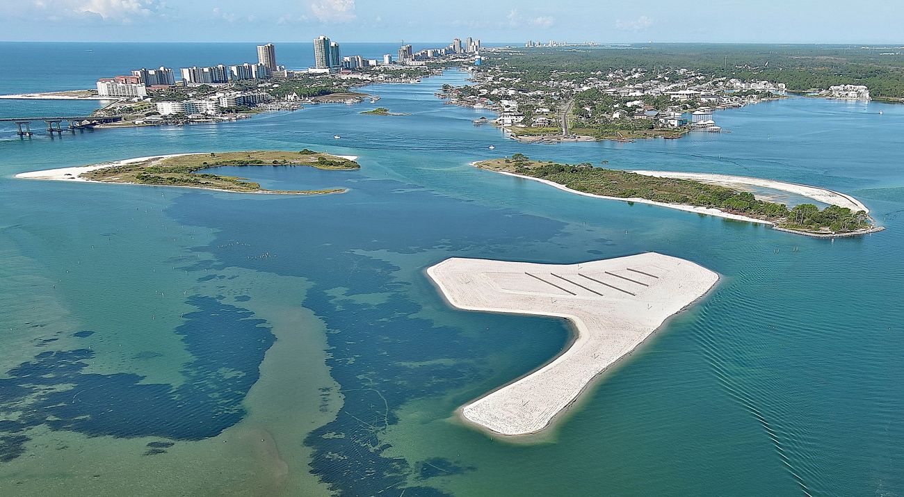
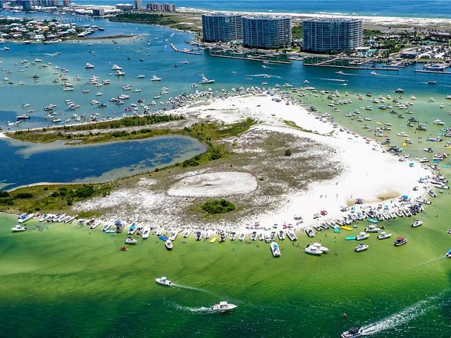
The Lower Perdido Islands are a group of small, undeveloped islands (Bird, Robinson and Walker) located near Perdido Pass in Orange Beach, Alabama. The islands and surrounding waters have never been more popular, not surprising given the beautiful blue-green waters, easy access to sandy beaches and unique wildlife.
Many of the roughly 8 million visitors that Baldwin County hosts annually visit the islands and adjacent waters. During holidays, the islands host well over 500 boats at a single point in time, with visitation numbers only increasing. Their popularity has impacted wildlife habitats and water quality in the area as a result of erosion from boat wakes, damage to seagrass, disturbance to nesting birds and their habitat, and increasing marine debris and human waste.
To address these concerns, the City of Orange Beach, Moffatt & Nichol, Olsen Associates Inc. and The Nature Conservancy teamed up in 2017 to develop a management plan that features conservation strategies and restoration concepts to support protection of the Lower Perdido Islands and their valuable habitats for the future. Upon completing the plan in 2022, the partners secured resources from the Bipartisan Infrastructure Law, Inflation Reduction Act and Natural Resource Damage Assessment funds from the Deepwater Horizon spill, administered by NOAA, to complete designs and construct the project.
Conservation Goals
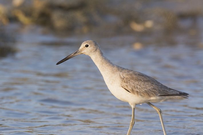
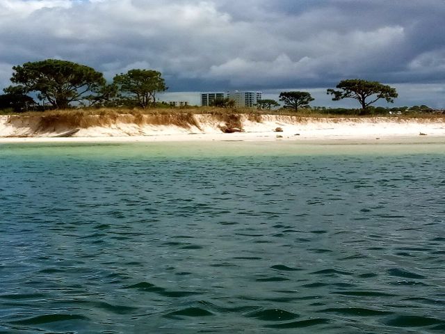
Marsh, forest and seagrass beds are all habitat types found on and adjacent to the Lower Perdido Islands. These unique habitats support a diverse array of wildlife, especially shorebirds, wading birds and waterfowl. Common birds include tricolored herons, reddish egrets, little blue herons, snowy egrets, white ibis and brown pelicans. Great blue herons, great egrets, clapper rails, willets and woodcocks also forage in the marsh. Migratory waterfowl and neotropical migrants use the area seasonally. The seagrass beds and calm, protected waters surrounding the islands provide nursery areas for coastal finfish and shellfish such as speckled seatrout, redfish, Atlantic croaker, shrimp and blue crabs.
Due to the wide variety of biodiversity found on and around the islands, TNC’s conservation goals include protecting and sustaining wildlife habitat while maintaining recreational opportunities for the public. Achieving these goals requires pursuing strategies that focus on habitat protection and also on raising public awareness of current rules and regulations and the importance of the unique habitats of the Lower Perdido Islands. Some of the conservation strategies highlighted in TNC’s plan include:
- Planting trees and shrubs for nesting and roosting wading birds
- Controlling vegetation in shorebird nesting and loafing areas
- Cordoning off areas to maintain distance between birds and humans
- Installing signs for public awareness (seagrass, no motor, no dogs, trash, etc.)
- Enforcing rules and regulations to protect the natural resources and for public safety
Restoration Concepts
While TNC’s conservation strategies focus on management, the concept recommendations propose habitat restoration actions developed by a team of ecologists and engineers that provide large-scale, sustainable options while ensuring space for recreation. Informed by stakeholder and public feedback, hydrodynamic modeling, morphological modeling, a series of surveys, design charrettes and existing conditions, the team developed these priority restoration concepts to push towards 100% designs.
This work focused on Walker Island and Robinson Island, while maintaining Bird Island as is for recreational use. Once complete, Robinson Island's nearshore areas and beaches will be open to the public while Walker Island will remain off limits to foot traffic just like before restoration efforts.
Designs
Once TNC and partners developed conservation and restoration goals for protecting valuable island habitats while maintaining recreational space, Moffatt & Nichol led a rigorous design process to bring ideas to reality. This involved topographic and bathymetric surveys, cultural resource surveys, hydrodynamic modeling, sediment transport studies, water level monitoring and seagrass assessments.
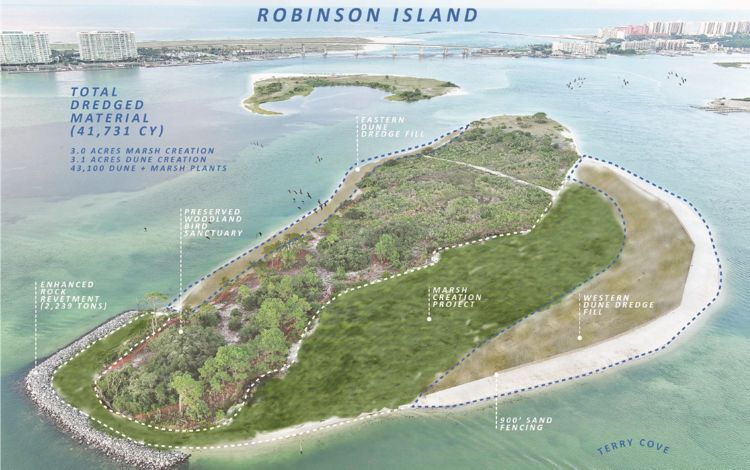
On Robinson Island, the team approached designs with the goals of addressing degraded marsh habitats, increasing areas of marsh and bird habitats, and reducing erosion to balance wildlife and public uses. Reinforcing the existing revetment on the north end will provide protection from the strong currents that erode the island. Placing a thin layer of sediment in strategic locations will also help increase the marsh platform for improved habitat health. A protective dune feature on the west end will reduce erosion, provide recreational space and protect the adjacent marsh habitat. Additional sediment placement along the eastern side of the island will cover roots exposed due to storm activity and improve upland habitat quality while stabilizing the shoreline. Overall, restoration efforts will provide almost three acres of newly created and/or restored marsh habitat and more than four acres of dune habitat.
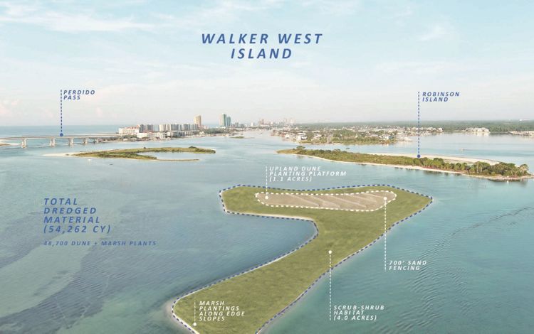
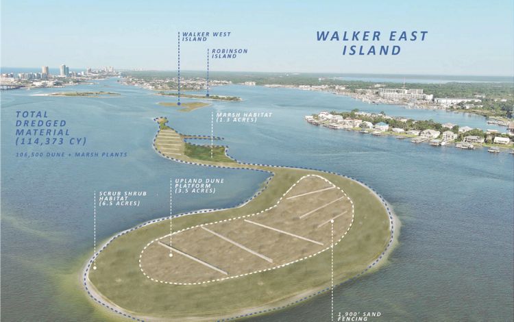
For Walker Island, Moffatt & Nichol designed two restoration placement areas to provide significant habitat for birds and other wildlife since it is off limits to the public. The western placement area will create over five acres of high marsh habitat, around one acre of upland habitat, and some subtidal shoal habitat. The eastern placement area will address degradation of marsh habitat and maximize dune and scrub shrub habitat to restore habitat lost over time due to storms and other impacts. This will result in over eight acres of high marsh and over three acres of upland habitat.
Each design aims to minimize impacts to existing seagrass beds surrounding the Robinson, Walker and Bird Islands. Specifically, the “hummingbird” shape of the western placement area and the “kidney bean” shape of the eastern placement area on Walker Island are designed to protect and reduce impacts to valuable seagrasses and allow room for their expansion. In these areas, the team will install native plants such as sea oats, marsh grasses and other species following sand placement. These plants will help hold the new material in place, reduce erosion on the islands, and provide shelter and foraging areas for both fish and wildlife species.
Seagrass on the Move
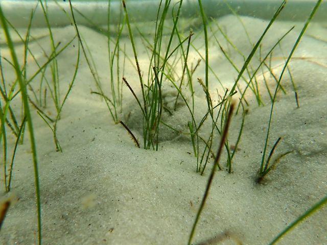
While the design team made every effort to minimize impacts to seagrass beds, a few patches of seagrass existed within the sediment placement areas. In partnership with the U.S. Army Corps of Engineers and NOAA’s National Marine Fisheries Service, the partners prepared documents outlining our approach to relocating the seagrasses within impact areas and monitoring transplanted sods (plants, roots and sediment) throughout the life of the project. These seagrass beds are extremely valuable as they have been steadily expanding over 20+ years, contrary to other areas exhibiting drastic declines in seagrasses worldwide. Thus, our project is doing everything possible to make sure this positive trend continues.
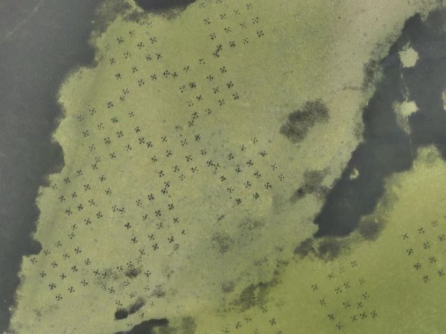
To prepare for construction, TNC, the Dauphin Island Sea Lab, CSA Ocean Sciences, Inc., Moffatt and Nichol, and many volunteers moved over 4,000 sods of shoal grass (Halodule wrightii) in July and August 2024 from sediment placement areas. The team placed the sods adjacent to the southern edge of an existing healthy seagrass bed located within a protected no-motor zone and outside of the construction footprint. The sods were planted in a checkerboard pattern to cover approximately 1.5 acres. The team will monitor the transplants for five years for survivability, adding additional plants if coverage declines.
Project Completion
In 2025, TNC and partners, together with Orange Beach-based MD Thomas Construction, realized the completion of this important and ambitious project. Restoration began at Robinson Island and then moved to Walker Island. During this time, dredging pipelines impacted navigation and boaters were encouraged to navigate the area cautiously around buoys and signs marking the construction areas. Throughout this process, TNC posted signage at the local boat ramp and will provided updates about the status of construction activities.
View a Brochure
-
Restoring the Lower Perdido Islands
TNC and partners are working to protect one of Alabama's most unique and popular outdoor destinations.
Download

