interstitialRedirectModalTitle

interstitialRedirectModalMessage

Places We Protect

Lubberland Creek Preserve

New Hampshire

View looking across a vast wetland with green grasses and a body of water in the distance.
Lubberland Creek This tidal creek flows into Great Bay in Newmarket, New Hampshire. © Jerry Monkman/EcoPhotography

Discover Great Bay’s Hidden Wild Side

From salt marsh to oak forest, this 400-acre preserve offers rich habitats and quiet trails for exploration.

Overview

Description

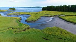
It is easy to leave behind the feel of civilization at the Lubberland Creek Preserve in Newmarket. “Lubberland”—a nickname for Great Bay’s northern shore recorded as early as 1669—likely came from sailors describing the “land‑loving” farmers along this coast.

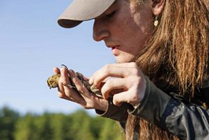
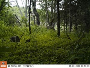
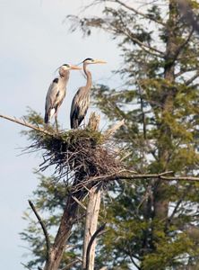
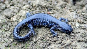
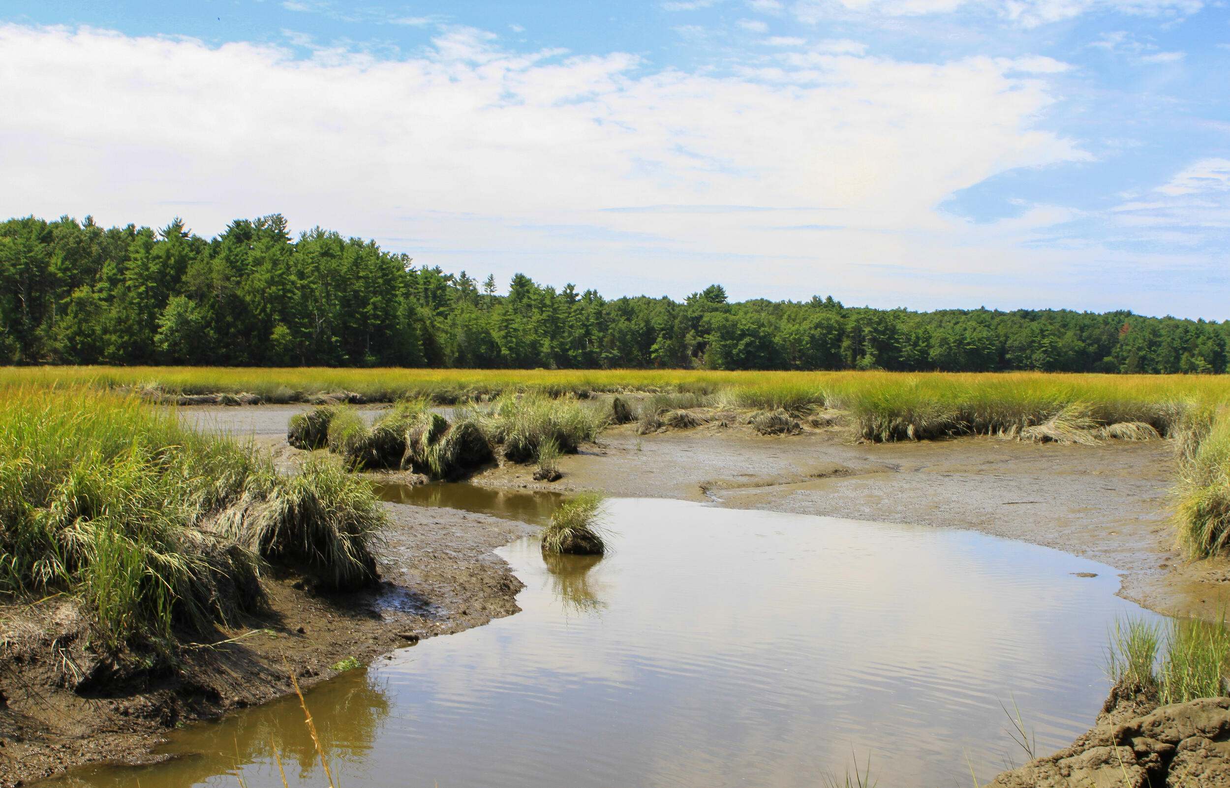
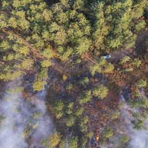
Today, the landscape has shifted from farms to forest, and the preserve offers a rich mosaic of estuarine, grassland, forest and freshwater wetland habitats, along with relics of its agricultural past. Trails cross streams, wetlands and dry uplands dotted with vernal pools. Rare Blanding’s turtles and spotted salamanders use these pools; beaver, osprey and great blue herons thrive in the wetlands. One of the largest salt marshes in the Great Bay Estuary anchors broad views and excellent birding. Want a sampler of everything here—from upland forest to salt marsh and bay views? The Sweet Trail runs about 4.3 miles from Durham to Great Bay, ending at our Lubberland Creek shoreline, with benches and big estuary vistas.

In addition to managing the preserve, TNC worked with the Town of Newmarket to replace an undersized culvert along Lubberland Creek that contributed to flooding and blocked fish like the American eel from migrating.

Please remember that leashed dogs are permitted only on the Sweet Trail portion of the preserve.

Access

OPEN TO THE PUBLIC

Hunting is allowed on this preserve; wear blaze orange during hunting season.

Highlights

Hikers will enjoy ponds, wetlands, salt marsh, mud flats, vernal pools, and a variety of critters including songbirds, fisher, deer, salamanders, beaver, wood duck and more. Keep your eyes peeled for the great blue heron rookery!

Size

400 acres

Explore our work in New Hampshire

Photos from Lubberland Creek Preserve

Lubberland Creek is a haven for nature lovers and researchers alike.

A tidal creek flowing through saltmarsh to a bay.
A great gray owl sitting in a tree.
A scientist studies a bird closely in his hand.
A bobcat roaming through lush greenery and trees.
A beaver climbing out of an icy pond.
A wild columbine - a pink and green flower with a pinkish stem.
Two great blue herons standing on a nest in a tree.
A blue salamander.
A scientist with a bucket scoops water. A small eel can be seen in the water in the foreground.
Red plants in green tall grasses.

Visit

    • Salt marsh to forest mosaic: One of the largest salt marshes in the Great Bay Estuary alongside ponds, mudflats, vernal pools and upland forest. Great birding and expansive Great Bay views.
    • Wildlife highlights: Look for osprey, great blue herons (rookery present), wood ducks, and signs of beaver; vernal pools support spotted salamanders and rare Blanding’s turtles—please always observe wildlife from a distance.
    • Sweet Trail features: Tin‑square wayfinding, stone walls, old foundations and Jeff’s Hill viewpoints; at the south end, a short spur reaches the bay’s edge.
    • Restoration and research in action: The nearby Bay Road culvert replacement improved fish passage—American eels now move more freely between Great Bay and upstream habitat. Meanwhile, scientists are studying the movements and habits of saltmarsh sparrows to better understand the effects of climate change and sea level rise.
  • Download the Lubberland Creek Preserve Trail Map and Guide

    The Sweet Trail
    — 4.3 mi (easy to moderate, uneven in places) THIS IS NOT A LOOP TRAIL.
    A point‑to‑point route between Longmarsh Road (Durham) and the Lubberland Creek shoreline (Newmarket). Wayfinding uses distinctive white tin squares with the Great Bay Resource Protection Partnership logo. For a full end‑to‑end description, maps, and parking details, see A Sweet Trail to a Great Bay and the Sweet Trail Map & Guide (PDF).

    Jeff’s Hill Loop — 0.6 mi (moderate, uneven in places)
    Climb through hemlock‑pine‑oak forest to views over active beaver ponds; watch for a small heron rookery in spring. Near the summit, a cluster of vernal pools hosts amphibians; compare the warmer, oak‑hickory south slope with the shadier north slope as you complete the loop.

    Channell Spur — 0.2 mi (easy)
    A short loop at the top of Jeff’s Hill leads to a bench honoring the Channell family, longtime landowners of this property before TNC’s protection.

    Grassland Trail — 0.2 mi (easy, out‑and‑back)
    A mowed path across the field to a hilltop observation point with a spotting scope overlooking the field and the 55‑acre salt marsh at the mouth of Lubberland Creek. Continue carefully to the old, non‑functional farm crossing at the tidal stream; return the way you came. Not a loop.

    • Getting there: From NH‑108 (Durham or Newmarket), take Durham Point Road (north end) or Bay Road (south end). The preserve is 6.3 miles from the north end or 1.4 miles from the south end. The small parking area (~6 cars) is on the west side of Bay Road at the trailhead.
    • Sweet Trail parking options: Additional parking is available in Durham at Longmarsh Road (main trailhead for the Sweet Trail) and Dame Road for an easier segment; parking is also available at the Lubberland Creek Preserve lot on Bay Road.
    • Dogs: To protect sensitive wildlife, pets are not permitted on the preserve except leashed dogs on the Sweet Trail portion. A leash lending station is available at the Lubberland Creek main kiosk on Bay Road and at the preserve entrance on Dame Road. Please respect posted signs.
    • Hunting: Allowed on portions of the preserve. Check with New Hampshire Fish & Game for seasons and regulations and wear blaze orange in fall.
    • Trail conditions: Generally gentle near Bay Road; more moderate/uneven north of the road. Expect wet/muddy spots near wetlands and after rain; waterproof footwear recommended.
    • Mobility devices (OPDMD): Limited access. Only non‑combustion OPDMDs under 24 in. wide and <500 lbs, at walking speed, are permitted from the Dame Road trailhead between the kiosk and next signpost. OPDMDs are not allowed from the Bay Road (Lubberland) trailhead. Please follow on‑site signage.
    • Leave No Trace: Pack out all trash, stay on marked trails, and help protect this globally rare estuarine ecosystem. Foot traffic only—no bikes, horses or motorized vehicles.
  • To minimize disturbance of the wildlife and habitat of this nature preserve and to support the enjoyment of all visitors, please follow these guidelines:

    • Leave No Trace—please keep the preserve clean by carrying out your trash (and any that you find).
    • No camping or open fires allowed.
    • Please, for your safety and the protection of this globally rare ecosystem, stay on marked trails.
    • Foot traffic only; horses, bikes and motorized vehicles are prohibited.
    • Pets are not permitted; help us protect wildlife on the preserve and be respectful of other hikers by leaving your pets at home (exception: leashed dogs are allowed on the Sweet Trail only). Leash lending stations are available at the preserve.
    • Hunting is allowed on portions of the preserve. Please obey all posted signs and contact the New Hampshire Fish & Game Department for dates and regulations.
    • Respect the natural world around you! Do not remove or destroy plants, wildlife, minerals or cultural items.
    • OPDMDs: The use of Other Power-Driven Mobility Devices is limited to: Only non-combustible engine OPDMDS < 24” wide, < 500lbs permitted between this kiosk and the next trail signpost; Walking speed only and only from the trailhead on Dame Road. OPDMDs are not allowed at the Lubberland Creek trailhead on Bay Road.
A creek winds through a saltmarsh.
Lubberland Creek Lubberland Creek meanders through the salt marsh at The Nature Conservancy's Lubberland Creek Preserve in Newmarket, New Hampshire. © Rebecca Laflam

History

Grassroots Action That Changed the Shoreline

While our efforts to protect Lubberland Creek began in the mid-1990s, conservation of this critical habitat would not have been possible without the efforts of a grassroots campaign 20 years earlier.

In the early 1970s, Aristotle Onassis acquired options to buy one third of the land in Durham in order to build what would have been the world’s largest oil refinery. He planned to build an oil terminal offshore on the Isles of Shoals, where incoming crude oil would be pumped into a pipeline that would carry the oil to the mainland in Rye and then on to the refinery in Durham.

Onassis had the strong support of New Hampshire Governor, Meldrim Thompson and the Manchester Union Leader newspaper. Several longtime landowners in the Crommet Creek Conservation Area refused to sell land to Onassis’ agents, and a local opposition group called Save Our Shores mounted a highly publicized grassroots campaign that eventually led to the defeat of the refinery proposal at both the local and state levels in 1974. Standing in the Lubberland Creek Preserve today, it is hard to imagine the scale of industrial development that could have engulfed the preserve and surrounding areas.

Find More Places We Protect

The Nature Conservancy owns nearly 1,500 preserves covering more than 2.5 million acres across all 50 states. These lands protect wildlife and natural systems, serve as living laboratories for innovative science and connect people to the natural world.

See the Complete Map

Support Our Work

Your contributions help us continue our conservation work in New Hampshire.