interstitialRedirectModalTitle

interstitialRedirectModalMessage

Places We Protect

Surry Mountain Preserve

New Hampshire

Aerial view of the preserve with wooded areas in the foreground and distance and streams and a pond on the middle left.
Surry Mountain This 1,300-acre property provides connectivity for wildlife in Gilsum, NH. © Joe Klementovich

With its towering trees and free-flowing streams, this mountainous escape is a stone's throw from Keene.

Overview

Description

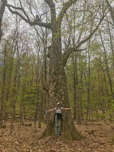
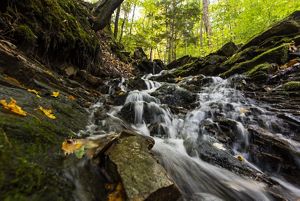
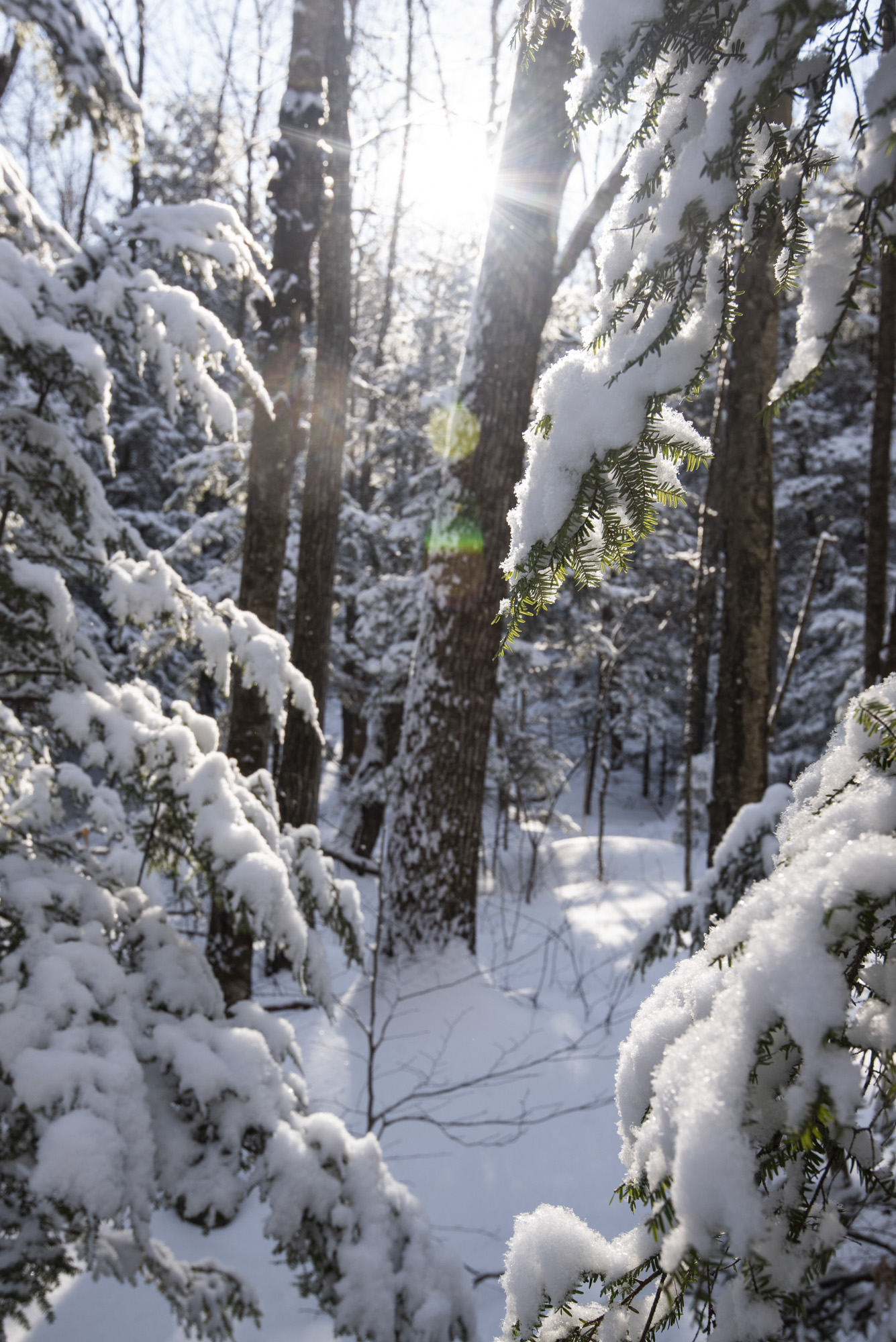
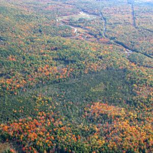
Towering trees. Safe haven for wildlife. Free-flowing streams. Abundant recreational possibilities. Surry Mountain is a place rich with natural treasure—a vast expanse of forests, ponds and headwater streams. This incredible preserve, just north of Keene, is a critical piece of a 50,000-acre conservation puzzle pieced together in the Monadnock region—a resilient and connected landscape where people and nature can thrive, even in the midst of a changing climate.

The Surry Mountain Preserve boasts 1,324 acres of climate-resilient land that will never be developed. Nearly nine miles of frontage along seven headwater streams provide clean water to those living, working and playing in the region. Black bears, bobcats, fishers and other wildlife roam freely across the land’s extensive, high-quality habitat. The beautiful and remote Lily Pond remains undeveloped, along with 16 acres of bogs, beaver ponds and other wetlands. The preserve’s healthy, well-managed forest lands continue to filter our air and water. Hiking, hunting, fishing and snowshoeing are just a few of the ways visitors can explore the preserve. Surry Mountain is open to the public as a place to take in an outdoor adventure, the inspiring vistas and revel in the restorative silence.

Download the Surry Mountain Preserve trail map and plan your visit!

Access

OPEN TO THE PUBLIC

Look for evidence of our Climate Resilient Forest Management work during your visit.

Highlights

Dense forest and nearly 9 miles of stream frontage set the backdrop for hiking, fishing, hunting and snowshoeing.

Size

1,324 acres

Explore our work in New Hampshire

Photos from Surry Mountain Preserve

From trees to waterfalls and beaver ponds to cellar holes, Surry Mountain offers so much to explore.

A rainbow over green hills and a lake.
A woman standing in front of a large tree in the woods with her arms outstretched.
An aerial view of a forest in fall color.
A waterfull running down rocks in a forest.
A moon shines in a dark sky with trees silouetted.

Visit

  • Discover a mountain landscape rich with towering trees, free‑flowing headwater streams and a restorative sense of quiet.

    • Forest & quiet ridges: A vast expanse of well‑managed, climate‑resilient forest with places to pause and take in the silence.
    • Streams & wetlands: Nearly nine miles of seven headwater streams plus Lily Pond, bogs, beaver ponds and other wetlands.
    • Wildlife: Surry Mountain provides habitat for all kinds of critters including black bear, bobcat and fisher—watch for tracks, scat and other signs along trails and streambanks. (And, as always, view wildlife from a safe distance.)
    • Climate‑smart forestry in action: Keep an eye out for reserve areas left to develop old‑forest features, small patch openings that add habitat diversity and thinned stands that help strong trees become future legacy trees.
  • Download the Surry Mountain Trail Map

    The Red Trail:
    This trail begins at the trailhead on Old Gilsum Road. The Red Trail is 2.4 miles one-way to Lily Pond. Note that this trail is shared by hikers and bikers. The trail ends with nice views over Lily Pond and the lean-to picnic area on the pond shore.

    The trail travels over rolling topography and crosses some wet drainages on the steeper slopes. For the most part, the trail is within hemlock-beech-oak-pine forest but does intersect some small pockets of ash forest in rocky, more enriched soils.

    Near Lily Pond, the trail follows a well-marked boundary of property protected with an easement held by the Monadnock Conservancy.

    To walk the Red Trail out and back is 4.8 miles.


    The Yellow Trail: The Yellow Trail is an alternate path to Lily Pond. Note that this is a foot-traffic-only trail. It starts just over one mile down the Red Trail from the trailhead. From the trail junction, the Yellow Trail climbs up and over Surry Mountain.

    There is no view from the summit of Surry Mountain, as it is more of a gentle ridge line than a distinct peak. The summit does have unusual rock cairn formations (origin and use unknown) which make for an interesting trailside feature.

    This trail travels over slightly more challenging topography than the Red Trail, but it, once again, leads to Lily Pond and the picnic area by the lean-to. The Yellow Trail is 1.2 miles long one-way.

    To traverse the Yellow Trail–Red Trail loop is a 5-mile walk.

    • Getting there (important): Approach the preserve via NH‑10 → Belvedere Rd → Old Gilsum Rd (from the south). Do not follow GPS directions that route you from the north via Vessel Rock Rd/Old Gilsum Rd—that approach is not navigable, and many map apps suggest it incorrectly. Use the “View Directions” / “Open in Maps” links on the preserve page for the correct route.
    • Access & hours: Open to the public year‑round. Hiking, hunting, fishing and snowshoeing are allowed; wear blaze orange in fall.
    • On‑site parking: Follow posted signs at the access point; do not block gates or driveways.
    • Terrain & conditions: Expect forest trails with uneven footing. Sections near streams, wetlands and Lily Pond can be wet or muddy after rain—waterproof footwear recommended.
    • Stewardship in progress: You may notice reserve areas, small patch openings and thinned stands—visible signs of our climate‑resilient forest management. Please stay on established routes and respect posted signs.
    • Leave No Trace: Pack out all trash, keep a safe distance from wildlife and protect sensitive habitats.
  • To minimize disturbance of the wildlife and habitat of this nature preserve and to support the enjoyment of all visitors, please follow these guidelines:

    • Leave No Trace—please keep the preserve clean by carrying out your trash (and any that you find).
    • No camping or open fires allowed.
    • Hunting is allowed. Please obey all posted signs and contact the New Hampshire Fish & Game Department for dates and regulations.
    • Respect the natural world around you! Do not remove or destroy plants, wildlife, minerals or cultural items.
    • Mountain biking is allowed on designated trails but is prohibited anywhere on “foot travel only” sections of the trail system.
  • We are incredibly grateful for all of you who generously supported the protection of Surry Mountain, including:

    • New Hampshire Land and Community Heritage Investment Program (LCHIP)
    • Drinking Water and Groundwater Trust Fund
    • New Hampshire Moose Plate Program
    • Town of Gilsum
    • Town of Surry
    • New Hampshire Fish and Game Department
    • The many generous members and donors like YOU!
Looking into a snowy forest.
Winter Wonderland Surry Mountain shrouded in snow. © Joe Klementovich 2018

Wildlife Wonders

How Surry Mountain Preserve Is Leading the Way in Climate Resilient Forest Management

Our forests face big challenges as the climate changes—and we’re taking action. At Surry Mountain Preserve, we’re partnering with New Hampshire Fish and Game to help forests and wildlife thrive for generations.

Eyes and Ears on Wildlife
We started with our first-ever forest inventory to capture a snapshot of the species calling this place home. Acoustic monitors record bat calls and bird songs, while game cameras—paired with a quirky skunk lure—snap photos of curious critters. These tools help us understand who’s here and how they use the habitat.

Managing for Resilience
We’re testing three approaches:

  • Reserve Areas: No cutting—preserve old-forest features.
  • Patch Cuts: Create openings for wildlife and pollinators.
  • Thinning: Reduce tree density to boost carbon storage and grow future legacy trees.

This work is part of a larger effort to bring landowners together across southwestern New Hampshire and the Mount Washington Valley to advance climate-smart forestry. By integrating climate adaptation into conservation, we’re building a healthier, more resilient future for our forests. Dive deeper into these innovative efforts.

Nearby Preserves

Need more nature? Visit The Nature Conservancy's other preserves.

Find More Places We Protect

The Nature Conservancy owns nearly 1,500 preserves covering more than 2.5 million acres across all 50 states. These lands protect wildlife and natural systems, serve as living laboratories for innovative science and connect people to the natural world.

See the Complete Map

Support Our Work

Your contributions help us continue our conservation work in New Hampshire.