

This Land Is Your Land: Celebrating Our Public Lands
Public lands in Pennsylvania, Delaware and beyond are more critical than ever for people and nature.
For 70 years, The Nature Conservancy has worked to protect the lands and waters on which all life depends. The strategies we use can be both innovative and complex; however, one of the most straightforward ways TNC and other NGOs protect lands and waters is by partnering with state and federal agencies to create and expand public lands.
Places like Badlands National Park, Great Sand Dunes National Park and Glacier National Park are just a few of America’s National Treasures that TNC has helped conserve. The story is no different locally where TNC has helped protect and expand a number of iconic public places such as King’s Gap State Park in Pennsylvania and the Prime Hook National Wildlife Refuge in Delaware.
.jpg)
Land Acknowledgement
We acknowledge the traditional stewards of the lands that we now know as Pennsylvania and Delaware.
Helpful resources to better understand for which Indigenous People certain land is traditional land are the Pennsylvania Native American Areas of Interest map created by PennDOT in consultation with the listed federally recognized Tribes and Native Land, a mapping tool that can provide information about Indigenous territories, treaties and languages.
We recommend visiting the websites of the Tribes and Nations to learn more directly from them. The tools above are designed for education and provide starting points for personal research but are not all-encompassing and are not meant to represent legal or official boundaries of any Indigenous nations. As we continue to learn, TNC PA/DE is working with Tribes and Nations who have vested interests in these lands and waters toward respecting their long-term stewardship and current goals for these lands and waters.
Celebrating Lands, Protecting Biodiversity
The United Nations Convention on Biological Diversity has established a global imperative to prevent the destruction of the planet’s biodiversity, known as 30 by 30. The goal of 30 by 30 is to protect at least 30 percent of the world’s land and seas by the year 2030. In January 2021, President Joe Biden announced the America the Beautiful plan, which adds the United States to a list of more than 50 countries that have committed to 30 by 30. In order to meet this goal, the U.S. government and conservation organizations must work across public, tribal and working lands to be successful.
As nations around the world work toward 30 by 30 commitments, public lands have an important role to play in raising awareness and inspiring people to act in support of conservation. Use the maps and links below to discover three locations in Pennsylvania and four in Delaware that TNC has helped protect. We invite you to learn more about these public lands, and to visit them in-person to explore what makes them so special for all people and nature.

Protecting Land in Pennsylvania
Since 1956, TNC has worked in Pennsylvania to protect nearly 100,000 acres of land. More than 15% of those acres have been transferred to state and federal partners to be available for public land use. The chapter’s very first public lands transfer occurred in 1972 to the Pennsylvania Department of Environmental Resources (predecessor agency to the Department of Conservation and Natural Resources.) One of the more recent transfers was to the state’s Bureau of Forestry that resulted in an 232-acre addition to the Buchanan State Forest.
.jpg?crop=222%2C0%2C3556%2C2667&wid=800&hei=600&scl=4.445)
Cherry Valley National Wildlife Refuge
In December 2008, TNC joined with our partners at U.S. Fish and Wildlife Service (USFWS) and the Monroe County Conservation District to celebrate the establishment of the Cherry Valley National Wildlife Refuge, a 24,000-acre refuge in Monroe and Northampton counties. For more than a decade, TNC has been working with the local community and businesses, including the grassroots Friends of Cherry Valley group, to begin building relationships and protecting parcels of land that would later become the Refuge.
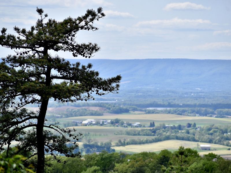
The vast and mostly rural landscape of Cherry Valley is flanked by the Kittatinny Ridge, part of a 185-mile intact and forested wildlife superhighway and renowned bird migration flyway that attracts more than 20,000 hawks, eagles and falcons each year.
_1640x1230.jpg?crop=0%2C94%2C4000%2C2500&wid=960&hei=600&scl=4.166666666666667)
TNC has conserved some spectacular properties on the Kittatinny Ridge, a priority landscape for climate resiliency and connectivity and one of eight Conservation Landscapes in Pennsylvania.

The lands and freshwaters of Cherry Valley have long been widely recognized as important natural resources. These include a diverse mosaic of wetland and upland habitats that support an unusually large number of species, including five federally listed, threatened, or endangered species.
Since the Refuge’s creation, TNC has worked with partners including local townships, Monroe and Northampton Counties, the Commonwealth of Pennsylvania, the Conservation Fund, the Pocono Heritage Land Trust and the Wildlands Conservancy to add additional acres to the Refuge.
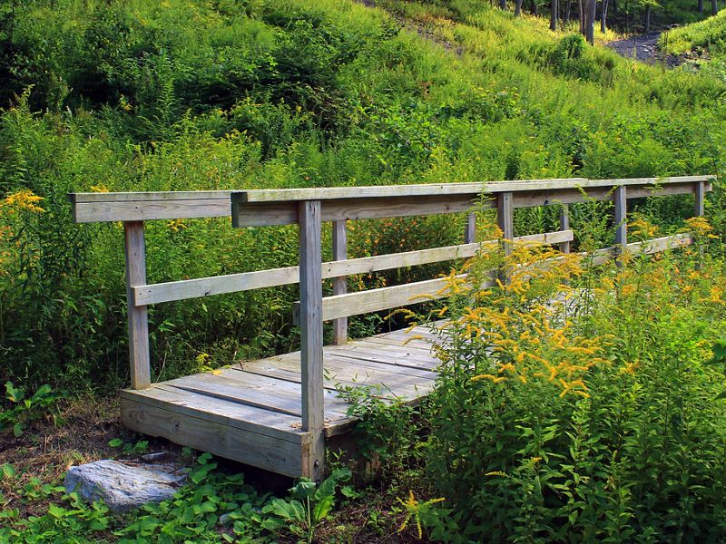
Kings Gap State Park
For almost 50 years, TNC has had the honor of helping to establish and grow Kings Gap State Park through land acquisitions and transfers. Kings Gap consists of 2,531 acres of forest on South Mountain, with more than 25 miles of hiking trails, a permanent orienteering course, picnicking, hunting and other recreational and educational opportunities.

In May 2021, TNC transferred 68 acres to King's Gap State Environmental Education Center, growing the park to nearly 2,600 acres. The property known as the Sutton Tract contains several vernal pools and a section of Kings Gap Hollow Run, which has a native brook trout population. Vernal pools are vital in the lifecycle of amphibians, like frogs and salamanders, and are at risk of drying earlier in the year due to climate change—which can impact reproduction. This makes it critically important to conserve and restore the springtime wet areas that we have.
Kings Gap is one of several state parks specifically dedicated to provide environmental education and recreational programs to the citizens of Pennsylvania. A variety of programs are available for children, teachers and the public to increase knowledge and awareness of the values and function of our natural resources. Visit the Kings Gap Environmental Center website or the Friends of Kings Gap community group page for additional events and hiking information.
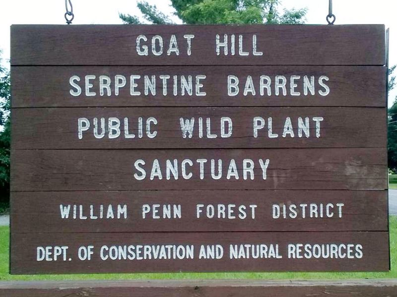
Stateline Serpentine Barrens
Located along the Maryland-Pennsylvania border, the State Line Serpentine Barrens contains some of the last major remnants of serpentine grassland in eastern North America. These grasslands were created when Native Americans used controlled burning to create grazing grassland corridors, which once stretched from New York to Alabama, to attract large game. Very few of these grasslands remain yet the habitat supports unusual, rare, or endangered species that have adapted to the environment over thousands of years thanks to Native American stewardship.

TNC joined Concerned Citizens of West Nottingham Township in 1979 to oppose a proposed serpentine rock quarry, which launched a partnership to protect critical land tracts containing this fragile habitat.
In some cases, TNC transferred ownership to like-minded public and private landowners. In other cases, TNC retained ownership and long-term management, including prescribed burning, tree cutting, leaf removal, replanting serpentine grasses, protecting buffer lands, maintaining trails and mapping and monitoring.
Tracts that are open to the public include:
- Goat Hill Wild Plant Sanctuary, a 602-acre tract that features serpentine aster, long-haired barrens chickweed, and a variety of moths and butterflies.
- Upper Chrome Serpentine Barrens Preserve, approximately 200 acres open to the public with hiking trails and babbling brooks
- Nottingham County Park, a National Natural Landmark as designated by the National Park Service in 2008.

Protecting Lands in Delaware
Established in 1990, TNC's Delaware chapter hit the ground running by successfully transferring nearly 450 acres to Delaware Seashore State Park and 40 acres to the State of Delaware’s Milford Neck Wildlife Area by the end of 1992.
After completing our most recent property transfer of 86 acres to expand Auburn Valley State Park in 2019, TNC has transferred ownership of nearly 2,500 acres to Federal and state agencies over the last 30 years. We are proud of our historic legacy of partnering with government agencies to protect natural resources and provide recreational opportunities for all to enjoy.
Please note that all of the public lands listed below charge an entry fee.
_Steven_Billups_4000x2200.jpg?crop=533%2C0%2C2933%2C2200&wid=2048&hei=1536&scl=1.4322916666666667)
Marian R. Okie Preserve Poplar Thicket Farm: Assawoman Wildlife Management Area
This 118 acre property containing tidal salt marsh, wetlands, coastal forest and fields is located on Indian River Bay in Sussex County. The property was originally donated by Austin F. “Pete” Okie to TNC before it was transferred to the State of Delaware’s Division of Fish & Wildlife in 2008. It is now considered part of the Assawoman Wildlife Area and is publicly accessible; a Conservation Access Pass is required to visit.
Protecting the property as wildlife habitat was intended to benefit the region by limiting the encroachment of development and minimizing contributions of pollutants to Indian River Bay, as well as providing sanctuary to a wide range of species. This tract of land is home to a variety of plants and animals including great blue herons, osprey and mourning doves, as well as fiddler crabs, monarch butterflies and diamondback terrapins.

“I feel a responsibility to the environment, for the wildlife that we are displacing, especially the birds—and I feel that people should have a responsibility for what we are destroying,” Okie said in 2008. With no close heirs, he opted to make the land his gift to future generations. “I just could not stand the thought of McMansions and a golf course on this land,” he added.


Oversee Farm: Auburn Valley State Park
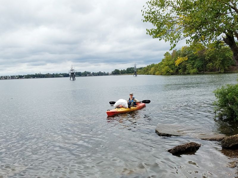
Now part of Auburn Valley State Park, Oversee Farm is a 121-acre property near Yorklyn, DE. In 2003, the state purchased a conservation easement on the Oversee Farm using Department of Transportation (DOT) scenic easement funds and Open Space funds. At the same time, TNC purchased the underlying fee interest in the property. In December 2006, the Division of Parks and Recreation assumed ownership of the property after acquiring the fee interest from TNC.
The property now contains a little more than one mile of wide, paved trails that take visitors among open fields and forest and by an historic farmhouse and barn. The Auburn Valley Master Plan envisions building a new, multi-use trail at Auburn Valley State Park—approximately a six-mile loop—that will connect preserved property along the Pennsylvania border to the Oversee Farm Property while providing a scenic and historic experience.
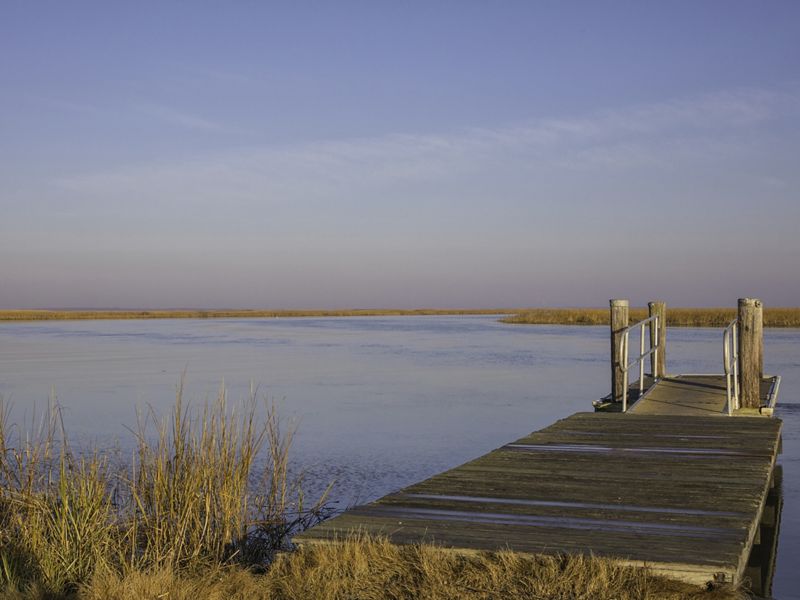
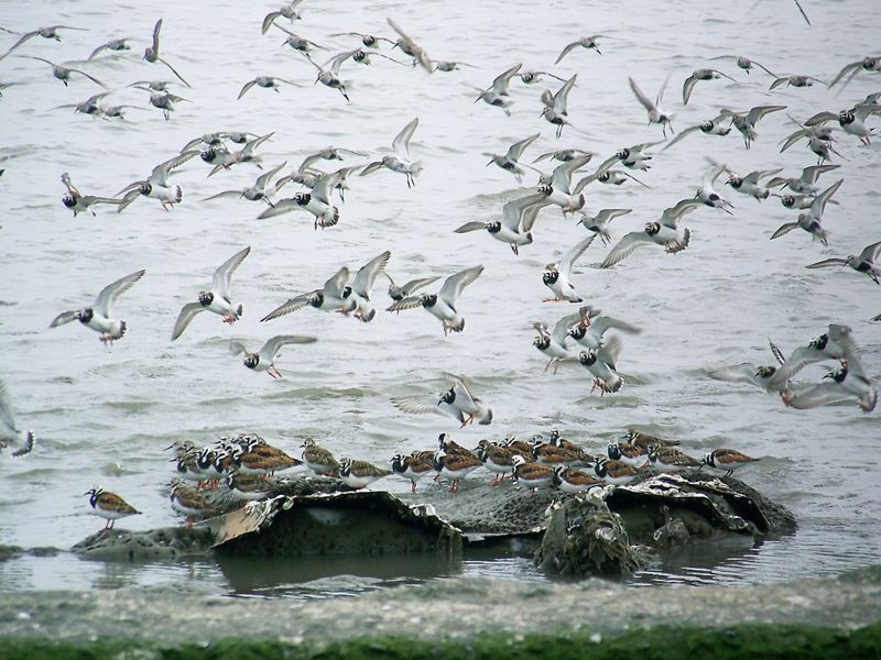
Port Mahon: Bombay Hook National Wildlife Refuge
Sited just east of Dover, Port Mahon is centrally located among Delaware’s Bayshore within a large conservation area that also includes Little Creek State Wildlife Area. TNC was gifted 341 acres of coastal marshland at Port Mahon in 1990, managing the preserve as a natural area and allowing controlled public use. In 2003, TNC transferred 273 acres to the U.S. Fish & Wildlife Service to become part of the adjacent Bombay Hook National Wildlife Refuge, one of the largest remaining expanses of tidal salt marsh in the mid-Atlantic region.
Sitting at the mouth of the Mahon River along the Delaware Bay, the beaches, saltmarshes and tidal creeks of Port Mahon provide a mosaic of habitats that are especially important for migratory birds. This includes numerous shorebirds like the iconic red knot as well as ruddy turnstones, sandpipers, sanderlings, dowitchers, dunlins and plovers. The land provides important nesting, breeding and wintering habitat for short-eared owl, northern harrier, rough-legged hawk and five species of rails.

Prime Hook National Wildlife Refuge
In 2003, TNC transferred several tracts of lands totaling nearly 50 acres to the U.S. Fish & Wildlife Service to expand Prime Hook National Wildlife Refuge. The 10,144 acre refuge is located along the southern portion of the Delaware Bay, just north of the popular beach towns of Lewes and Rehoboth.
Like Bombay Hook National Wildlife Refuge to the north, Prime Hook is beloved as a high-quality birdwatching area, especially during the spring and fall migrations. The Refuge provides an important stopover site for migratory birds as they travel up and down the Atlantic Flyway, as well as protected breeding habitat for federally and state-listed threatened and endangered species.
Salt marsh, freshwater marsh, ponds and impoundments, wooded swamps and upland grasslands and forest can be found at Prime Hook, providing habitat for 308 species of birds, 51 species of fish, 45 species of reptiles and amphibians, 37 species of mammals and an array of rare insect and plant species.

Partnering with State and Federal Agencies
In the Republic of Seychelles, an island nation in the middle of the Western Indian Ocean, TNC worked with the country’s government to designate 30% of the nation’s surrounding waters as marine protected areas through a partial buyout of the country’s national debt.
In Belize, TNC joined a coalition of more than a dozen government and conservation partners to protect 236,000 acres of tropical rainforest, which fills a critical gap in a vast forest network called the Selva Maya—38 million acres of forest spanning across Central America.
In the United States, TNC has partnered with local, state and federal government partners to protect and co-manage public lands for more than 50 years. In the U.S., the simplest way that TNC helps government agencies establish and expand public lands is through a real estate mechanism known as a “land transfer.” Typically, this happens when TNC’s agency partners identify parcels of land that are of critical conservation importance—often adjacent to existing public lands. As a non-governmental organization, TNC can move much more quickly to acquire the parcels, which we later transfer to our agency partners at cost.
Another simple tool that TNC uses to support public lands are public access conservation easements. A conservation easement is a voluntary legal agreement between a private landowner and a land trust—like TNC—or government agency that permanently protects specific conservation values on a property.
There are a wide variety of conservation easements, and they must all provide public benefits such as water quality, scenery, wildlife habitat and recreation. Some conservation easements grant public access for pedestrian recreation. These are typically used on private property that connects or adjoins public lands. When working with private landowners who are interested in a conservation easement, TNC plays the role of matchmaker, helping the landowner realize their conservation vision while achieving these public benefits.
TNC’s vision is to create a world where both people and nature can thrive. As such, the sustainable management of public lands is a high priority. Our scientists have established a national network of resilient and connected landscapes and waters across the country and around the world where conservation work will give nature the greatest opportunity to adapt to climate change.
When public lands fall within these resilient and connected landscapes, TNC works with our government partners to improve the ecological management of public lands through science and demonstration projects, and by adding capacity to the land management workforce.

Learn and Volunteer
National Public Lands Day is held annually on the fourth Saturday of September to celebrate the connection between people and green space in their community, inspire environmental stewardship, and encourage use of open space for education, recreation and health benefits..
First established in 1994, the annual event is consistently one of the largest volunteer efforts held nationwide to help restore and improve public lands across the country. National Public Lands Day (NPLD) is also a Fee-Free Day—entrance fees are waived at national parks and other public lands.

Although it is one of our smallest preserves, Bristol Marsh is not lacking in the amount of love it receives. For decades, hundreds of volunteers have assisted with our efforts to make it accessible for the community to enjoy.
In Delaware, our Stream Stewards program partners with First State National Historical Park as part of the Alliance for Watershed Education of the Delaware River NPLD to pick up litter from streams in the park’s Beaver Valley unit in north Wilmington. Over the past five years, hundreds of volunteers have removed thousands of pounds of trash from the park to benefit both wildlife and visitors and to improve water quality.
In Pennsylvania, we partner with the Heritage Conservancy at the Bristol Marsh Preserve to clean up litter from this popular local park and wetland located along the Delaware River, northeast of Philadelphia. Since 2009, hundreds of volunteers have collected and disposed of thousands of pounds of trash from the land and waters at Bristol Marsh.
Join us at a volunteer event in Pennsylvania or Delaware on National Public Lands Day to celebrate the value and beauty that public lands bring to our lives.

Access for All
Public Lands Day also provides an opportunity to underscore that outdoor engagement and recreation is meant for all communities; nature does not exclude anyone from its benefits.
Within the ambitious 30 by 30 goal, there is a need to address the issue of unequal access and accessibility to the outdoors. Statistics from the U.S. Forest Service, National Park Service and Fish and Wildlife Service reveal that close to 70% of people who visit national forests, national wildlife refuges and national parks are white, with Black people being the least represented.
There is hope that those statistics will shift more equitably as more voices are elevated and represented in conservation, thanks to efforts by groups like Outdoor Afro, Latino Outdoors and Unlikely Hikers, and trailblazers like Randy Moore, the first-ever African American Chief of the U.S. Forest Service. By listening to their experiences and diversity of perspectives and learning how a wide range of groups interact with nature, we can create natural spaces that are more welcoming and accessible for all.
We Can’t Save Nature Without You
Get global conservation news & the latest on local opportunities & projects.


